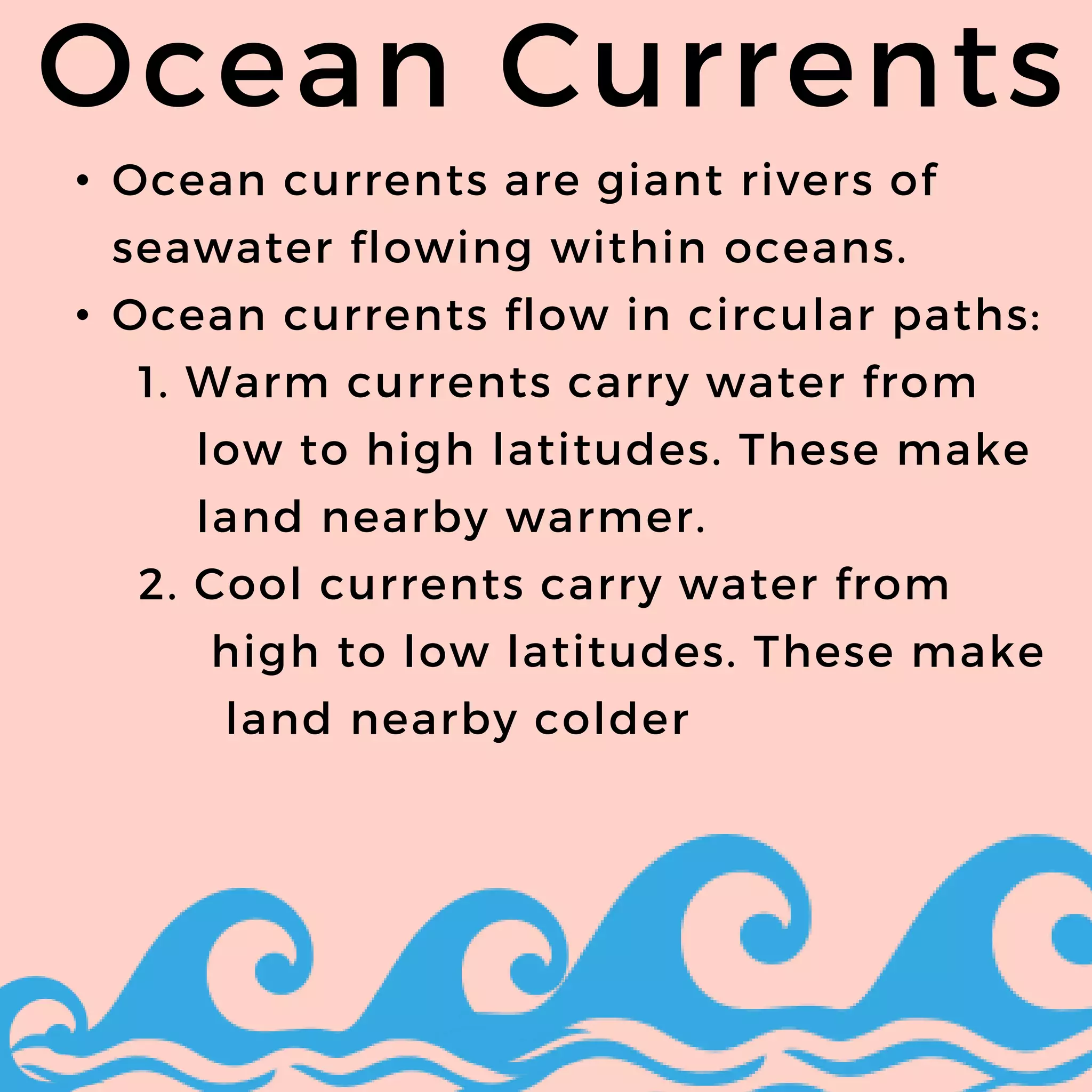
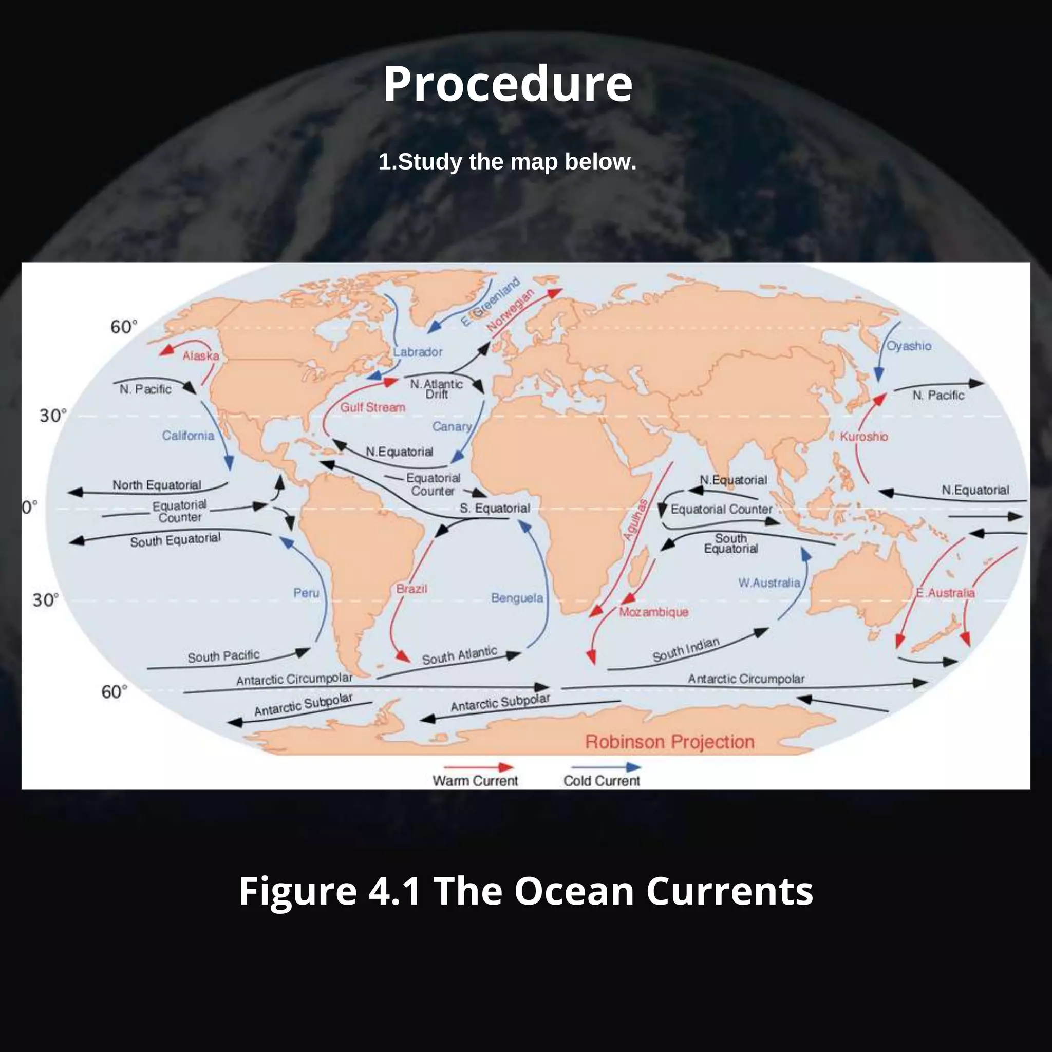
SCIENCE 9
PRAYER
Explain how different factors
affect the climate of an area.
LEARNING COMPETENCY FROM
MELCS
Pre- Assessment
Choose the letter of the
correct answer.
• City A is surrounded by bodies of
water and a moderate climate. It is
located near the equator. What will
likely affect the climate of the city
A.Latitude
B.Altitude.
C.Topography
D.All of the above
2. What happens to the temperature of
the air when altitude increases?
A.remains the same
B.increases
C.decreases
D.varies
3.Which of the following BEST
describes climate?
A.The weather that occurs in the
the atmosphere within the day
B.The pattern of weather that occurs
in a region over a long period of
time
C.The pattern of weather that occurs
in a region over a short period of
time
D.The disturbance in the atmosphere
that happens in a long period of
time
4.Why are the coldest places on earth
found at the poles?
A.Great amount of gaseous particles
trap heat from the surface
B.Great amount of thermal radiation
is received by these areas
C.Less amount of thermal radiation is
received by these areas
D.Less amount of gaseous particles
trap heat from the surface
5.What will happen when the rates of
evaporation and condensation are
equal?
A.Clouds form
B.The dew point is reached
C.The humidity increases
D. Precipitation occurs
• D
• C
• B
• C
• D
ANSWER KEYS
Activity 1: The Higher, the
colder
Objective
• Explain how altitude affects
climate
Materials:
• Pencils
• Ruler
Procedure
1. Study Table 2.1 below
Procedure
1. Study Table 2.1 below
Guide Questions:
1. Which place is coldest?
2. Which place is the
hottest?
LAMECOWS
Tropic of
Capricorn
Latitude
The farther away from the Equator,
the colder the climate becomes.
High
Mid
Low
Mid
High
Tropic of
Cancer
Equato
r
Cold
Warm
Hot
Warm
Cold
From which
latitude zone was
these pictures
taken?
Tell whether the temperature
of the zone is warm or cold.
Rainforest
warm
DeciduousTrees
warm
Tundra
cold
Steppe
warm
Tropical
Grasslands
warm
Marine West
Coast
warm or cold
A IS FOR AIR PRESSURE
Is caused by the unequal
heating of the Earth’s surface.
1. Low pressure is warm,
moist air.
It raises and forms clouds.
2. High pressure is cold, dry
air.It sinks and creates clear
skies.
Air Pressure
M IS FOR
MOUNTAIN
Barriers
Create a phenomenon called the
Orographic Effect or Rainshadow.
The rainshadow helps create deserts
Ex. Sierra Nevada mountains in CA
receive nice amounts of precipitation,
Las Vegas, NV is in the rainshadow
creating a desert climate.
Mountain Barriers
Rainshadow Effect
Windward
Side
Leeward
side
‘Wet’ side ‘Dry’
side
This rainshadow region in India was created
by the presence of the Western Ghats mountain
range, which blocks the monsoon(seasonal)
winds from the west.
E I S F O R
E L E V A T I O N
Based on
the location
of Quito,
Ecuador,
what type of
climate do
you think it
should
have?
What about
Guayaquil,
Ecuador?
• As elevation increases,
temperature decreases.
1. For every thousand feet the
temperature drops 3.6°F
• In a highlands climate, lower
elevation means more vegetation
Elevation
C
is for Continental
Location
• Large bodies of water are slower
to heat and cool than land.
• As a result, water temps. remain
stable, and land temps. change
frequently.
• Coastlines have stable
temperatures.
• The Interior of the continent has
extreme temperatures (hotter
and colder
Continental Location
O is for Ocean Currents
• Ocean currents are giant rivers of
seawater flowing within oceans.
• Ocean currents flow in circular paths:
1. Warm currents carry water from
low to high latitudes. These make
land nearby warmer.
2. Cool currents carry water from
high to low latitudes. These make
land nearby colder
Ocean Currents
• The wind is the movement of air
from high pressure to low
pressure
(like when you poke a hole in a
tire.)
1. Trade Winds
2. Westerlies
3. Polar Wind
Wind Belts
S is for Storms
• Occur during low pressure
conditions.
• Storm fronts occur when two air
masses with different
temperatures meet. (cold meats
warm)
1. Thunderstorms
2. Tornadoes
3. Hurricanes
Storm
s
Thunderstorms
Tornadoes
Hurricanes
L IS FOR LATITUDE
A IS FOR AIR PRESSURE
M IS FOR MOUNTAIN
BARRIERS
E IS FOR ELEVATION
C IS FOR CONTINENTAL
LOCATION
W IS FOR WIND BELTS
O IS FOR OCEAN
CURRENTS
S IS FOR STORMS
LAMECOWS
ACTIVITY 1:
Objective:
• Explain how latitude, altitude, and
distance from the ocean affect climate
• Materials
World Map Table with data
Table 3.1 World City TemperatureS
On a world map, locate the two
warmest and coldest cities in the table.
Determine what affects the regional
temperature for each city. Record your
findings. Then answer the following
questions
Guide Question:
1. Which City had the highest
temperature?
2. What factor do you think is the cause of
high temperature in that city?
1. MANILA
2. VIENNA
ANSWER KEYS
A C T I V I T Y 3
ASSIGNMENTS
Objective:
• Explain how currents affect climate
Materials:
Pen or pencil
Map of that illustrates ocean
currents
Ruler
Short bond paper
Procedure
1.Study the map below.
Figure 4.1 The Ocean Currents
Guide Question
• What are the different ocean currents
that carry warm water? Give at least
three example
• What are the different ocean currents
that carry cold water? Give at least three
examples
• What kind of air does Greenland
Current take long? explain
• how do the Kamchatka Current
andKuroshio Current affect the
northeastern part of southern part of
Japan?
• How do ocean currents affect climate?
Thank
you!

Factors affecting climate

  • 1.
  • 2.
  • 3.
    Explain how differentfactors affect the climate of an area. LEARNING COMPETENCY FROM MELCS
  • 4.
    Pre- Assessment Choose theletter of the correct answer.
  • 5.
    • City Ais surrounded by bodies of water and a moderate climate. It is located near the equator. What will likely affect the climate of the city A.Latitude B.Altitude. C.Topography D.All of the above
  • 6.
    2. What happensto the temperature of the air when altitude increases? A.remains the same B.increases C.decreases D.varies
  • 7.
    3.Which of thefollowing BEST describes climate? A.The weather that occurs in the the atmosphere within the day B.The pattern of weather that occurs in a region over a long period of time C.The pattern of weather that occurs in a region over a short period of time D.The disturbance in the atmosphere that happens in a long period of time
  • 8.
    4.Why are thecoldest places on earth found at the poles? A.Great amount of gaseous particles trap heat from the surface B.Great amount of thermal radiation is received by these areas C.Less amount of thermal radiation is received by these areas D.Less amount of gaseous particles trap heat from the surface
  • 9.
    5.What will happenwhen the rates of evaporation and condensation are equal? A.Clouds form B.The dew point is reached C.The humidity increases D. Precipitation occurs
  • 10.
    • D • C •B • C • D ANSWER KEYS
  • 11.
    Activity 1: TheHigher, the colder Objective • Explain how altitude affects climate Materials: • Pencils • Ruler Procedure 1. Study Table 2.1 below
  • 12.
    Procedure 1. Study Table2.1 below Guide Questions: 1. Which place is coldest? 2. Which place is the hottest?
  • 13.
  • 15.
    Tropic of Capricorn Latitude The fartheraway from the Equator, the colder the climate becomes. High Mid Low Mid High Tropic of Cancer Equato r Cold Warm Hot Warm Cold
  • 16.
    From which latitude zonewas these pictures taken? Tell whether the temperature of the zone is warm or cold.
  • 17.
  • 18.
  • 19.
  • 20.
  • 21.
  • 22.
  • 23.
  • 24.
  • 25.
  • 26.
  • 27.
  • 28.
  • 29.
    A IS FORAIR PRESSURE
  • 30.
    Is caused bythe unequal heating of the Earth’s surface. 1. Low pressure is warm, moist air. It raises and forms clouds. 2. High pressure is cold, dry air.It sinks and creates clear skies. Air Pressure
  • 31.
  • 32.
    Create a phenomenoncalled the Orographic Effect or Rainshadow. The rainshadow helps create deserts Ex. Sierra Nevada mountains in CA receive nice amounts of precipitation, Las Vegas, NV is in the rainshadow creating a desert climate. Mountain Barriers
  • 33.
  • 34.
    This rainshadow regionin India was created by the presence of the Western Ghats mountain range, which blocks the monsoon(seasonal) winds from the west.
  • 35.
    E I SF O R E L E V A T I O N
  • 36.
    Based on the location ofQuito, Ecuador, what type of climate do you think it should have? What about Guayaquil, Ecuador?
  • 37.
    • As elevationincreases, temperature decreases. 1. For every thousand feet the temperature drops 3.6°F • In a highlands climate, lower elevation means more vegetation Elevation
  • 38.
  • 39.
    • Large bodiesof water are slower to heat and cool than land. • As a result, water temps. remain stable, and land temps. change frequently. • Coastlines have stable temperatures. • The Interior of the continent has extreme temperatures (hotter and colder Continental Location
  • 41.
    O is forOcean Currents
  • 42.
    • Ocean currentsare giant rivers of seawater flowing within oceans. • Ocean currents flow in circular paths: 1. Warm currents carry water from low to high latitudes. These make land nearby warmer. 2. Cool currents carry water from high to low latitudes. These make land nearby colder Ocean Currents
  • 45.
    • The windis the movement of air from high pressure to low pressure (like when you poke a hole in a tire.) 1. Trade Winds 2. Westerlies 3. Polar Wind Wind Belts
  • 47.
    S is forStorms
  • 48.
    • Occur duringlow pressure conditions. • Storm fronts occur when two air masses with different temperatures meet. (cold meats warm) 1. Thunderstorms 2. Tornadoes 3. Hurricanes Storm s
  • 49.
  • 50.
  • 51.
  • 52.
    L IS FORLATITUDE A IS FOR AIR PRESSURE M IS FOR MOUNTAIN BARRIERS E IS FOR ELEVATION C IS FOR CONTINENTAL LOCATION W IS FOR WIND BELTS O IS FOR OCEAN CURRENTS S IS FOR STORMS
  • 53.
  • 54.
    ACTIVITY 1: Objective: • Explainhow latitude, altitude, and distance from the ocean affect climate • Materials World Map Table with data
  • 55.
    Table 3.1 WorldCity TemperatureS
  • 56.
    On a worldmap, locate the two warmest and coldest cities in the table. Determine what affects the regional temperature for each city. Record your findings. Then answer the following questions Guide Question: 1. Which City had the highest temperature? 2. What factor do you think is the cause of high temperature in that city?
  • 57.
  • 59.
    A C TI V I T Y 3 ASSIGNMENTS Objective: • Explain how currents affect climate Materials: Pen or pencil Map of that illustrates ocean currents Ruler Short bond paper
  • 60.
    Procedure 1.Study the mapbelow. Figure 4.1 The Ocean Currents
  • 61.
    Guide Question • Whatare the different ocean currents that carry warm water? Give at least three example • What are the different ocean currents that carry cold water? Give at least three examples • What kind of air does Greenland Current take long? explain • how do the Kamchatka Current andKuroshio Current affect the northeastern part of southern part of Japan? • How do ocean currents affect climate?
  • 62.

Editor's Notes