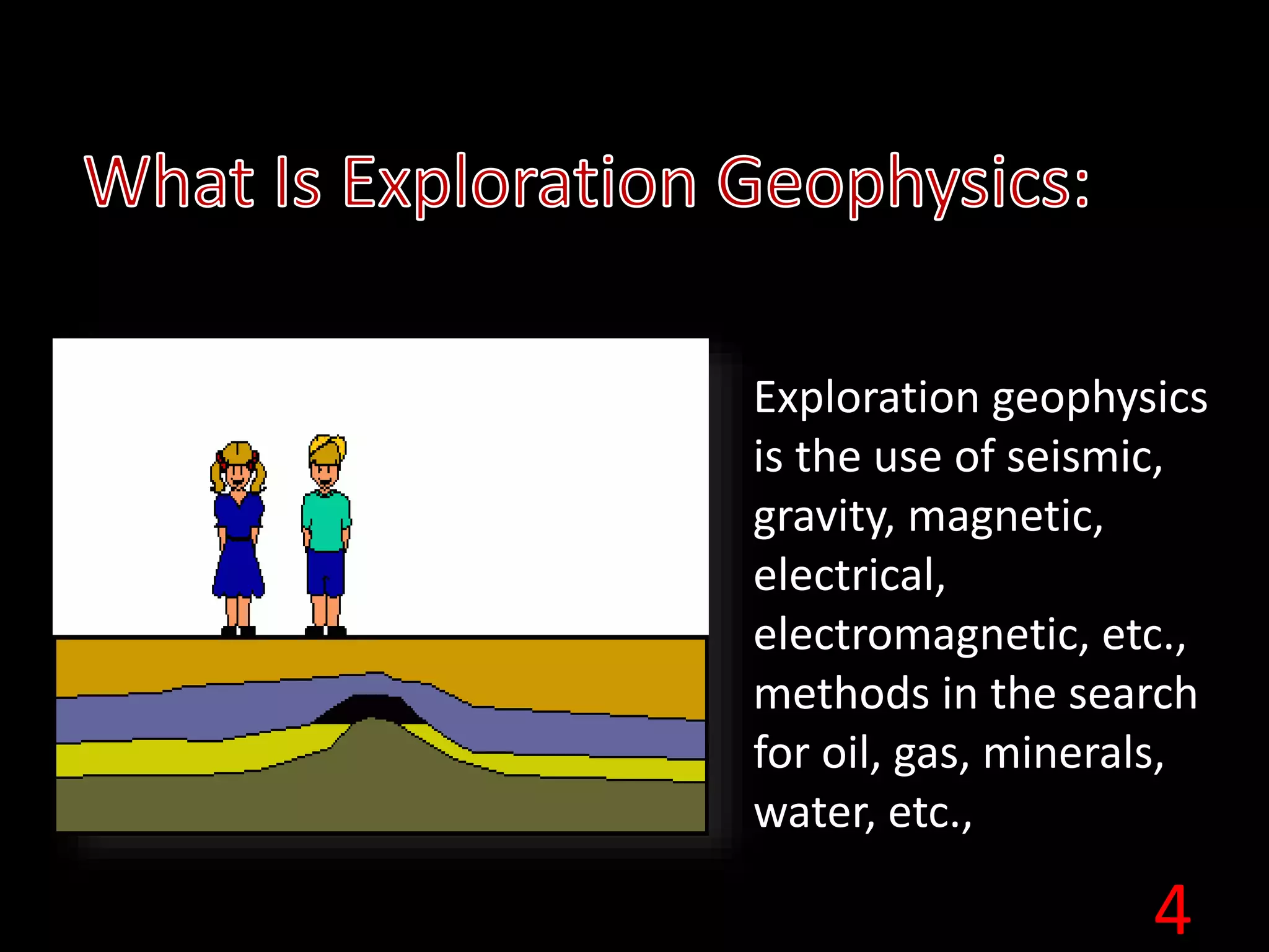
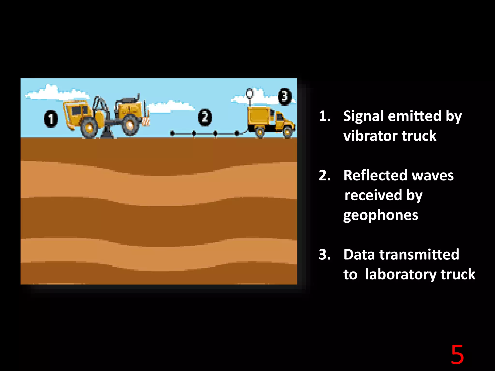
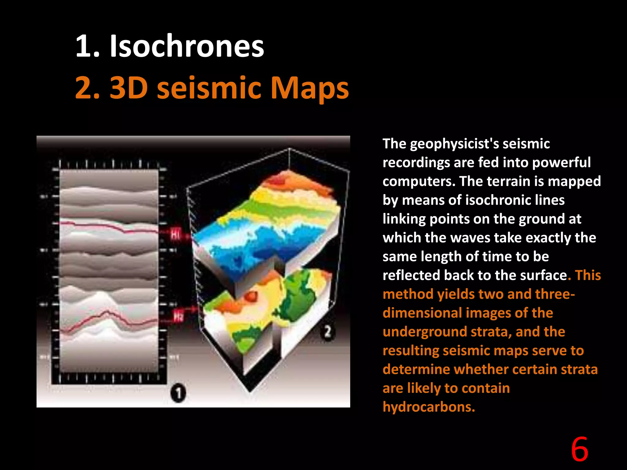
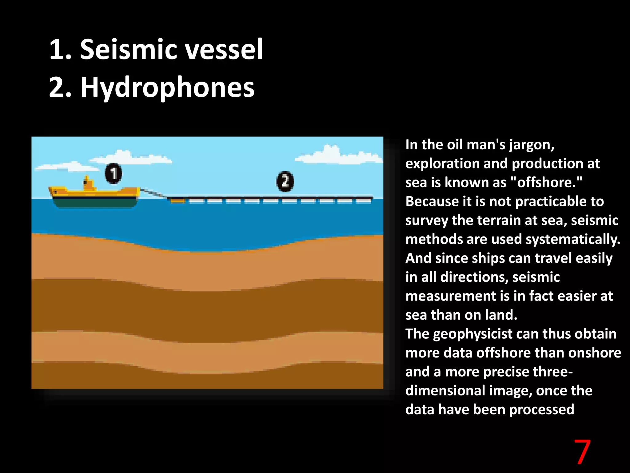
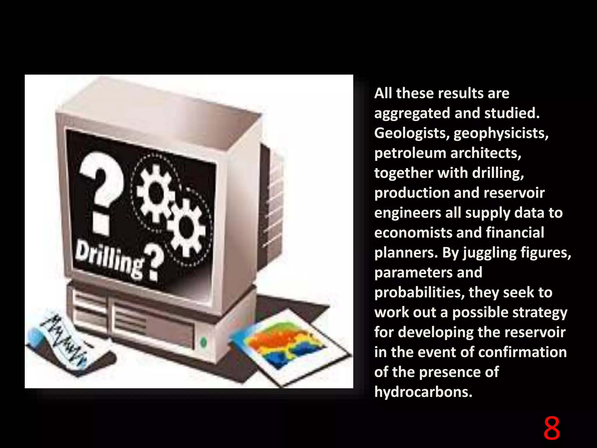
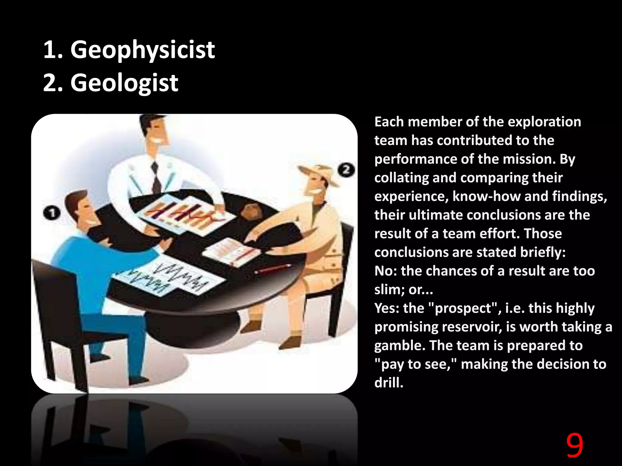
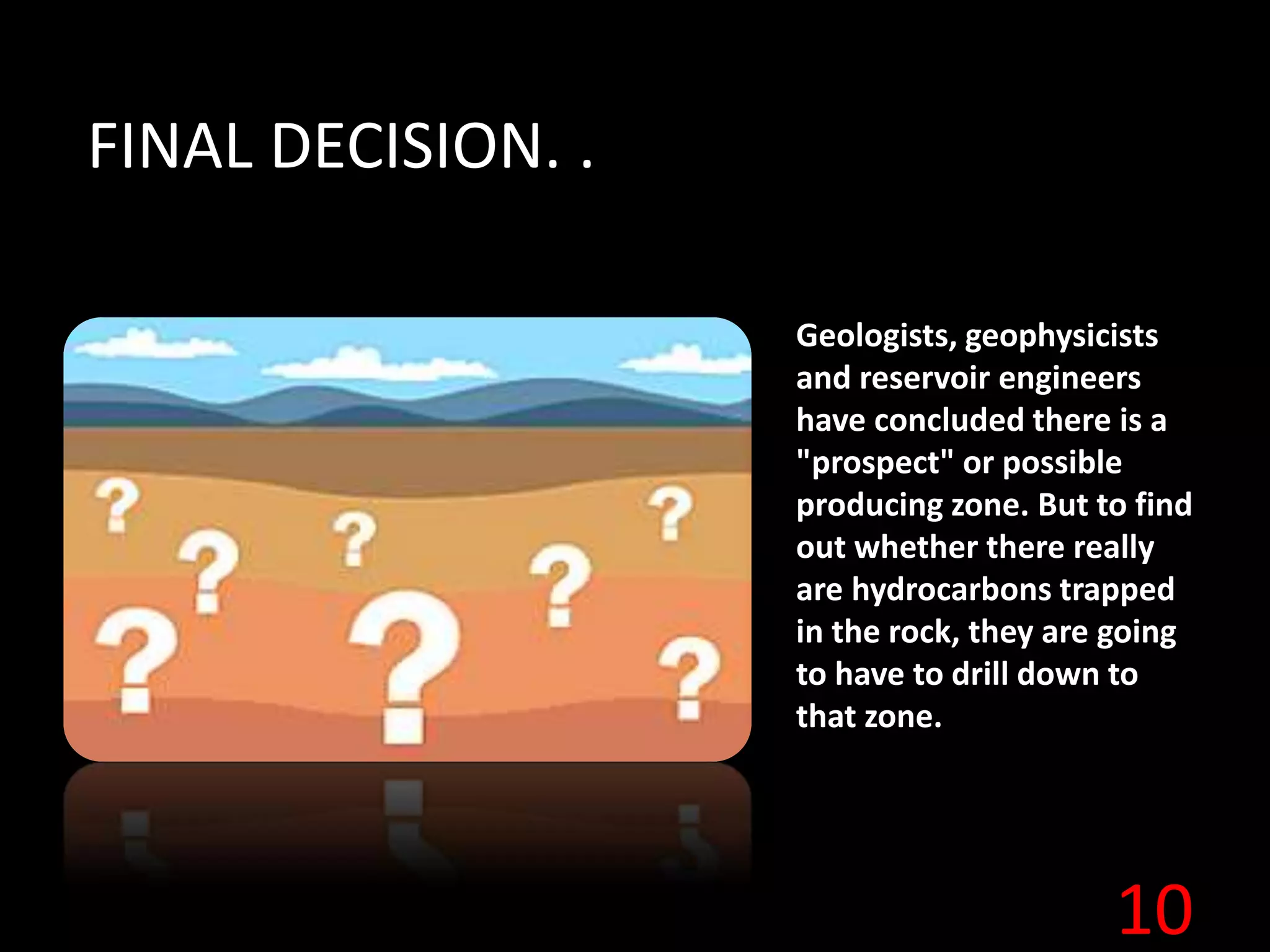
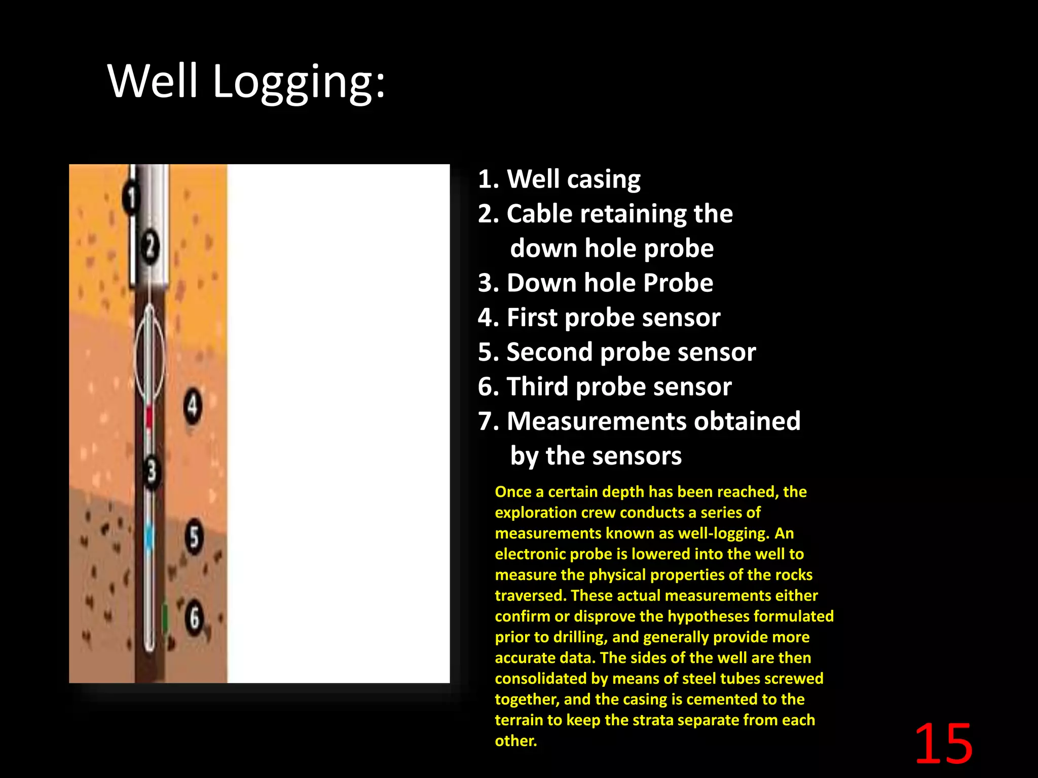
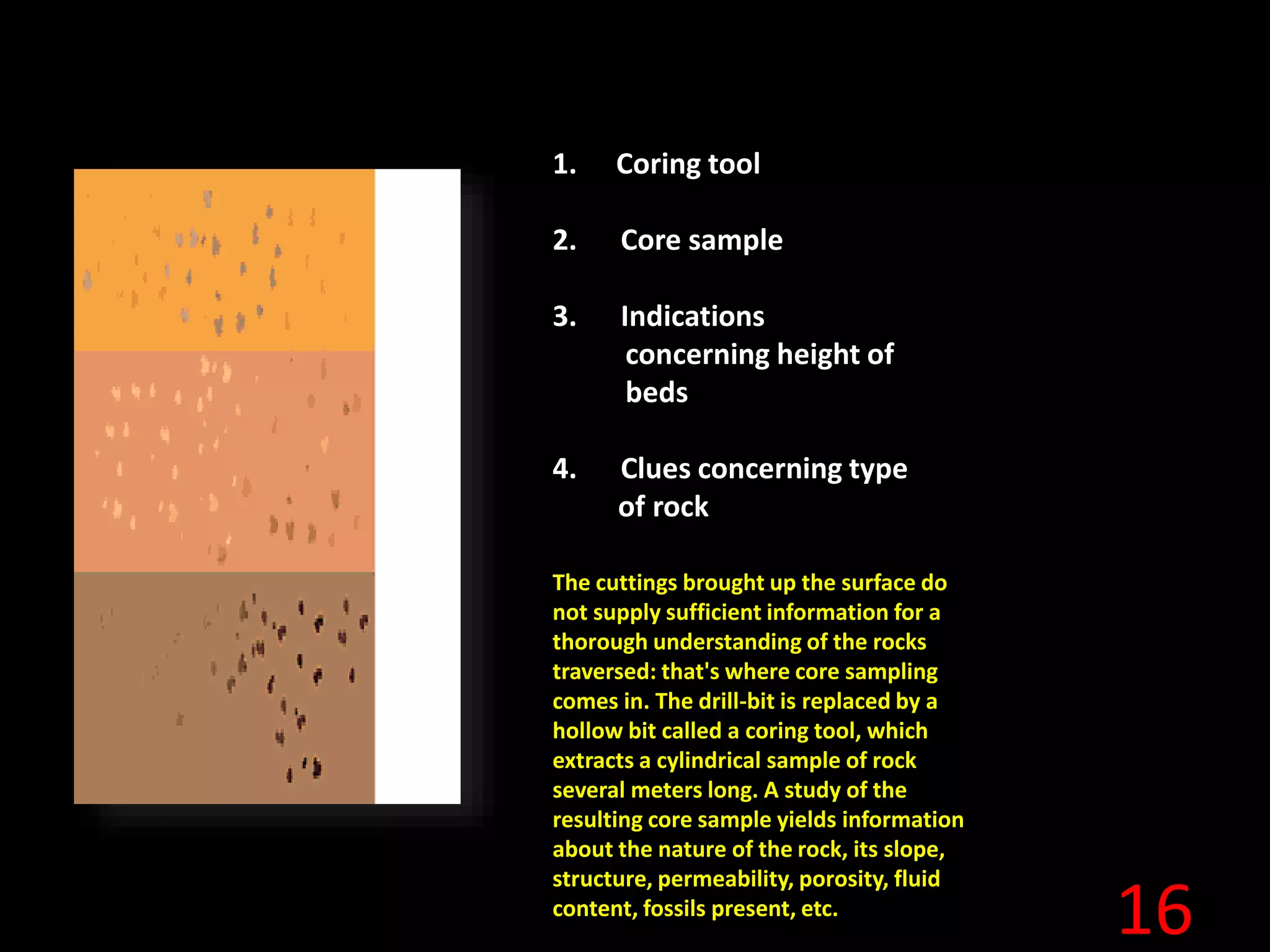
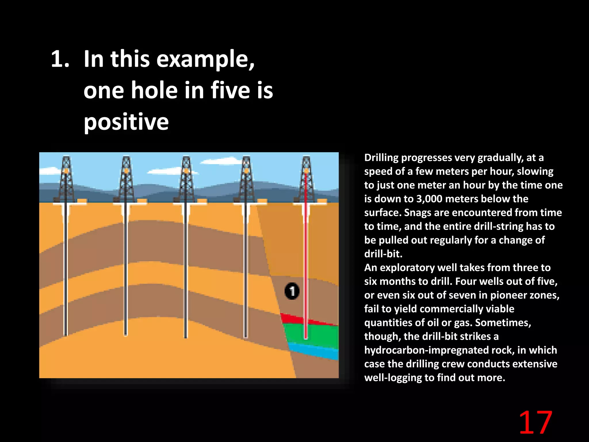
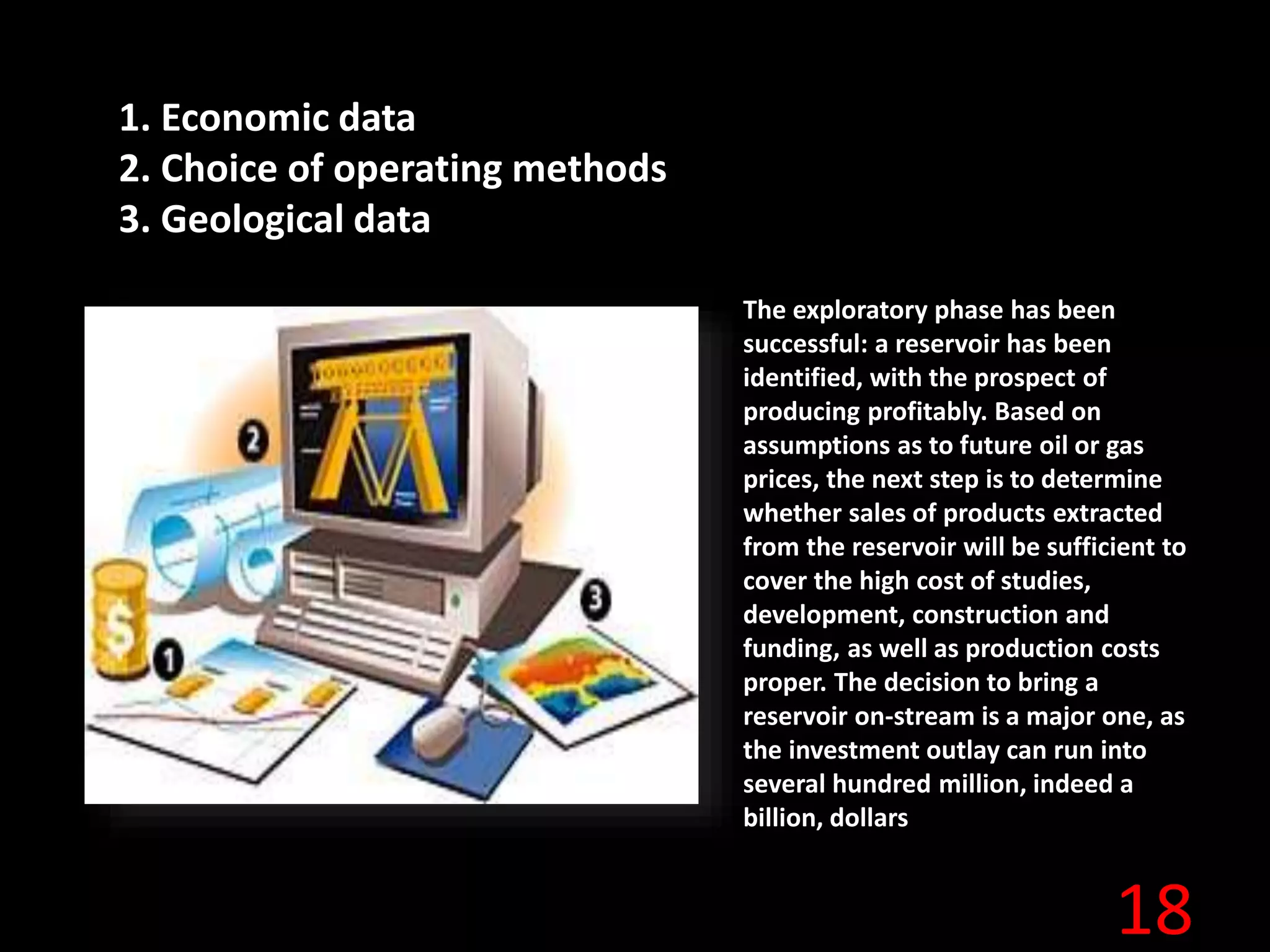
1
2
3
4
Exploration geophysics
is the use of seismic,
gravity, magnetic,
electrical,
electromagnetic, etc.,
methods in the search
for oil, gas, minerals,
water, etc.,
5
1. Signal emitted by
vibrator truck
2. Reflected waves
received by
geophones
3. Data transmitted
to laboratory truck
6
1. Isochrones
2. 3D seismic Maps
The geophysicist's seismic
recordings are fed into powerful
computers. The terrain is mapped
by means of isochronic lines
linking points on the ground at
which the waves take exactly the
same length of time to be
reflected back to the surface. This
method yields two and three-
dimensional images of the
underground strata, and the
resulting seismic maps serve to
determine whether certain strata
are likely to contain
hydrocarbons.
7
1. Seismic vessel
2. Hydrophones
In the oil man's jargon,
exploration and production at
sea is known as "offshore."
Because it is not practicable to
survey the terrain at sea, seismic
methods are used systematically.
And since ships can travel easily
in all directions, seismic
measurement is in fact easier at
sea than on land.
The geophysicist can thus obtain
more data offshore than onshore
and a more precise three-
dimensional image, once the
data have been processed.
8
All these results are
aggregated and studied.
Geologists, geophysicists,
petroleum architects,
together with drilling,
production and reservoir
engineers all supply data to
economists and financial
planners. By juggling figures,
parameters and
probabilities, they seek to
work out a possible strategy
for developing the reservoir
in the event of confirmation
of the presence of
hydrocarbons.
9
1. Geophysicist
2. Geologist
Each member of the exploration
team has contributed to the
performance of the mission. By
collating and comparing their
experience, know-how and findings,
their ultimate conclusions are the
result of a team effort. Those
conclusions are stated briefly:
No: the chances of a result are too
slim; or...
Yes: the "prospect", i.e. this highly
promising reservoir, is worth taking a
gamble. The team is prepared to
"pay to see," making the decision to
drill.
10
FINAL DECISION. .
Geologists, geophysicists
and reservoir engineers
have concluded there is a
"prospect" or possible
producing zone. But to find
out whether there really
are hydrocarbons trapped
in the rock, they are going
to have to drill down to
that zone.
11
1. Usually set up directly over the
thickest layer of hydrocarbons.
Some fields lie at depths
equivalent to twelve times the
height of the Eiffel Tower...
the siting of the drill rig is
determined based on the
existing state of knowledge of
underground conditions and the
topography of the terrain. This is
generally sited vertically above
the thickest part of the stratum
thought to contain
hydrocarbons. The drilling team
often operates under difficult
conditions. This narrow-bore
hole (with a diameter of 20-50
centimeters) is generally sunk to
a depth of between 2,000 and
4,000 meters. In a few cases it
may go beyond 6,000 meters,
and one has even gone to a
depth of 10 kilometers, or
30,000 feet.
12
1. Hoist attachment
2. Derrick (mast)
3. Traveling block
4. Hook
5. Injection head
6. Mud injection column
7. Turntable driving the
drilling pipes
8. Winches
9. Motors
10. Mud pump
11. Mud pit
12. Drilling pipe
13. Cement retaining the
casing
14. Casing
15. Drill string
16. Drilling tool
The derrick, or "mast" in
oil slang, is the visible
part of the well. This is a
metal tower several tens
of meters tall, and its
serves to lower the "drill-
string" vertically into the
ground. This drill string is
in fact a set of drill pipes
screwed end-to-end. In
rotary drilling, this string
transmits the rotating
movement to the drilling
tool (of drill-bit) and
channels mud down to
the well-bottom as the
drilling progresses.
13
1. Three-cone rock bit
2. Diamond drill bit
The drill assembly consists of
a derrick, drill-string, drive-
shaft, and the drill-bit itself.
The commonest kind of drill-
bit consists of three cones
made of extremely tough
steel capable of eating into
the rock face. When the rock
is very hard, a diamond-
tipped monobloc drill-bit is
used
14
1. Mud pit
2. Pump
3. Injection line
4. Injection head
5. Drilling pipes
6. Descending mud (in pipes)
7. Returning mud (in annular
space)
8. Filter
9. Mud return for recycling
Specially-formulated mud,
prepared under the
supervision of the hoghead
(oil man's slang for the mud
engineer) is injected through
the hollow drill-string in
order to cool the drill-bit and
consolidate the walls of the
hole. The mud also helps
prevent the oil, gas or water
found in the strata crossed
from gushing out at the
surface. Finally, the mud
cleans the well-bottom and
carries the rock cuttings back
along the pipes to the
surface. The geologist
analyzes these cuttings to
understand the nature of the
rocks traversed and detected
signs of hydrocarbons
15
Well Logging:
1. Well casing
2. Cable retaining the
down hole probe
3. Down hole Probe
4. First probe sensor
5. Second probe sensor
6. Third probe sensor
7. Measurements obtained
by the sensors
Once a certain depth has been reached, the
exploration crew conducts a series of
measurements known as well-logging. An
electronic probe is lowered into the well to
measure the physical properties of the rocks
traversed. These actual measurements either
confirm or disprove the hypotheses formulated
prior to drilling, and generally provide more
accurate data. The sides of the well are then
consolidated by means of steel tubes screwed
together, and the casing is cemented to the
terrain to keep the strata separate from each
other.
16
1. Coring tool
2. Core sample
3. Indications
concerning height of
beds
4. Clues concerning type
of rock
The cuttings brought up the surface do
not supply sufficient information for a
thorough understanding of the rocks
traversed: that's where core sampling
comes in. The drill-bit is replaced by a
hollow bit called a coring tool, which
extracts a cylindrical sample of rock
several meters long. A study of the
resulting core sample yields information
about the nature of the rock, its slope,
structure, permeability, porosity, fluid
content, fossils present, etc.
17
1. In this example,
one hole in five is
positive
Drilling progresses very gradually, at a
speed of a few meters per hour, slowing
to just one meter an hour by the time one
is down to 3,000 meters below the
surface. Snags are encountered from time
to time, and the entire drill-string has to
be pulled out regularly for a change of
drill-bit.
An exploratory well takes from three to
six months to drill. Four wells out of five,
or even six out of seven in pioneer zones,
fail to yield commercially viable
quantities of oil or gas. Sometimes,
though, the drill-bit strikes a
hydrocarbon-impregnated rock, in which
case the drilling crew conducts extensive
well-logging to find out more.
18
1. Economic data
2. Choice of operating methods
3. Geological data
The exploratory phase has been
successful: a reservoir has been
identified, with the prospect of
producing profitably. Based on
assumptions as to future oil or gas
prices, the next step is to determine
whether sales of products extracted
from the reservoir will be sufficient to
cover the high cost of studies,
development, construction and
funding, as well as production costs
proper. The decision to bring a
reservoir on-stream is a major one, as
the investment outlay can run into
several hundred million, indeed a
billion, dollars
19

Exploration Geophysics

  • 1.
  • 2.
  • 3.
  • 4.
    4 Exploration geophysics is theuse of seismic, gravity, magnetic, electrical, electromagnetic, etc., methods in the search for oil, gas, minerals, water, etc.,
  • 5.
    5 1. Signal emittedby vibrator truck 2. Reflected waves received by geophones 3. Data transmitted to laboratory truck
  • 6.
    6 1. Isochrones 2. 3Dseismic Maps The geophysicist's seismic recordings are fed into powerful computers. The terrain is mapped by means of isochronic lines linking points on the ground at which the waves take exactly the same length of time to be reflected back to the surface. This method yields two and three- dimensional images of the underground strata, and the resulting seismic maps serve to determine whether certain strata are likely to contain hydrocarbons.
  • 7.
    7 1. Seismic vessel 2.Hydrophones In the oil man's jargon, exploration and production at sea is known as "offshore." Because it is not practicable to survey the terrain at sea, seismic methods are used systematically. And since ships can travel easily in all directions, seismic measurement is in fact easier at sea than on land. The geophysicist can thus obtain more data offshore than onshore and a more precise three- dimensional image, once the data have been processed.
  • 8.
    8 All these resultsare aggregated and studied. Geologists, geophysicists, petroleum architects, together with drilling, production and reservoir engineers all supply data to economists and financial planners. By juggling figures, parameters and probabilities, they seek to work out a possible strategy for developing the reservoir in the event of confirmation of the presence of hydrocarbons.
  • 9.
    9 1. Geophysicist 2. Geologist Eachmember of the exploration team has contributed to the performance of the mission. By collating and comparing their experience, know-how and findings, their ultimate conclusions are the result of a team effort. Those conclusions are stated briefly: No: the chances of a result are too slim; or... Yes: the "prospect", i.e. this highly promising reservoir, is worth taking a gamble. The team is prepared to "pay to see," making the decision to drill.
  • 10.
    10 FINAL DECISION. . Geologists,geophysicists and reservoir engineers have concluded there is a "prospect" or possible producing zone. But to find out whether there really are hydrocarbons trapped in the rock, they are going to have to drill down to that zone.
  • 11.
    11 1. Usually setup directly over the thickest layer of hydrocarbons. Some fields lie at depths equivalent to twelve times the height of the Eiffel Tower... the siting of the drill rig is determined based on the existing state of knowledge of underground conditions and the topography of the terrain. This is generally sited vertically above the thickest part of the stratum thought to contain hydrocarbons. The drilling team often operates under difficult conditions. This narrow-bore hole (with a diameter of 20-50 centimeters) is generally sunk to a depth of between 2,000 and 4,000 meters. In a few cases it may go beyond 6,000 meters, and one has even gone to a depth of 10 kilometers, or 30,000 feet.
  • 12.
    12 1. Hoist attachment 2.Derrick (mast) 3. Traveling block 4. Hook 5. Injection head 6. Mud injection column 7. Turntable driving the drilling pipes 8. Winches 9. Motors 10. Mud pump 11. Mud pit 12. Drilling pipe 13. Cement retaining the casing 14. Casing 15. Drill string 16. Drilling tool The derrick, or "mast" in oil slang, is the visible part of the well. This is a metal tower several tens of meters tall, and its serves to lower the "drill- string" vertically into the ground. This drill string is in fact a set of drill pipes screwed end-to-end. In rotary drilling, this string transmits the rotating movement to the drilling tool (of drill-bit) and channels mud down to the well-bottom as the drilling progresses.
  • 13.
    13 1. Three-cone rockbit 2. Diamond drill bit The drill assembly consists of a derrick, drill-string, drive- shaft, and the drill-bit itself. The commonest kind of drill- bit consists of three cones made of extremely tough steel capable of eating into the rock face. When the rock is very hard, a diamond- tipped monobloc drill-bit is used
  • 14.
    14 1. Mud pit 2.Pump 3. Injection line 4. Injection head 5. Drilling pipes 6. Descending mud (in pipes) 7. Returning mud (in annular space) 8. Filter 9. Mud return for recycling Specially-formulated mud, prepared under the supervision of the hoghead (oil man's slang for the mud engineer) is injected through the hollow drill-string in order to cool the drill-bit and consolidate the walls of the hole. The mud also helps prevent the oil, gas or water found in the strata crossed from gushing out at the surface. Finally, the mud cleans the well-bottom and carries the rock cuttings back along the pipes to the surface. The geologist analyzes these cuttings to understand the nature of the rocks traversed and detected signs of hydrocarbons
  • 15.
    15 Well Logging: 1. Wellcasing 2. Cable retaining the down hole probe 3. Down hole Probe 4. First probe sensor 5. Second probe sensor 6. Third probe sensor 7. Measurements obtained by the sensors Once a certain depth has been reached, the exploration crew conducts a series of measurements known as well-logging. An electronic probe is lowered into the well to measure the physical properties of the rocks traversed. These actual measurements either confirm or disprove the hypotheses formulated prior to drilling, and generally provide more accurate data. The sides of the well are then consolidated by means of steel tubes screwed together, and the casing is cemented to the terrain to keep the strata separate from each other.
  • 16.
    16 1. Coring tool 2.Core sample 3. Indications concerning height of beds 4. Clues concerning type of rock The cuttings brought up the surface do not supply sufficient information for a thorough understanding of the rocks traversed: that's where core sampling comes in. The drill-bit is replaced by a hollow bit called a coring tool, which extracts a cylindrical sample of rock several meters long. A study of the resulting core sample yields information about the nature of the rock, its slope, structure, permeability, porosity, fluid content, fossils present, etc.
  • 17.
    17 1. In thisexample, one hole in five is positive Drilling progresses very gradually, at a speed of a few meters per hour, slowing to just one meter an hour by the time one is down to 3,000 meters below the surface. Snags are encountered from time to time, and the entire drill-string has to be pulled out regularly for a change of drill-bit. An exploratory well takes from three to six months to drill. Four wells out of five, or even six out of seven in pioneer zones, fail to yield commercially viable quantities of oil or gas. Sometimes, though, the drill-bit strikes a hydrocarbon-impregnated rock, in which case the drilling crew conducts extensive well-logging to find out more.
  • 18.
    18 1. Economic data 2.Choice of operating methods 3. Geological data The exploratory phase has been successful: a reservoir has been identified, with the prospect of producing profitably. Based on assumptions as to future oil or gas prices, the next step is to determine whether sales of products extracted from the reservoir will be sufficient to cover the high cost of studies, development, construction and funding, as well as production costs proper. The decision to bring a reservoir on-stream is a major one, as the investment outlay can run into several hundred million, indeed a billion, dollars
  • 19.