Cuyahoga Greenways: Community Meeting #3
•
1 like•1,056 views

The document summarizes Community Meeting #3 for the Cuyahoga Greenways project. It discusses the agenda, introduces the project background and partners. A proposed greenway network for Cuyahoga County is presented, including 120 miles of existing trails and 175 miles of proposed new trails and on-street bike facilities. An evaluation process involving 8 core factors was used to analyze over 300 proposed greenway projects based on criteria like access to parks, habitat, socioeconomics, and transit.

Recommended
More Related Content
Similar to Cuyahoga Greenways: Community Meeting #3
Similar to Cuyahoga Greenways: Community Meeting #3 (20)
More from Cuyahoga County Planning Commission
More from Cuyahoga County Planning Commission (20)
Recently uploaded
Recently uploaded (20)
Cuyahoga Greenways: Community Meeting #3
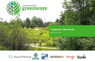
- 1. COMMUNITIY MEETING #3 May 22-23, 2018
- 2. AGENDA 1. Introduction & Background 2. Greenway Framework 3. Evaluation Process 4. Core Factor Analysis 5. Next Steps May 20182
- 4. CUYAHOGA COUNTY • Population: 1.25 million (Cleveland: 385,000) • 460 square miles • 59 cities, villages, and townships + County-wide park district 4 May 2018
- 5. PROJECT PURPOSE • Develop a strategic plan describing a series of interconnected greenways and urban trails across Cuyahoga County. • Build on the existing trail network and fill in the major missing links. • Establish a regionally significant network of routes to serve all ages and abilities. 5 May 2018
- 6. PROJECT PARTNERS CONSULTANTS: 6 Kelly Coffman Senior Strategic Parks Planner kbc@clevelandmetropark.com Glenn Coyne, FAICP Executive Director County Planning gcoyne@cuyahogacounty.us Andrew Stahlke TLCI Project Manager astahlke@mpo.noaca.org CuyahogaGreenways@clevelandmetroparks.com May 2018
- 7. MEETINGS & PUBLIC ENGAGEMENT May 20187 1 – Project Initiation • Steering Committee #1 June 2017 2 – Current Conditions • Steering Committee #2 July 2017 (3 meetings) • Community Meetings #1 August 2017 (3 meetings) • Public Web Survey August – December 2017 3 – Shaping the Vision • Steering Committee #3 November 2017 (3 meetings) • Community Meetings #2 January 2018 (3 meetings) 4 – Concept Development • Steering Committee #4 May 1 & 2 (3 meetings) • Community Meeting #3 May 22-23, 2018 (3 meetings) 5/6 – Draft Master Plan & Final Report • Final meetings TBD Summer 2018
- 9. • Priorities • Alignment with CIP/other projects • Funding • Implementation DATA DRIVEN, COMMUNITY LED Data and analysis used to inform the decision-making process. Identification of “CANDIDATE ROUTES” Greenways Off-Street Open Space Urban Trails On-Street Constrained Framework Plan Engagement Known opportunities Gap Identification Planning projects Technical Analysis Availability of: Rights-of-Way Land Properties Development of “EVALUATION CRITERIA” Where are the opportunities? How well do candidates meet our goals? Equity Connectivity Economic Ecology Engagement What are the priorities & critical issues/factors? Technical Analysis Metrics and maps 9 May 2018
- 10. COMMUNITY INPUT TO SHAPE ROUTES https://arcg.is/1WDTHP0 May 201810 2,200+ map points 103 questionnaire responses
- 11. QUESTIONNAIRE RESULTS (SAMPLE) May 201811
- 12. QUESTIONNAIRE RESULTS (SAMPLE) May 201812
- 13. GREENWAY NETWORK 13 #1 – Existing key trails May 2018
- 14. GREENWAY NETWORK 14 #2 – Regional Network Determined via public, technical, and steering committee input Regional network intended to provide: • Critical linkages to major destinations • Extend and close gaps in the existing trail network • Be designed for a broader range of users and abilities • Provide cross-county linkages May 2018
- 15. GREENWAY NETWORK 15 #3 – Regional Network Details Proposed regional routes include new trail connections as well as higher level on-street facilities, such as: • Complete sidewalks • Intersection improvements • Protected / separated bicycle lanes (cycle tracks, midway, etc.) or other appropriate facilities May 2018
- 16. GREENWAY NETWORK 16 #4 – Supporting Routes Also determined via public, technical, and steering committee input • Some on-street routes may include an existing bike facility – but may require additional enhancement. • Extend and close gaps in the existing trail network • Be designed for a broader range of users and abilities May 2018
- 17. GREENWAY NETWORK Overall Network = 811 miles Regional network • 120 miles of existing trail • 50 miles of proposed trail • 125 miles of proposed on- street routes Supporting network • 58 miles of existing trail • 104 miles of proposed trail • 354 miles of proposed on- street routes May 201817
- 18. GREENWAY NETWORK #5 – Defining “Projects” Routes are defined in terms of logical project start and end points, given a distinct name and ID number. 309 Projects Named May 201818
- 19. BICYCLE LEVEL OF TRAFFIC STRESS (LTS) May 201819 LTS 1 (children) – Low Stress LTS 2 (adults) – Moderately Low Stress LTS 3 – Moderately High Stress LTS 4 – High Stress Factors affecting bicycle traffic stress: 1. Type and size of bicycle facility (lanes width, protection, etc.) 2. Number of vehicle lanes 3. Vehicle speeds 4. Vehicle volume (Average Daily Trips or ADT) 5. 1-way vs. 2-way roads 6. Type of intersection and crossing treatments These criteria can also relate to pedestrian comfort and safety
- 20. LTS 1 & 2 FACILITIES May 201820 2-way Protected Bike Lane (cycletrack) Shared Street design w/ Advisory Bike Lanes 1-way Protected Bike Lane
- 22. EVALUATION EXAMPLE - POPULATION Step 1: Map census Population Data (Block-level) 22 May 2018
- 23. EVALUATION EXAMPLE - POPULATION Step 2: Translate into quarter-mile grid to determine population density (total population per grid cell) 23 May 2018
- 24. EVALUATION EXAMPLE - POPULATION Step 3: Overlay candidate routes 24 May 2018
- 25. EVALUATION EXAMPLE - POPULATION Step 4: Determine total population along a route based on intersected grid cells. Calculate totals based on the route length to get average population density along the route. 25 May 2018
- 26. EVALUATION EXAMPLE - POPULATION 26 May 2018 *Categorized by quantile Data Source: ACS 2016 POPULATION DENSITY • # of people per ¼ mile analysis grid Population Score Route Type Population Score 1 2 3 4 5 Top 20% Other Candidate Routes Existing Regional Network Step 5: Identify routes scoring in the top 20%. * Note that population density is used as one input into many of the core factor analyses.
- 27. CORE FACTOR ANALYSIS Cuyahoga Greenways May 201827
- 28. CORE FACTOR ANALYSIS 1 REGIONAL TRAILS ACCESS (ACS 2016 + Greenways Partner Data Set) • Density of trails within 1-mile 2 PARK & RECREATIONAL ACCESS FACTOR (ACS 2016 + CPC Land Use) • Walkable/bikeable access to parks and recreational spaces 3 HABITAT FACTOR (National Land Cover Data) • Preservation/protection opportunity • Restoration opportunity • Sewer District Watershed Planning related projects / LEAP Data 4 SOCIOECONOMIC FACTOR (ACS 2016) • Median Income • % of households, poverty rate • Unemployment rate • # unemployment /grid 5 PERSONAL MOBILITY FACTOR (ACS 2016) • Car ownership rate (people per car) • % of people commuting to work by walking/biking 6 TRANSIT FACTOR (RTA Transit Data) • Access to transit (areas with greater access prioritized) – ½ mile walk to bus stops • Priority transit corridors • Rail stations (½ mile walk) 7 JOB CENTERS FACTOR (BLS OnTheMap 2015 Data) • Focused around the places people are trying to commute to for work/school • Job / employment counts 8 COMMERCIAL-CIVIC FACTOR (CPC Land Use + ESRI Business Point Data) • Retail/entertainment destinations • Culture centers, venues, School destinations 28 PROCESS PER FACTOR: 1. Base data re-aggregated into ¼ mile grid cells 2. Sub-criteria scored on a 1-5 scale based on quantiles (20% ranges of data) 3. Sub-criteria combined at equal weighting (%’s) into factor score. 4. Factor scores computed for candidate route segments based on averaging overlapping grid cells. May 2018
- 29. CORE FACTOR ANALYSIS 29 May 2018 1 REGIONAL TRAILS ACCESS • Proximity and access to existing trails, side paths, and protected bike facilities. • “trail density” within 1-mile distance of each zone Data Source: ACS 2016 + Greenways Partner Data Set • Underserved routes • Good access routes Trail Acces Score Route Type Trail Access Score 1 2 3 4 5 Top 20% in UndeservedArea Top 20% in GoodAccess Area Other Candidate Routes Existing Regional Network
- 30. CORE FACTOR ANALYSIS 30 May 2018 2 PARK & RECREATIONAL ACCESS FACTOR • Walkable/bikeable access to parks and recreational spaces • Filtered by population density Data Source: ACS 2016 + CPC Land Use) • Underserved routes • Good access routes Trail Acces Score Route Type Trail Access Score 1 2 3 4 5 Top 20% in UndeservedArea Top 20% in GoodAccess Area Other Candidate Routes Existing Regional Network
- 31. CORE FACTOR ANALYSIS 31 May 2018 Habitat Score Route Type Top 20% Other Candidate Routes Existing Regional Network Habitat Score 1 2 3 4 5 3 HABITAT FACTOR • Preservation/protection opportunity • Natural land patch size • Density of riparian corridors • Restoration opportunity • Proximity to natural land and riparian corridors Data Source: National Landcover Dataset 2011, Greenprint Streams
- 32. CORE FACTOR ANALYSIS 32 May 2018 4 SOCIOECONOMIC FACTOR • Median Income • % of households poverty rate • Unemployment rate • Filtered by population density Data Source: ACS 2016 Socioeconomic Score Route Type Socioeconomic Score 1 2 3 4 5 Top 20% Other Candidate Routes Existing Regional Network
- 33. CORE FACTOR ANALYSIS 33 May 2018 5 PERSONAL MOBILITY FACTOR • Car ownership rate (people per car) • % of people commuting to work by walking/biking • Filtered by population density Data Source: ACS 2016 Mobility Score Route Type Top 20% Other Candidate Routes Existing Regional Network Mobility Score 1 2 3 4 5
- 34. 6 TRANSIT FACTOR • Access to transit (areas with greater access prioritized) – ½ mile walk to stops • Rail stations • Priority transit corridors Data Source: RTA Transit Data CORE FACTOR ANALYSIS 34 May 2018 Transit Score Route Type Transit Score 1 2 3 4 5 Top 20% Other Candidate Routes Existing Regional Network
- 35. CORE FACTOR ANALYSIS 35 May 2018 7 JOB CENTERS FACTOR • Focused around the places people are trying to commute to for work/school • Job / employment counts Data Source: BLS OnTheMap 2015 Data Job Score Route Type Top 20% Other Candidate Routes Existing Regional Network Job Score 1 2 3 4 5
- 36. CORE FACTOR ANALYSIS 36 May 2018 8 COMMERCIAL-CIVIC FACTOR • Retail/entertainment destinations • Culture centers, venues, School destinations Data Source: CPC Land Use + ESRI Business Point Data Commercial- Civic Score Route Type Commercial-Civic Score 1 2 3 4 5 Top 20% Other Candidate Routes Existing Regional Network
- 38. POPULATION SERVED • Total population within 1-mile of existing regional corridor: 280,453 (120 regional trail miles) Regional CGW Routes Regional Routes Regional Trail: Existing Recommended Supporting CGW Routes Local Routes Existing Proposed proposed within 1 mil of proposed reginal routes girds within 1 mile of proposed reginal routes Regional CGW Routes Regional Routes Regional Trail: Existing Recommended Supporting CGW Routes Local Routes Existing Proposed Gird - EX. Regional Routes girds within 1 mile of EX. reginal routes Total population within 1-mile of the full existing + proposed regional network : 508,091 (295 regional trail miles) 38 Grids within 1-mile of existing + proposed regional routesGrids within 1-mile of existing regional routes May 2018 Change of served population before and after full regional network built-out
- 39. • Total jobs within 1-mile of existing regional corridor: 355,159 (120 regional trail miles) Regional CGW Routes Regional Routes Regional Trail: Existing Recommended Supporting CGW Routes Local Routes Existing Proposed proposed within 1 mil of proposed reginal routes girds within 1 mile of proposed reginal routes Regional CGW Routes Regional Routes Regional Trail: Existing Recommended Supporting CGW Routes Local Routes Existing Proposed Gird - EX. Regional Routes girds within 1 mile of EX. reginal routes EMPLOYMENT AREAS SERVED Change of nearby jobs before and after full regional network built-out • Total jobs within 1-mile of the full existing + proposed regional network : 528,564 (295 regional trail miles) 39 Grids within 1-mile of existing + proposed regional routesGrids within 1-mile of existing regional routes May 2018
- 40. CONNECTIONS: PEOPLE TO JOBS May 201840 • High population area routes (RED) connected to high job density routes (GREEN) & utilizing existing trail network. • Both high job and high population density routes (PURPLE).
- 41. CONNECTIONS: JOBS TO TRANSIT May 201841 • Good access to transit (RED) routes connected to routes with both high job density and low transit access (PINK).
- 42. CONNECTIONS: PEOPLE TO PARKS May 201842 • Good access to parks (RED) routes connected to routes in underserved park areas (GREEN) • Underserved park area routes (PURPLE) that connect to existing trails.
- 43. • Good access to parks (RED) routes connected to routes in high habitat value (GREEN) areas • Routes in high habitat value and that have good access to parks (PURPLE) CONNECTIONS: PARKS TO HABITAT May 201843
- 44. Map shows all routes (102) that show up in the four “Connections” analyses • 18 routes show up twice • 84 routes show up once CONNECTIONS: ANALYSIS SUMMARY May 201844 Show up twice in hybrid analysis Show up once in hybrid analysis ROUTES THAT SHOW UP TWICE: 20 Big Creek Connector Trail 34 Brookpark Rd East 35 Brookpark Rd West 48 Chagrin Valley Connector South 53 Commercial Rd Connector 62 Day Drive To Big Creek Connector 82 E 22nd St 97 Fowles Rd 102 Garfield Park Reservation 159 Normandy Connector 179 Rockcliff Dr 183 S Belvoir Blvd 195 Smith Road Greenway 202 Som Center Rd 218 Towpath Trail 219 Treadway Creek Trail 231 W Ridgewood Dr 235 Warrensville Center Rd
- 45. EMPHASIZED PROJECTS 1. Critical regional gaps (9 routes & 13 miles) 2. Important regional links (19 routes & 88 miles) 3. Key Supporting Routes (21 routes & 70 miles) Projects identified based on stakeholder (public + steering committee) input and results from the data analysis. May 201845
- 46. NEXT TECHNICAL STEPS CORE ANALYSIS FACTORS 1 REGIONAL TRAILS ACCESS 2 PARK & RECREATIONAL ACCESS FACTOR 3 HABITAT FACTOR 4 SOCIOECONOMIC FACTOR 5 PERSONAL MOBILITY FACTOR 6 TRANSIT FACTOR 7 JOB CENTERS FACTOR 8 COMMERCIAL-CIVIC FACTOR • Understand core factors for regional and support routes. • Couple with community and stakeholder selected routes. • For priority routes, explore implementation and design considerations in greater detail. IMPLEMENTATION DESCRIPTORS Basic Route Information Land Access Network Role Project Cost Parallel Projects Champions / Partners Funding Phasing & Timing DESIGN CONSIDERATIONS Safety & Crime Route Difficulty Visual Character Stormwater Opportunity May 201846 ASSESSMENT AND FACTOR COMBINATIONS
- 47. Side Path or Widened Sidewalk Buffered / Protected Bike LanesShared Street / Advisory Bike Lanes FACILITY DESIGN – RESIDENTIAL / EXURBAN May 201847 Lane reduction and buffered lanes
- 48. FACILITY DESIGN – COMMERCIAL / URBAN May 201848 Midway Cycle Tracks Two-way protected/separated bike lane w/ on-street parking Sidepaths or widened sidewalksSlower streets / bike lanes / wide sidewalks with on-street parking
- 49. GREENWAY IMPLEMENTATION • The Cuyahoga Greenways plan will serve as a framework to guide regional connectivity • Communities can include trail routes in master plans and require implementation as a condition of site development or redevelopment • Local project champions will help: • Assess routes • Fine-tune alignments • Determine the best configuration for bicycle and pedestrian improvements • Partnerships have demonstrated success. Responsibilities can be divided between organizations for land acquisition, engineering, implementation, and management • Trail projects in northeast Ohio are funded by an array of sources May 201849
- 50. GREENWAY FUNDING Cuyahoga County communities and organizations have implemented trails with capital improvement funds and outside sources including: • Leadership and funding from non-profit organizations, developers, foundations, and individuals • Cuyahoga County Community Development Supplemental Grants • State of Ohio: • Clean Ohio Fund (Greenspace Conservation and Recreational Trails) • State Capital Improvement Program, etc. • Federal agencies: • Federal Highways Surface Transportation Program Block Grant • TIGER (Transportation Improvements Generating Economic Recovery) • CMAQ (Congestion Mitigation Air Quality) • Environmental Protection Agency Great Lakes Restoration Initiative and others • USACE – United States Army Corps of Engineers May 201850
- 51. DATA DRIVEN/COMMUNITY LED • Use the results of the analysis to assist with decision-making 1. Are the analysis results consistent with your experience? Anything missing? Data not representative? 2. Are there important routes to highlight, even if they didn’t score high on the analysis? 51 May 2018
- 52. NEXT STEPS Cuyahoga Greenways May 201852
- 53. NEXT STEPS • Community Meetings #3 • WEST: May 22nd, Lakewood Woman’s Club, Lakewood, 6:30-8:30 • CENTRAL: Canalway Center, Cleveland, 6:30-8:30 • EAST: May 23rd, Goldhorn Brewery, Cleveland, 6:30-8:30 • June→ Fall 2018 • Project Team Meeting #7 • Steering Committee Meeting #5 • Public Meeting #4 • Final Report 53 May 2018