
Recommended
More Related Content
What's hot
What's hot (19)
Viewers also liked
Viewers also liked (16)
Similar to Climate Change Geoscience
Similar to Climate Change Geoscience (20)
Recently uploaded
Recently uploaded (20)
Climate Change Geoscience
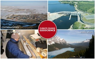
- 1. communities CLIMATE CHANGE sectors GEOSCIENCE paleoclimate indicators
- 2. CLIMATE CHANGE GEOSCIENCE Natural Resources Canada
- 3. “ For anyone who thinks that climate science must be impeachable to be useful, the past few months have been a depressing time. ” The Economist Mar 20 2010
- 4. 3 Ottawa has warmed by approximately 1°C since the late 1800s. 2 1 0 1971-2000 average -1 -2 -3 1900 1920 1940 1960 1980 2000 source: Adjusted Historical Canadian Climate Data, Environment Canada
- 5. Trend in annual temperature, 1900 - 2008 source: Goddard Institute for Space Studies, NASA degrees Celsius
- 6. The evidence for climate change is NOT just measurements of air temperature
- 7. Maximum sea ice extent September 2009 median sea ice extent 1979-2009 source: National Snow and Ice Data Center, University of Colorado
- 14. 14
- 15. CLIMATE CHANGE GEOSCIENCE Natural Resources Canada
- 16. Earth Science Sector - Program Activity Architecture CHALLENGE Develop and apply Earth Science to respond to the effects of climate change and address risks to infrastructure and communities
- 18. AGENCY PARTNERS GOVERNMENT PARTNERS Canadian Institute of Planners Parks Canada Toronto Public Health Department of Defense Halifax Port Authority Indian and Northern A airs International Joint Commission Canada-Nunavut Geoscience O ce Nunavut Nova Scotia New Brunswick Prince Edward Island British Columbia COMMUNITY PARTNERS Pangnirtung Vancouver Clyde River Iqaluit Arctic Bay Greater Toronto Resolute SCIENCE PARTNERS Repulse Bay INDUSTRY PARTNERS Climate Change Impacts and Adaptation Kugaaruk Manitoba Hydro US Geological Survey Arviat Hydro Quebec Intergovernmental Panel of Climate Change Gjoa Haven Seabridge Gold World Meteorological Organization Pond Inlet Purcell Green Power Université Laval Memorial University
- 19. EARTH SCIENCE
- 20. EARTH SCIENCE ✓shows us how climate change is a ecting critical landscapes and natural resources
- 21. EARTH SCIENCE ✓shows us how climate change is a ecting critical landscapes and natural resources ✓gives us a broader perspective on contemporary environmental and resource issues
- 22. EARTH SCIENCE ✓shows us how climate change is a ecting critical landscapes and natural resources ✓gives us a broader perspective on contemporary environmental and resource issues ✓helps us understand the past so that we can make better plans for the future
- 23. D Y N A M I C LANDSCAPES
- 24. FROM SEA TO SEA TO SEA Canada has more coastline than any other country
- 25. Coastal communities are vulnerable to ocean hazards
- 26. Globally, sea level has risen by nearly 0.2 m satellite altimetry coastal tide gauges reconstructed sea level source: IPCC (2007)
- 27. aerial photo - Vancouver COMMUNITY PARTNERS Metro Vancouver Municipality of Richmond Municipality of Delta
- 28. University of California - Santa Barbara c.f. Dyke, 2004
- 29. VANCOUVER’S UPS AND DOWNS Better forecasts of sea levels rise in Greater Vancouver
- 30. Burnaby Vancouver Richmond Delta
- 31. “ [Future sea-level rise] could have signi cant consequences for areas currently protected by dikes (such as the Fraser and Squamish deltas), where coastal erosion is already an issue (eastern Graham Island, Haida Gwaii), or where development and harbour infrastructure is close to present high tide limits. ” GOVERNMENT PARTNER Government of British Columbia
- 32. Cambridge Bay Kugluktuk Iqaluit Whale Cove Arviat
- 33. “ ...communities in the Canadian Arctic may experience continuing sea-level fall, or, at most, reduced levels of sea-level rise compared to the global average. ” James, T.S., Simon, K.M, Forbes, D,L.and Dyke, A.S. (2009) Sea-level Projections for Five Pilot Communities of the Nunavut Climate Change Partnership. Draft report submitted to the Canadian Institute of Planners, 25 p.
- 36. THE LONG VIEW
- 37. Our perspective on environmental issues is often limited in TIME and SPACE.
- 39. “We’ve got a map for that.”
- 40. NORTHERN COMMUNITIES How should development deal with thawing permafrost? 36
- 42. OUTPUT Landscape hazard maps for Nunavut communities avoid for construction recommend for construction
- 43. NORTHERN ECOSYSTEMS How is climate change impacting the tundra and boreal forest?
- 44. Satellite observations show Arctic ‘greening’ since the mid 1980s Pouliot, D., R. Latifovic, and I. Olthof (2009) International Journal of Remote Sensing
- 45. PEARLS UNSTRUNG? How will climate change a ect Canada’s Great Lakes?
- 46. 7,500-year old cedar stump rooted at the bottom of Georgian Bay
- 48. CANADA’S CHANGING CRYOSPHERE How will shrinking glaciers a ect downstream water resources?
- 49. Measuring snow accumulation in the Canadian Rocky Mountains
- 50. water gained or lost (mm) from High Arctic glaciers 2,500 Devon Meighen Melville Agassiz White 0 -2,500 -5,000 -7,500 -10,000 1960 1970 1980 1990 2000 2010
- 51. AGENCY PARTNERS GOVERNMENT PARTNERS Canadian Institute of Planners Parks Canada Toronto Public Health Department of Defense Halifax Port Authority Indian and Northern A airs International Joint Commission Canada-Nunavut Geoscience O ce Nunavut Nova Scotia New Brunswick Prince Edward Island British Columbia COMMUNITY PARTNERS Pangnirtung Vancouver Clyde River Iqaluit Arctic Bay Greater Toronto Resolute SCIENCE PARTNERS Repulse Bay INDUSTRY PARTNERS Climate Change Impacts and Adaptation Kugaaruk Manitoba Hydro US Geological Survey Arviat Hydro Quebec Intergovernmental Panel of Climate Change Gjoa Haven Seabridge Gold World Meteorological Organization Pond Inlet Purcell Green Power Université Laval Memorial University
- 54. AGENCY PARTNER Canadian Institute of Planners 50
- 55. C O N N E C T I N G PA S T WITH FUTURE
- 56. The Earth Sciences are often associated with changes that span “Deep Time”
- 57. 58.0% Percentage of Canada’s power supply 19.0% 12.0% 6.0% 3.0% 1.0% 0.5% 0.5% Source: Canadian Electricity Association
- 58. Wind power has expanded by more than 15x since 2000
- 59. Energy companies typically use short-term measurements for long-term planning
- 61. Long-term records demonstrate that the southern Prairies are vulnerable to ‘wind droughts’ ✓ Six major ‘wind droughts’ since 1954 ✓ Slow-downs persisted for 8 to 13 months ✓ Strongest events a ected most of western Canada
- 63. “ [The next strong El Niño] ... may also test the ability of Prairie wind farms to maintain expected energy outputs during a prolonged interval of unusually weak winds. ” Geophysical Research Letters December 2009
- 64. A “textbook” El Niño occurred during the 2009-2010 winter
- 65. “ And separately, we are seeing strong El Niño conditions. This has the seasonal impact of reducing wind supply compared to previous years. ” Stephen Snyder President and Chief Executive O cer February 24, 2010
- 66. Earth Science Sector - Program Activity Architecture CHALLENGE Develop and apply Earth Science to respond to the effects of climate change and address risks to infrastructure and communities
- 67. The Earth Sciences provide a unique perspective on our dynamic and changing landscape
- 68. Permafrost surveys help protect national historic sites in Canada’s North
- 69. High-altitude expeditions show how Canada’s Arctic has responded to past climate change
- 70. Understanding permafrost dynamics in emerging energy and transportation corridors
- 71. Bringing climate science to communities dealing with change
- 72. CLIMATE CHANGE GEOSCIENCE Natural Resources Canada