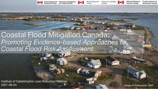
On September 24, 2021, ICLR conducted a Friday Forum webinar titled 'An evidence-based approach for Coastal Flood Risk Assessments', led by Nicky Hastings, Project Lead for the National Scale Geohazard Risk project within the Public Safety Geoscience Program at Natural Resources Canada
Canada has the longest coastline globally, approximately 243,000 kilometres of diverse geographies and geomorphologies, including fiords, arctic tundra, river delta's, bluffs and sandy or rocky beaches. The impacts of coastal flooding, tsunamis and related hazards vary across these landscapes. Approximately 6,570,000 people live in communities along Canada's coast. Many of them depend on the ocean to make their living in fisheries, shipping or other related industries. Our work applies science and technology (S&T) to advance operational capabilities, assess and model coastal hazards and risks at various scales across Canada. These assessments can better inform decisions that will reduce current and future risks and help communities adapt to a changing climate to become more resilient to these hazards. This presentation provides insights into a three-year collaborative project that brings together researchers and practitioners to work, share, demonstrate, provide guidance and integrate coastal flood models across Canada. These models are used to inform risk reduction decisions build resilience, support return on investment evaluations and buy-in for disaster risk reduction.
Nicky Hastings is the Project Lead for the National Scale Geohazard Risk project within the Public Safety Geoscience Program at Natural Resources Canada. Over the last 14 years, she has worked with a team to develop and adapt risk assessment methods to assess Canada's earthquake and flood risks. Nicky works closely with internal and external partners to better understand how scientific knowledge can inform decision making. Several initiatives are underway in the risk project, including a new five-year project under the Emergency Management Strategy that operationalizes evidence based methods to evaluate and prioritize earthquake risk reduction measures and other natural hazards.
ICLR Friday Forum: A Profile of Earthquake Risk in Canada (April 17, 2020) glennmcgillivray
On April 17, 2020 ICLR conducted a Friday Forum webinar titled 'A Profile of Earthquake Risk in Canada' led by Murray Journeay of the Geological Survey of Canada.
Individuals, businesses and government leaders are increasingly receptive to the principles of disaster resilience planning, but are unlikely to take actions in advance of a disaster without a clearly defined value proposition. While the rationale and evidence for substantial financial returns on risk reduction investments are well known, there remain significant barriers in transforming this knowledge into actions that are required on the ground to reduce the impacts of future disaster events. As a result, the short-term economic gains of continued urban growth and development that are driving escalating trends in vulnerability and risk are increasingly outpacing the willingness of individuals, businesses and institutions to invest in longer-term disaster resilience strategies. To address this challenge, the Geological Survey of Canada is developing a national earthquake risk model to establish a base of evidence to inform disaster resilience planning in accordance with policy and technical implementation guidelines established as part of the Sendai Framework for Disaster Risk Reduction (United Nations, 2015: SFDRR). The national risk extends the scope of probabilistic seismic hazard models currently used to inform Canada’s National Building Code (NBCC) by introducing a structured framework of indicators that profile the physical, social and economic dimensions of earthquake risk at the neighbourhood scale. Risk metrics are used to both analyze existing baseline conditions of earthquake risk, and to evaluate opportunities for risk reduction through proactive investments in seismic mitigation.
Murray Journeay has spent the last thirty years exploring the geological architecture and evolution of mountain systems in western Canada, and the ways in which communities interact with this landscape in terms of sustainable land use and disaster resilience planning. Research activities with the Geological Survey of Canada have ranged from field-based investigations of regional tectonic processes that drive crustal deformation and related earthquake hazards in Western Canada to computer-based modelling of earthquake risk and risk reduction strategies.
ICLR Friday Forum: Part 2 - National WUI Guide Impact Analysis (August 20, 2021)glennmcgillivray
On Friday, August 20, 2021, ICLR hosted a two-part webinar titled "The National Guide for Wildland Urban Interface Fires (Part 1), and an Impact Analysis of the National WUI Guide (Part 2).' Part two was led by Dr. Keith Porter, co-principal of SPA Risk LLC, an applied-research firm specializing in multihazard disaster risk to buildings and lifelines.
Part 2: National WUI Guide Impact Analysis
With NRC support, ICLR collaborated with SPA Risk LLC and several stakeholders to examine the impacts of following NRC’s WUI Fire Guide. Following the Guide for new construction can produce benefits that exceed the approximately $5/square-foot costs by 32:1, and more when one can rely on vegetation management. Retrofitting existing buildings, with somewhat higher costs, can save up to 14:1 in high-hazard locations. Application of the WUI Guide across Canada would add $125 billion to construction and retrofit costs over 10 years but avoid $500 billion in future losses, create 20,000 jobs, save 2,300 lives, avoid 17,000 nonfatal injuries, and protect $1 billion in tax revenues. The impact analysis suggests that the guide makes good financial sense for Canada.
On July 16, 2021 ICLR conducted a Friday Forum webinar titled 'Edmonton's approach to stormwater flood management', led by Susan Ancel, Director of One Water Planning for EPCOR Water Services in Edmonton, Alberta. EPCOR has developed a $1.6 billion Stormwater Integrated Resource Plan (SIRP) to mitigate the impacts of flooding in the community. SIRP envisions all stakeholders – citizens, businesses, industry, the City of Edmonton and EPCOR working together to build a flood-resilient future. The goal is to Slow, Move, Secure, Predict and Respond to flooding events to prevent or reduce the impact. EPCOR’s planned flood mitigations projects will take 20 years to complete. The types of projects that are included in SIRP include dry ponds, low impact development, tunnels, combined sewer separation, outfall control gates, inflow/infiltration reduction, building flood proofing, increased sensors and automatic controls and emergency response equipment. The plan was developed through consultation with Climate Change Adaptation, Insurance and Financial sector groups across North America.
Susan Ancel is the Director of One Water Planning for EPCOR Water Services in Edmonton, Alberta. In her prior role, she was Director of Stormwater Strategies, where she was responsible for developing an Integrated Resource Plan for flood mitigation that considered capital and operational risk mitigation planning, as well as the interrelationships between utilities, insurance, disaster response agencies and the public. Prior to her Stormwater Strategies role she was the Director of Water Distribution and Transmission for EPCOR. Susan is a Mechanical engineer with over 30 years’ experience with the municipal utility sector. She has also served on numerous industry committees including the Board of Directors for the Geospatial Information Technology Association (GITA) from 2001 to 2007 and was President of GITA in 2006. She currently serves on the Board of Directors for Canadian Water Network.
ICLR Friday Forum: Floodplain mapping over Canada: performance at inundation...glennmcgillivray
ICLR conducted a Friday Forum webinar on June 18, 2021 titled 'Floodplain mapping over Canada: Investigating performance at inundation level and understanding dynamics of population flood exposure', led by Dr. Slobodan Simonovic, Director of Engineering Studies, ICLR/Professor Emeritus, Department of Civil and Environmental Engineering, Western University.
Surface runoff estimates from atmospheric re-analysis datasets are increasingly preferred by hydrologists for modelling floods in regions where traditional observations are not sufficiently available. This presentation explores the fidelity of four widely used re-analyses runoff products as hydraulic forcings to a flood inundation model in describing inundation dynamics over Canada. The re-analysis obtained runoff is used with the Catchment-based Macroscale Floodplain (CaMa-Flood) global hydrodynamic model, to derive high-resolution floodplain maps for 100 and 200-yr return periods. The floodplain maps derived from each reanalysis dataset are compared with the regional developed or ‘benchmark floodplain maps’ over six selected flood-prone basins (test basins) in Canada through a set of performance statistics. Using the superior reanalysis runoff dataset, a few historic flood events over the test basins are simulated and subsequently compared with MODIS satellite-derived floodplain information. We notice that more than 75% of the inundation is precisely captured for these events.
The second part of the presentation will focus on the use of four global population datasets (together with census data from Statistics Canada as the reference), their performances and skill in flood exposure assessment across Canada. The flood exposure is quantified based on a set of floodplain maps for Canada derived from the CaMa-Flood global flood model. To obtain further insights at the regional level, the methodology is implemented over six flood-prone River Basins in Canada. We find that about 9% (3.31 million) and 11% (3.90 million) of the Canadian population resides within 1 in 100-yr and 1 in 200-yr floodplains.
This work (i) strongly supports the need for careful selection of a re-analysis dataset while performing inundation modelling for large regions: and (ii) also highlights the need for careful selection of population datasets for preventing further amplification of uncertainties in flood risk. The results derived from this study may be useful for flood risk management and contribute to understanding other disaster impacts on human-environment interrelationships.
On May 21, 2021, ICLR conducted a Friday Forum webinar titled 'Climate Disclosure, Litigation and Finance'"Climate Disclosure, Litigation and Finance' is a forthcoming chapter in 'Canada in a Changing Climate: National Issues'. In this webinar, chapter authors Paul Kovacs, Gordon McBean, Gordon Beal, Maryam Golnaraghi, Pat Koval and Bohan Li examined the evolving climate risks for businesses and governments.
Climate change is now widely regarded as an environmental and an economic issue. While the policy discussion about climate change emphasizes the urgent need to reduce greenhouse gas emissions and adapt to better cope with the impact of extreme events, the business community is increasingly focused on the physical and transition risks and opportunities presented by climate change. The research team will discuss how managing the risks and opportunities associated with climate change affect a company’s ability to access capital, deliver products and services, hire and retain employees and achieve positive financial performance.
Paul Kovacs is the Executive Director of the Institute for Catastrophic Loss Reduction.
Professor Emeritus Gordon McBean is with the ICLR and Department of Geography and Environment, Western University and the past President of the International Council for Science and former ADM of the atmospheric component of Environment Canada.
Gordon Beal, CPA, CA, M.Ed., is the Vice President of Research Guidance and Support for Chartered Professional Accountants Canada and a member of Canada’s National Climate Change Adaptation Platform Plenary.
Dr. Maryam Golnaraghi is the Director of Climate Change and Environment at The Geneva Association, a platform of Group CEOs of largest insurance companies, a non-resident senior fellow at The Atlantic Council and serves on a number of boards and advisory councils in the US, Canada and the UK.
Patricia Koval, JD, is a Board Director of a number of companies in the United States and Canada, a former partner of a major Canadian law firm, and a member of the Ontario Advisory Panel on Climate Change.
Dr. Bohan Li is a research associate at the Institute for Catastrophic Loss Reduction.
Managed Retreat for Climate Change Adaptation and Disaster Risk Reduction A C...Global Risk Forum GRFDavos
6th International Disaster and Risk Conference IDRC 2016 Integrative Risk Management - Towards Resilient Cities. 28 August - 01 September 2016 in Davos, Switzerland
Evaluating the Impact of Community Based DRR ProjectsOECD Governance
Investing in infrastructure: Costs, benefits and effectiveness of disaster risk reduction measures.
Presentation made by:
Jody Springer
Data Analytics
Hazard Mitigation Assistance, Mitigation Division
US Federal Emergency Management Agency
Economic Evaluation for Flood Control Investment in JapanOECD Governance
Investing in infrastructure: Costs, benefits and effectiveness of disaster risk reduction measures.
Presentation made by:
Kazushi FURUMOTO
Director for International Coordination of River Engineering
River Planning Division, Water and Disaster Management Bureau
Ministry of Land, Infrastructure, Transport and Tourism (MLIT), Japan
Showcases how to engage residents in climate change resiliency, building upon the equity-based model of the Cambridge Public Health Department in Cambridge, MA. A locally-tailored outreach campaign was launched collaboratively with community-based organizations. Teens were trained to help create video profiles of resident concerns.
Investing in infrastructure: Costs, benefits and effectiveness of disaster risk reduction measures.
Presentation made by:
Sabrina Lavarone
Economist – Economics and Social Science Team
Pathways for Coastal Adaptation in Metro Vancouver, Alexandra Heather RUTLEDGEGlobal Risk Forum GRFDavos
6th International Disaster and Risk Conference IDRC 2016 Integrative Risk Management - Towards Resilient Cities. 28 August - 01 September 2016 in Davos, Switzerland
Community engagement on adaptation to sea level changeNeil Dufty
A change in mean sea levels will require new ways to estimate flood risk, and ways
to mitigate this risk. This paper looks at the process of developing Adaptation Plans,
which are suburb specific studies on the risks and options for potential sea level rise,
and the key component of successful adaptation planning, community engagement.
Many coastal decision makers are actively assessing options to manage coastal
flood risk that incorporates rising sea levels. These adaptation options are broadly
grouped into three categories - protect, accommodate or retreat and each option has
its costs and benefits. The mix of options chosen largely depends on the attitudes
and perspectives of the community at risk - without their support, decisions within a
democratic political system are unlikely to be successful.
This paper reports the findings of a large survey and series of workshops of ‘at risk’
residents within Lake Macquarie Local Government Area. The survey helped gauge
their preferences for management options and decision-making considerations.
Following on from this survey is the current work on community engagement as part
of developing Adaptation Plans. This engagement is using an innovative
collaborative approach to engaging the community on sea level rise and adaptation
that focuses on building the capacity of Council and the community to work together
to find a solution that sticks.
The usefulness of this research is to increase understanding on the key concerns of
community to coastal adaptation, and more effective collaborative engagement on a
topic that is often controversial. As a result, this work aims to develop management
strategies that are more appealing to those at risk and the wider community.
Sample of a community flood education study and planNeil Dufty
Fairfield City, located in south-western Sydney, straddles parts of the Georges River and Hawkesbury-Nepean River catchments, and is home to approximately 190,000 people. Parts of the City are extremely prone to flooding.
Fairfield City Council proactively manages flood risks in accordance with the NSW Government’s 2005 Floodplain Development Manual. Council’s floodplain risk management activities are overseen by the Fairfield Floodplain Management Committee. During the last six years alone, the Committee has supervised nearly $10 million worth of investment made in floodplain management.
Although there has been this considerable investment in floodplain management, the Fairfield City communities will never be totally protected from the impacts of flooding nor can emergency authorities such as the NSW State Emergency Service (SES) ensure the safety of all residents in all floods. Therefore, it is critical that through community education the flood-affected communities across the City are aware of the flood risk, are prepared for floods, know how to respond appropriately and are able to recover as quickly as possible.
With this in mind, Council received funding to engage a suitably qualified consultant to undertake Council’s Flood Education and Awareness project for the City. Molino Stewart Pty Ltd was engaged in April 2012 to carry out the project with the main output being a community flood education plan for the City.
Methodology and findings
Molino Stewart collected a range of data to gauge the current level of flood awareness and preparedness of residents within the City. A survey that sampled flood-affected residences and a community forum on flooding run by Straight Talk Pty Ltd were the primary means of assessing flood awareness and preparedness.
The social research showed that there are generally low levels of flood awareness and preparedness across the City. This is most probably largely due to lack of flood experience as the last major flood event to occur in the City was in 1988.
Other challenges for community flood education in the City include a large culturally and linguistically diverse (CALD) population and the fact there is a relatively low level of internet usage within the City’s population.
Molino Stewart also conducted research into current best practice in community flood education to help inform the development of this plan. Research showed the need to adopt a disaster resilience learning approach with communities and this is the direction that Molino Stewart has taken in developing the plan.
Decision support system for Local Level Agencies and Communities Disaster Ris...practicalanswerssl
This is an introductory presentations to the pilot project on DRSLUP methodology implemented in Ambalantota DS Division in Hambantota District in Sri Lanka by Practical Action Sri Lanka
This was a group project I completed in Autumn of 2008, for a class on Resolving Social Conflict about environmental issues. My team conducted a stakeholder and conflict analysis covering an Environmental Impact Statement submitted by NiSource Columbia Gas in 2007, which included a request for a 50-year Incidental Take Permit.
This analysis included the interests, frames, goals, and concerns of NiSource, the Ohio EPA, environmentalist groups, local landowners, the US Fish and Wildlife Service, and other state and local agencies. We also addressed the permitting process, as well as legal issues related to the Endangered Species Act and the National Environmental Policy Act (NEPA). This SlideShare presents our analysis and recommendations for conflict prevention.
Dr. Jennifer L. Jurado, Southeast Florida Climate Change Compact, Broward County Staff Steering Committee Member, Broward County Director Natural Resources Planning and Management Division; National Institute for Coastal & Harbor Infrastructure, John F. Kennedy Center, Boston, Nov. 12, 2013: "The Triple Threat of Rising Sea Levels, Extreme Storms and Aging Infrastructure: Coastal Community Responses and The Federal Role" See http://www.nichiusa.org or http://www.nichi.us
This presentation was given as part of the EPA-funded Catchment Science and Management Course focusing on Integrated Catchment Management, held in June 2015. This course was delivered by RPS Consultants. If you have any queries or comments, or wish to use the material in this presentation, please contact catchments@epa.ie
It is increasingly being recognised internationally that integrated catchment management (ICM) is a useful organising framework for tackling the ongoing challenge of balancing sustainable use and development of our natural resource, against achieving environmental goals. The basic principles of ICM (Williams, 2012) are to:
• Take a holistic and integrated approach to the management of land, biodiversity, water and community resources at the water catchment scale;
• Involve communities in planning and managing their landscapes; and
• Find a balance between resource use and resource conservation
ICM is now well established in Australia, New Zealand, and the United States. In Europe the ICM approach has been proposed as being required to achieve effective water and catchment management, and is the approach being promoted by DEFRA for the UK, where it is called the “Catchment Based Approach” (CaBA). The principles and methodologies behind ICM sit well within the context of the Water Framework Directive with its aims and objectives for good water quality, sustainable development and public participation in water resource management. In Ireland it is proposed that the ICM approach will underlie the work and philosophy in developing and implementing future River Basin Management Plans.
DSD-INT 2017 - Coastal Hazards Adaptation Resiliency - San Francisco Bay regi...Deltares
Presentation by Rohin Saleh, Alameda County Flood Control District, USA, at the Symposium Knowledge and Innovation for Decision Making, during Delft Software Days - Edition 2017. Friday, 27 October 2017, Delft.
Presentation by Katharine Otto, Southern Windsor County Regional Planning Commission, at the National Rural Transportation Conference, December 3 - 5, 2014 in Cincinnati, OH.
Boston Harbor, Julie Wormser, Executive Director, The Boston Harbor Association, Co-Author, Preparing for the Rising Tide; National Institute for Coastal & Harbor Infrastructure, John F. Kennedy Center, Boston, Nov. 12, 2013: "The Triple Threat of Rising Sea Levels, Extreme Storms and Aging Infrastructure: Coastal Community Responses and The Federal Role"
WAMM North East Regional Workshop York 29 Jan 2020CaBASupport
Presentations from the WAMM (Wholescape Approach to Marine Management) North East Regional Workshop.
A series of 4 regional workshops is being held in 2020 to build knowledge and expertise within coastal, estuarine and CaBA partnerships across a range of issues including data and evidence, policy and legislation and the benefits of collaborative working. The workshops also provide the opportunity to meet other partnerships and initiate collaboration with potential partners, hear about project case studies and discuss barriers and opportunities to collaborative delivery. You can find out more about the WAMM project at https://www.theriverstrust.org/projects/wamm-wholescape-approach-to-marine-management/
Oil and gas are essential parts of a sustainable future. Though these are finite energy resources and sources of greenhouse gas emissions, the world continues to require their production. For this reason, it is imperative that we consider improved industry practices.
To begin, the audience will be presented with the most basic principles of sustainability pertaining to oil and gas operations, including SPE’s position on this matter. When oil is discovered at a location, decisions and guarantees cannot be made without considering the project’s life cycle. Our commitments must be demonstrated consistently along each stage of a project in direct consideration of a sustainable future.
Next, several case studies relating to sustainability, integrating the realities of the social license to operate and operations will be presented to the audience, detailing the required steps for the successful execution of any project facing challenging conditions.
The presentation will conclude by underlining that the inclusion of internal and external stakeholders will only enrich the project and, therefore, pave the road to success. It is our responsibility to create a culture of operational professionalism and reliability through active participation. In order to counterbalance the world’s energy demand, we must produce oil and gas while considering that the more efficiently the energy is produced, the more affordable the energy will be. The oil industry is not only committed to its own sustainability but also to the sustainability of our planet.
This presentation was given as part of the EPA-funded Catchment Science and Management Course focusing on Integrated Catchment Management, held in June 2015. This course was delivered by RPS Consultants. If you have any queries or comments, or wish to use the material in this presentation, please contact catchments@epa.ie
It is increasingly being recognised internationally that integrated catchment management (ICM) is a useful organising framework for tackling the ongoing challenge of balancing sustainable use and development of our natural resource, against achieving environmental goals. The basic principles of ICM (Williams, 2012) are to:
• Take a holistic and integrated approach to the management of land, biodiversity, water and community resources at the water catchment scale;
• Involve communities in planning and managing their landscapes; and
• Find a balance between resource use and resource conservation
ICM is now well established in Australia, New Zealand, and the United States. In Europe the ICM approach has been proposed as being required to achieve effective water and catchment management, and is the approach being promoted by DEFRA for the UK, where it is called the “Catchment Based Approach” (CaBA). The principles and methodologies behind ICM sit well within the context of the Water Framework Directive with its aims and objectives for good water quality, sustainable development and public participation in water resource management. In Ireland it is proposed that the ICM approach will underlie the work and philosophy in developing and implementing future River Basin Management Plans.
Presentation - Adapting to a changing climate in the management of coastal zo...OECD Environment
Presentation - Adapting to a changing climate in the management of coastal zones meeting, Enhancing Climate Resilience through the National Coastal zone management program - Laura Petes (USA)
This presentation was given at the 2019 Catchment Management Notwork meeting, which was held on the 11 October in Tullamore. All our local authorities and other bodies responsible for implementing the Water Framework Directive in Ireland attended to share knowledge and learn from each other.
DAMMED IF YOU DO, DAMNED IF YOU DON'T:
Global sea level rise and the consequences for the built environment
In light of the impacts of recent natural disasters, including the cases of Hurricane Katrina and Andrew, the need is evident for a proactive and transparent Engineering Policy approach to protect the coastal built environment. This response is especially critical considering climate change and the potential for global rise in mean sea level accompanied by increases in storm intensity and frequency.
This talk presents our simulation of the design and construction response required to protect the world's major ports from a significant rise in mean sea level. This simulation was developed through engineering design, GIS (Geographical Information System) Science, hydrologic modeling, and time scheduling based on a comparison of the project requirements to the current industry capacity. While our preliminary results show that the cost of protecting only the 177 most significant ports in terms of economic value (amongst nearly 3,000 major ports total) will be significant, our analysis also shows that the most troubling aspect of an engineering and construction response to sea level rise is the requirement for materials. This will cause dramatic shortages in sand, gravel and other materials, which will ripple through the entire construction industry.
Dr. Cynthia Rosenzweig, Senior Research Scientist, NASA Goddard Institute for Space Studies Senior Research Scientist, Earth Institute at Columbia University Co-Chair Mayor Bloomberg’s Climate Change Commission Co-Director Urban Climate Change Research Network (UCCRN); National Institute for Coastal & Harbor Infrastructure, John F. Kennedy Center, Boston, Nov. 12, 2013: "The Triple Threat of Rising Sea Levels, Extreme Storms and Aging Infrastructure: Coastal Community Responses and The Federal Role" See http://www.nichiusa.org or http://www.nichi.us
Designing for waterfront resilience in Hudson Riverfront communitiesLibby Zemaitis
The Climate-Adaptive Design (CAD) Studio links Cornell students in landscape architecture with flood-risk Hudson Riverfront communities to explore design alternatives for more climate resilient, beautiful and connected waterfront areas.
http://wri.cals.cornell.edu/hudson-river-estuary/climate-change-hudson-river-estuary/climate-adaptive-design
Find here the top headlines from the IPCC's Special Report on the Ocean and Cryosphere in a Changing Climate: as summarised by CDKN for Latin American audiences - please use together with our report of the same name on www.cdkn.org/oceanreport and find all narratives and photo credits in our associated report.
Find here the top headlines from the IPCC's Special Report on the Ocean and Cryosphere in a Changing Climate: as summarised by CDKN for South Asian audiences - please use together with our report of the same name on www.cdkn.org/oceanreport and find all narratives and photo credits in our associated report.
ICLR Friday Forum: Earthquake Early Warning (April 22, 2022)glennmcgillivray
On April 22, 2022, ICLR conducted a Friday Forum webinar title 'Earthquake Early Warning", led by Henry Seywerd, Program Manager for the Earthquake Early Warning at Natural Resources Canada.
Earthquake Early Warning (EEW) provides the ability to give warnings seconds to tens of seconds prior to the arrival of strong shaking from a major earthquake allowing the initiation of protective actions. EEW is available in many earthquake-prone countries around the world including Japan, Turkey, Mexico, and the United States. Natural Resources Canada is developing a national earthquake early warning system for Canada to cover the west coast of BC, the corridor from Ottawa to Quebec City, and other areas in Canada. The system will involve the installation of 400-600 new sensor stations, fast communication links, and new data centres for the creation of alert messages. The Canadian EEW system will be closely integrated with that operated by the US Geological Survey and use the same software packages; this will ensure consistent cross border alerts, which is particularly important in SW British Columbia. Alert messages will be distributed to the Canadian public via the National Public Alerting System. In addition, customized alerts will be available for the use of critical infrastructure operators and others to allow them to implement automated protective actions for facilities and equipment. The system is currently under development and expected to be producing alerts in 2024.
Henry Seywerd, Program Manager for the Earthquake Early Warning at Natural Resources Canada, is heading a project to establish a national system for providing rapid warnings to mitigate the effects major earthquakes. He has been involved in emergency management at NRCan for over ten years including managing the refurbishment of the Canada’s seismic monitoring network, and leading its nuclear emergency response team. Prior to joining NRCan Henry has held diverse positions in industry and research including the development of equipment for medical imaging and performing fundamental research in high energy physics.
ICLR Friday Forum: Impacts, Adaptation and Vulnerability (March 11, 2022)glennmcgillivray
On March 11, 2022, ICLR conducted a Friday Forum Webinar titled 'What are some key findings relevant to the Canadian context from the Intergovernmental Panel on Climate Change Sixth Assessment Report – Climate Change 2022: Impacts, Adoption and Vulnerability?" led by Linda Mortsch.
IPCC Assessment Reports are considered the gold standard for information on climate change impacts, adaptation and vulnerability. In February 2022, the second of four reports in the sixth assessment cycle - Working Group II’s Impacts, Adaptation and Vulnerability - was released. It represents the culmination of an exacting process where experts review and assess climate change information in order to provide a synthesis for decision-making that is policy-relevant but not policy prescriptive. This presentation addresses three topics. It begins by describing the unique IPCC assessment process. Next, it highlights key, overarching findings from the report’s Summary for Policy Makers (SPM), which has received governments’ approval. Lastly, it focuses on the North America Chapter providing details relevant to the Canadian context on a wide range of topics such as water resources, forest fires, cities, and economic sectors.
Linda Mortsch has devoted much of her career to addressing climate change issues and facilitating adaptation planning and decision-making in water resources, coastal zones, wetland ecosystems and urban areas. She has expertise collaborating with stakeholders to assess impacts, vulnerability, and resilience, and initiate adaptation. Her 1992 research project “Adapting to climate variability and change in the Great Lakes Basin” was one of the first to engage stakeholders and explore adaptation to climate change in Canada. Since 1989, Linda has played a role in the Intergovernmental Panel on Climate Change (IPCC), a co-recipient of the 2007 Nobel Peace Prize. For the sixth assessment cycle, she was the Convening Lead Author for the North America chapter. Now retired from Environment and Climate Change Canada, Linda has an adjunct appointment in the Faculty of Environment at the University of Waterloo. She continues to undertake studies that support adaptation capacity building and help meet the challenges of moving from adaptation planning to implementation and from incremental to transformative changes. Linda received the 2009 University of Waterloo, Faculty of Environment, Alumni Achievement Award in recognition of professional achievement and distinguished environmental and community leadership.
ICLR Friday Forum: Functional Recovery for Lifeline Infrastructure Systems (F...glennmcgillivray
On February 25, 2022 ICLR conducted a Friday Forum webinar titled 'Functional Recovery for Lifeline Infrastructure Systems', led by Craig A. Davis, Ph.D., P.E., G.E. of C A Davis Engineering.
Engineers design buildings and lifelines mostly to protect life safety, with few provisions to safeguard post-disaster functionality and recovery. Codes evolve, so older infrastructure tends to be less safe than new. As a result, natural disasters can damage utilities and transportation infrastructure (commonly called lifelines), kill and injure users, displace residents, close businesses, and cause other economic and socio-cultural harm. We cannot completely eliminate these risks, but we can improve community resilience by designing and retrofitting our lifelines with codes, standards, and policies that focus on post-disaster recovery. Engineers speak of these developing requirements and policies as “functional recovery,” meaning that we hope to design or modify lifelines to better ensure fast restoration of at least there basic functionality, even before all repairs are completed. Functional recovery requires acknowledging and accounting for the way lifelines interact—water service can rely on electricity and vice versa—so a functional recovery framework must ensure common degrees of reliability between interacting lifelines. In the United States, an effort is underway to develop recovery-based goals and functional-recovery design and retrofit guidelines and standards. The US Federal Emergency Management Agency and the National Institute of Standards and Technology are leading the development of recovery-based objectives for earthquake design, with consideration for future applications to other natural hazards.
Dr. Davis is a professional consultant on geotechnical, earthquake, and lifeline infrastructure system resilience engineering. He currently leads the development of functional recovery and operability concepts for lifeline infrastructure systems. Before opening a consulting firm, he led efforts to improve disaster resilience at the Los Angeles Department of Water and Power. He has written over 180 technical publications and has investigated numerous earthquakes.
ICLR Friday Forum: Risk as analysis and risk as emotion (Jan 21, 2022)glennmcgillivray
On Friday, January 21, 2022 ICLR conducted a Friday Forum webinar titled 'Risk as analysis and risk as emotion', with Dr. Lucy Jones, founder and Chief Scientist of the Dr. Lucy Jones Center for Science and Society.
Long before engineers existed, human beings evolved the concept of risk and appropriate responses to it. Psychologists have shown that we have parallel processing systems for risk, the analytical and the affective. The analytical is logical and slow, bringing reason and scientific deliberation to hazard management. The affective is our fast, instinctive and intuitive reactions to danger. Our survival has often depended on the affective system and thus we are wired to only act when our emotions are involved. Because unseen risks are more frightening, we take more precautions against nuclear accidents and earthquakes than other risks that are far more likely to kill us, such as car accidents. This talk will explore the various emotions that govern our response to risk and how this information can be used to encourage mitigation.
Dr. Lucy Jones is the founder and Chief Scientist of the Dr. Lucy Jones Center for Science and Society, with a mission to foster the understanding and application of scientific information in the creation of more resilient communities, and a Research Associate at the Seismological Laboratory of Caltech. With a Bachelor of Arts in Chinese Language and Literature from Brown University and a Ph.D. in Geophysics from MIT, Dr. Jones has been active in earthquake research for decades, furthering earthquake risk reduction, including 33 years of federal service with the US Geological Survey. Her work at the USGS included developing the methodology for estimating the probability that an earthquake will be a foreshock to a bigger event, leading the creation of a national science strategy for natural hazards research, creating the first American major earthquake drill, the Great ShakeOut, that has expanded to now encompass over 60 million participants around the world in 2019 and writing over 100 published papers on statistical seismology and integrated disaster scenarios.
ICLR Friday Forum: Development, Responsibility + Creation of Flood Risk in Ca...glennmcgillivray
On December 10, 2021, ICLR conducted a Friday Forum webinar titled 'Development, Responsibility, and the Creation of Flood Risk in Calgary, Alberta', led by Dr. Tim Haney, Mount Royal University.
Why do developers continue to build homes near rivers? Should municipal governments allow it? Should real estate agents be required to disclose a home's location in a floodplain? These are some of the questions we will explore in this talk. Based on interviews with Calgarians affected by the 2013 Southern Alberta Flood, Dr. Tim Haney's research looks at how they view the construction of new housing near Calgary's rivers, how they attribute responsibility for these new forms of risk, how they view developers and municipal government, and what they believe should be done to protect residents from flooding. The talk was based upon Dr. Haney's new article "Development, Responsibility, and the Creation of Urban Hazard Risk," and uses theory from urban political economy to understand and frame the ongoing creation of risk in Calgary.
Timothy J. Haney is Professor of Sociology at Mount Royal University in Calgary, and holds the inaugural Board of Governors Research Chair in Resilience & Sustainability. From 2014 to 2919 he served as the founding Director of the Centre for Community Disaster Research at MRU. He's a sociologist of disaster, environment, cities, and science, and holds a Ph.D. from the University of Oregon. His research covers topics such as risk perception, social inequalities in disaster recovery, climate change beliefs, post-disaster environmental views, and urban politics. His research has been published in journals such as the Journal of Urban Affairs, Environmental Sociology, Disasters, Journal of Contingencies and Crisis Management, International Journal of Mass Emergencies and Disasters, and The Sociological Quarterly. Dr. Haney lived in New Orleans during Hurricane Katrina, and takes classes of MRU students to New Orleans to learn about disaster recovery while serving the community.
ICLR Friday Forum: Quantifying Risks for Canadian Homeowners Using Quake Cat ...glennmcgillivray
On November 19, 2021, the Institute for Catastrophic Loss Reduction held a webinar title 'Quantifying Financial Risks for Canadian Homeowners Using Earthquake Catastrophe Models", led by Katsuichiro Goda, PhD, Associate Professor and Canada Research Chair in Multi-hazard Risk Assessment, Faulty of Science, Western University.
Earthquake insurance plays a pivotal role in the recovery from earthquake disasters and protects people from financial risks that damaging earthquakes pose. Currently there are significant earthquake insurance gaps between West (British Columbia) and East (Quebec). This presentation will discuss the quantification of financial insurance risks for Canadian homeowners. Possible causes of the earthquake insurance gap problems, such as risk perception and affordability, are investigated using the state-of-the-art earthquake catastrophe models and consumer survey results.
Dr Katsuichiro Goda is an Associate Professor and a Canada Research Chair in Multi-Hazard Risk Assessment at the University of Western Ontario, Canada. His research is focused on catastrophic earthquake-related multi-hazard risk management from economic and societal viewpoints. He has received international recognition on his high-quality research through various awards and grants, including a prestigious 2012 Charles F. Richter Early Career Award given by the Seismological Society of America and a Humboldt Research Fellowship Award for experienced researchers by the Alexander von Humboldt Foundation. He received the 2017 IASSAR Early Achievement Research Award given by the International Association for Structural Safety and Reliability.
ICLR Friday Forum: How Media Reports on Disaster Events (October 15, 2021)glennmcgillivray
On October 15, 2021, ICLR conducted a Friday Forum webinar titled 'Disaster Coverage: How Media Reports on Disaster Events', led by Kevin Quigley, PhD, Scholarly Director, Professor, School of Public Administration, Dalhousie University.
Media narratives play an important role in how we understand disaster events and how we hold public officials to account for their response. While media coverage of high impact-low probability events seems dramatic, in fact, it’s quite nuanced. Different types of events generate different types of coverage. Pandemics generate high volume and alarming media coverage. So, too, do terrorist attacks and industrial failures. In contrast, terrorist plots and natural disasters generate medium- to high-volume coverage that is mildly negative and at times positive towards officials. Media cover cybersecurity very little. This presentation will review the patterns and reflect on their consequences.
Kevin Quigley is a public administration scholar who specializes in risk governance and critical infrastructure, focusing in particular on public sector responses to rare and high impact events, such as pandemics, natural disasters, industrial failures and cyber and terrorist attacks. Dr. Quigley has published two critically acclaimed books on critical infrastructure, including his most recent, 'Too Critical to Fail: How Canada Manages Threats to Critical Infrastructure' (co-authored with Bisset and Mills) which was shortlisted for the 2018 Donner Prize, awarded for the best public policy book by a Canadian.
ICLR Friday Forum: Part 1 - Canada’s National Guide for WUI Fires (August 20,...glennmcgillivray
On Friday, August 20, 2021, ICLR hosted a two-part webinar titled "The National Guide for Wildland Urban Interface Fires (Part 1), and an Impact Analysis of the National WUI Guide (Part 2).' Part one was led by Dr. Noureddine Bénichou, a Principal Research Officer at the National Research Council (NRC) of Canada.
Part 1: Canada’s National Guide for Wildland-Urban Interface Fires
A National Guide for Wildland-Urban Interface Fires, the first of its kind for Canada, was recently published by the National Research Council of Canada as part of the Climate-Resilient Buildings and Core Public Infrastructure (CRBCPI) initiative. The Guide is intended to mitigate the growing risk of damage and loss due to WUI fires by improving the resilience of buildings and communities to wildfire. Drawing on recent wildfire research, existing codes, standards and guidelines, and new insights from international experts, the Guide provides comprehensive support for the WUI areas of Canada, including information on hazard and exposure assessment, vegetation management and construction measures, and community planning, resources and outreach.
ICLR special webinar: Observations from the 07/15/2021 Barrie Tornado (July 2...glennmcgillivray
On July 28, 2021 ICLR conducted a special webinar titled 'Observations from the July 15, 2021 Barrie Tornado' led by Greg Kopp of Western University Engineering, ImpactWX Chair in Severe Storms Engineering, and Project Leader of the Northern Tornadoes Project.
In this session, Dr. Greg Kopp reviewed findings he and his team documented while conducting an investigation of the aftermath of the July 15 tornado in Barrie, Ontario. The EF2-rated storm damaged approximately 150 homes, with 71 deemed by the City as “too dangerous to enter.” Dr. Kopp and his team arrived in Barrie within hours of the storm.
Dr. Greg Kopp is the ImpactWX Chair in Severe Storms Engineering and a professor in Western University’s Department of Civil and Environmental Engineering. He received a B.Sc.M.E. from the University of Manitoba in 1989, a M.Eng. from McMaster University in 1991 and a Ph.D. in Mechanical Engineering from the University of Toronto in 1995. His expertise and research relate to mitigating damage to structures during extreme wind storms such as tornadoes and hurricanes. He works actively to implement research findings into practice, currently serving as Chair of the ASCE 49 Standards Committee on Wind Tunnel Testing For Buildings and other Structures, and as a member of various other Building Code committees. A former Canada Research Chair in Wind Engineering, he is also the lead researcher for the Three Little Pigs Project at The Insurance Research Lab for Better Homes.
ICLR wildfire season forecast 2021 (May 20, 2021)glennmcgillivray
This is a forecast of the 2021 wildfire season led by Richard Carr from the Canadian Forest Service. The webinar summarizes the current conditions in Canada and provided a forecast for the 2021 wildfire season.
ICLR Friday Forum: Driving resilience forward with research (April 16, 2021)glennmcgillivray
On April 16, 2021, ICLR conducted a Friday Forum webinar titled 'Narrow the Path of Damage: Driving resilience forward with research', led by Anne Cope, PhD, Chief Engineer at the Insurance Institute for Business & Home Safety.
Severe weather disrupts lives, displaces families and drives financial loss. Anne Cope, PhD, Chief Engineer at IBHS, discussed the Institute’s latest research investigating wind, wind-driven rain, hail, and wildfire. From how wildfires burn to how hail damages a roof, top-tier science delivers actionable insights for the insurance industry and homeowners. Anne will demonstrate how IBHS is working to motivate resilience through research to drive down losses and support thriving communities.
Anne D. Cope, PhD, P.E., Chief Engineer: Dr. Anne Cope joined IBHS in 2009 just a few months before the groundbreaking for the construction of the IBHS Research Center in Richburg, South Carolina. As the Chief Engineer, she leads the development of research programs to improve the performance of structures in hurricanes, wildfires, severe thunderstorms, and hailstorms as well as the team of engineers, scientists, and skilled craftsman who conduct research on full-scale homes and commercial buildings. She is responsible for the team’s implementation of research findings into building codes and standards.
Prior to joining IBHS, Dr. Cope was a project manager and structural engineer with Reynolds, Smith & Hills, Inc., designing projects for NASA, Department of Defense, and commercial launch operations. Dr. Cope’s research encompasses topics ranging from the full-scale simulation of wind effects on buildings to detailed studies of the vulnerabilities of buildings to natural hazards and the development of damage prediction models. She is also a proud veteran of the United States Army. She earned her bachelor’s and master’s degrees in civil engineering from Clemson University, and her doctorate from the University of Florida. She is a registered professional engineer in Florida and South Carolina.
On Friday, March 19, 2021, ICLR conducted a Friday Forum webinar titled 'Solutions for Tantramar marshes flooding', led by Dr. Jeff 0llerhead, Professor, Geography and Environment Department, Mount Allison University.
Most former salt marshes in the Tantramar region of Atlantic Canada are now protected by dykes and are used primarily for agriculture. This has been true for decades to centuries and, as such, their elevation can be as much as 2 m below that of undyked salt marshes in the region. The key environmental drivers shaping the marshes are changing over time with climate change. The rate of relative sea level (RSL) rise is accelerating and there is some evidence that storms are becoming more frequent and sea ice is diminishing. The risk of a catastrophic dyke failure and associated flooding increases each year. Risk from inland flooding is also increasing.
Possible solutions include a combination of: (i) raise and reenforce the dyke system, (ii) realign existing dykes and restore salt marshes to provide natural protection, and (iii) remove existing dykes and allow the system to return to a natural state. The highest priority for managing our salt marshes should be to provide them with sufficient accommodation space into which they can transgress naturally.
Jeff 0llerhead is a member of the Geography and Environment Department at Mount Allison University in Sackville, NB. He is a coastal geomorphologist who studies beaches and salt marshes. In recent years, he has been particularly involved in designing and monitoring salt marsh restorations in the upper Bay of Fundy.
ICLR Friday Forum: Canmore: Working toward a FireSmart community (Feb 26, 2021)glennmcgillivray
On February 26, 2021, ICLR conducted a Friday Forum webinar title 'Town of Canmore: Working Towards a FireSmart Community, led by Kerri Martens, Deputy Chief of Canmore Fire Rescue and Stew Wilkenshaw, owner/operator of Montane Forest Management.
The Town of Canmore is located in southwestern Alberta between Calgary and Banff. The Bow Valley had a rich wildfire history and has evolved from centuries of wildfire. Wildfire exclusion for the past 80+ years and development in the Town of Canmore has resulted in a wildland/urban interface fire threat that requires attention.
Stew Walkinshaw and Keri Martens discussed the wildland/urban interface threat within and surrounding the Bow Valley and the steps that have been taken over the past 20+ years to reduce the threat.
Keri Martens
Keri Martens, MA, is the Deputy Fire Chief of Canmore Fire Rescue. She has been involved in the fire service for over 20 years, originally starting her career as a paid responder and then taking on the position of Fire Chief for the Lake Louise Fire Department in Alberta. Keri took on the role of Deputy Chief with Canmore Fire Rescue in 2018 where her responsibilities include overseeing the Town’s FireSmart program including the implementation of the Home Assessment program along with yearly FireSmart Forums for community residents.
Chief Martens sits on the Board of Directors of the Canadian Association of Fire Chiefs and chairs the CAFC’s Diversity, Equity and Inclusion Committee. She holds a Masters degree in Disaster and Emergency Management and is a member of Canada Task Force 2. Keri is married with 2 children and enjoys all the recreational perks of living in the Canadian Rocky Mountains.
Stew Walkinshaw
Stew Wilkenshaw is owner/operator of Montane Forest Management, based out of Canmore, and provides FireSmart specialist services to the Town of Canmore. He has specialized in FireSmart community planning and wildland/urban interface fire operations in western Canada since 1993.
ICLR Friday Forum: What's that sound?: Residents' reaction during a tsunami e...glennmcgillivray
On January 15, 2021, ICLR conducted a Friday Forum webinar titled 'What's that sound?: How Residents Responded During a Tsunami Evacuation on Vancouver Island and How Similar Evacuations Might be Improved", led by Ryan P. Reynolds, MGIS, PhD, Post Doctoral Research Fellow, School of Community and Regional Planning, University of B.C.
It’s 3am on an early Tuesday morning, and you wake to the sound of a warning siren. You realize it’s your community’s tsunami warning system, and listen as it broadcasts instructions to evacuate the tsunami inundation zone and seek shelter on higher ground. You aren’t sure if you live in the inundation zone or not. What do you do? Dr. Reynolds conducted parallel door-to-door and online surveys to better understand how Port Alberni residents responded to this exact scenario on an early January morning in 2018. He wanted to learn how and when residents learned about the tsunami warning, what actions they took to respond, and where evacuees sought safety. We also wanted to explore residents’ views on how the evacuation was conducted by emergency officials and how the event may have changed their perceptions of tsunami risk in the community. In this webinar, findings were discussed from over 450 public surveys and interviews with 11 community and regional emergency officials in the Alberni Valley and highlight some best practices to improve future evacuations.
ICLR Friday Forum: Safety + serviceability of mass timber buildings for wind ...glennmcgillivray
On December 11, 2020 ICLR conducted a Friday Forum webinar titled 'Ensuring safety and serviceability of tall mass timber buildings for wind', led by Dr. Girma Bitsuamlak of Western University.
The past two decades have seen the continuing global recognition of tall-wood buildings as a sustainable alternative to address urban densification and sprawl issues. Recent design strategies are using wood as the primary construction material for tall buildings. Alan Davenport’s wind-load-chain indicates that the wind response of structures is governed by their aerodynamic features (shape), wind speed and direction (micro-climate), and dynamic properties (weight, stiffness, and damping). The use of wood panels to construct the lateral and gravity systems of the tall-wood building makes them lightweight and less stiff than buildings made from conventional construction materials. Frequent exposure to wind-induced oscillations can cause discomfort to occupants and deflection related serviceability problems.
A coordinated wind research program was launched in January 2016 between FPInnovations, The University of British Columbia, and Western University. The research program includes aerodynamic and aeroelastic investigations of dozens of tall-wood building case studies in the boundary layer wind tunnel laboratory. It also includes a tornadic wind load study at the WindEEE dome. This talk summarized the main findings of the research program. For all case studies, safety and serviceability criteria were satisfied. However, for heights exceeding ninety meters, either aerodynamic optimization, or supplemental damping, or “wind bracing” through different hybridization techniques is required to satisfy the serviceability criteria of the 2015 National Building Code of Canada.
Girma T. Bitsuamlak, PhD, PEng, F CSCE
Professor and Canada Research Chair in Wind Engineering at the Department of Civil and Environmental Engineering; Research Director at Boundary Layer Wind Tunnel Lab. (BLWTL) and WindEEE Research Institute, Site leader at SHARCNET, Western University.
ICLR Friday Forum: Reducing the risk of fire following earthquake in B.C. (No...glennmcgillivray
On November 13, 2020, ICLR conducted a Friday Forum webinar titled 'Reducing the risk of fire following earthquake in the Lower Mainland, B.C.' led by Dr. Charles Scawthorn.
The Lower Mainland of British Columbia has significant risk due to earthquakes and the fires that follow them. Modeling was performed that accounted for fire department response, water system damage, weather and other conditions and the growth and ultimate final burnt area of fires. The resulting losses are estimated to be from nil to about C$10 billion. These are median estimates – there are significant probabilities of greater or less damage and the range is a function of the specific earthquake scenario (i.e., location and magnitude), time of day, weather and other factors. This loss would be almost entirely insured and would have a very significant impact on the Canadian insurance industry. Fire losses would come on top of shaking and other losses which would be insured to a lesser extent. A leading global reinsurer has stated that losses of this magnitude would likely result in failure of some insurers, would entail secondary and contingent losses, and could conceivably lead to financial contagion.
This risk need not be tolerated and indeed the Province of British Columbia, City of Vancouver, and regional agencies such as Metro Vancouver and BC Hydro have implemented excellent programs to reduce this risk. Further actions however can still be taken to reduce the risk of fire damage and include creation of a regional portable water supply system, providing secondary water supplies for high-rise buildings, and improvements in the region’s energy infrastructure. In this respect two actions have been de rigueur in other regions, and should be considered in the Lower Mainland: (a) a review of the overall seismic vulnerability and reliability of major energy facilities; (b) review of the gas distribution operator’s ability to control and isolate its transmission and distribution networks in the event of a major earthquake, and consideration by the operator of incorporating an automatic gas shutoff device in gas meters.
This webinar presented the modeling and results, and discussed opportunities for mitigation.
Charles Scawthorn (cscawthorn@sparisk.com ) is Principal of SPA Risk LLC and is internationally recognized as an authority for the analysis and mitigation of natural and technological hazards. He retired in 2008 as Professor and head of the Earthquake Disaster Prevention Systems Laboratory, Kyoto University (Japan), has been Visiting Professor at Stanford, Beijing Normal and Waseda (Tokyo) Universities and is now Visiting Researcher, Univ. California at Berkeley. He consults with the global insurance industry, the World Bank, local/state/federal agencies and Global 1000 corporations.
ICLR Friday Forum: Reducing the Risk of Flooding by Implementing Better Pract...glennmcgillivray
On October 9, 2020, ICLR conducted a Friday Forum webinar titled 'Reducing the Risk of Flooding by Implementing Better Practices for Sewer Construction', led by Barbara Robinson, Principal of Norton Engineering.
The conceptualization, design, construction, inspection, testing and acceptance of sanitary sewers has not changed very much in the past few decades. Civil Engineering is a very conservative field, and changes are slow to be accepted. Recent research has indicated that current design and construction practices for sanitary sewers are inadequate in reducing the risk that clean water (called Inflow and Infiltration, or I/I) enters sanitary sewers. Findings indicate that sewers are leaking unacceptably (e.g. allowing much more I/I that is permitted) when they are newly constructed, resulting in increased sewer backup flood risk in the immediate area and also downstream. Indeed, instances of basement flooding in new subdivisions are unacceptably common today.
This research (partially funded by the ICLR and Standards Council of Canada) has resulted in the publication of Best Practices Manuals to assist all stakeholders in building better sewers. These practices are being closely followed and implemented across Canada. For example, the Ontario Ministry of Environment, Conservation and Parks (the regulator that approves new sewers in Ontario) has incorporated many of these best practices in their Draft Sanitary Sewer Design Standards. The Standards Council of Canada is currently in the process of tendering the preparation of new national guidelines for new sewer system construction, based on this research. A second guideline is being prepared to share best practices in reducing excess water in existing sewer systems, with similar goals.
This presentation presented the problem, and summarized the massive costs associated with this excess I/I - costs that have not traditionally been considered in Engineering studies. In addition, the increased risks to municipalities that do not address this excess I/I was demonstrated.
Barbara Robinson, M.A.Sc., P.Eng., has been working in (literally) sanitary sewers for 30 years. As the president of Norton Engineering (est. 2015), she works across Canada assisting municipalities, provincial and federal government agencies in establishing and implementing provincial and national best practices in sanitary sewer construction, monitoring and repair. She also works as the CBC Radio 1 Infrastructure Columnist and with other media organizations.
Friday Forum: Updating Canada’s Fire Danger Rating System (August 7, 2020)glennmcgillivray
On August 7, 2020, ICLR conducted a Friday Forum webinar titled 'Updating Canada's fire danger rating system, led by Dr. Mike Wotton of the Canadian Forest Service. The Canadian Forest Fire Danger Rating System (CFFDRS) as it exists today has evolved over more than eight decades, driven by ongoing research and also by the decision support needs of wildfire management operations in Canada. The development of the next significant step in the evolution of the CFFDRS (which we refer to as the Next Generation CFFDRS research program) is currently underway. The goal of these modifications is to allow greater flexibility and consistency in predicting fire ignition and spread across a broad range of fuel complexes. The underlying approach however will still remain rooted in the philosophy of using field-based observations calibrate simple physics-based models of the key processes that influence fire environment and hence fire behaviour.
This presentation summarized the methods used for assessing and communicating wildfire potential across the Canadian landscape. It described some of the modifications being proposed to develop the next generation of the CFFDRS and what these changes will mean to both casual and expert users of the system.
This presentation, by Mike Wotton of the Canadian Forest Service, made linkages between the most publicly well-known output of the CFFDRS --the roadside fire danger sign -- and the elements of system that operational fire managers use to inform their daily response and operational planning.
On July 10, 2020, ICLR conducted a Friday Forum webinar titled 'Impact resilient roofing', lead by Vince Carrier and Mark Okland of IKO. Insurance companies across North America are experiencing rising claims from hail, severe wind and other climate risks. In many events, the most extensive losses involve damage to the roof, losses that can be prevented. IKO203 FORTIFIED Asphalt Shingle Roofs is an American Institute of Architects course that sets out actions required to install a damage resistant asphalt roof consistent with the FORTIFIED program.
This presentation explored why the program was created by the insurance industry in the United States through the Institute for Business and Home Safety. The presentation also explained how these measures provide protection from damage beyond that required in the building code, including a review of climate related resilient roofing products, testing results and the benefits of performance enhanced products.
The presentation by Mark Okland and Vince Carrier from Canada’s leading producer of asphalt shingles, IKO, was of particular interest to those presently responding to the damage resulting from the June 13 Calgary hail storm and will set out the value of an impact resilient roof.
ICLR Friday Forum: Anatomy of a billion dollar hailstorm (June 26, 2020)glennmcgillivray
On June 26, 2020, ICLR conducted a special webinar on the June 13, 2020 Southern Alberta storm. On the evening of Saturday, June 13, 2020, large swaths of southern Alberta, including portions of Calgary, where hit with high winds, torrential rain and tennis ball-sized hail. ICLR estimates that the hailstorm could very well be the costliest hail event in Canadian insurance history, surpassing the $580 million in insured damage caused by the August 7, 2014 hailstorm in Airdrie, Alberta. In this session, presenters discussed the meteorology of the event (what happened, when, why and how); the damage, as experienced by insurance adjusters responding to storm claims, and the impacts of hail on structures, including a look at building material performance, damage thresholds and damage mitigation.
Presentations include:
The anatomy of a billion dollar hailstorm
Dr. Julian Brimelow, Physical Sciences Specialist, Applied Environmental Prediction Science, Prairie & Northern Region, Environment and Climate Change Canada.
Boots on the ground: The adjusters’ view
Glenn Smith, Head of Global Catastrophe Logistics, CRU Group.
Calgary Hailstorm: Exposing our vulnerability to hail & where do we go from here?
Dr. Ian Giammanco, Lead Research Meteorologist and Senior Director for Product Design, Insurance Institute for Business and Home Safety (IBHS).
Francesca Gottschalk - How can education support child empowerment.pptxEduSkills OECD
Francesca Gottschalk from the OECD’s Centre for Educational Research and Innovation presents at the Ask an Expert Webinar: How can education support child empowerment?
Acetabularia Information For Class 9 .docxvaibhavrinwa19
Acetabularia acetabulum is a single-celled green alga that in its vegetative state is morphologically differentiated into a basal rhizoid and an axially elongated stalk, which bears whorls of branching hairs. The single diploid nucleus resides in the rhizoid.
A Strategic Approach: GenAI in EducationPeter Windle
Artificial Intelligence (AI) technologies such as Generative AI, Image Generators and Large Language Models have had a dramatic impact on teaching, learning and assessment over the past 18 months. The most immediate threat AI posed was to Academic Integrity with Higher Education Institutes (HEIs) focusing their efforts on combating the use of GenAI in assessment. Guidelines were developed for staff and students, policies put in place too. Innovative educators have forged paths in the use of Generative AI for teaching, learning and assessments leading to pockets of transformation springing up across HEIs, often with little or no top-down guidance, support or direction.
This Gasta posits a strategic approach to integrating AI into HEIs to prepare staff, students and the curriculum for an evolving world and workplace. We will highlight the advantages of working with these technologies beyond the realm of teaching, learning and assessment by considering prompt engineering skills, industry impact, curriculum changes, and the need for staff upskilling. In contrast, not engaging strategically with Generative AI poses risks, including falling behind peers, missed opportunities and failing to ensure our graduates remain employable. The rapid evolution of AI technologies necessitates a proactive and strategic approach if we are to remain relevant.
Model Attribute Check Company Auto PropertyCeline George
In Odoo, the multi-company feature allows you to manage multiple companies within a single Odoo database instance. Each company can have its own configurations while still sharing common resources such as products, customers, and suppliers.
Operation “Blue Star” is the only event in the history of Independent India where the state went into war with its own people. Even after about 40 years it is not clear if it was culmination of states anger over people of the region, a political game of power or start of dictatorial chapter in the democratic setup.
The people of Punjab felt alienated from main stream due to denial of their just demands during a long democratic struggle since independence. As it happen all over the word, it led to militant struggle with great loss of lives of military, police and civilian personnel. Killing of Indira Gandhi and massacre of innocent Sikhs in Delhi and other India cities was also associated with this movement.
Honest Reviews of Tim Han LMA Course Program.pptxtimhan337
Personal development courses are widely available today, with each one promising life-changing outcomes. Tim Han’s Life Mastery Achievers (LMA) Course has drawn a lot of interest. In addition to offering my frank assessment of Success Insider’s LMA Course, this piece examines the course’s effects via a variety of Tim Han LMA course reviews and Success Insider comments.
Read| The latest issue of The Challenger is here! We are thrilled to announce that our school paper has qualified for the NATIONAL SCHOOLS PRESS CONFERENCE (NSPC) 2024. Thank you for your unwavering support and trust. Dive into the stories that made us stand out!
Macroeconomics- Movie Location
This will be used as part of your Personal Professional Portfolio once graded.
Objective:
Prepare a presentation or a paper using research, basic comparative analysis, data organization and application of economic information. You will make an informed assessment of an economic climate outside of the United States to accomplish an entertainment industry objective.
1. Coastal Flood Mitigation Canada:
Promoting Evidence-based Approaches to
Coastal Flood Risk Assessment
Institute of Catatstrophic Loss Reduction Webinar
2021-09-24 Hamlet of Tuktoyaktuk, NWT
2. 2
Presentation Outline
1. Project Overview
2. Guidelines
3. Boundary Bay Case Study
4. Acadian Peninsula Case Study
5. Tuktoyaktuk Case Study
6. Q&A
3. Kelin Wang
Natural Resources
Canada
Tom James
Natural Resources
Canada
Gwyn Lintern
Natural Resources
Canada
Gavin Manson
Natural Resources
Canada
Carol Wagner
Natural Resources
Canada
Brent Baron
Indigenous
Services Canada
Jesal Shah
Emergency
Management BC
Lucina Leonard
University of
Victoria
Reza Amouzgar
Ocean Networks
Canada
Sean Mullen
Ocean Networks
Canada
Richard Thomson
Fisheries and
Oceans Canada
Teron Moore
Ocean Networks
Canada
Mark Rankin
Ocean Networks
Canada
Nicky Hastings
Natural Resources
Canada
Jackie Yip
Natural Resources
Canada
Julie Van de Valk
Natural Resources
Canada
Mike Ellerbeck
Natural Resources
Canada
Enda Murphy
National Research
Council Canada
Sean Ferguson
National Research
Council Canada
Joseph Kim
National Research
Council Canada
Fisheries and Oceans Peches et Oceans
Canada Canada
Research Team
Core Team
4. 4
Project Overview
FUNDING
$1.5 million from Defence Research
Development Canada
$1.4 million co-invest in-kind
Total $2.9 million over 3 years
Jan 2019 to Jan 2022
GOAL
Develop and demonstrate
best practices and tools in coastal flood
risk assessment to help coastal
communities better understand and manage
flood risk from storm surge, tsunami and
sea-level rise.
RESEARCH
PARTNERS
Natural Resources Canada (lead)
National Research Council
Department of Fisheries and Oceans
Ocean Networks Canada
Emergency Management British
Columbia
Indigenous Services Canada
University of Victoria
5. 5
Project Outcomes
Google Satellite
Imagery
Tuktoyaktuk,
NWT
Boundary
Bay, BC
Acadian
Peninsula,
NB
Three Community-level
Flood Risk Assessments
Informs Coastal Flood Hazard Assessment
Guideline
Generates new hazard data
Develop and demonstrate flood damage
modeling tools
Informs local risk reduction planning and
decision-making
6. 6
Federal Flood Mapping Guideline Series
Federal Flood Mapping Framework
Federal Hazard ID & Priority Setting
Case Studies on CC in Floodplain Mapping vol1
Federal H&H Procedures (River)
Federal Coastal Hazard Guidelines
Federal Geomatics Guidelines
Federal Flood Risk Assessment
Federal Flood Damage Estimation Guideline
Federal Land Use Guide
Bibliographies of Best Practices & References
Published In Progress
7. 7
Federal Guidelines – Coastal Flood Hazards
Procedural guidance to identify & apply coastal
flood hazard assessment methods, consistent
with best-practices
A Risk Based Approach
With guidance on current & future flood hazards
PURPOSE
TARGET AUDIENCE
Technical content targeted towards Canadian
practitioners tasked with conducting coastal flood
hazard assessment
Reference information for community
representatives and decision makers
8. 8
Federal Guidelines – Background and Introduction
The federal guidelines are being developed as a collaborative effort amongst project
partners and are informed by the outcomes of the three case studies
Boundary Bay, BC (Pacific)
Tuktoyaktuk, NWT (Arctic)
Acadian Peninsula, NB (Atlantic)
Local Experts and
Community Representatives
Project Research Team
Partnerships to support
community flood risk
assessment
Coastal Flood Hazard
Assessment Guidelines for
Risk-Based Analysis
Coastal Flood Risk Assessment Case Studies
Knowledge and expertise from
a diverse group of researchers
and practitioners
Knowledge and lessons-
learned from community case
studies
Google Satellite Imagery
9. 9
Federal Guidelines – Framework
Coastal Flood Hazard Assessment for Risk-Based Analysis
Preliminary
Identification of
Objectives,
Scenarios, and
Hazards
Data Collection
Hazard
Assessment
Communicating
Results
Flood Risk
Assessment
Community and Partner Engagement
10. 10
Flood Risk Assessment
Open
● Open Data
● Open Tools
● Collaborative
● Accessible
Standard
● Common Approach
● Scaleable
● Collaborative
● Aligns with Federal
Flood RIsk
Assessment
Guideline
Adaptable
● Ease of use
● Risk and event
based assessments
● Build on modules
● Libraries for hazard,
exposure, and
vulnerability
https://github.com/NRCan/CanFlood
Download app in
QGIS as a plugin
Manual and Tutorials
11. 11
Federal Guidelines – Community and Partner Engagement
Community and Partner Engagement
Preliminary Identification of
Objectives, Scenarios, and
Hazards
Data Collection Hazard Assessment Communicating Results
Bridge between communities and
project staff
Stronger projects and stronger
communities
Principles for engagement
12. 12
Federal Guidelines – Objectives, Scenarios, and Hazards
Community and Partner Engagement
Preliminary Identification of
Objectives, Scenarios, and
Hazards
Data Collection Hazard Assessment Communicating Results
Objective?
Appropriate
level of
analysis?
Hazard
sources?
Hazard
scenarios?
Knowledge
and
information
gaps?
Scope
13. 13
Federal Guidelines – Data Collection
Purpose: identifying and acquiring data to be incorporated into coastal flood
hazard assessment.
Key Topics:
• Elevations (bathymetry and topography)
• Hazard sources (water levels, tsunami, waves)
• Buildings, infrastructure, and flood defences
• Climate change and relative sea-level rise
Regional Data Products:
• BC Lower Mainland DEM
• Regional hazard modelling results
• Tsunami hazard sources
Community and Partner Engagement
Preliminary Identification of
Objectives, Scenarios, and
Hazards
Data Collection Hazard Assessment Communicating Results
Google Satellite Imagery
14. 14
Federal Guidelines – Hazard Assessment
Purpose: establish coastal flood hazard scenarios and
model coastal flood events
Key Topics:
• Establishing hazard scenarios and likelihoods
• Model development (e.g. model domain, spatial/temporal resolution, model
forcing, calibration and validation)
• Incorporating climate change and relative sea-level rise
Community and Partner Engagement
Preliminary Identification of
Objectives, Scenarios, and
Hazards
Data Collection Hazard Assessment Communicating Results
Google Satellite Imagery
15. 15
Federal Guidelines – Communicating Results
Community and Partner Engagement
Preliminary Identification of
Objectives, Scenarios, and
Hazards
Data Collection Hazard Assessment Communicating Results
16. 16
Federal Guidelines – Next Steps
Draft guideline
Fall 2021
Guideline review
via expert
committee
Final bilingual
guideline Spring
2022
17. 17
Boundary Bay Case Study
Coastal Flood Hazard and
Risk Assessment for the
Boundary Bay Area and
Semiahmoo First Nation
Google Satellite Imagery
Google Satellite Imagery
Paul Gadbois
19. 19
Boundary Bay - Indigenous and Scientific Knowledge
“Indigenous
people’s terrifying
tsunami stories are
a history and a
warning.”
- Ann Finkbeiner
Nuu-chah-nulth artist Tim Paul
20. 20
Boundary Bay – Data Collection
Topo-Bathy DEM
• Collection and merger of many datasets
• International considerations
• Vertical datum adjustment
• DEM workshops with multiple stakeholders
21. 21
Boundary Bay – Hazard Assessment
Effect of global sea level rise on Boundary
Bay area
• Conclusions:
• Storm surge flooding will impact
communities if not mitigated
• Significant parts of the region are
below high tide level & protected by
sea dikes which flood as sea levels
rise.
• Storm surge amplitudes are higher in
shallow areas such as Boundary Bay
• Models align well with actual events
Photo: Paul Gadbois
Storm Surge Modelling
Dec 2018 Storm
22. 22
Boundary Bay – Hazard Assessment
Meteo
Landslide
Local Earthquake – Cascadia 1700
• Buried rupture
• Splay fault
Distant Earthquake - Alaska 1964
• Historical event
Shallow crustal Earthquakes
• Sandy Bay fault
• Birch Bay fault
• Skip Jack Fault
Tsunami Scenarios
23. 23
Boundary Bay – Hazard Assessment
Max wave heights for various
disturbances
Max wave heights for disturbance
at 35m/s
Max current speeds for
disturbance at 35m/s
Meteotsunami - November 1st 2010 Event
24. 24
Boundary Bay – Hazard Assessment
Research by: Fatemeh Nematii, UVictoria
Landslide Generated Tsunamis Orcas Island max height at t=120min
31. 31
Acadian Peninsula Case Study
Coastal Flood Hazard and
Risk Assessment for the
Acadian Peninsula Region
of New Brunswick
D. Bérubé & M. Desrosiers
Google Satellite Imagery
Google Satellite Imagery
32. 32
Acadian Peninsula – Community Workshop and Site Visit
Community Workshop
Sainte-Marie – Saint-Raphäel, NB
Lamèque, NB
Community Workshop – Valorēs, Shippagan, NB
Learn about coastal flooding concerns
Identify information needs
Shape project scope
Discussion with local researchers regarding coastal threats,
concerns, and perspectives
Storm surge flooding and sea-level rise
Waves
Coastal morphology and erosion (dunes and cliffs)
Existing mitigation measures
Site Visits - Coastal communities
33. 33
Acadian Peninsula– Community Workshop and Site Visit
What we asked
• Are there any sources of data that can be used to support
model calibration/validation?
• What local contexts should be considered?
• What kind of information do your communities need to
support planning and decision making?
What we learned
• Existing quantitative and qualitative flood observation data available
from local research initiatives build upon this work
• Saltwater intrusion on peat land can disrupt this industry
• Dunes and reliefs are vulnerable to wave actions
• Port infrastructure (economically important)
• Fish processing plant & wharf are at risk of flooding
• Impacts on property values and insurance premiums
• Continue public consultation on the project
• Simulate scenarios to propose to municipalities
• Information about the effect of flood protection structures
• Regular reviews of the models used for mapping
Community Workshop:
A. Robichaud
35. 35
Acadian Peninsula – Data Collection
Community-Scale Model Development
• Elevation data:
• Bathymetry: Best-available bathymetry from
CHS
• Topography: 1m-resolution hydro-enforced
DEM and LiDAR point data
• Roughness based on land cover data
• Boundary conditions based on regional-scale
model output
• Winds and atmospheric pressure forcing from
ERA5 reanalysis dataset
• Resolution of 10m near communities of interest
Regional-scale model
Community-scale model
36. 36
Acadian Peninsula – Hazard Modelling
Nested Model Approach:
Regional-Scale / Coarse Resolution
• Simulate generation and evolution of storm
surges on the Atlantic continental shelf
Community-Scale / Fine Resolution
• Simulate inundation with sufficient resolution to
support assessment of damages and
consequences caused by flooding
37. 37
Acadian Peninsula – Regional-Scale Model
Regional-Scale Model Development
• Developed using TELEMAC-2D
• Forced by synoptic-scale wind and atmospheric pressure fields from ERA5 global reanalysis dataset
• Resolution ranging from 30km (along boundary) to 200m near the Acadian Peninsula
• Calibrated by adjusting wind drag and bed friction parameters
• Possible to incorporate impacts of sea-ice via adjustment of wind drag
Hurricane Dorian – September 2019
38. 38
Acadian Peninsula – Community-Scale Model Calibration
• Calibration was conducted using surveyed
debris observations (sea-wrack) provided by
Government of New Brunswick
• Indicate peak water elevation and
maximum flood extent
• Field survey data available for two events
• Additional validation based on photographic
and video evidence
50m
D. Bérubé & M. Desrosiers
39. 39
Acadian Peninsula – Flood Scenarios
Storm surge events primarily driven by:
• Extratropical winter storms
• Post-tropical cyclones
Statistical methods were used to estimate extreme
water levels and likelihoods (Annual Exceedance
Probability – AEP) based on data from the Belledune
tide gauge
• Peak-over-threshold (POT) extreme value
analysis of
• Surges
• Water Levels
• Joint-probability of surges and tides
• Values from literature
AEP Return Period
Storm Surge
(m)
Water Level
(m MWL)
50% 2-yr 0.95 1.82
20% 5-yr 1.10 1.97
10% 10-yr 1.23 2.10
5% 20-yr 1.36 2.23
2% 50-yr 1.56 2.48
1% 100-yr 1.73 2.69
41. 41
Acadian Peninsula – Risk Assessment
The results from the flood hazard modelling will be used to support risk assessment
• What types of assets and infrastructure are exposed to flood water?
• How much damage is incurred?
ELEMENTS/IMPACTS
EXPOSURE
(location and number of
element exposed to
flooding)
VULNERABILITY
(level of damage and
monetary cost)
SOCIAL
Total population ✔
Vulnerable population ✔
Schools ✔
Senior and disabilities care
facilities
✔
BUILT ENVIRONMENT
Residential buildings ✔ ✔
Commercial & Industrial
buildings
✔ ✔
Public/recreational buildings ✔
Segments of roads ✔
Electric power assets ✔
NATURAL ENVIRONMENT
National parks and protected
areas
✔
Agricultural land ✔
Flood debris (tons) ✔
Flood hazard modelling results are integrated with
assets inventory and damage functions to estimate
annualized damages
• CanFlood – Flood risk modelling toolbox (QGIS)
42. 42
Acadian Peninsula – Conclusions and Next Steps
Next Steps
• Complete risk assessment tasks to estimate damages
and consequences based on modelled flood hazard
• Communicate findings with community members and
representatives
• Explore avenues to support decision making and
integrate with existing tools and systems
• Integrate findings and lessons-learned from the case
study work into the federal guideline document
45. 45
Tuktoyaktuk – Community Engagement
Consultation with the Elders of Tuktoyaktuk,
March 29th, 2021
“Every summer it is getting worse weather
with more wind than ever. On the north
side, every year, they try to put some
protection on the coastline, but it does not
work as the winds are too strong.
46. 46
Tuktoyaktuk - Challenges
Effect of sea ice on storm
surges
Left image: Damon, A., & Laine, B. (2019). Arctic melt: The threat beneath the ice. CNN.
Non-conventional high water
marks (Driftwood)
47. 47
Tuktoyaktuk – Regional Model
July 2019 Storm Event August 2013 Storm Event
August 2018 Storm Event
Regional Model
48. CSSP Update March 18th, 2021
48
Tuktoyaktuk – Community Scale Model
100 year return period event
Scenarios under
consideration:
• 100 year
• 50 year
• 20 year
• 10 year
• 5 year
• All at present-day, 0.5m,
1m, 2m global SLR.
Flood Simulation for July 21st,
2019
Flooding Extents
A
B
50. 50
Questions
• Do you see the guidelines being useful for your
purposes? (yes – very, yes – somewhat, not at all)
• Have you carried out a coastal flood hazard or risk
assessment in your community? (yes, no, hope to)
• In what areas did you face challenges with your
hazard or risk assessment? (topographic data,
hazard data, climate change data, lack of guidance,
scenario selection, community involvement, other)
51. 51
Thank you
Fisheries and Oceans Peches et Oceans
Canada Canada
To express interest
in the guideline review
committee, email
nicky.hastings@nrcan-
rncan.gc.ca