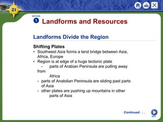
Physical Geography of Southwest Asia:
Harsh and Arid Lands
Southwest Asia’s land is mostly arid or desert. The
region is defined by the resource it lacks—water,
and the one it has in abundance—oil.
NEXT
SECTION 1 Landforms and Resources
SECTION 2 Climate and Vegetation
NEXT
SECTION 3 Human-Environment Interaction
Physical Geography of Southwest Asia:
Harsh and Arid Lands
NEXT
Section 1
Landforms and
Resources
• The Southwest Asian landforms have had a
major impact on movement in the region.
• The most valuable resources in Southwest
Asia are oil and water.
Landforms Divide the Region
Shifting Plates
• Southwest Asia forms a land bridge between Asia,
Africa, Europe
• Region is at edge of a huge tectonic plate
- parts of Arabian Peninsula are pulling away
from
Africa
- parts of Anatolian Peninsula are sliding past parts
of Asia
- other plates are pushing up mountains in other
parts of Asia
Landforms and Resources
SECTION
1
NEXT
Continued . . .
SECTION
1
NEXT
Peninsulas and Waterways
• Arabian Peninsula lies between Red Sea and
Persian Gulf
• Red Sea covers a rift valley created by Arabian plate
movement
• Zagros, Elburz, Taurus mountains at north side cut
off part of region
• Anatolian Peninsula (Turkey) is between Black and
Mediterranean seas
• Strategic waterways include Suez Canal from Red
Sea to Mediterranean
- Bosporus and Dardenelles straits connect to
Russia, Asia
continued Landforms Divide the Region
Continued . . .
SECTION
1
NEXT
Plains and Highlands
• Arabian Peninsula is covered by dry, sandy, windy
plains
- wadis—riverbeds that are dry except in rainy
season
• Iran has stony, salty, sandy desert plateau
surrounded by mountains
• Anatolian Peninsula is plateau with some
agriculture, grazing
• Afghanistan’s Northern Plain is farming area
surrounded by mountains
• Golan Heights (Al Jawlan)—plateau near Jordan
River, Sea of Galilee
- site of conflict due to strategic location
continued Landforms Divide the Region
Continued . . .
SECTION
1
NEXT
Mountains
• Afghanistan’s Hindu Kush Mountains help frame
southern Asia
- country is isolated by its landlocked, mountainous
terrain
• Iran’s Zagros Mountains isolate it from rest of
Southwest Asia
- Elburz Mountains cut Iran off from the Caspian
Sea
• Taurus Mountains separate Turkey from rest of
Southwest Asia
• Goods, people, ideas move through region in spite
of mountains
continued Landforms Divide the Region
Continued . . .
SECTION
1
NEXT
Water Bodies
• Region is surrounded by bodies of water; few rivers
flow all year
• The Tigris and the Euphrates rivers flow through
Turkey, Syria, Iraq
- Fertile Crescent supported several ancient
civilizations
- parallel rivers meet at Shatt al Arab, empty into
Persian Gulf
• Jordan River flows from Lebanon’s Mt. Hermon
between Israel, Jordan
• Empties into Dead Sea—landlocked salt lake that
only bacteria live in
- lowest place on earth’s exposed crust: 1,349 feet
below sea level
continued Landforms Divide the Region
Resources for a Modern World
An Oil-Rich Region
• Oil is region’s most abundant resource
- oil fields located in Arabian Peninsula, Iran, Iraq
- provide major part of those nations’ income
• Half of the world’s oil reserves are in Southwest Asia
- found along Persian Gulf coast or at offshore sites
• U.S. and many other countries depend on oil
reserves
SECTION
1
NEXT
Continued . . .
SECTION
1
NEXT
Other Resources
• In some parts of region, the most valuable resource
is water
• Water is relatively plentiful in Turkey, Iran, Lebanon,
Afghanistan
- harnessed for hydroelectric power
• In other regions, water is scarce; must be guarded,
conserved
• Coal, copper, potash, phosphate deposits mostly
small, scattered
- Iran, Turkey have large coal deposits
- salts like calcium chloride around Dead Sea have
not been developed
continued Resources for a Modern World
NEXT
Section 2
Climate and Vegetation
• Most of Southwest Asia has a very arid
climate.
• Irrigation is critical to growing crops in this
very dry region.
Variety in Arid Lands
Mostly Dry and Desert, but Some Green
• Most areas get less than 18 inches of precipitation a
year
• Rough, dry terrain includes sand dunes, salt flats
• Rivers don’t flow all year; plants, animals live on little
water
- in many areas irrigation turns desert into farmland
• Other areas have Mediterranean climate; green, lush
part of each year
• Mountain ranges and plateaus have highland
climates
Climate and Vegetation
SECTION
2
NEXT
Deserts Limit Movement
Sandy Deserts
• Rub al-Khali—Arabian Peninsula desert, known as
the Empty Quarter
- 250,000 square miles, with dunes as high as 800
feet
- 10 years can pass without rain
• Nearby An-Nafud Desert contains the occasional
oasis
- desert area where underground spring water
supports vegetation
• Syrian Desert is between Lebanon, Israel, Syria, and
Fertile Crescent
• Israel’s Negev Desert produces crops through
irrigation
SECTION
2
Continued . . .
NEXT
SECTION
2
NEXT
Salt Deserts
• In Iran, high mountains block rain; dry winds increase
evaporation
- loss of moisture in soil leaves chemical salts,
creates salt flat
• Iran’s salt flat deserts:
- Dasht-e Kavir in central Iran
- Dasht-e Lut in eastern Iran
• Land is salt-crusted, surrounded by salt marshes, very
hot
- almost uninhabited, it’s a barrier to easy travel
across Iran
continued Deserts Limit Movement
Semi-Arid Lands
The Edge of the Desert
• Fringes of deserts have semiarid climate
• Warm to hot summers; enough rainfall for grasses,
shrubs
- cotton and wheat can be grown
• Good pasture for animals
- herds of mohair goats raised in Turkey
- mohair hair and fabrics from it are among Turkey’s
exports
SECTION
2
NEXT
Well-Watered Coast Lands
The Mediterranean Coast
• Areas along Mediterranean coast and in Turkey
have adequate rainfall
- hot summers, rainy winters promote citrus fruits,
olives, vegetables
• Mild winters and summer irrigation let farmers grow
crops all year
• Areas are heavily populated due to comfortable
climate
SECTION
2
NEXT
The Tigris and Euphrates
• River valleys the site of intensive farming for
thousands of years
- Turkey, Iraq built dams on rivers to provide
irrigation all year
NEXT
Section 3
Human-Environment
Interaction
• Water is critical to regional physical survival
and economic development.
• Discovery of oil increased the global
economic importance of Southwest Asia.
Providing Precious Water
Dams and Irrigation Systems
• Large farms and growing populations require dams,
irrigation
- Turkey is building dams and a man-made lake on
upper Euphrates
- controversial project will deprive downstream
countries of water
• Israel’s National Water Carrier project
- takes water from northern areas
- carries it to central, south, Negev Desert
- water flows through several countries so project
creating conflict
Human-Environment Interaction
SECTION
3
NEXT
Continued . . .
SECTION
3
NEXT
Modern Water Technology
• Drip irrigation—small pipes slowly drip water just
above ground
• Desalinization removes salt from ocean water at
treatment plants
- plants are expensive, cannot provide enough water
• Wastewater can be treated and used for agriculture
• Fossil water is pumped from underground aquifers
- water has been in aquifer for long periods of time
- rainfall won’t refill aquifers; only 25–30 years of
usage remain
continued Providing Precious Water
Oil From the Sand
Forming Petroleum
• Oil, natural gas deposits formed millions of years
ago
- sea covered area; remains of plants, animals
mingled in sand, mud
- pressure and heat slowly transformed material
into hydrocarbons
• Oil, gas are not in underground pools, but in the tiny
pores of rocks
- nonporous rock barriers trap gas, oil below
surface
- makes oil difficult to find, remove
- wasn’t found in region until 1920–30s
SECTION
3
NEXT
Continued . . .
SECTION
3
NEXT
Early Exploration
• Industrialization, automobiles increase need for
petroleum
• First oil discovery in region was in 1908 in Persia (now
Iran)
- more oil fields found in Arabian Peninsula, Persian
Gulf in 1938
• In 1948, al-Ghawar field discovered at eastern edge
of Rub al-Khali
- became one of world’s largest oil fields
- contains one-quarter of Saudi Arabia’s oil reserves
continued Oil From the Sand
Continued . . .
SECTION
3
NEXT
Transporting Oil
• Crude oil is petroleum that has not been processed
- refinery converts crude oil into useful products
• Pipelines move crude oil to refineries, ports
- ports on Persian Gulf, Red Sea, Mediterranean Sea
- tankers carry petroleum to world markets
• In some places refineries process crude oil near ports
continued Oil From the Sand
Continued . . .
SECTION
3
NEXT
Risks of Transporting Oil
• Largest oil spill was in January 1991, during Persian
Gulf War
- Kuwaiti tankers, oil storage tanks were blown up
- 240 million gallons of crude oil spilled into water,
land
• Buried pipelines reduce accidents; are monitored for
leaks
• Tankers are a high pollution risk; operate in shallow,
narrow waters
- double hulls help prevent some spills
continued Oil From the Sand
NEXT
This is the end of the chapter presentation of
lecture notes. Click the HOME or EXIT button.
Print Slide Show
1. On the File menu, select Print
2. In the pop-up menu, select Microsoft PowerPoint
If the dialog box does not include this pop-up, continue
to step 4
3. In the Print what box, choose the presentation format
you want to print: slides, notes, handouts, or outline
4. Click the Print button to print the PowerPoint
presentation
CONTINUE

Chapter 21

  • 1.
    Physical Geography ofSouthwest Asia: Harsh and Arid Lands Southwest Asia’s land is mostly arid or desert. The region is defined by the resource it lacks—water, and the one it has in abundance—oil. NEXT
  • 2.
    SECTION 1 Landformsand Resources SECTION 2 Climate and Vegetation NEXT SECTION 3 Human-Environment Interaction Physical Geography of Southwest Asia: Harsh and Arid Lands
  • 3.
    NEXT Section 1 Landforms and Resources •The Southwest Asian landforms have had a major impact on movement in the region. • The most valuable resources in Southwest Asia are oil and water.
  • 4.
    Landforms Divide theRegion Shifting Plates • Southwest Asia forms a land bridge between Asia, Africa, Europe • Region is at edge of a huge tectonic plate - parts of Arabian Peninsula are pulling away from Africa - parts of Anatolian Peninsula are sliding past parts of Asia - other plates are pushing up mountains in other parts of Asia Landforms and Resources SECTION 1 NEXT Continued . . .
  • 5.
    SECTION 1 NEXT Peninsulas and Waterways •Arabian Peninsula lies between Red Sea and Persian Gulf • Red Sea covers a rift valley created by Arabian plate movement • Zagros, Elburz, Taurus mountains at north side cut off part of region • Anatolian Peninsula (Turkey) is between Black and Mediterranean seas • Strategic waterways include Suez Canal from Red Sea to Mediterranean - Bosporus and Dardenelles straits connect to Russia, Asia continued Landforms Divide the Region Continued . . .
  • 6.
    SECTION 1 NEXT Plains and Highlands •Arabian Peninsula is covered by dry, sandy, windy plains - wadis—riverbeds that are dry except in rainy season • Iran has stony, salty, sandy desert plateau surrounded by mountains • Anatolian Peninsula is plateau with some agriculture, grazing • Afghanistan’s Northern Plain is farming area surrounded by mountains • Golan Heights (Al Jawlan)—plateau near Jordan River, Sea of Galilee - site of conflict due to strategic location continued Landforms Divide the Region Continued . . .
  • 7.
    SECTION 1 NEXT Mountains • Afghanistan’s HinduKush Mountains help frame southern Asia - country is isolated by its landlocked, mountainous terrain • Iran’s Zagros Mountains isolate it from rest of Southwest Asia - Elburz Mountains cut Iran off from the Caspian Sea • Taurus Mountains separate Turkey from rest of Southwest Asia • Goods, people, ideas move through region in spite of mountains continued Landforms Divide the Region Continued . . .
  • 8.
    SECTION 1 NEXT Water Bodies • Regionis surrounded by bodies of water; few rivers flow all year • The Tigris and the Euphrates rivers flow through Turkey, Syria, Iraq - Fertile Crescent supported several ancient civilizations - parallel rivers meet at Shatt al Arab, empty into Persian Gulf • Jordan River flows from Lebanon’s Mt. Hermon between Israel, Jordan • Empties into Dead Sea—landlocked salt lake that only bacteria live in - lowest place on earth’s exposed crust: 1,349 feet below sea level continued Landforms Divide the Region
  • 9.
    Resources for aModern World An Oil-Rich Region • Oil is region’s most abundant resource - oil fields located in Arabian Peninsula, Iran, Iraq - provide major part of those nations’ income • Half of the world’s oil reserves are in Southwest Asia - found along Persian Gulf coast or at offshore sites • U.S. and many other countries depend on oil reserves SECTION 1 NEXT Continued . . .
  • 10.
    SECTION 1 NEXT Other Resources • Insome parts of region, the most valuable resource is water • Water is relatively plentiful in Turkey, Iran, Lebanon, Afghanistan - harnessed for hydroelectric power • In other regions, water is scarce; must be guarded, conserved • Coal, copper, potash, phosphate deposits mostly small, scattered - Iran, Turkey have large coal deposits - salts like calcium chloride around Dead Sea have not been developed continued Resources for a Modern World
  • 11.
    NEXT Section 2 Climate andVegetation • Most of Southwest Asia has a very arid climate. • Irrigation is critical to growing crops in this very dry region.
  • 12.
    Variety in AridLands Mostly Dry and Desert, but Some Green • Most areas get less than 18 inches of precipitation a year • Rough, dry terrain includes sand dunes, salt flats • Rivers don’t flow all year; plants, animals live on little water - in many areas irrigation turns desert into farmland • Other areas have Mediterranean climate; green, lush part of each year • Mountain ranges and plateaus have highland climates Climate and Vegetation SECTION 2 NEXT
  • 13.
    Deserts Limit Movement SandyDeserts • Rub al-Khali—Arabian Peninsula desert, known as the Empty Quarter - 250,000 square miles, with dunes as high as 800 feet - 10 years can pass without rain • Nearby An-Nafud Desert contains the occasional oasis - desert area where underground spring water supports vegetation • Syrian Desert is between Lebanon, Israel, Syria, and Fertile Crescent • Israel’s Negev Desert produces crops through irrigation SECTION 2 Continued . . . NEXT
  • 14.
    SECTION 2 NEXT Salt Deserts • InIran, high mountains block rain; dry winds increase evaporation - loss of moisture in soil leaves chemical salts, creates salt flat • Iran’s salt flat deserts: - Dasht-e Kavir in central Iran - Dasht-e Lut in eastern Iran • Land is salt-crusted, surrounded by salt marshes, very hot - almost uninhabited, it’s a barrier to easy travel across Iran continued Deserts Limit Movement
  • 15.
    Semi-Arid Lands The Edgeof the Desert • Fringes of deserts have semiarid climate • Warm to hot summers; enough rainfall for grasses, shrubs - cotton and wheat can be grown • Good pasture for animals - herds of mohair goats raised in Turkey - mohair hair and fabrics from it are among Turkey’s exports SECTION 2 NEXT
  • 16.
    Well-Watered Coast Lands TheMediterranean Coast • Areas along Mediterranean coast and in Turkey have adequate rainfall - hot summers, rainy winters promote citrus fruits, olives, vegetables • Mild winters and summer irrigation let farmers grow crops all year • Areas are heavily populated due to comfortable climate SECTION 2 NEXT The Tigris and Euphrates • River valleys the site of intensive farming for thousands of years - Turkey, Iraq built dams on rivers to provide irrigation all year
  • 17.
    NEXT Section 3 Human-Environment Interaction • Wateris critical to regional physical survival and economic development. • Discovery of oil increased the global economic importance of Southwest Asia.
  • 18.
    Providing Precious Water Damsand Irrigation Systems • Large farms and growing populations require dams, irrigation - Turkey is building dams and a man-made lake on upper Euphrates - controversial project will deprive downstream countries of water • Israel’s National Water Carrier project - takes water from northern areas - carries it to central, south, Negev Desert - water flows through several countries so project creating conflict Human-Environment Interaction SECTION 3 NEXT Continued . . .
  • 19.
    SECTION 3 NEXT Modern Water Technology •Drip irrigation—small pipes slowly drip water just above ground • Desalinization removes salt from ocean water at treatment plants - plants are expensive, cannot provide enough water • Wastewater can be treated and used for agriculture • Fossil water is pumped from underground aquifers - water has been in aquifer for long periods of time - rainfall won’t refill aquifers; only 25–30 years of usage remain continued Providing Precious Water
  • 20.
    Oil From theSand Forming Petroleum • Oil, natural gas deposits formed millions of years ago - sea covered area; remains of plants, animals mingled in sand, mud - pressure and heat slowly transformed material into hydrocarbons • Oil, gas are not in underground pools, but in the tiny pores of rocks - nonporous rock barriers trap gas, oil below surface - makes oil difficult to find, remove - wasn’t found in region until 1920–30s SECTION 3 NEXT Continued . . .
  • 21.
    SECTION 3 NEXT Early Exploration • Industrialization,automobiles increase need for petroleum • First oil discovery in region was in 1908 in Persia (now Iran) - more oil fields found in Arabian Peninsula, Persian Gulf in 1938 • In 1948, al-Ghawar field discovered at eastern edge of Rub al-Khali - became one of world’s largest oil fields - contains one-quarter of Saudi Arabia’s oil reserves continued Oil From the Sand Continued . . .
  • 22.
    SECTION 3 NEXT Transporting Oil • Crudeoil is petroleum that has not been processed - refinery converts crude oil into useful products • Pipelines move crude oil to refineries, ports - ports on Persian Gulf, Red Sea, Mediterranean Sea - tankers carry petroleum to world markets • In some places refineries process crude oil near ports continued Oil From the Sand Continued . . .
  • 23.
    SECTION 3 NEXT Risks of TransportingOil • Largest oil spill was in January 1991, during Persian Gulf War - Kuwaiti tankers, oil storage tanks were blown up - 240 million gallons of crude oil spilled into water, land • Buried pipelines reduce accidents; are monitored for leaks • Tankers are a high pollution risk; operate in shallow, narrow waters - double hulls help prevent some spills continued Oil From the Sand
  • 24.
    NEXT This is theend of the chapter presentation of lecture notes. Click the HOME or EXIT button.
  • 25.
    Print Slide Show 1.On the File menu, select Print 2. In the pop-up menu, select Microsoft PowerPoint If the dialog box does not include this pop-up, continue to step 4 3. In the Print what box, choose the presentation format you want to print: slides, notes, handouts, or outline 4. Click the Print button to print the PowerPoint presentation CONTINUE