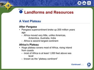
Physical Geography of Africa:
The Plateau Continent
A continent of plateaus, basins, and rift valleys,
Africa features dense rain forests, vast grasslands,
and the world’s largest desert.
NEXT
SECTION 1 Landforms and Resources
SECTION 2 Climate and Vegetation
NEXT
SECTION 3 Human-Environment Interactions
Physical Geography of Africa:
The Plateau Continent
NEXT
Section 1
Landforms and
Resources
• A large plateau covers most of Africa.
• Africa’s natural resources made it appealing
to European colonizers.
A Vast Plateau
After Pangaea
• Pangaea supercontinent broke up 200 million years
ago
- Africa moved very little, unlike Americas,
Antarctica, Australia, India
- Africa is second largest continent
Landforms and Resources
SECTION
1
NEXT
Continued . . .
Africa’s Plateau
• Huge plateau covers most of Africa, rising inland
from coasts
- most of Africa is at least 1,000 feet above sea
level
- known as the “plateau continent”
SECTION
1
NEXT
Basins and Rivers
• Basins—huge depressions on plateau
- each is more than 625 miles across, up to 5,000
feet deep
• Nile River—world’s longest: 4,000 miles though
Uganda, Sudan, Egypt
- waters used for irrigation; 95% of Egyptians get
water from Nile
• Egypt’s population density near Nile is 3,320 people
per square mile
- only 177 per square mile overall
continued A Vast Plateau
Distinctive African Landforms
Basins and Rivers
• Waterfalls, rapids, gorges make rivers less useful for
transportation
- 2,900-mile Congo is largest river network
- 32 cataracts (waterfalls) make much of Congo
impassable
• Rivers’ meandering courses also make them less
useful
SECTION
1
NEXT
Continued . . .
SECTION
1
NEXT
Rift Valleys and Lakes
• East Africa: continental shift created huge cracks in
East Africa
- land sank, formed long, thin rift valleys
- stretch 4,000 miles from Jordan to Mozambique
- eastern part is still slowly pulling away from Africa
• Long, deep lakes form at bottoms of rift valleys
- Lake Tanganyika is longest freshwater lake in
world
• Lake Victoria is Africa’s largest; sits in basin
between rift valleys
continued Distinctive African Landforms
Continued . . .
SECTION
1
NEXT
Mountains
• Africa mainly has volcanic mountains:Mount Kenya,
Mount Kilimanjaro
- Mount Kilimanjaro is Africa’s highest mountain
- volcanoes created Ethiopian Highlands
- also Tibesti Mountains (Sahara), Mount
Cameroon (West Africa)
• Volcanic rock covers Great Escarpment in Southern
Africa
- escarpment—steep slope with flat plateau on top
continued Distinctive African Landforms
Africa’s Wealth of Resources
A Wealth of Minerals
• Africa’s minerals make it one of world’s richest
continents
- copper, phosphates, diamonds; 42% of world’s
cobalt
• South Africa is largest producer of chromium, for
stainless steel
- produces 80% of world’s platinum, 30% of gold
• Mineral wealth has not created general African
prosperity
- colonial rulers sent natural resources to Europe
- nations are slow to develop infrastructure,
industries
SECTION
1
NEXT
Continued . . .
SECTION
1
NEXT
Oil Resources
• Libya, Nigeria, Algeria among world’s leading
petroleum producers
- Angola, Gabon have untapped oil reserves
• Angola is example of resources not benefiting
Africans
- oil deposits will make it Africa’s most oil-rich
country
- American companies will pay Angola to drill oil
- money will be spent on ongoing ethnic civil war
- little will be invested in schools, hospitals, other
infrastructure
continued Africa’s Wealth of Resources
Diversity of Resources
Major Commodities
• Coffee is Africa’s second most profitable commodity
- few Africans drink coffee, but 20% of world’s
supply is grown there
• Nigeria leads in lumber exports, but logging is
depleting forests
- each year an area twice the size of New Jersey is
cleared
• Other commodities include sugar, palm oil, cocoa
• Agriculture is Africa’s single most important
economic activity
- 66% of Africans earn a living farming; accounts for
1/3 of exports
SECTION
1
NEXT
NEXT
Section 2
Climate and Vegetation
• Africa contains dry and hot deserts, warm
tropics, and permanently snow-capped
mountains.
• Africa’s vegetation includes thick rain
forests, tall grasslands, and desert areas.
A Warm Continent
The Deserts
• Sahara is largest desert in world; name means
“desert” in Arabic
- 3,000 miles from Atlantic to Red Sea; 1,200 miles
north to south
- temperatures as high as 136 degrees in
summer, freezing at night
- fewer than 2 million of Africa’s 800 million people
live in Sahara
• Only 20% is sand; rest is mountains, rocks, gravelly
plains
- Tibesti Mountains in northwestern Chad rise
11,000 feet
Climate and Vegetation
SECTION
2
NEXT
Continued . . .
SECTION
2
NEXT
The Deserts
• Saharan travelers rely on camels that can go 17
days without water
• 6,000 feet under Sahara are aquifers—stores of
underground water
- when this water comes to the surface it creates an
oasis
• Other African deserts include Kalahari, Namib
continued A Warm Continent
Continued . . .
SECTION
2
The Tropics
• Africa has largest tropical area of any continent
- 90% of Africa lies between tropics of Cancer,
Capricorn
- high temperatures year around, especially in
Somalian Sahara
- Africans say nighttime is the “winter” of the tropics
continued A Warm Continent
NEXT
Sunshine and Rainfall
Rainfall Patterns
• Rains all year in rain forests; most of Africa has rainy
seasons
• Tropical savanna covers half of Africa; six-month
rainy season
• Longer rainy seasons near equator; longer dry
seasons near desert
• West coast gets heavy rain; Monrovia, Liberia, has
120 inches yearly
• Sahara, other deserts may go years without rain
SECTION
2
Continued . . .
NEXT
SECTION
2
NEXT
Africa’s Moderate Areas
• Mediterranean climate on northern, southern tips of
Africa
- clear blue skies, moderate summers, rain in winter
continued Sunshine and Rainfall
A Grassy Continent
Tropical Grassland
• Tropical grassland covers most of Africa
• Serengeti Plain—northern Tanzania grassland
- dry climate, hard soil prevent growth of trees,
crops
• Serengeti National Park has best grasslands in the
world
- some grasses grow taller than a person
- ideal for grazing animals like wildebeests,
gazelles, zebras
- site of largest numbers of migrating land mammals
SECTION
2
NEXT
Africa’s Extremes
Rain Forest
• Major tropical rain forests are on equator in Congo
Basin
• A square acre can have hundreds of different types
of trees, birds
- plants, trees, leaves block out most sunlight; air is
hot, moist
- plants, vegetation decay 8 times faster than in
Europe
• Most animals live in canopy—uppermost branches,
150 feet off ground
- birds, monkeys, flying foxes, snakes
SECTION
2
NEXT
Continued . . .
SECTION
2
NEXT
Rain Forest
• Farmers’ slash-and-burn methods endanger rain
forest
- Madagascar’s rain forest is almost completely gone
- some estimate over half of Africa’s original rain
forests are gone
continued Africa’s Extremes
Continued . . .
SECTION
2
NEXT
Varieties of Plantlife
• Oak, pine forests in Atlas Mountains of North Africa
• Mangrove trees grow along West African river banks
- roots are breeding grounds for fish
- roots help build dry land by holding silt
continued Africa’s Extremes
NEXT
Section 3
Human-Environment
Interaction
• The Sahara’s expansion is causing
problems of Africa’s farmers.
• The Nigerian oil industry has caused
serious environmental damage in the Niger
delta.
Desertification of the Sahel
The Spreading Sahara
• Sahel means “shore of the desert”
- narrow band of grassland runs east-west along
southern Sahara edge
- used for farming, herding
• Since 1960s, desert has spread into Sahel
- desertification—expansion of dry conditions into
nearby moist areas
- natural, long-term desertification cycles sped up
by human activity
Human-Environment Interaction
SECTION
3
NEXT
Continued . . .
SECTION
3
NEXT
Human Causes of Desertification
• Livestock overgrazing exposes and tramples soil,
increases erosion
• Clearing land for farming increases erosion
• Water drilling, irrigation increase soil’s salt levels
- vegetation growth is stunted
• Population levels require more crop land, more fuel
(wood) to burn
continued Desertification of the Sahel
Results of Desertification
• Forests around Khartoum (Sudan), Lake Chad are
vanishing
- some countries are planting trees to slow
desertification
Harming the Environment in Nigeria
A Major Oil Producer
• Oil discovered in Nigeria in 1956 in Niger delta
• Nigeria is world’s 6th
leading oil exporter
- 2 million barrels extracted each day, most shipped
to U.S.
- oil provides up to 90% of national income
• In 1970s, high oil prices made Nigeria one of
African’s richest nations
- when prices fell, Nigeria owed millions to other
nations, U.S.
- poor planning, corruption helped leave Nigeria
poorer than ever
SECTION
3
NEXT
Continued . . .
SECTION
3
NEXT
Destroying the Land and People
• Over 4,000 oil spills in four decades with slow or no
cleanup
- acid rain and soot from oil fires lead to respiratory
diseases
• Pipeline explosions kill 2,000 between 1998 and 2000
- bandits work with corrupt officials, drain pipeline
fuel, sell it
continued Harming the Environment in Nigeria
A New Start
• Olusegun Obasanjo becomes new Nigerian president
in 1999
- fires corrupt officials, begins economic reform
Controlling the Nile
The Aswan High Dam
• Egyptians have always tried to control the Nile’s
flood, droughts
- built first Aswan Dam in 1902; quickly obsolete
• Aswan High Dam completed in 1970, creates
300-mile Lake Nasser
• Dam provides regular supply of water for farmers
- holds back Nile floodwaters for irrigation
- farmers now have two, three harvests a year
- Egypt’s farmable land increased by 50%
SECTION
3
NEXT
Continued . . .
SECTION
3
NEXT
Problems with the Dam
• Construction meant relocating people, changing
Nubian’s way of life
• Abu Simbel temples moved, but other treasures lost
at bottom of lake
• River no longer deposits rich silt—sediment—on
farmland
• Irrigation raises water table
- river doesn’t flush out salts that decrease soil
fertility
• Mosquitoes thrive in Lake Nasser, spread malaria,
other diseases
• Millions of gallons of fresh water lost yearly to lake
evaporation
continued Controlling the Nile
NEXT
This is the end of the chapter presentation of
lecture notes. Click the HOME or EXIT button.
Print Slide Show
1. On the File menu, select Print
2. In the pop-up menu, select Microsoft PowerPoint
If the dialog box does not include this pop-up, continue
to step 4
3. In the Print what box, choose the presentation format
you want to print: slides, notes, handouts, or outline
4. Click the Print button to print the PowerPoint
presentation
CONTINUE

Chapter 18

  • 1.
    Physical Geography ofAfrica: The Plateau Continent A continent of plateaus, basins, and rift valleys, Africa features dense rain forests, vast grasslands, and the world’s largest desert. NEXT
  • 2.
    SECTION 1 Landformsand Resources SECTION 2 Climate and Vegetation NEXT SECTION 3 Human-Environment Interactions Physical Geography of Africa: The Plateau Continent
  • 3.
    NEXT Section 1 Landforms and Resources •A large plateau covers most of Africa. • Africa’s natural resources made it appealing to European colonizers.
  • 4.
    A Vast Plateau AfterPangaea • Pangaea supercontinent broke up 200 million years ago - Africa moved very little, unlike Americas, Antarctica, Australia, India - Africa is second largest continent Landforms and Resources SECTION 1 NEXT Continued . . . Africa’s Plateau • Huge plateau covers most of Africa, rising inland from coasts - most of Africa is at least 1,000 feet above sea level - known as the “plateau continent”
  • 5.
    SECTION 1 NEXT Basins and Rivers •Basins—huge depressions on plateau - each is more than 625 miles across, up to 5,000 feet deep • Nile River—world’s longest: 4,000 miles though Uganda, Sudan, Egypt - waters used for irrigation; 95% of Egyptians get water from Nile • Egypt’s population density near Nile is 3,320 people per square mile - only 177 per square mile overall continued A Vast Plateau
  • 6.
    Distinctive African Landforms Basinsand Rivers • Waterfalls, rapids, gorges make rivers less useful for transportation - 2,900-mile Congo is largest river network - 32 cataracts (waterfalls) make much of Congo impassable • Rivers’ meandering courses also make them less useful SECTION 1 NEXT Continued . . .
  • 7.
    SECTION 1 NEXT Rift Valleys andLakes • East Africa: continental shift created huge cracks in East Africa - land sank, formed long, thin rift valleys - stretch 4,000 miles from Jordan to Mozambique - eastern part is still slowly pulling away from Africa • Long, deep lakes form at bottoms of rift valleys - Lake Tanganyika is longest freshwater lake in world • Lake Victoria is Africa’s largest; sits in basin between rift valleys continued Distinctive African Landforms Continued . . .
  • 8.
    SECTION 1 NEXT Mountains • Africa mainlyhas volcanic mountains:Mount Kenya, Mount Kilimanjaro - Mount Kilimanjaro is Africa’s highest mountain - volcanoes created Ethiopian Highlands - also Tibesti Mountains (Sahara), Mount Cameroon (West Africa) • Volcanic rock covers Great Escarpment in Southern Africa - escarpment—steep slope with flat plateau on top continued Distinctive African Landforms
  • 9.
    Africa’s Wealth ofResources A Wealth of Minerals • Africa’s minerals make it one of world’s richest continents - copper, phosphates, diamonds; 42% of world’s cobalt • South Africa is largest producer of chromium, for stainless steel - produces 80% of world’s platinum, 30% of gold • Mineral wealth has not created general African prosperity - colonial rulers sent natural resources to Europe - nations are slow to develop infrastructure, industries SECTION 1 NEXT Continued . . .
  • 10.
    SECTION 1 NEXT Oil Resources • Libya,Nigeria, Algeria among world’s leading petroleum producers - Angola, Gabon have untapped oil reserves • Angola is example of resources not benefiting Africans - oil deposits will make it Africa’s most oil-rich country - American companies will pay Angola to drill oil - money will be spent on ongoing ethnic civil war - little will be invested in schools, hospitals, other infrastructure continued Africa’s Wealth of Resources
  • 11.
    Diversity of Resources MajorCommodities • Coffee is Africa’s second most profitable commodity - few Africans drink coffee, but 20% of world’s supply is grown there • Nigeria leads in lumber exports, but logging is depleting forests - each year an area twice the size of New Jersey is cleared • Other commodities include sugar, palm oil, cocoa • Agriculture is Africa’s single most important economic activity - 66% of Africans earn a living farming; accounts for 1/3 of exports SECTION 1 NEXT
  • 12.
    NEXT Section 2 Climate andVegetation • Africa contains dry and hot deserts, warm tropics, and permanently snow-capped mountains. • Africa’s vegetation includes thick rain forests, tall grasslands, and desert areas.
  • 13.
    A Warm Continent TheDeserts • Sahara is largest desert in world; name means “desert” in Arabic - 3,000 miles from Atlantic to Red Sea; 1,200 miles north to south - temperatures as high as 136 degrees in summer, freezing at night - fewer than 2 million of Africa’s 800 million people live in Sahara • Only 20% is sand; rest is mountains, rocks, gravelly plains - Tibesti Mountains in northwestern Chad rise 11,000 feet Climate and Vegetation SECTION 2 NEXT Continued . . .
  • 14.
    SECTION 2 NEXT The Deserts • Saharantravelers rely on camels that can go 17 days without water • 6,000 feet under Sahara are aquifers—stores of underground water - when this water comes to the surface it creates an oasis • Other African deserts include Kalahari, Namib continued A Warm Continent Continued . . .
  • 15.
    SECTION 2 The Tropics • Africahas largest tropical area of any continent - 90% of Africa lies between tropics of Cancer, Capricorn - high temperatures year around, especially in Somalian Sahara - Africans say nighttime is the “winter” of the tropics continued A Warm Continent NEXT
  • 16.
    Sunshine and Rainfall RainfallPatterns • Rains all year in rain forests; most of Africa has rainy seasons • Tropical savanna covers half of Africa; six-month rainy season • Longer rainy seasons near equator; longer dry seasons near desert • West coast gets heavy rain; Monrovia, Liberia, has 120 inches yearly • Sahara, other deserts may go years without rain SECTION 2 Continued . . . NEXT
  • 17.
    SECTION 2 NEXT Africa’s Moderate Areas •Mediterranean climate on northern, southern tips of Africa - clear blue skies, moderate summers, rain in winter continued Sunshine and Rainfall
  • 18.
    A Grassy Continent TropicalGrassland • Tropical grassland covers most of Africa • Serengeti Plain—northern Tanzania grassland - dry climate, hard soil prevent growth of trees, crops • Serengeti National Park has best grasslands in the world - some grasses grow taller than a person - ideal for grazing animals like wildebeests, gazelles, zebras - site of largest numbers of migrating land mammals SECTION 2 NEXT
  • 19.
    Africa’s Extremes Rain Forest •Major tropical rain forests are on equator in Congo Basin • A square acre can have hundreds of different types of trees, birds - plants, trees, leaves block out most sunlight; air is hot, moist - plants, vegetation decay 8 times faster than in Europe • Most animals live in canopy—uppermost branches, 150 feet off ground - birds, monkeys, flying foxes, snakes SECTION 2 NEXT Continued . . .
  • 20.
    SECTION 2 NEXT Rain Forest • Farmers’slash-and-burn methods endanger rain forest - Madagascar’s rain forest is almost completely gone - some estimate over half of Africa’s original rain forests are gone continued Africa’s Extremes Continued . . .
  • 21.
    SECTION 2 NEXT Varieties of Plantlife •Oak, pine forests in Atlas Mountains of North Africa • Mangrove trees grow along West African river banks - roots are breeding grounds for fish - roots help build dry land by holding silt continued Africa’s Extremes
  • 22.
    NEXT Section 3 Human-Environment Interaction • TheSahara’s expansion is causing problems of Africa’s farmers. • The Nigerian oil industry has caused serious environmental damage in the Niger delta.
  • 23.
    Desertification of theSahel The Spreading Sahara • Sahel means “shore of the desert” - narrow band of grassland runs east-west along southern Sahara edge - used for farming, herding • Since 1960s, desert has spread into Sahel - desertification—expansion of dry conditions into nearby moist areas - natural, long-term desertification cycles sped up by human activity Human-Environment Interaction SECTION 3 NEXT Continued . . .
  • 24.
    SECTION 3 NEXT Human Causes ofDesertification • Livestock overgrazing exposes and tramples soil, increases erosion • Clearing land for farming increases erosion • Water drilling, irrigation increase soil’s salt levels - vegetation growth is stunted • Population levels require more crop land, more fuel (wood) to burn continued Desertification of the Sahel Results of Desertification • Forests around Khartoum (Sudan), Lake Chad are vanishing - some countries are planting trees to slow desertification
  • 25.
    Harming the Environmentin Nigeria A Major Oil Producer • Oil discovered in Nigeria in 1956 in Niger delta • Nigeria is world’s 6th leading oil exporter - 2 million barrels extracted each day, most shipped to U.S. - oil provides up to 90% of national income • In 1970s, high oil prices made Nigeria one of African’s richest nations - when prices fell, Nigeria owed millions to other nations, U.S. - poor planning, corruption helped leave Nigeria poorer than ever SECTION 3 NEXT Continued . . .
  • 26.
    SECTION 3 NEXT Destroying the Landand People • Over 4,000 oil spills in four decades with slow or no cleanup - acid rain and soot from oil fires lead to respiratory diseases • Pipeline explosions kill 2,000 between 1998 and 2000 - bandits work with corrupt officials, drain pipeline fuel, sell it continued Harming the Environment in Nigeria A New Start • Olusegun Obasanjo becomes new Nigerian president in 1999 - fires corrupt officials, begins economic reform
  • 27.
    Controlling the Nile TheAswan High Dam • Egyptians have always tried to control the Nile’s flood, droughts - built first Aswan Dam in 1902; quickly obsolete • Aswan High Dam completed in 1970, creates 300-mile Lake Nasser • Dam provides regular supply of water for farmers - holds back Nile floodwaters for irrigation - farmers now have two, three harvests a year - Egypt’s farmable land increased by 50% SECTION 3 NEXT Continued . . .
  • 28.
    SECTION 3 NEXT Problems with theDam • Construction meant relocating people, changing Nubian’s way of life • Abu Simbel temples moved, but other treasures lost at bottom of lake • River no longer deposits rich silt—sediment—on farmland • Irrigation raises water table - river doesn’t flush out salts that decrease soil fertility • Mosquitoes thrive in Lake Nasser, spread malaria, other diseases • Millions of gallons of fresh water lost yearly to lake evaporation continued Controlling the Nile
  • 29.
    NEXT This is theend of the chapter presentation of lecture notes. Click the HOME or EXIT button.
  • 30.
    Print Slide Show 1.On the File menu, select Print 2. In the pop-up menu, select Microsoft PowerPoint If the dialog box does not include this pop-up, continue to step 4 3. In the Print what box, choose the presentation format you want to print: slides, notes, handouts, or outline 4. Click the Print button to print the PowerPoint presentation CONTINUE