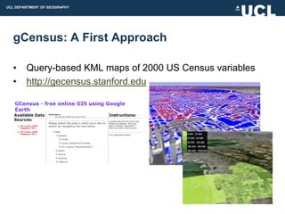
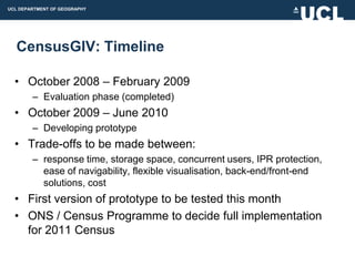
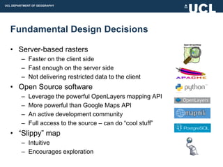
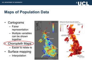
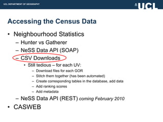
Downloaded 52 times


![UCL DEPARTMENT OF GEOGRAPHY
A Note on Python
• If you don‟t use it already, you will!
– ArcGIS 9.4
• “Python is now integrated directly into ArcMap [9.4]. I say it
every year, but if you are an ArcGIS Desktop user, you need to
take a close look at python as your scripting language.” - James
Fee
• The best thing about Python is:
– Tidy scripts!](https://image.slidesharecdn.com/chorogencasa-091209144719-phpapp02/85/CensusGIV-Geographic-Information-Visualisation-of-Census-Data-50-320.jpg)
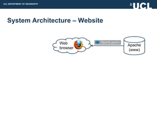
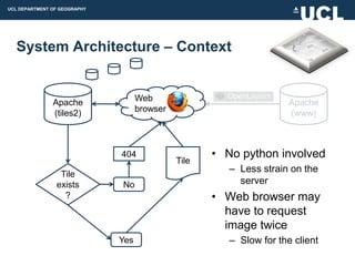
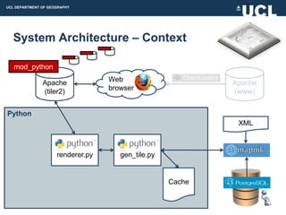
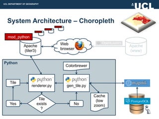


The document discusses the development of CensusGIV, a prototype for providing innovative geographic visualization of UK census small area statistics. It aims to develop an interactive web-based mapping application using open source technologies to allow users to easily explore and analyze census data through dynamic choropleth maps and other visualization techniques. The document outlines the objectives, design considerations, system architecture, and timeline for the CensusGIV prototype. Key aspects discussed include data access, map creation, color theory, and a modular client-server architecture.


