Download as PDF, PPTX
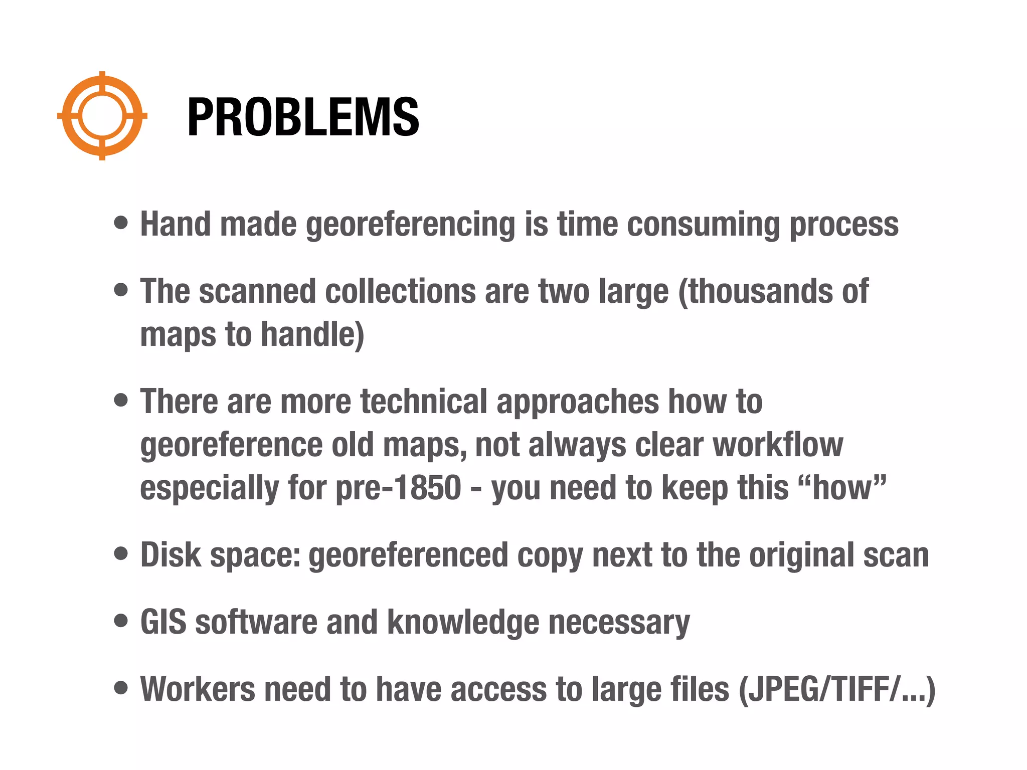
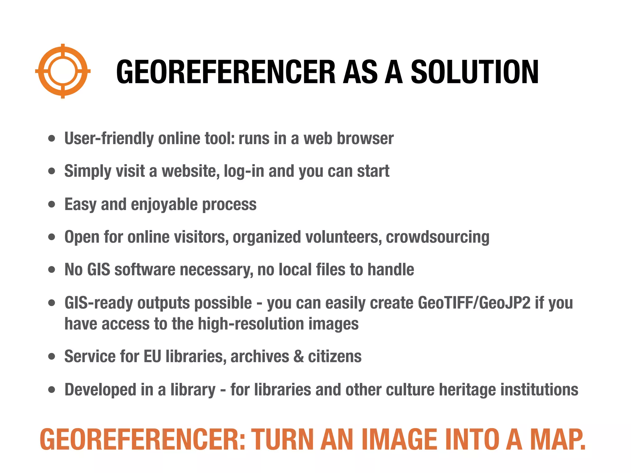
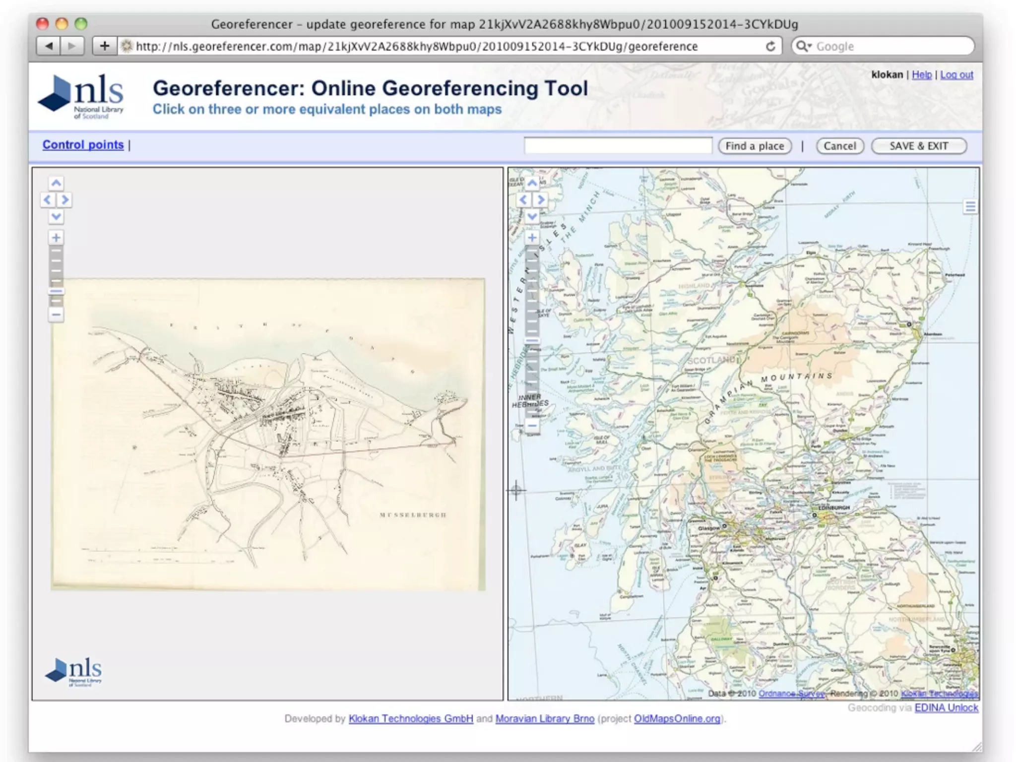
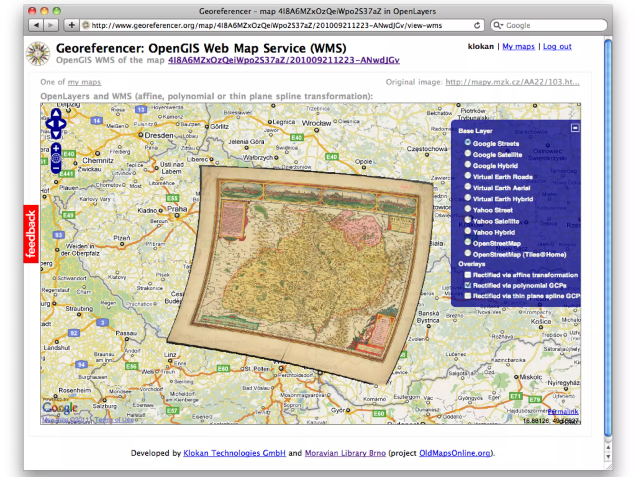
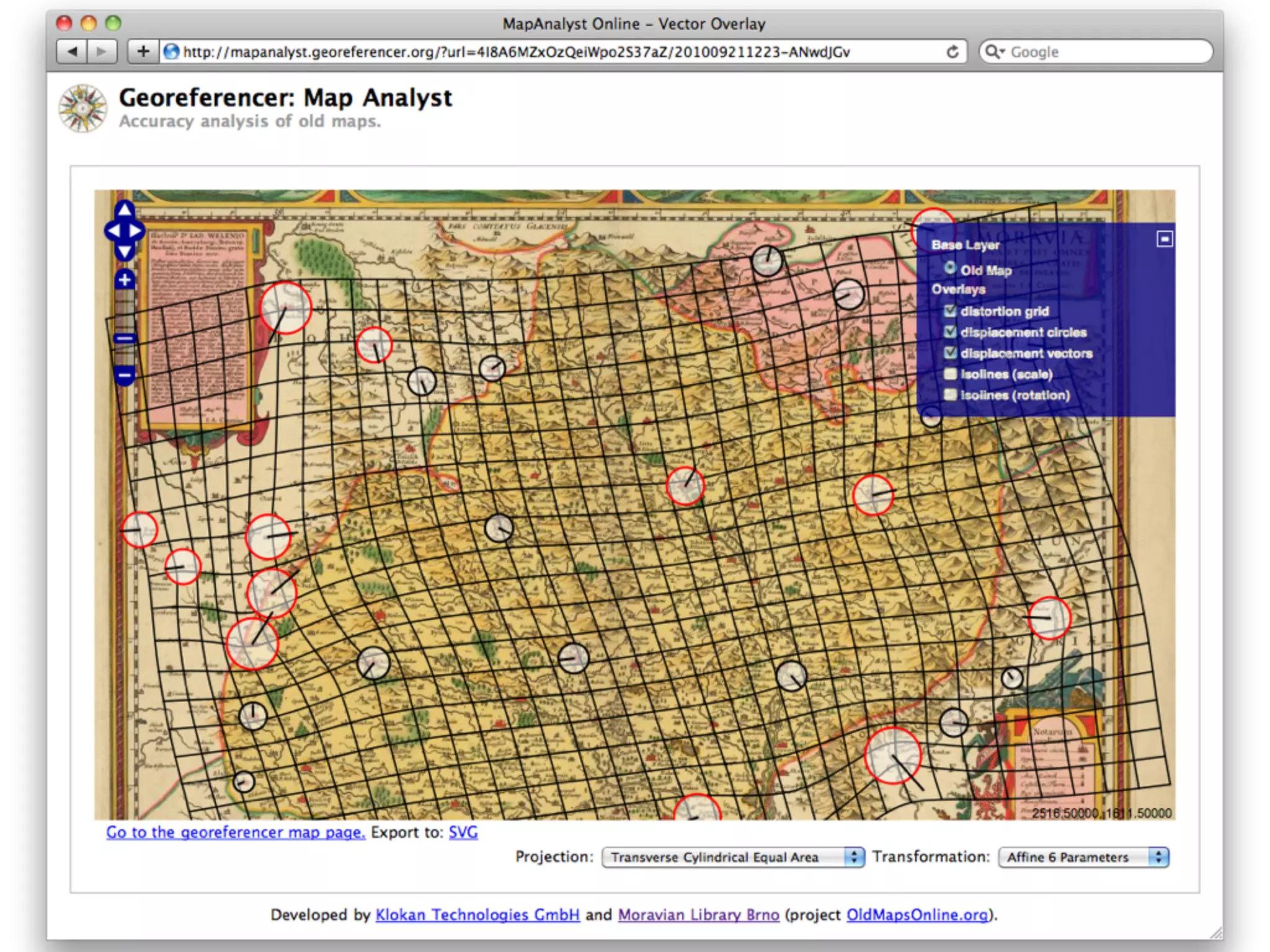
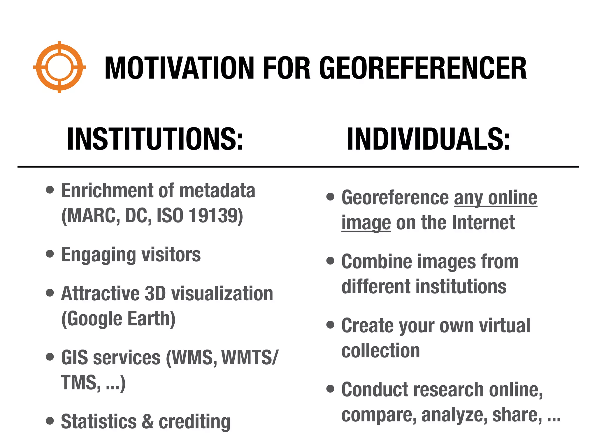
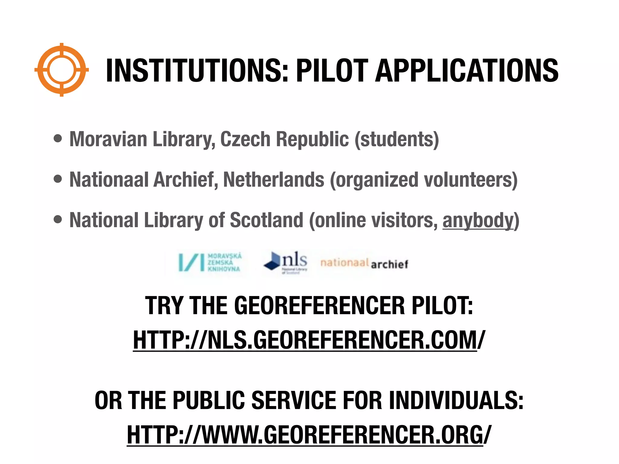
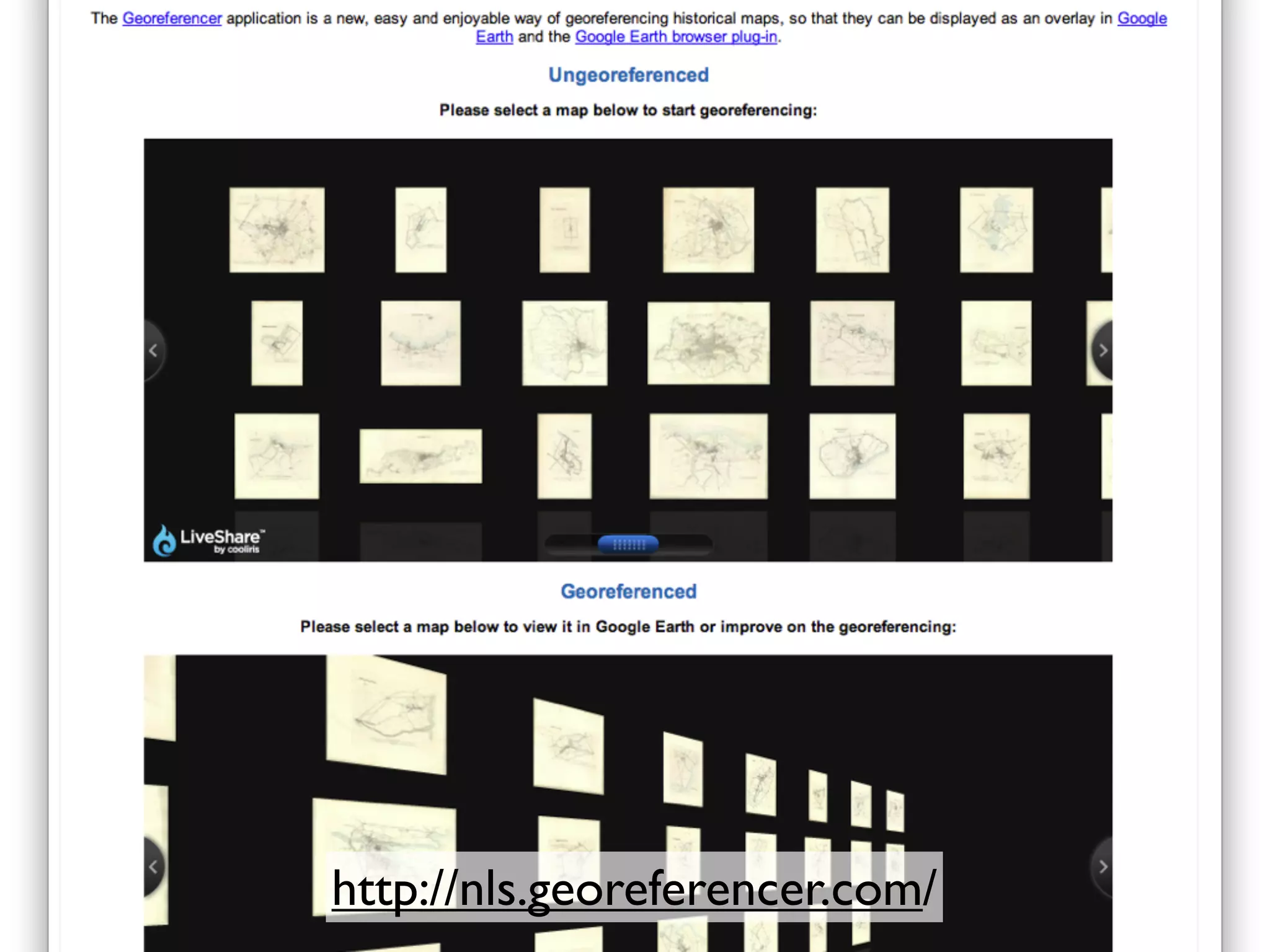
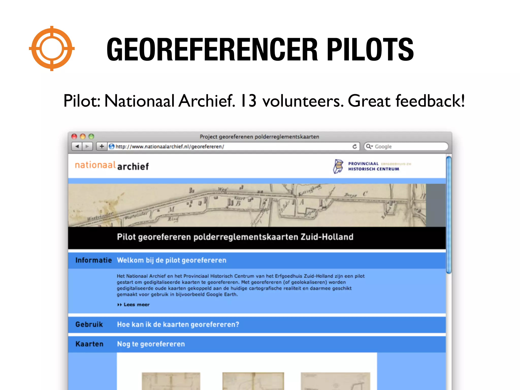
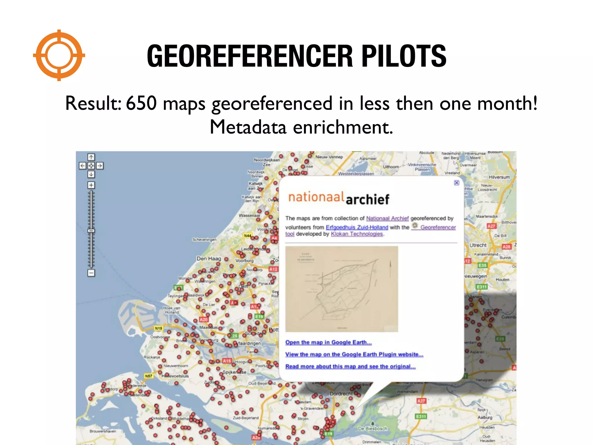
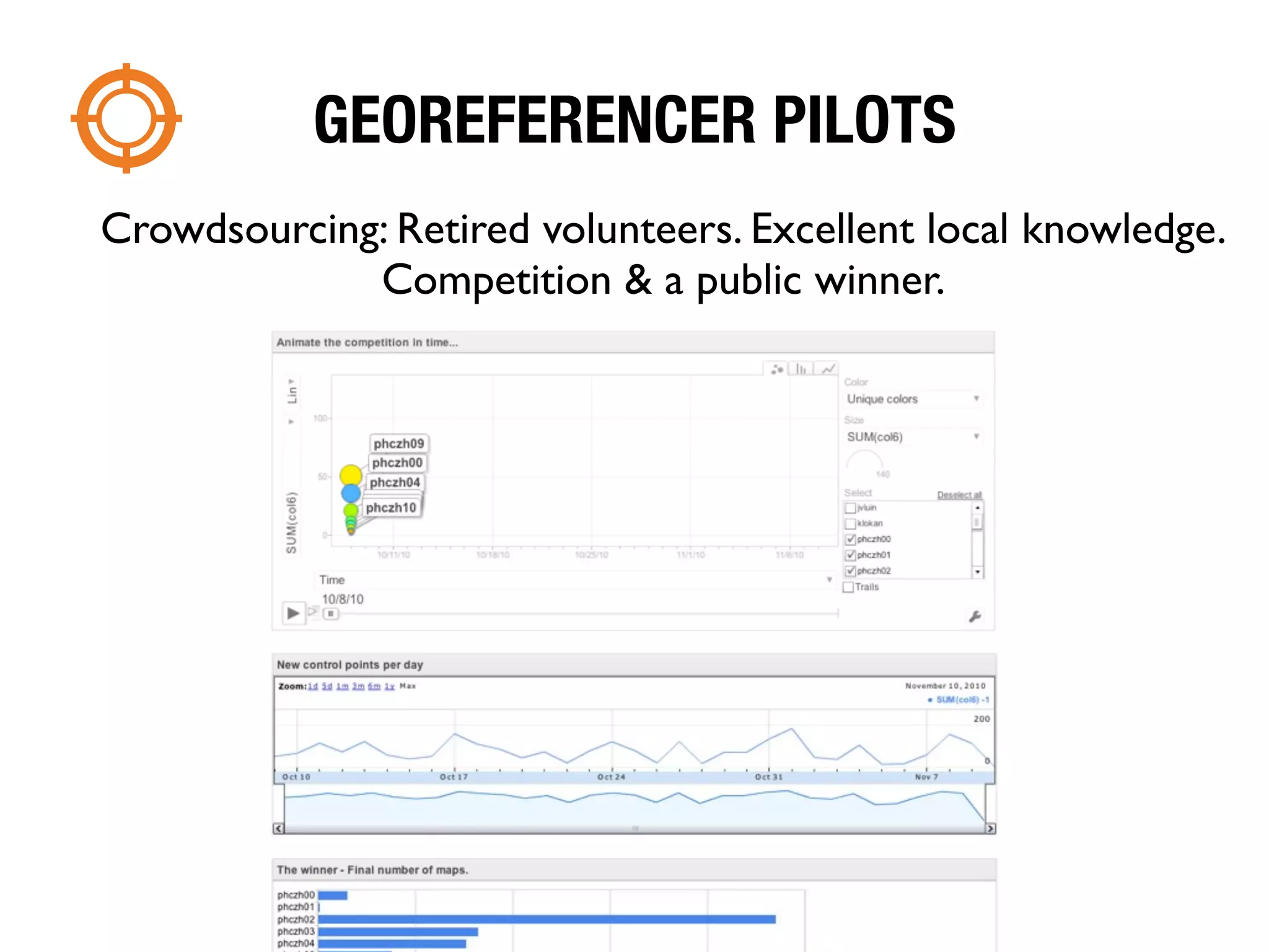
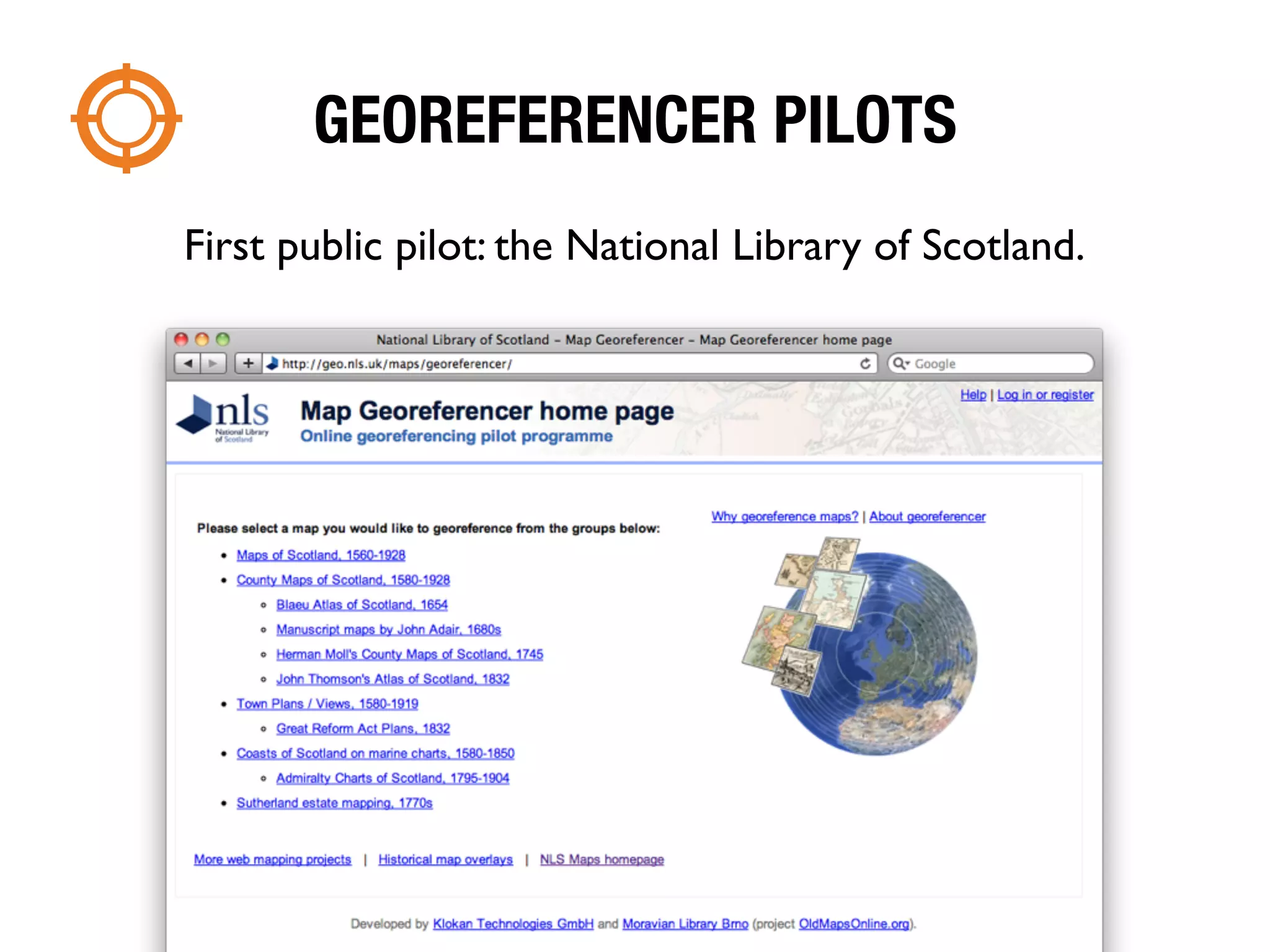
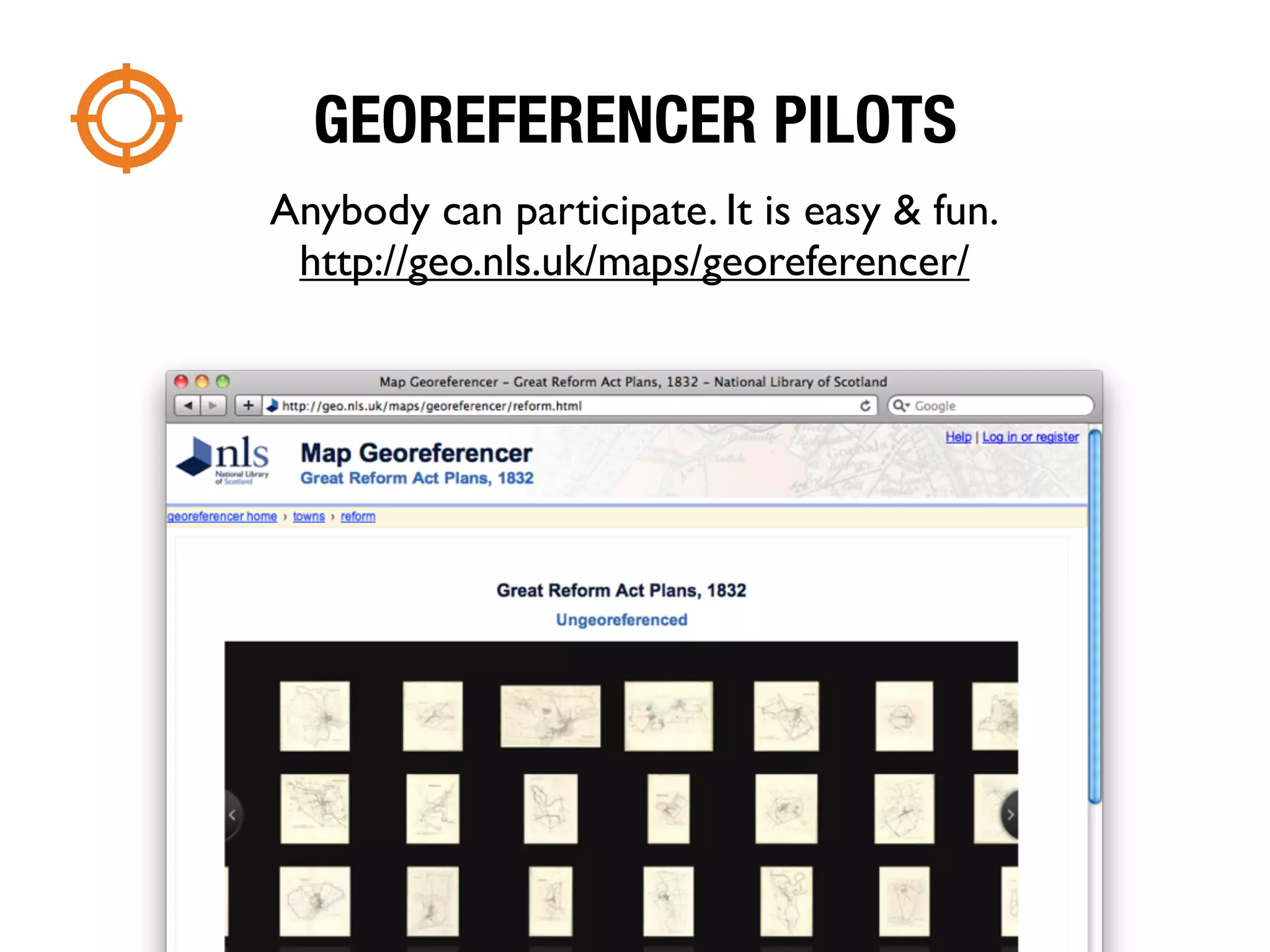


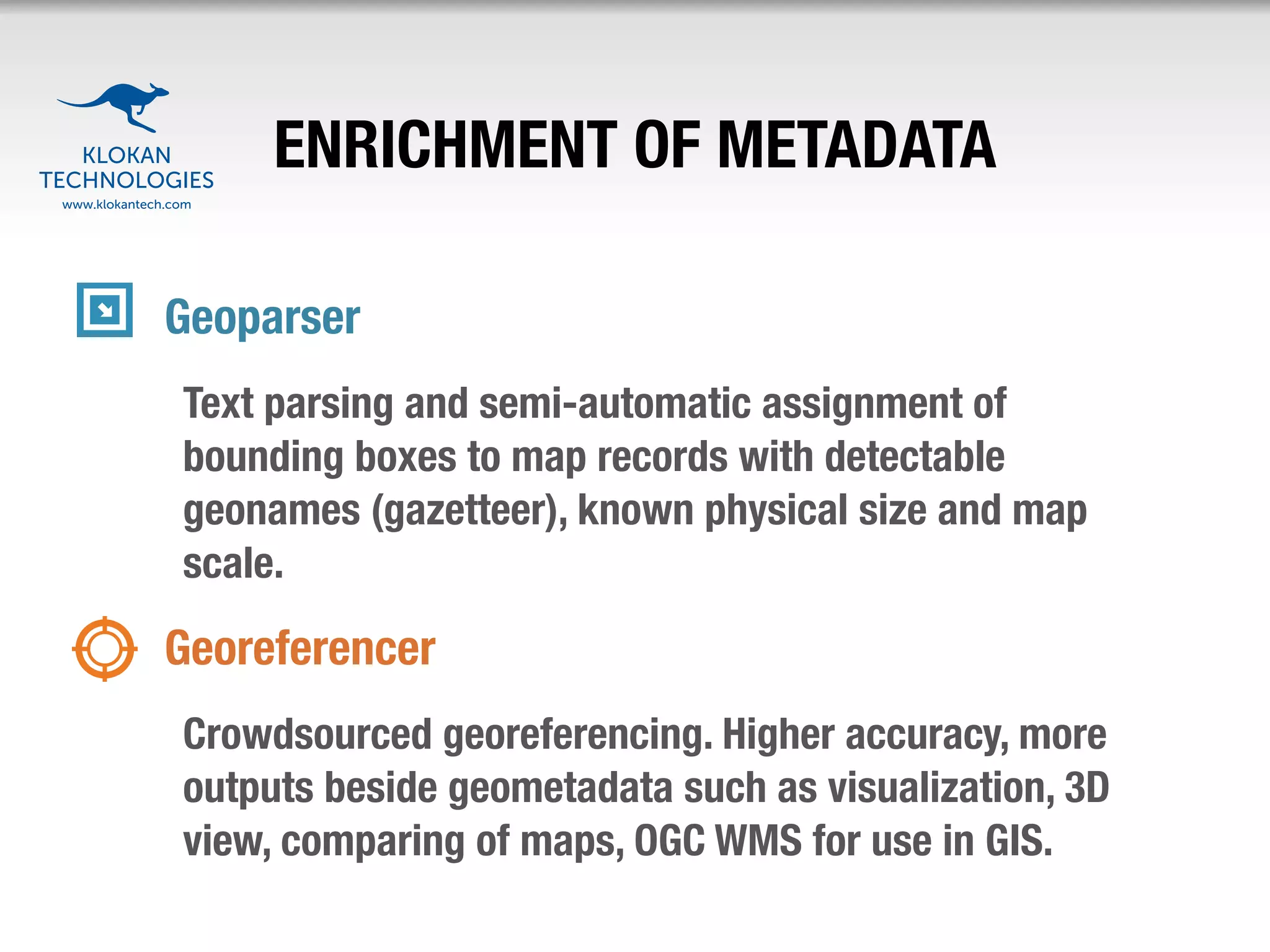
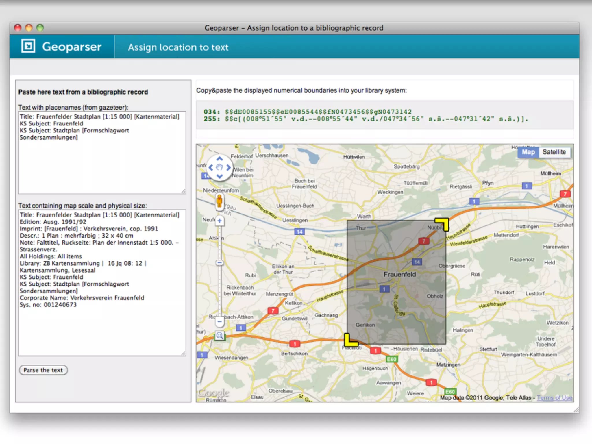
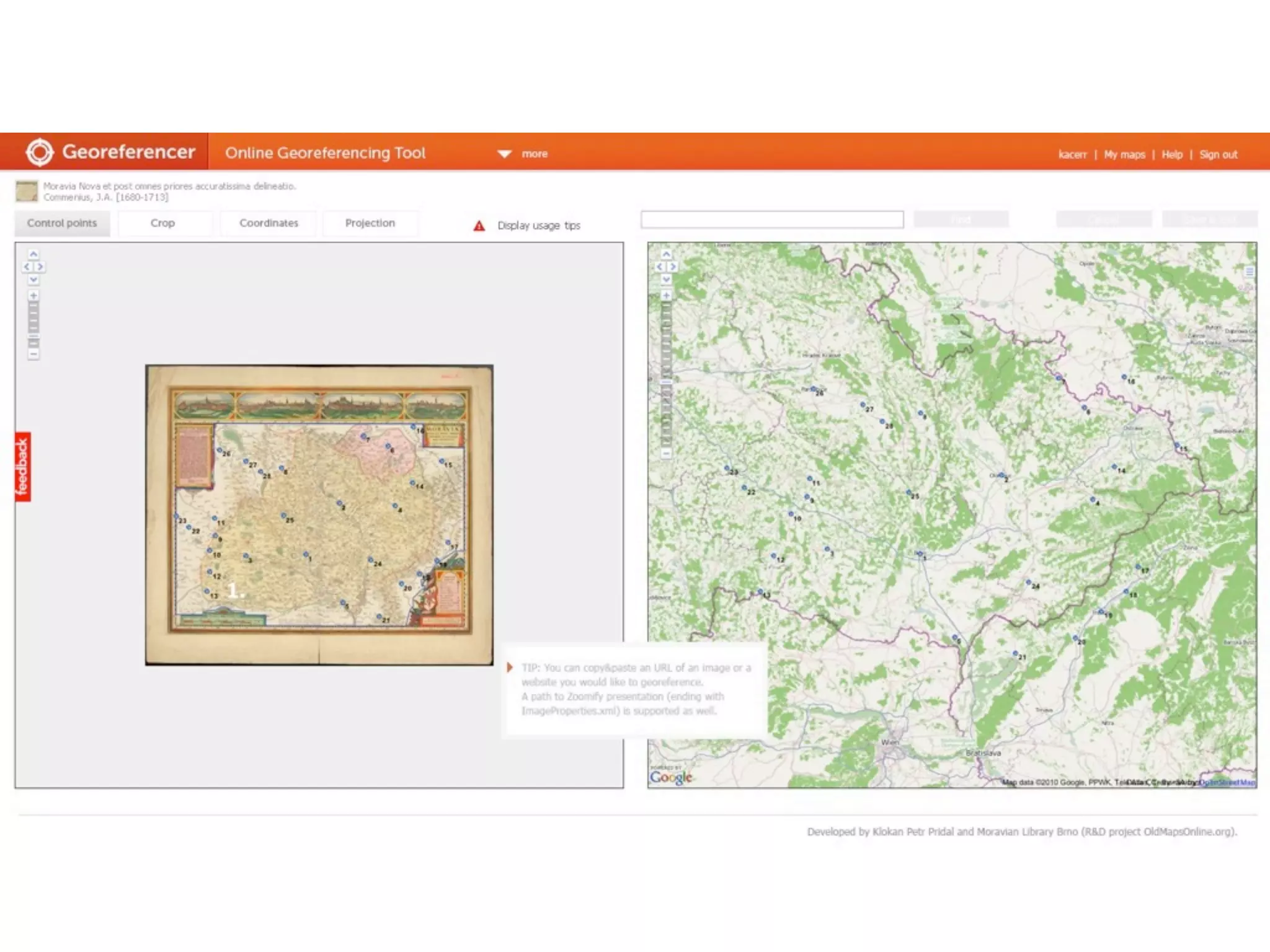


The document discusses the development of Georeferencer, an online collaborative tool for georeferencing scanned maps, initiated by various institutions to enhance metadata and facilitate easy access to historical cartographic materials. It addresses challenges of manual georeferencing and highlights features such as user-friendly access, crowdsourcing, and advanced geospatial searches. The Georeferencer tool aims to serve libraries, archives, and the public by providing a scalable, cloud-based solution that enables efficient map digitization and metadata enrichment.