Download as PDF, PPTX
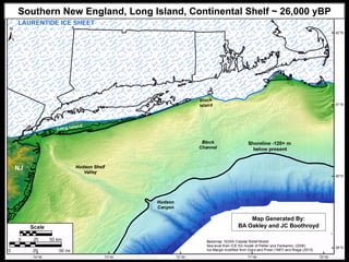
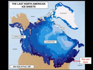
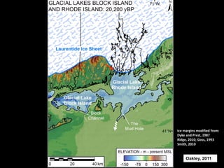
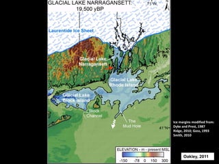
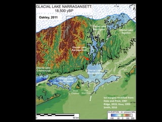
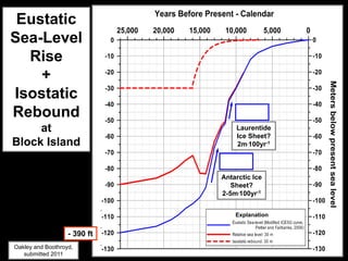
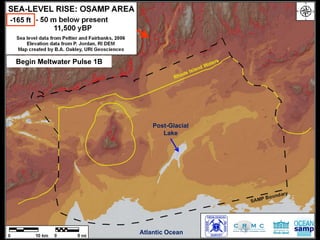
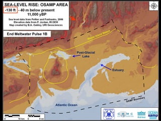
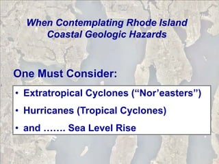
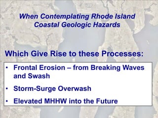
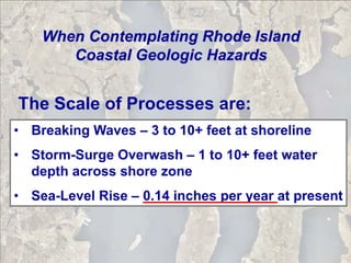
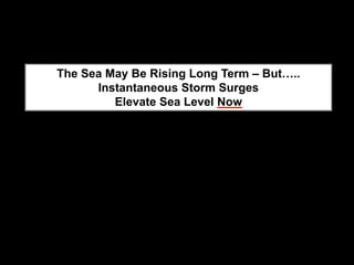
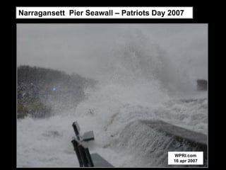
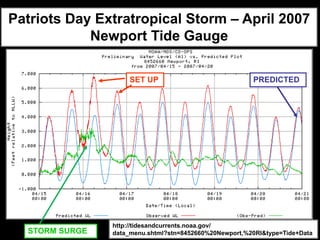

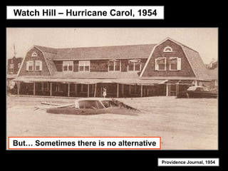
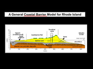
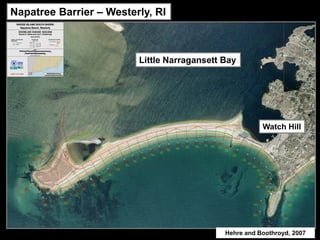
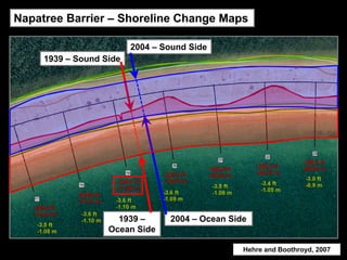
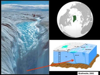
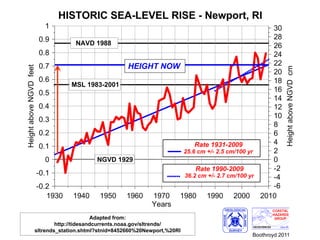
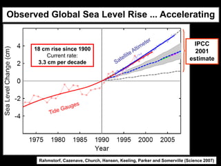
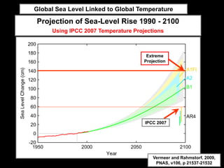
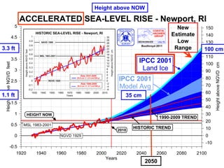
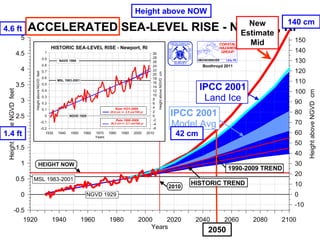
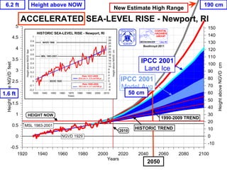
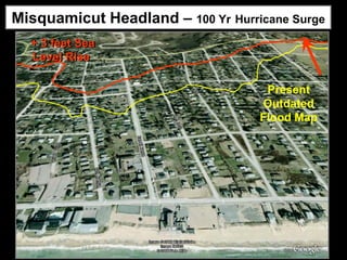
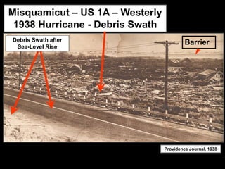
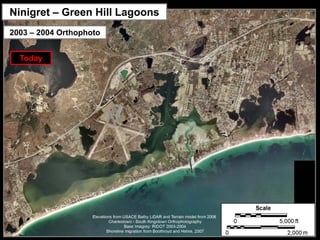
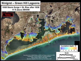
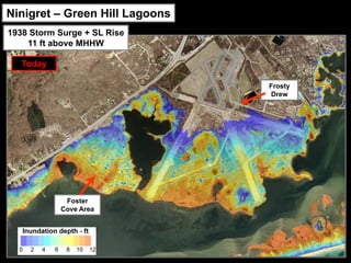
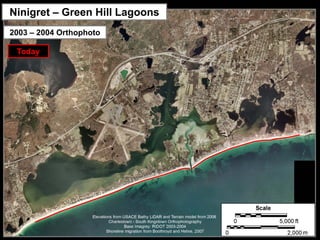
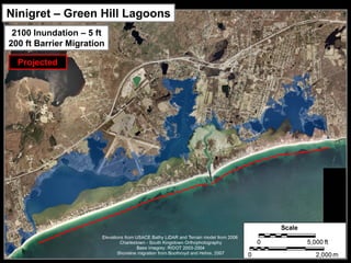
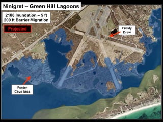
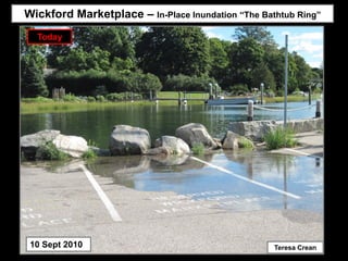

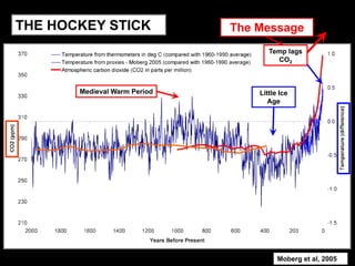

This document discusses climate change, coastal hazards, and sea level rise in Rhode Island. It provides background on past glaciation and ice sheets in the region. It then examines current coastal hazards from storms and erosion exacerbated by sea level rise. Projections show global sea level rising significantly by 2100 due to climate change, threatening Rhode Island's coasts with flooding and barrier migration. Adaptation strategies may be needed to address these coastal impacts of climate change.


![Getting Started with Apache Spark: Big Data Made Simple [Free Meetup]](https://cdn.slidesharecdn.com/ss_thumbnails/apachesparkgettingstarted-260203175547-8361bcc3-thumbnail.jpg?width=640&height=640&fit=bounds)


