This PPT covers basics of remote sensing which include definition, advantage and disadvantage of remote sensing, principles of remote sensing and its application. it is prepared by focusing the civil engineering application.
passive and active remote sensing systems, characteristics and operationsNzar Braim
passive and active remote sensing systems,
characteristics and operations
The development of remote sensing technologies increases the potential to support more
precise, efficient, and ecologically-sensitive approaches to forest resource management. One of
the primary requirements of precision forest management is accurate and detailed 3D spatial
data relating to the type and condition of forest stands and characteristics of the underlying
terrain surface.
Remote sensing is the process of detecting and monitoring the physical characteristics of an area by measuring its reflected and emitted radiation at a distance (typically from satellite or aircraft).
Special cameras collect remotely sensed images, which help researchers "sense" things about the Earth.
Remote sensing implies to the collection of data
about an object from a distance. With the use of LiDAR
remote sensing technology, the three dimensional
distribution of plant canopies and vegetation structural
attributes can be accurately estimated. The measure of
difference in reflectance from leaves of plants, due to the
presence of chlorophyll pigments in different ratios, can be
helpful to locate and characterize the plant remote
location through remote sensing technology and
Geographic Information System (GIS). The present study
highlights the importance of remote sensing technology and
GIS in detection of herbs located distantly.
Remote sensing is the observation of an object from a distance.
It is the art of identifying, observing and measuring an object without coming into direct contact with it by detecting and measuring the radiation of different wavelengths reflected from distant objects.
Immunizing Image Classifiers Against Localized Adversary Attacksgerogepatton
This paper addresses the vulnerability of deep learning models, particularly convolutional neural networks
(CNN)s, to adversarial attacks and presents a proactive training technique designed to counter them. We
introduce a novel volumization algorithm, which transforms 2D images into 3D volumetric representations.
When combined with 3D convolution and deep curriculum learning optimization (CLO), itsignificantly improves
the immunity of models against localized universal attacks by up to 40%. We evaluate our proposed approach
using contemporary CNN architectures and the modified Canadian Institute for Advanced Research (CIFAR-10
and CIFAR-100) and ImageNet Large Scale Visual Recognition Challenge (ILSVRC12) datasets, showcasing
accuracy improvements over previous techniques. The results indicate that the combination of the volumetric
input and curriculum learning holds significant promise for mitigating adversarial attacks without necessitating
adversary training.
Saudi Arabia stands as a titan in the global energy landscape, renowned for its abundant oil and gas resources. It's the largest exporter of petroleum and holds some of the world's most significant reserves. Let's delve into the top 10 oil and gas projects shaping Saudi Arabia's energy future in 2024.
CW RADAR, FMCW RADAR, FMCW ALTIMETER, AND THEIR PARAMETERSveerababupersonal22
It consists of cw radar and fmcw radar ,range measurement,if amplifier and fmcw altimeterThe CW radar operates using continuous wave transmission, while the FMCW radar employs frequency-modulated continuous wave technology. Range measurement is a crucial aspect of radar systems, providing information about the distance to a target. The IF amplifier plays a key role in signal processing, amplifying intermediate frequency signals for further analysis. The FMCW altimeter utilizes frequency-modulated continuous wave technology to accurately measure altitude above a reference point.
Student information management system project report ii.pdfKamal Acharya
Our project explains about the student management. This project mainly explains the various actions related to student details. This project shows some ease in adding, editing and deleting the student details. It also provides a less time consuming process for viewing, adding, editing and deleting the marks of the students.
We have compiled the most important slides from each speaker's presentation. This year’s compilation, available for free, captures the key insights and contributions shared during the DfMAy 2024 conference.
NO1 Uk best vashikaran specialist in delhi vashikaran baba near me online vas...Amil Baba Dawood bangali
Contact with Dawood Bhai Just call on +92322-6382012 and we'll help you. We'll solve all your problems within 12 to 24 hours and with 101% guarantee and with astrology systematic. If you want to take any personal or professional advice then also you can call us on +92322-6382012 , ONLINE LOVE PROBLEM & Other all types of Daily Life Problem's.Then CALL or WHATSAPP us on +92322-6382012 and Get all these problems solutions here by Amil Baba DAWOOD BANGALI
#vashikaranspecialist #astrologer #palmistry #amliyaat #taweez #manpasandshadi #horoscope #spiritual #lovelife #lovespell #marriagespell#aamilbabainpakistan #amilbabainkarachi #powerfullblackmagicspell #kalajadumantarspecialist #realamilbaba #AmilbabainPakistan #astrologerincanada #astrologerindubai #lovespellsmaster #kalajaduspecialist #lovespellsthatwork #aamilbabainlahore#blackmagicformarriage #aamilbaba #kalajadu #kalailam #taweez #wazifaexpert #jadumantar #vashikaranspecialist #astrologer #palmistry #amliyaat #taweez #manpasandshadi #horoscope #spiritual #lovelife #lovespell #marriagespell#aamilbabainpakistan #amilbabainkarachi #powerfullblackmagicspell #kalajadumantarspecialist #realamilbaba #AmilbabainPakistan #astrologerincanada #astrologerindubai #lovespellsmaster #kalajaduspecialist #lovespellsthatwork #aamilbabainlahore #blackmagicforlove #blackmagicformarriage #aamilbaba #kalajadu #kalailam #taweez #wazifaexpert #jadumantar #vashikaranspecialist #astrologer #palmistry #amliyaat #taweez #manpasandshadi #horoscope #spiritual #lovelife #lovespell #marriagespell#aamilbabainpakistan #amilbabainkarachi #powerfullblackmagicspell #kalajadumantarspecialist #realamilbaba #AmilbabainPakistan #astrologerincanada #astrologerindubai #lovespellsmaster #kalajaduspecialist #lovespellsthatwork #aamilbabainlahore #Amilbabainuk #amilbabainspain #amilbabaindubai #Amilbabainnorway #amilbabainkrachi #amilbabainlahore #amilbabaingujranwalan #amilbabainislamabad
Industrial Training at Shahjalal Fertilizer Company Limited (SFCL)MdTanvirMahtab2
This presentation is about the working procedure of Shahjalal Fertilizer Company Limited (SFCL). A Govt. owned Company of Bangladesh Chemical Industries Corporation under Ministry of Industries.
Final project report on grocery store management system..pdfKamal Acharya
In today’s fast-changing business environment, it’s extremely important to be able to respond to client needs in the most effective and timely manner. If your customers wish to see your business online and have instant access to your products or services.
Online Grocery Store is an e-commerce website, which retails various grocery products. This project allows viewing various products available enables registered users to purchase desired products instantly using Paytm, UPI payment processor (Instant Pay) and also can place order by using Cash on Delivery (Pay Later) option. This project provides an easy access to Administrators and Managers to view orders placed using Pay Later and Instant Pay options.
In order to develop an e-commerce website, a number of Technologies must be studied and understood. These include multi-tiered architecture, server and client-side scripting techniques, implementation technologies, programming language (such as PHP, HTML, CSS, JavaScript) and MySQL relational databases. This is a project with the objective to develop a basic website where a consumer is provided with a shopping cart website and also to know about the technologies used to develop such a website.
This document will discuss each of the underlying technologies to create and implement an e- commerce website.
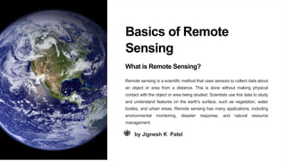
1. Basics of Remote
Sensing
What is Remote Sensing?
Remote sensing is a scientific method that uses sensors to collect data about
an object or area from a distance. This is done without making physical
contact with the object or area being studied. Scientists use this data to study
and understand features on the earth's surface, such as vegetation, water
bodies, and urban areas. Remote sensing has many applications, including
environmental monitoring, disaster response, and natural resource
management.
by Jignesh K Patel
2. Advantage and disadvantage of remote sensing
• Advantages:
• Provides a large coverage area of the earth's surface
• Can detect features that are otherwise hidden or difficult to observe
• Allows for the collection of data in hazardous or inaccessible areas
• Enables the monitoring of changes over time
• Disadvantages:
• Requires specific conditions, such as clear skies and suitable lighting, to obtain quality images
• Has limitations in the resolution of images, which can affect the accuracy of measurements and interpretation of
features
• May require specialized knowledge to interpret the data collected
3.
4. The Electromagnetic Spectrum
Radio
The lowest frequency and longest
wavelength part of the spectrum, used in
radar and communication systems.
Infrared
Used in thermal imaging and detecting heat
signatures of objects and organisms.
Microwave
Used in some satellite-based remote sensing
systems, usually to measure ocean surface
and movement.
Visible Light
The part of the spectrum detectable by the
human eye. Used in many imaging
techniques.
5. The Principles of Remote Sensing
1 Interaction
The first principle of remote sensing, where energy from
the source interacts with the target.
2 Transmission
The second principle, where energy is transmitted from
the target to the sensor.
3 Detection
The third principle, where energy is detected by the
sensor, often in the form of electromagnetic radiation.
4 Analysis
The final principle, where data is analyzed to obtain
valuable information about the target and the
environment.
6. Types of Remote Sensing Systems
1
Active Systems
Send their own energy source to the target and measure the
reflected or scattered energy, usually using radar or lidar
systems.
2
Passive Systems
Measure the energy naturally emitted or reflected from the
target, usually using cameras or radiometers, and can sense
the visible light spectrum and beyond.
3
Ground-based Systems
Used for research or monitoring purposes, usually using
sensors installed on the ground or other fixed locations.
7. Environmental Monitoring
Remote sensing systems provide
valuable data about environmental
conditions such as forest fires or air
quality and support decision-making
processes.
Disaster Management
By providing real-time data and
monitoring of events like floods,
earthquakes, or wildfires, remote
sensing allows for better disaster
response.
Agriculture and Forestry
Remote sensing helps in mapping and
monitoring crops, forests, and
ecosystems, aiding in land use and
management planning, and decision-
making processes.
Urban Planning
Remote sensing can aid in urban
planning by providing data on land use,
transportation infrastructure, and
environmental factors that affect urban
areas.
Land Use Planning
Remote sensing technology can be used to
collect data about land use and land cover,
which is helpful for identify areas of urban
growth, sprawl, or decline. Remote sensing
can also be used to detect changes in land
use over time, which can inform land use
policies and zoning decisions.
8. Remote Sensing: In
Conclusion
From exploring the universe to monitoring our planet, remote sensing has
come a long way. As technology advances, we can expect even more
exciting and groundbreaking applications of this fascinating field.