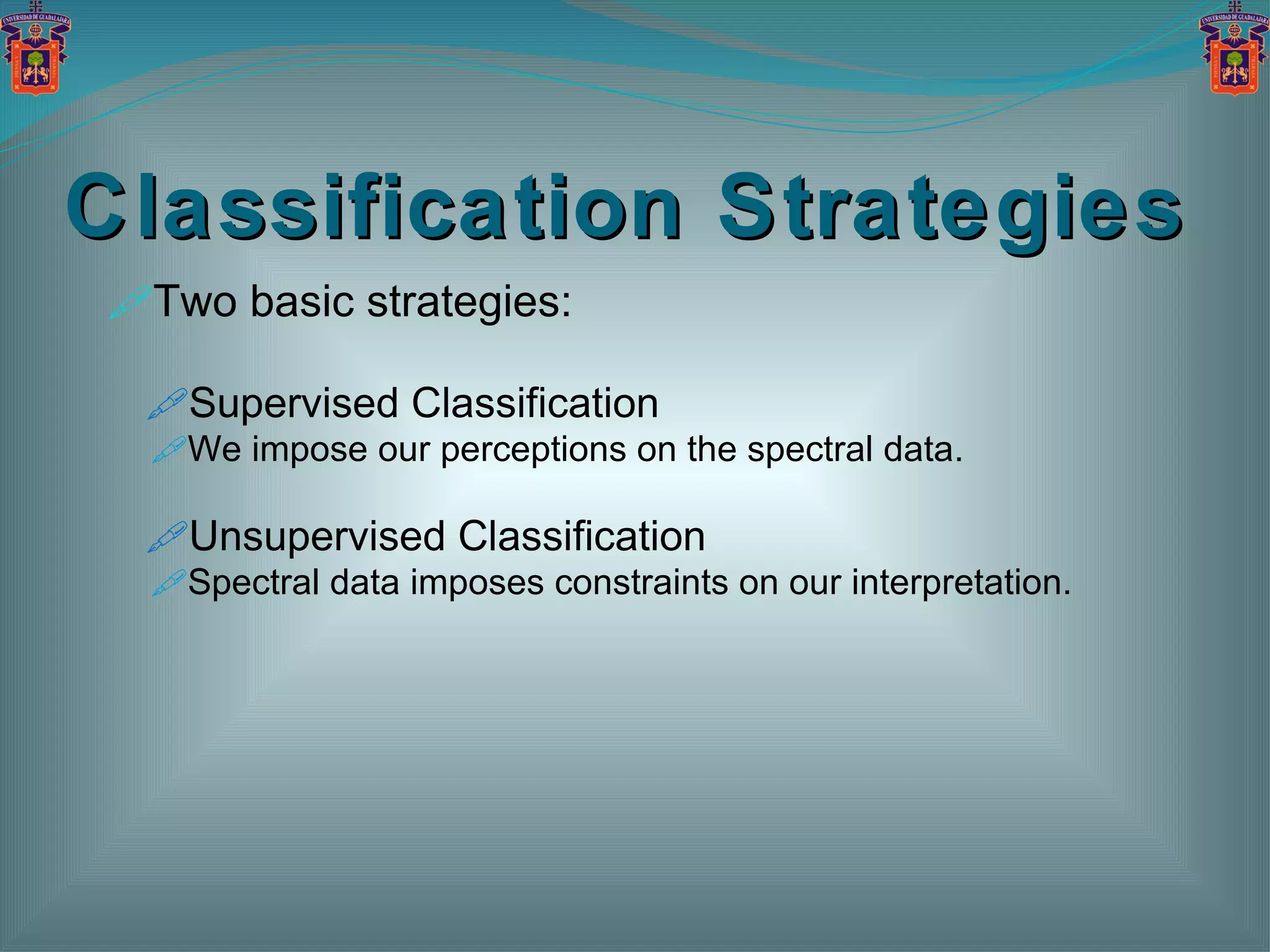
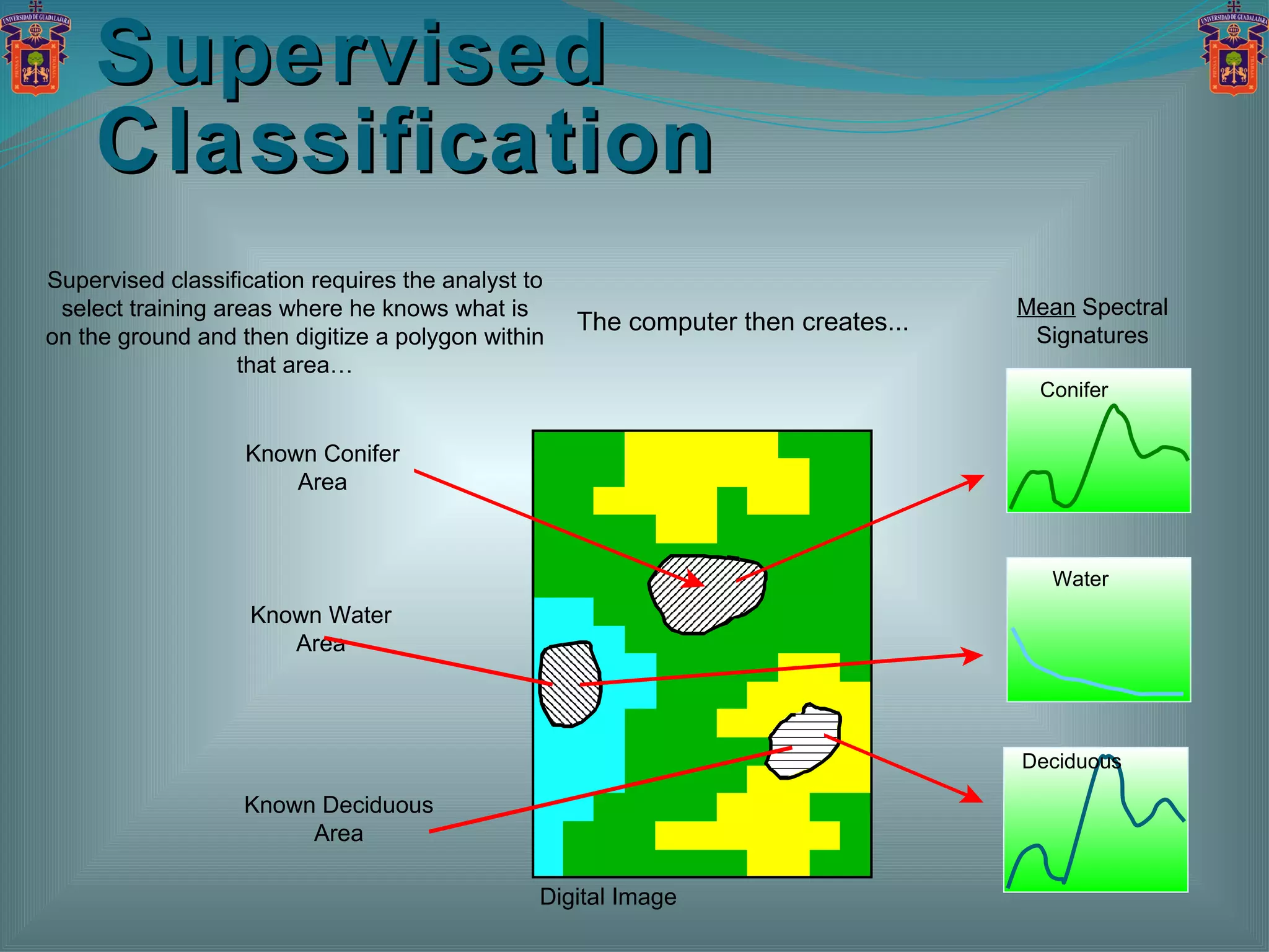
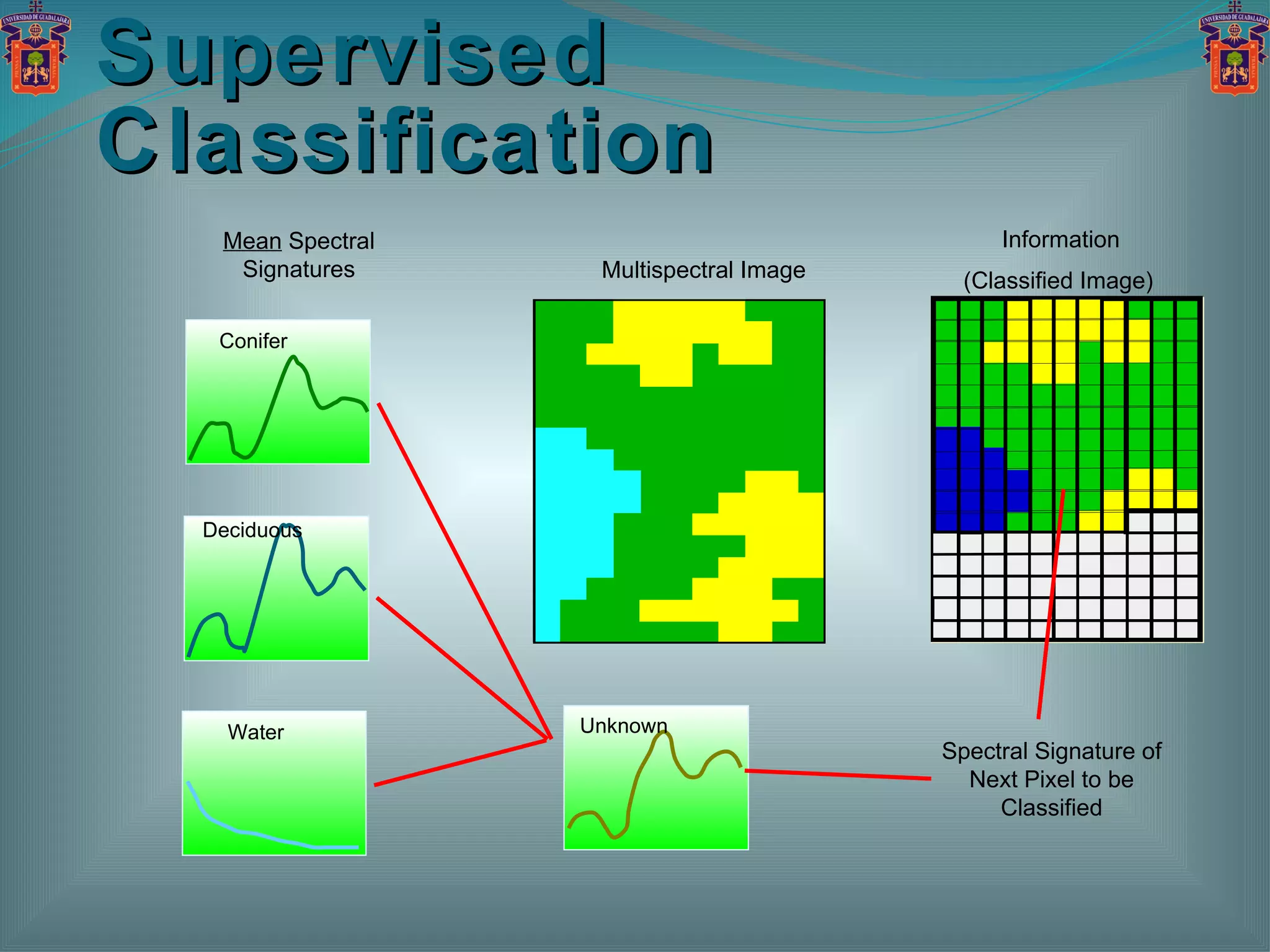
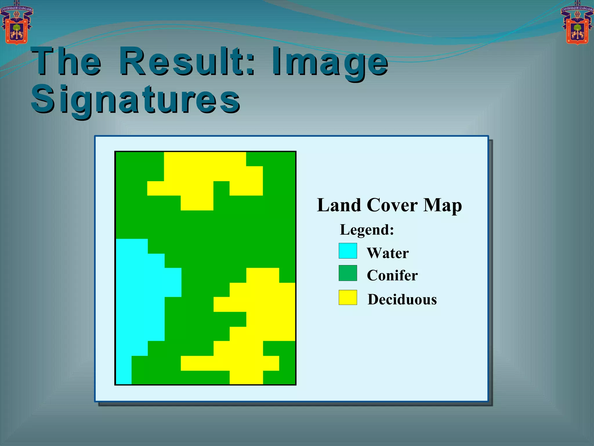
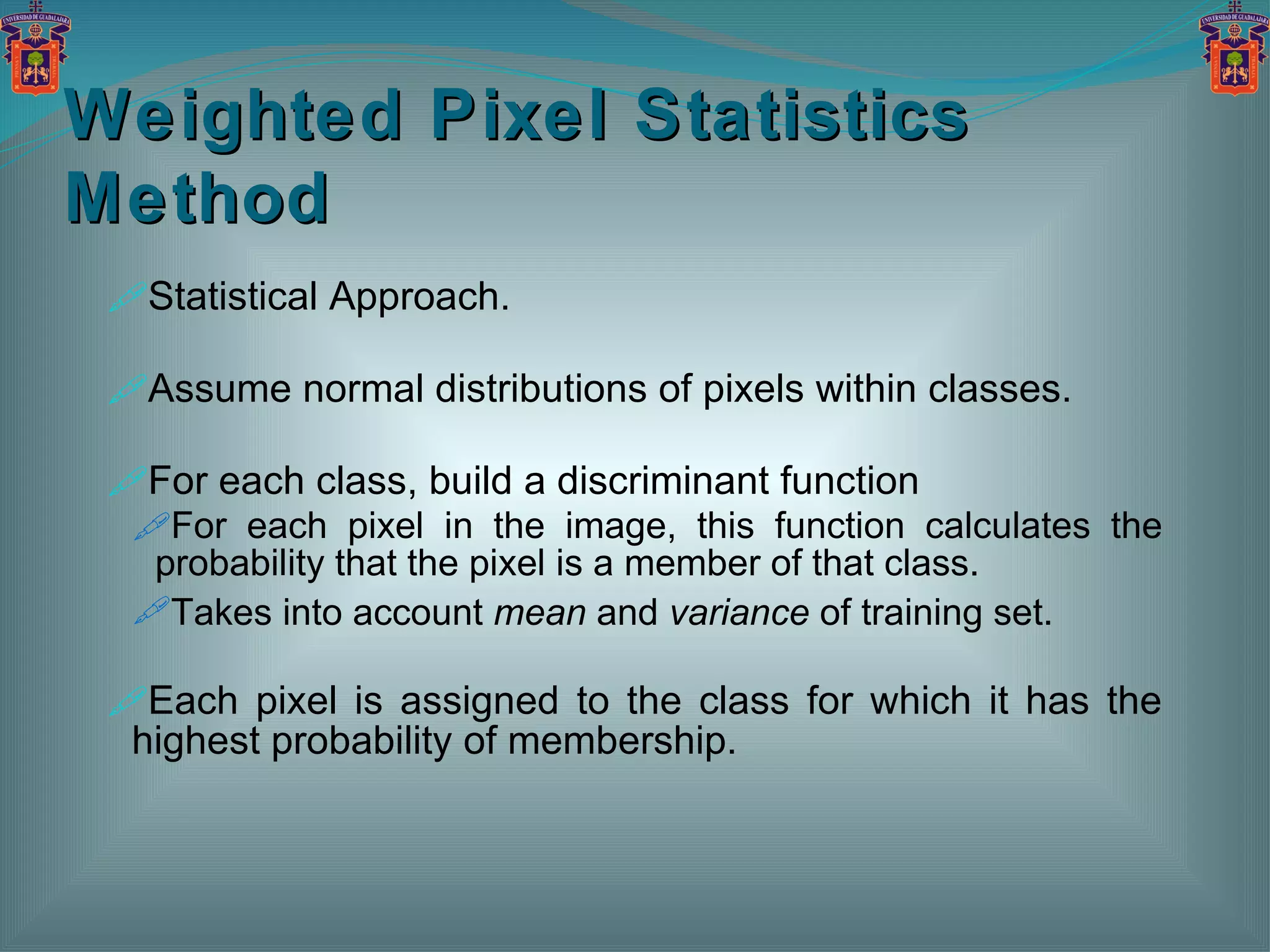
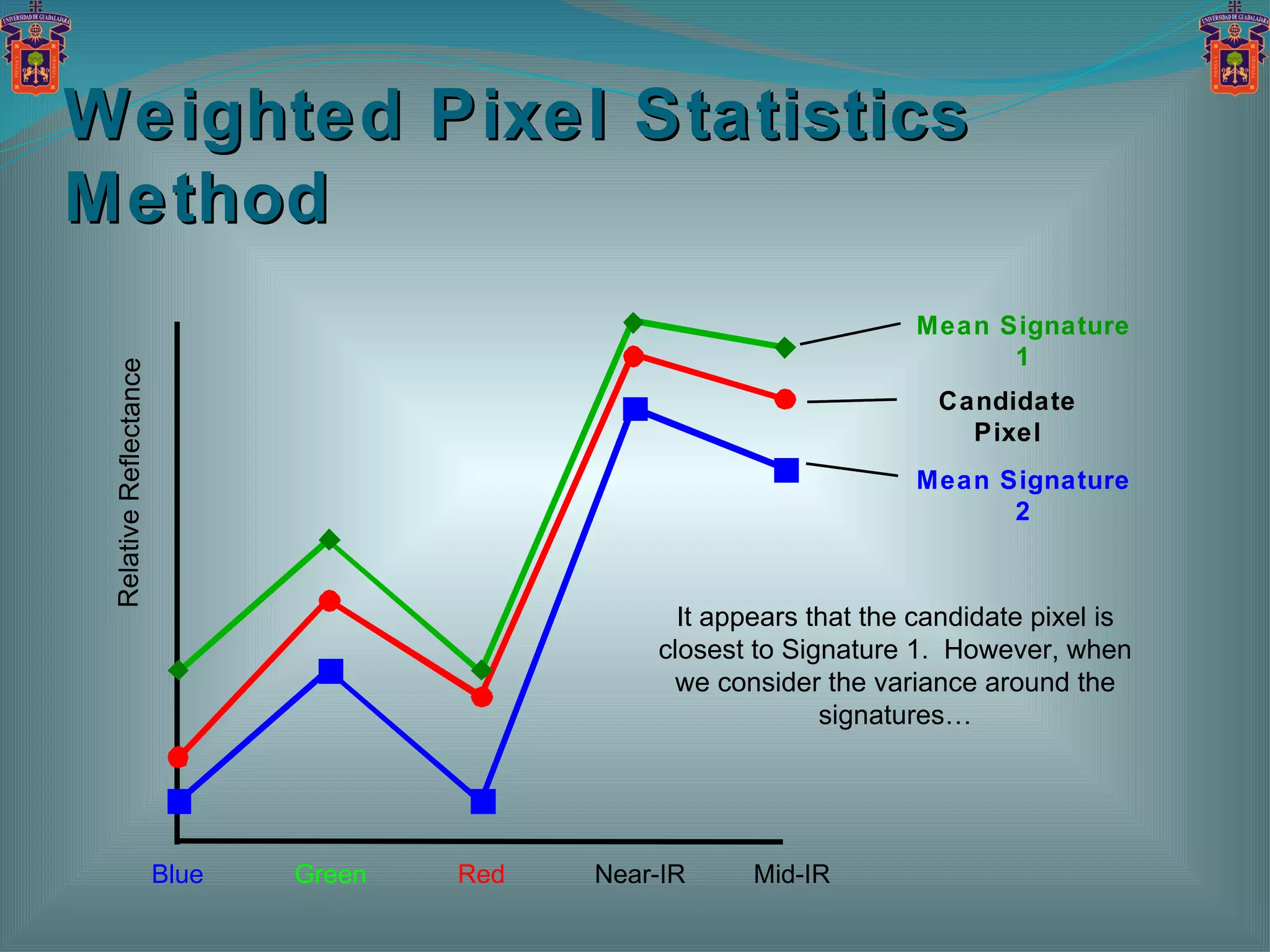
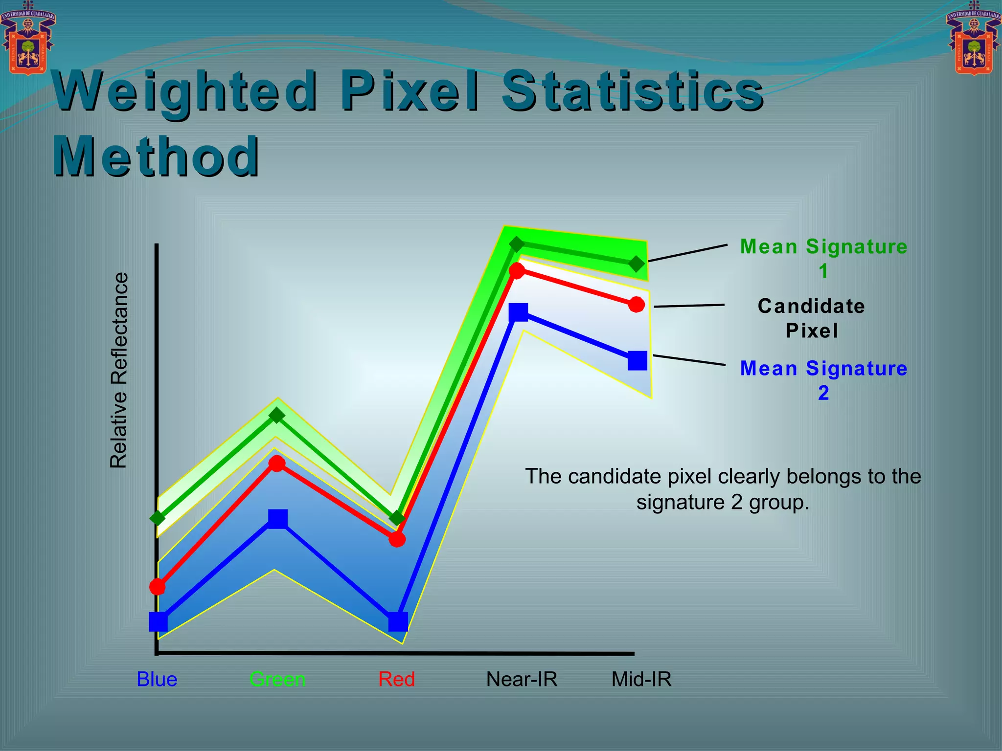
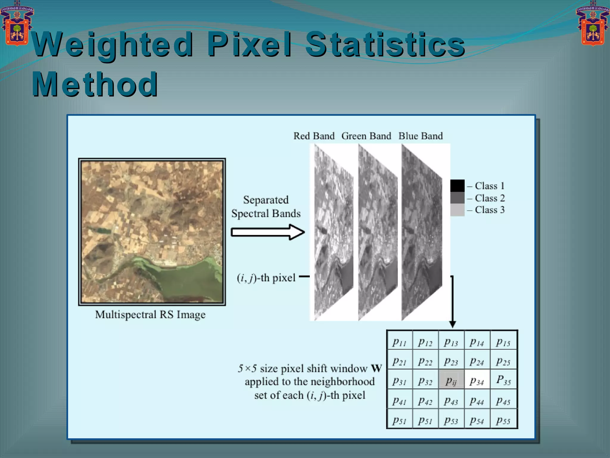
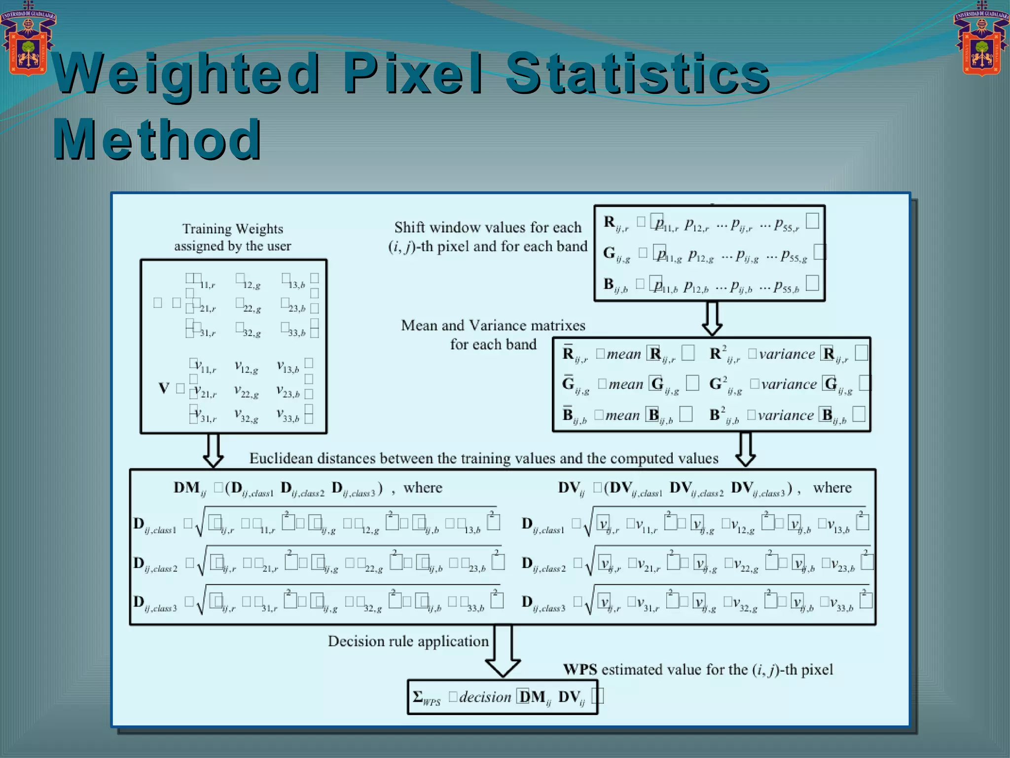
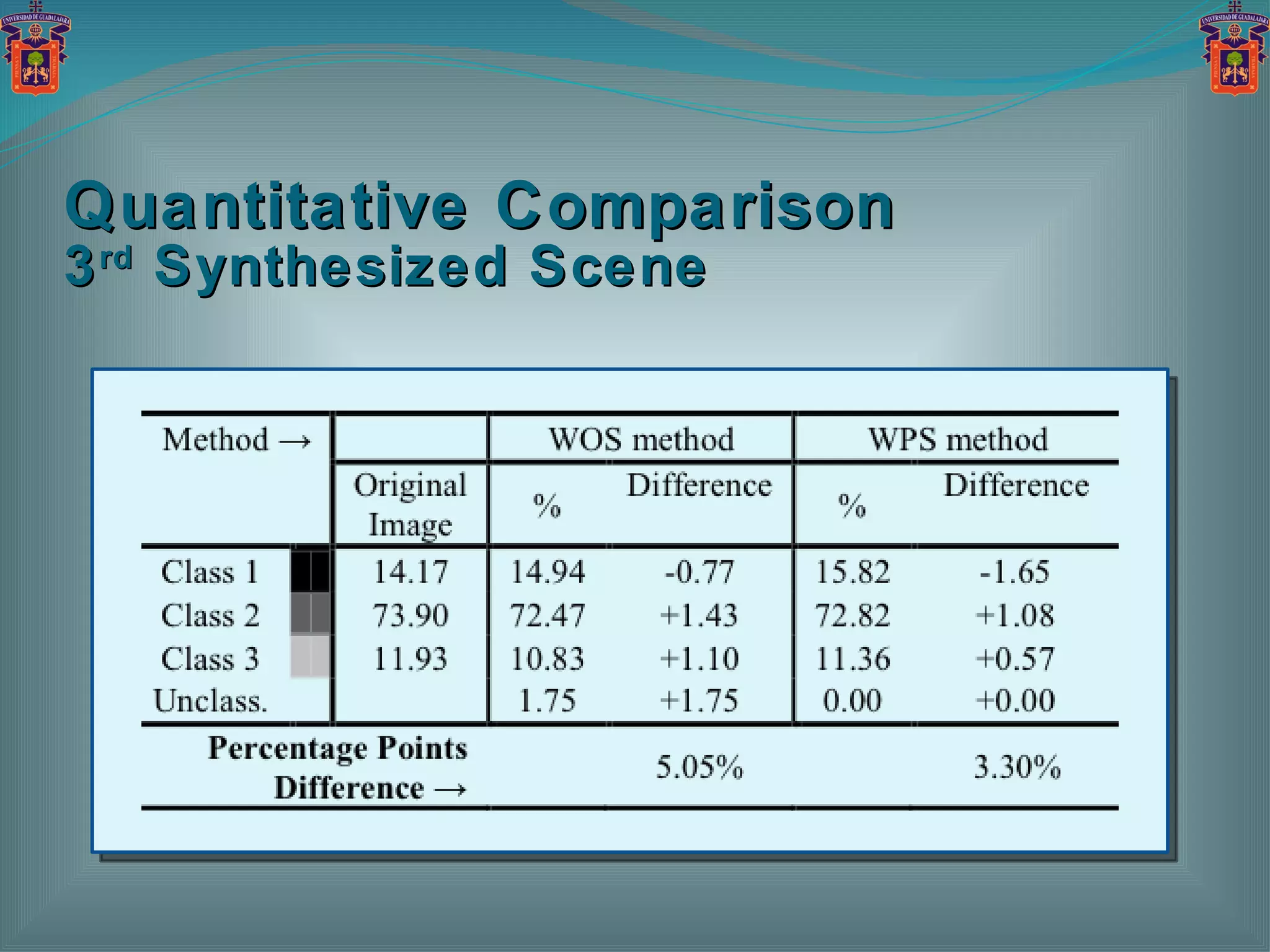
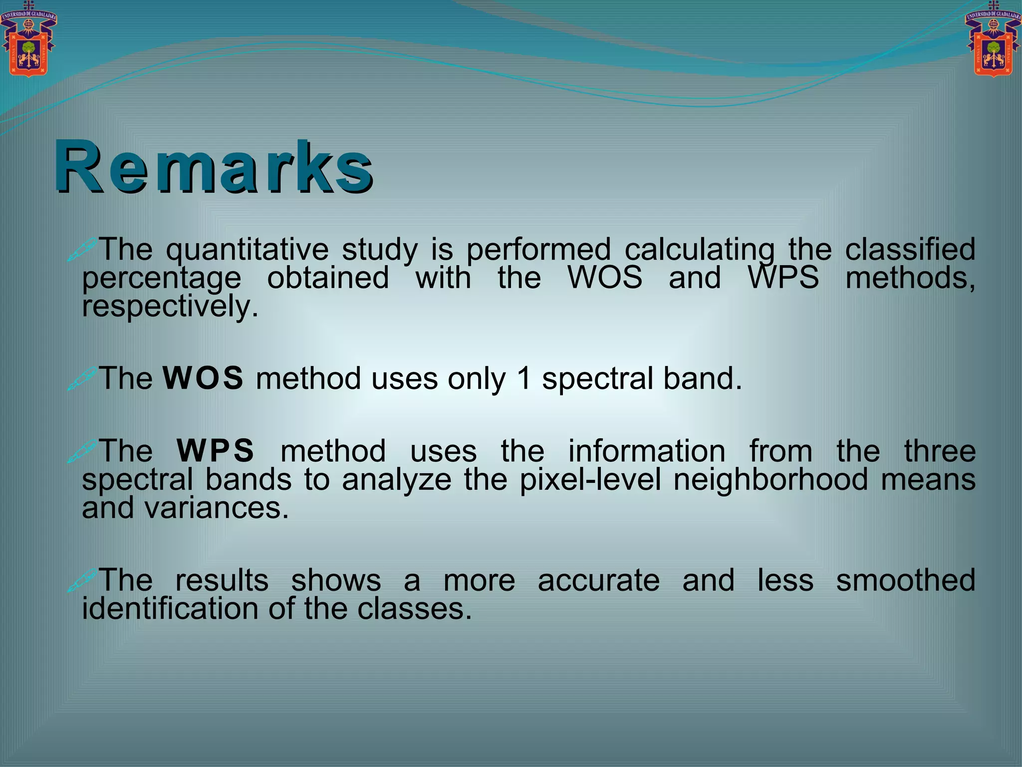
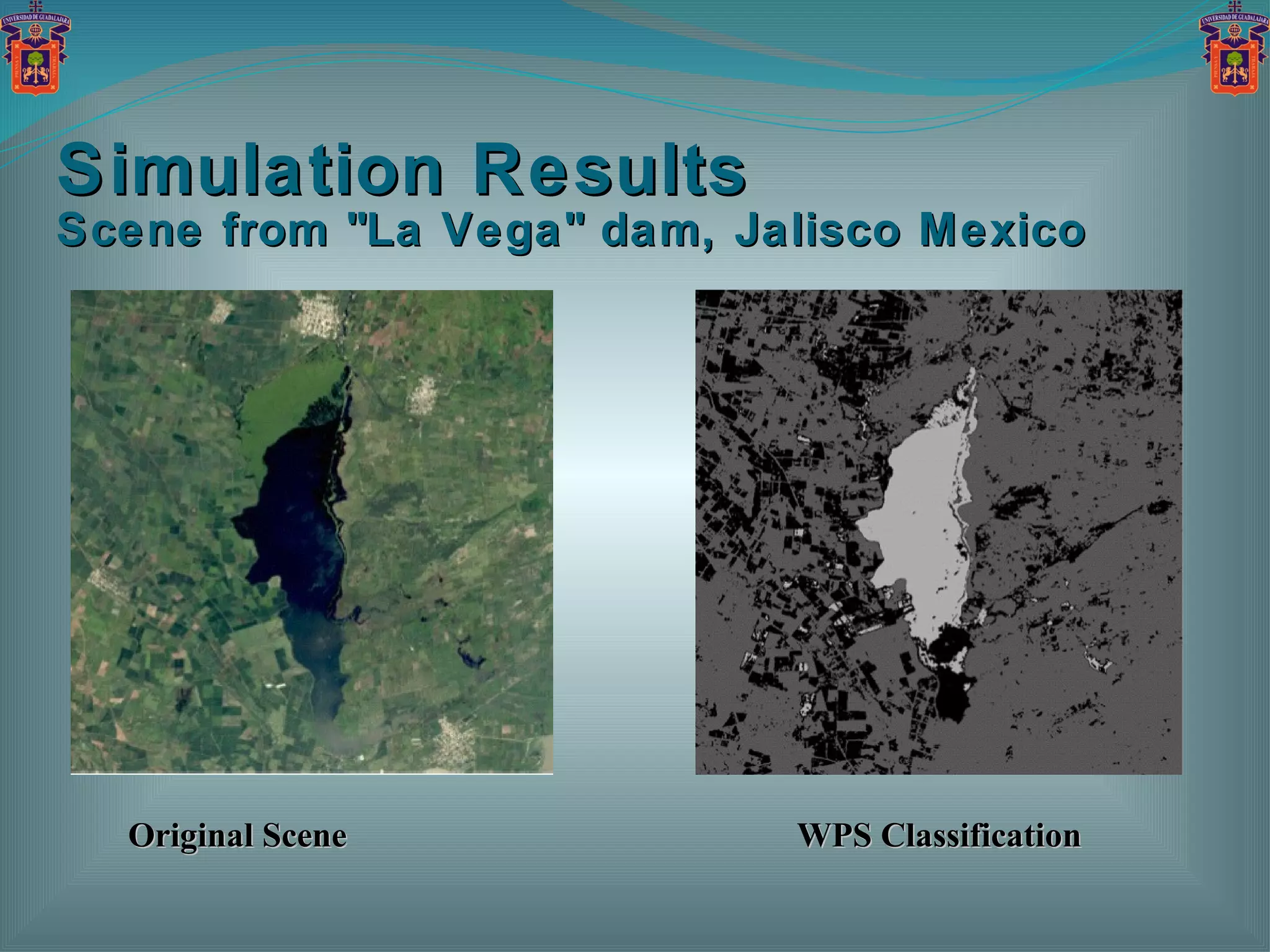
This document summarizes a new approach for classifying remote sensing signatures extracted from multispectral imagery. It combines spectral signatures to perform accurate classification. Simulation results are provided to verify the efficiency of the proposed weighted pixel statistics approach, which uses information from multiple spectral bands. It is shown to provide more accurate and less smoothed identification of classes compared to traditional weighted order statistics methods.


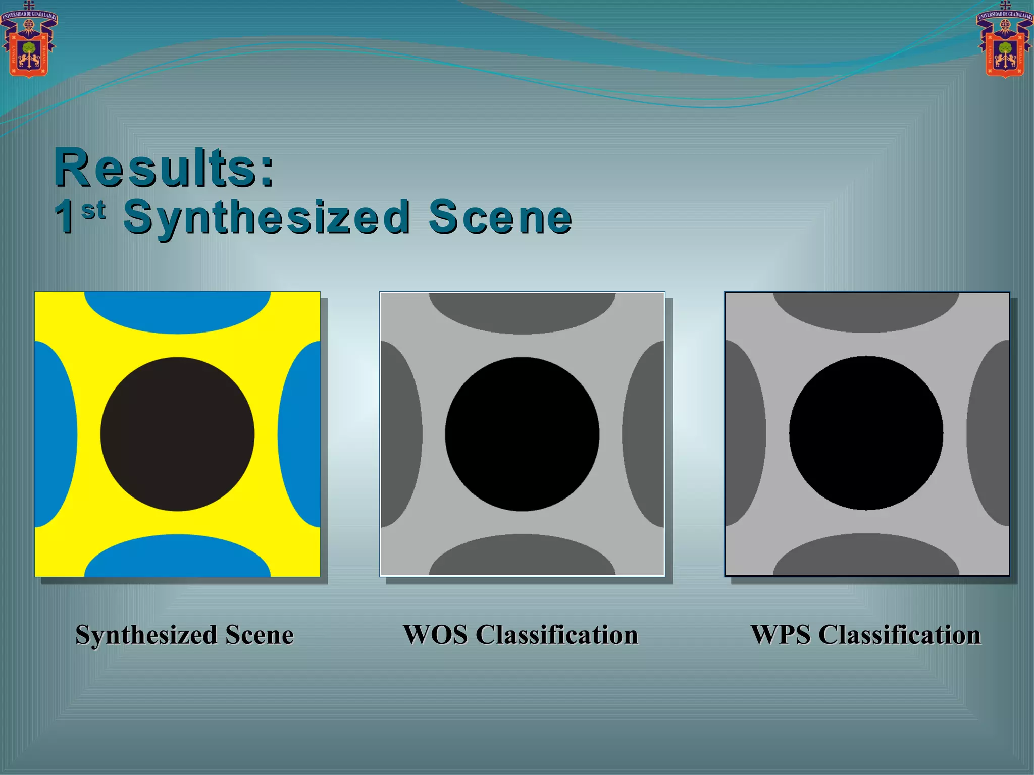
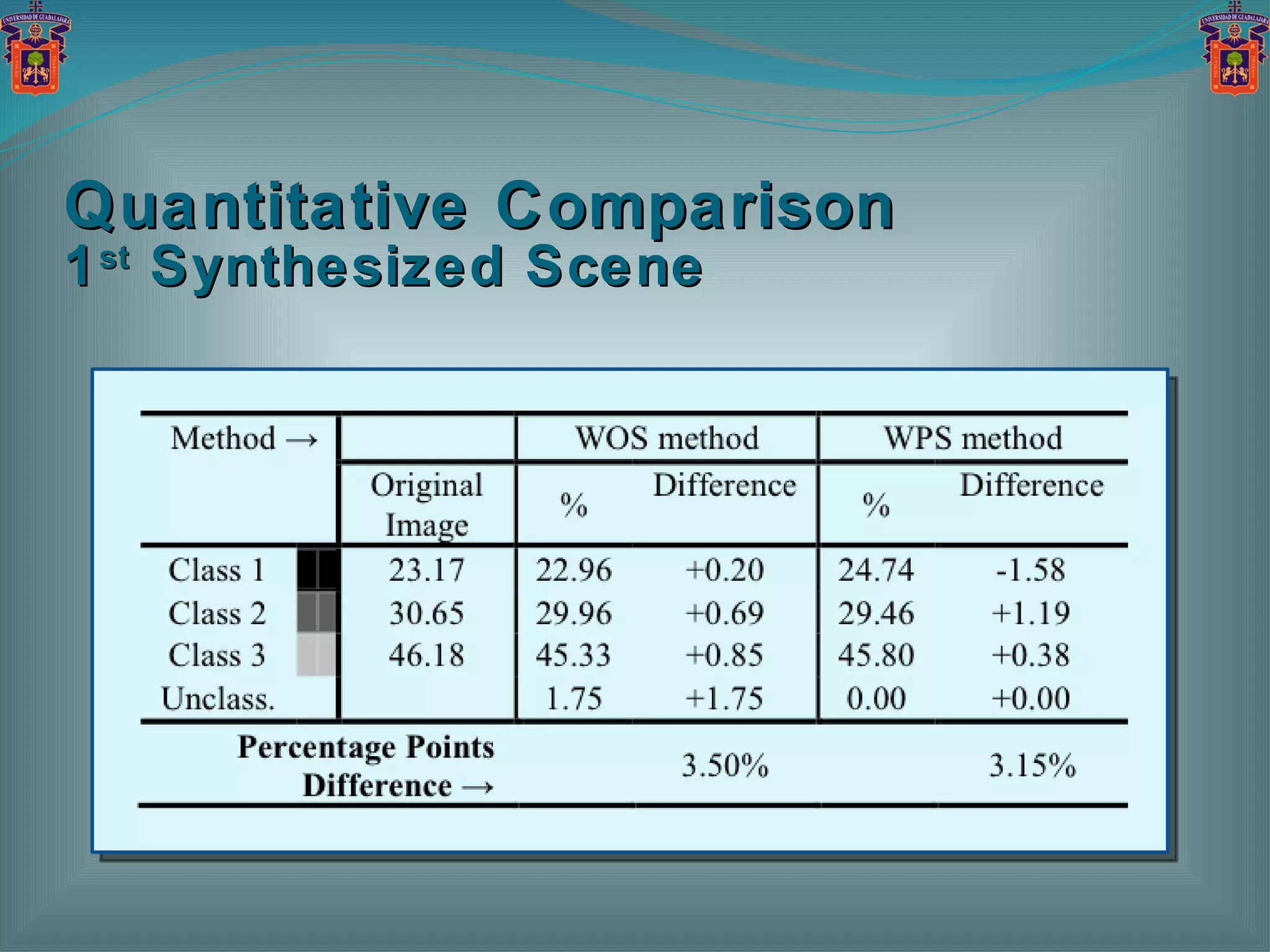
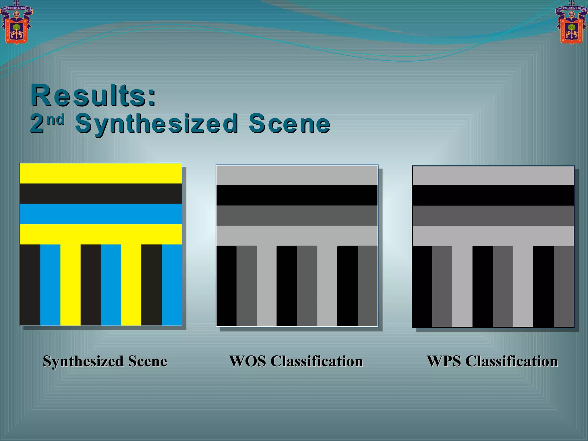
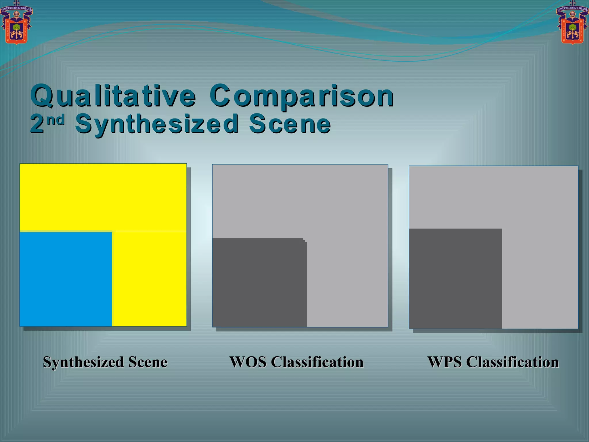
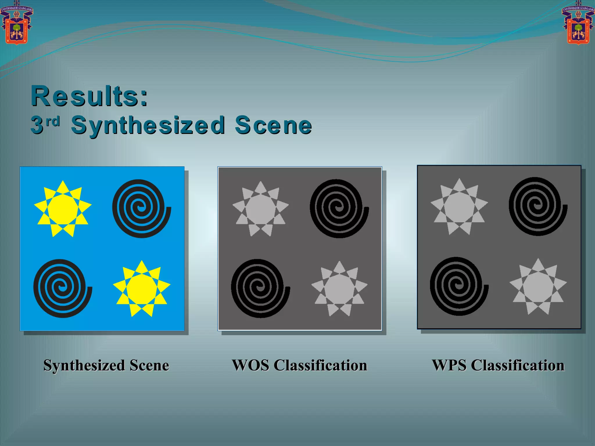
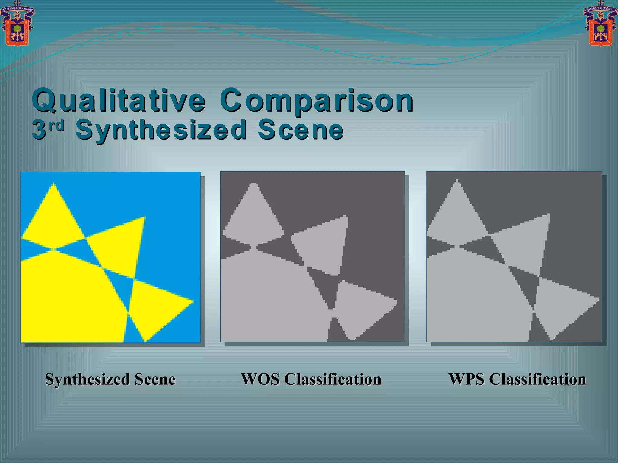
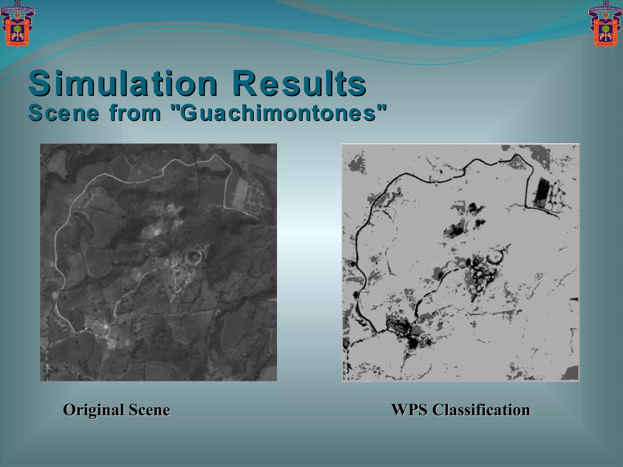
![Verification Protocols A set of three synthesized images are used as verification protocols. All synthesized images are True-Color (RGB), presented in 1024-by-1024 pixels (TIFF format). Each synthesized image contains three different regions (in yellow, blue and black colors) with a different pattern. The developed Weighted Pixel Statistics ( WPS ) algorithm is compared with the most traditional Weighted Order Statistics ( WOS ) method [S.W. Perry, H.S. Wong, 2002].](https://image.slidesharecdn.com/igarss-2011-arch3-110725160410-phpapp02/75/ARCHAEOLOGICAL-LAND-USE-CHARACTERIZATION-USING-MULTISPECTRAL-REMOTE-SENSING-DATA-45-2048.jpg)


![Coded Agents – with UiPath SDK + LangGraph [Virtual Hands-on Workshop]](https://cdn.slidesharecdn.com/ss_thumbnails/codedagentsdeck-251215155422-5497c599-thumbnail.jpg?width=640&height=640&fit=bounds)


![Vibe Coding vs. Spec-Driven Development [Free Meetup]](https://cdn.slidesharecdn.com/ss_thumbnails/vibecodingvsspecdrivendevelopment-251209105622-43f455e7-thumbnail.jpg?width=640&height=640&fit=bounds)