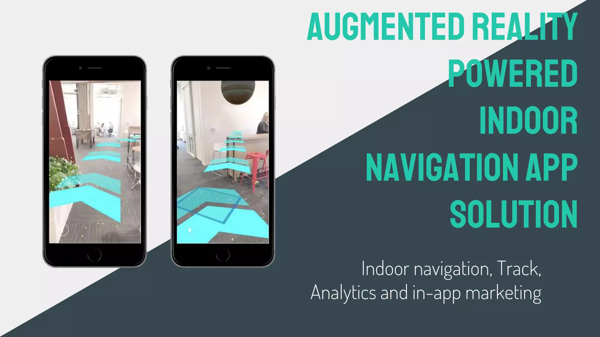
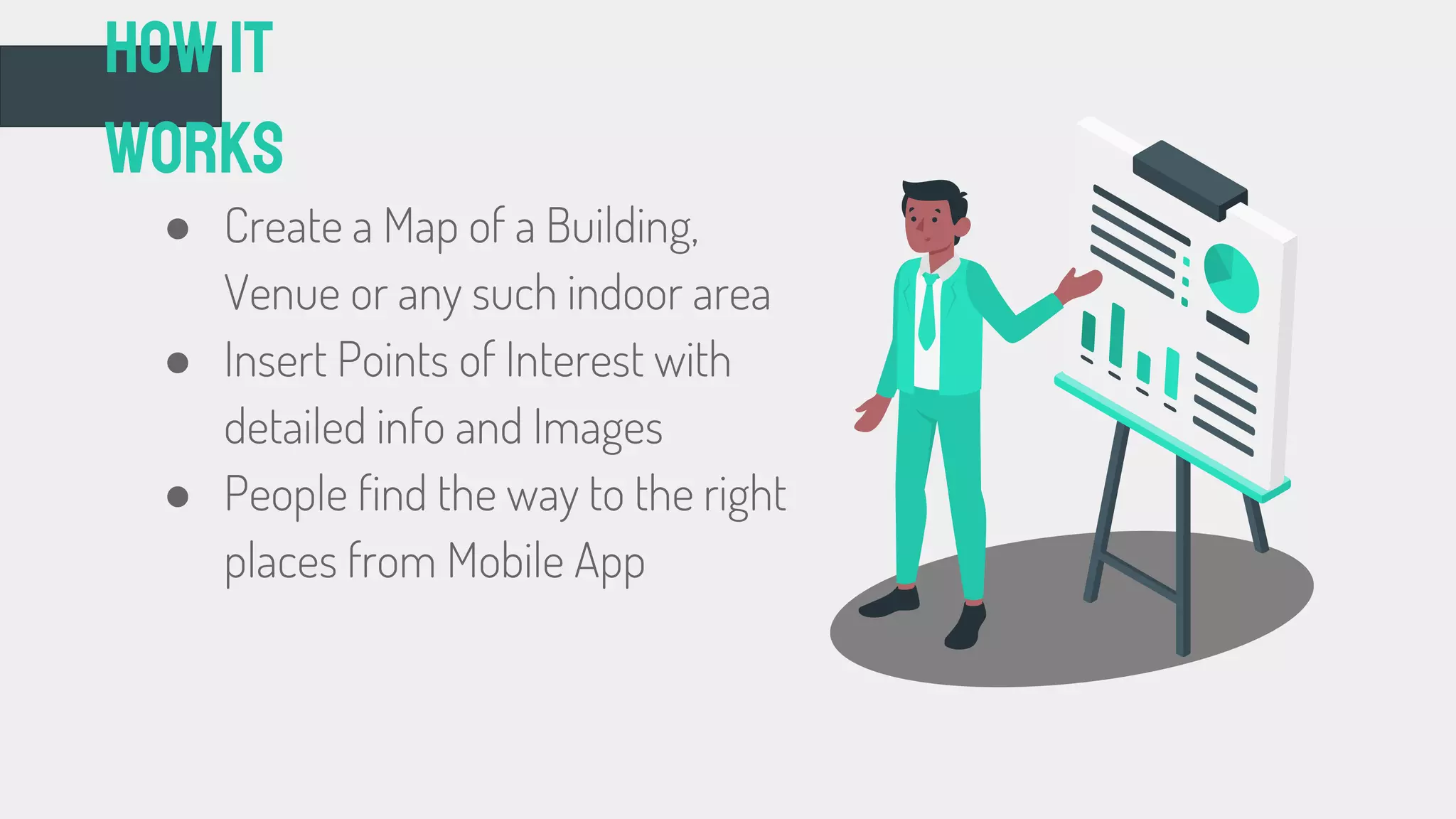
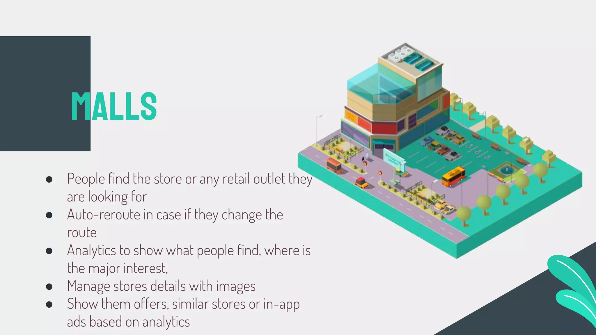
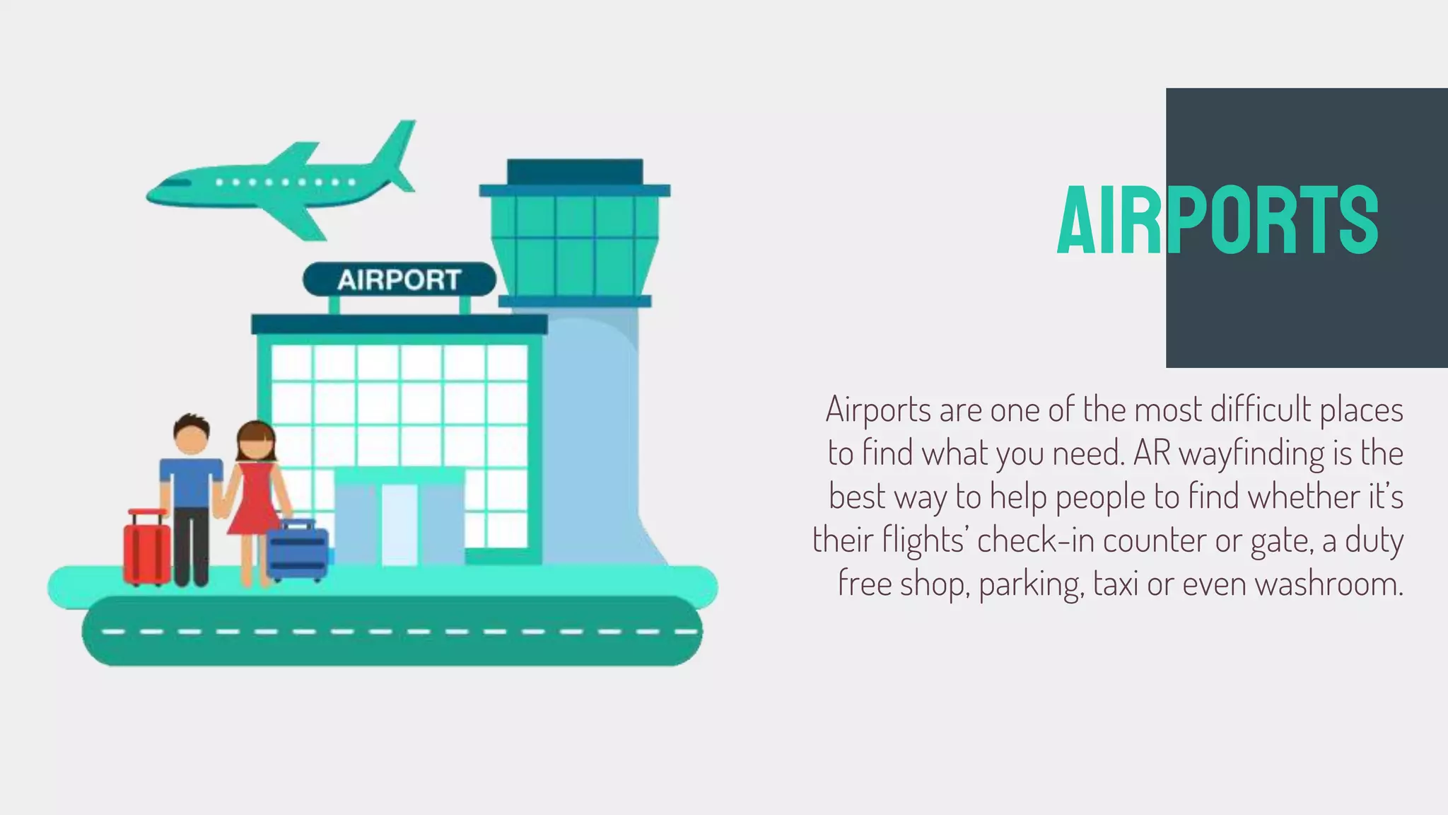
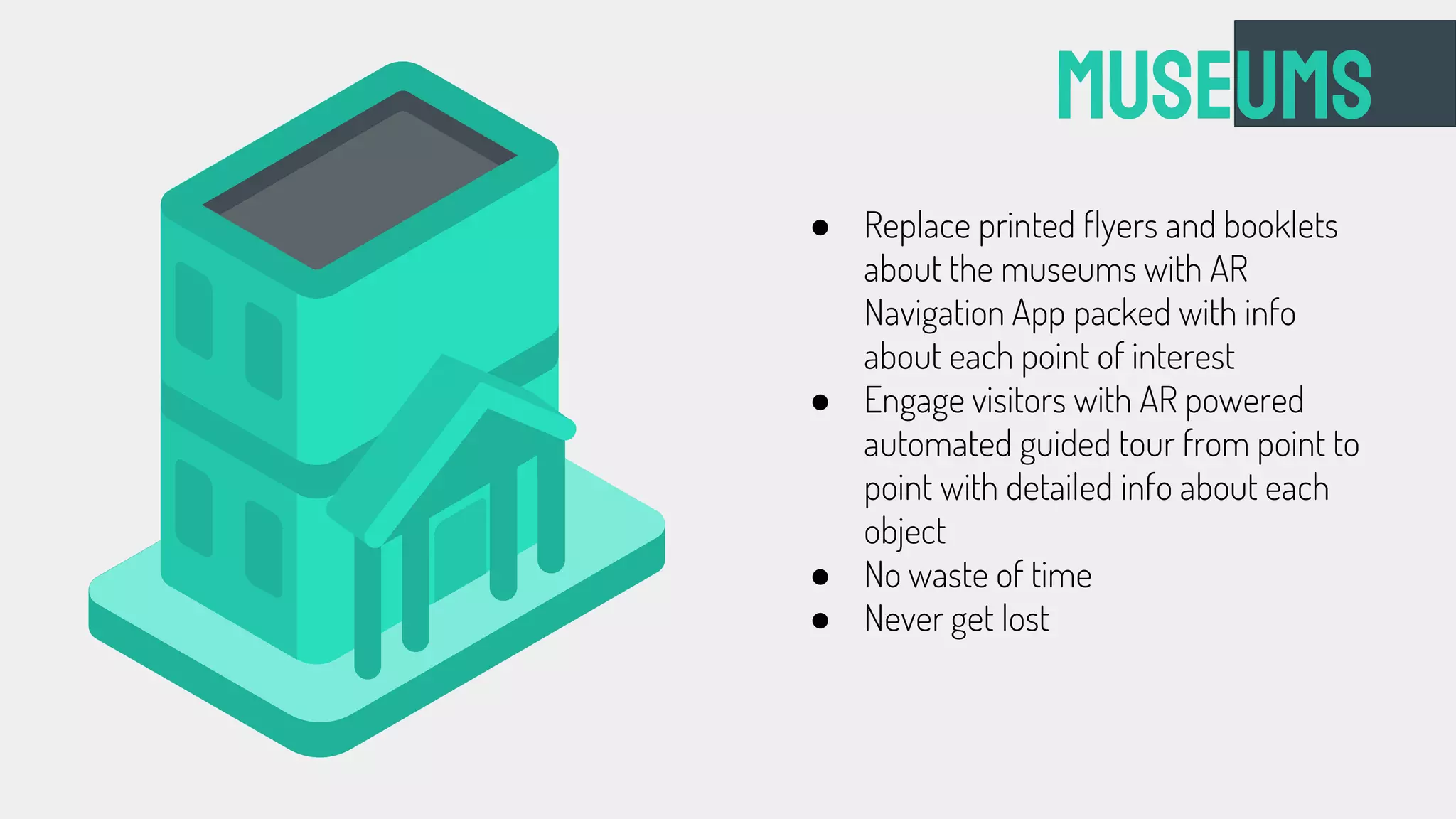
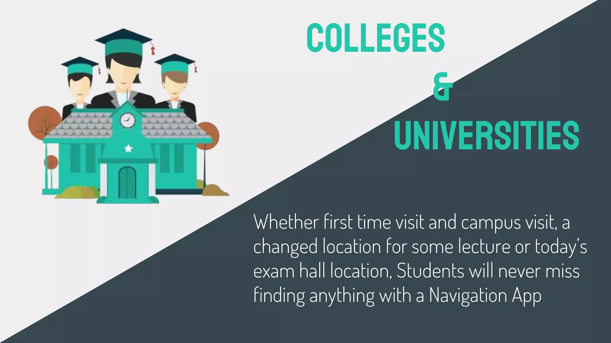
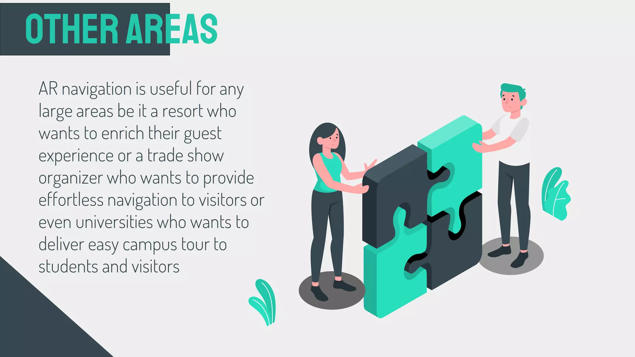
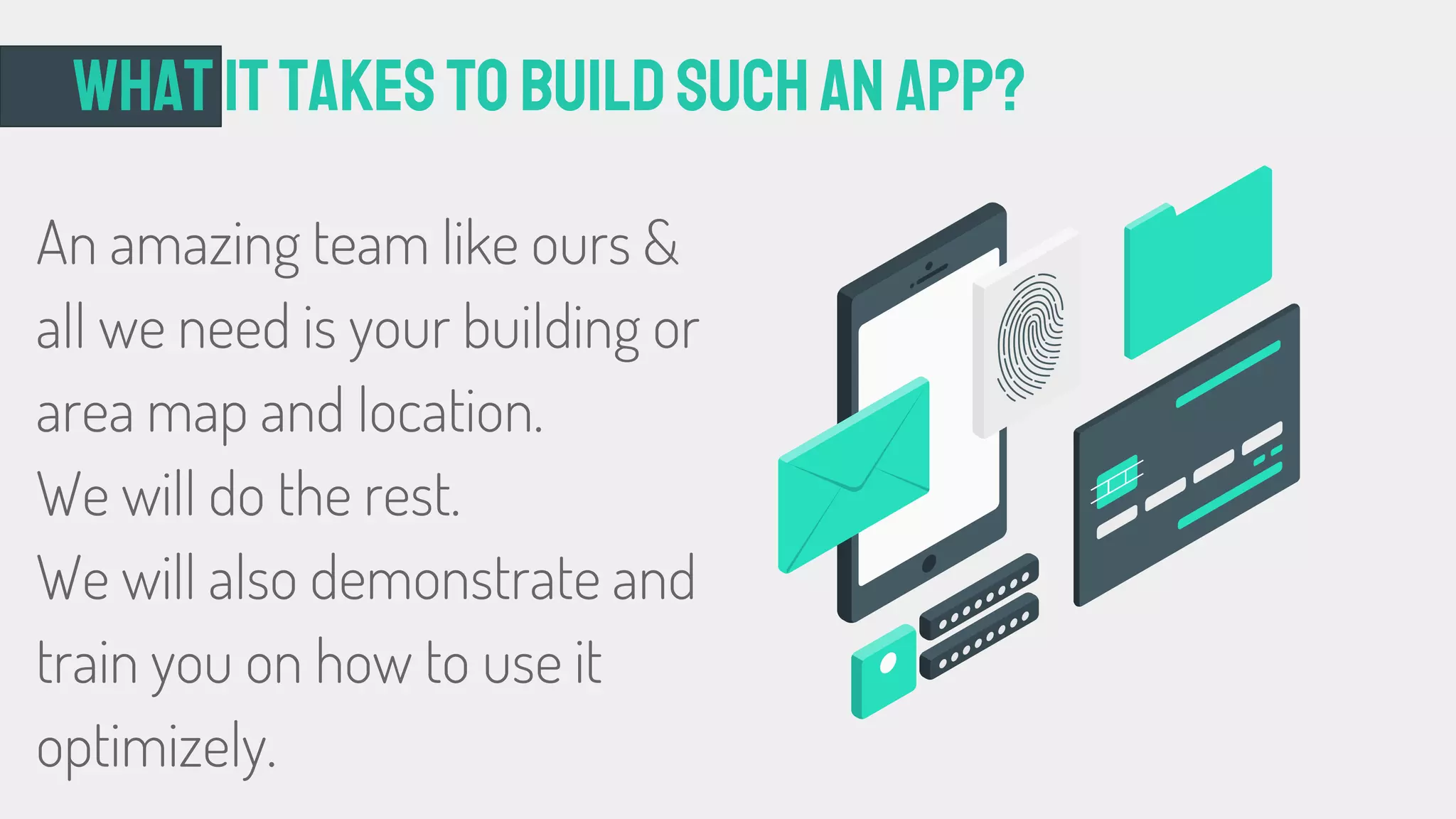
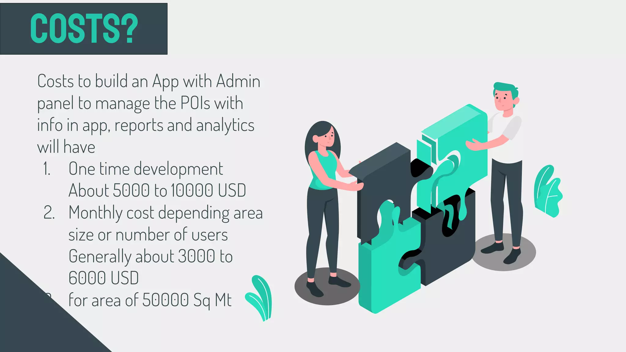
The document discusses an indoor navigation system that uses WiFi positioning to determine a user's location inside a building and provide routing directions. It covers several key aspects:
1. An overview of various indoor positioning technologies including GPS, cellular, infrared, UWB, Bluetooth, and WiFi. WiFi is identified as the preferred approach due to widespread availability and low cost.
2. Details on how WiFi positioning works, including techniques like triangulation, fingerprinting, and considerations of RSSI, MAC addresses, and network details.
3. The system's objectives of indoor positioning, routing, and tracking. It also outlines implementation in models like universities and shopping malls.
4. Additional technical components
This document describes an indoor navigation Android application that uses Wi-Fi fingerprinting for localization and a routing algorithm to navigate between nodes on a map. It discusses challenges with GPS indoors and explores localization techniques including Wi-Fi, Bluetooth, and sensors. The application utilizes a SQLite database of Wi-Fi fingerprints mapped to locations, calculates the user's position by comparing live readings to stored values, and determines displacement using accelerometer and gyroscope data. It draws the user's position on a map and calculates a path between nodes using numbering to navigate between points of interest selected on the interface.
This document discusses location-based reminder applications and proposes an architecture for location-based services using GPS. It describes how location-based reminders can remind users to do something when arriving at or leaving specific locations. It then proposes a system architecture divided into five components: task management, user interface, trigger management, service management, and storage/retrieval management. Finally, it discusses technologies involved like GPS, location-based services, and considerations for implementation.
Indoor geolocation is an emerging technology that has applications in commercial, public safety, and military domains. It uses various techniques like RSS, AOA, TOA, and TDOA to locate tags or mobile devices within buildings. Key challenges include multipath effects from the indoor environment and lack of line of sight between devices, which reduce location accuracy. Existing short-range technologies like RFID have limited range, while mid-range options have reliability issues. The 3D-iD system presented a potential solution using an indoor antenna infrastructure and cell controllers to determine tag locations through triangulation of signal distances to multiple antennas.
Human Computer Interaction, Gesture provides a way for computers to understand human body language, Deals with the goal of interpreting hand gestures via mathematical algorithms, Enables humans to interface with the machine (HMI) and interact naturally without any mechanical devices
The document describes the components and working of Sixth Sense technology, which is a wearable gestural interface. It consists of a camera, projector, mirror, smartphone, and color markers on the fingertips. The camera captures images and tracks hand gestures via the color markers. The smartphone processes the data and searches the internet. It projects information onto surfaces using the projector and mirror. The technology bridges the physical and digital world by recognizing objects and displaying related information using hand gestures.
The Gesture Recognition Technology is rapidly growing technology and this PPT describes about the working of gesture recognition technology,the sub fields in it, its applications and the challenges it faces.
Intelligent traffic information and control systemSADEED AMEEN
This document proposes an intelligent traffic information and control system that uses image processing and wireless communication to control traffic lights. A camera at intersections will capture images and detect vehicle presence to adjust light durations accordingly. An emergency vehicle clearance system will turn all lights green on its path. Zigbee modules allow wireless communication between an ambulance and traffic controller. Additionally, a traffic management system and chatbot provide traffic information to users. The system will use incremental development, initially controlling lights with Arduino then adding congestion control with image processing.
Avvkskeve vsjsoneceyeu scgsuieks na scec snsjscsyisbs svegsijsceiebe svsjskndcdidken scegsjjebececgdcr. E ejdidnrceyjevr evhejevr .uwjegejiej.eveibe e e.ejevhej.
The project is about building a human-computer interaction system
using hand gesture by cheap alternative to depth camera. We present
a robust , efficient and real-time technique for depth mapping using
normal 2D -camera and Infrared LED arrays . We use HOG feature
based SVM classifiers to predict hand pose and dynamic hand gestures . The system also tracks hand movements and events like grabbing and
clicking bythe hand.
Vehicle anti theft tracking system based on internet of things Jyothsna Sridhar
As the number of urban vehicles are growing rapidly vehicle theft has become an important concern for all vehicle owners.
However present anti theft system lacks the tracking and monitoring system.
The vehicle anti theft tracking System based on Internet of things is proposed which can provide all round service to car owners.
Automated attendance system based on facial recognitionDhanush Kasargod
A MATLAB based system to take attendance in a classroom automatically using a camera. This project was carried out as a final year project in our Electronics and Communications Engineering course. The entire MATLAB code I've uploaded it in mathworks.com. Also the entire report will be available at academia.edu page. Will be delighted to hear from you.
This document discusses 3D searching and 3D search engines. It begins by introducing 3D searching as a method to search for 3D objects in a database based on a query. It then discusses the need for 3D search engines, the methodology which involves query formulation, search process, and search results. Examples of specific 3D search systems from Purdue and Princeton are provided. The advantages, limitations, and future prospects of 3D searching are outlined before concluding that 3D search engines can help find 3D models online, but their use is currently limited.
Artificial intelligence in autonomous vehicleGwenaël C
Présentation réalisé pour le cours d'anglais de la Licence 3 Miashs parcours Miage réalisée l'université de Toulouse Capitole conjointement à l'université Toulouse Paul Sabatier
IoT Based Garbage Monitoring System pptRanjan Gupta
1) A group of students presented on an IOT Garbage Monitoring System to help keep cities clean.
2) The system uses ultrasonic sensors and a microcontroller to monitor garbage levels in bins and displays the status on an LCD screen and web page.
3) When fully implemented, the system will help support initiatives like Swachh Bharat Mission by enabling real-time garbage monitoring and efficient collection.
Driver drowsiness detection is a car safety technology which helps prevent accidents caused by the driver getting drowsy. Various studies have suggested that around 20% of all road accidents are fatigue-related, up to 50% on certain roads
This document summarizes a project that aims to develop a software system using computer vision and machine learning to detect whether motorcycle riders in Bangladesh are wearing helmets. It will use a camera to take photos of riders, apply object detection models like YOLO to identify bikes and people, and check if the riders are wearing helmets. If not, it will record the bike's license plate number. The document reviews similar existing works and compares the parameters of this project. It outlines that the project will be implemented in Python using YOLO and OpenCV for real-time object detection and helmet detection from images to help enforce road safety in Bangladesh.
The document discusses light-based Wi-Fi (Li-Fi) which uses visible light communication and LED lamps to transmit data wirelessly. It notes that Li-Fi has significantly higher capacity than radio-based Wi-Fi as the light spectrum is much larger. It also describes how Li-Fi has advantages over Wi-Fi such as better security since light cannot pass through walls to intercept signals. The document outlines some of the key components used in a Li-Fi system like LED lamps that can transmit data by varying in intensity and a photodetector that receives the signals.
Drowsiness is a critical factor impairing drivers’ performance in driving safely. There are several approaches in dealing with this issue based on human-machine interaction to detect drivers’ dozing off state, and then alert them to keep awake by sound or visual. These techniques fundamentally measure driver’s physical changes such as head angle, fatigue level and eyes states which are the indicators of drowsy state. However, they are limited in providing accurate and reliable results. Therefore, the project aims to achieve higher accuracy rate of drowsiness detection by using a very potential technology, electroencephalography (EEG) which is used widely in medical areas. Other than providing reliable result, the final product would bring more conveniences for customers with portability, easy-to-deploy and multi-device compatibility feature. In this project, its methodology first shows the strong correlation between drowsy state with brainwave frequency. Then a proposed system and testing plan are suggested based on the project objectives and available technologies. The final product is simply comprised of a hat with attached small electronic package used to record brainwave and a handheld device placing on dashboard of the car with an installed app. Finally, project management section will present in detail the human resources, scheduling, budget plan and risk analysis to show how it will be going to complete the project in six months.
Automatic vehicle accident detection and messaging system using gsm and gps m...mahesh_rman
This document summarizes an automatic vehicle accident detection and messaging system using GSM and GPS technology. The system uses a microcontroller, GSM modem, and GPS modem to detect if an accident occurs and send an SMS message with the vehicle's location to alert contacts. Some key advantages are providing security while traveling by detecting accident locations and notifying others. The system could also be expanded to track stolen vehicles or interface with other vehicle security systems.
This document describes a proposed smart parking system with the following key elements:
- The system uses ultrasonic sensors in each parking space to detect vehicles and coordinate payments and check in/out functions.
- Users can check in by entering their phone number, then pay automatically using RFID or by entering their card details. They can check out using their phone number.
- The spaces communicate information to a central coordinator, and a mobile app allows remote check in, payment and check out.
- Future improvements could include GPS location tracking, additional sensors for better detection, and integrating payments with bank accounts or existing systems.
This document summarizes a seminar presentation on Money Pad, an e-cash handling system that uses fingerprint recognition to authenticate users for transactions. It describes the current credit/debit card system and its limitations. The Money Pad architecture uses biometric technology to allow for instant clearing of funds, strong security, and avoidance of physical wallets or cards. It has applications in e-banking, e-commerce, and daily transactions. The Money Pad aims to provide instant clearing, eliminate payment risk, and enable secure transactions through strong encryption.
Eye tracking technology allows users to control devices with their eyes. It works by tracking the movement of the user's eyes using infrared light and cameras. The technology measures the point of gaze and motion of the eyes. It is being used in applications like assistive technologies, video games, and marketing research. In the future, eye tracking may allow new methods of human-computer interaction and be integrated into more devices.
The document describes Ming-Zher Poh's invention of the Medical Mirror, which allows contactless measurement of heart rate using a webcam and mirror setup. The mirror contains a webcam and LCD monitor behind a two-way mirror. Software analyzes subtle light reflections caused by blood flow to determine heart rate in real-time. This provides a more comfortable alternative to external sensors. Future applications could non-invasively monitor multiple health parameters using the system.
How much would it cost to develop an indoor navigation app.pdfFuGenx Technologies
Well, the indoor positioning app technology helps businesses better so that they can take advantage of this service. They can use the Indoor Positioning & Navigation app to map large buildings such as malls, railways, and airports for visitors. Offices, malls, hospitals, airports, warehouses, and university campuses, all of these buildings are built on a large area, making it a challenge for visitors to quickly find their way.
Indoor Navigation System for Shopping Malls.pdfTechugo
Indoor navigation and positioning apps are required indoors. They differ from outdoor navigation apps. GPS outdoor navigation apps rely on satellite signals and can lose signal in dense areas, large buildings, or complexes. On the other hand, these indoor mapping software are designed for smaller areas and use augmented reality to display your location by accessing integrated GPS maps. The apps offer the fastest route to your destination by allowing you to access the built-in GPS maps.
Indoor Navigation System for Shopping Malls- Features, Costs & Tech Stack.pdfTechugo
Indoor navigation system for shopping malls can locate objects and visitors within buildings. However, GPS indoors is unreliable due to the lack of visual contact with GPS satellites. Thus, the mechanism must therefore use other positioning methods. These include widely accepted consumer standards for WiFi and Bluetooth Low Energy (BLE) and ultra-wideband or passive RFID solutions. The choice of technology and method is the first and most crucial step in the implementation process.
FlightsLogic Trip Planner provides a comprehensive travel planning solution for individuals and businesses. Users may use this service to effortlessly search for flights, hotels, and rental vehicles and create customized itineraries that match their specific travel demands.
Navifit is a navigation and fitness app that provides accurate offline maps, turn-by-turn directions, live traffic updates, augmented reality views, and integrated fitness tracking. It aims to solve common travel problems like getting lost or relying on untrustworthy transportation services. The app targets tourists and health-conscious individuals. It has features to find nearby places, track workouts, and add safety features. Navifit is available for free with basic maps or at a premium price for expanded maps and features like live traffic or head-up displays. It aims to increase users and distribution through app stores and promotional incentives.
Wayfinder - is a navigation portal that transforms any kind of property in a cozy, safe and comfortable environment for any visitor.
Customers will easily find the way around many useful locations and will never get lost wherever they are. Optimal routes and effective communications are guaranteed.
This document summarizes the mobile application development services of Geniteam. It highlights major clients that Geniteam has helped by developing mobile apps, including Princeton Review, oDesk, SXSW, and others. It also provides statistics on Geniteam's experience developing over 300 apps since 2008 for iPhone, iPad, Android and Blackberry. Geniteam claims a 100% approval rating from app stores, high customer retention and satisfaction rates, and awards they have received for their work.
This document outlines a marketing plan for a parking app. The executive summary introduces the problem of limited parking and the goal of providing an efficient digital parking solution. The situation analysis notes population growth and fewer parking slots are causing traffic issues. The strategy is to promote the app for finding cheap parking through digital marketing. Tactics include analyzing user behavior, creating ads, and sponsoring events. The plan is to develop the app, collaborate with payment companies and organizations for promotion, and hire needed teams to implement the plan.
This document discusses how artificial intelligence will change navigation by providing more accurate real-time traffic information and smarter routing recommendations. Key points include:
- AI systems can combine historical traffic data with live GPS updates to predict traffic patterns and forecast congestion.
- Predictive maps factor in events like accidents to suggest alternate routes in real-time.
- Over time, navigation systems will integrate more contextual data like locations of businesses and points of interest.
- Traffic management systems using AI aim to lower economic costs of congestion, like the $10 billion annually in Delhi, by providing smarter routing guidance.
Travel App Development Guide Features Steps Cost.pdfSuccessiveDigital
This is an article about travel app development. It discusses the benefits of travel apps for businesses and travelers. It also details the steps involved in developing a travel app. Some of the important points from this article are the different types of travel apps that can be developed and the features that can be included in them.
Visit: https://successive.tech/blog/travel-app-development-guide/
This document provides an overview of Intelegain Technologies, a business and technology solutions partner that has over 13 years of experience developing mobile, web, and enterprise applications. It highlights Intelegain's services in areas like mobile app development, web development, enterprise solutions, and dedicated development teams. The document also summarizes several case studies of mobile and web applications developed by Intelegain for clients in various industries including finance, retail, travel, and media.
This document summarizes the proposed rebranding and redesign of the SG BusLeh mobile app. The app will be rebranded as SG JalanKaki: MRT & Bus Companion to better address users' pain points with public transportation navigation. Research found users confused by maps and signage or misdirected by other apps. The redesign aims to provide streamlined trip planning and navigation. A new minimalist user interface concept of "Essentialism" is shown through prototype key frames. The marketing strategy will focus on specific, measurable objectives like new downloads and app ratings to increase market penetration through digital tactics like social media campaigns.
How software solutions are changing the travel & tourism businessInexture Solutions
The travel and tourism industry is being transformed by technology. With software solutions becoming more widely available and affordable, the way we travel is evolving. From online booking systems to virtual tours, the possibilities are endless.
How to Start Tour and Travel App Development in 2024.pdfJPLoft Solutions
Mobile applications have evolved into essential companions for travelers in an ever-changing world of travel. By 2024, the importance of travel app development has never been more crucial. These apps aren't only convenient, but they are also essential to modern travelers. This blog delved into the most critical steps in application development, examining all aspects from the initial planning stage through post-launch maintenance.
These slides use concepts from my (Jeff Funk) course on Business Models at National University of Singapore to analyze the business model of Augmented Reality for travel. Augmented reality superimposes information on top of our sensory data. One way to do AR is to use a smart phone’s camera to view a world with information superimposed on the smart phone’s display. For travel, nearby places of interest can be provides along with ratings, reviews directions, public transport, and other information on them. This information can be obtained from Google Earth and other sources. The slides describe the value proposition, method of value capture, customers, scope of activities, and method of strategic control for two startups involved with AR and travel.
bluepath solution for Conference, Exhibitions and Eventsbluepath
bluepath solution for Conference ( MICE ), Exhibitions and Events providing Indoor Positioning, Indoor Navigation, Realtime and Asset Tracking, Proximity notifications and Location Based Services.
This document summarizes the services of Lean Technologies, a product development company. They help clients build digital products, taking them from idea to scalable business. Their full-cycle development process includes product strategy, design, development and growth hacking. They specialize in building minimum viable products and using agile methodology. One of their major clients is TaxiStartup, for which they developed a dispatch system used by over 100,000 taxi drivers across 13 countries.
Variance Offer Sales Force consulting and customization service by gaining experience in CRM domain for almost Decade. Contact us on salesforce@varianceinfotech.com if you've any requirement to discuss salesforce consulting services.
This document provides a user guide for the SuiteCRM HRMS system. It describes the main modules of the system including HRM, Business Units, Departments, Opening/Positions, Candidates, Interviews, and Employees. It provides steps for accessing and using each module to manage organizational data, the recruitment process, and employee records.
The company wanted to improve their order, shipping, and invoicing processes by reducing time spent on tasks, increasing compliance, and accountability. They were using spreadsheets and emails to manage orders, scheduling, shipments, and invoicing across different systems. The company engaged Variance InfoTech to customize Microsoft Dynamics CRM and migrate their data to integrate their key processes and enable additional capabilities like dashboards, document management, and sales management.
GraphRAG for Life Science to increase LLM accuracyTomaz Bratanic
GraphRAG for life science domain, where you retriever information from biomedical knowledge graphs using LLMs to increase the accuracy and performance of generated answers
Best 20 SEO Techniques To Improve Website Visibility In SERPPixlogix Infotech
Boost your website's visibility with proven SEO techniques! Our latest blog dives into essential strategies to enhance your online presence, increase traffic, and rank higher on search engines. From keyword optimization to quality content creation, learn how to make your site stand out in the crowded digital landscape. Discover actionable tips and expert insights to elevate your SEO game.
Threats to mobile devices are more prevalent and increasing in scope and complexity. Users of mobile devices desire to take full advantage of the features
available on those devices, but many of the features provide convenience and capability but sacrifice security. This best practices guide outlines steps the users can take to better protect personal devices and information.
In his public lecture, Christian Timmerer provides insights into the fascinating history of video streaming, starting from its humble beginnings before YouTube to the groundbreaking technologies that now dominate platforms like Netflix and ORF ON. Timmerer also presents provocative contributions of his own that have significantly influenced the industry. He concludes by looking at future challenges and invites the audience to join in a discussion.
Unlock the Future of Search with MongoDB Atlas_ Vector Search Unleashed.pdfMalak Abu Hammad
Discover how MongoDB Atlas and vector search technology can revolutionize your application's search capabilities. This comprehensive presentation covers:
* What is Vector Search?
* Importance and benefits of vector search
* Practical use cases across various industries
* Step-by-step implementation guide
* Live demos with code snippets
* Enhancing LLM capabilities with vector search
* Best practices and optimization strategies
Perfect for developers, AI enthusiasts, and tech leaders. Learn how to leverage MongoDB Atlas to deliver highly relevant, context-aware search results, transforming your data retrieval process. Stay ahead in tech innovation and maximize the potential of your applications.
#MongoDB #VectorSearch #AI #SemanticSearch #TechInnovation #DataScience #LLM #MachineLearning #SearchTechnology
Pushing the limits of ePRTC: 100ns holdover for 100 daysAdtran
At WSTS 2024, Alon Stern explored the topic of parametric holdover and explained how recent research findings can be implemented in real-world PNT networks to achieve 100 nanoseconds of accuracy for up to 100 days.
TrustArc Webinar - 2024 Global Privacy SurveyTrustArc
How does your privacy program stack up against your peers? What challenges are privacy teams tackling and prioritizing in 2024?
In the fifth annual Global Privacy Benchmarks Survey, we asked over 1,800 global privacy professionals and business executives to share their perspectives on the current state of privacy inside and outside of their organizations. This year’s report focused on emerging areas of importance for privacy and compliance professionals, including considerations and implications of Artificial Intelligence (AI) technologies, building brand trust, and different approaches for achieving higher privacy competence scores.
See how organizational priorities and strategic approaches to data security and privacy are evolving around the globe.
This webinar will review:
- The top 10 privacy insights from the fifth annual Global Privacy Benchmarks Survey
- The top challenges for privacy leaders, practitioners, and organizations in 2024
- Key themes to consider in developing and maintaining your privacy program
Cosa hanno in comune un mattoncino Lego e la backdoor XZ?Speck&Tech
ABSTRACT: A prima vista, un mattoncino Lego e la backdoor XZ potrebbero avere in comune il fatto di essere entrambi blocchi di costruzione, o dipendenze di progetti creativi e software. La realtà è che un mattoncino Lego e il caso della backdoor XZ hanno molto di più di tutto ciò in comune.
Partecipate alla presentazione per immergervi in una storia di interoperabilità, standard e formati aperti, per poi discutere del ruolo importante che i contributori hanno in una comunità open source sostenibile.
BIO: Sostenitrice del software libero e dei formati standard e aperti. È stata un membro attivo dei progetti Fedora e openSUSE e ha co-fondato l'Associazione LibreItalia dove è stata coinvolta in diversi eventi, migrazioni e formazione relativi a LibreOffice. In precedenza ha lavorato a migrazioni e corsi di formazione su LibreOffice per diverse amministrazioni pubbliche e privati. Da gennaio 2020 lavora in SUSE come Software Release Engineer per Uyuni e SUSE Manager e quando non segue la sua passione per i computer e per Geeko coltiva la sua curiosità per l'astronomia (da cui deriva il suo nickname deneb_alpha).
HCL Notes and Domino License Cost Reduction in the World of DLAUpanagenda
Webinar Recording: https://www.panagenda.com/webinars/hcl-notes-and-domino-license-cost-reduction-in-the-world-of-dlau/
The introduction of DLAU and the CCB & CCX licensing model caused quite a stir in the HCL community. As a Notes and Domino customer, you may have faced challenges with unexpected user counts and license costs. You probably have questions on how this new licensing approach works and how to benefit from it. Most importantly, you likely have budget constraints and want to save money where possible. Don’t worry, we can help with all of this!
We’ll show you how to fix common misconfigurations that cause higher-than-expected user counts, and how to identify accounts which you can deactivate to save money. There are also frequent patterns that can cause unnecessary cost, like using a person document instead of a mail-in for shared mailboxes. We’ll provide examples and solutions for those as well. And naturally we’ll explain the new licensing model.
Join HCL Ambassador Marc Thomas in this webinar with a special guest appearance from Franz Walder. It will give you the tools and know-how to stay on top of what is going on with Domino licensing. You will be able lower your cost through an optimized configuration and keep it low going forward.
These topics will be covered
- Reducing license cost by finding and fixing misconfigurations and superfluous accounts
- How do CCB and CCX licenses really work?
- Understanding the DLAU tool and how to best utilize it
- Tips for common problem areas, like team mailboxes, functional/test users, etc
- Practical examples and best practices to implement right away
Removing Uninteresting Bytes in Software FuzzingAftab Hussain
Imagine a world where software fuzzing, the process of mutating bytes in test seeds to uncover hidden and erroneous program behaviors, becomes faster and more effective. A lot depends on the initial seeds, which can significantly dictate the trajectory of a fuzzing campaign, particularly in terms of how long it takes to uncover interesting behaviour in your code. We introduce DIAR, a technique designed to speedup fuzzing campaigns by pinpointing and eliminating those uninteresting bytes in the seeds. Picture this: instead of wasting valuable resources on meaningless mutations in large, bloated seeds, DIAR removes the unnecessary bytes, streamlining the entire process.
In this work, we equipped AFL, a popular fuzzer, with DIAR and examined two critical Linux libraries -- Libxml's xmllint, a tool for parsing xml documents, and Binutil's readelf, an essential debugging and security analysis command-line tool used to display detailed information about ELF (Executable and Linkable Format). Our preliminary results show that AFL+DIAR does not only discover new paths more quickly but also achieves higher coverage overall. This work thus showcases how starting with lean and optimized seeds can lead to faster, more comprehensive fuzzing campaigns -- and DIAR helps you find such seeds.
- These are slides of the talk given at IEEE International Conference on Software Testing Verification and Validation Workshop, ICSTW 2022.
Sudheer Mechineni, Head of Application Frameworks, Standard Chartered Bank
Discover how Standard Chartered Bank harnessed the power of Neo4j to transform complex data access challenges into a dynamic, scalable graph database solution. This keynote will cover their journey from initial adoption to deploying a fully automated, enterprise-grade causal cluster, highlighting key strategies for modelling organisational changes and ensuring robust disaster recovery. Learn how these innovations have not only enhanced Standard Chartered Bank’s data infrastructure but also positioned them as pioneers in the banking sector’s adoption of graph technology.
UiPath Test Automation using UiPath Test Suite series, part 5DianaGray10
Welcome to UiPath Test Automation using UiPath Test Suite series part 5. In this session, we will cover CI/CD with devops.
Topics covered:
CI/CD with in UiPath
End-to-end overview of CI/CD pipeline with Azure devops
Speaker:
Lyndsey Byblow, Test Suite Sales Engineer @ UiPath, Inc.
2. How it
works
● Create a Map of a Building,
Venue or any such indoor area
● Insert Points of Interest with
detailed info and Images
● People find the way to the right
places from Mobile App
4. ● People find the store or any retail outlet they
are looking for
● Auto-reroute in case if they change the
route
● Analytics to show what people find, where is
the major interest,
● Manage stores details with images
● Show them offers, similar stores or in-app
ads based on analytics
Malls
5. Make it easy for patients
and their friends and
relatives to find a way to
reach a particular
department or doctor
without asking anyone.
Hospitals
6. Airports
Airports are one of the most difficult places
to find what you need. AR wayfinding is the
best way to help people to find whether it’s
their flights’ check-in counter or gate, a duty
free shop, parking, taxi or even washroom.
7. Tradeshows
● Visitors have list of exhibitors
in the app
● Reach any exhibitor’s booth
without any help. Simply
follow the arrow in the app
● Exhibitors list their products
and get found easily
● Organisers send offers and
promotional info to
attendees with locations
8. Museums
● Replace printed flyers and booklets
about the museums with AR
Navigation App packed with info
about each point of interest
● Engage visitors with AR powered
automated guided tour from point to
point with detailed info about each
object
● No waste of time
● Never get lost
9. Colleges
&
Universities
Whether first time visit and campus visit, a
changed location for some lecture or today’s
exam hall location, Students will never miss
finding anything with a Navigation App
10. Parks&
Resorts
Gone are the days for printed
maps to various rides in a theme
park or different facilities in a
large resorts
Navigation Apps will guide people
to their places of interest from
anywhere to anywhere
11. Otherareas
AR navigation is useful for any
large areas be it a resort who
wants to enrich their guest
experience or a trade show
organizer who wants to provide
effortless navigation to visitors or
even universities who wants to
deliver easy campus tour to
students and visitors
12. Apart from Augmented Reality which gives the experience to
the users, indoor navigation or wayfinding apps use wifi,
computer vision, magnetometer, GPS, beacon and gyroscope .
Not all of the above is required and we can build the app
without the requirement of WiFi, GPS or Beacon or any other
hardware
Technologyand
otherstuff
13. Whatittakestobuildsuchan App?
An amazing team like ours &
all we need is your building or
area map and location.
We will do the rest.
We will also demonstrate and
train you on how to use it
optimizely.
14. Costs?
Costs to build an App with Admin
panel to manage the POIs with
info in app, reports and analytics
will have
1. One time development
About 5000 to 10000 USD
2. Monthly cost depending area
size or number of users
Generally about 3000 to
6000 USD
3. for area of 50000 Sq Mt