Downloaded 13 times

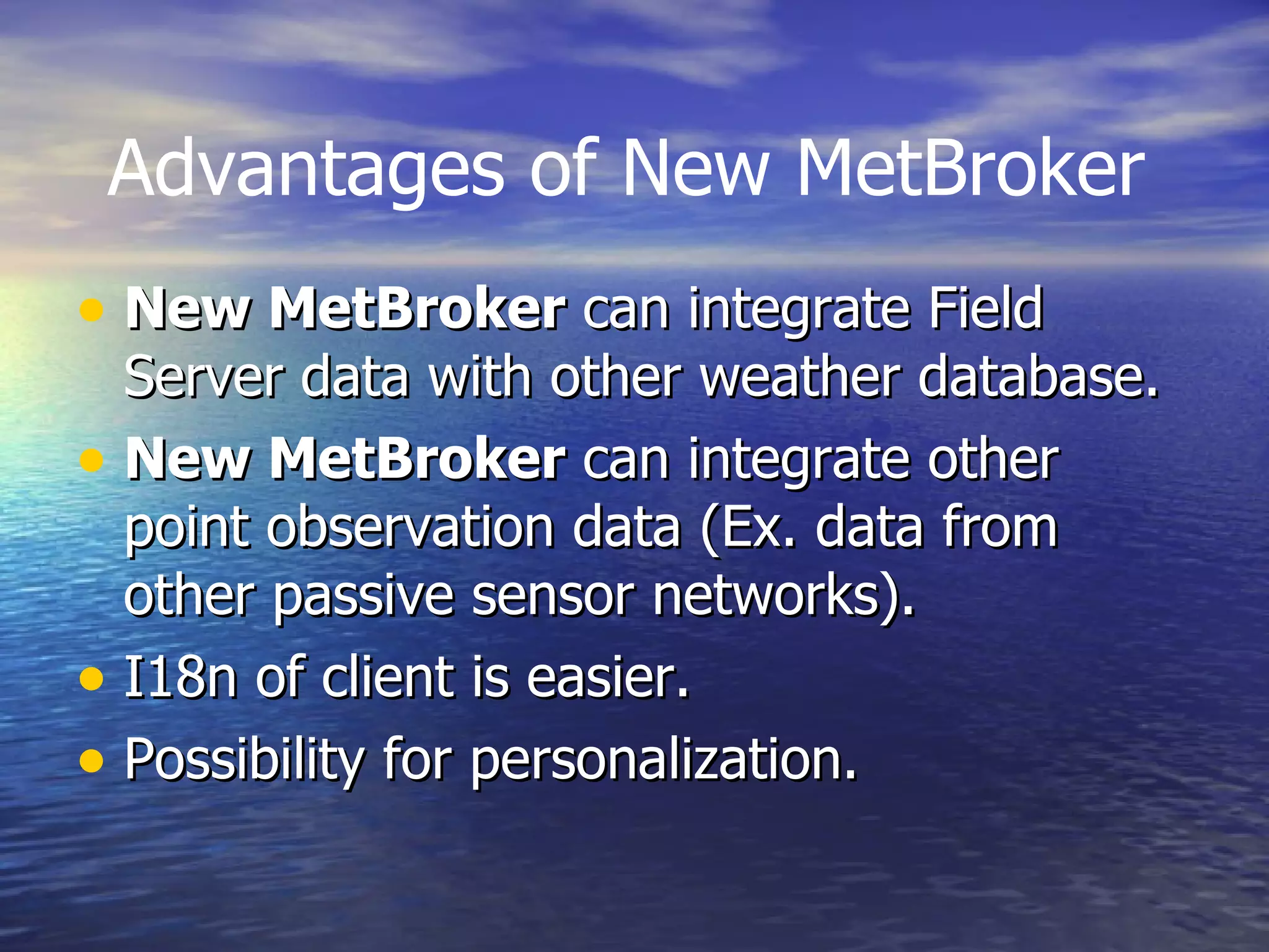
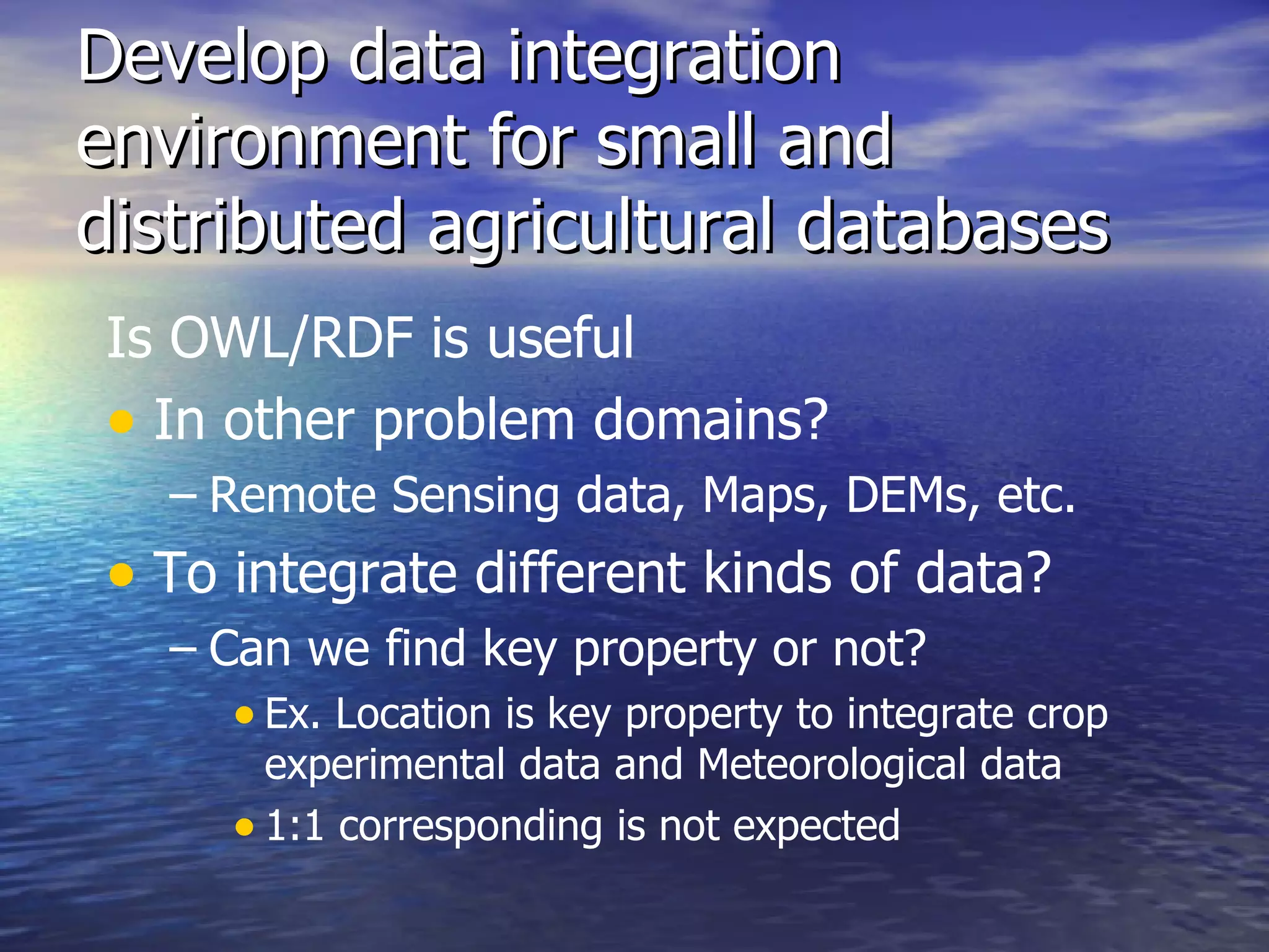

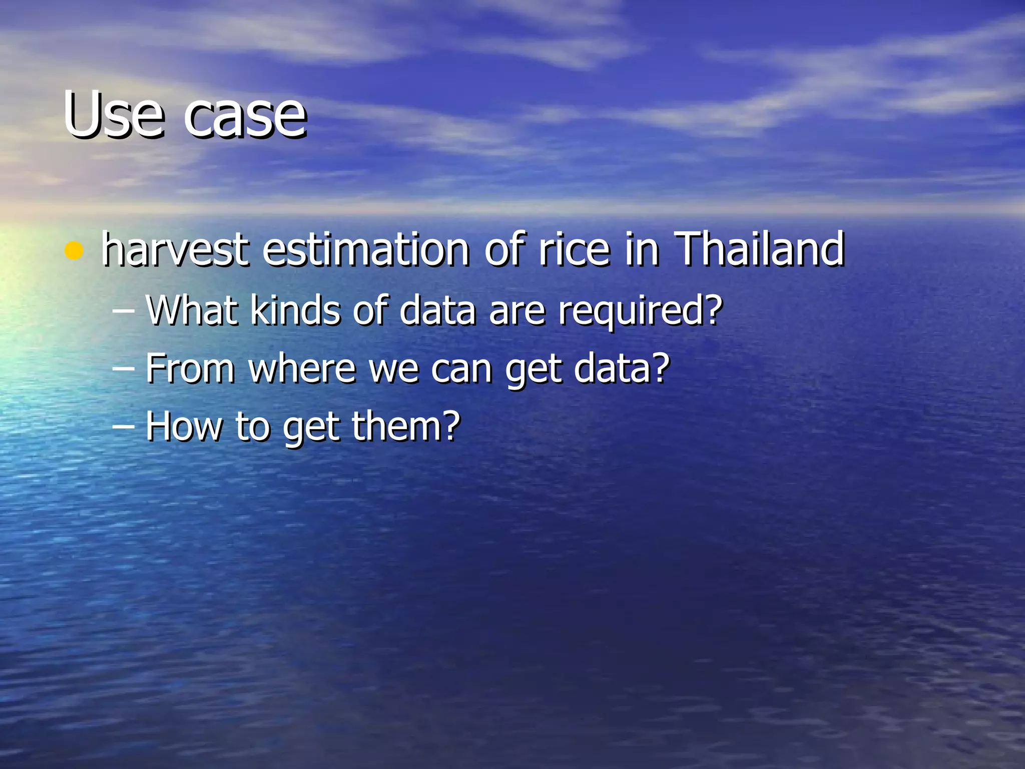
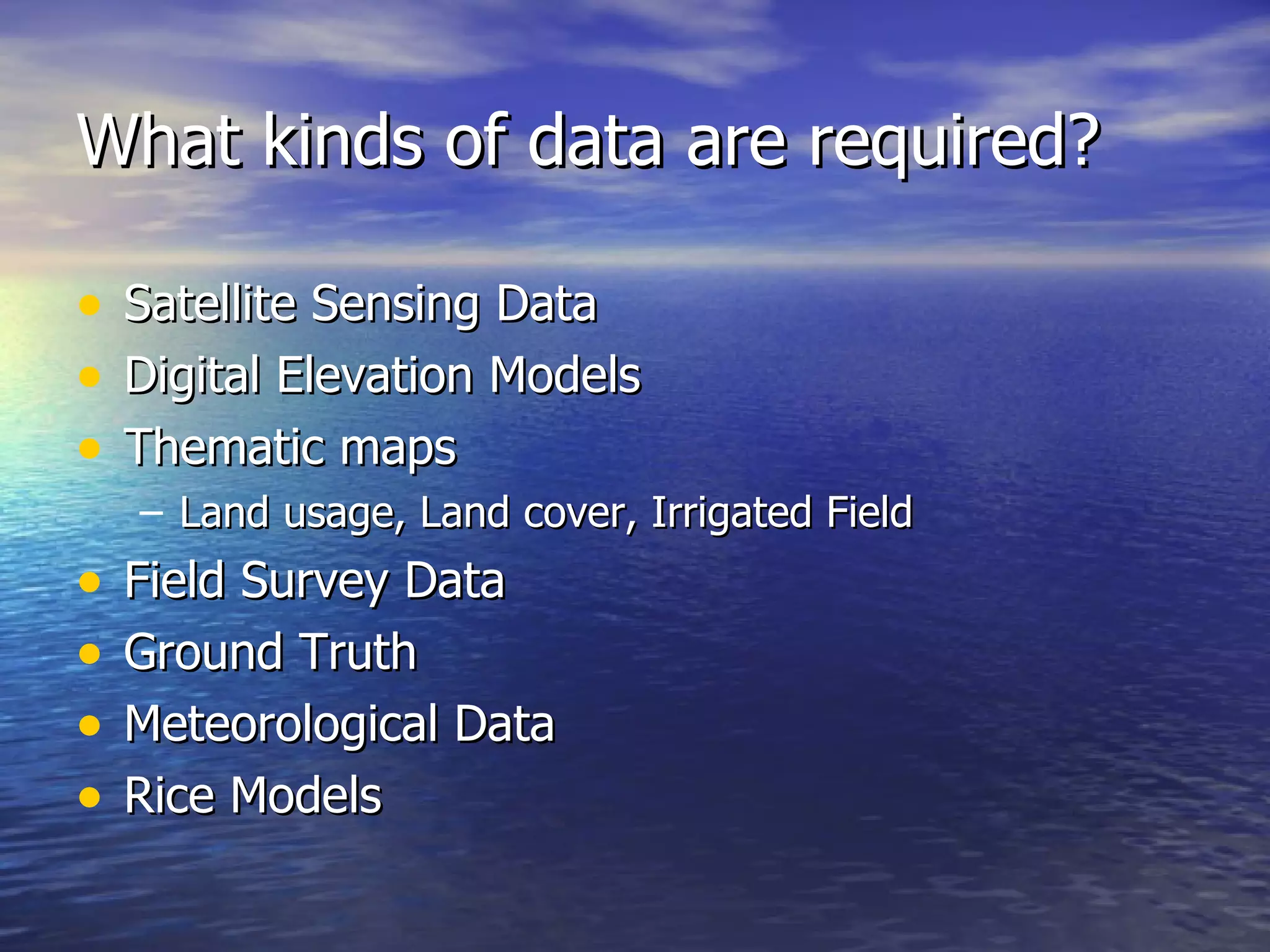
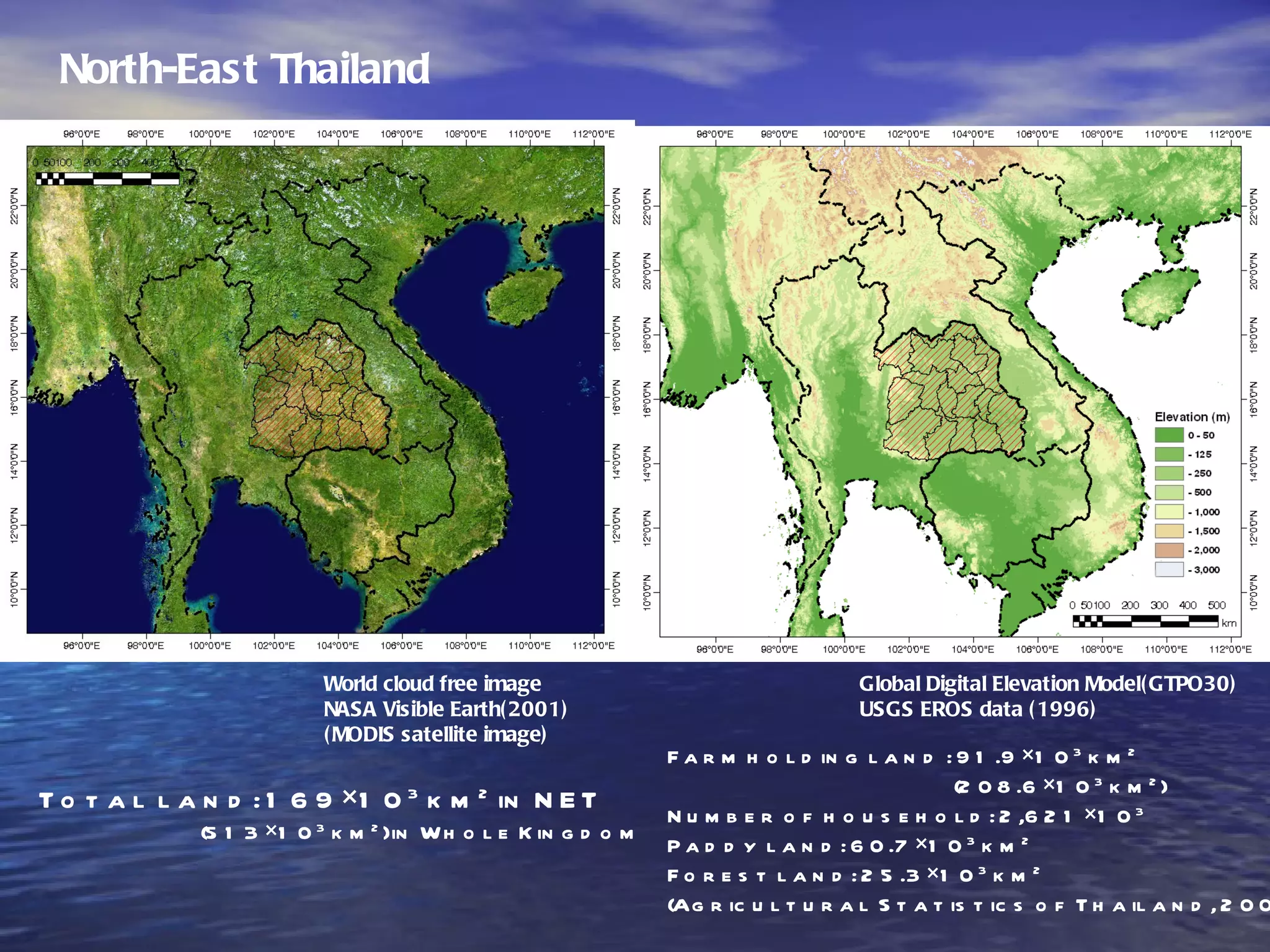
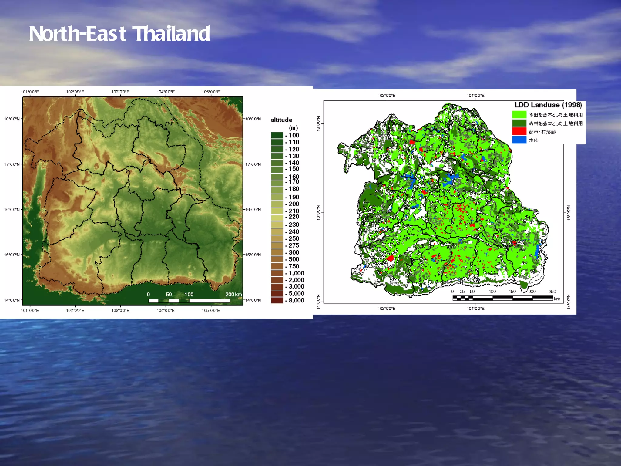
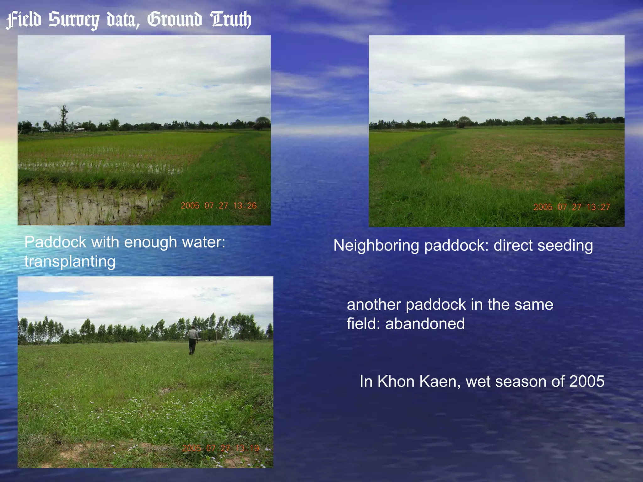
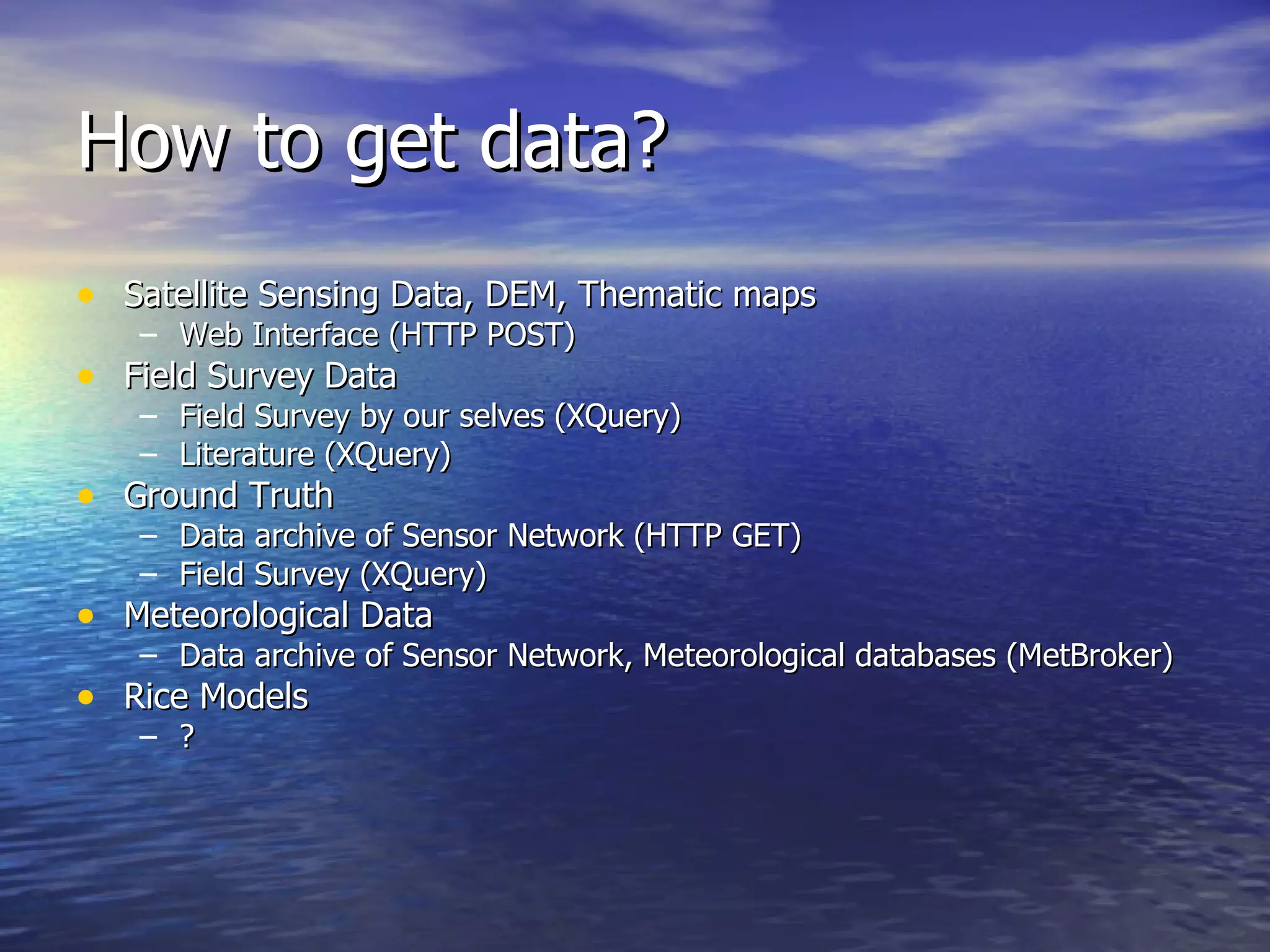
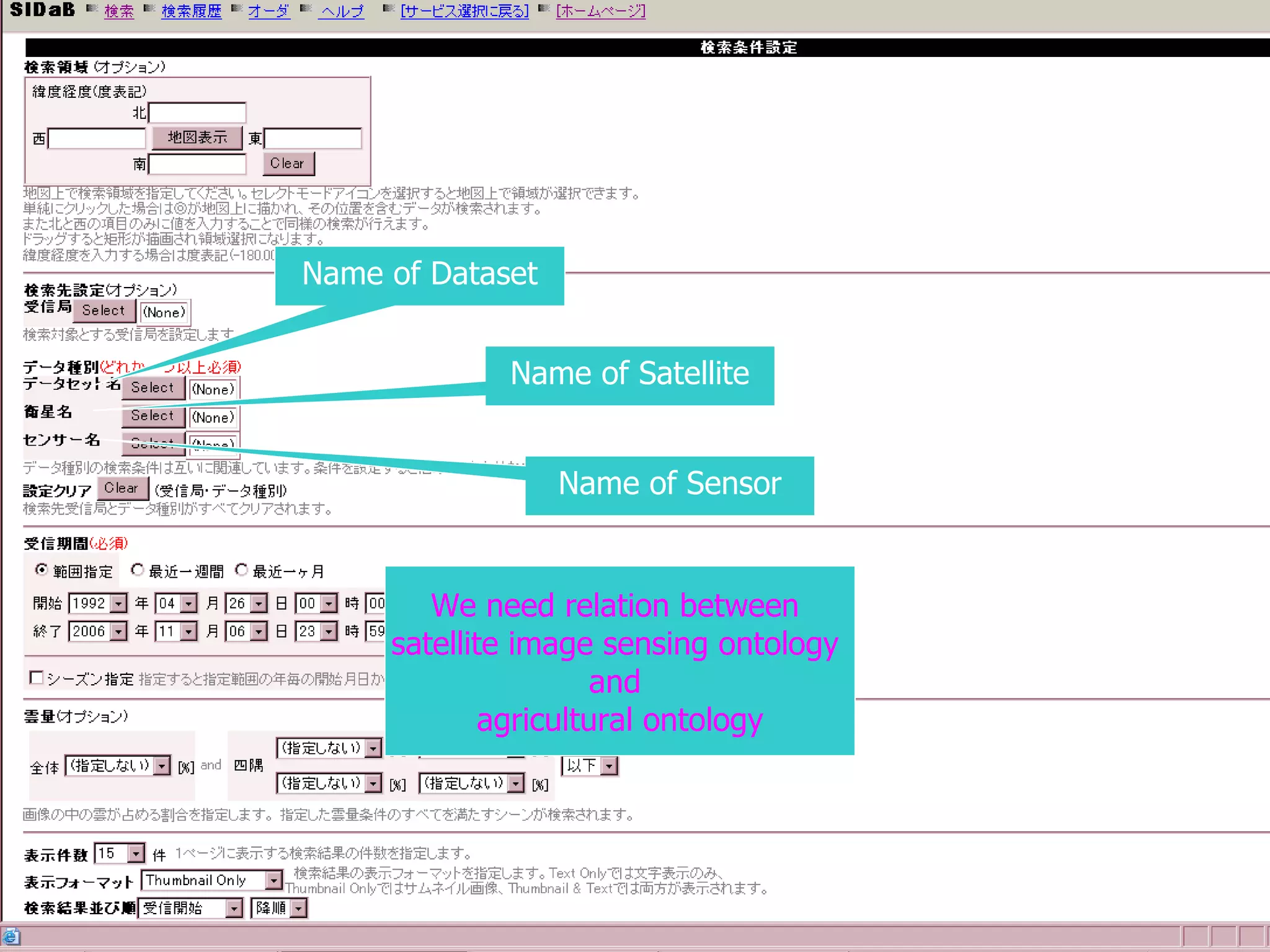
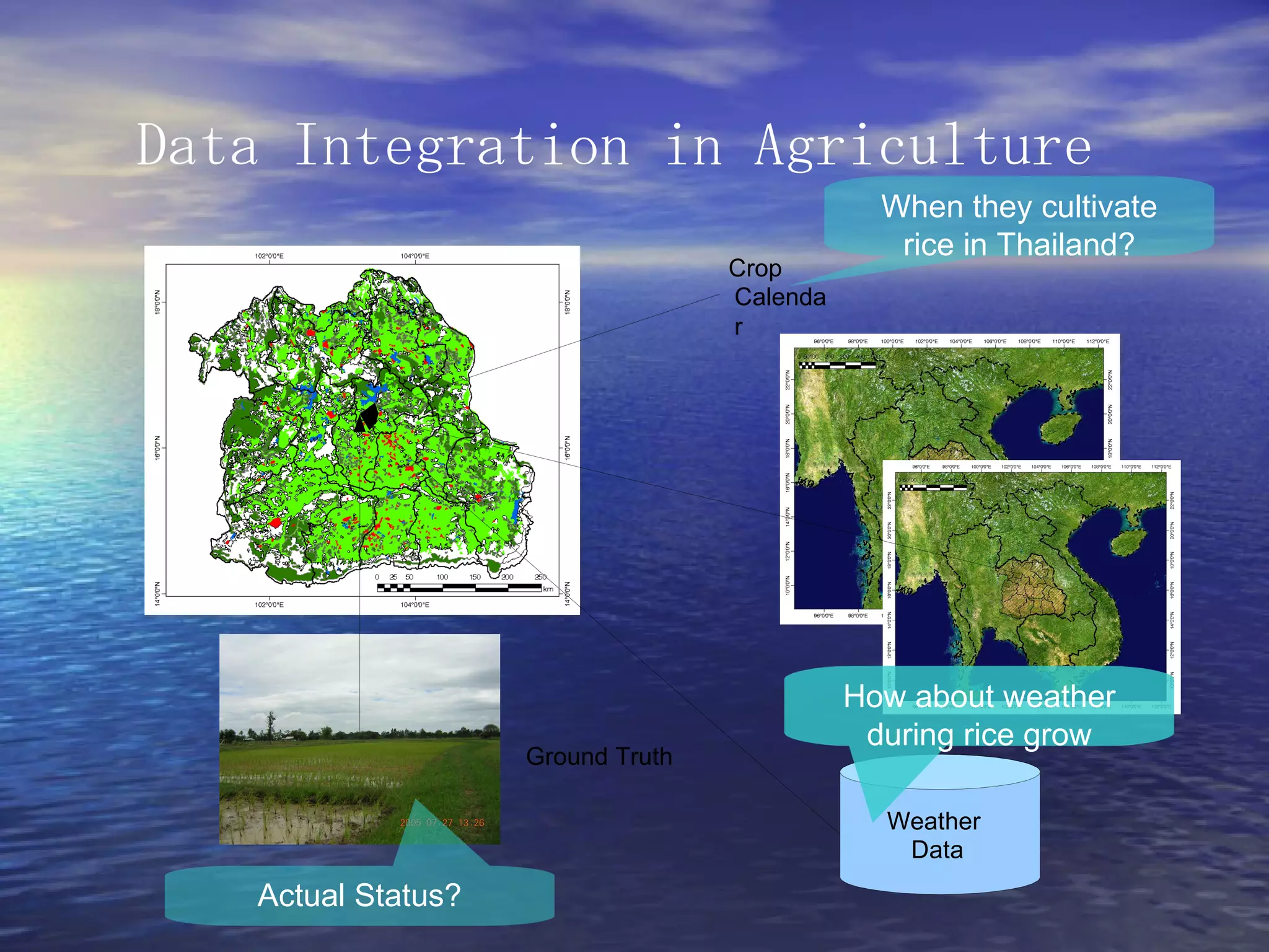
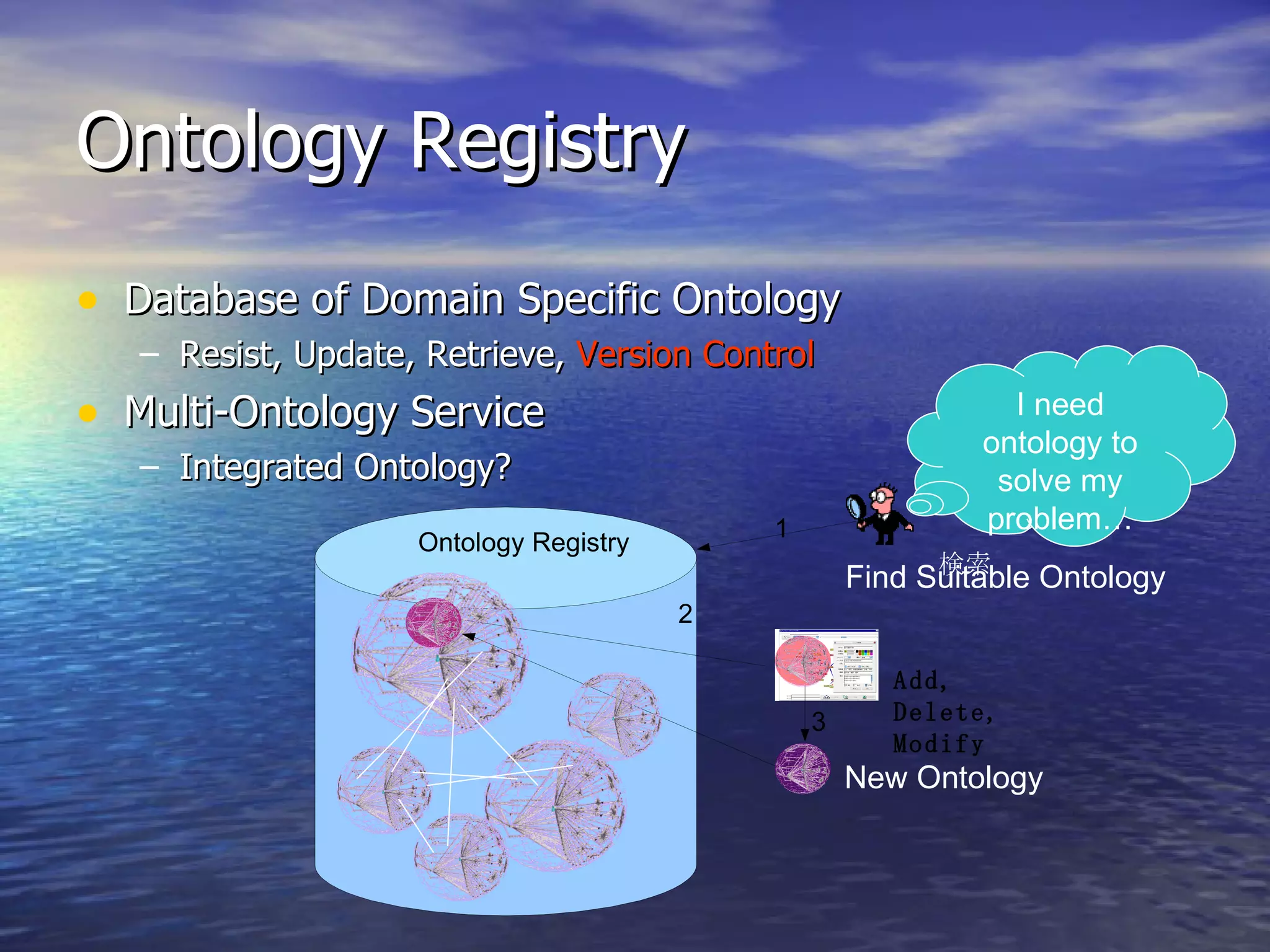

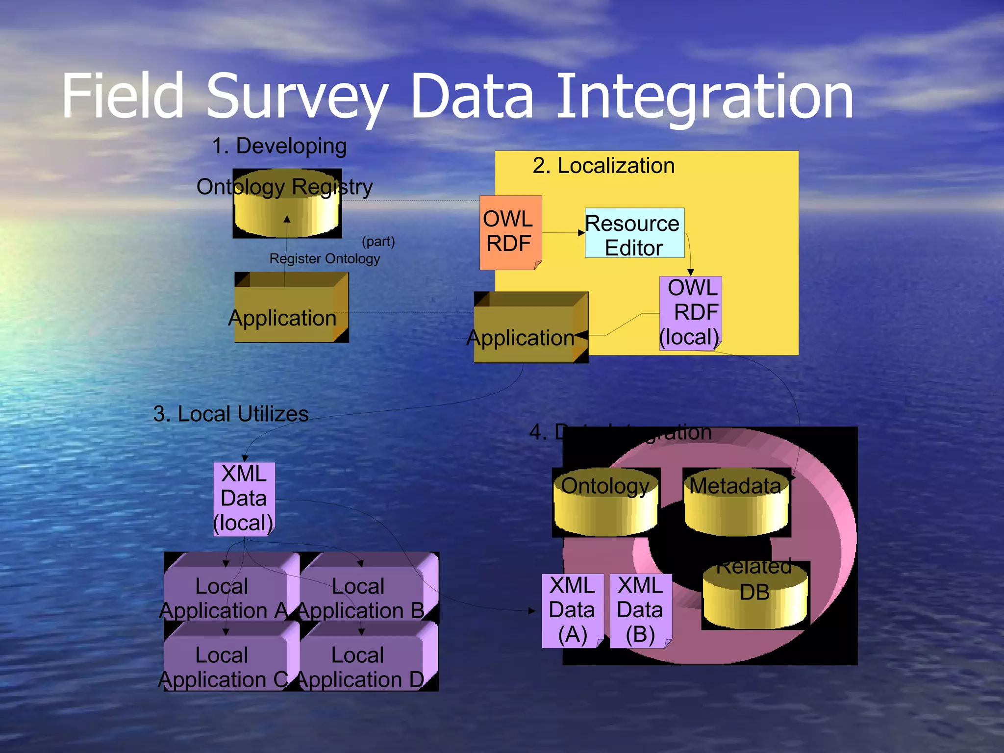


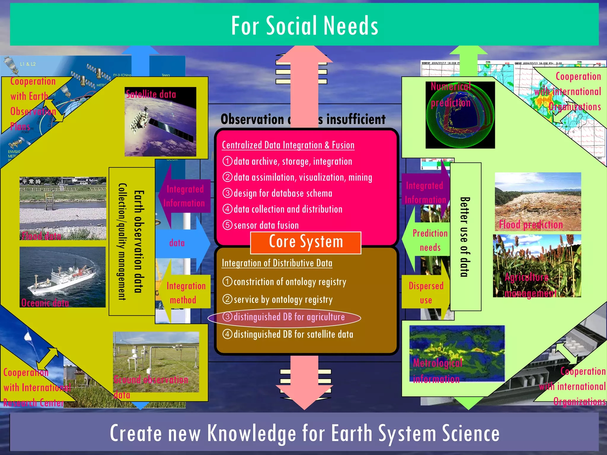

This document discusses using ontologies and semantic web technologies to integrate heterogeneous agricultural data sources for estimating rice harvests in Thailand. It describes using an ontology registry and integrated ontologies to combine satellite imagery, digital elevation models, land use maps, field survey data, meteorological data, and rice growth models. The goal is to develop a data integration environment to estimate rice harvests using small, distributed agricultural databases from various sources.