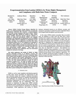
Evapotranspiration from Landsat (SEBAL) for Water Rights Management
and Compliance with Multi-State Water Compacts
Richard G.
Allen
Univ. Idaho
Kimberly, ID
83341
Anthony Morse
Idaho Dept. Water
Resources
1301 North
Orchard, Boise, ID
83706
Masahiro
Tasumi
Univ. Idaho
Moscow, ID
83844
Abstract- SEBAL (Surface Energy Balance Algorithm for
Land) is an image-processing model comprised of twenty-five
computational submodels that calculates evapotranspiration
(ET) and other energy exchanges at the earth’s surface. SEBAL
uses digital image data collected by Landsat or other remote-
sensing satellites measuring thermal infrared radiation in
addition to visible and near-infrared. SEBAL was originally
developed in the Netherlands by Bastiaanssen and was moditied
during the Idaho study for application to mountainous terrain
and clear, cold lakes. In an application to the Bear River Basin
of southeastern Idaho, USA, ET was computed as a component of
the surface energy balance on a pixel-by-pixel basis. ET for
periods in between satellite overpasses was computed using ratios
of ET from SEBAL to reference ET computed using data from
from ground-based weather stations. These ratios were
essentially customized “crop coefficients” that were determined
uniquely for each pixel of an image.
This initial application and testing of SEBAL in Idaho
indicates substantial promise as an efficient, accurate, and
inexpensive procedure to predict the actual evaporation fluxes
from irrigated lands throughout a growing season. Predicted ET
has been compared with ground measurements of ET by
lysimeter with good results, with monthly differences averaging
+I- 16%, but with seasonal differences of only 4% due to
reduction in random error. ET maps via SEBAL provide the
means to quantify, in terms of both the amount and spatial
distribution, the ET on a field by field basis within each state. In
particular, the Idaho Department of Water Resources (IDWR)
will use results to predict total, net depletion of water from the
Bear River system resulting from irrigation diversions.
I. INTRODUCTION
IDWR, aswell aswater regulatory andplanning agencies
of other states,desiresproceduresfor determining ET that
may ultimately replace the common, traditional procedures
that useground-basedreferenceET equationsandgeneralized
crop coefficients, for example those by the UN Food and
Agriculture Organization [ 11.Thesecurrent procedureshave
substantial uncertainty and are cumbersome, slow, and
expensive to implement for large areas. IDWR currently
incorporatesremotesensingandGIS tools to map crop types,
but must usethe ground basedET calculationsasa basisfor
extrapolation. Initial application and testing of SEBAL
Wim William Hal Anderson
Bastiaanssen Kramber
WaterWatch IdahoDept. Water IdahoDept. Water
Generaal Resources Resources
Foulkesweg28 1301North 1301North
6703BS Orchard, Boise,ID Orchard, Boise,ID
Wageningen,NL 83706 83706
indicates substantial promise as an efficient, accurate, and
inexpensiveprocedureto predict the actual evaporationfluxes
from irrigated landsthroughout agrowing season.
In this study, IDWR neededa procedure that can predict
total, net depletion of water from the Bear River system
resulting from irrigation diversions within a three-statearea.
The Bear River Basincovers20,000 km2 of Idaho, Utah, and
Wyoming and containsabout 190,000ha of crop andpasture
land (Fig. 1). Depletions for irrigated agriculture aredefined
asthe differencesbetweengrossdiversionsandnet returnsto
the river systemvia ground water. Becausethe net returnsto
the river of unevaporatedportionsof diversionsarein diffused
form, they are impossibleto measure. Net depletions are
therefore predicted using predictions of ET horn irrigated
landslessany ET that would have occurredfrom naturalrange
conditionsin the absenceof any irrigation or agriculture. ET
mapsvia SEBAL provide the meansto quantify, in termsof
both the amountand spatialdistribution, the ET on a field by
field basiswithin eachstate.
Fig. 1. Bear River basin of Idaho, Wyoming and Utah.
0-7803-7031-7/01/$10.00 (C) 2001 IEEE 830
0-7803-7031-7/01/$17.00 (C) 2001 IEEE
II. THE SEBAL MODEL
SEBAL was originally developed in the Netherlands for
use in Egypt by Bastiaanssen [2] and was modified during the
Idaho study for application to mountainous terrain and clear,
cold lakes [3]. Specific details and equations for application
of SEBAL are contained in [2] - [7]. [3] and [7] are available
on the web. The computation details are not repeated here.
A. TheComputationProcess
The general computation process for SEBAL is illustrated
in Fig. 2. The radiation balance for each pixel of the image
keys off from surface temperature, short wave reflectance, and
assumed atmospheric transmissivity and emittance. Soil heat
flux G is predicted as a ratio of net radiation Rn as a function
of normalized difference vegetation index (NDVI). Sensible
heat H is calculated following [S] where the near surface
aerodynamic resistance is computed using a measurement or
estimate of wind speed at the time of the image that is
representative of the area of interest, and surface roughness is
determined as an empirical function of NDVI following [S]
and 171.Allen [S] found better prediction and delineation of
roughness in an application in Florida when predicted as a
function of the ratio of NDVI to albedo. This improved the
delineation of tall trees from shorter agricultural vegetation
and wetlands. DEM data were also used to lapse correct T, for use in the
T, - T, relationships [3]. This was necessary to remove biases
in T, caused by elevation.
The difference between air temperature (T,) and surface
temperature (T,) is required for predicting H. The difference
T, - T, was predicted as a linear function of T, for each pixel
following [5]. Endpoints for T, - T, vs. T, were determined
from selected, known locations. It was assumed that T, - T, =
(R, - G) ra /(p g) at location(s) where ET = 0, and where ra is
aerodynamic roughness, p is air density and g is gravitational
acceleration. In the Idaho application we assumedthat T, - T,
=: 0 for a completely vegetated, fully watered location(s)
where ET = R,, - G, following [7]. However, [S] used T, - T,
= CR, - G - ET,) ra 4~ g> as an endpoint in defining T, - T,
vs. T, in Florida where ET,, is grass reference ET, and where
the relationship was determined for known grassed sites. The
T, - T, = (R,, - G) r, /(p g) vs. T, relationships were
iteratively updated during the SEBAL process by
recalculation of r, using Monin-Obukhov stability functions
according to H asoutlined by [7].
III. APPLICATIONTOTHEBEARRIVERBASIN
ET maps were generated on an approximately monthly
basis for a 500 km x 150 km area (2 Landsat images). The
Bear River basin is a mountainous area with elevation ranging
from 1200 m to over 2500 m. Agriculture includes row crops
at lower elevations to irrigated native meadow forage at
higher elevations. The climate is semiarid with mean annual
precipitation of about 25 cm in agricultural areas to over 100
cm in some mountain areas.
Landsat images were processed for 1985 to coincide with
an ET study using lysimeters [lo]. Lysimeter ET was
compared with ET from SEBAL for a location near
Montepelier, Idaho. The lysimeters contained native sedge
characteristic of the area and identical to the local
surroundings. The vegetation was harvested once during late
July and allowed to re-grow before grazing during the late
summer and fall. The lysimeters were measured only weekly,
so that only weekly ET values could be compared to SEBAL.
Following the calculation of ET for the instant of the
satellite image (generally about 1100 for Landsat), ET for the
enjoining 24-hour period was predicted for each pixel by
assuming that the evaporation fraction, defined as EF =
ET/&-G) was constant during the day. ET for the 24-hour
period was then computed by multiplying EF for each pixel by Wind speed data are the only ground-based measurements
the %-G for the pixel, computed for a 24-hour time step, required to apply SEBAL. Wind speed for the Bear River
assuming cloud-free conditions.
application was measured next to the lysimeter study site.
The “wet” pixel, where it was assumed that LE = Rn - G, so
Fig. 2. Generalcomputationprocessfor SEBAL.
B. Enhancements
Digital elevation model (DEM) data was added to SEBAL
during the 2000 Idaho study to account for impacts of slope-
aspect on incident solar radiation, %. R, was integrated over
24-hour periods for mountainous areas using trigonometric
equations incorporating sun azimuth, slope, aspect, solar
angle, latitude and declination [9].
0-7803-7031-7/01/$10.00 (C) 2001 IEEE 831
0-7803-7031-7/01/$17.00 (C) 2001 IEEE
that T, - T, = 0, was located in a large alfalfa field about 60
km NW of the lysimeters. The “dry” pixel, where it was
assumed that LE =:0, was located in a range area about 30 km
NE of the lysimeter site that had recently burned.
Results for four satellite images are compared in Table 1.
The results compare well to lysimeter data for the last three
image dates. The earliest date, July 14, compares well when
examined in context of the impact of precipitation preceding
the Landsat image date and rapidly growing vegetation [3].
The crop coefficients, K,, are defined as ET/ET, where ET,
is reference ET computed using an alfalfa-reference based
Penman equation [lo]. Kc’s were computed for each pixel and
were used to interpolate ET from the day of the satellite image
to days between images. ET, accounted for weather variation
fi-om day to day. Kc values from the Landsat dates and from
weekly lysimeter measurement periods are plotted in Fig. 3.
Predicted ET for monthly periods averaged +/- 16% as
compared to the lysimeter at Montepelier (Table 2).
However, seasonal differences between SEBAL and
lysimeters were only 4% due to impacts of reduction in the
random error components.
TABLE 2.
Summary of SEBAL- and lysimeter-derived ET values for
weekly and monthly periods and the associated error.
,_ y_____~~~--y~~~~~~~~~-~,~-~I-.~~~.-~~~~~.
Lysime SEBAL 7-day Differen Monthly
ter ET Kc SEBAL ce in 7- Alfalfa
7-day ET day ET Reference
average mm/d (SEBAL ET
mm/d - LYS) mm
%
-__ ----_ --__ ---.-- _ -___ _I___I.--- _.__
_ __ “_--- -
(1) (2) (3) (4) (5) (6)
July 14 5.3 0.98 68 28% 202
Aug15 35 0.59 3.7 6% 201
Sept16 1.9 0.57 2.1 10% 115
Oct18 07 0.49 0.6 -14% 45
TABLE 1. Ave. 2.9 0.73 3.3 15% 563
~-~--~ I=--- ~~-~-~-~_,~-.~~~_-“~-_____X__YU~L_~--”,”.-~
Lysimeter measuredET and SEBAL predicted ET aswell asKC’sfor
7-day periods enclosing the satellite images. ~-~~~~~-~~-~~v_~~-y_=yry_Ev-~,~_~~~~s.~
ms- u___~~~-----~ssdxsm.~~~~ SEBAL
Lands& date 7-day Equivalent 24- 24-hour 7&y
Lysim. Monthly Monthly Season
al
Lysimeter Hour Lysimeter SEBAL Reference
Monthly Month K for
ET, mm/d El’, mm/d ET, ET, mm/d
ET ET Lysimeter (SEEL)- Error
mm/d mm mm Lys %
July 14 5.3 5.1 6.5 6.9 __________ -_x_I __. -. .-_--~ I-....,_______ -.-__- -. .__.-..__.
Aug 15 3.5 3.8 4.2 6.2 (1) (7) (8) (9) (10) TI1,..-
Sept 16 1.9 2.4 2.6 3.7 July 14 198 167 0.83 19%
Ott 18 0.7 1.1 1.0 1.3 Au8 15 119 145 0.72 -18%
-~~~-_.~z.~~-~~_--~-~~yL__.~~.~*-~--_n_~~~~~
Sept16 66 54 0.47 22%
,~‘_Lu_~~___~~~~_F_____--~~~~-~.--~I -M‘s
Landsatdate 7&y ‘I-day 24-hour SEBAL
Oet 18 22 23 0.51 -5%
Lvsimeter Lvsimeter K_ Reference ET, K, _A 405 388 0.69 4% 4.3%
M--P”--- iil___r_(______u_-~~~~.~:=~,.~~~~-,-”
Ir
period
July 14 0.78 1.11 6.6 0.98 Fig. 4 contains two ET for the
maps Bear River basin,
Au8 15 0.57 0.60 6.6 0.59 where two Landsat images are combined.
Sept 16 0.53 0.52 4.6 0.57
O;t 18 0.56 0.51 2.0 0.49 ‘y
- I---~-~-~~~--~-_u__I-I~---~---- _’,
a..
ET by Lysimeters and SEBPL
Montpelier, Idaho 1985
Fig. 4. ET maps created for the Bear River basin (300 x 150 km
area) for Aug 15 and Oct. 18, 1985.
A. Rejinements to SEBAL Application Process under
Development
Fig. 3. K, values from 7-day Iysimeter measurements at Montpelier,
Idaho during 1985 and derived from SEBAL for four Landsat dates. One of the modifications to SEBAL implemented during
the Bear River study was prediction of the flow of sensible
heat into lakes. In previous applications, Bastiaanssen (2000)
0-7803-7031-7/01/$10.00 (C) 2001 IEEE 832
0-7803-7031-7/01/$17.00 (C) 2001 IEEE
predicted G for water bodies such as oceans to be small, by
using (l), purported to work for both vegetation and water:
~=~(O.O038r, +O.O074rj$-0.98NDVI”)
Rn ro
(1)
where T,, is in OCand r. is albedo. This relationship, when
applied to water, where NDVI is small and negative, produces
ratios of G/R, that average about 0.08. In the Bear River
basin, many of the lakes are clear, deep, and cold, causing
substantial penetration and conversion of short wave radiation
into sensible heat of the water bodies. Therefore, G/R, during
the growing seasoncan be very high, reaching 0.7 for the Bear
Lake [111. Yamamoto reported seasonal trends for G for a
deep Japanese lake (mean depth = 21 m) based on a heat
balance [121.Fig. 5 shows monthly averages for & and G.
Fig. 5. Monthly Rn and G for a deep lake in Japan (after [121).
Relationships were compared to G measured by [1l] for
Bear Lake that could be expressed as G = R, - 60. This is
similar to Yamamoto and Kondo’s data in magnitude and
trend indicating relationships between G/R, for deep, clear,
cold lakes, albeit seasonal, are similar between locations.
Future work will evaluate using water turbidity, as predicted
from satellite images, to adjust coefficients in (2)-(5).
G for snow surfaces,was predicted for daytime periods as
GSnOw
= O.SR, This is admittedly a very crude estimate. G for
snow for 24-hour periods was presumed 0. Additional
research and literature review will be conducted in this area.
A third area of refinement needed to improve application
of SEBAL in Idaho is the adjustment of T, before it is used to
predict T, - T, Adjustment is needed to separate variation in
T, caused by orographic effects from that caused by fluxes of
Rn, LE and H as discussed earlier. In the application to the
Bear River, T, was adjusted using a simple lapse correction of
6.5”C per km. The correction did not properly predict
adjusted temperatures for many mountain areas of the basin.
Some of the error or bias in underprediction of H in mountain
areasmay stem from errors in extrapolation of wind speed.
In the SEBAL, wind speed is extrapolated to 200 m height
and then extrapolated back toward the surface using
aerodynamic roughness predicted for each pixel. In
mountainous terrain, prediction of wind speed is complicated
by effects of varying roughness within pixels, abruptness of
terrain, and venturi effects. Improvement is needed in
extrapolation of wind speed as well as in improvement in the
prediction of T, - T, in mountains.
IV Co~cLUs10Ns
Application of SEBAL to the Bear River basin of Idaho,
Wyoming and Utah produced 30 m resolution ET maps for the
region that were integrated over the growing season.
Comparisons of predicted ET by SEBAL to lysimeter
measurements indicate relatively good accuracy and promise
for use in river basin planning and water rights management.
REFERENCES
[l] Allen,R.G.,L.S. Pereira,
D. Raes,andM. Smith. 1998. crop
Evapotranspiration: Guidelines for Computing Crop Water
Requirements. UnitedNationsFAO,IrrigationandDrainage
Paper
56.
Rome,
Italy. 300 p.
[2] Bastiaanssen,
W.G.M. 1995. Regionalizationof surfaceflux densities
andmoistureindicatorsin compositeterrain. Thesispublishedby DLO
WinandStaringCentrefor IntegratedLand, Soil andWaterResearch,
Wageningen,theNetherlands. 273p.
[3] Morse,A., M. Tasumi,R.G.Allen, W.J.Kramber. 2000. Application
of the SEBAL Methodology for Estimating ConsumptiveUseof Water
andStreamflowDepletion in theBearRiver Basin of Idaho,PhaseI.
IdahoDepartmentof WaterResourcesandUniversity of Idaho. 107p.
http://www.idwr.state.id.us/gisdata/ETifin
[4] Bastiaanssen,
W.G.M., D.H. HoekmanandR.A. Roebeling,1994.A
methodologyfor the assessment
of surfaceresistanceandsoil water
storagevariability at mesoscale
basedon remotesensingmeasurements,
IAHS SpecialPublications,No. 2, IAHS Press,Wallingford,
Oxfordshire,UK
[S] Bastiaanssen,
W.G.M., M. Menenti, R.A. FeddesandA.A.M. Holtslag,
1998a.The SurfaceEnergyBalanceAlgorithm for Land(SEBAL): Part
1formulation,J.of Hydr. 212-213:198-212
[6] Bastiaanssen,
W.G.M., H. Pelgrum,J.Wang,Y. Ma, J.Moreno,G.J.
RoerinkandT. vanderWal, 1998b.The SurfaceEnergyBalance
Algorithm for Land (SEBAL): Part2 Validation, J.Of Hydr. 212-213:
213-229
[7] Bastiaanssen,
W.G.M. 2000. SEBAL-basedsensibleandlatentheat
fluxes in the irrigated GedizBasin,Turkey. .I Hydrology 229537-100.
[8] Allen, R.G. 2000. Predictionof ET in time andspacefor theTampa
Bay region. reportsubmittedto WaterstoneEnviron. Inc., Boulder,
Colorado.
[9] Allen, R.G. andM. Tasumi,2000.Algorithms for applying SEBAL to
sloping or mountainousareas.Appendix B. Univ. Idaho. ~70-78.
http://www.idwr,state.id.us/gisdataT/fin~-sebal_page.h~
[lo] Hill, R.W., C.E.Brockway, R.D. Burman,L.N. Allen, andC.W.
Robison.1989. Duty of Water Under the Bear River Compact: Field
Verification ofEmpirical Methods for Estimating Depletion. Report
125. UtahAg. Exp. Sta.,Utah StateUniversity, Logan,Utah.
[1I] Amayreh, J.A. 1995. Lakeevaporation:amodelstudy. Ph.D.
dissertation,Dept.Biological andIrrigation Engineering,Utah State
University, Logan,UT. 178p.
[12] Yamamoto, G. and J. Kondo. 1968. Evaporation from Lake Nojiri. .I
Meteor. Sot. Japan. 46: 166-176.
0-7803-7031-7/01/$10.00 (C) 2001 IEEE 833
0-7803-7031-7/01/$17.00 (C) 2001 IEEE

Allen 2001

  • 1.
    Evapotranspiration from Landsat(SEBAL) for Water Rights Management and Compliance with Multi-State Water Compacts Richard G. Allen Univ. Idaho Kimberly, ID 83341 Anthony Morse Idaho Dept. Water Resources 1301 North Orchard, Boise, ID 83706 Masahiro Tasumi Univ. Idaho Moscow, ID 83844 Abstract- SEBAL (Surface Energy Balance Algorithm for Land) is an image-processing model comprised of twenty-five computational submodels that calculates evapotranspiration (ET) and other energy exchanges at the earth’s surface. SEBAL uses digital image data collected by Landsat or other remote- sensing satellites measuring thermal infrared radiation in addition to visible and near-infrared. SEBAL was originally developed in the Netherlands by Bastiaanssen and was moditied during the Idaho study for application to mountainous terrain and clear, cold lakes. In an application to the Bear River Basin of southeastern Idaho, USA, ET was computed as a component of the surface energy balance on a pixel-by-pixel basis. ET for periods in between satellite overpasses was computed using ratios of ET from SEBAL to reference ET computed using data from from ground-based weather stations. These ratios were essentially customized “crop coefficients” that were determined uniquely for each pixel of an image. This initial application and testing of SEBAL in Idaho indicates substantial promise as an efficient, accurate, and inexpensive procedure to predict the actual evaporation fluxes from irrigated lands throughout a growing season. Predicted ET has been compared with ground measurements of ET by lysimeter with good results, with monthly differences averaging +I- 16%, but with seasonal differences of only 4% due to reduction in random error. ET maps via SEBAL provide the means to quantify, in terms of both the amount and spatial distribution, the ET on a field by field basis within each state. In particular, the Idaho Department of Water Resources (IDWR) will use results to predict total, net depletion of water from the Bear River system resulting from irrigation diversions. I. INTRODUCTION IDWR, aswell aswater regulatory andplanning agencies of other states,desiresproceduresfor determining ET that may ultimately replace the common, traditional procedures that useground-basedreferenceET equationsandgeneralized crop coefficients, for example those by the UN Food and Agriculture Organization [ 11.Thesecurrent procedureshave substantial uncertainty and are cumbersome, slow, and expensive to implement for large areas. IDWR currently incorporatesremotesensingandGIS tools to map crop types, but must usethe ground basedET calculationsasa basisfor extrapolation. Initial application and testing of SEBAL Wim William Hal Anderson Bastiaanssen Kramber WaterWatch IdahoDept. Water IdahoDept. Water Generaal Resources Resources Foulkesweg28 1301North 1301North 6703BS Orchard, Boise,ID Orchard, Boise,ID Wageningen,NL 83706 83706 indicates substantial promise as an efficient, accurate, and inexpensiveprocedureto predict the actual evaporationfluxes from irrigated landsthroughout agrowing season. In this study, IDWR neededa procedure that can predict total, net depletion of water from the Bear River system resulting from irrigation diversions within a three-statearea. The Bear River Basincovers20,000 km2 of Idaho, Utah, and Wyoming and containsabout 190,000ha of crop andpasture land (Fig. 1). Depletions for irrigated agriculture aredefined asthe differencesbetweengrossdiversionsandnet returnsto the river systemvia ground water. Becausethe net returnsto the river of unevaporatedportionsof diversionsarein diffused form, they are impossibleto measure. Net depletions are therefore predicted using predictions of ET horn irrigated landslessany ET that would have occurredfrom naturalrange conditionsin the absenceof any irrigation or agriculture. ET mapsvia SEBAL provide the meansto quantify, in termsof both the amountand spatialdistribution, the ET on a field by field basiswithin eachstate. Fig. 1. Bear River basin of Idaho, Wyoming and Utah. 0-7803-7031-7/01/$10.00 (C) 2001 IEEE 830 0-7803-7031-7/01/$17.00 (C) 2001 IEEE
  • 2.
    II. THE SEBALMODEL SEBAL was originally developed in the Netherlands for use in Egypt by Bastiaanssen [2] and was modified during the Idaho study for application to mountainous terrain and clear, cold lakes [3]. Specific details and equations for application of SEBAL are contained in [2] - [7]. [3] and [7] are available on the web. The computation details are not repeated here. A. TheComputationProcess The general computation process for SEBAL is illustrated in Fig. 2. The radiation balance for each pixel of the image keys off from surface temperature, short wave reflectance, and assumed atmospheric transmissivity and emittance. Soil heat flux G is predicted as a ratio of net radiation Rn as a function of normalized difference vegetation index (NDVI). Sensible heat H is calculated following [S] where the near surface aerodynamic resistance is computed using a measurement or estimate of wind speed at the time of the image that is representative of the area of interest, and surface roughness is determined as an empirical function of NDVI following [S] and 171.Allen [S] found better prediction and delineation of roughness in an application in Florida when predicted as a function of the ratio of NDVI to albedo. This improved the delineation of tall trees from shorter agricultural vegetation and wetlands. DEM data were also used to lapse correct T, for use in the T, - T, relationships [3]. This was necessary to remove biases in T, caused by elevation. The difference between air temperature (T,) and surface temperature (T,) is required for predicting H. The difference T, - T, was predicted as a linear function of T, for each pixel following [5]. Endpoints for T, - T, vs. T, were determined from selected, known locations. It was assumed that T, - T, = (R, - G) ra /(p g) at location(s) where ET = 0, and where ra is aerodynamic roughness, p is air density and g is gravitational acceleration. In the Idaho application we assumedthat T, - T, =: 0 for a completely vegetated, fully watered location(s) where ET = R,, - G, following [7]. However, [S] used T, - T, = CR, - G - ET,) ra 4~ g> as an endpoint in defining T, - T, vs. T, in Florida where ET,, is grass reference ET, and where the relationship was determined for known grassed sites. The T, - T, = (R,, - G) r, /(p g) vs. T, relationships were iteratively updated during the SEBAL process by recalculation of r, using Monin-Obukhov stability functions according to H asoutlined by [7]. III. APPLICATIONTOTHEBEARRIVERBASIN ET maps were generated on an approximately monthly basis for a 500 km x 150 km area (2 Landsat images). The Bear River basin is a mountainous area with elevation ranging from 1200 m to over 2500 m. Agriculture includes row crops at lower elevations to irrigated native meadow forage at higher elevations. The climate is semiarid with mean annual precipitation of about 25 cm in agricultural areas to over 100 cm in some mountain areas. Landsat images were processed for 1985 to coincide with an ET study using lysimeters [lo]. Lysimeter ET was compared with ET from SEBAL for a location near Montepelier, Idaho. The lysimeters contained native sedge characteristic of the area and identical to the local surroundings. The vegetation was harvested once during late July and allowed to re-grow before grazing during the late summer and fall. The lysimeters were measured only weekly, so that only weekly ET values could be compared to SEBAL. Following the calculation of ET for the instant of the satellite image (generally about 1100 for Landsat), ET for the enjoining 24-hour period was predicted for each pixel by assuming that the evaporation fraction, defined as EF = ET/&-G) was constant during the day. ET for the 24-hour period was then computed by multiplying EF for each pixel by Wind speed data are the only ground-based measurements the %-G for the pixel, computed for a 24-hour time step, required to apply SEBAL. Wind speed for the Bear River assuming cloud-free conditions. application was measured next to the lysimeter study site. The “wet” pixel, where it was assumed that LE = Rn - G, so Fig. 2. Generalcomputationprocessfor SEBAL. B. Enhancements Digital elevation model (DEM) data was added to SEBAL during the 2000 Idaho study to account for impacts of slope- aspect on incident solar radiation, %. R, was integrated over 24-hour periods for mountainous areas using trigonometric equations incorporating sun azimuth, slope, aspect, solar angle, latitude and declination [9]. 0-7803-7031-7/01/$10.00 (C) 2001 IEEE 831 0-7803-7031-7/01/$17.00 (C) 2001 IEEE
  • 3.
    that T, -T, = 0, was located in a large alfalfa field about 60 km NW of the lysimeters. The “dry” pixel, where it was assumed that LE =:0, was located in a range area about 30 km NE of the lysimeter site that had recently burned. Results for four satellite images are compared in Table 1. The results compare well to lysimeter data for the last three image dates. The earliest date, July 14, compares well when examined in context of the impact of precipitation preceding the Landsat image date and rapidly growing vegetation [3]. The crop coefficients, K,, are defined as ET/ET, where ET, is reference ET computed using an alfalfa-reference based Penman equation [lo]. Kc’s were computed for each pixel and were used to interpolate ET from the day of the satellite image to days between images. ET, accounted for weather variation fi-om day to day. Kc values from the Landsat dates and from weekly lysimeter measurement periods are plotted in Fig. 3. Predicted ET for monthly periods averaged +/- 16% as compared to the lysimeter at Montepelier (Table 2). However, seasonal differences between SEBAL and lysimeters were only 4% due to impacts of reduction in the random error components. TABLE 2. Summary of SEBAL- and lysimeter-derived ET values for weekly and monthly periods and the associated error. ,_ y_____~~~--y~~~~~~~~~-~,~-~I-.~~~.-~~~~~. Lysime SEBAL 7-day Differen Monthly ter ET Kc SEBAL ce in 7- Alfalfa 7-day ET day ET Reference average mm/d (SEBAL ET mm/d - LYS) mm % -__ ----_ --__ ---.-- _ -___ _I___I.--- _.__ _ __ “_--- - (1) (2) (3) (4) (5) (6) July 14 5.3 0.98 68 28% 202 Aug15 35 0.59 3.7 6% 201 Sept16 1.9 0.57 2.1 10% 115 Oct18 07 0.49 0.6 -14% 45 TABLE 1. Ave. 2.9 0.73 3.3 15% 563 ~-~--~ I=--- ~~-~-~-~_,~-.~~~_-“~-_____X__YU~L_~--”,”.-~ Lysimeter measuredET and SEBAL predicted ET aswell asKC’sfor 7-day periods enclosing the satellite images. ~-~~~~~-~~-~~v_~~-y_=yry_Ev-~,~_~~~~s.~ ms- u___~~~-----~ssdxsm.~~~~ SEBAL Lands& date 7-day Equivalent 24- 24-hour 7&y Lysim. Monthly Monthly Season al Lysimeter Hour Lysimeter SEBAL Reference Monthly Month K for ET, mm/d El’, mm/d ET, ET, mm/d ET ET Lysimeter (SEEL)- Error mm/d mm mm Lys % July 14 5.3 5.1 6.5 6.9 __________ -_x_I __. -. .-_--~ I-....,_______ -.-__- -. .__.-..__. Aug 15 3.5 3.8 4.2 6.2 (1) (7) (8) (9) (10) TI1,..- Sept 16 1.9 2.4 2.6 3.7 July 14 198 167 0.83 19% Ott 18 0.7 1.1 1.0 1.3 Au8 15 119 145 0.72 -18% -~~~-_.~z.~~-~~_--~-~~yL__.~~.~*-~--_n_~~~~~ Sept16 66 54 0.47 22% ,~‘_Lu_~~___~~~~_F_____--~~~~-~.--~I -M‘s Landsatdate 7&y ‘I-day 24-hour SEBAL Oet 18 22 23 0.51 -5% Lvsimeter Lvsimeter K_ Reference ET, K, _A 405 388 0.69 4% 4.3% M--P”--- iil___r_(______u_-~~~~.~:=~,.~~~~-,-” Ir period July 14 0.78 1.11 6.6 0.98 Fig. 4 contains two ET for the maps Bear River basin, Au8 15 0.57 0.60 6.6 0.59 where two Landsat images are combined. Sept 16 0.53 0.52 4.6 0.57 O;t 18 0.56 0.51 2.0 0.49 ‘y - I---~-~-~~~--~-_u__I-I~---~---- _’, a.. ET by Lysimeters and SEBPL Montpelier, Idaho 1985 Fig. 4. ET maps created for the Bear River basin (300 x 150 km area) for Aug 15 and Oct. 18, 1985. A. Rejinements to SEBAL Application Process under Development Fig. 3. K, values from 7-day Iysimeter measurements at Montpelier, Idaho during 1985 and derived from SEBAL for four Landsat dates. One of the modifications to SEBAL implemented during the Bear River study was prediction of the flow of sensible heat into lakes. In previous applications, Bastiaanssen (2000) 0-7803-7031-7/01/$10.00 (C) 2001 IEEE 832 0-7803-7031-7/01/$17.00 (C) 2001 IEEE
  • 4.
    predicted G forwater bodies such as oceans to be small, by using (l), purported to work for both vegetation and water: ~=~(O.O038r, +O.O074rj$-0.98NDVI”) Rn ro (1) where T,, is in OCand r. is albedo. This relationship, when applied to water, where NDVI is small and negative, produces ratios of G/R, that average about 0.08. In the Bear River basin, many of the lakes are clear, deep, and cold, causing substantial penetration and conversion of short wave radiation into sensible heat of the water bodies. Therefore, G/R, during the growing seasoncan be very high, reaching 0.7 for the Bear Lake [111. Yamamoto reported seasonal trends for G for a deep Japanese lake (mean depth = 21 m) based on a heat balance [121.Fig. 5 shows monthly averages for & and G. Fig. 5. Monthly Rn and G for a deep lake in Japan (after [121). Relationships were compared to G measured by [1l] for Bear Lake that could be expressed as G = R, - 60. This is similar to Yamamoto and Kondo’s data in magnitude and trend indicating relationships between G/R, for deep, clear, cold lakes, albeit seasonal, are similar between locations. Future work will evaluate using water turbidity, as predicted from satellite images, to adjust coefficients in (2)-(5). G for snow surfaces,was predicted for daytime periods as GSnOw = O.SR, This is admittedly a very crude estimate. G for snow for 24-hour periods was presumed 0. Additional research and literature review will be conducted in this area. A third area of refinement needed to improve application of SEBAL in Idaho is the adjustment of T, before it is used to predict T, - T, Adjustment is needed to separate variation in T, caused by orographic effects from that caused by fluxes of Rn, LE and H as discussed earlier. In the application to the Bear River, T, was adjusted using a simple lapse correction of 6.5”C per km. The correction did not properly predict adjusted temperatures for many mountain areas of the basin. Some of the error or bias in underprediction of H in mountain areasmay stem from errors in extrapolation of wind speed. In the SEBAL, wind speed is extrapolated to 200 m height and then extrapolated back toward the surface using aerodynamic roughness predicted for each pixel. In mountainous terrain, prediction of wind speed is complicated by effects of varying roughness within pixels, abruptness of terrain, and venturi effects. Improvement is needed in extrapolation of wind speed as well as in improvement in the prediction of T, - T, in mountains. IV Co~cLUs10Ns Application of SEBAL to the Bear River basin of Idaho, Wyoming and Utah produced 30 m resolution ET maps for the region that were integrated over the growing season. Comparisons of predicted ET by SEBAL to lysimeter measurements indicate relatively good accuracy and promise for use in river basin planning and water rights management. REFERENCES [l] Allen,R.G.,L.S. Pereira, D. Raes,andM. Smith. 1998. crop Evapotranspiration: Guidelines for Computing Crop Water Requirements. UnitedNationsFAO,IrrigationandDrainage Paper 56. Rome, Italy. 300 p. [2] Bastiaanssen, W.G.M. 1995. Regionalizationof surfaceflux densities andmoistureindicatorsin compositeterrain. Thesispublishedby DLO WinandStaringCentrefor IntegratedLand, Soil andWaterResearch, Wageningen,theNetherlands. 273p. [3] Morse,A., M. Tasumi,R.G.Allen, W.J.Kramber. 2000. Application of the SEBAL Methodology for Estimating ConsumptiveUseof Water andStreamflowDepletion in theBearRiver Basin of Idaho,PhaseI. IdahoDepartmentof WaterResourcesandUniversity of Idaho. 107p. http://www.idwr.state.id.us/gisdata/ETifin [4] Bastiaanssen, W.G.M., D.H. HoekmanandR.A. Roebeling,1994.A methodologyfor the assessment of surfaceresistanceandsoil water storagevariability at mesoscale basedon remotesensingmeasurements, IAHS SpecialPublications,No. 2, IAHS Press,Wallingford, Oxfordshire,UK [S] Bastiaanssen, W.G.M., M. Menenti, R.A. FeddesandA.A.M. Holtslag, 1998a.The SurfaceEnergyBalanceAlgorithm for Land(SEBAL): Part 1formulation,J.of Hydr. 212-213:198-212 [6] Bastiaanssen, W.G.M., H. Pelgrum,J.Wang,Y. Ma, J.Moreno,G.J. RoerinkandT. vanderWal, 1998b.The SurfaceEnergyBalance Algorithm for Land (SEBAL): Part2 Validation, J.Of Hydr. 212-213: 213-229 [7] Bastiaanssen, W.G.M. 2000. SEBAL-basedsensibleandlatentheat fluxes in the irrigated GedizBasin,Turkey. .I Hydrology 229537-100. [8] Allen, R.G. 2000. Predictionof ET in time andspacefor theTampa Bay region. reportsubmittedto WaterstoneEnviron. Inc., Boulder, Colorado. [9] Allen, R.G. andM. Tasumi,2000.Algorithms for applying SEBAL to sloping or mountainousareas.Appendix B. Univ. Idaho. ~70-78. http://www.idwr,state.id.us/gisdataT/fin~-sebal_page.h~ [lo] Hill, R.W., C.E.Brockway, R.D. Burman,L.N. Allen, andC.W. Robison.1989. Duty of Water Under the Bear River Compact: Field Verification ofEmpirical Methods for Estimating Depletion. Report 125. UtahAg. Exp. Sta.,Utah StateUniversity, Logan,Utah. [1I] Amayreh, J.A. 1995. Lakeevaporation:amodelstudy. Ph.D. dissertation,Dept.Biological andIrrigation Engineering,Utah State University, Logan,UT. 178p. [12] Yamamoto, G. and J. Kondo. 1968. Evaporation from Lake Nojiri. .I Meteor. Sot. Japan. 46: 166-176. 0-7803-7031-7/01/$10.00 (C) 2001 IEEE 833 0-7803-7031-7/01/$17.00 (C) 2001 IEEE