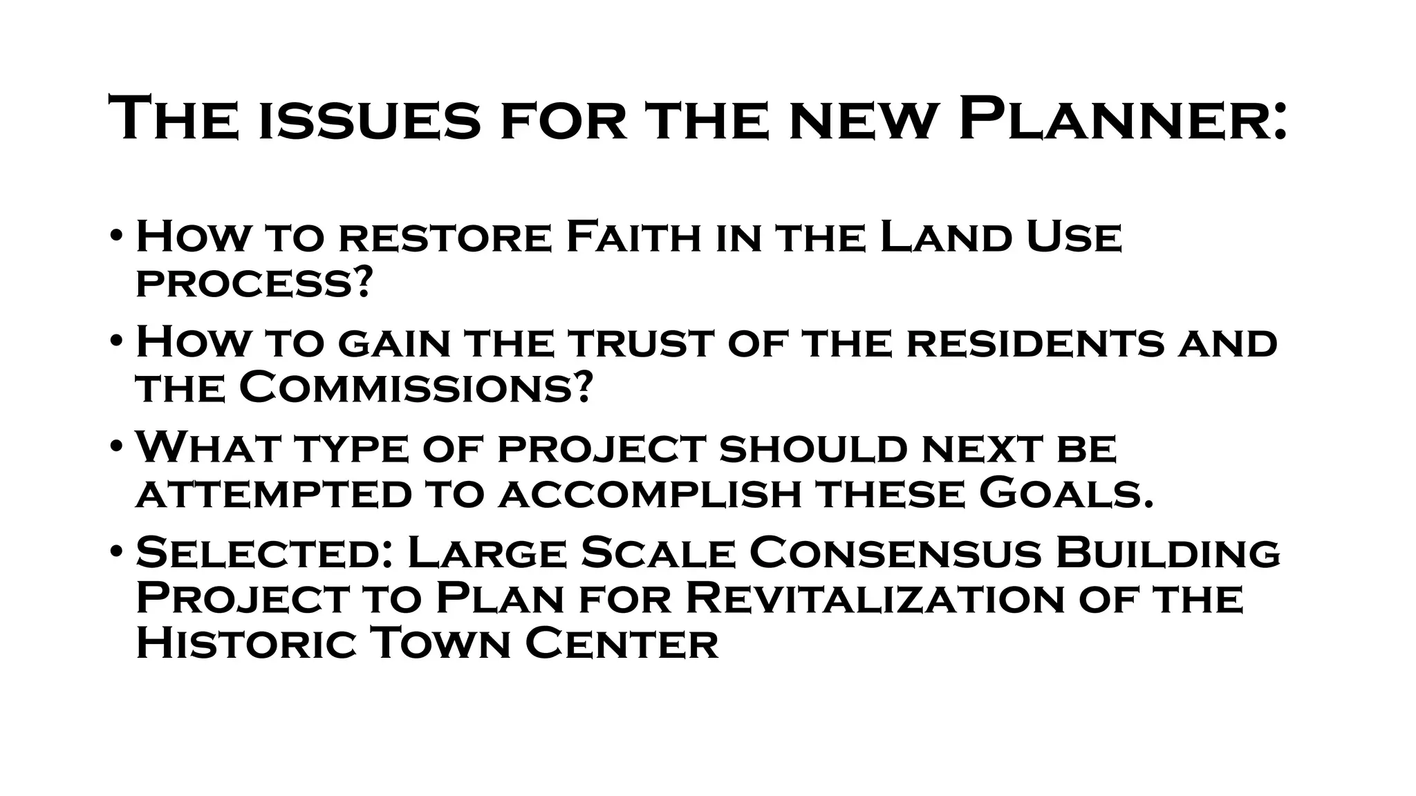
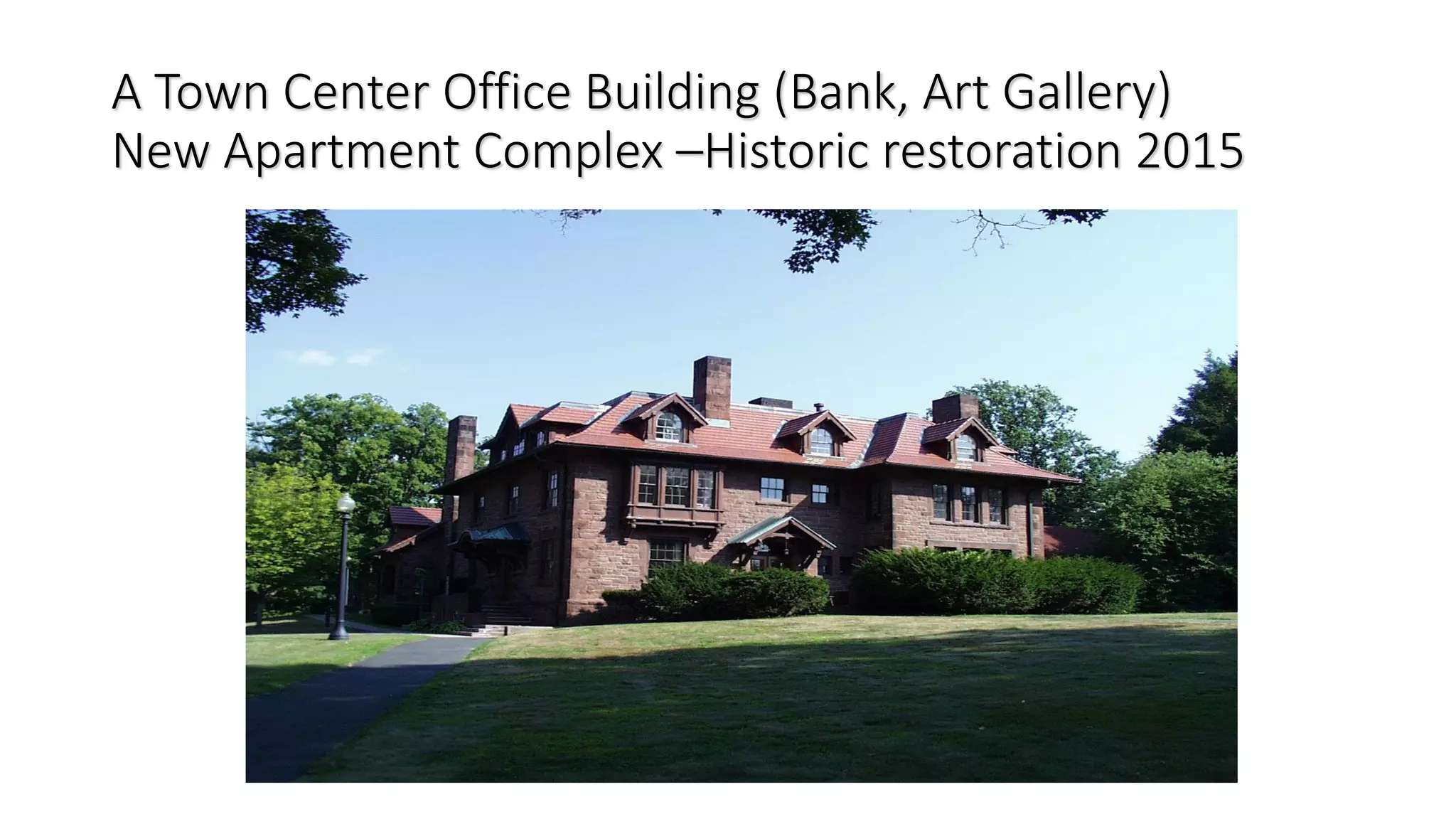
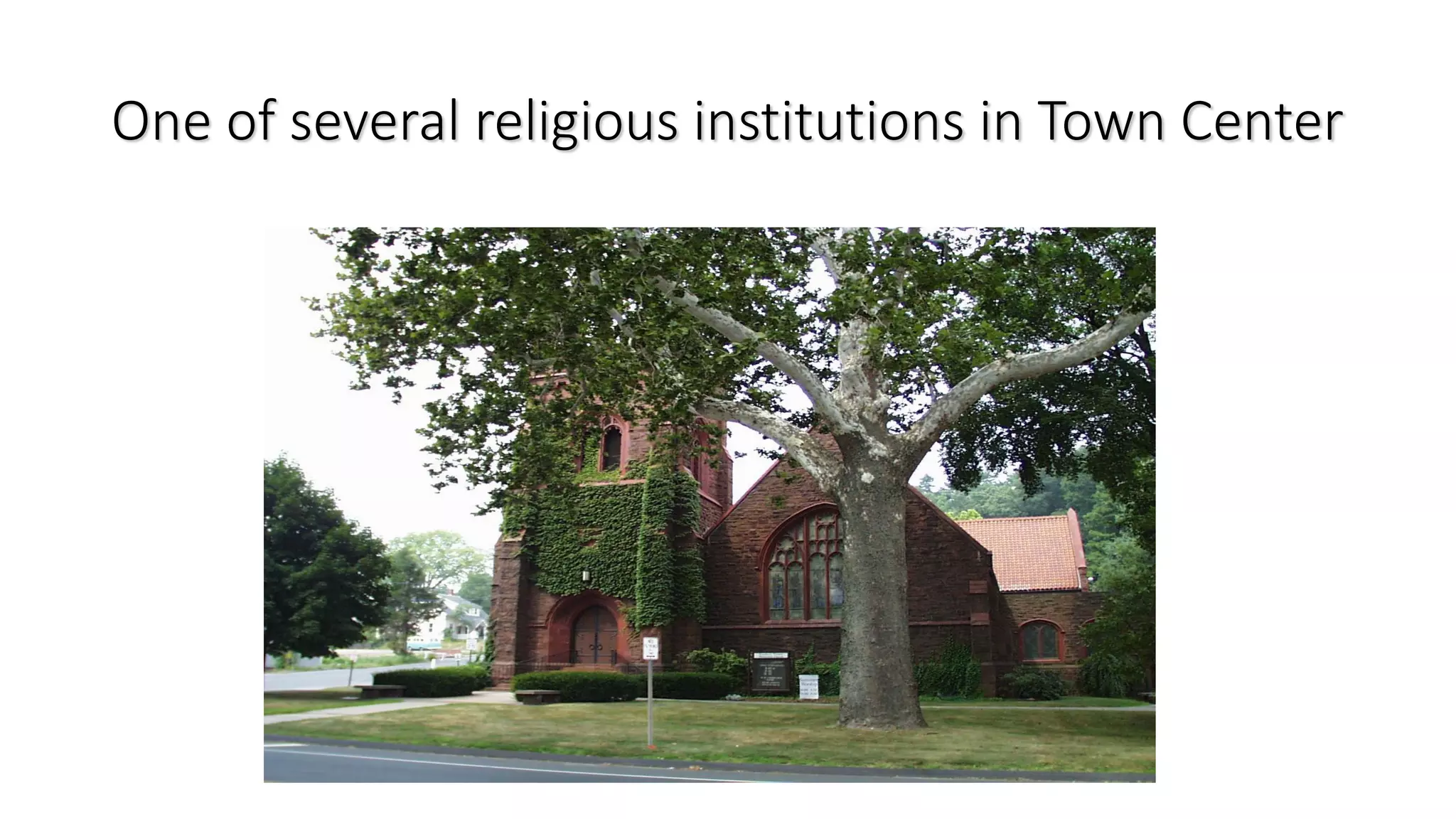
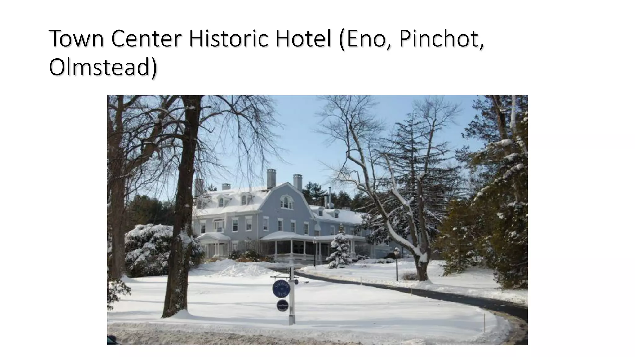
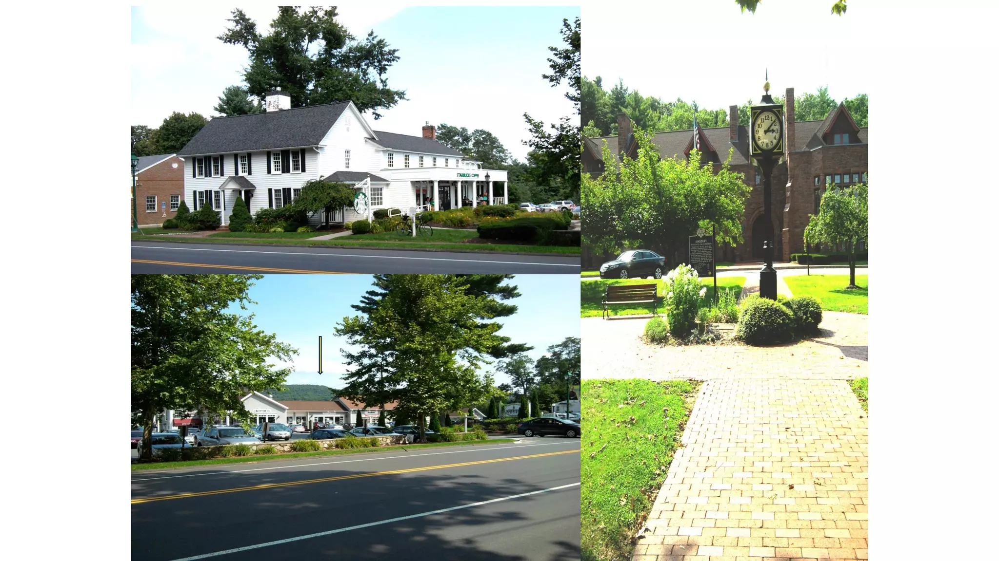
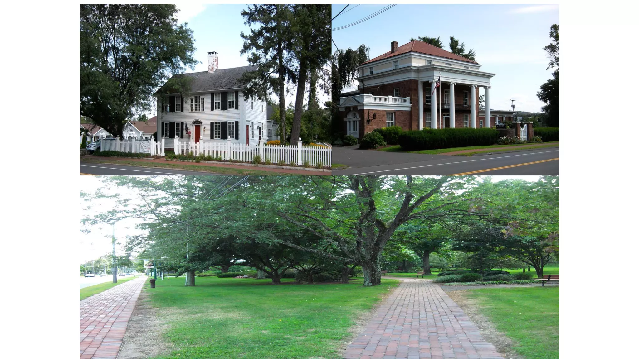
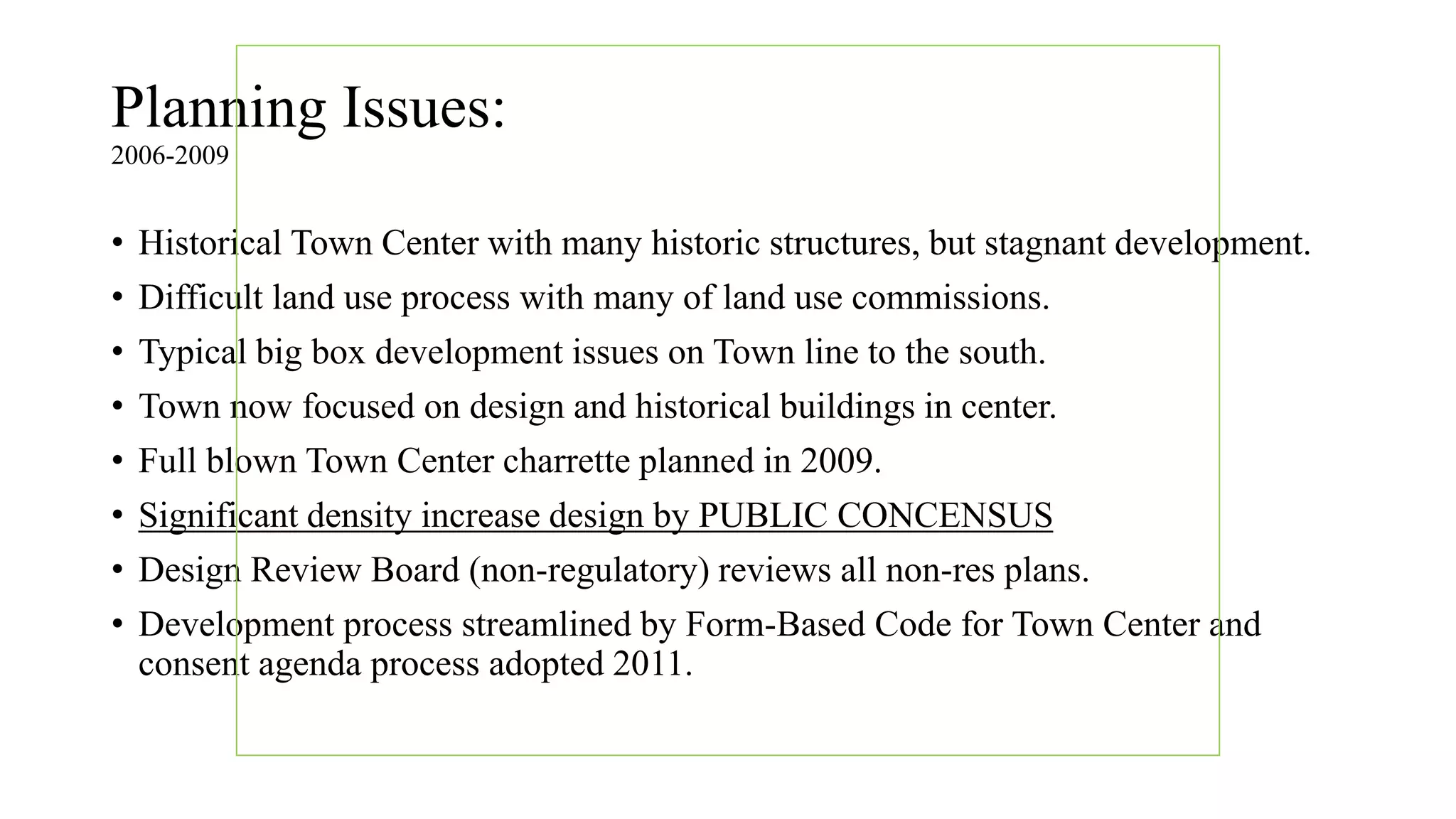
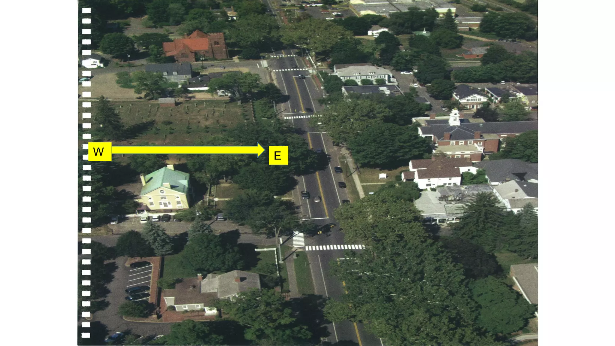
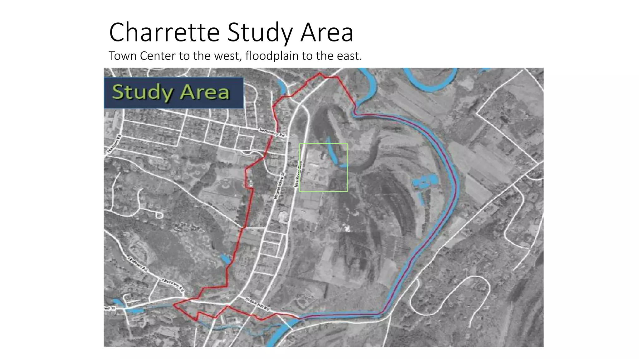
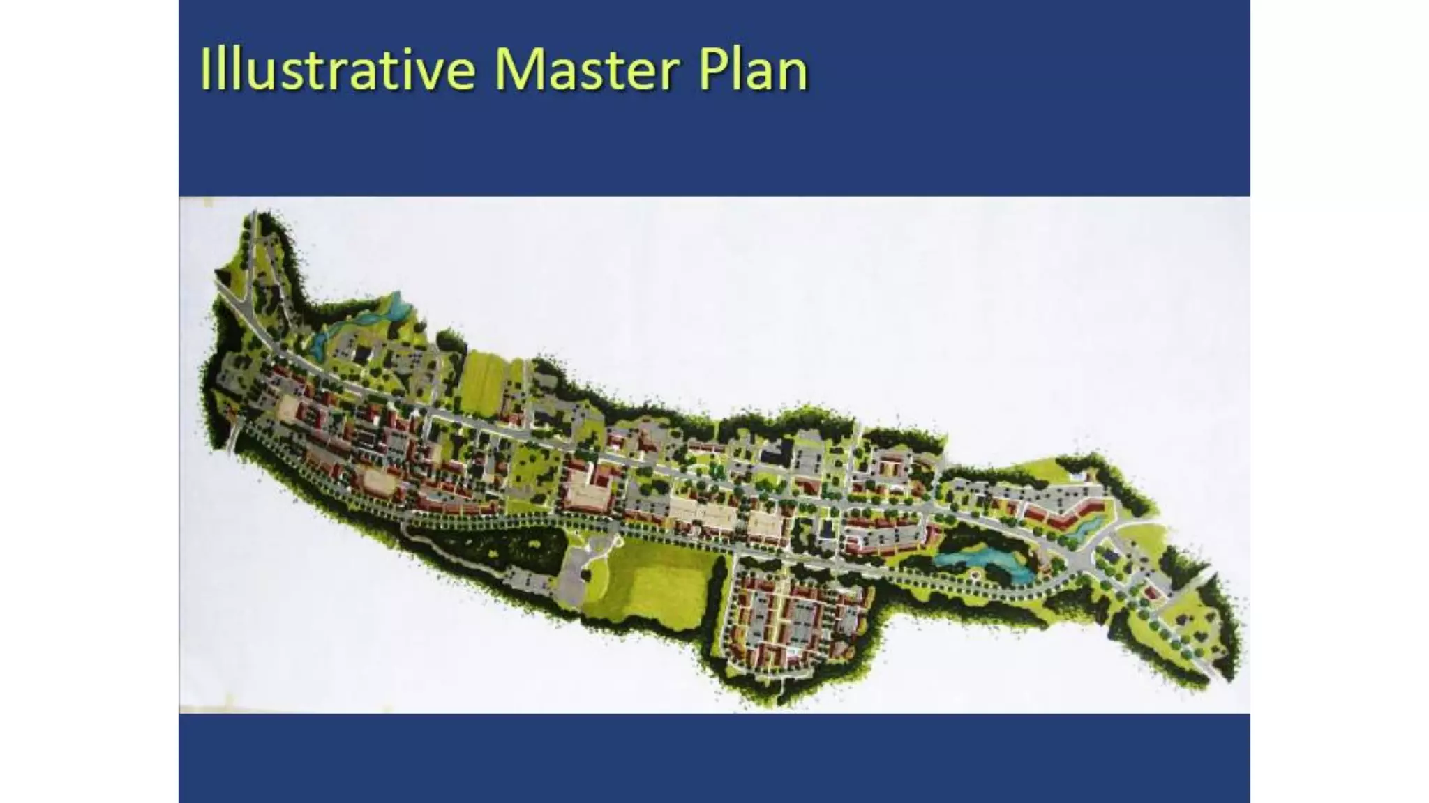
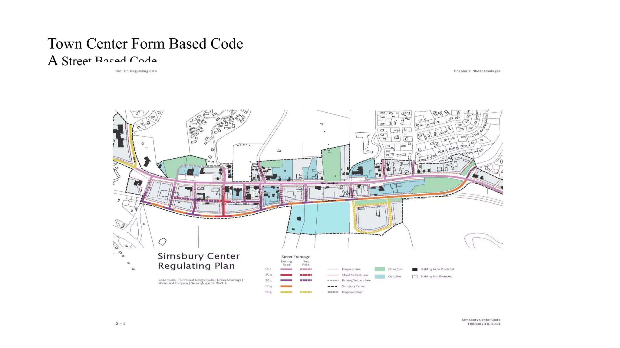
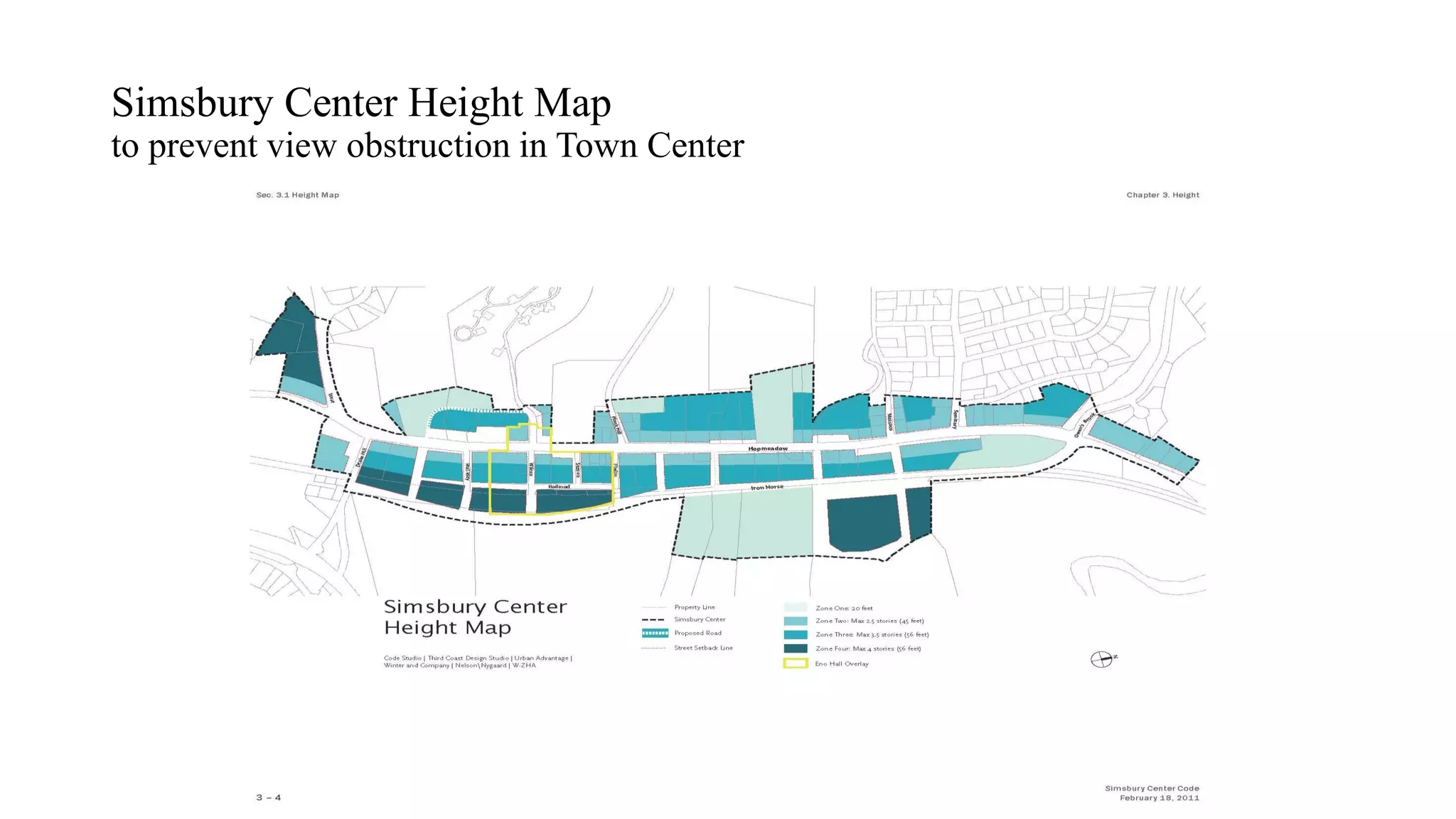
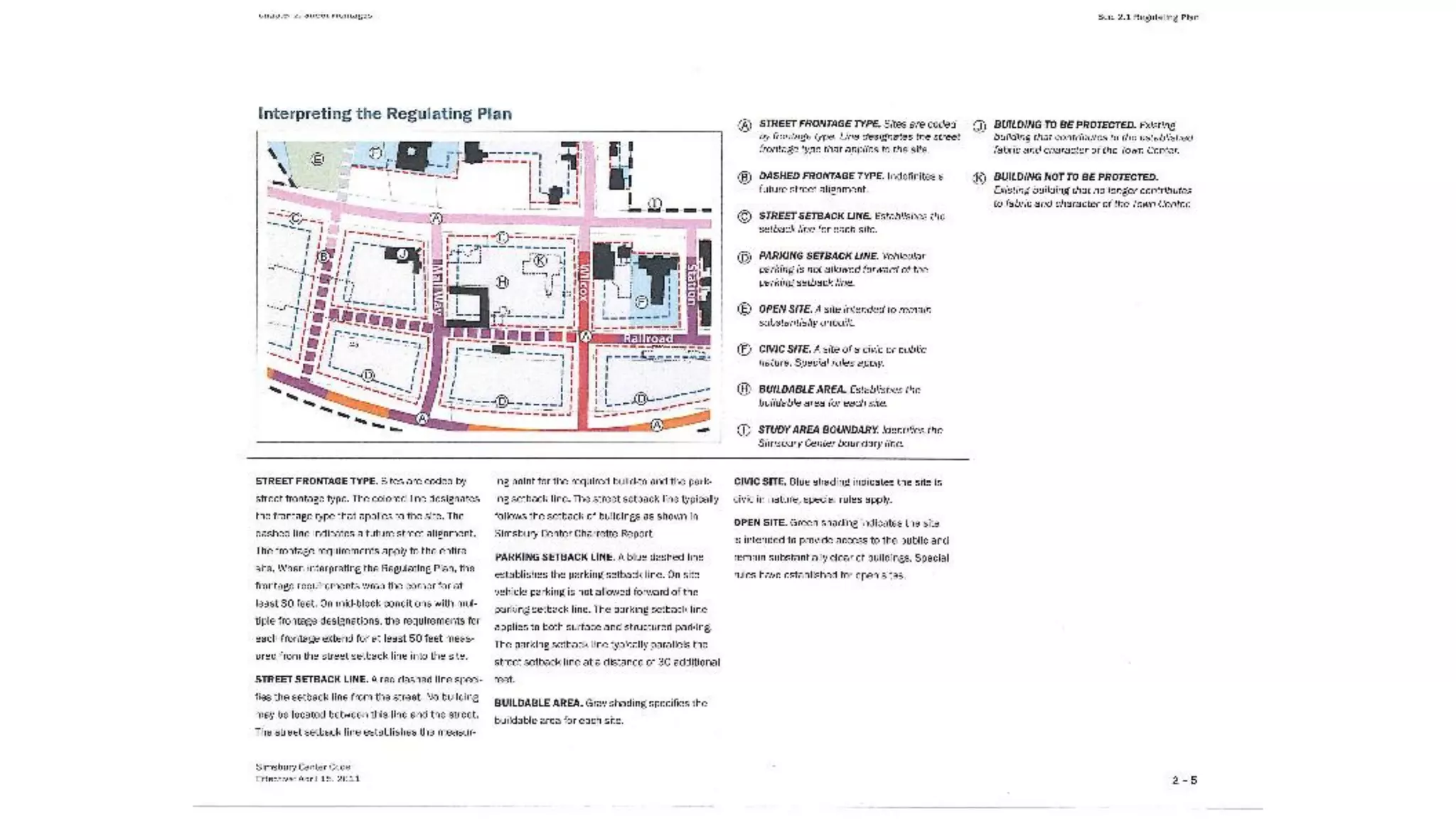
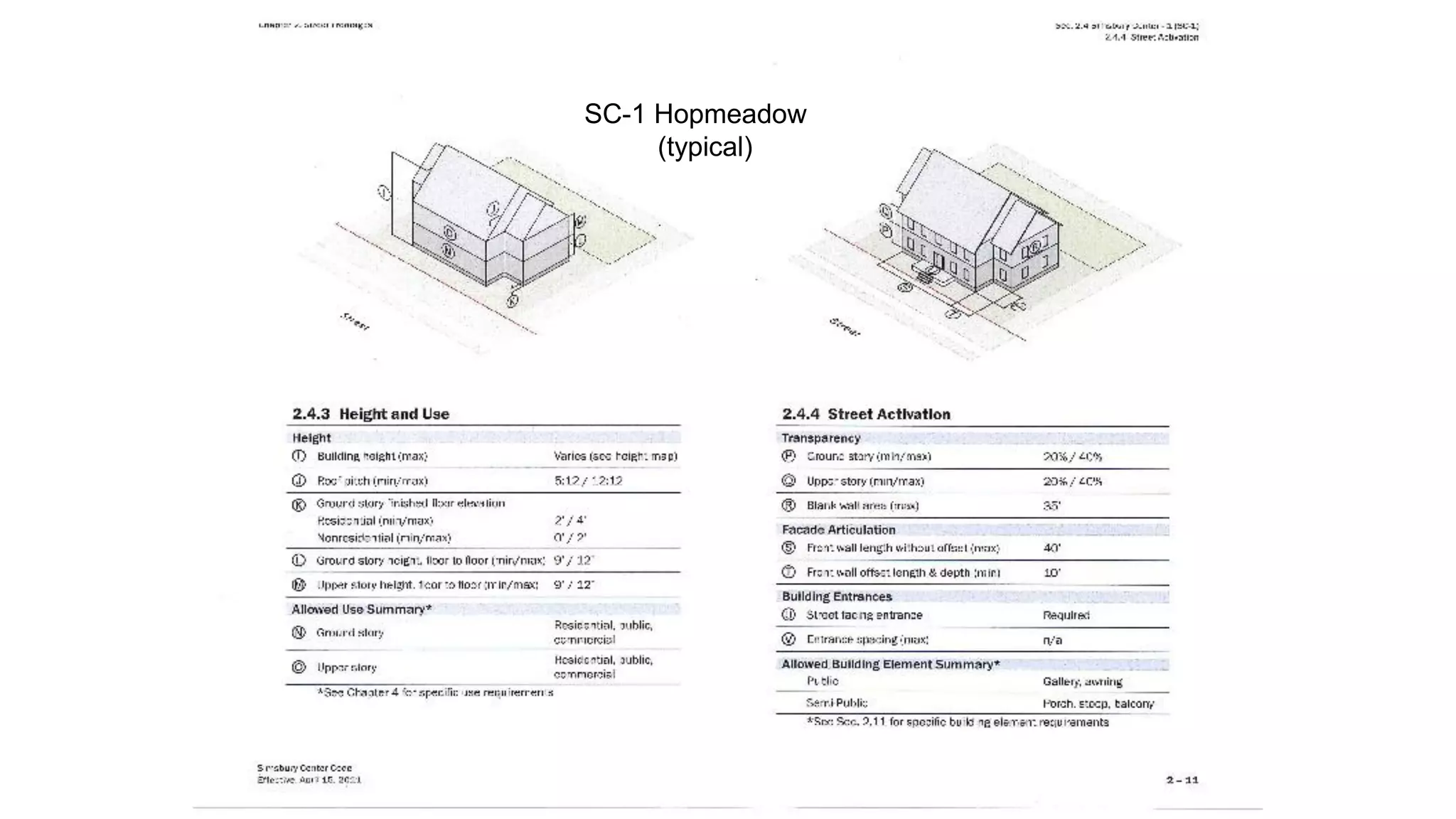
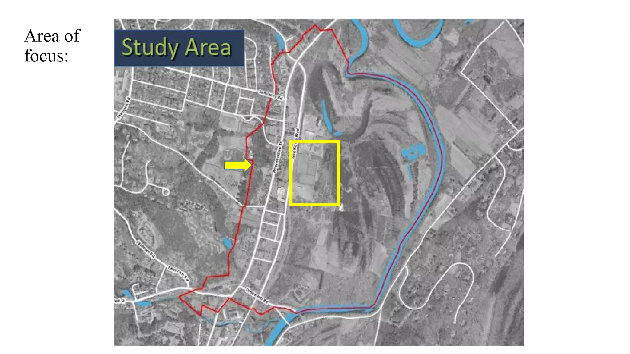
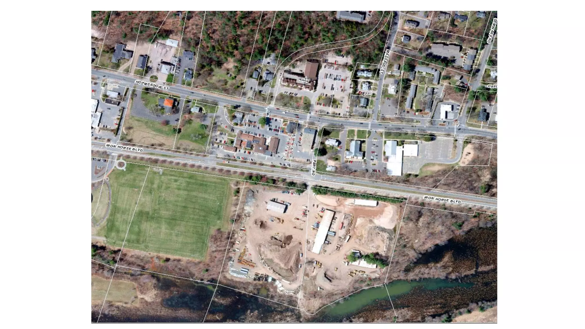
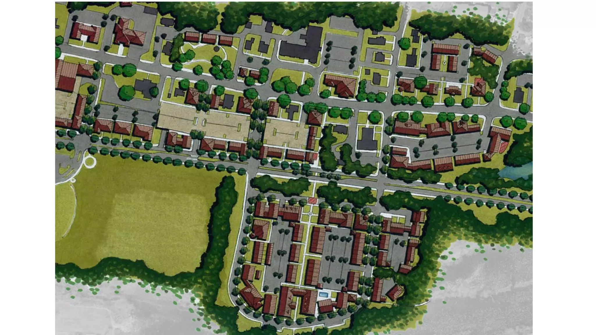
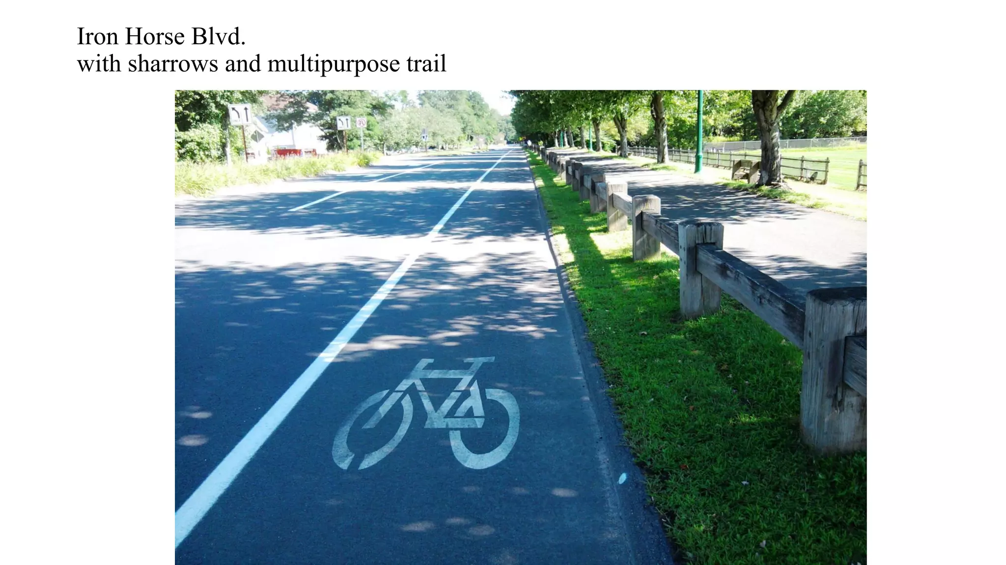
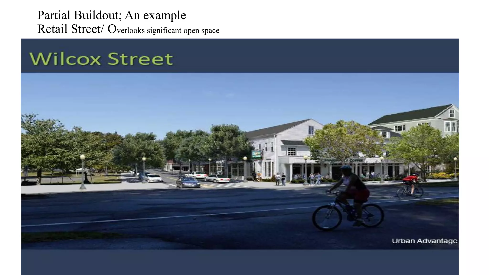
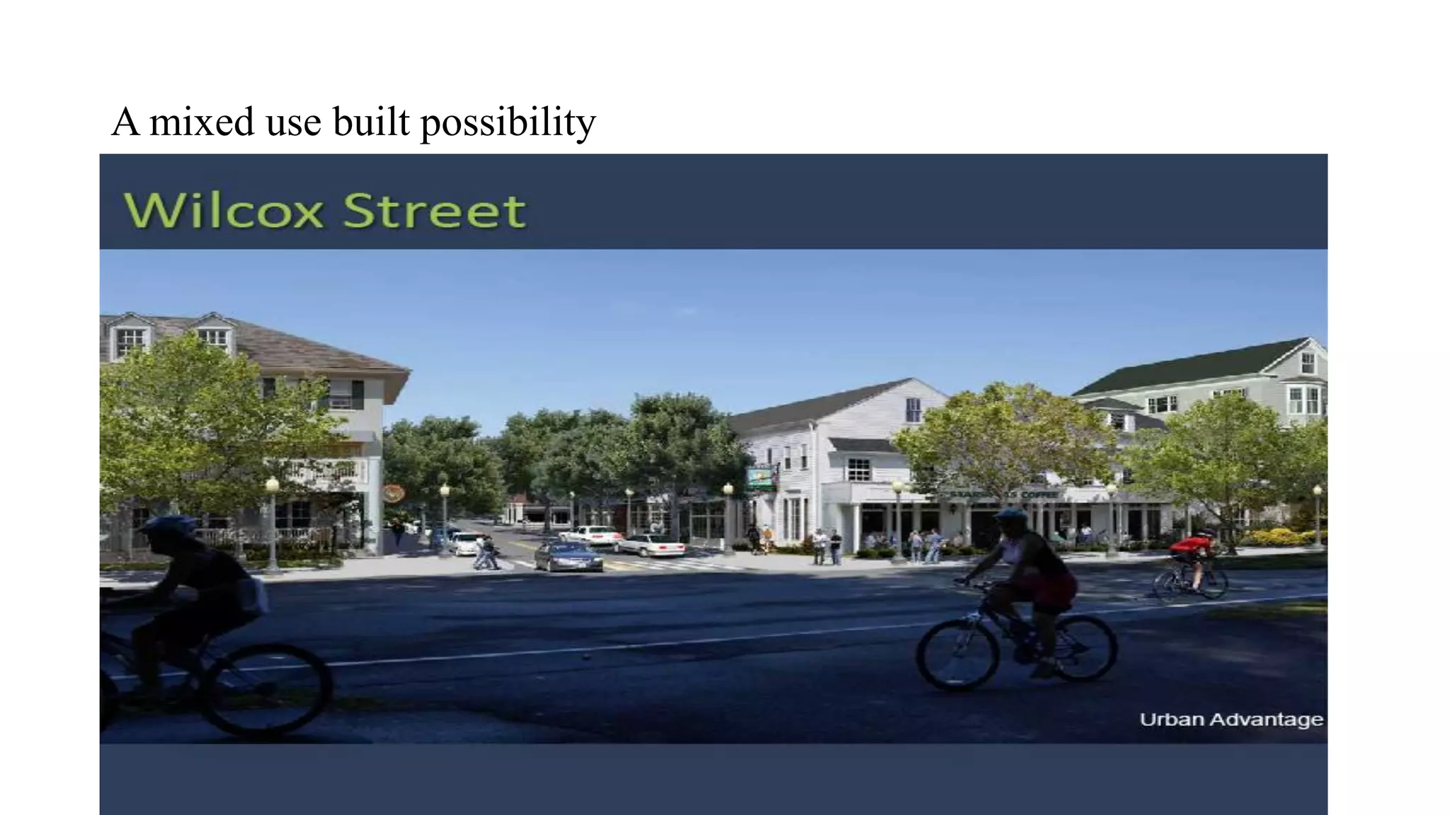
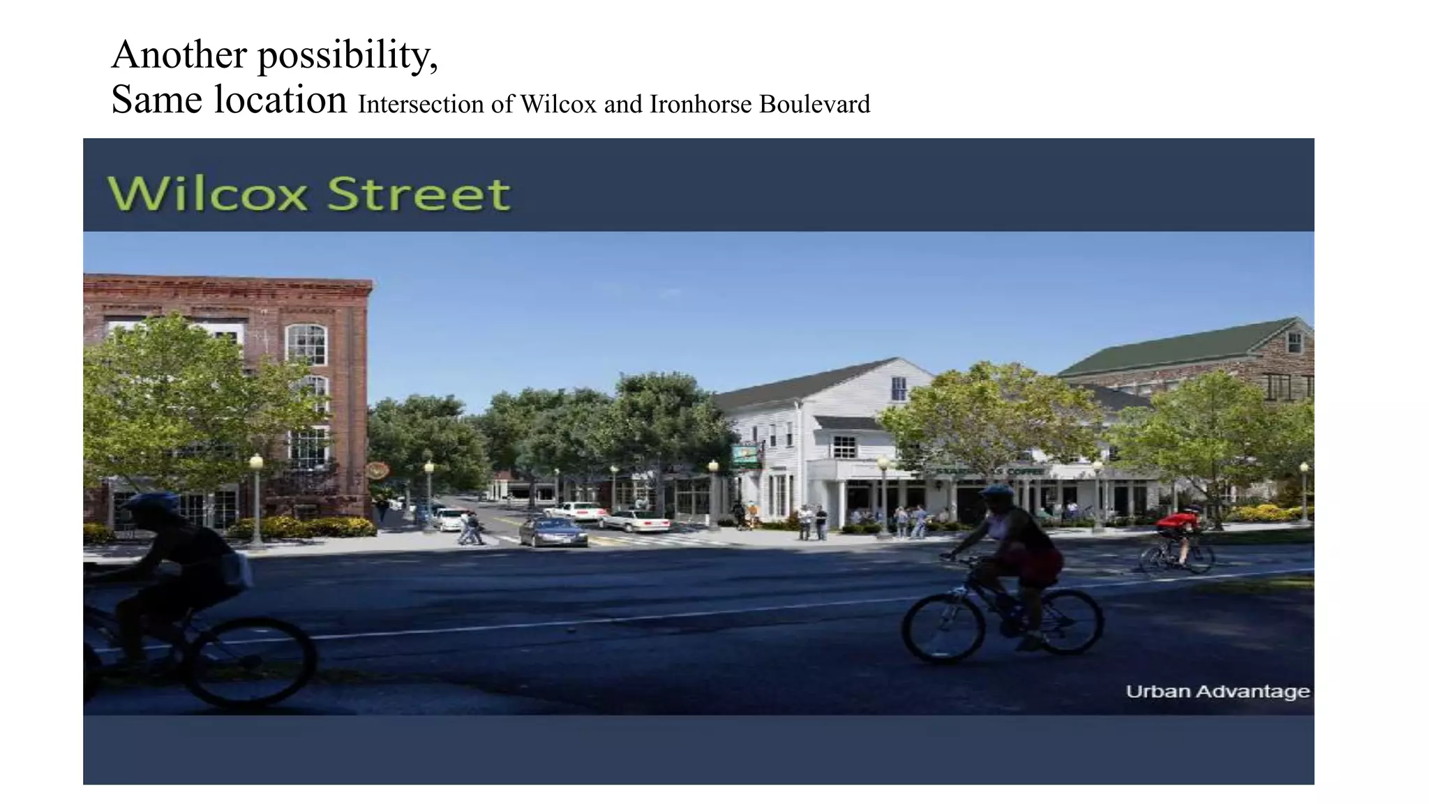
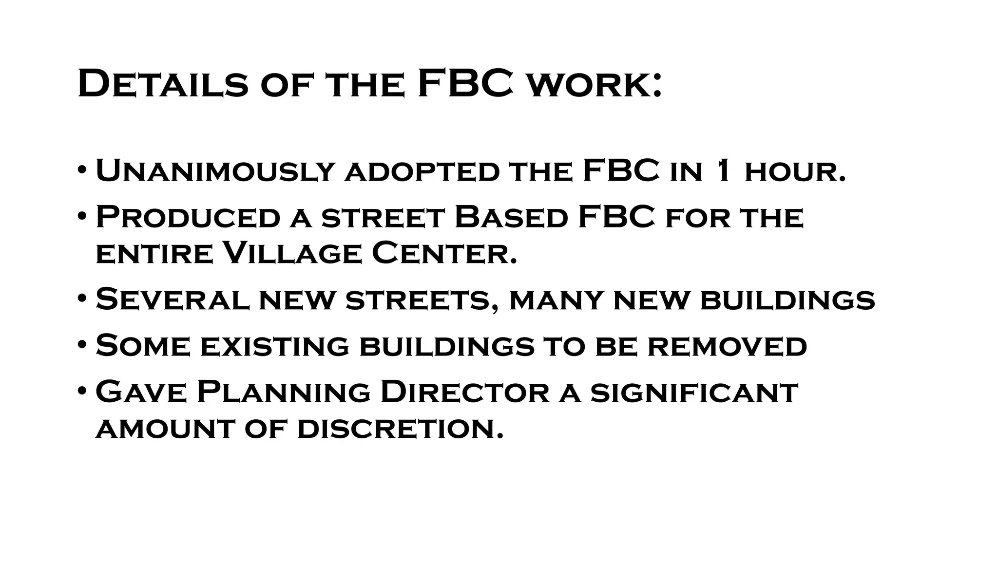
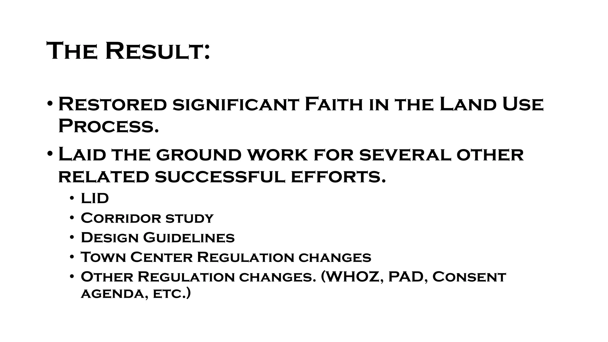
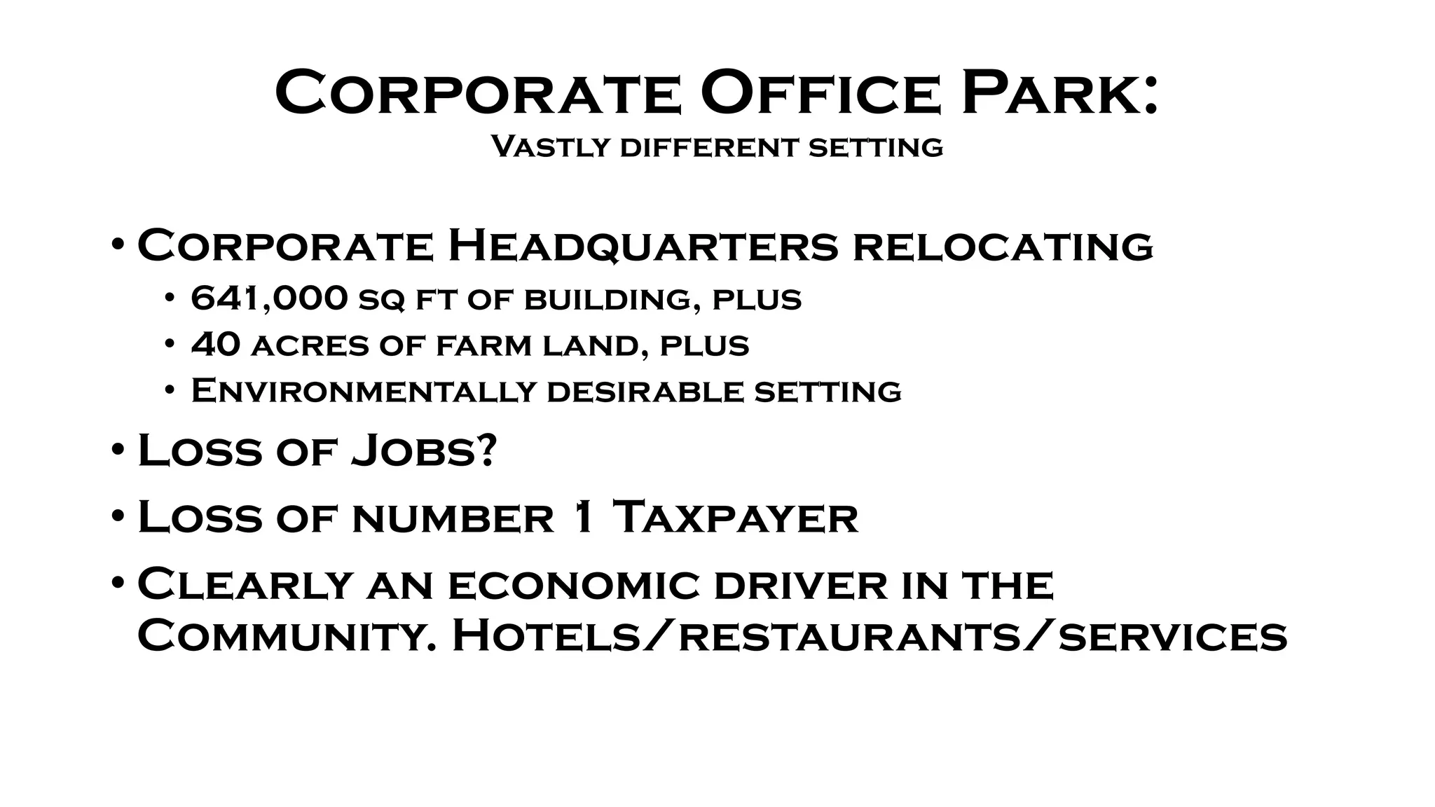
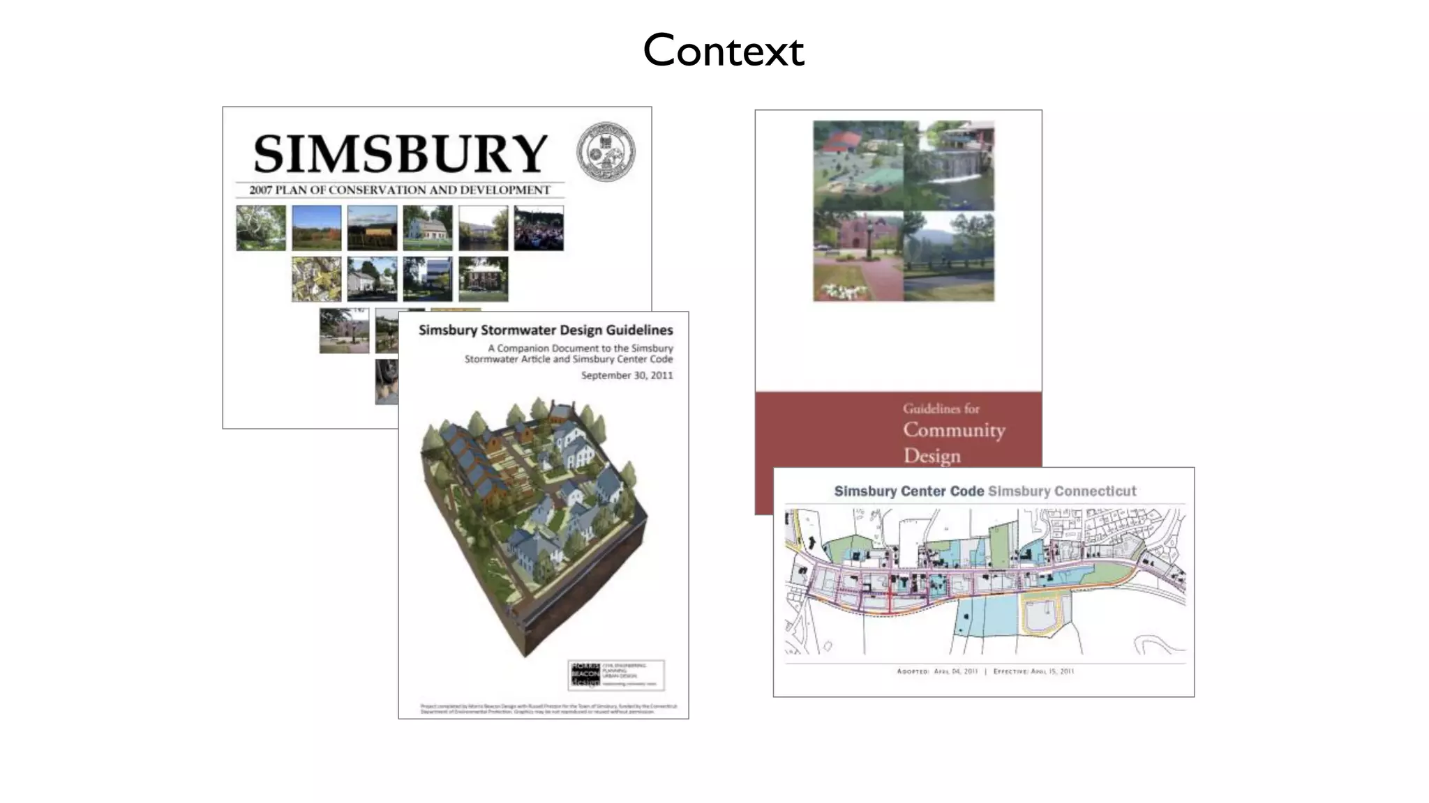
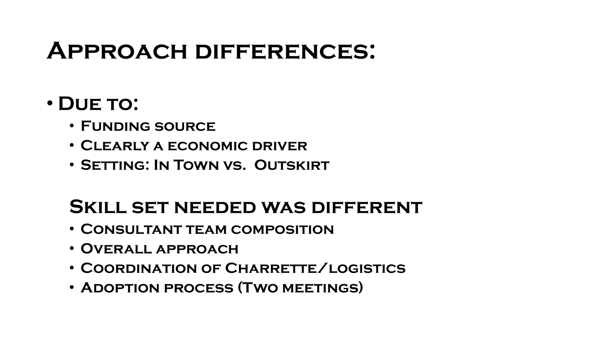
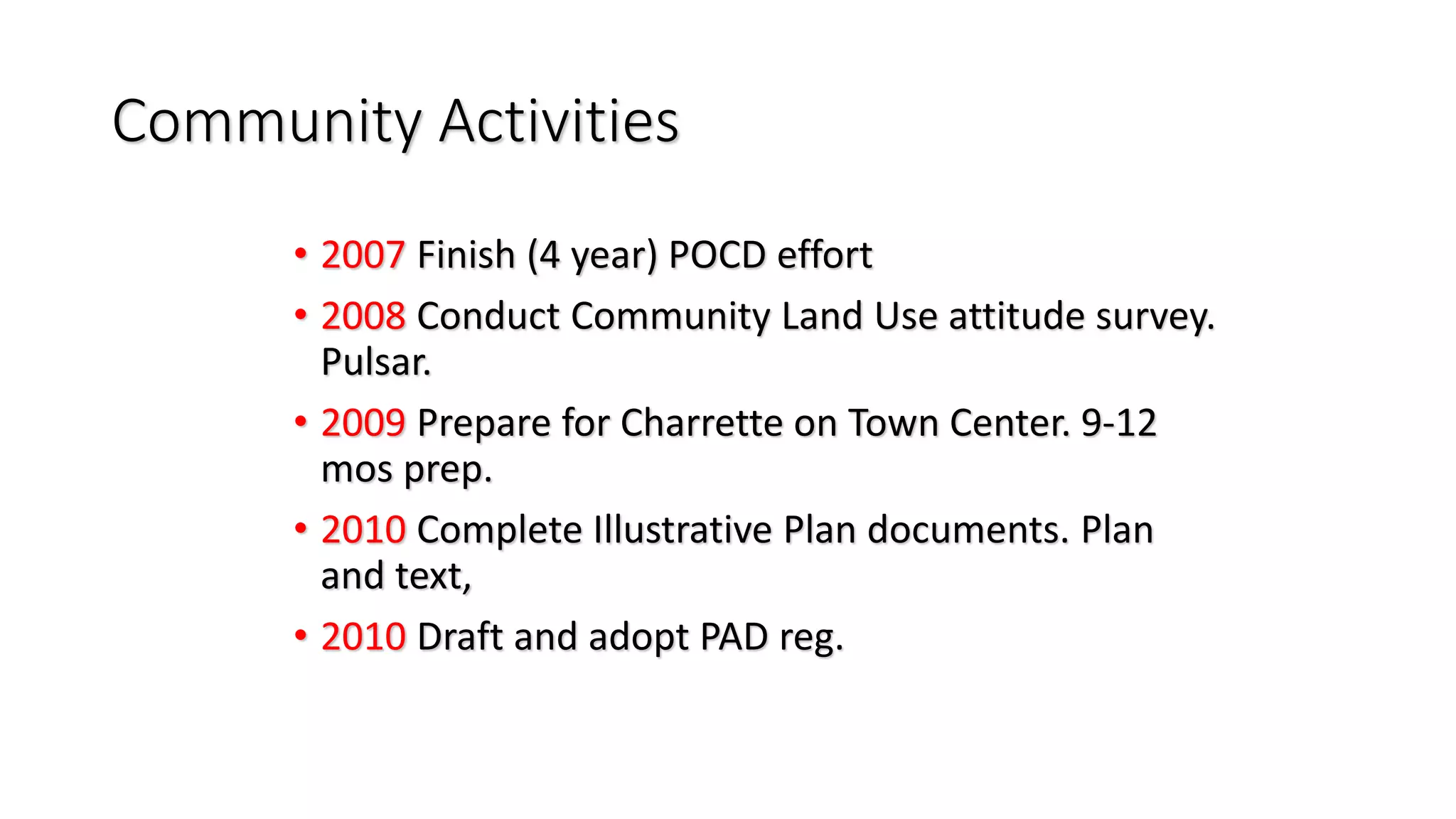
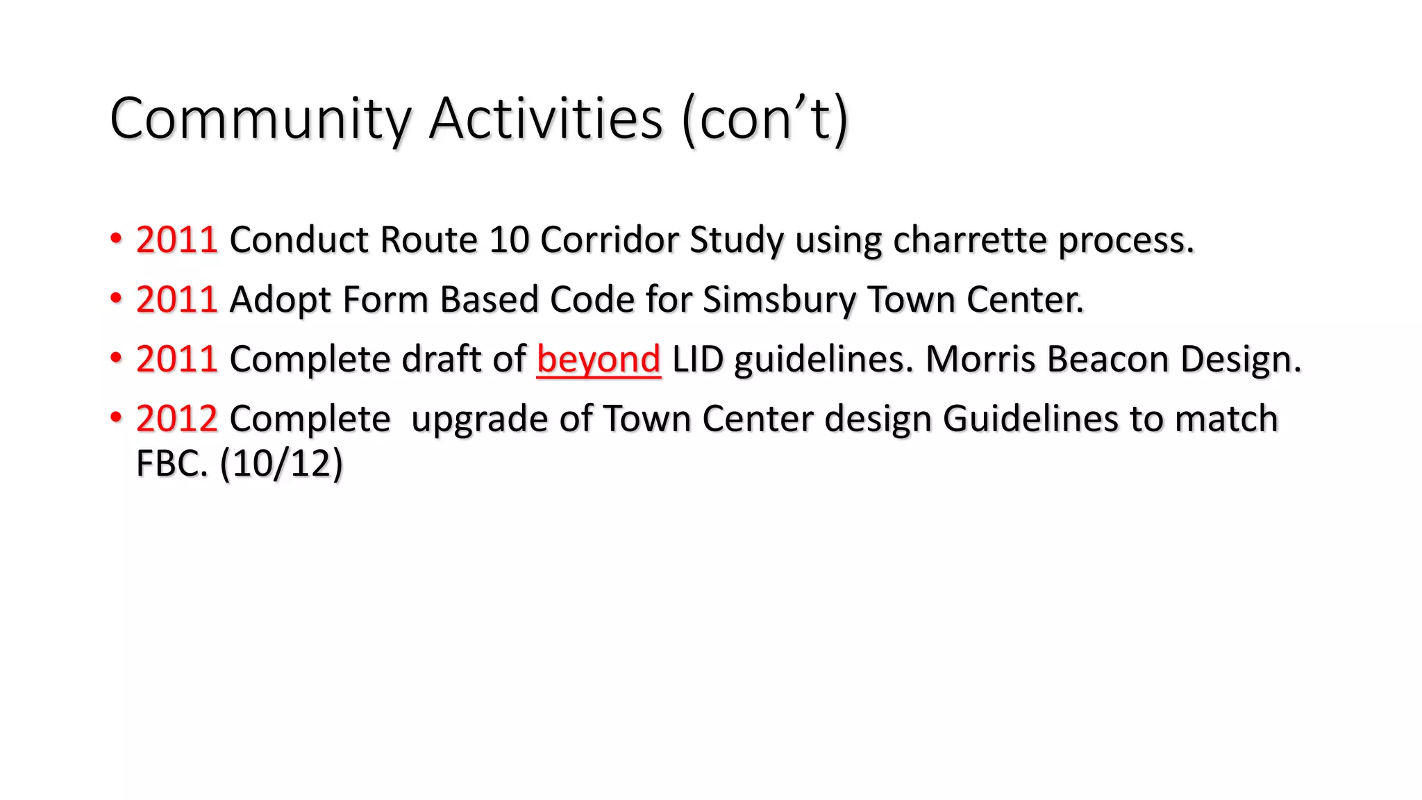
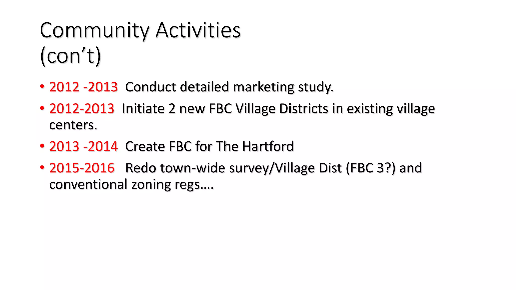
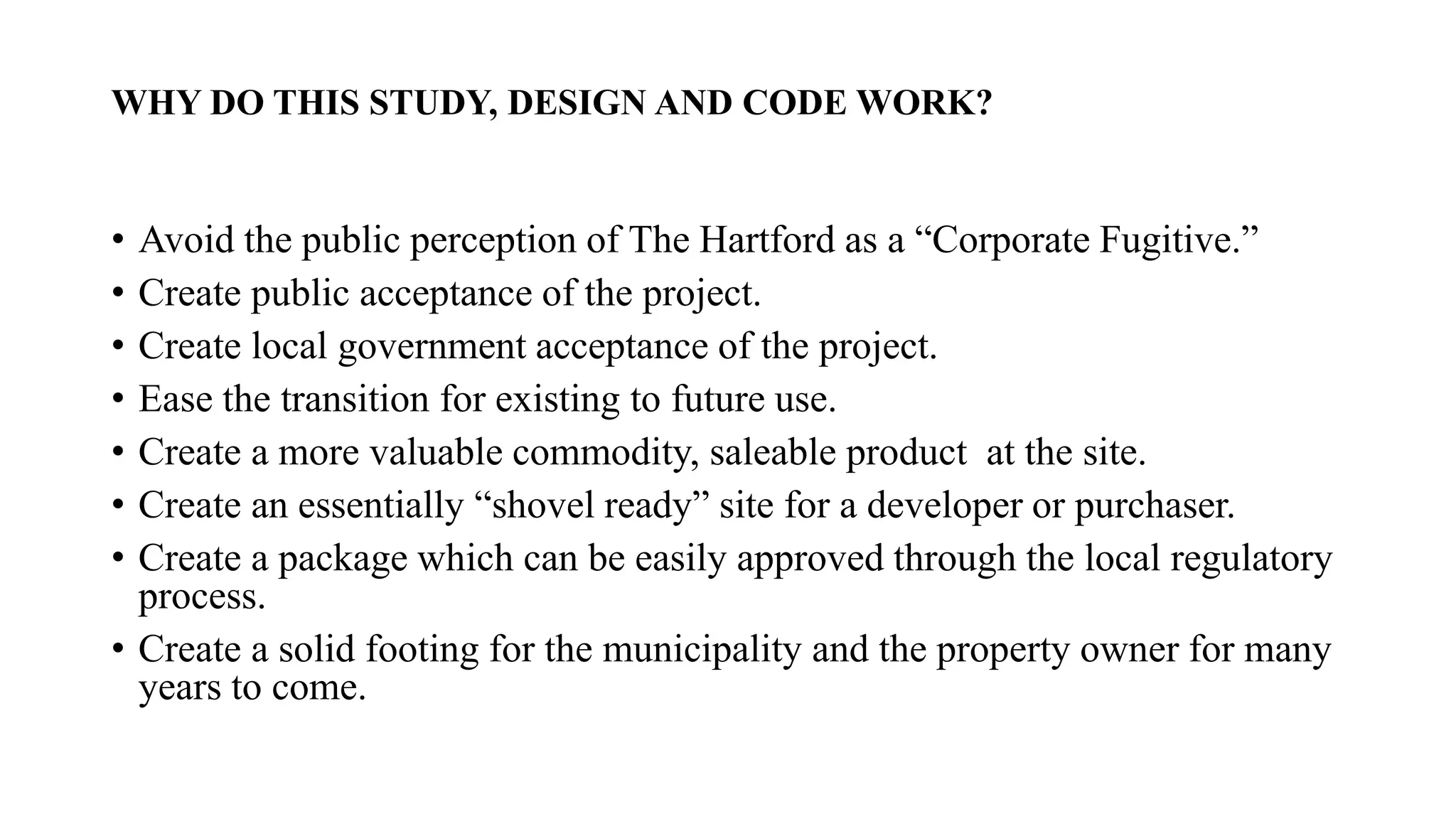
“Different Codes
for
different Nodes”
How to obtain more predictable development
AND
Streamline the application and approval Process
AND
Make almost everyone happy!
Hiram Peck, AICP
Town of Avon, CT
hpeck@avonct.gov
The Simsbury Solutions:
• Town Background
• Planning History
• The Issues
• The Town Center Approach
• The Corporate Office Park Approach
• The need for different Teams/Skills
• The Results
Town Center Considerations….
The issues for the new Planner:
• How to restore Faith in the Land Use
process?
• How to gain the trust of the residents and
the Commissions?
• What type of project should next be
attempted to accomplish these Goals.
• Selected: Large Scale Consensus Building
Project to Plan for Revitalization of the
Historic Town Center
Why do a charrette for a Form Based Code?
What we did:
• Town Center Charrette
• Six Days (and nights) with Talented team of
professionals from all over the Country.
• Public involved from the outset.
• Complete transparency clearly promoted.
• Final presentation finished 3 mins before
the Final public Session.
• Standing ovation for Illustrative Plan!
It was important to….
Blend higher density, high quality
development in a historic New
England Village Center while
assisting in cleaning stormwater
and insuring watershed health.
A Town Center Office Building (Bank, Art Gallery)
New Apartment Complex –Historic restoration 2015
One of several religious institutions in Town Center
Town Center Historic Hotel (Eno, Pinchot,
Olmstead)
Planning Issues:
2006-2009
• Historical Town Center with many historic structures, but stagnant development.
• Difficult land use process with many of land use commissions.
• Typical big box development issues on Town line to the south.
• Town now focused on design and historical buildings in center.
• Full blown Town Center charrette planned in 2009.
• Significant density increase design by PUBLIC CONCENSUS
• Design Review Board (non-regulatory) reviews all non-res plans.
• Development process streamlined by Form-Based Code for Town Center and
consent agenda process adopted 2011.
W E
Charrette Study Area
Town Center to the west, floodplain to the east.
Town Center Form Based Code
A Street Based Code
Simsbury Center Height Map
to prevent view obstruction in Town Center
SC-1 Hopmeadow
(typical)
Area of
focus:
Iron Horse Blvd.
with sharrows and multipurpose trail
Another Example: Existing Conditions
Partial Buildout; An example
Retail Street/ Overlooks significant open space
A mixed use built possibility
Another possibility,
Same location Intersection of Wilcox and Ironhorse Boulevard
Social, Environmental and Economic views
all considered as part of our plan.
Details of the FBC work:
• Unanimously adopted the FBC in 1 hour.
• Produced a street Based FBC for the
entire Village Center.
• Several new streets, many new buildings
• Some existing buildings to be removed
• Gave Planning Director a significant
amount of discretion.
The Result:
• Restored significant Faith in the Land Use
Process.
• Laid the ground work for several other
related successful efforts.
• LID
• Corridor study
• Design Guidelines
• Town Center Regulation changes
• Other Regulation changes. (WHOZ, PAD, Consent
agenda, etc.)
FBC Project
Example 2
Corporate Office Park:
Vastly different setting
• Corporate Headquarters relocating
• 641,000 sq ft of building, plus
• 40 acres of farm land, plus
• Environmentally desirable setting
• Loss of Jobs?
• Loss of number 1 Taxpayer
• Clearly an economic driver in the
Community. Hotels/restaurants/services
Context
Approach differences:
• Due to:
• Funding source
• Clearly a economic driver
• Setting: In Town vs. Outskirt
Skill set needed was different
• Consultant team composition
• Overall approach
• Coordination of Charrette/logistics
• Adoption process (Two meetings)
Community Activities
• 2007 Finish (4 year) POCD effort
• 2008 Conduct Community Land Use attitude survey.
Pulsar.
• 2009 Prepare for Charrette on Town Center. 9-12
mos prep.
• 2010 Complete Illustrative Plan documents. Plan
and text,
• 2010 Draft and adopt PAD reg.
Community Activities (con’t)
• 2011 Conduct Route 10 Corridor Study using charrette process.
• 2011 Adopt Form Based Code for Simsbury Town Center.
• 2011 Complete draft of beyond LID guidelines. Morris Beacon Design.
• 2012 Complete upgrade of Town Center design Guidelines to match
FBC. (10/12)
Community Activities
(con’t)
• 2012 -2013 Conduct detailed marketing study.
• 2012-2013 Initiate 2 new FBC Village Districts in existing village
centers.
• 2013 -2014 Create FBC for The Hartford
• 2015-2016 Redo town-wide survey/Village Dist (FBC 3?) and
conventional zoning regs….
Details of Hartford FBC Effort:
Place-Driven Job
Creation,
The Public-Private
Opportunity
Simsbury, CT 2013-2014
Town of Simsbury/ The Hartford
Insurance Company/ Gateway Planning
Congress for the New Urbanism
2015
The Hartford/Town of
Simsbury
2013 Land Use Study.
Joint Land Use Study of The Hartford
property in Simsbury, CT 2013
The Property:
• Acres
• Lot 1: Parking and Drives: 99.0 acres
• Lot 2: Parking and building: 33.433 acres
• Lot 3: Undeveloped land: 40 acres
• Total Land: 172.433 acres
The Property
The current revenue to the Town:
• 200 Hopmeadow Street: (638,174 square feet)
Built in 1983, Four stories.
Appraised Value: 70% Assessment:
Land: $5,265,000 $3,685,500
Buildings: $40,485,000 $28,339,500
Total:$45,750,000 $32,025,000
Tax on Real Estate: $1,143,584
(not counting personal property)
The plan:
• The Hartford Land Use Study will take the form of a broad based community
charrette which will have several positive impacts and specific positive results for
both the Town of Simsbury and The Hartford.
• Reasons to do this study. This study will significantly increase:
• The value of the property for both the Town and The Hartford
• The number of potential buyers for the site
• The number of potential uses for the site
• The level of broad public acceptance from the outset
• The local land use commissions acceptance from the outset.
• Chronology: (Tentative)
• Committee established: March 2013
• Project Outlined: April 2013
• Project Scoped: April 2013
• Project proposals received and interviews completed: May/June 2013
• Project team assembled: June, 2013
• Stakeholders meeting with Committee: June 2013
• Plan produced: late July 2013
• Plan presented to Hartford Late July 2013
• Plan reviewed, revised if needed and finalized August 2013
• Plan presented to public: September 2013.
Plan (continued)
• Cost:
-The study will cost $175,000 for the entire Hartford site.
The Hartford has agreed to share the costs of this study. The
Town portion of this study will be $30,000.
- Other sites could be added for additional study and
design costs.
• OUTLINE of Study elements and products:
• The planning study, including an Illustrative Plan for the property
• Detailed analysis including:
• Detailed plan with all land use components studied
• Detailed economic analysis of the site and impact of alternative
plans
• Graphic plan/s
• Code (Zoning Regulation) for the site
• Subsequent implementation of new code into existing regulations.
• Stormwater preliminary engineering analysis (LID study basis)
• Traffic from Route 10 corridor study
WHY DO THIS STUDY, DESIGN AND CODE WORK?
• Avoid the public perception of The Hartford as a “Corporate Fugitive.”
• Create public acceptance of the project.
• Create local government acceptance of the project.
• Ease the transition for existing to future use.
• Create a more valuable commodity, saleable product at the site.
• Create an essentially “shovel ready” site for a developer or purchaser.
• Create a package which can be easily approved through the local regulatory
process.
• Create a solid footing for the municipality and the property owner for many
years to come.
The Hartford Code Details…
Purpose and Intent:
• Covers: Vision, vibrant and sustainable,
• Healthcare, technology, retail, residential,
• Environmental integration of trails, biking,
• Connected community, sections,
• Transitions to other res areas,
• Ease of development process.
• High level of architecture.
• AND created a Public-Private Partnership model
Results: Excellent to Date
• Property and approach discussed at
National Conferences
• Interviews with 3 serious contenders for
the property.
• Property is in Due Diligence stage with one
prospective purchaser.
• The FBC was one thing that particularly
interested the buyer.
Summary:
• Codes while having some commonalities are
all different
• Serve different purposes
• Serve different Ends
• Require a variety of different skills to
develop and implement.
Questions, Please.
Hiram Peck, AICP
Town of Avon, CT
hpeck@avonct.gov
NOTHING attracts spectators like a train wreck!
Back on track!
A5 Form Based Codes

A5 Form Based Codes

  • 1.
    “Different Codes for different Nodes” Howto obtain more predictable development AND Streamline the application and approval Process AND Make almost everyone happy! Hiram Peck, AICP Town of Avon, CT hpeck@avonct.gov
  • 2.
    The Simsbury Solutions: •Town Background • Planning History • The Issues • The Town Center Approach • The Corporate Office Park Approach • The need for different Teams/Skills • The Results Town Center Considerations….
  • 3.
    The issues forthe new Planner: • How to restore Faith in the Land Use process? • How to gain the trust of the residents and the Commissions? • What type of project should next be attempted to accomplish these Goals. • Selected: Large Scale Consensus Building Project to Plan for Revitalization of the Historic Town Center
  • 4.
    Why do acharrette for a Form Based Code?
  • 5.
    What we did: •Town Center Charrette • Six Days (and nights) with Talented team of professionals from all over the Country. • Public involved from the outset. • Complete transparency clearly promoted. • Final presentation finished 3 mins before the Final public Session. • Standing ovation for Illustrative Plan!
  • 6.
    It was importantto…. Blend higher density, high quality development in a historic New England Village Center while assisting in cleaning stormwater and insuring watershed health.
  • 7.
    A Town CenterOffice Building (Bank, Art Gallery) New Apartment Complex –Historic restoration 2015
  • 8.
    One of severalreligious institutions in Town Center
  • 9.
    Town Center HistoricHotel (Eno, Pinchot, Olmstead)
  • 12.
    Planning Issues: 2006-2009 • HistoricalTown Center with many historic structures, but stagnant development. • Difficult land use process with many of land use commissions. • Typical big box development issues on Town line to the south. • Town now focused on design and historical buildings in center. • Full blown Town Center charrette planned in 2009. • Significant density increase design by PUBLIC CONCENSUS • Design Review Board (non-regulatory) reviews all non-res plans. • Development process streamlined by Form-Based Code for Town Center and consent agenda process adopted 2011.
  • 13.
  • 14.
    Charrette Study Area TownCenter to the west, floodplain to the east.
  • 16.
    Town Center FormBased Code A Street Based Code
  • 17.
    Simsbury Center HeightMap to prevent view obstruction in Town Center
  • 19.
  • 20.
  • 23.
    Iron Horse Blvd. withsharrows and multipurpose trail
  • 24.
  • 25.
    Partial Buildout; Anexample Retail Street/ Overlooks significant open space
  • 26.
    A mixed usebuilt possibility
  • 27.
    Another possibility, Same locationIntersection of Wilcox and Ironhorse Boulevard
  • 28.
    Social, Environmental andEconomic views all considered as part of our plan.
  • 29.
    Details of theFBC work: • Unanimously adopted the FBC in 1 hour. • Produced a street Based FBC for the entire Village Center. • Several new streets, many new buildings • Some existing buildings to be removed • Gave Planning Director a significant amount of discretion.
  • 30.
    The Result: • Restoredsignificant Faith in the Land Use Process. • Laid the ground work for several other related successful efforts. • LID • Corridor study • Design Guidelines • Town Center Regulation changes • Other Regulation changes. (WHOZ, PAD, Consent agenda, etc.)
  • 31.
  • 32.
    Corporate Office Park: Vastlydifferent setting • Corporate Headquarters relocating • 641,000 sq ft of building, plus • 40 acres of farm land, plus • Environmentally desirable setting • Loss of Jobs? • Loss of number 1 Taxpayer • Clearly an economic driver in the Community. Hotels/restaurants/services
  • 33.
  • 34.
    Approach differences: • Dueto: • Funding source • Clearly a economic driver • Setting: In Town vs. Outskirt Skill set needed was different • Consultant team composition • Overall approach • Coordination of Charrette/logistics • Adoption process (Two meetings)
  • 35.
    Community Activities • 2007Finish (4 year) POCD effort • 2008 Conduct Community Land Use attitude survey. Pulsar. • 2009 Prepare for Charrette on Town Center. 9-12 mos prep. • 2010 Complete Illustrative Plan documents. Plan and text, • 2010 Draft and adopt PAD reg.
  • 36.
    Community Activities (con’t) •2011 Conduct Route 10 Corridor Study using charrette process. • 2011 Adopt Form Based Code for Simsbury Town Center. • 2011 Complete draft of beyond LID guidelines. Morris Beacon Design. • 2012 Complete upgrade of Town Center design Guidelines to match FBC. (10/12)
  • 37.
    Community Activities (con’t) • 2012-2013 Conduct detailed marketing study. • 2012-2013 Initiate 2 new FBC Village Districts in existing village centers. • 2013 -2014 Create FBC for The Hartford • 2015-2016 Redo town-wide survey/Village Dist (FBC 3?) and conventional zoning regs….
  • 38.
  • 39.
    Place-Driven Job Creation, The Public-Private Opportunity Simsbury,CT 2013-2014 Town of Simsbury/ The Hartford Insurance Company/ Gateway Planning Congress for the New Urbanism 2015
  • 40.
  • 41.
    Joint Land UseStudy of The Hartford property in Simsbury, CT 2013
  • 42.
    The Property: • Acres •Lot 1: Parking and Drives: 99.0 acres • Lot 2: Parking and building: 33.433 acres • Lot 3: Undeveloped land: 40 acres • Total Land: 172.433 acres
  • 43.
  • 45.
    The current revenueto the Town: • 200 Hopmeadow Street: (638,174 square feet) Built in 1983, Four stories. Appraised Value: 70% Assessment: Land: $5,265,000 $3,685,500 Buildings: $40,485,000 $28,339,500 Total:$45,750,000 $32,025,000 Tax on Real Estate: $1,143,584 (not counting personal property)
  • 46.
    The plan: • TheHartford Land Use Study will take the form of a broad based community charrette which will have several positive impacts and specific positive results for both the Town of Simsbury and The Hartford. • Reasons to do this study. This study will significantly increase: • The value of the property for both the Town and The Hartford • The number of potential buyers for the site • The number of potential uses for the site • The level of broad public acceptance from the outset • The local land use commissions acceptance from the outset. • Chronology: (Tentative) • Committee established: March 2013 • Project Outlined: April 2013 • Project Scoped: April 2013 • Project proposals received and interviews completed: May/June 2013 • Project team assembled: June, 2013 • Stakeholders meeting with Committee: June 2013 • Plan produced: late July 2013 • Plan presented to Hartford Late July 2013 • Plan reviewed, revised if needed and finalized August 2013 • Plan presented to public: September 2013.
  • 47.
    Plan (continued) • Cost: -Thestudy will cost $175,000 for the entire Hartford site. The Hartford has agreed to share the costs of this study. The Town portion of this study will be $30,000. - Other sites could be added for additional study and design costs. • OUTLINE of Study elements and products: • The planning study, including an Illustrative Plan for the property • Detailed analysis including: • Detailed plan with all land use components studied • Detailed economic analysis of the site and impact of alternative plans • Graphic plan/s • Code (Zoning Regulation) for the site • Subsequent implementation of new code into existing regulations. • Stormwater preliminary engineering analysis (LID study basis) • Traffic from Route 10 corridor study
  • 48.
    WHY DO THISSTUDY, DESIGN AND CODE WORK? • Avoid the public perception of The Hartford as a “Corporate Fugitive.” • Create public acceptance of the project. • Create local government acceptance of the project. • Ease the transition for existing to future use. • Create a more valuable commodity, saleable product at the site. • Create an essentially “shovel ready” site for a developer or purchaser. • Create a package which can be easily approved through the local regulatory process. • Create a solid footing for the municipality and the property owner for many years to come.
  • 49.
  • 50.
    Purpose and Intent: •Covers: Vision, vibrant and sustainable, • Healthcare, technology, retail, residential, • Environmental integration of trails, biking, • Connected community, sections, • Transitions to other res areas, • Ease of development process. • High level of architecture. • AND created a Public-Private Partnership model
  • 51.
    Results: Excellent toDate • Property and approach discussed at National Conferences • Interviews with 3 serious contenders for the property. • Property is in Due Diligence stage with one prospective purchaser. • The FBC was one thing that particularly interested the buyer.
  • 52.
    Summary: • Codes whilehaving some commonalities are all different • Serve different purposes • Serve different Ends • Require a variety of different skills to develop and implement.
  • 53.
    Questions, Please. Hiram Peck,AICP Town of Avon, CT hpeck@avonct.gov
  • 54.
    NOTHING attracts spectatorslike a train wreck!
  • 55.