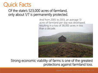
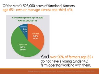
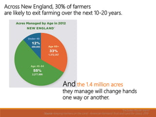
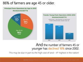
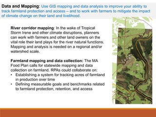
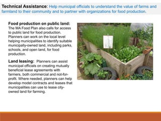
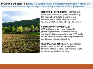
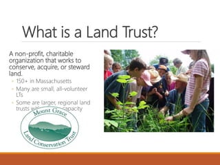
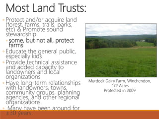
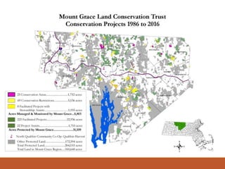
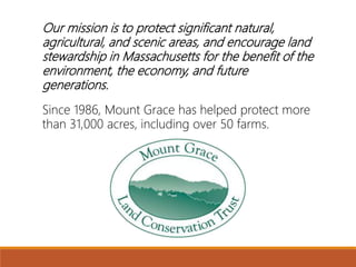
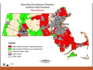
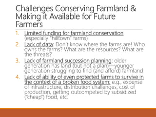
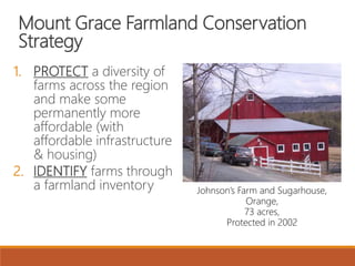
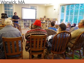
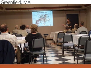
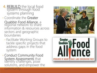
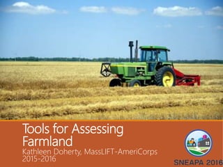
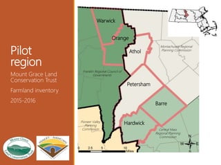
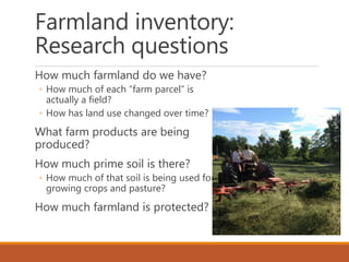
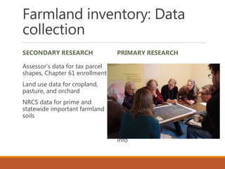
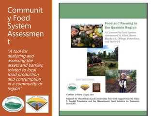
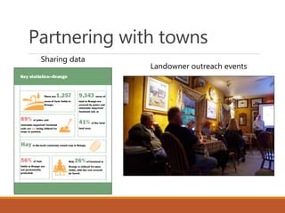
2. Presentation
outline
Land Access Challenges
Kathy Ruhf
Integrating Agriculture into
Community Planning
Mary Chicoine
The Role of Conservation
Organizations
Jamie Pottern
Tools for Assessing Farmland
Kathleen Doherty
Kathy Ruhf, Land for
Good
Mary Chicoine,
Franklin Regional
Council of
Governments
Jamie Pottern, Mount
Grace Land
Conservation Trust
Kathleen Doherty,
MassLIFT-
AmeriCorps 2015-
2016
4. Of the state’s 523,000 acres of farmland,
only about 1/7 is permanently protected.
Source: Massachusetts Local Food Action Plan 2015
Strong economic viability of farms is one of the greatest
protections against farmland loss.
And from 2005 to 2013, an average 13
acres of farmland per day was developed,
resulting in a loss of 38,000 acres in less
than a decade.
Quick Facts
5. Of the state’s 523,000 acres of farmland, farmers
age 65+ own or manage almost one-third of it.
And over 90% of farmers age 65+
do not have a young (under 45)
farm operator working with them.
Source: Keeping Farmers on the Land. American Farmland Trust and Land for Good, 2016.
6. Across New England, 30% of farmers
are likely to exit farming over the next 10-20 years.
*Excludes Rhode Island
Source: Keeping Farmers on the Land. American Farmland Trust and Land for Good, 2016.
And the 1.4 million acres
they manage will change hands
one way or another.
7. 86% of farmers are age 45 or older.
Source: Keeping Farmers on the Land. American Farmland Trust and Land for Good, 2016.
And the number of farmers 45 or
younger has declined 16% since 2002.
This may be due in part to the high cost of land – 4th highest in the nation!
9. The topic of land figures prominently in the
2015 MA Local Food Action Plan
Access to land was identified as one of the
most significant barriers to increasing food
production
Planners were identified as an important
resource to help address land access and
protection
Integrating agriculture into local
and regional planning could include
many different facets of
planning:
• land use and zoning
• economic development
• natural resources, climate
change
• social equity
• public health
and many more!
10. Urban Agriculture as Green Infrastructure: Urban farms provide
important ecological services amidst vast expanses of impermeable surfaces.
Some cities are exploring quantifying those benefits and providing
compensation to farmers for them.
Model Conservation Restrictions (CR) and Rivers: Farms that are
located along rivers can help steward water quality through their practices.
Planning agencies can work with land trusts to develop CRs for use on
agricultural land which calculate the value of leaving riparian buffers undisturbed
so they can serve as a floodplain, and are determining ways to provide financial
incentives to farmers who do so.
Land Use and Natural Resources:
Planners can explore innovative ways to provide farmers with incentives for providing
ecological services related to the land and water, such as carbon storage and water
protection.
11. Land Use and Zoning: Planners can use various zoning strategies to help
protect farmland and encourage infill develop.
Agricultural Overlay District: Agricultural overlay districts and other zoning tools to
can help protect farmland.
Large-Scale Solar Siting and Regulation: Towns need guidance around solar
development, including size and siting. Some arrays and installation techniques minimize
the long-term impact on agricultural resources and use existing infrastructure or marginal
land for siting.
Transfer of Development Rights (TDR): The MA Food plan calls for a statewide
TDR program, which would require enabling legislation. Absent that, planners can provide
interested communities with technical assistance on how to implement TDR in their town
or municipality.
Other Zoning: Open Space Residential Design, Cluster Commercial, and Back Lot
Development with Farmland Set-Aside (Buckland)
12. Data and Mapping: Use GIS mapping and data analysis to improve your ability to
track farmland protection and access – and to work with farmers to mitigate the impact
of climate change on their land and livelihood.
River corridor mapping: In the wake of Tropical
Storm Irene and other climate disruptions, planners
can work with farmers and other land owners on the
vital role their land plays for the river natural functions.
Mapping and analysis is needed on a regional and/or
watershed scale.
Farmland mapping and data collection: The MA
Food Plan calls for statewide mapping and data
collection on farmland. RPAs could collaborate on:
• Establishing a system for tracking acres of farmland
in production over time
• Defining measurable goals and benchmarks related
to farmland protection, retention, and access
13. Food production on public land:
The MA Food Plan also calls for access
to public land for food production.
Planners can work on the local level
helping municipalities to identify suitable
municipally-owned land, including parks,
schools, and open land, for food
production.
Land leasing: Planners can assist
municipal officials on creating mutually
beneficial lease agreements with
farmers, both commercial and not-for-
profit. Where needed, planners can help
develop model contracts and leases that
municipalities can use to lease city-
owned land for farming.
Technical Assistance: Help municipal officials to understand the value of farms and
farmland to their community and to partner with organizations for food production.
14. Benefits of agriculture: Planners can
assist town and municipalities in assessing
the value of agriculture in terms of job
creation, the multiplier effect/economic
impact, rural character and property values.
Community Preservation Act:
CPA funds are a source of funding for
preserving farmland. Planners can help
municipal officials understand how CPA funds
can be used to support farmland protection in
combination with other funding.
Other Planning Activities: As we work on
projects and reports, add an emphasis on
farmland if there is none, and improve existing
templates to prioritize farmland.
Technical Assistance: Help municipal officials to understand the value of farms and
farmland to their community and to partner with organizations for food production.
15. The Role of Conservation
Organizations
Jamie Pottern, Mount Grace Land
Conservation Trust
16. What is a Land Trust?
A non-profit, charitable
organization that works to
conserve, acquire, or steward
land.
◦ 150+ in Massachusetts
◦ Many are small, all-volunteer
LTs
◦ Some are larger, regional land
trusts with greater capacity
17. Most Land Trusts:
◦ Protect and/or acquire land
(forest, farms, trails, parks,
etc) & Promote sound
stewardship
◦ some, but not all, protect
farms
◦ Educate the general public,
especially kids
◦ Provide technical assistance
and added capacity to
landowners and local
organizations
◦ Have long-term relationships
with landowners, towns,
community groups, planning
agencies, and other regional
organizations.
◦ Many have been around for
±30 years.
Murdock Dairy Farm, Winchendon,
172 Acres
Protected in 2009
18.
19. Our mission is to protect significant natural,
agricultural, and scenic areas, and encourage land
stewardship in Massachusetts for the benefit of the
environment, the economy, and future
generations.
Since 1986, Mount Grace has helped protect more
than 31,000 acres, including over 50 farms.
20.
21. Challenges Conserving Farmland &
Making it Available for Future
Farmers
1. Limited funding for farmland conservation
(especially “hilltown” farms)
2. Lack of data: Don’t know where the farms are! Who
owns the farms? What are the resources? What are
the threats?
3. Lack of farmland succession planning: older
generation has land (but not a plan)—younger
generation struggling to find (and afford) farmland
4. Lack of ability of even protected farms to survive in
the context of a broken food system: e.g., expense
of infrastructure, distribution challenges, cost of
production, getting outcompeted by subsidized
(“cheap”) food, etc.
22. Mount Grace Farmland Conservation
Strategy
1. PROTECT a diversity of
farms across the region
and make some
permanently more
affordable (with
affordable infrastructure
& housing)
2. IDENTIFY farms through
a farmland inventory Johnson’s Farm and Sugarhouse,
Orange,
73 acres,
Protected in 2002
23. 3. UTILIZE farmland data for:
◦ Strategic planning for farmland conservation
◦ Priority Ranking of most threatened/important farms (for internal
farm conservation planning)
◦ Farmland Aggregation Projects: e.g. Landscape Partnership
Grant—aggregating farmland together that would be too hard to
protect on a one-off basis
◦ Identify best sites for conserving “whole farms” (land &
infrastructure) & addressing farm affordability e.g., Red Fire Farm
(shared ownership model)
◦ Provide accurate farmland data and Priority Ranking toolkit to
towns & planning community for open space planning
◦ Partner with diverse service providers, including Planning
Commissions & conduct outreach to farmers to provide them with
resources on:
◦ Estate Planning & Tax advisors
◦ Conservation
◦ Forestry & Farm technical assistance
◦ Farm Succession Planning (LFG)
◦ Leasing to farmers (e.g., Just Roots/Greenfield Town Farm)
27. 4. REBUILD the local food
system through food
systems planning
◦ Coordinate the Greater
Quabbin Food Alliance, a
regional network to share
information & resources across
sectors and geographic
boundaries
◦ Facilitate Working Groups to
tackle specific projects that
address gaps in the food
system
◦ Conduct Community Food
System Assessments that
identify challenges, pose
solutions, and empower the
community
29. Tools for assessing
farmland
1. Farmland inventory – where are the farms?
2. Priority ranking tool – which farms are most
threatened?
3. Community food system assessment – what
can we do to build a strong food system?
Case study:
Mount Grace
Land Conservation Trust
30. Potential applications
Open space planning
Master planning
Food system planning
Strategic planning
Tool for landowner outreach
There may be different outcomes for
different audiences!
31. Pilot
region
Mount Grace Land
Conservation Trust
Farmland inventory
2015-2016
Montachusett Regional
Planning Commission
Central Mass
Regional Planning
Commission
Franklin Regional Council of
Governments
Pioneer Valley
Planning
Commission
Warwick
Orange
Athol
Petersham
Barre
Hardwick
32. Farmland inventory:
Research questions
How much farmland do we have?
◦ How much of each “farm parcel” is
actually a field?
◦ How has land use changed over time?
What farm products are being
produced?
How much prime soil is there?
◦ How much of that soil is being used for
growing crops and pasture?
How much farmland is protected?
33. Farmland inventory: Data
collection
SECONDARY RESEARCH
Assessor’s data for tax parcel
shapes, Chapter 61 enrollment
Land use data for cropland,
pasture, and orchard
NRCS data for prime and
statewide important farmland
soils
PRIMARY RESEARCH
Farm products
Farm name
Farm infrastructure
Leasing info
Conservation status
Succession planning info
Updated landowner mailing
info
34. Priority ranking tool
What are your priorities?
◦ Which farms should be conserved first?
◦ Which town-owned parcels could be leased to
farmers?
◦ Which landowners could be targeted for an estate
planning workshop or other resources?
◦ Which farms might be included in a local food
brochure?
◦ Which landowners could benefit from outreach
about Chapter 61?
35. Priority
farms for
conservatio
n
“Large farms with
lots of prime soil
that produce a
diversity of
products and are
important to the
community”
Warwick
Orange
Athol
Petersham
Barre
Hardwick
36. Communit
y Food
System
Assessmen
t
“A tool for
analyzing and
assessing the
assets and barriers
related to local
food production
and consumption
in a community or
region”
Graphic from Food Well Alliance, http://www.foodwellalliance.org/
38. Tools for assessing
farmland: Lessons learned
1. Land trusts can partner with towns to
improve access to farmland and conserve the
most important farms first
2. A community-based approach to research
yields deeper findings
3. A Community Food System Assessment can
be a useful tool for communities to see
beyond farmland to the entire food system
39. Thank you
Kathy Ruhf, Land for Good
◦ kathy@landforgood.org
Mary Chicoine, Franklin Regional Council of
Governments
◦ maryc@frcog.org
Jamie Pottern, Mount Grace Land Conservation
Trust
◦ pottern@mountgrace.org
Kathleen Doherty, MassLIFT-AmeriCorps 2015-
2016
◦ kathleen@bear-paw.org
Editor's Notes
These stats track closely with New England wide stats
Urban Ag / Green Infrastructure: Examples: Land use planners in Cleveland have evaluated potential return on land use activities such as urban ag, using the triple bottom line of economic, social and environmental benefits to a community. And Baltimore approved a bill that provides urban farmers a property tax break of 90%, acknowledging the benefits of farms to the city.
Model CRs and Rivers Example: The Vermont Rivers Program River Corridor Easement Program provides financial incentives to landowners to allow for passive restoration of rivers and their floodplains.
Overlay districts: Example: Washington, NY Agricultural Zoning Ordinance in which overlay zones provide incentives or institute additional development standards for parcels with certain characteristics such as those that are greater than 10 acres, have at least 50 percent prime soils or are located in a certified agricultural district.
Solar:
TDRs: Hadley, Ma has an active TDR program. Montgomery County, MD established a TDR program with a Rural Density Transfer Zone where the minimum lot size is 25 acres. They also established high-density receiving zones.
River corridor: example tbd
Farmland mapping and date: example tbd
Food production and land leasing: example is Just Roots
Other examples tbd
Benefits of Ag: Example: Whately’s Benefits of Agriculture infographics
Community Preservation Act: tbd
Other Planning Activities: Examples includes master plans, open space plans, hazard mitigation, economic development, transportation and many others.
Other potential questions: patterns of ownership (e.g., town-owned land, owned versus leased farmland); Chapter 61 enrollment