SlideShare a Scribd company logo
International Indexed & Referred Research Journal, April, 2012. ISSN- 0974-2832, RNI-RAJBIL 2009/29954; VoL. IV * ISSUE-39
                                      Research Paper -Geography
            A Study on Flood Hazard in Dakshin Dinaj Pur
                     District of West Bengal,India
                 * Pradip Chouhan                                                                               April , 2012
        * Assistant Professor in Geography Gour Mahavidyalaya, Malda,
A B S T R A C T
 Flood is inundation of extensive area with water for several days. Flood, a natural phenomenon is a component of
 hydrological cycle of a drainage basin and is the result of excessive rainfall. Flood becomes hazard when it is responsible
 for the loss of human lives and properties. The general appearance of the Dakshin Dinajpur district is flat, sloping gently
 southward. Punarbhaba, Brahmani, Tangan, Ghagra and Atrayee are the main rivers of the district and flowing towards
 south. This study is an attempt to find out the causes and consequences of flood hazard in the district and to give suggestions
 to reduce flood hazards.
Key words: Flood, Inundation, Hydrological Cycle, Hazard
                                                                 ii) To highlight the problems associated with flood and
Introduction:                                                    iii)To give suggestions to check flood hazards.
          Flood occurred in Dakshin Dinajpur district
from very early history. As per the report of the West
Bengal Action Plan on Climate Change, Govt. of West
Bengal; about 42% of the state area is flood prone and
is manifested across the state by various modes. Floods
can be due to excess water carried over from
transnationals and inter state borders. Floods are caused
in North Bengal, by flood waters received through
rivers Teesta, Torsa, Jaldhaka, Raidak from Sikkim and
Bhutan. In Uttar and Dakshin Dinajpur by flood waters
in rivers passing through these two districts and origi-
nating in Bangladesh. Extreme rainfall, relating to late
monsoon cloud bursts also lead to floods here.
Study Area
          The District Dakshin Dinajpur came into ex-
istence on 01.04.1992 with bifurcation of West Dinajpur
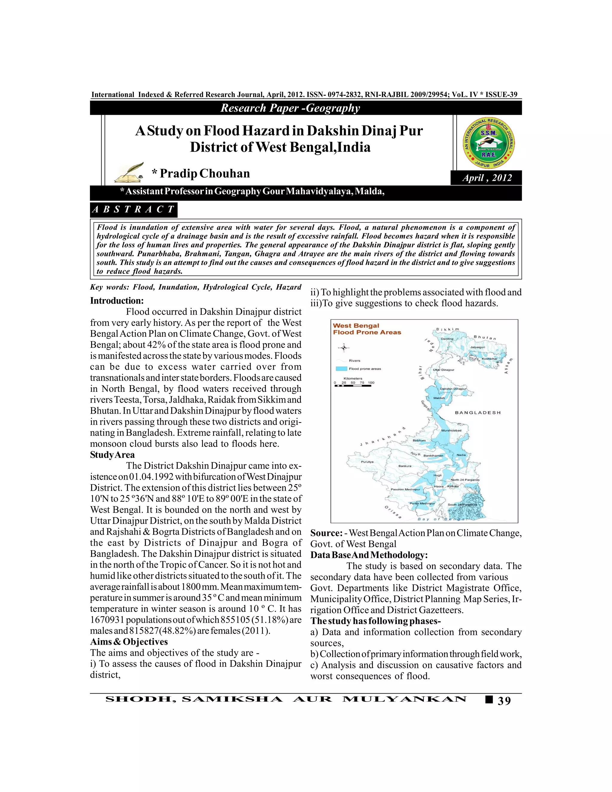
District. The extension of this district lies between 25º
10'N to 25 º36'N and 88º 10'E to 89º 00'E in the state of
West Bengal. It is bounded on the north and west by
Uttar Dinajpur District, on the south by Malda District
and Rajshahi & Bogrta Districts of Bangladesh and on             Source: - West Bengal Action Plan on Climate Change,
the east by Districts of Dinajpur and Bogra of                   Govt. of West Bengal
Bangladesh. The Dakshin Dinajpur district is situated            Data BaseAnd Methodology:
in the north of the Tropic of Cancer. So it is not hot and                The study is based on secondary data. The
humid like other districts situated to the south of it. The      secondary data have been collected from various
average rainfall is about 1800 mm. Mean maximum tem-             Govt. Departments like District Magistrate Office,
perature in summer is around 35 º C and mean minimum             Municipality Office, District Planning Map Series, Ir-
temperature in winter season is around 10 º C. It has            rigation Office and District Gazetteers.
1670931 populations out of which 855105 (51.18%) are             The study has following phases-
males and 815827(48.82%) are females (2011).                     a) Data and information collection from secondary
Aims & Objectives                                                sources,
The aims and objectives of the study are -                       b) Collection of primary information through field work,
i) To assess the causes of flood in Dakshin Dinajpur             c) Analysis and discussion on causative factors and
district,                                                        worst consequences of flood.

    SHODH, SAMIKSHA                                         AUR            MULYANKAN                                      39
International Indexed & Referred Research Journal, April, 2012. ISSN- 0974-2832, RNI-RAJBIL 2009/29954; VoL. IV * ISSUE-39
Causes of Flood Dakshin Dinajpur district faced the           4. Lack of advance flood warning message:
severe flood in 1987, 1988, 1991,1995,1998,1999 and                     The rivers flow from Bangladesh to
2001.Floods are caused by one or more unfavourable            Bangladesh via Dakshin Dinajpur .The rainfall report
and meteorological and physical factors (Khullar,             and advance flood warning messages are not commu-
2008).The main causes of flood are-                           nicated to the district authority to move peoples in
1. Insufficient depth of Rivers:                              safer places advance.
           The Punarbhaba, Brahmani, Tangan, Ghagra           5.Weak Embankment:
and Atrayee rivers are suffering from low water capac-                  During 1987,1988,1995 and 1998 floods weak
ity due to insufficient depth. Insufficient depth re-         Atrayee embankments near Patiram Nuniyapara,
duces the carrying capacity of the river channels             Bharabitala, Khidirpur, Dangi , Punarbhaba embank-
(Chouhan, 2004). As a result the rivers and channels          ment near Belbari, Shibbari ,Brahmani embankment near
take little time to attain bank full condition.               Laxmitala and Tangan embankment near Bansihari
2. Water Logging in Low Lands:                                breach due to huge pressure of flood water and exten-
           Some areas of the district (Kadighat,              sive area was flooded.
Narayanpur, Belbari, Buniadpur, Bolla, Jalghar,               6. Meandering River Courses:
Chakbhrugu, Amritakhanda etc.) have low lands. Due                      Meandering courses of Punarbhaba,
to heavy rain fall water logging in these areas is very       Brahmani, Tangan, Ghagra and Atrayee rivers obstruct
common.                                                       normal discharge of water .Consequently the meander-
3. Heavy Rainfall:                                            ing belts are over flooded.
           Heavy rainfall for long period in continuation     7. Inadequate Drainage:
is the root cause of river flood because immense vol-                   The channels of the rivers are narrow and due
ume of water either through high intensity rainfall or        to the deposition of sediments their carrying capacity
large scale snow melts is the prerequisite condition for      has been reduced.
river floods (Singh, 2001).In the district the situation      Effects of Flood: The effects of flood are -1. River bank
was alarming when an uninterrupted rainfall exceeds           erosion: The scenario of bank erosion is represented
776 mm in September during 1995 and which was the             below (Table-1),
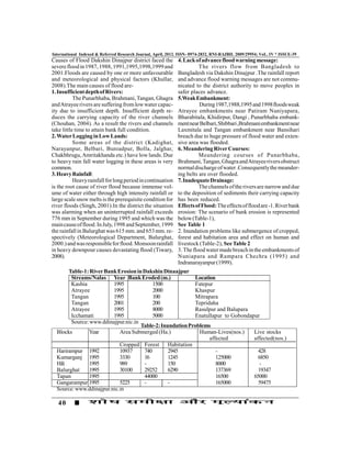
main cause of flood. In July, 1998 and September, 1999        See Table 1
the rainfall in Balurghat was 615 mm. and 653 mm. re-         2. Inundation problems like submergence of cropped,
spectively (Meteorological Department, Balurghat,             forest and habitation area and effect on human and
2000.) and was responsible for flood. Monsoon rainfall        livestock (Table-2), See Table 2
in heavy downpour causes devastating flood (Tiwary,           3. The flood water made breach in the embankments of
2008).                                                        Nuniapara and Rampara Chechra (1995) and
                                                              Indranarayanpur (1999).
       Table-1: River Bank Erosion in Dakshin Dinaajpur
        Streams/Nalas Year Bank Eroded (m.)                Location
        Kashia           1995             1500             Fatepur
        Atrayee          1995             2000             Khaspur
        Tangan           1995             100              Mitrapara
        Tangan           2001             200              Tepridaha
        Atrayee          1995             8000             Rasulpur and Balupara
        Icchamati        1995             5000             Enatullapur to Gobondapur
        Source: www.ddinajpur.nic.in
                                     Table-2: Inundation Problems
  Blocks       Year         Area Submerged (Ha.)             Human-Lives(nos.)    Live stocks
                                                                 affected         affected(nos.)
                            Cropped Forest Habitation
  Harirampur 1992           10937     740        2945               -               428
  Kumarganj 1995            3330      16         1245               125000          6850
  Hili         1995         989       -          150                8000            -
  Balurghat    1995         30100     29252      6290               137369          19347
  Tapan        1995                   44000                         16500         65000
  Gangarampur 1995          5225      -          -                  165000          59475
  Source: www.ddinajpur.nic.in

   40
International Indexed & Referred Research Journal, April, 2012. ISSN- 0974-2832, RNI-RAJBIL 2009/29954; VoL. IV * ISSUE-39
4 .In Gangarampur block Punarbhaba river shifted 10m               2. Rivers should be dredged in collaboration with
at Bardangi, 30m at Mallikpur, 35m at Hossainpur and               Bangladesh
20m at Narayanpur between 1995-1999.                               3. Strengthening the flood protecting bunds, culverts
Findings:                                                          and sluice gate construction
1. The main causes of flood in the district are lack of            4. Bank protection and afforestation in erosion prone
water capacity of rivers, water logging, heavy rainfall,           zones
weak embankment, lack of proper drainage system etc.               5. Raising and strengthening embankments of rivers
2. The main effects of flood are river bank erosion,               6. Adequate flood shelters should be constructed and
submergence of cropped, forest and habitation areas,               relief materials should be provided.
loss of human lives and live stocks.                               Conclusion: The district is one of the flood prone dis-
3. The existing flood control measures are not suffi-              tricts of West Bengal and agriculture is the most pre-
cient for severe flood.                                            dominant economic activity. Low intensity flood can
Suggestions:                                                       be tackled in the district, but in case of severe flood
1. Embankments are not prepared due to lack of avail-              existing remedial measures are not sufficient. So, govt.
ability of funds. So, govt. should provide adequate                should be aware of the fact and should take proper
fund                                                               flood control measures.

R E F E R E N C E
1. Chouhan, S (2004).Dissertation on Flood Situation of            Dinajpur.Survey of India.
Balurghat and its Surroundings of D.Dinalpur District by Atrayee   4. Singh, S (2001).Environmental Geography.Prayag Pustak
River, NBU.                                                        Bhaban.Allahabad.p.392
2.Khullar,D.R(2008).India-A Comprehensive Geography.               5. Tiwary, R. C (2008). Geography of India. Prayag Pustak
Kalyani Publisher. New Delhi.p.224.                                Bhaban.Allahabad.p.154. www.ddinajpur.nic.in
3. Mehta, S. P (1994). District Planning Map Series-Dakshin


    SHODH, SAMIKSHA                                          AUR           MULYANKAN                                 41

More Related Content

What's hot

Lecture 1 flood
Lecture 1 floodLecture 1 flood
Lecture 1 flood
Dr. H.M.A. Mahzuz
 
Save Ganga Presentation By Mallika Bhanot
Save Ganga Presentation By Mallika BhanotSave Ganga Presentation By Mallika Bhanot
Save Ganga Presentation By Mallika Bhanot
ManushiIndia
 
Endosulfan has not contaminated yamuna river scientific report
Endosulfan has not contaminated yamuna river  scientific reportEndosulfan has not contaminated yamuna river  scientific report
Endosulfan has not contaminated yamuna river scientific report
shreeramkannan
 
Reaching the Unreached_J&K report
Reaching the Unreached_J&K reportReaching the Unreached_J&K report
Reaching the Unreached_J&K reportDeepti Tripathi
 
DU_Presentation on Thesis _Flood Early Warning_Rev3_19 Mar 2015
DU_Presentation on Thesis _Flood Early Warning_Rev3_19 Mar 2015DU_Presentation on Thesis _Flood Early Warning_Rev3_19 Mar 2015
DU_Presentation on Thesis _Flood Early Warning_Rev3_19 Mar 2015Shafiqur Rahman
 
Dry River Musi and Gandipet
Dry River Musi and GandipetDry River Musi and Gandipet
Dry River Musi and Gandipet
Narasimha Reddy Donthi
 
Environmental impact assessment
Environmental impact assessmentEnvironmental impact assessment
Environmental impact assessment
endw
 
Evaluation of Non-structural and Structural Flood Management Measures
Evaluation of Non-structural and Structural Flood Management MeasuresEvaluation of Non-structural and Structural Flood Management Measures
Evaluation of Non-structural and Structural Flood Management Measures
AM Publications
 
Eacc bangladesh
Eacc bangladeshEacc bangladesh
Eacc bangladeshwiriana
 
Paase Koh Lecture Liongson
Paase Koh Lecture LiongsonPaase Koh Lecture Liongson
Paase Koh Lecture Liongsonleony1948
 
Y01201770183
Y01201770183Y01201770183
Y01201770183theijes
 
Flood Management in Bangladesh
Flood Management in Bangladesh Flood Management in Bangladesh
Lake lanao an ancient lake in distress
Lake lanao   an ancient lake in distressLake lanao   an ancient lake in distress
Lake lanao an ancient lake in distressPip Naga
 
Evs presentation
Evs presentationEvs presentation
Evs presentation
burhanuddinmp
 
The case of lake lanao 16042010
The case of lake lanao 16042010The case of lake lanao 16042010
The case of lake lanao 16042010Pip Naga
 
Analytical study on effects of water quality parameters using remote sensing ...
Analytical study on effects of water quality parameters using remote sensing ...Analytical study on effects of water quality parameters using remote sensing ...
Analytical study on effects of water quality parameters using remote sensing ...
eSAT Journals
 
Analytical study on effects of water quality parameters using remote sensing ...
Analytical study on effects of water quality parameters using remote sensing ...Analytical study on effects of water quality parameters using remote sensing ...
Analytical study on effects of water quality parameters using remote sensing ...
eSAT Publishing House
 
Revival of village tanks in Sri Lanka
Revival of village tanks in Sri LankaRevival of village tanks in Sri Lanka
Revival of village tanks in Sri Lanka
Dr. P.B.Dharmasena
 
Impact of flood disaster in a drought prone area – case study of alampur vill...
Impact of flood disaster in a drought prone area – case study of alampur vill...Impact of flood disaster in a drought prone area – case study of alampur vill...
Impact of flood disaster in a drought prone area – case study of alampur vill...
eSAT Publishing House
 
Institute of water and flood management (iwfm)
Institute of water and flood management (iwfm)Institute of water and flood management (iwfm)
Institute of water and flood management (iwfm)
Ahad Rudro
 

What's hot (20)

Lecture 1 flood
Lecture 1 floodLecture 1 flood
Lecture 1 flood
 
Save Ganga Presentation By Mallika Bhanot
Save Ganga Presentation By Mallika BhanotSave Ganga Presentation By Mallika Bhanot
Save Ganga Presentation By Mallika Bhanot
 
Endosulfan has not contaminated yamuna river scientific report
Endosulfan has not contaminated yamuna river  scientific reportEndosulfan has not contaminated yamuna river  scientific report
Endosulfan has not contaminated yamuna river scientific report
 
Reaching the Unreached_J&K report
Reaching the Unreached_J&K reportReaching the Unreached_J&K report
Reaching the Unreached_J&K report
 
DU_Presentation on Thesis _Flood Early Warning_Rev3_19 Mar 2015
DU_Presentation on Thesis _Flood Early Warning_Rev3_19 Mar 2015DU_Presentation on Thesis _Flood Early Warning_Rev3_19 Mar 2015
DU_Presentation on Thesis _Flood Early Warning_Rev3_19 Mar 2015
 
Dry River Musi and Gandipet
Dry River Musi and GandipetDry River Musi and Gandipet
Dry River Musi and Gandipet
 
Environmental impact assessment
Environmental impact assessmentEnvironmental impact assessment
Environmental impact assessment
 
Evaluation of Non-structural and Structural Flood Management Measures
Evaluation of Non-structural and Structural Flood Management MeasuresEvaluation of Non-structural and Structural Flood Management Measures
Evaluation of Non-structural and Structural Flood Management Measures
 
Eacc bangladesh
Eacc bangladeshEacc bangladesh
Eacc bangladesh
 
Paase Koh Lecture Liongson
Paase Koh Lecture LiongsonPaase Koh Lecture Liongson
Paase Koh Lecture Liongson
 
Y01201770183
Y01201770183Y01201770183
Y01201770183
 
Flood Management in Bangladesh
Flood Management in Bangladesh Flood Management in Bangladesh
Flood Management in Bangladesh
 
Lake lanao an ancient lake in distress
Lake lanao   an ancient lake in distressLake lanao   an ancient lake in distress
Lake lanao an ancient lake in distress
 
Evs presentation
Evs presentationEvs presentation
Evs presentation
 
The case of lake lanao 16042010
The case of lake lanao 16042010The case of lake lanao 16042010
The case of lake lanao 16042010
 
Analytical study on effects of water quality parameters using remote sensing ...
Analytical study on effects of water quality parameters using remote sensing ...Analytical study on effects of water quality parameters using remote sensing ...
Analytical study on effects of water quality parameters using remote sensing ...
 
Analytical study on effects of water quality parameters using remote sensing ...
Analytical study on effects of water quality parameters using remote sensing ...Analytical study on effects of water quality parameters using remote sensing ...
Analytical study on effects of water quality parameters using remote sensing ...
 
Revival of village tanks in Sri Lanka
Revival of village tanks in Sri LankaRevival of village tanks in Sri Lanka
Revival of village tanks in Sri Lanka
 
Impact of flood disaster in a drought prone area – case study of alampur vill...
Impact of flood disaster in a drought prone area – case study of alampur vill...Impact of flood disaster in a drought prone area – case study of alampur vill...
Impact of flood disaster in a drought prone area – case study of alampur vill...
 
Institute of water and flood management (iwfm)
Institute of water and flood management (iwfm)Institute of water and flood management (iwfm)
Institute of water and flood management (iwfm)
 

Viewers also liked

Viewers also liked (19)

RESEARCH ANALYSIS AND EVALUATION
RESEARCH ANALYSIS AND EVALUATIONRESEARCH ANALYSIS AND EVALUATION
RESEARCH ANALYSIS AND EVALUATION
 
RESEARCH ANALYSIS AND EVALUATION
RESEARCH ANALYSIS AND EVALUATIONRESEARCH ANALYSIS AND EVALUATION
RESEARCH ANALYSIS AND EVALUATION
 
163 167
163 167163 167
163 167
 
INTERNATIONAL INDEXED REFEREED RESEARCH PAPER
INTERNATIONAL INDEXED REFEREED RESEARCH PAPERINTERNATIONAL INDEXED REFEREED RESEARCH PAPER
INTERNATIONAL INDEXED REFEREED RESEARCH PAPER
 
3 5
3 53 5
3 5
 
RESEARCH ANALYSIS AND EVALUATION
RESEARCH ANALYSIS AND EVALUATIONRESEARCH ANALYSIS AND EVALUATION
RESEARCH ANALYSIS AND EVALUATION
 
RESEARCH ANALYSIS AND EVALUATION
RESEARCH ANALYSIS AND EVALUATIONRESEARCH ANALYSIS AND EVALUATION
RESEARCH ANALYSIS AND EVALUATION
 
20 24
20 2420 24
20 24
 
151 153
151 153151 153
151 153
 
131 133
131 133131 133
131 133
 
128 130
128 130128 130
128 130
 
RESEARCH ANALYSIS AND EVALUATION
RESEARCH ANALYSIS AND EVALUATIONRESEARCH ANALYSIS AND EVALUATION
RESEARCH ANALYSIS AND EVALUATION
 
94 96
94 9694 96
94 96
 
RESEARCH ANALYSIS AND EVALUATION
RESEARCH ANALYSIS AND EVALUATIONRESEARCH ANALYSIS AND EVALUATION
RESEARCH ANALYSIS AND EVALUATION
 
77 79
77 7977 79
77 79
 
41 43
41 4341 43
41 43
 
19 23
19 2319 23
19 23
 
RESEARCH ANALYSIS AND EVALUATION
RESEARCH ANALYSIS AND EVALUATIONRESEARCH ANALYSIS AND EVALUATION
RESEARCH ANALYSIS AND EVALUATION
 
RESEARCH ANALYSIS AND EVALUATION
RESEARCH ANALYSIS AND EVALUATIONRESEARCH ANALYSIS AND EVALUATION
RESEARCH ANALYSIS AND EVALUATION
 

Similar to 39 41

Flood hazards in india
Flood hazards in indiaFlood hazards in india
Flood hazards in india
Manjit Das
 
ASSIGNMENT 3 final.pdf
ASSIGNMENT 3 final.pdfASSIGNMENT 3 final.pdf
ASSIGNMENT 3 final.pdf
amatulwasey
 
Himalayan tsunami
Himalayan tsunamiHimalayan tsunami
Himalayan tsunami
Mahendra Poudel
 
RAIN WATER HARVESTING AROUND RAMTEK AREA (PERTAINING TO DUDHALA LAKE)
RAIN WATER HARVESTING AROUND RAMTEK AREA (PERTAINING TO DUDHALA LAKE)RAIN WATER HARVESTING AROUND RAMTEK AREA (PERTAINING TO DUDHALA LAKE)
RAIN WATER HARVESTING AROUND RAMTEK AREA (PERTAINING TO DUDHALA LAKE)
ijiert bestjournal
 
Exploring groundwater level of namakkal district in tamil nadu by employing g...
Exploring groundwater level of namakkal district in tamil nadu by employing g...Exploring groundwater level of namakkal district in tamil nadu by employing g...
Exploring groundwater level of namakkal district in tamil nadu by employing g...
IRJET Journal
 
Climate change science, knowledge and impacts on water resources in South Asia
Climate change science, knowledge and impacts on water resources in South AsiaClimate change science, knowledge and impacts on water resources in South Asia
Climate change science, knowledge and impacts on water resources in South Asia
International Water Management Institute (IWMI)
 
The Kedarnath Trajedy
The Kedarnath TrajedyThe Kedarnath Trajedy
The Kedarnath Trajedy
vishvjeet tholia
 
Lesson 9 sri lankan environment
Lesson 9   sri lankan environmentLesson 9   sri lankan environment
Lesson 9 sri lankan environment
Dr. P.B.Dharmasena
 
Introduction to Watershed Management
Introduction to Watershed ManagementIntroduction to Watershed Management
Introduction to Watershed Management
Malla Reddy University
 
5. devendra singh and g.s. chauhan
5. devendra singh  and g.s. chauhan5. devendra singh  and g.s. chauhan
5. devendra singh and g.s. chauhan
Journal of Global Resources
 
Investigation of salinity, livilihood and safe drinking water crisis
Investigation of salinity, livilihood and safe drinking water crisisInvestigation of salinity, livilihood and safe drinking water crisis
Investigation of salinity, livilihood and safe drinking water crisis
jihan ibrahim
 
(2)_IJGES_A023_(p.12-24)
(2)_IJGES_A023_(p.12-24)(2)_IJGES_A023_(p.12-24)
(2)_IJGES_A023_(p.12-24)rakeshsucks
 
Chitwan sand mining
Chitwan sand miningChitwan sand mining
Chitwan sand mining
Hari Krishna Shrestha
 
disaster management
disaster managementdisaster management
disaster management
YuktiSharma44
 
Environmental and Socio-economic Impacts of Gorkha Earthquake, Nepal
Environmental and Socio-economic Impacts of Gorkha Earthquake, Nepal Environmental and Socio-economic Impacts of Gorkha Earthquake, Nepal
Environmental and Socio-economic Impacts of Gorkha Earthquake, Nepal
Saroj Upadhyay
 
Bangladesh Flooding
Bangladesh FloodingBangladesh Flooding
Bangladesh Floodingsamuel valko
 
Concept of Basin, Watershed, Sub watershed and Micro watershed in Nepalese co...
Concept of Basin, Watershed, Sub watershed and Micro watershed in Nepalese co...Concept of Basin, Watershed, Sub watershed and Micro watershed in Nepalese co...
Concept of Basin, Watershed, Sub watershed and Micro watershed in Nepalese co...
AvinashKafle2
 
Sequential Damming Induced Winter Season Flash Flood in Uttarakhand Province ...
Sequential Damming Induced Winter Season Flash Flood in Uttarakhand Province ...Sequential Damming Induced Winter Season Flash Flood in Uttarakhand Province ...
Sequential Damming Induced Winter Season Flash Flood in Uttarakhand Province ...
Bilingual Publishing Group
 
Cyclone Phailin in Odisha, 2013
Cyclone Phailin in Odisha, 2013Cyclone Phailin in Odisha, 2013
Cyclone Phailin in Odisha, 2013
Hrishikesh Satpute
 
Wet lands day
Wet lands dayWet lands day
Wet lands day
Supratim Karmakar
 

Similar to 39 41 (20)

Flood hazards in india
Flood hazards in indiaFlood hazards in india
Flood hazards in india
 
ASSIGNMENT 3 final.pdf
ASSIGNMENT 3 final.pdfASSIGNMENT 3 final.pdf
ASSIGNMENT 3 final.pdf
 
Himalayan tsunami
Himalayan tsunamiHimalayan tsunami
Himalayan tsunami
 
RAIN WATER HARVESTING AROUND RAMTEK AREA (PERTAINING TO DUDHALA LAKE)
RAIN WATER HARVESTING AROUND RAMTEK AREA (PERTAINING TO DUDHALA LAKE)RAIN WATER HARVESTING AROUND RAMTEK AREA (PERTAINING TO DUDHALA LAKE)
RAIN WATER HARVESTING AROUND RAMTEK AREA (PERTAINING TO DUDHALA LAKE)
 
Exploring groundwater level of namakkal district in tamil nadu by employing g...
Exploring groundwater level of namakkal district in tamil nadu by employing g...Exploring groundwater level of namakkal district in tamil nadu by employing g...
Exploring groundwater level of namakkal district in tamil nadu by employing g...
 
Climate change science, knowledge and impacts on water resources in South Asia
Climate change science, knowledge and impacts on water resources in South AsiaClimate change science, knowledge and impacts on water resources in South Asia
Climate change science, knowledge and impacts on water resources in South Asia
 
The Kedarnath Trajedy
The Kedarnath TrajedyThe Kedarnath Trajedy
The Kedarnath Trajedy
 
Lesson 9 sri lankan environment
Lesson 9   sri lankan environmentLesson 9   sri lankan environment
Lesson 9 sri lankan environment
 
Introduction to Watershed Management
Introduction to Watershed ManagementIntroduction to Watershed Management
Introduction to Watershed Management
 
5. devendra singh and g.s. chauhan
5. devendra singh  and g.s. chauhan5. devendra singh  and g.s. chauhan
5. devendra singh and g.s. chauhan
 
Investigation of salinity, livilihood and safe drinking water crisis
Investigation of salinity, livilihood and safe drinking water crisisInvestigation of salinity, livilihood and safe drinking water crisis
Investigation of salinity, livilihood and safe drinking water crisis
 
(2)_IJGES_A023_(p.12-24)
(2)_IJGES_A023_(p.12-24)(2)_IJGES_A023_(p.12-24)
(2)_IJGES_A023_(p.12-24)
 
Chitwan sand mining
Chitwan sand miningChitwan sand mining
Chitwan sand mining
 
disaster management
disaster managementdisaster management
disaster management
 
Environmental and Socio-economic Impacts of Gorkha Earthquake, Nepal
Environmental and Socio-economic Impacts of Gorkha Earthquake, Nepal Environmental and Socio-economic Impacts of Gorkha Earthquake, Nepal
Environmental and Socio-economic Impacts of Gorkha Earthquake, Nepal
 
Bangladesh Flooding
Bangladesh FloodingBangladesh Flooding
Bangladesh Flooding
 
Concept of Basin, Watershed, Sub watershed and Micro watershed in Nepalese co...
Concept of Basin, Watershed, Sub watershed and Micro watershed in Nepalese co...Concept of Basin, Watershed, Sub watershed and Micro watershed in Nepalese co...
Concept of Basin, Watershed, Sub watershed and Micro watershed in Nepalese co...
 
Sequential Damming Induced Winter Season Flash Flood in Uttarakhand Province ...
Sequential Damming Induced Winter Season Flash Flood in Uttarakhand Province ...Sequential Damming Induced Winter Season Flash Flood in Uttarakhand Province ...
Sequential Damming Induced Winter Season Flash Flood in Uttarakhand Province ...
 
Cyclone Phailin in Odisha, 2013
Cyclone Phailin in Odisha, 2013Cyclone Phailin in Odisha, 2013
Cyclone Phailin in Odisha, 2013
 
Wet lands day
Wet lands dayWet lands day
Wet lands day
 

More from INTERNATIONAL INDEXED,REFERRED,MULTILINGUAL,INTERDISCIPLINARY, MONTHLY RESEARCH JOURNAL

Effect of Pesticide 'Companion' on the Nutritional Composition and Certain Me...
Effect of Pesticide 'Companion' on the Nutritional Composition and Certain Me...Effect of Pesticide 'Companion' on the Nutritional Composition and Certain Me...
Effect of Pesticide 'Companion' on the Nutritional Composition and Certain Me...
INTERNATIONAL INDEXED,REFERRED,MULTILINGUAL,INTERDISCIPLINARY, MONTHLY RESEARCH JOURNAL
 
The Geo-Strategic Significance of Afghanistan : From The Past to The Present...
The Geo-Strategic Significance of Afghanistan :  From The Past to The Present...The Geo-Strategic Significance of Afghanistan :  From The Past to The Present...
The Geo-Strategic Significance of Afghanistan : From The Past to The Present...
INTERNATIONAL INDEXED,REFERRED,MULTILINGUAL,INTERDISCIPLINARY, MONTHLY RESEARCH JOURNAL
 
Acculturation And Diasporic Influence In Uma Parmeswaran's "What Was Always H...
Acculturation And Diasporic Influence In Uma Parmeswaran's "What Was Always H...Acculturation And Diasporic Influence In Uma Parmeswaran's "What Was Always H...
Acculturation And Diasporic Influence In Uma Parmeswaran's "What Was Always H...
INTERNATIONAL INDEXED,REFERRED,MULTILINGUAL,INTERDISCIPLINARY, MONTHLY RESEARCH JOURNAL
 

More from INTERNATIONAL INDEXED,REFERRED,MULTILINGUAL,INTERDISCIPLINARY, MONTHLY RESEARCH JOURNAL (20)

Effect of Pesticide 'Companion' on the Nutritional Composition and Certain Me...
Effect of Pesticide 'Companion' on the Nutritional Composition and Certain Me...Effect of Pesticide 'Companion' on the Nutritional Composition and Certain Me...
Effect of Pesticide 'Companion' on the Nutritional Composition and Certain Me...
 
The Geo-Strategic Significance of Afghanistan : From The Past to The Present...
The Geo-Strategic Significance of Afghanistan :  From The Past to The Present...The Geo-Strategic Significance of Afghanistan :  From The Past to The Present...
The Geo-Strategic Significance of Afghanistan : From The Past to The Present...
 
Acculturation And Diasporic Influence In Uma Parmeswaran's "What Was Always H...
Acculturation And Diasporic Influence In Uma Parmeswaran's "What Was Always H...Acculturation And Diasporic Influence In Uma Parmeswaran's "What Was Always H...
Acculturation And Diasporic Influence In Uma Parmeswaran's "What Was Always H...
 
Goel-INTERNATIONAL INDEXED REFEREED RESEARCH PAPER
Goel-INTERNATIONAL INDEXED REFEREED RESEARCH PAPERGoel-INTERNATIONAL INDEXED REFEREED RESEARCH PAPER
Goel-INTERNATIONAL INDEXED REFEREED RESEARCH PAPER
 
INTERNATIONAL INDEXED REFEREED RESEARCH PAPER
INTERNATIONAL INDEXED REFEREED RESEARCH PAPERINTERNATIONAL INDEXED REFEREED RESEARCH PAPER
INTERNATIONAL INDEXED REFEREED RESEARCH PAPER
 
INTERNATIONAL INDEXED REFEREED RESEARCH PAPER
INTERNATIONAL INDEXED REFEREED RESEARCH PAPERINTERNATIONAL INDEXED REFEREED RESEARCH PAPER
INTERNATIONAL INDEXED REFEREED RESEARCH PAPER
 
INTERNATIONAL INDEXED REFEREED RESEARCH PAPER
INTERNATIONAL INDEXED REFEREED RESEARCH PAPERINTERNATIONAL INDEXED REFEREED RESEARCH PAPER
INTERNATIONAL INDEXED REFEREED RESEARCH PAPER
 
INTERNATIONAL INDEXED REFEREED RESEARCH PAPER
INTERNATIONAL INDEXED REFEREED RESEARCH PAPERINTERNATIONAL INDEXED REFEREED RESEARCH PAPER
INTERNATIONAL INDEXED REFEREED RESEARCH PAPER
 
INTERNATIONAL INDEXED REFEREED RESEARCH PAPER
INTERNATIONAL INDEXED REFEREED RESEARCH PAPERINTERNATIONAL INDEXED REFEREED RESEARCH PAPER
INTERNATIONAL INDEXED REFEREED RESEARCH PAPER
 
INTERNATIONAL INDEXED REFEREED RESEARCH PAPER
INTERNATIONAL INDEXED REFEREED RESEARCH PAPERINTERNATIONAL INDEXED REFEREED RESEARCH PAPER
INTERNATIONAL INDEXED REFEREED RESEARCH PAPER
 
INTERNATIONAL INDEXED REFEREED RESEARCH PAPER
INTERNATIONAL INDEXED REFEREED RESEARCH PAPERINTERNATIONAL INDEXED REFEREED RESEARCH PAPER
INTERNATIONAL INDEXED REFEREED RESEARCH PAPER
 
INTERNATIONAL INDEXED REFEREED RESEARCH PAPER
INTERNATIONAL INDEXED REFEREED RESEARCH PAPERINTERNATIONAL INDEXED REFEREED RESEARCH PAPER
INTERNATIONAL INDEXED REFEREED RESEARCH PAPER
 
INTERNATIONAL INDEXED REFEREED RESEARCH PAPER
INTERNATIONAL INDEXED REFEREED RESEARCH PAPERINTERNATIONAL INDEXED REFEREED RESEARCH PAPER
INTERNATIONAL INDEXED REFEREED RESEARCH PAPER
 
INTERNATIONAL INDEXED REFEREED RESEARCH PAPER
INTERNATIONAL INDEXED REFEREED RESEARCH PAPERINTERNATIONAL INDEXED REFEREED RESEARCH PAPER
INTERNATIONAL INDEXED REFEREED RESEARCH PAPER
 
INTERNATIONAL INDEXED REFEREED RESEARCH PAPER
INTERNATIONAL INDEXED REFEREED RESEARCH PAPERINTERNATIONAL INDEXED REFEREED RESEARCH PAPER
INTERNATIONAL INDEXED REFEREED RESEARCH PAPER
 
INTERNATIONAL INDEXED REFEREED RESEARCH PAPER
INTERNATIONAL INDEXED REFEREED RESEARCH PAPERINTERNATIONAL INDEXED REFEREED RESEARCH PAPER
INTERNATIONAL INDEXED REFEREED RESEARCH PAPER
 
INTERNATIONAL INDEXED REFEREED RESEARCH PAPER
INTERNATIONAL INDEXED REFEREED RESEARCH PAPERINTERNATIONAL INDEXED REFEREED RESEARCH PAPER
INTERNATIONAL INDEXED REFEREED RESEARCH PAPER
 
INTERNATIONAL INDEXED REFEREED RESEARCH PAPER
INTERNATIONAL INDEXED REFEREED RESEARCH PAPERINTERNATIONAL INDEXED REFEREED RESEARCH PAPER
INTERNATIONAL INDEXED REFEREED RESEARCH PAPER
 
INTERNATIONAL INDEXED REFEREED RESEARCH PAPER
INTERNATIONAL INDEXED REFEREED RESEARCH PAPERINTERNATIONAL INDEXED REFEREED RESEARCH PAPER
INTERNATIONAL INDEXED REFEREED RESEARCH PAPER
 
INTERNATIONAL INDEXED REFEREED RESEARCH PAPER
INTERNATIONAL INDEXED REFEREED RESEARCH PAPERINTERNATIONAL INDEXED REFEREED RESEARCH PAPER
INTERNATIONAL INDEXED REFEREED RESEARCH PAPER
 

Recently uploaded

Securing your Kubernetes cluster_ a step-by-step guide to success !
Securing your Kubernetes cluster_ a step-by-step guide to success !Securing your Kubernetes cluster_ a step-by-step guide to success !
Securing your Kubernetes cluster_ a step-by-step guide to success !
KatiaHIMEUR1
 
Generative AI Deep Dive: Advancing from Proof of Concept to Production
Generative AI Deep Dive: Advancing from Proof of Concept to ProductionGenerative AI Deep Dive: Advancing from Proof of Concept to Production
Generative AI Deep Dive: Advancing from Proof of Concept to Production
Aggregage
 
Elizabeth Buie - Older adults: Are we really designing for our future selves?
Elizabeth Buie - Older adults: Are we really designing for our future selves?Elizabeth Buie - Older adults: Are we really designing for our future selves?
Elizabeth Buie - Older adults: Are we really designing for our future selves?
Nexer Digital
 
GraphSummit Singapore | Graphing Success: Revolutionising Organisational Stru...
GraphSummit Singapore | Graphing Success: Revolutionising Organisational Stru...GraphSummit Singapore | Graphing Success: Revolutionising Organisational Stru...
GraphSummit Singapore | Graphing Success: Revolutionising Organisational Stru...
Neo4j
 
GridMate - End to end testing is a critical piece to ensure quality and avoid...
GridMate - End to end testing is a critical piece to ensure quality and avoid...GridMate - End to end testing is a critical piece to ensure quality and avoid...
GridMate - End to end testing is a critical piece to ensure quality and avoid...
ThomasParaiso2
 
FIDO Alliance Osaka Seminar: The WebAuthn API and Discoverable Credentials.pdf
FIDO Alliance Osaka Seminar: The WebAuthn API and Discoverable Credentials.pdfFIDO Alliance Osaka Seminar: The WebAuthn API and Discoverable Credentials.pdf
FIDO Alliance Osaka Seminar: The WebAuthn API and Discoverable Credentials.pdf
FIDO Alliance
 
LF Energy Webinar: Electrical Grid Modelling and Simulation Through PowSyBl -...
LF Energy Webinar: Electrical Grid Modelling and Simulation Through PowSyBl -...LF Energy Webinar: Electrical Grid Modelling and Simulation Through PowSyBl -...
LF Energy Webinar: Electrical Grid Modelling and Simulation Through PowSyBl -...
DanBrown980551
 
20240607 QFM018 Elixir Reading List May 2024
20240607 QFM018 Elixir Reading List May 202420240607 QFM018 Elixir Reading List May 2024
20240607 QFM018 Elixir Reading List May 2024
Matthew Sinclair
 
Monitoring Java Application Security with JDK Tools and JFR Events
Monitoring Java Application Security with JDK Tools and JFR EventsMonitoring Java Application Security with JDK Tools and JFR Events
Monitoring Java Application Security with JDK Tools and JFR Events
Ana-Maria Mihalceanu
 
Large Language Model (LLM) and it’s Geospatial Applications
Large Language Model (LLM) and it’s Geospatial ApplicationsLarge Language Model (LLM) and it’s Geospatial Applications
Large Language Model (LLM) and it’s Geospatial Applications
Rohit Gautam
 
20240609 QFM020 Irresponsible AI Reading List May 2024
20240609 QFM020 Irresponsible AI Reading List May 202420240609 QFM020 Irresponsible AI Reading List May 2024
20240609 QFM020 Irresponsible AI Reading List May 2024
Matthew Sinclair
 
DevOps and Testing slides at DASA Connect
DevOps and Testing slides at DASA ConnectDevOps and Testing slides at DASA Connect
DevOps and Testing slides at DASA Connect
Kari Kakkonen
 
Goodbye Windows 11: Make Way for Nitrux Linux 3.5.0!
Goodbye Windows 11: Make Way for Nitrux Linux 3.5.0!Goodbye Windows 11: Make Way for Nitrux Linux 3.5.0!
Goodbye Windows 11: Make Way for Nitrux Linux 3.5.0!
SOFTTECHHUB
 
GraphSummit Singapore | The Future of Agility: Supercharging Digital Transfor...
GraphSummit Singapore | The Future of Agility: Supercharging Digital Transfor...GraphSummit Singapore | The Future of Agility: Supercharging Digital Transfor...
GraphSummit Singapore | The Future of Agility: Supercharging Digital Transfor...
Neo4j
 
Pushing the limits of ePRTC: 100ns holdover for 100 days
Pushing the limits of ePRTC: 100ns holdover for 100 daysPushing the limits of ePRTC: 100ns holdover for 100 days
Pushing the limits of ePRTC: 100ns holdover for 100 days
Adtran
 
By Design, not by Accident - Agile Venture Bolzano 2024
By Design, not by Accident - Agile Venture Bolzano 2024By Design, not by Accident - Agile Venture Bolzano 2024
By Design, not by Accident - Agile Venture Bolzano 2024
Pierluigi Pugliese
 
Building RAG with self-deployed Milvus vector database and Snowpark Container...
Building RAG with self-deployed Milvus vector database and Snowpark Container...Building RAG with self-deployed Milvus vector database and Snowpark Container...
Building RAG with self-deployed Milvus vector database and Snowpark Container...
Zilliz
 
Unlock the Future of Search with MongoDB Atlas_ Vector Search Unleashed.pdf
Unlock the Future of Search with MongoDB Atlas_ Vector Search Unleashed.pdfUnlock the Future of Search with MongoDB Atlas_ Vector Search Unleashed.pdf
Unlock the Future of Search with MongoDB Atlas_ Vector Search Unleashed.pdf
Malak Abu Hammad
 
GraphSummit Singapore | Enhancing Changi Airport Group's Passenger Experience...
GraphSummit Singapore | Enhancing Changi Airport Group's Passenger Experience...GraphSummit Singapore | Enhancing Changi Airport Group's Passenger Experience...
GraphSummit Singapore | Enhancing Changi Airport Group's Passenger Experience...
Neo4j
 
Video Streaming: Then, Now, and in the Future
Video Streaming: Then, Now, and in the FutureVideo Streaming: Then, Now, and in the Future
Video Streaming: Then, Now, and in the Future
Alpen-Adria-Universität
 

Recently uploaded (20)

Securing your Kubernetes cluster_ a step-by-step guide to success !
Securing your Kubernetes cluster_ a step-by-step guide to success !Securing your Kubernetes cluster_ a step-by-step guide to success !
Securing your Kubernetes cluster_ a step-by-step guide to success !
 
Generative AI Deep Dive: Advancing from Proof of Concept to Production
Generative AI Deep Dive: Advancing from Proof of Concept to ProductionGenerative AI Deep Dive: Advancing from Proof of Concept to Production
Generative AI Deep Dive: Advancing from Proof of Concept to Production
 
Elizabeth Buie - Older adults: Are we really designing for our future selves?
Elizabeth Buie - Older adults: Are we really designing for our future selves?Elizabeth Buie - Older adults: Are we really designing for our future selves?
Elizabeth Buie - Older adults: Are we really designing for our future selves?
 
GraphSummit Singapore | Graphing Success: Revolutionising Organisational Stru...
GraphSummit Singapore | Graphing Success: Revolutionising Organisational Stru...GraphSummit Singapore | Graphing Success: Revolutionising Organisational Stru...
GraphSummit Singapore | Graphing Success: Revolutionising Organisational Stru...
 
GridMate - End to end testing is a critical piece to ensure quality and avoid...
GridMate - End to end testing is a critical piece to ensure quality and avoid...GridMate - End to end testing is a critical piece to ensure quality and avoid...
GridMate - End to end testing is a critical piece to ensure quality and avoid...
 
FIDO Alliance Osaka Seminar: The WebAuthn API and Discoverable Credentials.pdf
FIDO Alliance Osaka Seminar: The WebAuthn API and Discoverable Credentials.pdfFIDO Alliance Osaka Seminar: The WebAuthn API and Discoverable Credentials.pdf
FIDO Alliance Osaka Seminar: The WebAuthn API and Discoverable Credentials.pdf
 
LF Energy Webinar: Electrical Grid Modelling and Simulation Through PowSyBl -...
LF Energy Webinar: Electrical Grid Modelling and Simulation Through PowSyBl -...LF Energy Webinar: Electrical Grid Modelling and Simulation Through PowSyBl -...
LF Energy Webinar: Electrical Grid Modelling and Simulation Through PowSyBl -...
 
20240607 QFM018 Elixir Reading List May 2024
20240607 QFM018 Elixir Reading List May 202420240607 QFM018 Elixir Reading List May 2024
20240607 QFM018 Elixir Reading List May 2024
 
Monitoring Java Application Security with JDK Tools and JFR Events
Monitoring Java Application Security with JDK Tools and JFR EventsMonitoring Java Application Security with JDK Tools and JFR Events
Monitoring Java Application Security with JDK Tools and JFR Events
 
Large Language Model (LLM) and it’s Geospatial Applications
Large Language Model (LLM) and it’s Geospatial ApplicationsLarge Language Model (LLM) and it’s Geospatial Applications
Large Language Model (LLM) and it’s Geospatial Applications
 
20240609 QFM020 Irresponsible AI Reading List May 2024
20240609 QFM020 Irresponsible AI Reading List May 202420240609 QFM020 Irresponsible AI Reading List May 2024
20240609 QFM020 Irresponsible AI Reading List May 2024
 
DevOps and Testing slides at DASA Connect
DevOps and Testing slides at DASA ConnectDevOps and Testing slides at DASA Connect
DevOps and Testing slides at DASA Connect
 
Goodbye Windows 11: Make Way for Nitrux Linux 3.5.0!
Goodbye Windows 11: Make Way for Nitrux Linux 3.5.0!Goodbye Windows 11: Make Way for Nitrux Linux 3.5.0!
Goodbye Windows 11: Make Way for Nitrux Linux 3.5.0!
 
GraphSummit Singapore | The Future of Agility: Supercharging Digital Transfor...
GraphSummit Singapore | The Future of Agility: Supercharging Digital Transfor...GraphSummit Singapore | The Future of Agility: Supercharging Digital Transfor...
GraphSummit Singapore | The Future of Agility: Supercharging Digital Transfor...
 
Pushing the limits of ePRTC: 100ns holdover for 100 days
Pushing the limits of ePRTC: 100ns holdover for 100 daysPushing the limits of ePRTC: 100ns holdover for 100 days
Pushing the limits of ePRTC: 100ns holdover for 100 days
 
By Design, not by Accident - Agile Venture Bolzano 2024
By Design, not by Accident - Agile Venture Bolzano 2024By Design, not by Accident - Agile Venture Bolzano 2024
By Design, not by Accident - Agile Venture Bolzano 2024
 
Building RAG with self-deployed Milvus vector database and Snowpark Container...
Building RAG with self-deployed Milvus vector database and Snowpark Container...Building RAG with self-deployed Milvus vector database and Snowpark Container...
Building RAG with self-deployed Milvus vector database and Snowpark Container...
 
Unlock the Future of Search with MongoDB Atlas_ Vector Search Unleashed.pdf
Unlock the Future of Search with MongoDB Atlas_ Vector Search Unleashed.pdfUnlock the Future of Search with MongoDB Atlas_ Vector Search Unleashed.pdf
Unlock the Future of Search with MongoDB Atlas_ Vector Search Unleashed.pdf
 
GraphSummit Singapore | Enhancing Changi Airport Group's Passenger Experience...
GraphSummit Singapore | Enhancing Changi Airport Group's Passenger Experience...GraphSummit Singapore | Enhancing Changi Airport Group's Passenger Experience...
GraphSummit Singapore | Enhancing Changi Airport Group's Passenger Experience...
 
Video Streaming: Then, Now, and in the Future
Video Streaming: Then, Now, and in the FutureVideo Streaming: Then, Now, and in the Future
Video Streaming: Then, Now, and in the Future
 

39 41

  • 1. International Indexed & Referred Research Journal, April, 2012. ISSN- 0974-2832, RNI-RAJBIL 2009/29954; VoL. IV * ISSUE-39 Research Paper -Geography A Study on Flood Hazard in Dakshin Dinaj Pur District of West Bengal,India * Pradip Chouhan April , 2012 * Assistant Professor in Geography Gour Mahavidyalaya, Malda, A B S T R A C T Flood is inundation of extensive area with water for several days. Flood, a natural phenomenon is a component of hydrological cycle of a drainage basin and is the result of excessive rainfall. Flood becomes hazard when it is responsible for the loss of human lives and properties. The general appearance of the Dakshin Dinajpur district is flat, sloping gently southward. Punarbhaba, Brahmani, Tangan, Ghagra and Atrayee are the main rivers of the district and flowing towards south. This study is an attempt to find out the causes and consequences of flood hazard in the district and to give suggestions to reduce flood hazards. Key words: Flood, Inundation, Hydrological Cycle, Hazard ii) To highlight the problems associated with flood and Introduction: iii)To give suggestions to check flood hazards. Flood occurred in Dakshin Dinajpur district from very early history. As per the report of the West Bengal Action Plan on Climate Change, Govt. of West Bengal; about 42% of the state area is flood prone and is manifested across the state by various modes. Floods can be due to excess water carried over from transnationals and inter state borders. Floods are caused in North Bengal, by flood waters received through rivers Teesta, Torsa, Jaldhaka, Raidak from Sikkim and Bhutan. In Uttar and Dakshin Dinajpur by flood waters in rivers passing through these two districts and origi- nating in Bangladesh. Extreme rainfall, relating to late monsoon cloud bursts also lead to floods here. Study Area The District Dakshin Dinajpur came into ex- istence on 01.04.1992 with bifurcation of West Dinajpur District. The extension of this district lies between 25º 10'N to 25 º36'N and 88º 10'E to 89º 00'E in the state of West Bengal. It is bounded on the north and west by Uttar Dinajpur District, on the south by Malda District and Rajshahi & Bogrta Districts of Bangladesh and on Source: - West Bengal Action Plan on Climate Change, the east by Districts of Dinajpur and Bogra of Govt. of West Bengal Bangladesh. The Dakshin Dinajpur district is situated Data BaseAnd Methodology: in the north of the Tropic of Cancer. So it is not hot and The study is based on secondary data. The humid like other districts situated to the south of it. The secondary data have been collected from various average rainfall is about 1800 mm. Mean maximum tem- Govt. Departments like District Magistrate Office, perature in summer is around 35 º C and mean minimum Municipality Office, District Planning Map Series, Ir- temperature in winter season is around 10 º C. It has rigation Office and District Gazetteers. 1670931 populations out of which 855105 (51.18%) are The study has following phases- males and 815827(48.82%) are females (2011). a) Data and information collection from secondary Aims & Objectives sources, The aims and objectives of the study are - b) Collection of primary information through field work, i) To assess the causes of flood in Dakshin Dinajpur c) Analysis and discussion on causative factors and district, worst consequences of flood. SHODH, SAMIKSHA AUR MULYANKAN 39
  • 2. International Indexed & Referred Research Journal, April, 2012. ISSN- 0974-2832, RNI-RAJBIL 2009/29954; VoL. IV * ISSUE-39 Causes of Flood Dakshin Dinajpur district faced the 4. Lack of advance flood warning message: severe flood in 1987, 1988, 1991,1995,1998,1999 and The rivers flow from Bangladesh to 2001.Floods are caused by one or more unfavourable Bangladesh via Dakshin Dinajpur .The rainfall report and meteorological and physical factors (Khullar, and advance flood warning messages are not commu- 2008).The main causes of flood are- nicated to the district authority to move peoples in 1. Insufficient depth of Rivers: safer places advance. The Punarbhaba, Brahmani, Tangan, Ghagra 5.Weak Embankment: and Atrayee rivers are suffering from low water capac- During 1987,1988,1995 and 1998 floods weak ity due to insufficient depth. Insufficient depth re- Atrayee embankments near Patiram Nuniyapara, duces the carrying capacity of the river channels Bharabitala, Khidirpur, Dangi , Punarbhaba embank- (Chouhan, 2004). As a result the rivers and channels ment near Belbari, Shibbari ,Brahmani embankment near take little time to attain bank full condition. Laxmitala and Tangan embankment near Bansihari 2. Water Logging in Low Lands: breach due to huge pressure of flood water and exten- Some areas of the district (Kadighat, sive area was flooded. Narayanpur, Belbari, Buniadpur, Bolla, Jalghar, 6. Meandering River Courses: Chakbhrugu, Amritakhanda etc.) have low lands. Due Meandering courses of Punarbhaba, to heavy rain fall water logging in these areas is very Brahmani, Tangan, Ghagra and Atrayee rivers obstruct common. normal discharge of water .Consequently the meander- 3. Heavy Rainfall: ing belts are over flooded. Heavy rainfall for long period in continuation 7. Inadequate Drainage: is the root cause of river flood because immense vol- The channels of the rivers are narrow and due ume of water either through high intensity rainfall or to the deposition of sediments their carrying capacity large scale snow melts is the prerequisite condition for has been reduced. river floods (Singh, 2001).In the district the situation Effects of Flood: The effects of flood are -1. River bank was alarming when an uninterrupted rainfall exceeds erosion: The scenario of bank erosion is represented 776 mm in September during 1995 and which was the below (Table-1), main cause of flood. In July, 1998 and September, 1999 See Table 1 the rainfall in Balurghat was 615 mm. and 653 mm. re- 2. Inundation problems like submergence of cropped, spectively (Meteorological Department, Balurghat, forest and habitation area and effect on human and 2000.) and was responsible for flood. Monsoon rainfall livestock (Table-2), See Table 2 in heavy downpour causes devastating flood (Tiwary, 3. The flood water made breach in the embankments of 2008). Nuniapara and Rampara Chechra (1995) and Indranarayanpur (1999). Table-1: River Bank Erosion in Dakshin Dinaajpur Streams/Nalas Year Bank Eroded (m.) Location Kashia 1995 1500 Fatepur Atrayee 1995 2000 Khaspur Tangan 1995 100 Mitrapara Tangan 2001 200 Tepridaha Atrayee 1995 8000 Rasulpur and Balupara Icchamati 1995 5000 Enatullapur to Gobondapur Source: www.ddinajpur.nic.in Table-2: Inundation Problems Blocks Year Area Submerged (Ha.) Human-Lives(nos.) Live stocks affected affected(nos.) Cropped Forest Habitation Harirampur 1992 10937 740 2945 - 428 Kumarganj 1995 3330 16 1245 125000 6850 Hili 1995 989 - 150 8000 - Balurghat 1995 30100 29252 6290 137369 19347 Tapan 1995 44000 16500 65000 Gangarampur 1995 5225 - - 165000 59475 Source: www.ddinajpur.nic.in 40
  • 3. International Indexed & Referred Research Journal, April, 2012. ISSN- 0974-2832, RNI-RAJBIL 2009/29954; VoL. IV * ISSUE-39 4 .In Gangarampur block Punarbhaba river shifted 10m 2. Rivers should be dredged in collaboration with at Bardangi, 30m at Mallikpur, 35m at Hossainpur and Bangladesh 20m at Narayanpur between 1995-1999. 3. Strengthening the flood protecting bunds, culverts Findings: and sluice gate construction 1. The main causes of flood in the district are lack of 4. Bank protection and afforestation in erosion prone water capacity of rivers, water logging, heavy rainfall, zones weak embankment, lack of proper drainage system etc. 5. Raising and strengthening embankments of rivers 2. The main effects of flood are river bank erosion, 6. Adequate flood shelters should be constructed and submergence of cropped, forest and habitation areas, relief materials should be provided. loss of human lives and live stocks. Conclusion: The district is one of the flood prone dis- 3. The existing flood control measures are not suffi- tricts of West Bengal and agriculture is the most pre- cient for severe flood. dominant economic activity. Low intensity flood can Suggestions: be tackled in the district, but in case of severe flood 1. Embankments are not prepared due to lack of avail- existing remedial measures are not sufficient. So, govt. ability of funds. So, govt. should provide adequate should be aware of the fact and should take proper fund flood control measures. R E F E R E N C E 1. Chouhan, S (2004).Dissertation on Flood Situation of Dinajpur.Survey of India. Balurghat and its Surroundings of D.Dinalpur District by Atrayee 4. Singh, S (2001).Environmental Geography.Prayag Pustak River, NBU. Bhaban.Allahabad.p.392 2.Khullar,D.R(2008).India-A Comprehensive Geography. 5. Tiwary, R. C (2008). Geography of India. Prayag Pustak Kalyani Publisher. New Delhi.p.224. Bhaban.Allahabad.p.154. www.ddinajpur.nic.in 3. Mehta, S. P (1994). District Planning Map Series-Dakshin SHODH, SAMIKSHA AUR MULYANKAN 41