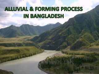
Alluvial & forming process in baangladesh
•Download as PPT, PDF•
0 likes•78 views

From Nazla Bushra and Dr. Seraj

Recommended
More Related Content
What's hot
What's hot (20)
Similar to Alluvial & forming process in baangladesh
Similar to Alluvial & forming process in baangladesh (20)
Recently uploaded
Recently uploaded (20)
Alluvial & forming process in baangladesh
- 3. •Morphology •Hydrology •Quaternary Deposits •Deltaic Lands & Wetland Environment
- 4. THE INTERLINKED PROCESSES Deltaic Lands & Wetland Environment Morphology Hydrology Quaternary Deposits
- 6. Indian Landmass Srilanka 71 million years ago 55 million years ago 38 million years ago 10 million years ago
- 8. Ganges-Brahmaputra Delta have 1670 million tons of sediment load per year.
- 11. Shillong Shield Indoburman Range Bay of Bengal
- 13. Stable Platform Deep (geosynclinal) Basin Hinge Zone
- 14. Dinajpur Shield Bogra Shelf Foredeep Foldbelt STABLE PLATFORM HINGE ZONE GEOSYNCLINAL BASIN On the basis of thickness of sedimentary cover- • Rangpur Saddle or Dinajpur Shield • Bogra Shelf • A narrow northeast-southwest trending zone separated the two units diagonally almost through the middle of the country. • Fold belt – in the east • Foredeep – in the west
- 15. A B
- 16. A. STABLE PLATFORM 1. Rangpur Saddle or Dinajpur Shield 2. Bogra Shelf • Rajshahi-Bogra-Rangpur-Dinajpur areas • Limited to moderate thickness of sedimentary rock • Geologically stable & has not been affected by fold movement • Sedimentary rocks of Paleeozoic, Mesozoic and Cenozoic Era • In the north • Thin to limited (130m to 1000m) sedimentary cover • Moderate sediment cover (1 to 6 km). • Sedimentary layers dips very gently towards southeast until it reaches the hinge zone.
- 17. A. DEEP (geosynclinal BASIN) 1. The Fold Belt 2. Bogra Shelf • Lies to the south and east of Stable Platform. • Greater Dhaka-Faridpur-Noakhali-Sylhet-Comilla-Chittagong Hill tract areas and the Bay of Bengal. • Huge thickness of sedimentary rock (maximum of 22 km near the basin center). • Huge thickness is a result of tectonic mobility causing rapid subsidence and sedimentation. • Sedimentary rocks (mostly sandstone & shale)of Tertiary age. • Mild or no folding. • Sedimentary layers horizontal to sub-horizontals. • Free from major tectonic deformation • Central part of the basin. • Represented by river to delta plain topography at the surface. • Folding of sedimentary layers into a series of anticlines & synclines • Seen in the topography of the Chittagong-Comilla-Sylhet regions. • Intensity of folding is greater towards the east than the western part.
- 19. • The Quaternary is represented by Pleistocene reddish brown clay . • A pebbly sand to occasional gravelly deposit of river origin below the alluvial is referred to as Dihing Formation. • Overlain by Bengal alluvial of the Holocene (Recent) fluvial plain deposits at the top.
- 20. • The Quaternary rocks are represented by Modhupur Clay formation of Pleistocene age. • Composed of reddish to brownish clay with subordinate silt. • Above is covered with about 1000 m of sandy, silty & clayey sediment of Bengal Alluvium of Recent (Holocene) age.
- 21. • Bangladesh lies in the northeastern corner of the Indian subcontinent at the head of the Bay of Bengal. • It occupies major part of the Ganges-Brahmaputra delta - largest of its kind in the world in terms of sediment load carried to the sea (Orton and Reading 1993). • As the mega delta pro-graded south accompanied by rapid subsidence of the basin, a huge thickness of deltaic to fluvio-deltaic sediments was deposited. • The delta building is still continuing into the present Bay of Bengal and the broad fluvial front of Ganges-Brahmaputra-Meghna river system gradually follows it from behind.
- 22. • Imam, Bodrul (June, 2005), Energy Resources of Bangladesh, Dhaka: University Grants Commission of Bangladesh • Center for Environmental and Geographic Information Services (CEGIS), House 6, Road 23/C, Gulshan-1, Dhaka-1212, Bangladesh, Received 15 January 2005; revised 7 July 2005; accepted 29 March 2006. Available online 14 September 2006. • http:www. Geodeticsurvey. Org
- 23. THANK YOU