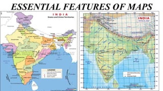
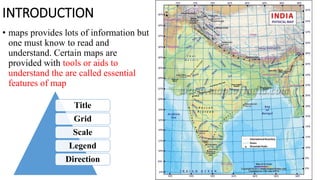
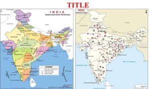
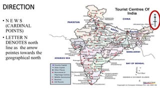
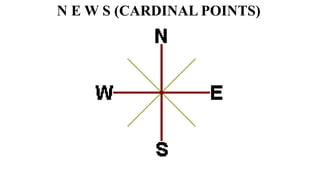
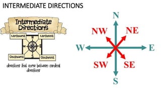
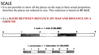
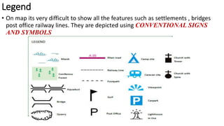
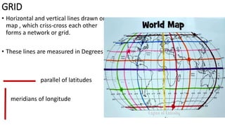
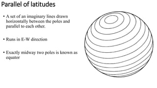
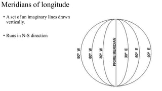
ESSENTIAL FEATURES OF MAPS
INTRODUCTION
• maps provides lots of information but
one must know to read and
understand. Certain maps are
provided with tools or aids to
understand the are called essential
features of map
Title
Grid
Scale
Legend
Direction
TITLE
DIRECTION
• N E W S
(CARDINAL
POINTS)
• LETTER N
DENOTES north
line as the arrow
pointes towards the
geographical north
N E W S (CARDINAL POINTS)
INTERMEDIATE DIRECTIONS
SCALE
• It is not possible to show all the places on the map in their actual proportion,
therefore the places are reduced in size. This reduction is based on SCALE.
• It’s a RATIO BETWEEN DISTANCE ON MAPAND DISTANCE ON A
GROUND
Legend
• On map its very difficult to show all the features such as settlements , bridges
post office railway lines. They are depicted using CONVENTIONAL SIGNS
AND SYMBOLS
GRID
• Horizontal and vertical lines drawn on
map , which criss-cross each other
forms a network or grid.
• These lines are measured in Degrees
parallel of latitudes
meridians of longitude
Parallel of latitudes
• A set of an imaginary lines drawn
horizontally between the poles and
parallel to each other.
• Runs in E-W direction
• Exactly midway two poles is known as
equator
Meridians of longitude
• A set of an imaginary lines drawn
vertically.
• Runs in N-S direction

Essential features of maps

  • 1.
  • 2.
    INTRODUCTION • maps provideslots of information but one must know to read and understand. Certain maps are provided with tools or aids to understand the are called essential features of map Title Grid Scale Legend Direction
  • 3.
  • 5.
    DIRECTION • N EW S (CARDINAL POINTS) • LETTER N DENOTES north line as the arrow pointes towards the geographical north
  • 6.
    N E WS (CARDINAL POINTS)
  • 7.
  • 8.
    SCALE • It isnot possible to show all the places on the map in their actual proportion, therefore the places are reduced in size. This reduction is based on SCALE. • It’s a RATIO BETWEEN DISTANCE ON MAPAND DISTANCE ON A GROUND
  • 9.
    Legend • On mapits very difficult to show all the features such as settlements , bridges post office railway lines. They are depicted using CONVENTIONAL SIGNS AND SYMBOLS
  • 10.
    GRID • Horizontal andvertical lines drawn on map , which criss-cross each other forms a network or grid. • These lines are measured in Degrees parallel of latitudes meridians of longitude
  • 11.
    Parallel of latitudes •A set of an imaginary lines drawn horizontally between the poles and parallel to each other. • Runs in E-W direction • Exactly midway two poles is known as equator
  • 12.
    Meridians of longitude •A set of an imaginary lines drawn vertically. • Runs in N-S direction