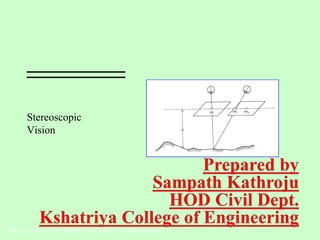
SlideShare a Scribd company logo
1 of 24
Stereoscopic
Vision
FOR 220 Aerial Photo Interpretation and Forest Measurements
• The pictures used in the
stereo views where in
the form of
"stereographs" which
were two pictures of the
same scene that were
slightly offset and
mounted side-by-side.
Stereoscopic Vision
Stereoscopy
The use of binocular vision to achieve 3-dimensional effects.
Enables you to view an object from 2 different camera
positions to obtain a 3-dimensional view.
Stereo pairs of photographs
Two adjacent, overlapping photographs in the same
flight line.
Stereo views can only be seen in the overlapping portion
of the photos.
Stereoscopic Vision
Stereoscopes:
A binocular optical instrument that helps us view two properly oriented photos to
obtain a 3-dimensional model.
Types of Stereoscopes:
Lens (pocket) stereoscope
Simplest
Least expensive
Small
2-4 x magnification
Used in the field
Stereoscopic Vision
Types of Stereoscopes:
Mirror stereoscope
Photos can be placed separately
for viewing
Used in the field?
Stereoscopic Vision
Types of Stereoscopes:
Scanning mirror stereoscope
A series of lenses and prisms
Relatively expensive
Not used in the field
Stereoscopic Vision
Types of Stereoscopes:
Zoom stereoscope
Variable magnification:
2.5 - 20 x
Very Expensive
Not used in the field
The “Cadillac” of stereoscopes
Stereoscopic Vision
Types of Stereoscopes:
Zoom transfer stereoscope
Variable magnification:
2.5 - 20 x
Used to transfer features from
a stereo-pair of photos onto a
map or other photo
Very Expensive
Not used in the field
1. Obtain 2 photographs consecutively marked on a flight line.
2. Locate and mark the Principal Points on each photograph.
3. Locate and mark the Conjugate Principal Points on each photograph.
4. Line up all 4 points and adjust the distance between photographs to suit your needs.
Stereo Photograph Geometry
Orientation of Stereo Pairs
Flight Line
Note “photo-crab”
Rick Lathrop, Rutgers University
Stereo Photograph Geometry
Where:
h = object height
H = flying height
dP = differential parallax
P = avg. photo base length (avg. distance, PP to CPP)
** Above equation is for level terrain only.
General formula for calculating height using parallax






+
×
=
)( dPP
dPH
h
Stereo Photograph Geometry
1. Determine average photo-base (P)
Average distance between PP and CPP for stereopair
Example: if then
P1 = 4.5 in. P = 4.4 in.
P2 = 4.3 in.
P1
PP CPP
P2
PPCPP
Measurements for parallax height calculations:
Stereo Photograph Geometry
2. Determine differential parallax (dP)
Difference of the distances between feature bases and tops while stereopair is
in stereo viewing postion.
Example: if then
db = 2.06 in. dP = 0.6 in.
dt = 1.46 in.
Measurments for parallax height calculations:
PP CPP PPCPP
db
dt
Stereo Photograph Geometry
Using the measurements from previous slides, “plug and chug”
h = object height (we want this)
H = flying height (2,200 ft. given in flight information)
dP = differential parallax (0.6 in.= 2.06in. - 1.46in.)
P = avg. photo base length (4.4 in.) (avg. distance, PP to CPP)
Example: Computing height using stereoscopic parallax
Solve for h:
h = (2,200 ft. * 0.6 in.) / (4.4 in. + 0.6 in.)
= 1320 ft. in. / 5 in.
= 264 ft.






+
×
=
)( dPP
dPH
h
Stereo Photograph Geometry
Parallax calculations of height are useful where the object of interest is:
On small scale photographs (high altitude flight)
Located at or near the nadir of a single photo.
Obscured on one photo of a stereopair, but the base and top can still be
located.
Flight or camera variables (except aircraft height) are not known.
Stereoplotters - precision instruments designed to duplicate the exact relative position
and orientation of the aerial camera at the time of photo acquisition to recreate the
stereo model. A floating mark can be used trace specific elevations. Relief
displacement is removed creating a planimetric map.
Soft-copy photogrammetry workstations - computer software recreates the stereo
model and allows for digital mapping
Stereo Photograph Geometry
Stereoscopic Plotting Instruments
Photographic distortion and relief displacement are removed during
orthorectification
Orthophoto - rectified aerial photo showing objects in their true planimetric
position
Orthophotoquad - orthophoto in the standard USGS 7.5 minute quadrangle
format with same scale accuracy as USGS topographic maps
DOQ – digital orthophoto quad
DOQQ - digital orthophoto quarter quad
“Native” format of orthophotos is digital
Stereo Photograph Geometry
Orthophotography
Digital Orthophotograph
1 meter pixel size
Georectified to UTM
Panchromatic
Some Color Infrared
Scale 1:24000
DOQ of Mammoth Springs,
Yellowstone National Park

More Related Content

What's hot

Multispectral remote sensing
Multispectral remote sensingMultispectral remote sensing
Multispectral remote sensing
Dharmendera Meena
 
Aerial photographs and their interpretation
Aerial photographs and their interpretationAerial photographs and their interpretation
Aerial photographs and their interpretation
Sumant Diwakar
 

What's hot (20)

Aerial photography- Concept and Terminologies
Aerial photography- Concept and Terminologies Aerial photography- Concept and Terminologies
Aerial photography- Concept and Terminologies
 
Introduction to Aerial Photogrammetry
Introduction to Aerial PhotogrammetryIntroduction to Aerial Photogrammetry
Introduction to Aerial Photogrammetry
 
Aerial Photogrammetry
Aerial Photogrammetry Aerial Photogrammetry
Aerial Photogrammetry
 
Distortions and displacement on aerial photograph
Distortions and displacement on aerial photographDistortions and displacement on aerial photograph
Distortions and displacement on aerial photograph
 
Remote Sensing Platforms and Its types
Remote Sensing Platforms and Its typesRemote Sensing Platforms and Its types
Remote Sensing Platforms and Its types
 
Flight planning (aerial Photogrammetry)
Flight planning            (aerial Photogrammetry)Flight planning            (aerial Photogrammetry)
Flight planning (aerial Photogrammetry)
 
Remote Sensing Platforms and Sensors
Remote Sensing Platforms and SensorsRemote Sensing Platforms and Sensors
Remote Sensing Platforms and Sensors
 
Aerial photography.pptx
Aerial photography.pptxAerial photography.pptx
Aerial photography.pptx
 
Digital Elevation Model (DEM)
Digital Elevation Model (DEM)Digital Elevation Model (DEM)
Digital Elevation Model (DEM)
 
Aerial photogrammetry ppt 2
Aerial photogrammetry ppt 2Aerial photogrammetry ppt 2
Aerial photogrammetry ppt 2
 
Photogrammetry
PhotogrammetryPhotogrammetry
Photogrammetry
 
Photogrammetry
PhotogrammetryPhotogrammetry
Photogrammetry
 
Chapter 5: Remote sensing
Chapter 5: Remote sensingChapter 5: Remote sensing
Chapter 5: Remote sensing
 
Lecture01: Introduction to Photogrammetry
Lecture01: Introduction to PhotogrammetryLecture01: Introduction to Photogrammetry
Lecture01: Introduction to Photogrammetry
 
Introduction of photogrammetry
Introduction of photogrammetryIntroduction of photogrammetry
Introduction of photogrammetry
 
Determination of Flight Direction
Determination of Flight DirectionDetermination of Flight Direction
Determination of Flight Direction
 
Optical remote sensing
Optical remote sensingOptical remote sensing
Optical remote sensing
 
Scale of photograph (Aerial Photogrammetry)
Scale of photograph (Aerial Photogrammetry)Scale of photograph (Aerial Photogrammetry)
Scale of photograph (Aerial Photogrammetry)
 
Multispectral remote sensing
Multispectral remote sensingMultispectral remote sensing
Multispectral remote sensing
 
Aerial photographs and their interpretation
Aerial photographs and their interpretationAerial photographs and their interpretation
Aerial photographs and their interpretation
 

Viewers also liked (18)

stereopsis and types of stereopsis tests
stereopsis and types of stereopsis testsstereopsis and types of stereopsis tests
stereopsis and types of stereopsis tests
 
Stereopsis
Stereopsis  Stereopsis
Stereopsis
 
Stereoscopic Vision
Stereoscopic VisionStereoscopic Vision
Stereoscopic Vision
 
Binocular vision
Binocular visionBinocular vision
Binocular vision
 
Assesment of streopsis
Assesment of streopsisAssesment of streopsis
Assesment of streopsis
 
Binocular single vision ppt
Binocular single vision pptBinocular single vision ppt
Binocular single vision ppt
 
binocular single vision
binocular single visionbinocular single vision
binocular single vision
 
Evaluation of squint
Evaluation of squint Evaluation of squint
Evaluation of squint
 
Binocular vision
Binocular visionBinocular vision
Binocular vision
 
Photogrammetry 1.
Photogrammetry 1.Photogrammetry 1.
Photogrammetry 1.
 
Lecture on photogrammetry
Lecture on photogrammetryLecture on photogrammetry
Lecture on photogrammetry
 
Avilgiin tuhai huuli
Avilgiin tuhai huuliAvilgiin tuhai huuli
Avilgiin tuhai huuli
 
Informatica
InformaticaInformatica
Informatica
 
CertificateMTGN Destintion
CertificateMTGN DestintionCertificateMTGN Destintion
CertificateMTGN Destintion
 
La paz
La pazLa paz
La paz
 
DIDÁCTICA DE LAS TICS
DIDÁCTICA DE LAS TICSDIDÁCTICA DE LAS TICS
DIDÁCTICA DE LAS TICS
 
Boss Ltda
Boss LtdaBoss Ltda
Boss Ltda
 
Dia wiki
Dia wikiDia wiki
Dia wiki
 

Similar to Stereoscopic vision

PHOTOGRAMMETRY (REMOTE SENSING & GIS).pptx
PHOTOGRAMMETRY  (REMOTE SENSING & GIS).pptxPHOTOGRAMMETRY  (REMOTE SENSING & GIS).pptx
PHOTOGRAMMETRY (REMOTE SENSING & GIS).pptx
BSuresh26
 
Introduction on Photogrammetry.pdf
Introduction on Photogrammetry.pdfIntroduction on Photogrammetry.pdf
Introduction on Photogrammetry.pdf
BSuresh26
 

Similar to Stereoscopic vision (20)

Geometry of Aerial Photographs.pdf
Geometry of Aerial Photographs.pdfGeometry of Aerial Photographs.pdf
Geometry of Aerial Photographs.pdf
 
Photogrammetry_nec.pdf
Photogrammetry_nec.pdfPhotogrammetry_nec.pdf
Photogrammetry_nec.pdf
 
Photogrammetry.pdf
Photogrammetry.pdfPhotogrammetry.pdf
Photogrammetry.pdf
 
Aerial Photography.pptx
Aerial Photography.pptxAerial Photography.pptx
Aerial Photography.pptx
 
Surveying ii module iii class 1,2
Surveying ii module iii class 1,2Surveying ii module iii class 1,2
Surveying ii module iii class 1,2
 
Photogyammetry-Notes2.pdf
Photogyammetry-Notes2.pdfPhotogyammetry-Notes2.pdf
Photogyammetry-Notes2.pdf
 
Mirror Stereoscope.pptx
Mirror Stereoscope.pptxMirror Stereoscope.pptx
Mirror Stereoscope.pptx
 
photogrammetry.pptx
photogrammetry.pptxphotogrammetry.pptx
photogrammetry.pptx
 
Vertical aerial photographs
Vertical aerial photographsVertical aerial photographs
Vertical aerial photographs
 
BASIC CONCEPTS OF PHOTOGRAMMETRY
BASIC CONCEPTS OF PHOTOGRAMMETRYBASIC CONCEPTS OF PHOTOGRAMMETRY
BASIC CONCEPTS OF PHOTOGRAMMETRY
 
Photogrammatic survey
Photogrammatic surveyPhotogrammatic survey
Photogrammatic survey
 
Photogrammetry
PhotogrammetryPhotogrammetry
Photogrammetry
 
PHOTOGRAMMETRY (REMOTE SENSING & GIS).pptx
PHOTOGRAMMETRY  (REMOTE SENSING & GIS).pptxPHOTOGRAMMETRY  (REMOTE SENSING & GIS).pptx
PHOTOGRAMMETRY (REMOTE SENSING & GIS).pptx
 
Photogrammetry1
Photogrammetry1Photogrammetry1
Photogrammetry1
 
PHOTOGRAMMETRY.pptx
PHOTOGRAMMETRY.pptxPHOTOGRAMMETRY.pptx
PHOTOGRAMMETRY.pptx
 
Photogrammetry-part 1
Photogrammetry-part 1Photogrammetry-part 1
Photogrammetry-part 1
 
PhotogrammetryArcGIS_V202108.pdf
PhotogrammetryArcGIS_V202108.pdfPhotogrammetryArcGIS_V202108.pdf
PhotogrammetryArcGIS_V202108.pdf
 
D04432528
D04432528D04432528
D04432528
 
Introduction on Photogrammetry.pdf
Introduction on Photogrammetry.pdfIntroduction on Photogrammetry.pdf
Introduction on Photogrammetry.pdf
 
02 principle of photography and imaging
02 principle of photography and imaging02 principle of photography and imaging
02 principle of photography and imaging
 

More from Collation Soft Solutions Pvt.Ltd

Development of centralized spatial database server for
Development of centralized spatial database server forDevelopment of centralized spatial database server for
Development of centralized spatial database server for
Collation Soft Solutions Pvt.Ltd
 
Role of soil brick industry in the degradation of land and environment 1942 (2)
Role of soil brick industry in the degradation of land and environment 1942 (2)Role of soil brick industry in the degradation of land and environment 1942 (2)
Role of soil brick industry in the degradation of land and environment 1942 (2)
Collation Soft Solutions Pvt.Ltd
 

More from Collation Soft Solutions Pvt.Ltd (12)

Well foundation
Well foundationWell foundation
Well foundation
 
Development of centralized spatial database server for
Development of centralized spatial database server forDevelopment of centralized spatial database server for
Development of centralized spatial database server for
 
Shallowfoundations
ShallowfoundationsShallowfoundations
Shallowfoundations
 
Role of soil brick industry in the degradation of land and environment 1942 (2)
Role of soil brick industry in the degradation of land and environment 1942 (2)Role of soil brick industry in the degradation of land and environment 1942 (2)
Role of soil brick industry in the degradation of land and environment 1942 (2)
 
Photogrammetry 2,Remote sensing-2
Photogrammetry 2,Remote sensing-2Photogrammetry 2,Remote sensing-2
Photogrammetry 2,Remote sensing-2
 
Types of map
Types of mapTypes of map
Types of map
 
Geographical entities,Topology
Geographical entities,TopologyGeographical entities,Topology
Geographical entities,Topology
 
Aerial photo
Aerial photoAerial photo
Aerial photo
 
Remote sensing,Introduction and Basic Concepts
Remote sensing,Introduction and Basic ConceptsRemote sensing,Introduction and Basic Concepts
Remote sensing,Introduction and Basic Concepts
 
Photogrammetry
Photogrammetry Photogrammetry
Photogrammetry
 
Sensors
SensorsSensors
Sensors
 
Unit 5
Unit 5Unit 5
Unit 5
 

Recently uploaded

FULL ENJOY Call Girls In Mahipalpur Delhi Contact Us 8377877756
FULL ENJOY Call Girls In Mahipalpur Delhi Contact Us 8377877756FULL ENJOY Call Girls In Mahipalpur Delhi Contact Us 8377877756
FULL ENJOY Call Girls In Mahipalpur Delhi Contact Us 8377877756
dollysharma2066
 
Call Now ≽ 9953056974 ≼🔝 Call Girls In New Ashok Nagar ≼🔝 Delhi door step de...
Call Now ≽ 9953056974 ≼🔝 Call Girls In New Ashok Nagar  ≼🔝 Delhi door step de...Call Now ≽ 9953056974 ≼🔝 Call Girls In New Ashok Nagar  ≼🔝 Delhi door step de...
Call Now ≽ 9953056974 ≼🔝 Call Girls In New Ashok Nagar ≼🔝 Delhi door step de...
9953056974 Low Rate Call Girls In Saket, Delhi NCR
 
Call for Papers - African Journal of Biological Sciences, E-ISSN: 2663-2187, ...
Call for Papers - African Journal of Biological Sciences, E-ISSN: 2663-2187, ...Call for Papers - African Journal of Biological Sciences, E-ISSN: 2663-2187, ...
Call for Papers - African Journal of Biological Sciences, E-ISSN: 2663-2187, ...
Christo Ananth
 
AKTU Computer Networks notes --- Unit 3.pdf
AKTU Computer Networks notes ---  Unit 3.pdfAKTU Computer Networks notes ---  Unit 3.pdf
AKTU Computer Networks notes --- Unit 3.pdf
ankushspencer015
 
UNIT-V FMM.HYDRAULIC TURBINE - Construction and working
UNIT-V FMM.HYDRAULIC TURBINE - Construction and workingUNIT-V FMM.HYDRAULIC TURBINE - Construction and working
UNIT-V FMM.HYDRAULIC TURBINE - Construction and working
rknatarajan
 

Recently uploaded (20)

UNIT-III FMM. DIMENSIONAL ANALYSIS
UNIT-III FMM.        DIMENSIONAL ANALYSISUNIT-III FMM.        DIMENSIONAL ANALYSIS
UNIT-III FMM. DIMENSIONAL ANALYSIS
 
Java Programming :Event Handling(Types of Events)
Java Programming :Event Handling(Types of Events)Java Programming :Event Handling(Types of Events)
Java Programming :Event Handling(Types of Events)
 
Thermal Engineering -unit - III & IV.ppt
Thermal Engineering -unit - III & IV.pptThermal Engineering -unit - III & IV.ppt
Thermal Engineering -unit - III & IV.ppt
 
FULL ENJOY Call Girls In Mahipalpur Delhi Contact Us 8377877756
FULL ENJOY Call Girls In Mahipalpur Delhi Contact Us 8377877756FULL ENJOY Call Girls In Mahipalpur Delhi Contact Us 8377877756
FULL ENJOY Call Girls In Mahipalpur Delhi Contact Us 8377877756
 
Call Now ≽ 9953056974 ≼🔝 Call Girls In New Ashok Nagar ≼🔝 Delhi door step de...
Call Now ≽ 9953056974 ≼🔝 Call Girls In New Ashok Nagar  ≼🔝 Delhi door step de...Call Now ≽ 9953056974 ≼🔝 Call Girls In New Ashok Nagar  ≼🔝 Delhi door step de...
Call Now ≽ 9953056974 ≼🔝 Call Girls In New Ashok Nagar ≼🔝 Delhi door step de...
 
CCS335 _ Neural Networks and Deep Learning Laboratory_Lab Complete Record
CCS335 _ Neural Networks and Deep Learning Laboratory_Lab Complete RecordCCS335 _ Neural Networks and Deep Learning Laboratory_Lab Complete Record
CCS335 _ Neural Networks and Deep Learning Laboratory_Lab Complete Record
 
Generative AI or GenAI technology based PPT
Generative AI or GenAI technology based PPTGenerative AI or GenAI technology based PPT
Generative AI or GenAI technology based PPT
 
KubeKraft presentation @CloudNativeHooghly
KubeKraft presentation @CloudNativeHooghlyKubeKraft presentation @CloudNativeHooghly
KubeKraft presentation @CloudNativeHooghly
 
Call for Papers - African Journal of Biological Sciences, E-ISSN: 2663-2187, ...
Call for Papers - African Journal of Biological Sciences, E-ISSN: 2663-2187, ...Call for Papers - African Journal of Biological Sciences, E-ISSN: 2663-2187, ...
Call for Papers - African Journal of Biological Sciences, E-ISSN: 2663-2187, ...
 
Booking open Available Pune Call Girls Koregaon Park 6297143586 Call Hot Ind...
Booking open Available Pune Call Girls Koregaon Park  6297143586 Call Hot Ind...Booking open Available Pune Call Girls Koregaon Park  6297143586 Call Hot Ind...
Booking open Available Pune Call Girls Koregaon Park 6297143586 Call Hot Ind...
 
Vivazz, Mieres Social Housing Design Spain
Vivazz, Mieres Social Housing Design SpainVivazz, Mieres Social Housing Design Spain
Vivazz, Mieres Social Housing Design Spain
 
NFPA 5000 2024 standard .
NFPA 5000 2024 standard                                  .NFPA 5000 2024 standard                                  .
NFPA 5000 2024 standard .
 
Booking open Available Pune Call Girls Pargaon 6297143586 Call Hot Indian Gi...
Booking open Available Pune Call Girls Pargaon  6297143586 Call Hot Indian Gi...Booking open Available Pune Call Girls Pargaon  6297143586 Call Hot Indian Gi...
Booking open Available Pune Call Girls Pargaon 6297143586 Call Hot Indian Gi...
 
Intze Overhead Water Tank Design by Working Stress - IS Method.pdf
Intze Overhead Water Tank  Design by Working Stress - IS Method.pdfIntze Overhead Water Tank  Design by Working Stress - IS Method.pdf
Intze Overhead Water Tank Design by Working Stress - IS Method.pdf
 
AKTU Computer Networks notes --- Unit 3.pdf
AKTU Computer Networks notes ---  Unit 3.pdfAKTU Computer Networks notes ---  Unit 3.pdf
AKTU Computer Networks notes --- Unit 3.pdf
 
Water Industry Process Automation & Control Monthly - April 2024
Water Industry Process Automation & Control Monthly - April 2024Water Industry Process Automation & Control Monthly - April 2024
Water Industry Process Automation & Control Monthly - April 2024
 
data_management_and _data_science_cheat_sheet.pdf
data_management_and _data_science_cheat_sheet.pdfdata_management_and _data_science_cheat_sheet.pdf
data_management_and _data_science_cheat_sheet.pdf
 
UNIT-V FMM.HYDRAULIC TURBINE - Construction and working
UNIT-V FMM.HYDRAULIC TURBINE - Construction and workingUNIT-V FMM.HYDRAULIC TURBINE - Construction and working
UNIT-V FMM.HYDRAULIC TURBINE - Construction and working
 
The Most Attractive Pune Call Girls Budhwar Peth 8250192130 Will You Miss Thi...
The Most Attractive Pune Call Girls Budhwar Peth 8250192130 Will You Miss Thi...The Most Attractive Pune Call Girls Budhwar Peth 8250192130 Will You Miss Thi...
The Most Attractive Pune Call Girls Budhwar Peth 8250192130 Will You Miss Thi...
 
UNIT - IV - Air Compressors and its Performance
UNIT - IV - Air Compressors and its PerformanceUNIT - IV - Air Compressors and its Performance
UNIT - IV - Air Compressors and its Performance
 

Stereoscopic vision

  • 1. Stereoscopic Vision FOR 220 Aerial Photo Interpretation and Forest Measurements
  • 2. • The pictures used in the stereo views where in the form of "stereographs" which were two pictures of the same scene that were slightly offset and mounted side-by-side.
  • 3. Stereoscopic Vision Stereoscopy The use of binocular vision to achieve 3-dimensional effects. Enables you to view an object from 2 different camera positions to obtain a 3-dimensional view. Stereo pairs of photographs Two adjacent, overlapping photographs in the same flight line. Stereo views can only be seen in the overlapping portion of the photos.
  • 4. Stereoscopic Vision Stereoscopes: A binocular optical instrument that helps us view two properly oriented photos to obtain a 3-dimensional model. Types of Stereoscopes: Lens (pocket) stereoscope Simplest Least expensive Small 2-4 x magnification Used in the field
  • 5. Stereoscopic Vision Types of Stereoscopes: Mirror stereoscope Photos can be placed separately for viewing Used in the field?
  • 6. Stereoscopic Vision Types of Stereoscopes: Scanning mirror stereoscope A series of lenses and prisms Relatively expensive Not used in the field
  • 7. Stereoscopic Vision Types of Stereoscopes: Zoom stereoscope Variable magnification: 2.5 - 20 x Very Expensive Not used in the field The “Cadillac” of stereoscopes
  • 8. Stereoscopic Vision Types of Stereoscopes: Zoom transfer stereoscope Variable magnification: 2.5 - 20 x Used to transfer features from a stereo-pair of photos onto a map or other photo Very Expensive Not used in the field
  • 9. 1. Obtain 2 photographs consecutively marked on a flight line. 2. Locate and mark the Principal Points on each photograph. 3. Locate and mark the Conjugate Principal Points on each photograph. 4. Line up all 4 points and adjust the distance between photographs to suit your needs. Stereo Photograph Geometry Orientation of Stereo Pairs Flight Line Note “photo-crab”
  • 10. Rick Lathrop, Rutgers University
  • 11. Rick Lathrop, Rutgers University
  • 12. Rick Lathrop, Rutgers University
  • 13. Rick Lathrop, Rutgers University
  • 14. Stereo Photograph Geometry Where: h = object height H = flying height dP = differential parallax P = avg. photo base length (avg. distance, PP to CPP) ** Above equation is for level terrain only. General formula for calculating height using parallax       + × = )( dPP dPH h
  • 15. Stereo Photograph Geometry 1. Determine average photo-base (P) Average distance between PP and CPP for stereopair Example: if then P1 = 4.5 in. P = 4.4 in. P2 = 4.3 in. P1 PP CPP P2 PPCPP Measurements for parallax height calculations:
  • 16. Stereo Photograph Geometry 2. Determine differential parallax (dP) Difference of the distances between feature bases and tops while stereopair is in stereo viewing postion. Example: if then db = 2.06 in. dP = 0.6 in. dt = 1.46 in. Measurments for parallax height calculations: PP CPP PPCPP db dt
  • 17. Stereo Photograph Geometry Using the measurements from previous slides, “plug and chug” h = object height (we want this) H = flying height (2,200 ft. given in flight information) dP = differential parallax (0.6 in.= 2.06in. - 1.46in.) P = avg. photo base length (4.4 in.) (avg. distance, PP to CPP) Example: Computing height using stereoscopic parallax Solve for h: h = (2,200 ft. * 0.6 in.) / (4.4 in. + 0.6 in.) = 1320 ft. in. / 5 in. = 264 ft.       + × = )( dPP dPH h
  • 18. Stereo Photograph Geometry Parallax calculations of height are useful where the object of interest is: On small scale photographs (high altitude flight) Located at or near the nadir of a single photo. Obscured on one photo of a stereopair, but the base and top can still be located. Flight or camera variables (except aircraft height) are not known.
  • 19. Stereoplotters - precision instruments designed to duplicate the exact relative position and orientation of the aerial camera at the time of photo acquisition to recreate the stereo model. A floating mark can be used trace specific elevations. Relief displacement is removed creating a planimetric map. Soft-copy photogrammetry workstations - computer software recreates the stereo model and allows for digital mapping Stereo Photograph Geometry Stereoscopic Plotting Instruments
  • 20.
  • 21.
  • 22.
  • 23. Photographic distortion and relief displacement are removed during orthorectification Orthophoto - rectified aerial photo showing objects in their true planimetric position Orthophotoquad - orthophoto in the standard USGS 7.5 minute quadrangle format with same scale accuracy as USGS topographic maps DOQ – digital orthophoto quad DOQQ - digital orthophoto quarter quad “Native” format of orthophotos is digital Stereo Photograph Geometry Orthophotography
  • 24. Digital Orthophotograph 1 meter pixel size Georectified to UTM Panchromatic Some Color Infrared Scale 1:24000 DOQ of Mammoth Springs, Yellowstone National Park