Surveying ii module iii class 1,2
•Download as PPT, PDF•
16 likes•3,985 views

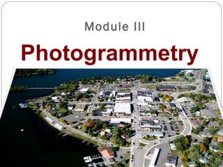
Photogrammetry is the science of obtaining reliable information about physical objects through analyzing photographic images. It involves recording, measuring, and interpreting photographs and electromagnetic radiation. There are two main types: aerial photogrammetry which uses photographs taken from aircraft, and terrestrial photogrammetry which uses ground-based photos. Photogrammetry is used to produce topographic maps and digital terrain models for purposes like architecture, engineering, archaeology and more.

Recommended
More Related Content
What's hot
What's hot (20)
Viewers also liked
Viewers also liked (18)
Similar to Surveying ii module iii class 1,2
Similar to Surveying ii module iii class 1,2 (20)
More from SHAMJITH KM
More from SHAMJITH KM (20)
Recently uploaded
Recently uploaded (20)
Surveying ii module iii class 1,2
- 2. Photogrammetry Photogrammetry is the art, science, and technology of obtaining reliable information about physical objects and the environment through processes of recording, measuring, and interpreting photographic images and patterns of Electromagnetic radiant energy and other phenomena
- 5. Photogrammetry Derived from 3 Greek words – photos – light – gramma - something drawn or written – metron - to measure
- 8. Definitions Camera axis Line passing through the centre of the camera lens perpendicular both to the camera plate (negative) and the picture plane (photograph) Picture plane Plane perpendicular to the camera axis at the focal distance in front of the lens. Principal point Intersection of camera axis with either the picture plane (positive) or the camera plate (negative) Focal length Perpendicular distance from the centre of camera lens to either the picture plane or the camera plate
- 9. Definitions Focal plane (image plane) plane (perpendicular to the axis of the lens) in which images of points in the object space of the lens are focused Perspective Centre Every light ray, which reached the film surface during exposure, passed through the camera lens (which is mathematically considered as a single point, the so called “perspective center”) A photographic image is thus a “central perspective”.
- 10. Basic elements Fiducial marks Marks at the edges and corners recorded during exposure Principal point Point of intersection of lines connecting opposite pairs of fiducial marks
- 11. Basic Elements Ground nadir point on the ground vertically beneath the center of the camera lens during exposure Photographic nadir intersection of the photograph and the vertical line that intersects the ground nadir and the center of the lens
- 12. Date of Photography Principal Point Nadir Point Mission ID Frame Number Fiducial Marks
- 13. Principally, photogrammetry can be divided into: 1. Depending on the lens-setting: • Far range photogrammetry (with camera distance setting to indefinite), and • Close range photogrammetry (with camera distance settings to finite values).
- 15. • Terrestrial photogrammetry (Terrestrial photogrammetry (mostly close range photogrammetry) Branch of photogrammetry wherein photographs are taken from a fixed position on or near the ground • Aerial photogrammetry (Aerial photogrammetry (mostly far range photogrammetry) Photographs are taken by a camera mounted in an aircraft flying over the area 2. Another grouping can be
- 17. Oblique photographs - Cameras oriented toward the side of the aircraft - Vertical photographs - camera aimed directly at the ground surface from above - difficult to recognize ground features but measurements can be made
- 20. Vertical aerial photograph an aerial photograph is considered vertical only if the isocenter, nadir and the principal point are in perfect alignment Orthophoto a digital image derived from aerial photography where all distortions and displacements have been removed photogrammetrically
- 26. Advantages An aerial photograph has the following advantages over a map: 1. It provides a current pictorial view of the ground that no map can equal. 2. It is more readily obtained. The photograph may be in the hands of the user within a few hours after it is taken; a map may take months to prepare. 3. It may be made for places that are inaccessible to ground soldiers. 4. It shows military features that do not appear on maps. 5. It can provide a day-to-day comparison of selected areas, permitting evaluations to be made of enemy activity. 6. It provides a permanent and objective record of the day-to-day changes with the area.
- 27. Disadvantages The aerial photograph has the following disadvantages as compared to a map: 1. Ground features are difficult to identify or interpret without symbols and are often obscured by other ground detail as, for example, buildings in wooded areas. 2. Position location and scale are only approximate. 3. Detailed variations in the terrain features are not readily apparent without overlapping photography and a stereoscopic viewing instrument. 4. Because of a lack of contrasting colors and tone, a photograph is difficult to use in poor light. 5. It lacks marginal data. 6. It requires more training to interpret than a map.
- 28. Uses and Users Aerial photogrammetry is mainly used to produce topographical or thematical maps and digital terrain models. Among the users of close-range photogrammetry are architects and civil engineers (to supervise buildings, document their current state, deformations or damages), archaeologists,
- 29. Advantages of vertical over oblique aerial photographs Vertical photographs present approximately uniform scale The determination of directions (i.e., bearing or azimuth) can be performed in the same manner as a map. Vertical photographs are easier to interpret than oblique photographs. tall objects (e.g., buildings, trees, hills, etc.) will not mask other objects as much as they would on oblique photos. simple to use photogrammetrically as a minimum of mathematical correction is required. To some extent and under certain conditions (e.g., flat terrain), a vertical aerial photograph may be used as a map if a coordinate grid system and legend information are added. Stereoscopic study is also more effective on vertical than on oblique photographs.
- 30. Advantages of oblique over vertical aerial photographs covers more ground area than a vertical photo taken from the same altitude and with the same focal length. If an area is frequently covered by cloud layer Oblique photos have a more natural view Objects that are under trees or under other tall objects may not be visible on vertical photos if they are viewed from above. Determination of feature elevations is more accurate using oblique photograph than vertical aerial photographs. oblique aerial photos are not used for photogrammetric and precision purposes, they may use inexpensive cameras.
- 31. Terrestrial Photogrammetry Basic Principles Similar to plane table surveying. If the directions of the same objects photographed from two extremities of measured base are known their position can be located by the intersection of two rays to the same object
- 32. 20° 20°20° 20°10°10°10° 10° 0°0° Direction of pointings in terrestrial photogrammetry S1 S2
- 33. Terrestrial Photogrammetry classifications Plane table photogrammetry Consists essentially in taking a photograph of the area to be mapped from each of the two or three stations. Terrestrial stereophotogrammetry The camera base and the angles of intersection of the datum rays to the points to be measured can be considerably reduced since the camera axes at two stations exhibit great similarity at two stations. The image points which are parallactically displaced relative to each other in the two photographs are fused to a single spatial image by the stereoscopic measurement
- 35. Photo Theodolite a combination of a theodolite and a terrestrial camera
- 36. Photo Theodolite The instrument consists of a photographic camera with an internal compass card, housed in an aluminum box with a horizontal circle below, and a transit-mounted telescope with vertical arc above. The horizontal circle is graduated to 30 minutes, and read by vernier to single minutes. The vertical arc extends 90 degrees either way, and is graduated to 30 minutes and read by vernier and small telescope to single minutes. The whole instrument sits on a tribach base, suitable for mounting on a tripod.
- 37. A I