
Recommended
More Related Content
What's hot
What's hot (20)
Similar to Bihar
Similar to Bihar (20)
Recently uploaded
Recently uploaded (20)
Bihar
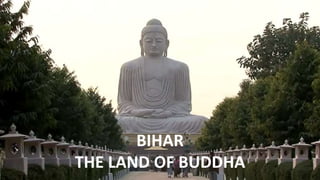
- 1. BIHAR THE LAND OF BUDDHA
- 2. • Bihar is located in the eastern part of India. The state is surrounded by Nepal in the north, West Bengal in the east, Uttar Pradesh in the west & Jharkhand in the south. • The state has a number of rivers; the most important of which is the Ganges. • Patna, Gaya, Bhagalpur, Muzaffarpur & Darbhanga are some of the key cities in Bihar. • The most commonly spoken languages in the state are Hindi, English, Urdu, Bhojpuri, Maithili & Angika. • The 4 agro-climatic seasons and fertile soil of Bihar support cultivation of a wide range of crops. Parameters Bihar Capital Patna Geographical area (sq. km) 94,163 Administrative districts (No) 38 Population density (persons per sq. km) 1,106 Total population (million) 104.1 Male population (million) 54.3 Female population (million) 49.8 Literacy rate (%) 61.8 BIHAR TABLE DATA
- 5. 1. Ajay River 2. Bagmati 3. Budhi Gandak 4. Bhutahi Balan 5. Gandak 6. Ganges 7. Ghaghra 8. Phalgu 9. Gandaki River 10. Kamala 11. Karmanasha 12. Koshi River 13. Mahananda River 14. Punpun 15. Sapt Koshi 16. Son River RIVER BODIES OF BIHAR
- 6. “ Total human deaths is 5874 and animal deaths is 19044 in Bihar due to floods between 1979–2006 • Bihar is India's most flood-prone State, with 76% of the population in the north Bihar living under the recurring threat of flood devastation. • According to some historical data, 16.5% of the total flood affected area in India is located in Bihar while 22.1% of the flood affected population in India lives in Bihar. • About 68,800 square kilometres (26,600 sq. mi) out of total geographical area of 94,160 square kilometres (36,360 sq. mi) comprising 73.06% is flood affected. • Floods in Bihar are a recurring disaster which on an annual basis destroys thousands of human lives apart from livestock and assets worth millions. ”
- 7. “ THE RIVER THAT SHIFTS ITS COURSE - UNPREDICTED ” • Koshi River is also known as Saptakoshi • Koshi drains the northern slopes of the Himalayas in Tibet and the southern slopes in Nepal. • The Koshi is 720 km (450 mi) long and drains an area of about 74,500 km2 (28,800 sq. mi) in Tibet, Nepal and Bihar. • the river has shifted its course for more than 133 km (83 mi) from east to west during the last 200 years. • But a review of 28 historical maps dating 1760 to 1960 revealed a slight eastward shift for a long duration, and that the shifting was random and oscillating in nature. • Its unstable nature has been attributed to the heavy silt it carries during the monsoon season and flooding in India has extreme effects. • Fishing is an important enterprise on the river but fishing resources are being depleted and youth are leaving for other areas of work.
- 8. “ SORROW OF BIHAR ” • annual floods affect about 21,000 km2 (8,100 sq. mi) of fertile agricultural lands thereby disturbing the rural economy. • The Koshi has an average water flow (discharge) of 2,166 cubic meters per second (76,500 cu ft/s). • During floods, it increases to as much as 18 times the average. • The greatest recorded flood was 24,200 m3/s (850,000 cu ft/s) on 24 August 1954. • On 18 August 2008, the Koshi river picked up an old channel it had abandoned over 100 years previously near the border with Nepal and India. • Approximately 2.7 million people were affected as the river broke its embankment at Kusaha in Nepal, submerging several districts of Nepal and India. 95% of the Koshi's water flowed through the new course. • The fury of the Koshi river left at least 2.5 million people marooned in eight districts and inundated 650 km2. • The Indian Army, National Disaster Response Force (NDRF) and non-government organizations operated the biggest flood rescue operation in India in more than 50 years.
- 9. • 77% of workforce and generating nearly 24.84% of the State Domestic Product. • The percentage of population employed in agriculture production system in Bihar is estimated to 77%, which is much higher than the national average. • Nearly 24.84% of GDP of the state (2011-12) has been from agriculture sector (including forestry and fishing). • Agriculture is the single largest private sector occupation in Bihar. “ Agriculture is the backbone of Bihar's economy ”
- 10. “ India stands 1st in List of most-polluted cities by particulate matter concentration ” Gaya • 3rd most polluted city of the world according to the WHO report. The air of this holy place has become polluted due to …… • Harmful particles less than 2.5 micrometers (PM2.5): 149µg/m3 • Harmful particles less than 10 micrometres (PM10): 275µg/m3 Patna • 5th most polluted city in India in terms of PM 2.5 concentration as per the report of WHO. Pollution due to……. • Harmful particles less than 2.5 micrometers (PM2.5): 144µg/m3 • Harmful particles less than 10 micrometres (PM10): 266µg/m3 Muzaffarpur • Muzaffarpur stands on the 11th position in the list of most polluted cities in WHO’s report • The main source of the air pollution is low circulation of air around the city PM 2.5 which is a microscopic matter. • Harmful particles less than 2.5 micrometers (PM2.5): 120µg/m3 • Harmful particles less than 10 micrometres (PM10): 221µg/m3
- 11. धन्वाद