
Recommended
More Related Content
Similar to The great indian desert and the environment.ppt
Similar to The great indian desert and the environment.ppt (20)
More from RashmiSanghi1
More from RashmiSanghi1 (20)
Recently uploaded
Recently uploaded (20)
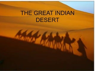
The great indian desert and the environment.ppt
- 3. MAP
- 4. INTRODUCTION • Total area=446,000 sq. kms. • Out of that area covered in INDIA is 208,110 sq. kms. • Spans over four states- Rajasthan(61%), Gujarat(20%), Punjab Hariyana.
- 5. INTRODUCTION • Bounded by Aravallis in east, Rann of Kutch in south, plains of Hariyana and Punjab in North and Indus valleys of Pakistan in West. • Most populated Desert in World. • In Pakistan it is called Cholistan Desert.
- 7. EVOLUTION OF THAR DESERT Contradicting theories.
- 8. EVOLUTION OF THAR DESERT • Archeological evidence the region was once a flourishing green country- side with thick forests and river-systems of which ‘Saraswati’ and ‘Yamuna’ were the most important. • About 4,000 years ago this area supported what is considered to be one of the world's oldest civilizations, the Mohenjo Daro and Harappa also known as Indus Valley Civilization. • One prediction is that the over-exploitation of land and water resources since the earliest times has made this place a desert.
- 9. Evolution • Another theory • Epigraphic evidence by Landsat Satellites Imagery • Underground tectonic movements changed the course of Yamuna and Saraswati.
- 10. Evolution • Yet another theory…!!! • Thar Desert was all under Arabian Sea. • The Great Arabian Sea then changed its route.
- 11. PHYSICAL FEATURES • Latitudes 23°3 and 30°12 North • Longitudes 63°30 and 70°18 East. • Landforms of Thar Desert are:- 1. The predominantly sand covered Thar 2. Plains with hills including the central dune-free country 3.Hills
- 12. • Population is increasing at very higher rate. • Average growth rate is 3.9 % per year • Thar constitutes one of the five major physical divisions of India;.
- 13. CLIMATIC CONDITIONS Characterized by • High Velocity Wind. • High Shifting Sand-dunes. • Scarce Rainfall. • Intense Solar Radiations. • High rate of Evaporation. • Annual Temperature : extreme variation ranging from 50C in Summer to near freezing point in Winter.
- 14. CLIMATIC CONDITIONS • Annual Rainfall = 100 mm to 500mm • 90% of which falls between July and September. • Out of every 10 years, 4 years are “DROUGHT” years. • All conditions are hostile for existence of life.
- 15. RESOURCES • Agriculture and animal husbandry • Out of 4.5 million acres, 3.4 million is cultivable land and the remaining, about 24% ,is the grazing land for cattle and livestock and the waste land. • Rainfall is very erratic, a pattern of mixed farming has been developed in which human and animal populations benefit from each other.
- 16. Agriculture • Pearl Millet or Bajra is the main monsoonal crop. • The other common crops are: Mong ,Moth and Til. • Cash crops grown in IG canal irrigated region includes Groundnut , Cotton , Rice , Sugarcane , Wheat and Barley .
- 17. Oil Fields • Just over three years ago Cairn Energy had discovered Mangala oil field in the state. • To date Cairn (and previously Shell) have drilled 144 wells during the exploration stage of which 22 were discoveries. Actually there are 16 different oil and gas fields. • Major ones are Mangala, Bhagyam and Aishwariya.
- 18. Oil Fields • Estimated to contain oil in volumes of 3.6 Billion Barrels of which 500 million barrels are thought to be recoverable. • The targeted gross production from these three fields is 150,000 barrels of oil per day (bopd), estimated to last for 30 years. • The state cabinet approved the formation of Rajasthan State Petroleum Corp Ltd.
- 19. Minerals • rich in mineral resources. • The chief minerals are • Bentonite, Sandstone, Fuller's earth, gypsum, dolomite, asbestos, lignite and limestone. • Gypsum mining has become very popular in Ganganagar, Bikaner, Churu, Jaisalmer etc. • Rajasthan accounts for nearly 90% of the country's gypsum production.
- 20. MINERALS • Granite rock formation is found in the Nagarparkar region of Thar. • More than 50 Salt mines are found in the southern belt of Thar. • Coal has been found around 45 kilometers radius around Islamkot.
- 21. SALT MINE
- 22. Solar Energy • The Great Indian Desert receives more Solar energy than many areas closer to equater. • Energy inflow : avg. 275 W/m² • The quantum of energy received by Rajasthan State alone is more than sufficient to meet the world’s annual energy demands. • Solar intensity in the region varies from 5.85 to 6.44 kW/m²/day. • Sun is available for 345-355 days in a
- 23. Wind Energy • Very high wind velocity (up to 45 km/hr for some 3000 hrs/year ). • Avg. wind speed : 15 to 30 km/hr. • Electricity production • Water pumping • On this wind velocity 25 feet diameter Low Speed Windmill can pump 12000 gallons water/day from a depth of 120-150 feet.
- 24. VEGETATION • Stunted scrub and a few sporadic trees. • 700 species of plants are found • 107 are of grass alone. • These plants are deep-rooted and tenacious enough to withstand extended droughts and yet efficient enough to gain biomass rapidly during a favorable season. • The local grasses are generally prolific seeders, and most of the species are palatable, fairly nutritious and rich in minerals, including trace elements
- 25. Wildlife • several species have evolved to survive the extreme conditions here. • There are overall 41 species of mammals. • Sheeps, Goats,Camel, blackbuck, Chinkara, Donkeys and Horses. • At present there are about 4.6 million cattle and livestock
- 26. CAMEL THE DESERT RIDER
- 27. Wildlife Among the 141 birds known in this eco-region, the GREAT INDIAN BUSTARD is a globally threatened species.
- 28. Wildlife • About 23 species of lizard and 25 species of snakes are found here and several of them are endemic to the region . • At present, there are ten times more animals/ person in Rajasthan than the national average
- 29. Tourism In Thar there are only three protected areas: • 1. Desert National Park (3,162 sq.km ) • 2. Gajner Wildlife Sactuary (24 sq. km ) • 3. Tal Chhaper Blackbuck Sanctuary (7 sq.km) . • Jodhpur, Jaisalmer, Bikaner and Barmer are famous for historical monuments. • Thar festival is a significant part of Thar's cultural life.
- 30. Water Resources With frequent droughts, poor drainage and low rainfall, the inhabitants of the Thar desert were used to face acute scarcity of drinking water before the development of Indra Gandhi Nahar Project(IGNP). • IGNP (Rajasthan Canal) was started in 1958. • A water canal bring the sweet Himalayan waters to the desert region. • The canal is still not fully complete . • The IG Canal, has a capacity to flow 524 cubic m of water/sec.
- 31. Water Resources • The total length of the main canal ,at present, is 649 km from Harike barrage in Punjab to Mohangarh in Jaisalmer. • In addition to the main canal, feeder channels are estimated to total nearly 8,000 km in length after completion. • Other sources of water are wells and tube-wells. • The only river flowing through the desert is Luni
- 32. DESERTIFICATION • Spreading 12000 hectares/yr. • Degrading the productive land • Advancing towards the national capital New Delhi at the rate of 0.5 km/yr. • This expansion is due to both Natural and Man Maintained phenomena.
- 33. CAUSES OF DESERTIFICATION • Over-Grazing by Animals • Shifting of Sand-Dunes • Poaching ( illegal hunting ) • Tree Cutting • Over Exploitation of resources
- 34. Delhi a desert town by 2050? • This is a big question • After this rate of expansion of Thar ,will our National Capital “DELHI” be a desert town by 2050??????? • Can we do something to stop expansion of THAR??
- 35. MEASURES TAKEN • Sand dune fixation work • Silvipastoral plantations • Village fodder and fuel wood plantation • Shelterbelt plantation • Ecological regeneration • Restoration and rehabilitation of degraded desert lands • Afforestation on barren hills • Re-seeding of old pastures and farm forestry Wildlife
- 36. World Day to Combat Desertification 2009 • "Conserving land and water = Securing our common future" 17 June 2009
- 37. PRESENTATION MADE BY… • PARTH KANUNGO • PARV GUPTA • PAWAN PAREEK • PEEYUSH GUPTA • PRANKUR • PRABHAKAR PANDEY