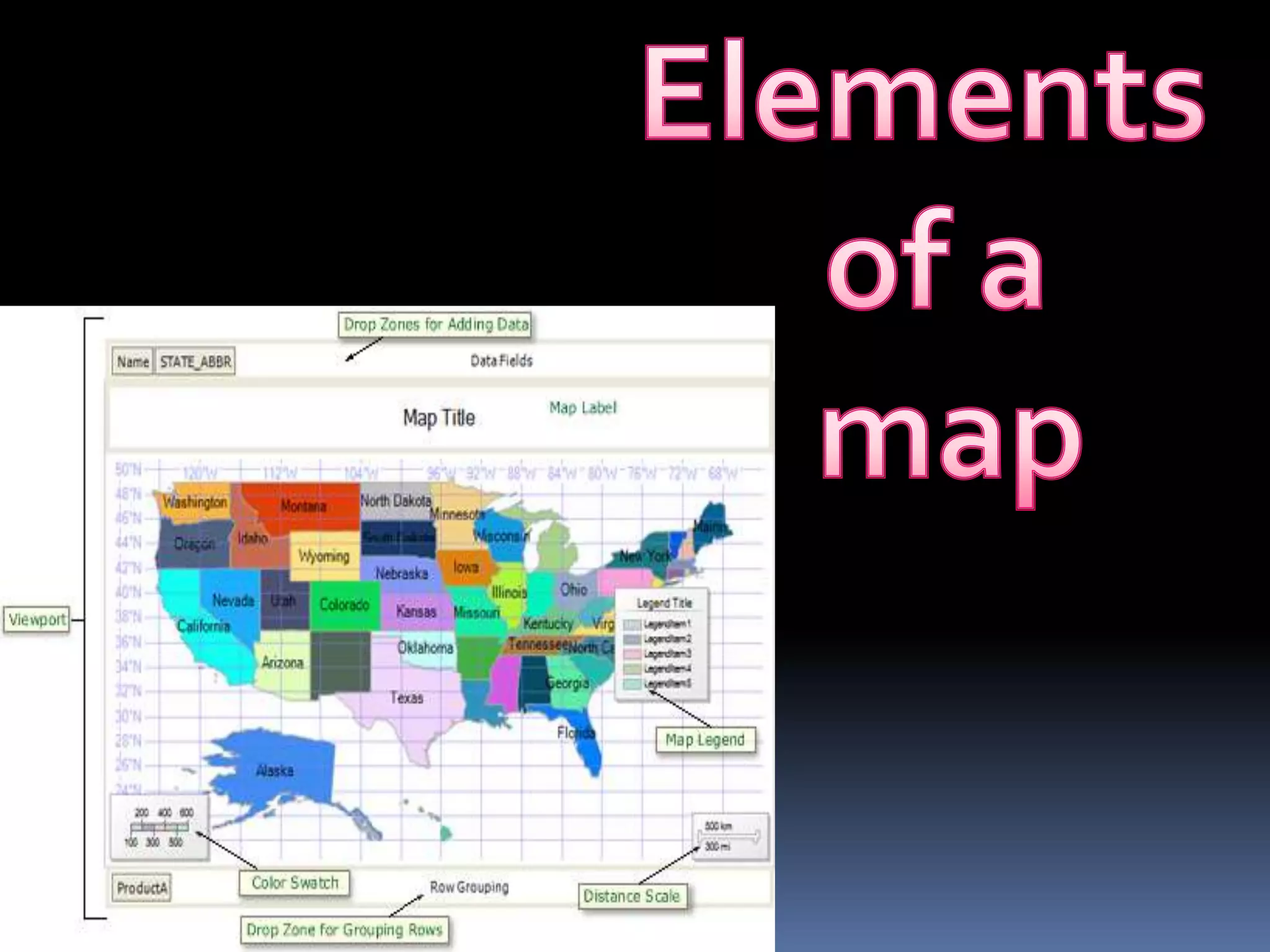
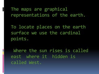
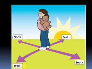
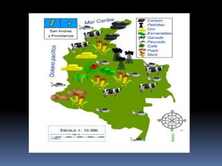
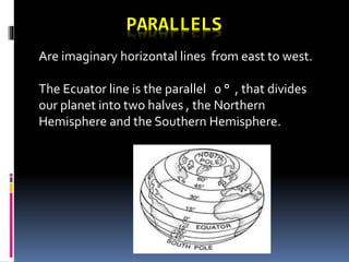
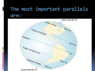
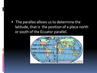
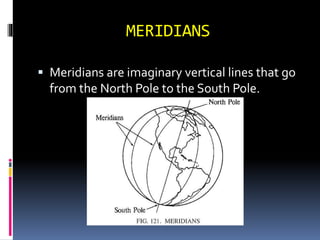
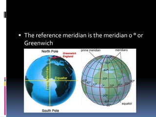
The maps are graphical
representations of the earth.
To locate places on the earth
surface we use the cardinal
points.
Where the sun rises is called
east where it hidden is
called West.
To use a map is important to
identify the elements that
allow read or interpret it.
THE TITTLE: Is the name of
the map.
Map orientation: allows to
know the cardinal points of
the map.
The conventions: allow to
know the characteristics of
objects, for example if
airports or roads etc.
Scale: is the real
dimensions of the terrain
and the size at which the
map is shown.
PARALLELS AND MERIDIANS.
Watch the video.
https://www.youtube.com/watc
h?v=2FcPDYs19Oo
PARALLELS
Are imaginary horizontal lines from east to west.
The Ecuator line is the parallel 0 ° , that divides
our planet into two halves , the Northern
Hemisphere and the Southern Hemisphere.
The most important parallels
are:
 The paralles allows us to determine the
latitude, that is the position of a place north
or south of the Ecuator parallel.
MERIDIANS
 Meridians are imaginary vertical lines that go
from the North Pole to the South Pole.
 The reference meridian is the meridian 0 ° or
Greenwich
 This meridian divides the Earth in the
Western Hemisphere and Eastern
Hemisphere
Worksheet
 In a polystyrene ball represent the principal
parallels and meridian.

Elements of a map 4th grade

  • 2.
    The maps aregraphical representations of the earth. To locate places on the earth surface we use the cardinal points. Where the sun rises is called east where it hidden is called West.
  • 4.
    To use amap is important to identify the elements that allow read or interpret it.
  • 5.
    THE TITTLE: Isthe name of the map. Map orientation: allows to know the cardinal points of the map.
  • 6.
    The conventions: allowto know the characteristics of objects, for example if airports or roads etc. Scale: is the real dimensions of the terrain and the size at which the map is shown.
  • 8.
    PARALLELS AND MERIDIANS. Watchthe video. https://www.youtube.com/watc h?v=2FcPDYs19Oo
  • 9.
    PARALLELS Are imaginary horizontallines from east to west. The Ecuator line is the parallel 0 ° , that divides our planet into two halves , the Northern Hemisphere and the Southern Hemisphere.
  • 10.
    The most importantparallels are:
  • 11.
     The parallesallows us to determine the latitude, that is the position of a place north or south of the Ecuator parallel.
  • 12.
    MERIDIANS  Meridians areimaginary vertical lines that go from the North Pole to the South Pole.
  • 13.
     The referencemeridian is the meridian 0 ° or Greenwich
  • 14.
     This meridiandivides the Earth in the Western Hemisphere and Eastern Hemisphere
  • 15.
    Worksheet  In apolystyrene ball represent the principal parallels and meridian.