SlideShare a Scribd company logo
1 of 18
Download to read offline
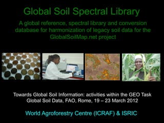
Global Soil Spectral Library
World Agroforestry Centre (ICRAF) & ISRIC
A global reference, spectral library and conversion
database for harmonization of legacy soil data for the
GlobalSoilMap.net project
Towards Global Soil Information: activities within the GEO Task
Global Soil Data, FAO, Rome, 19 – 23 March 2012
Rationale
• GlobalSoilMap.net largely based on making effective use of legacy soils
data.
• Legacy soil data consists of field observations, laboratory analyses and
conventional soil maps collected over the last 60-80 years as part of
numerous national, regional and institutional soil survey programs.
• Much of this legacy soils data is fragmented, non-standard between
countries and often even within countries.
• Difficult to share or exchange data across national, state or even project
borders because of significant differences in standards, methods of analysis,
definitions and legends.
• Need for soil data to be harmonized to a single consistent reference method
in order to be comparable globally and suitable for use in producing global
maps and databases.
• In addition soil infrared spectroscopy and proximal sensing methods
increasingly used for estimating soil properties, but as yet no comprehensive
global calibration libraries exists (Viscarra Rossel, 2009; Terhoeven et al.,
Project Objectives
1. Design and populate a global soil property and spectral
reference library
 Full range of soil types & environmental settings
on each continent or node (500 profiles per node)
 Sample from each horizon analysed using
commonly used methods for each soil property
2. Provide inter-method calibrations
1. Provide infrared spectral calibrations
1. Maintain and further build the reference library
Infrared Spectroscopy for rapid soil
characterization
• Rapid
• Low cost
• Reproducible
•Predicts many soil
functional
properties
What soil properties affect spectral
shape?
These are the key determinants of soil functional properties:
nutrient supply & retention; carbon sequestration; hydraulic properties;
erodibility; tillage & engineering properties
www.africasoils.net
Randomization of Sentinel Site
locations stratified by climate
zone
African Soil Information
Service
AfricaSoils Sentinel
Site based on the Land
Degradation Surveillance
Framework
a spatially stratified, hierarchical,
rand
omized sampling framework
Sentinel site (100 km2)
16 Clusters (1 km2)
10 Plots (1000 m2)
4 Sub-Plots (100 m2)
?
Cost surfaces, etc.
Covariates
Remote Sensing (RS) and Spatial Data
Elevation
Vegetation
Hydrology
Topographical
properties
Climate
Landsat
Legacy data
ASTER
Quickbird
MODIS
500 m
250 m
28.5 m
15 m
2.4 m
0.6 m
Local(site-level)Cref
High resolution digital mapping
10 km
RegionalCref
160 km
Regional mapping
Instrumentation
Dispersive VNIR FT-NIR FT-MIR Handheld NIR/MIR
•Portable
•Repeatability?
•External service
•No validation
•Benchtop
•Repeatability ***
•Self serviceable
•Validation in-built
•ISO compliant
•Industry proven
•Multipurpose
•Benchtop
•Repeatability***
•No gas purging
•Some servicing
•Robotic
•Validation in-built
•ISO compliant
•Outperforms NIR
•Handheld
•Sample
homogeneity?
•Variable
moisture?
•Repeatability?
•Still expensive
•Rapidly
developing
•Need to prepare
by developing
soil reference
libraries
Current global spectral library initiatives
• Soil Spectroscopy Group
(Geophysical Research Abstracts, Vol. 11, EGU2009-14021, 2009; NIR News 2009 doi:
10.1255/nirn.1131)
• global soil spectral library (VNIR)
• community of practice for soil spectroscopy
BEN DOR, Eyal - Tel Aviv University; BROWN, David - Washington State University; DEMATTE, Alexandre - Sao
Paolo University; SHEPHERD, Keith – ICRAF; STENBERG, Bosse - Swedish Agricultural University; VISCARRA
ROSSEL*, Raphael – CSIRO Land & Water
• Brown et al 2006: VNIR spectra from NSSC archives: 3768 samples
from all 50 U.S. states and two tropical territories and an additional
416 samples from 36 different countries in Africa (125), Asia (104),
the Americas (75) and Europe (112)
• Terhoeven-Urselmans et al 2010: MIR spectra from ISRIC archives:
4438 soil samples from 754 soil profiles (56 countries) but only 971
samples from 18 countries with complete data
ISRIC global spectral library
Terhoeven-Urselmans T, Vagen T-G, Spaargaren O, Shepherd KD. 2010. Prediction of soil fertility properties
from a globally distributed soil mid-infrared spectral library. Soil Sci. Soc. Am. J. 74:1792–1799
Results for
30%
independent
validation set
Spectral prediction of
TOC, POC, Charcoal-C
Australian and Kenya
soils
Janik LJ, Skjemstad JO, Shepherd KD and
Spouncer LR (2007) The prediction of soil
carbon fractions using mid-infrared-partial
least square analysis. Journal of Australian
TOC: alkyl–CH2 stretching modes; carbohydrate
overtones of the –COH stretch; carboxylic acid–
COOH; amide I and II bands; alkyl–CH2
deformation; aromatic–CH in plane deformation;
carbohydrate–COH stretch.
CHAR: C=C skeletal vibrations; phenolic, or COO
stretching vibrations; ring C–H in plane deformations
Africa Soil Information Service
Spectral library
Prediction performance for soil physical properties and total carbon and nitrogen
using mid-infrared spectroscopy for sentinel sites analysed to date.
Validation results are for a 50% random hold-out sample using boosted regression
trees.
Spectral calibration transfer
Robotoic high throughput
MIR (Shepherd & Walsh, 2007)
Current global spectral library limitations
• Soil spectral calibrations limited by quality and
consistency of the reference data
• Large libraries needed to cover the global range in soil
conditions
• Need to include a number spectral instrument types
(VNIR, NIR, MIR)
A viable library will be based on conducting new reference
measures in one laboratory with excellent quality control
Proposed plan
• Phase 1 (6 months): Scoping, evaluation, feasibility
assessment
• Survey available profiles; additional sampling?
• Export/import procedures; shipping
• Suite of methods to be used
• Analytical lab for spectral and reference methods
• Cost analysis
• Full proposal development
• Phase 2 (3 years): Sampling and analysis
• Full implementation
• Global database made available

More Related Content

What's hot

Indian remote sensing satellites
Indian  remote  sensing  satellitesIndian  remote  sensing  satellites
Indian remote sensing satellitesPramoda Raj
 
REMOTE SENSING
REMOTE SENSINGREMOTE SENSING
REMOTE SENSINGKANNAN
 
Intro to RS and GIS by mndp poonia
Intro to RS and GIS by mndp pooniaIntro to RS and GIS by mndp poonia
Intro to RS and GIS by mndp pooniamndp_slide
 
Introduction to Landsat
Introduction to LandsatIntroduction to Landsat
Introduction to LandsatNizam GIS
 
Multispectral remote sensing
Multispectral remote sensingMultispectral remote sensing
Multispectral remote sensingDharmendera Meena
 
remote sensing
remote sensingremote sensing
remote sensing78harshith
 
Ppt on remote sensing system
Ppt on remote sensing systemPpt on remote sensing system
Ppt on remote sensing systemAlisha Korpal
 
Remote sensing ppt
Remote sensing pptRemote sensing ppt
Remote sensing pptcoolmridul92
 
Basics of Remote Sensing
Basics of Remote SensingBasics of Remote Sensing
Basics of Remote SensingAkash Tikhe
 
Hyperspectral remote sensing for oil exploration
Hyperspectral remote sensing for oil explorationHyperspectral remote sensing for oil exploration
Hyperspectral remote sensing for oil explorationJayanth Joshua
 
Basics of remote sensing, pk mani
Basics of remote sensing, pk maniBasics of remote sensing, pk mani
Basics of remote sensing, pk maniP.K. Mani
 
Meteorological Satellites
Meteorological SatellitesMeteorological Satellites
Meteorological SatellitesManoj Barman
 

What's hot (19)

Indian remote sensing satellites
Indian  remote  sensing  satellitesIndian  remote  sensing  satellites
Indian remote sensing satellites
 
REMOTE SENSING
REMOTE SENSINGREMOTE SENSING
REMOTE SENSING
 
Intro to RS and GIS by mndp poonia
Intro to RS and GIS by mndp pooniaIntro to RS and GIS by mndp poonia
Intro to RS and GIS by mndp poonia
 
Spot satellite
Spot satelliteSpot satellite
Spot satellite
 
Introduction to Landsat
Introduction to LandsatIntroduction to Landsat
Introduction to Landsat
 
Introduction to Remote Sensing
Introduction to Remote SensingIntroduction to Remote Sensing
Introduction to Remote Sensing
 
Multispectral remote sensing
Multispectral remote sensingMultispectral remote sensing
Multispectral remote sensing
 
remote sensing
remote sensingremote sensing
remote sensing
 
Ppt on remote sensing system
Ppt on remote sensing systemPpt on remote sensing system
Ppt on remote sensing system
 
Remote sensing ppt
Remote sensing pptRemote sensing ppt
Remote sensing ppt
 
Basics of Remote Sensing
Basics of Remote SensingBasics of Remote Sensing
Basics of Remote Sensing
 
Hyperspectral remote sensing for oil exploration
Hyperspectral remote sensing for oil explorationHyperspectral remote sensing for oil exploration
Hyperspectral remote sensing for oil exploration
 
Basics of remote sensing, pk mani
Basics of remote sensing, pk maniBasics of remote sensing, pk mani
Basics of remote sensing, pk mani
 
Landsat seminar
Landsat seminarLandsat seminar
Landsat seminar
 
Remote Sensing of Aerosols
Remote Sensing of AerosolsRemote Sensing of Aerosols
Remote Sensing of Aerosols
 
Meteorological Satellites
Meteorological SatellitesMeteorological Satellites
Meteorological Satellites
 
Remote sensing
Remote sensingRemote sensing
Remote sensing
 
Ikonos
IkonosIkonos
Ikonos
 
Remote sensing
Remote sensingRemote sensing
Remote sensing
 

Similar to Global Soil Spectral Library, A global reference, spectral library and conversion database for harmonization of legacy soil data for the GlobalSoilMap.net project - World Agroforestry Centre (ICRAF) & ISRIC

Item 1: Soil infrared spectroscopy
Item 1: Soil infrared spectroscopyItem 1: Soil infrared spectroscopy
Item 1: Soil infrared spectroscopySoils FAO-GSP
 
Mark Thomas_A digital soil mapping approach for regolith thickness in the com...
Mark Thomas_A digital soil mapping approach for regolith thickness in the com...Mark Thomas_A digital soil mapping approach for regolith thickness in the com...
Mark Thomas_A digital soil mapping approach for regolith thickness in the com...TERN Australia
 
MSc Project Presentation 2016
MSc Project  Presentation 2016MSc Project  Presentation 2016
MSc Project Presentation 2016Antonin Kusbach
 
NIFA-BARD Collaborative: Rapid Hydrophobicity Sensing and Computing through M...
NIFA-BARD Collaborative: Rapid Hydrophobicity Sensing and Computing through M...NIFA-BARD Collaborative: Rapid Hydrophobicity Sensing and Computing through M...
NIFA-BARD Collaborative: Rapid Hydrophobicity Sensing and Computing through M...National Institute of Food and Agriculture
 
Analysis of large scale soil spectral libraries
Analysis of large scale soil spectral librariesAnalysis of large scale soil spectral libraries
Analysis of large scale soil spectral librariesFAO
 
Digital Soil Mapping by Ronald Vargas Rojas
Digital Soil Mapping by Ronald Vargas RojasDigital Soil Mapping by Ronald Vargas Rojas
Digital Soil Mapping by Ronald Vargas RojasFAO
 
Spectroscopy - A new paradigm for Evidence-based Land &Soil Management recomm...
Spectroscopy - A new paradigm for Evidence-based Land &Soil Management recomm...Spectroscopy - A new paradigm for Evidence-based Land &Soil Management recomm...
Spectroscopy - A new paradigm for Evidence-based Land &Soil Management recomm...Stankovic G
 
Predicting and mapping soil properties using proximal/remote sensing by Zhou ...
Predicting and mapping soil properties using proximal/remote sensing by Zhou ...Predicting and mapping soil properties using proximal/remote sensing by Zhou ...
Predicting and mapping soil properties using proximal/remote sensing by Zhou ...FAO
 
The performance of portable mid-infrared spectroscopy for the prediction of s...
The performance of portable mid-infrared spectroscopy for the prediction of s...The performance of portable mid-infrared spectroscopy for the prediction of s...
The performance of portable mid-infrared spectroscopy for the prediction of s...ExternalEvents
 
Analysis of Soil in the Field using portable FTIR - A H Jean Robertson, H Rac...
Analysis of Soil in the Field using portable FTIR - A H Jean Robertson, H Rac...Analysis of Soil in the Field using portable FTIR - A H Jean Robertson, H Rac...
Analysis of Soil in the Field using portable FTIR - A H Jean Robertson, H Rac...FAO
 
Diffuse reflectance spectroscopy to estimate soil attributes of Brazilian wet...
Diffuse reflectance spectroscopy to estimate soil attributes of Brazilian wet...Diffuse reflectance spectroscopy to estimate soil attributes of Brazilian wet...
Diffuse reflectance spectroscopy to estimate soil attributes of Brazilian wet...Agriculture Journal IJOEAR
 
Ross Searle_The need for effective soil information infrastructure: TERN's So...
Ross Searle_The need for effective soil information infrastructure: TERN's So...Ross Searle_The need for effective soil information infrastructure: TERN's So...
Ross Searle_The need for effective soil information infrastructure: TERN's So...TERN Australia
 
Turkey’s National Geospatial Soil Organic Carbon Information System
Turkey’s National Geospatial Soil Organic Carbon Information SystemTurkey’s National Geospatial Soil Organic Carbon Information System
Turkey’s National Geospatial Soil Organic Carbon Information SystemExternalEvents
 
Soil Organic Carbon Map of Mexico
Soil Organic Carbon Map of MexicoSoil Organic Carbon Map of Mexico
Soil Organic Carbon Map of MexicoExternalEvents
 
Remote sensing of biophysical parameters: linking field, airborne and contine...
Remote sensing of biophysical parameters: linking field, airborne and contine...Remote sensing of biophysical parameters: linking field, airborne and contine...
Remote sensing of biophysical parameters: linking field, airborne and contine...TERN Australia
 

Similar to Global Soil Spectral Library, A global reference, spectral library and conversion database for harmonization of legacy soil data for the GlobalSoilMap.net project - World Agroforestry Centre (ICRAF) & ISRIC (20)

Fao longterm trials shepherd dec 2011
Fao longterm trials shepherd dec 2011Fao longterm trials shepherd dec 2011
Fao longterm trials shepherd dec 2011
 
Item 1: Soil infrared spectroscopy
Item 1: Soil infrared spectroscopyItem 1: Soil infrared spectroscopy
Item 1: Soil infrared spectroscopy
 
Nachtergaele Available soil databases Nov 10 2014
Nachtergaele Available soil databases Nov 10 2014Nachtergaele Available soil databases Nov 10 2014
Nachtergaele Available soil databases Nov 10 2014
 
Mark Thomas_A digital soil mapping approach for regolith thickness in the com...
Mark Thomas_A digital soil mapping approach for regolith thickness in the com...Mark Thomas_A digital soil mapping approach for regolith thickness in the com...
Mark Thomas_A digital soil mapping approach for regolith thickness in the com...
 
MSc Project Presentation 2016
MSc Project  Presentation 2016MSc Project  Presentation 2016
MSc Project Presentation 2016
 
NIFA-BARD Collaborative: Rapid Hydrophobicity Sensing and Computing through M...
NIFA-BARD Collaborative: Rapid Hydrophobicity Sensing and Computing through M...NIFA-BARD Collaborative: Rapid Hydrophobicity Sensing and Computing through M...
NIFA-BARD Collaborative: Rapid Hydrophobicity Sensing and Computing through M...
 
Analysis of large scale soil spectral libraries
Analysis of large scale soil spectral librariesAnalysis of large scale soil spectral libraries
Analysis of large scale soil spectral libraries
 
Digital Soil Mapping by Ronald Vargas Rojas
Digital Soil Mapping by Ronald Vargas RojasDigital Soil Mapping by Ronald Vargas Rojas
Digital Soil Mapping by Ronald Vargas Rojas
 
Carbon Benefits Kds V3 07
Carbon Benefits Kds V3 07Carbon Benefits Kds V3 07
Carbon Benefits Kds V3 07
 
Spectroscopy - A new paradigm for Evidence-based Land &Soil Management recomm...
Spectroscopy - A new paradigm for Evidence-based Land &Soil Management recomm...Spectroscopy - A new paradigm for Evidence-based Land &Soil Management recomm...
Spectroscopy - A new paradigm for Evidence-based Land &Soil Management recomm...
 
Predicting and mapping soil properties using proximal/remote sensing by Zhou ...
Predicting and mapping soil properties using proximal/remote sensing by Zhou ...Predicting and mapping soil properties using proximal/remote sensing by Zhou ...
Predicting and mapping soil properties using proximal/remote sensing by Zhou ...
 
Habibur research week poster 2016 4 (1)
Habibur research week poster 2016 4 (1)Habibur research week poster 2016 4 (1)
Habibur research week poster 2016 4 (1)
 
The performance of portable mid-infrared spectroscopy for the prediction of s...
The performance of portable mid-infrared spectroscopy for the prediction of s...The performance of portable mid-infrared spectroscopy for the prediction of s...
The performance of portable mid-infrared spectroscopy for the prediction of s...
 
Analysis of Soil in the Field using portable FTIR - A H Jean Robertson, H Rac...
Analysis of Soil in the Field using portable FTIR - A H Jean Robertson, H Rac...Analysis of Soil in the Field using portable FTIR - A H Jean Robertson, H Rac...
Analysis of Soil in the Field using portable FTIR - A H Jean Robertson, H Rac...
 
Using soil data to inform soil health
Using soil data to inform soil healthUsing soil data to inform soil health
Using soil data to inform soil health
 
Diffuse reflectance spectroscopy to estimate soil attributes of Brazilian wet...
Diffuse reflectance spectroscopy to estimate soil attributes of Brazilian wet...Diffuse reflectance spectroscopy to estimate soil attributes of Brazilian wet...
Diffuse reflectance spectroscopy to estimate soil attributes of Brazilian wet...
 
Ross Searle_The need for effective soil information infrastructure: TERN's So...
Ross Searle_The need for effective soil information infrastructure: TERN's So...Ross Searle_The need for effective soil information infrastructure: TERN's So...
Ross Searle_The need for effective soil information infrastructure: TERN's So...
 
Turkey’s National Geospatial Soil Organic Carbon Information System
Turkey’s National Geospatial Soil Organic Carbon Information SystemTurkey’s National Geospatial Soil Organic Carbon Information System
Turkey’s National Geospatial Soil Organic Carbon Information System
 
Soil Organic Carbon Map of Mexico
Soil Organic Carbon Map of MexicoSoil Organic Carbon Map of Mexico
Soil Organic Carbon Map of Mexico
 
Remote sensing of biophysical parameters: linking field, airborne and contine...
Remote sensing of biophysical parameters: linking field, airborne and contine...Remote sensing of biophysical parameters: linking field, airborne and contine...
Remote sensing of biophysical parameters: linking field, airborne and contine...
 

More from FAO

Nigeria
NigeriaNigeria
NigeriaFAO
 
Niger
NigerNiger
NigerFAO
 
Namibia
NamibiaNamibia
NamibiaFAO
 
Mozambique
MozambiqueMozambique
MozambiqueFAO
 
Zimbabwe takesure
Zimbabwe takesureZimbabwe takesure
Zimbabwe takesureFAO
 
Zimbabwe
ZimbabweZimbabwe
ZimbabweFAO
 
Zambia
ZambiaZambia
ZambiaFAO
 
Togo
TogoTogo
TogoFAO
 
Tanzania
TanzaniaTanzania
TanzaniaFAO
 
Spal presentation
Spal presentationSpal presentation
Spal presentationFAO
 
Rwanda
RwandaRwanda
RwandaFAO
 
Nigeria uponi
Nigeria uponiNigeria uponi
Nigeria uponiFAO
 
The multi-faced role of soil in the NENA regions (part 2)
The multi-faced role of soil in the NENA regions (part 2)The multi-faced role of soil in the NENA regions (part 2)
The multi-faced role of soil in the NENA regions (part 2)FAO
 
The multi-faced role of soil in the NENA regions (part 1)
The multi-faced role of soil in the NENA regions (part 1)The multi-faced role of soil in the NENA regions (part 1)
The multi-faced role of soil in the NENA regions (part 1)FAO
 
Agenda of the launch of the soil policy brief at the Land&Water Days
Agenda of the launch of the soil policy brief at the Land&Water DaysAgenda of the launch of the soil policy brief at the Land&Water Days
Agenda of the launch of the soil policy brief at the Land&Water DaysFAO
 
Agenda of the 5th NENA Soil Partnership meeting
Agenda of the 5th NENA Soil Partnership meetingAgenda of the 5th NENA Soil Partnership meeting
Agenda of the 5th NENA Soil Partnership meetingFAO
 
The Voluntary Guidelines for Sustainable Soil Management
The Voluntary Guidelines for Sustainable Soil ManagementThe Voluntary Guidelines for Sustainable Soil Management
The Voluntary Guidelines for Sustainable Soil ManagementFAO
 
GLOSOLAN - Mission, status and way forward
GLOSOLAN - Mission, status and way forwardGLOSOLAN - Mission, status and way forward
GLOSOLAN - Mission, status and way forwardFAO
 
Towards a Global Soil Information System (GLOSIS)
Towards a Global Soil Information System (GLOSIS)Towards a Global Soil Information System (GLOSIS)
Towards a Global Soil Information System (GLOSIS)FAO
 
GSP developments of regional interest in 2019
GSP developments of regional interest in 2019GSP developments of regional interest in 2019
GSP developments of regional interest in 2019FAO
 

More from FAO (20)

Nigeria
NigeriaNigeria
Nigeria
 
Niger
NigerNiger
Niger
 
Namibia
NamibiaNamibia
Namibia
 
Mozambique
MozambiqueMozambique
Mozambique
 
Zimbabwe takesure
Zimbabwe takesureZimbabwe takesure
Zimbabwe takesure
 
Zimbabwe
ZimbabweZimbabwe
Zimbabwe
 
Zambia
ZambiaZambia
Zambia
 
Togo
TogoTogo
Togo
 
Tanzania
TanzaniaTanzania
Tanzania
 
Spal presentation
Spal presentationSpal presentation
Spal presentation
 
Rwanda
RwandaRwanda
Rwanda
 
Nigeria uponi
Nigeria uponiNigeria uponi
Nigeria uponi
 
The multi-faced role of soil in the NENA regions (part 2)
The multi-faced role of soil in the NENA regions (part 2)The multi-faced role of soil in the NENA regions (part 2)
The multi-faced role of soil in the NENA regions (part 2)
 
The multi-faced role of soil in the NENA regions (part 1)
The multi-faced role of soil in the NENA regions (part 1)The multi-faced role of soil in the NENA regions (part 1)
The multi-faced role of soil in the NENA regions (part 1)
 
Agenda of the launch of the soil policy brief at the Land&Water Days
Agenda of the launch of the soil policy brief at the Land&Water DaysAgenda of the launch of the soil policy brief at the Land&Water Days
Agenda of the launch of the soil policy brief at the Land&Water Days
 
Agenda of the 5th NENA Soil Partnership meeting
Agenda of the 5th NENA Soil Partnership meetingAgenda of the 5th NENA Soil Partnership meeting
Agenda of the 5th NENA Soil Partnership meeting
 
The Voluntary Guidelines for Sustainable Soil Management
The Voluntary Guidelines for Sustainable Soil ManagementThe Voluntary Guidelines for Sustainable Soil Management
The Voluntary Guidelines for Sustainable Soil Management
 
GLOSOLAN - Mission, status and way forward
GLOSOLAN - Mission, status and way forwardGLOSOLAN - Mission, status and way forward
GLOSOLAN - Mission, status and way forward
 
Towards a Global Soil Information System (GLOSIS)
Towards a Global Soil Information System (GLOSIS)Towards a Global Soil Information System (GLOSIS)
Towards a Global Soil Information System (GLOSIS)
 
GSP developments of regional interest in 2019
GSP developments of regional interest in 2019GSP developments of regional interest in 2019
GSP developments of regional interest in 2019
 

Recently uploaded

call girls in Kamla Market (DELHI) 🔝 >༒9953330565🔝 genuine Escort Service 🔝✔️✔️
call girls in Kamla Market (DELHI) 🔝 >༒9953330565🔝 genuine Escort Service 🔝✔️✔️call girls in Kamla Market (DELHI) 🔝 >༒9953330565🔝 genuine Escort Service 🔝✔️✔️
call girls in Kamla Market (DELHI) 🔝 >༒9953330565🔝 genuine Escort Service 🔝✔️✔️9953056974 Low Rate Call Girls In Saket, Delhi NCR
 
ECONOMIC CONTEXT - LONG FORM TV DRAMA - PPT
ECONOMIC CONTEXT - LONG FORM TV DRAMA - PPTECONOMIC CONTEXT - LONG FORM TV DRAMA - PPT
ECONOMIC CONTEXT - LONG FORM TV DRAMA - PPTiammrhaywood
 
MULTIDISCIPLINRY NATURE OF THE ENVIRONMENTAL STUDIES.pptx
MULTIDISCIPLINRY NATURE OF THE ENVIRONMENTAL STUDIES.pptxMULTIDISCIPLINRY NATURE OF THE ENVIRONMENTAL STUDIES.pptx
MULTIDISCIPLINRY NATURE OF THE ENVIRONMENTAL STUDIES.pptxAnupkumar Sharma
 
Grade 9 Q4-MELC1-Active and Passive Voice.pptx
Grade 9 Q4-MELC1-Active and Passive Voice.pptxGrade 9 Q4-MELC1-Active and Passive Voice.pptx
Grade 9 Q4-MELC1-Active and Passive Voice.pptxChelloAnnAsuncion2
 
Hierarchy of management that covers different levels of management
Hierarchy of management that covers different levels of managementHierarchy of management that covers different levels of management
Hierarchy of management that covers different levels of managementmkooblal
 
Difference Between Search & Browse Methods in Odoo 17
Difference Between Search & Browse Methods in Odoo 17Difference Between Search & Browse Methods in Odoo 17
Difference Between Search & Browse Methods in Odoo 17Celine George
 
Field Attribute Index Feature in Odoo 17
Field Attribute Index Feature in Odoo 17Field Attribute Index Feature in Odoo 17
Field Attribute Index Feature in Odoo 17Celine George
 
Romantic Opera MUSIC FOR GRADE NINE pptx
Romantic Opera MUSIC FOR GRADE NINE pptxRomantic Opera MUSIC FOR GRADE NINE pptx
Romantic Opera MUSIC FOR GRADE NINE pptxsqpmdrvczh
 
How to do quick user assign in kanban in Odoo 17 ERP
How to do quick user assign in kanban in Odoo 17 ERPHow to do quick user assign in kanban in Odoo 17 ERP
How to do quick user assign in kanban in Odoo 17 ERPCeline George
 
DATA STRUCTURE AND ALGORITHM for beginners
DATA STRUCTURE AND ALGORITHM for beginnersDATA STRUCTURE AND ALGORITHM for beginners
DATA STRUCTURE AND ALGORITHM for beginnersSabitha Banu
 
EPANDING THE CONTENT OF AN OUTLINE using notes.pptx
EPANDING THE CONTENT OF AN OUTLINE using notes.pptxEPANDING THE CONTENT OF AN OUTLINE using notes.pptx
EPANDING THE CONTENT OF AN OUTLINE using notes.pptxRaymartEstabillo3
 
AmericanHighSchoolsprezentacijaoskolama.
AmericanHighSchoolsprezentacijaoskolama.AmericanHighSchoolsprezentacijaoskolama.
AmericanHighSchoolsprezentacijaoskolama.arsicmarija21
 
Planning a health career 4th Quarter.pptx
Planning a health career 4th Quarter.pptxPlanning a health career 4th Quarter.pptx
Planning a health career 4th Quarter.pptxLigayaBacuel1
 
Computed Fields and api Depends in the Odoo 17
Computed Fields and api Depends in the Odoo 17Computed Fields and api Depends in the Odoo 17
Computed Fields and api Depends in the Odoo 17Celine George
 
Framing an Appropriate Research Question 6b9b26d93da94caf993c038d9efcdedb.pdf
Framing an Appropriate Research Question 6b9b26d93da94caf993c038d9efcdedb.pdfFraming an Appropriate Research Question 6b9b26d93da94caf993c038d9efcdedb.pdf
Framing an Appropriate Research Question 6b9b26d93da94caf993c038d9efcdedb.pdfUjwalaBharambe
 
Procuring digital preservation CAN be quick and painless with our new dynamic...
Procuring digital preservation CAN be quick and painless with our new dynamic...Procuring digital preservation CAN be quick and painless with our new dynamic...
Procuring digital preservation CAN be quick and painless with our new dynamic...Jisc
 
ENGLISH 7_Q4_LESSON 2_ Employing a Variety of Strategies for Effective Interp...
ENGLISH 7_Q4_LESSON 2_ Employing a Variety of Strategies for Effective Interp...ENGLISH 7_Q4_LESSON 2_ Employing a Variety of Strategies for Effective Interp...
ENGLISH 7_Q4_LESSON 2_ Employing a Variety of Strategies for Effective Interp...JhezDiaz1
 

Recently uploaded (20)

call girls in Kamla Market (DELHI) 🔝 >༒9953330565🔝 genuine Escort Service 🔝✔️✔️
call girls in Kamla Market (DELHI) 🔝 >༒9953330565🔝 genuine Escort Service 🔝✔️✔️call girls in Kamla Market (DELHI) 🔝 >༒9953330565🔝 genuine Escort Service 🔝✔️✔️
call girls in Kamla Market (DELHI) 🔝 >༒9953330565🔝 genuine Escort Service 🔝✔️✔️
 
ECONOMIC CONTEXT - LONG FORM TV DRAMA - PPT
ECONOMIC CONTEXT - LONG FORM TV DRAMA - PPTECONOMIC CONTEXT - LONG FORM TV DRAMA - PPT
ECONOMIC CONTEXT - LONG FORM TV DRAMA - PPT
 
MULTIDISCIPLINRY NATURE OF THE ENVIRONMENTAL STUDIES.pptx
MULTIDISCIPLINRY NATURE OF THE ENVIRONMENTAL STUDIES.pptxMULTIDISCIPLINRY NATURE OF THE ENVIRONMENTAL STUDIES.pptx
MULTIDISCIPLINRY NATURE OF THE ENVIRONMENTAL STUDIES.pptx
 
Grade 9 Q4-MELC1-Active and Passive Voice.pptx
Grade 9 Q4-MELC1-Active and Passive Voice.pptxGrade 9 Q4-MELC1-Active and Passive Voice.pptx
Grade 9 Q4-MELC1-Active and Passive Voice.pptx
 
Hierarchy of management that covers different levels of management
Hierarchy of management that covers different levels of managementHierarchy of management that covers different levels of management
Hierarchy of management that covers different levels of management
 
Difference Between Search & Browse Methods in Odoo 17
Difference Between Search & Browse Methods in Odoo 17Difference Between Search & Browse Methods in Odoo 17
Difference Between Search & Browse Methods in Odoo 17
 
Field Attribute Index Feature in Odoo 17
Field Attribute Index Feature in Odoo 17Field Attribute Index Feature in Odoo 17
Field Attribute Index Feature in Odoo 17
 
Romantic Opera MUSIC FOR GRADE NINE pptx
Romantic Opera MUSIC FOR GRADE NINE pptxRomantic Opera MUSIC FOR GRADE NINE pptx
Romantic Opera MUSIC FOR GRADE NINE pptx
 
How to do quick user assign in kanban in Odoo 17 ERP
How to do quick user assign in kanban in Odoo 17 ERPHow to do quick user assign in kanban in Odoo 17 ERP
How to do quick user assign in kanban in Odoo 17 ERP
 
DATA STRUCTURE AND ALGORITHM for beginners
DATA STRUCTURE AND ALGORITHM for beginnersDATA STRUCTURE AND ALGORITHM for beginners
DATA STRUCTURE AND ALGORITHM for beginners
 
EPANDING THE CONTENT OF AN OUTLINE using notes.pptx
EPANDING THE CONTENT OF AN OUTLINE using notes.pptxEPANDING THE CONTENT OF AN OUTLINE using notes.pptx
EPANDING THE CONTENT OF AN OUTLINE using notes.pptx
 
Rapple "Scholarly Communications and the Sustainable Development Goals"
Rapple "Scholarly Communications and the Sustainable Development Goals"Rapple "Scholarly Communications and the Sustainable Development Goals"
Rapple "Scholarly Communications and the Sustainable Development Goals"
 
AmericanHighSchoolsprezentacijaoskolama.
AmericanHighSchoolsprezentacijaoskolama.AmericanHighSchoolsprezentacijaoskolama.
AmericanHighSchoolsprezentacijaoskolama.
 
Planning a health career 4th Quarter.pptx
Planning a health career 4th Quarter.pptxPlanning a health career 4th Quarter.pptx
Planning a health career 4th Quarter.pptx
 
Computed Fields and api Depends in the Odoo 17
Computed Fields and api Depends in the Odoo 17Computed Fields and api Depends in the Odoo 17
Computed Fields and api Depends in the Odoo 17
 
Framing an Appropriate Research Question 6b9b26d93da94caf993c038d9efcdedb.pdf
Framing an Appropriate Research Question 6b9b26d93da94caf993c038d9efcdedb.pdfFraming an Appropriate Research Question 6b9b26d93da94caf993c038d9efcdedb.pdf
Framing an Appropriate Research Question 6b9b26d93da94caf993c038d9efcdedb.pdf
 
Procuring digital preservation CAN be quick and painless with our new dynamic...
Procuring digital preservation CAN be quick and painless with our new dynamic...Procuring digital preservation CAN be quick and painless with our new dynamic...
Procuring digital preservation CAN be quick and painless with our new dynamic...
 
OS-operating systems- ch04 (Threads) ...
OS-operating systems- ch04 (Threads) ...OS-operating systems- ch04 (Threads) ...
OS-operating systems- ch04 (Threads) ...
 
ENGLISH 7_Q4_LESSON 2_ Employing a Variety of Strategies for Effective Interp...
ENGLISH 7_Q4_LESSON 2_ Employing a Variety of Strategies for Effective Interp...ENGLISH 7_Q4_LESSON 2_ Employing a Variety of Strategies for Effective Interp...
ENGLISH 7_Q4_LESSON 2_ Employing a Variety of Strategies for Effective Interp...
 
TataKelola dan KamSiber Kecerdasan Buatan v022.pdf
TataKelola dan KamSiber Kecerdasan Buatan v022.pdfTataKelola dan KamSiber Kecerdasan Buatan v022.pdf
TataKelola dan KamSiber Kecerdasan Buatan v022.pdf
 

Global Soil Spectral Library, A global reference, spectral library and conversion database for harmonization of legacy soil data for the GlobalSoilMap.net project - World Agroforestry Centre (ICRAF) & ISRIC

  • 1. Global Soil Spectral Library World Agroforestry Centre (ICRAF) & ISRIC A global reference, spectral library and conversion database for harmonization of legacy soil data for the GlobalSoilMap.net project Towards Global Soil Information: activities within the GEO Task Global Soil Data, FAO, Rome, 19 – 23 March 2012
  • 2. Rationale • GlobalSoilMap.net largely based on making effective use of legacy soils data. • Legacy soil data consists of field observations, laboratory analyses and conventional soil maps collected over the last 60-80 years as part of numerous national, regional and institutional soil survey programs. • Much of this legacy soils data is fragmented, non-standard between countries and often even within countries. • Difficult to share or exchange data across national, state or even project borders because of significant differences in standards, methods of analysis, definitions and legends. • Need for soil data to be harmonized to a single consistent reference method in order to be comparable globally and suitable for use in producing global maps and databases. • In addition soil infrared spectroscopy and proximal sensing methods increasingly used for estimating soil properties, but as yet no comprehensive global calibration libraries exists (Viscarra Rossel, 2009; Terhoeven et al.,
  • 3. Project Objectives 1. Design and populate a global soil property and spectral reference library  Full range of soil types & environmental settings on each continent or node (500 profiles per node)  Sample from each horizon analysed using commonly used methods for each soil property 2. Provide inter-method calibrations 1. Provide infrared spectral calibrations 1. Maintain and further build the reference library
  • 4. Infrared Spectroscopy for rapid soil characterization • Rapid • Low cost • Reproducible •Predicts many soil functional properties
  • 5. What soil properties affect spectral shape? These are the key determinants of soil functional properties: nutrient supply & retention; carbon sequestration; hydraulic properties; erodibility; tillage & engineering properties
  • 6. www.africasoils.net Randomization of Sentinel Site locations stratified by climate zone African Soil Information Service
  • 7. AfricaSoils Sentinel Site based on the Land Degradation Surveillance Framework a spatially stratified, hierarchical, rand omized sampling framework Sentinel site (100 km2) 16 Clusters (1 km2) 10 Plots (1000 m2) 4 Sub-Plots (100 m2)
  • 8. ? Cost surfaces, etc. Covariates Remote Sensing (RS) and Spatial Data Elevation Vegetation Hydrology Topographical properties Climate Landsat Legacy data ASTER Quickbird MODIS 500 m 250 m 28.5 m 15 m 2.4 m 0.6 m
  • 11. Instrumentation Dispersive VNIR FT-NIR FT-MIR Handheld NIR/MIR •Portable •Repeatability? •External service •No validation •Benchtop •Repeatability *** •Self serviceable •Validation in-built •ISO compliant •Industry proven •Multipurpose •Benchtop •Repeatability*** •No gas purging •Some servicing •Robotic •Validation in-built •ISO compliant •Outperforms NIR •Handheld •Sample homogeneity? •Variable moisture? •Repeatability? •Still expensive •Rapidly developing •Need to prepare by developing soil reference libraries
  • 12. Current global spectral library initiatives • Soil Spectroscopy Group (Geophysical Research Abstracts, Vol. 11, EGU2009-14021, 2009; NIR News 2009 doi: 10.1255/nirn.1131) • global soil spectral library (VNIR) • community of practice for soil spectroscopy BEN DOR, Eyal - Tel Aviv University; BROWN, David - Washington State University; DEMATTE, Alexandre - Sao Paolo University; SHEPHERD, Keith – ICRAF; STENBERG, Bosse - Swedish Agricultural University; VISCARRA ROSSEL*, Raphael – CSIRO Land & Water • Brown et al 2006: VNIR spectra from NSSC archives: 3768 samples from all 50 U.S. states and two tropical territories and an additional 416 samples from 36 different countries in Africa (125), Asia (104), the Americas (75) and Europe (112) • Terhoeven-Urselmans et al 2010: MIR spectra from ISRIC archives: 4438 soil samples from 754 soil profiles (56 countries) but only 971 samples from 18 countries with complete data
  • 13. ISRIC global spectral library Terhoeven-Urselmans T, Vagen T-G, Spaargaren O, Shepherd KD. 2010. Prediction of soil fertility properties from a globally distributed soil mid-infrared spectral library. Soil Sci. Soc. Am. J. 74:1792–1799 Results for 30% independent validation set
  • 14. Spectral prediction of TOC, POC, Charcoal-C Australian and Kenya soils Janik LJ, Skjemstad JO, Shepherd KD and Spouncer LR (2007) The prediction of soil carbon fractions using mid-infrared-partial least square analysis. Journal of Australian TOC: alkyl–CH2 stretching modes; carbohydrate overtones of the –COH stretch; carboxylic acid– COOH; amide I and II bands; alkyl–CH2 deformation; aromatic–CH in plane deformation; carbohydrate–COH stretch. CHAR: C=C skeletal vibrations; phenolic, or COO stretching vibrations; ring C–H in plane deformations
  • 15. Africa Soil Information Service Spectral library Prediction performance for soil physical properties and total carbon and nitrogen using mid-infrared spectroscopy for sentinel sites analysed to date. Validation results are for a 50% random hold-out sample using boosted regression trees.
  • 16. Spectral calibration transfer Robotoic high throughput MIR (Shepherd & Walsh, 2007)
  • 17. Current global spectral library limitations • Soil spectral calibrations limited by quality and consistency of the reference data • Large libraries needed to cover the global range in soil conditions • Need to include a number spectral instrument types (VNIR, NIR, MIR) A viable library will be based on conducting new reference measures in one laboratory with excellent quality control
  • 18. Proposed plan • Phase 1 (6 months): Scoping, evaluation, feasibility assessment • Survey available profiles; additional sampling? • Export/import procedures; shipping • Suite of methods to be used • Analytical lab for spectral and reference methods • Cost analysis • Full proposal development • Phase 2 (3 years): Sampling and analysis • Full implementation • Global database made available