SlideShare a Scribd company logo
1 of 4
Download to read offline
APACHE 4
AUTONOMOUS HYDROGRAPHIC
SURVEY USV
MARINE SURVEY
& CONSTRUCTION
CHCNAV · APACHE 4
ADVANCED NAVIGATION
CONTROLLER
The autonomous control system enables
APACHE 4 to navigate straight along the
cross-section according to the profile view
when the flow rate, turbulence, etc. change.
The hovering technology can make APACHE
4 hover stably in the turbulent flow at the
start and end points of ADCP observation,
thereby improving the accuracy of flow
estimation.
Integrated adaptive water flow straight
-line and hovering technology.
BUILT-IN SINGLE-BEAM
ECHO SOUNDER
Single beam sounding data can be used to
verify the accuracy of ADCP bottom tracking
data, and even fed directly into the ADCP
flow measurement software to compensate
for the unavailability of ADCP data, and at
the same time provide water depth profile
data associated with the flow velocity profile
measurement.
Expand your unmanned survey capability.
SMART POSITIONING
AND NAVIGATION
APACHE 4 provides stable position and
heading to the ADCP and autopilot. Its IMU
sensor ensures the availability of position
data even during momentary GNSS signal
loss. The obstacle avoidance radar system
and live video feed ensure safe operations
in case of loss of visibility or difficult
environmental conditions. Completely
autonomous, the APACHE 4 is safely
operated from the shore. The AutoPlanner
and HydroSurvey software suite allows the
operator to define the entire mission, from
the survey area to the export of the results.
Interrupted positioning with GNSS+IMU.
COMPATIBLE WITH MOST
COMMON ADCPS
The APACHE 4 central access shaft design
provides unmanned cross-sectional flow
measurement solutions for the leading
ADCPs on the market. The APACHE 4 is
particularly suited for hydrologists using
ADCP sensors such as the M9, RTDP 1200,
RiverPro, and RiverRay who are looking
for an integrated, portable, and affordable
unmanned solution. It does not only carry
the ADCP, but also provides its positioning,
orientation, power, waterproofing, network
and 4G transmission solutions.
Versatile. Carries up to 30 kg of payload.
AUTONOMOUS
SURVEY USV
HYDROGRAPHIC
The APACHE 4 is an Unmanned Surface Vessel (USV) that supports a wide variety of Acoustic Doppler
Current Profiler (ADCP) systems available on the market. It offers an unmanned operation solution with
a shallow draft, high navigational accuracy and stable hovering for hydrologists when measuring water
flow velocity and discharge of a current section. Very compact, it enables easy handling at the mission
site, facilitates safe launching and convenient transportation by car.
The APACHE 4 USV brings together the best of high-accuracy positioning and automated navigation
control technology, built around the operator's habits when conducting ADCP hydrographic cross-
section flow measurements. The built-in adaptive water flow and hovering navigation technology
significantly improves the accuracy of flow estimation. Even when GNSS positioning might be degraded
by obstructed environments, the internal GNSS+IMU module continues to provide reliable position and
heading for the ADCP and autopilot controller.
The APACHE 4 is a perfect solution for obtaining high quality data for flow and velocity measurements
in water where manned boat access is impractical, such as in front of dam structures, or where safety
is a concern, such as during flood level measurements.
CHCNAV · APACHE 4
Motor SBES Transducer 360° Camera
ADCP access shaft
EFFICIENT
HYDROGRAPHIC
SURVEY USV
3 @
CHC Navigation Headquarter
Shanghai Huace Navigation
Technology Ltd.
599 Gaojing Road, Building D,
Shanghai, 201702, China
+86 21 54260273
CHC Navigation Europe
Infopark Building , Sétány 1, 1117
Budapest, Hungary
+36 20 235 8248
+36 20 5999 369
info@chcnav.eu
CHC Navigation USA LLC
16412 N 92nd Street, Suite 115,
85 260 Scottsdale,
Arizona, USA
+1 480 676 4306
CHC Navigation India
409 Trade Center, Khokhra Circle,
Maninagar East, Ahmedabad,
Gujarat, India
+91 90 99 98 08 02
WWW.CHCNAV.COM | SALES@CHCNAV.COM
9 kg
IP65
Electric
Veering without steering engine
Auto-return while low battery or signal
loss
Two-color light (Display satellite and
positioning status)
7000 rpm
2 x 2 hours @ 2 m/s
(running on 2 battery sets)
1200 mm x 750 mm x 300 mm
3rd
wind level and 2nd
wave level
30 kg
SPECIFICATIONS
* Specifications are subject to change without notice.
(1) CHCGD is CHCNAV format.
© 2021 Shanghai Huace Navigation Technology Ltd. All rights reserved. The CHC and CHC logo are trademarks of
Shanghai Huace Navigation Technology Limited. All other trademarks are the property of their respective owners.
Revision May 2021.
Type
Direction Control
Auto-return
Indicator Light
Weight (w/o instrument
and battery)
Water Proof
Maximum Motor Speed
Battery Endurance
Hull Dimension
(L × W × H)
Anti-Wave & Wind
Draft
Hull Design
Propeller type
Video
10 cm
Triple-hull vessel
Brushless DC
700 W
4 x 40,000mAh, 18.5 V
5 m/s
Maximum Motor Power
Li-ion Battery Capacity
Top Speed
360° omnidirectional video
Maximum payload
Physical
Power
Communication
Interface
Positioning
D230 Single Beam Echo Sounder
Software
Network bridge: 1 km and 4G: unlimited
1 km
Data Communication
Remote Control Range
2.4 GHz
Nano SIM
432
0.2 ⁰ @1 m baseline
CHCGD (1)
, NMEA SDDPT/SDDBT,
original waveform
R/C Communication
SIM Card Slot
Channel
Heading Accuracy
Data Type
Manual or Auto-Pilot
1.1 kg
200 KHz
10-30 V DC/ 220 V AC
±0.01 m + 0.1% x D
(D is the depth of water)
0.15 m to 200 m
0.01 m
6.5° ± 1°
6 ⁰/ h
Data collection and post-processing,
coordinate conversion
Path planning, autonomous navigation,
hull parameter control, multi-angle video
display
Local multi-sessions and FTP push
BDS B1/B2, GPS L1/L2, GLONASS L1/
L2, Galileo E1/E5, SBAS, QZSS
Horizontal: 0.5 m
Vertical: 0.85 m
Horizontal: ±8 mm + 1 ppm
Vertical: ±15 mm + 1 ppm
Navigation Mode
Weight
Frequency
Supply Voltage
Sounding Accuracy
Sounding Range
Resolution
Beam Angle
Inertial Navigation
Accuracy
Hydro Survey
Auto Planner
Data Storage
Satellite System
SBAS Positioning
Accuracy
RTK Positioning
Accuracy
2 x RJ45 port
2 x RS232 serial port
1 x RS485 serial port
1 x PPS
Interface
IP67
Horizontal: 1.5 m
Vertical: 2.5 m
Horizontal: 0.4 m + 1 ppm
Vertical: 0.85 m + 1 ppm
Water Proof of Master
Control
Single Point Position
(RMS)
DGNSS Positioning
Accuracy
Macromolecule polyester carbon fiber
Material

More Related Content

What's hot

Aircraft navigation system
Aircraft navigation systemAircraft navigation system
Aircraft navigation system
Krishikesh Singh
 
Aircraft navigation report
Aircraft navigation reportAircraft navigation report
Aircraft navigation report
Romell B. Diona
 

What's hot (20)

Ecdis
EcdisEcdis
Ecdis
 
AUV-based Cathodic Protection (CP) Automatic Inspection Technology for offsho...
AUV-based Cathodic Protection (CP) Automatic Inspection Technology for offsho...AUV-based Cathodic Protection (CP) Automatic Inspection Technology for offsho...
AUV-based Cathodic Protection (CP) Automatic Inspection Technology for offsho...
 
Paper Seminar
Paper SeminarPaper Seminar
Paper Seminar
 
Autonomous Unmanned Vehicles
Autonomous Unmanned VehiclesAutonomous Unmanned Vehicles
Autonomous Unmanned Vehicles
 
Merging Technology Ui2009
Merging Technology Ui2009Merging Technology Ui2009
Merging Technology Ui2009
 
Aircraft navigation system
Aircraft navigation systemAircraft navigation system
Aircraft navigation system
 
Autonomous underwater vehicles
Autonomous underwater vehiclesAutonomous underwater vehicles
Autonomous underwater vehicles
 
Airline traffic control (atc)..
Airline traffic control (atc)..Airline traffic control (atc)..
Airline traffic control (atc)..
 
Maritime Robotics
Maritime RoboticsMaritime Robotics
Maritime Robotics
 
Advantages of a combined sonar data acquisition system for AUVs and ASVs
Advantages of a combined sonar data acquisition system for AUVs and ASVsAdvantages of a combined sonar data acquisition system for AUVs and ASVs
Advantages of a combined sonar data acquisition system for AUVs and ASVs
 
Kongsberg Maritime AUVs
Kongsberg Maritime AUVs Kongsberg Maritime AUVs
Kongsberg Maritime AUVs
 
A320 auto flight
A320  auto flightA320  auto flight
A320 auto flight
 
Hydrographic and marine software Solutions
Hydrographic and marine software SolutionsHydrographic and marine software Solutions
Hydrographic and marine software Solutions
 
Arpa
ArpaArpa
Arpa
 
Traffic signal
Traffic signalTraffic signal
Traffic signal
 
RADAR, Mlat, ADS, Bird RADAR, Weather RADAR Guide
RADAR, Mlat, ADS, Bird RADAR, Weather RADAR GuideRADAR, Mlat, ADS, Bird RADAR, Weather RADAR Guide
RADAR, Mlat, ADS, Bird RADAR, Weather RADAR Guide
 
REPORT IN NAV 6 RADAR ARPA
REPORT IN NAV 6 RADAR ARPAREPORT IN NAV 6 RADAR ARPA
REPORT IN NAV 6 RADAR ARPA
 
Aai industrial training
Aai industrial trainingAai industrial training
Aai industrial training
 
Aircraft navigation report
Aircraft navigation reportAircraft navigation report
Aircraft navigation report
 
Active rollover Protection (ARP)
Active rollover Protection (ARP)Active rollover Protection (ARP)
Active rollover Protection (ARP)
 

Similar to APACHE 4 AUTONOMOUS HYDROGRAPHIC SURVEY USV CALL/ WA 082119953499

Acoustic doppler current profiler
Acoustic doppler current profilerAcoustic doppler current profiler
Acoustic doppler current profiler
hydrologyproject0
 
ASLO2016_C-PrOPS_Poster_Final
ASLO2016_C-PrOPS_Poster_FinalASLO2016_C-PrOPS_Poster_Final
ASLO2016_C-PrOPS_Poster_Final
Alexandra Olivier
 

Similar to APACHE 4 AUTONOMOUS HYDROGRAPHIC SURVEY USV CALL/ WA 082119953499 (20)

Acoustic doppler current profiler
Acoustic doppler current profilerAcoustic doppler current profiler
Acoustic doppler current profiler
 
Cnfms 18-06-14 sai bhaskar
Cnfms  18-06-14 sai bhaskarCnfms  18-06-14 sai bhaskar
Cnfms 18-06-14 sai bhaskar
 
Acoustic doppler current profiler (adcp)
Acoustic doppler current profiler (adcp)Acoustic doppler current profiler (adcp)
Acoustic doppler current profiler (adcp)
 
Autonomous Underwater Vehicles - Copy (3).pptx
Autonomous Underwater Vehicles - Copy (3).pptxAutonomous Underwater Vehicles - Copy (3).pptx
Autonomous Underwater Vehicles - Copy (3).pptx
 
Hydrologic Monitoring Network Questionnaire
Hydrologic Monitoring Network QuestionnaireHydrologic Monitoring Network Questionnaire
Hydrologic Monitoring Network Questionnaire
 
10 - Xylem River Water Monitoring WORLD BANK-Sep-15
10 - Xylem River Water Monitoring WORLD BANK-Sep-1510 - Xylem River Water Monitoring WORLD BANK-Sep-15
10 - Xylem River Water Monitoring WORLD BANK-Sep-15
 
Valeport LTD Catalogue - March 2016
Valeport LTD Catalogue - March 2016Valeport LTD Catalogue - March 2016
Valeport LTD Catalogue - March 2016
 
Apogee Marine Series
Apogee Marine SeriesApogee Marine Series
Apogee Marine Series
 
ASDECO Project
ASDECO ProjectASDECO Project
ASDECO Project
 
Underwater Robotics
Underwater RoboticsUnderwater Robotics
Underwater Robotics
 
Underwater Sensor wireless Network
Underwater Sensor wireless NetworkUnderwater Sensor wireless Network
Underwater Sensor wireless Network
 
Advanced Laser Doppler Technology for Non-Contacting Area Velocity Flow Measu...
Advanced Laser Doppler Technology for Non-Contacting Area Velocity Flow Measu...Advanced Laser Doppler Technology for Non-Contacting Area Velocity Flow Measu...
Advanced Laser Doppler Technology for Non-Contacting Area Velocity Flow Measu...
 
Adcp procurement note
Adcp procurement noteAdcp procurement note
Adcp procurement note
 
Hydro vision brochure_acousticflowmeasurement_en
Hydro vision brochure_acousticflowmeasurement_enHydro vision brochure_acousticflowmeasurement_en
Hydro vision brochure_acousticflowmeasurement_en
 
Nav 6 power point presentation
Nav 6 power point presentationNav 6 power point presentation
Nav 6 power point presentation
 
Autonomous ship
Autonomous shipAutonomous ship
Autonomous ship
 
Autonomous ship
Autonomous shipAutonomous ship
Autonomous ship
 
ASLO2016_C-PrOPS_Poster_Final
ASLO2016_C-PrOPS_Poster_FinalASLO2016_C-PrOPS_Poster_Final
ASLO2016_C-PrOPS_Poster_Final
 
EIVA Brochure
EIVA BrochureEIVA Brochure
EIVA Brochure
 
Analysis on Data Transmission in Underwater Acoustic Sensor Network for Compl...
Analysis on Data Transmission in Underwater Acoustic Sensor Network for Compl...Analysis on Data Transmission in Underwater Acoustic Sensor Network for Compl...
Analysis on Data Transmission in Underwater Acoustic Sensor Network for Compl...
 

More from Budi anto

Brosur spectra Call 082119953499
Brosur spectra Call 082119953499Brosur spectra Call 082119953499
Brosur spectra Call 082119953499
Budi anto
 
Ready Base Station Spectra Pro flex 800cors Call 08211
Ready Base Station Spectra Pro flex 800cors Call 08211Ready Base Station Spectra Pro flex 800cors Call 08211
Ready Base Station Spectra Pro flex 800cors Call 08211
Budi anto
 

More from Budi anto (20)

Jual Waterpas Leica NA300 Series
Jual Waterpas Leica NA300 SeriesJual Waterpas Leica NA300 Series
Jual Waterpas Leica NA300 Series
 
Jual Digital Level Leica Sprinter 150M
Jual Digital Level Leica Sprinter 150MJual Digital Level Leica Sprinter 150M
Jual Digital Level Leica Sprinter 150M
 
Jual Theodolite Sokkia
Jual Theodolite Sokkia Jual Theodolite Sokkia
Jual Theodolite Sokkia
 
Jual Leica ULTRA DS Utility Tracing System
Jual Leica ULTRA DS Utility Tracing SystemJual Leica ULTRA DS Utility Tracing System
Jual Leica ULTRA DS Utility Tracing System
 
Jual ECHO SOUNDER D270
Jual ECHO SOUNDER D270 Jual ECHO SOUNDER D270
Jual ECHO SOUNDER D270
 
Jual CHCNAV P330 PRO UAV VTOL
Jual CHCNAV P330 PRO UAV VTOL Jual CHCNAV P330 PRO UAV VTOL
Jual CHCNAV P330 PRO UAV VTOL
 
Jual CHCNAV UAV BB4 dengan rancangan khusus untuk pekerjaan survey profesional
Jual CHCNAV UAV BB4 dengan rancangan khusus untuk pekerjaan survey profesional Jual CHCNAV UAV BB4 dengan rancangan khusus untuk pekerjaan survey profesional
Jual CHCNAV UAV BB4 dengan rancangan khusus untuk pekerjaan survey profesional
 
Jual GPS Spectra SP20 Call / wa 082119953499
Jual GPS Spectra SP20 Call / wa 082119953499Jual GPS Spectra SP20 Call / wa 082119953499
Jual GPS Spectra SP20 Call / wa 082119953499
 
Jual Waterpas Sokkia B20, B30, B40 Call/ wa : 082119953499
Jual Waterpas Sokkia B20, B30, B40 Call/ wa : 082119953499Jual Waterpas Sokkia B20, B30, B40 Call/ wa : 082119953499
Jual Waterpas Sokkia B20, B30, B40 Call/ wa : 082119953499
 
Jual Total Station Sokkia IM-105 Call 082119953499
Jual Total Station Sokkia IM-105 Call 082119953499Jual Total Station Sokkia IM-105 Call 082119953499
Jual Total Station Sokkia IM-105 Call 082119953499
 
Jasa Kalibrasi, Rental dan Jual Total Station Sokkia IM-52 Call/ wa 082119953499
Jasa Kalibrasi, Rental dan Jual Total Station Sokkia IM-52 Call/ wa 082119953499Jasa Kalibrasi, Rental dan Jual Total Station Sokkia IM-52 Call/ wa 082119953499
Jasa Kalibrasi, Rental dan Jual Total Station Sokkia IM-52 Call/ wa 082119953499
 
Jasa Kalibrasi, Rental dan Jual Total Station Topcon GM-105 Call 082119953499
Jasa Kalibrasi, Rental dan Jual Total Station Topcon GM-105 Call 082119953499Jasa Kalibrasi, Rental dan Jual Total Station Topcon GM-105 Call 082119953499
Jasa Kalibrasi, Rental dan Jual Total Station Topcon GM-105 Call 082119953499
 
Jual Total Station Topcon GM-100 Series Call 082119953499
Jual Total Station Topcon GM-100 Series Call 082119953499Jual Total Station Topcon GM-100 Series Call 082119953499
Jual Total Station Topcon GM-100 Series Call 082119953499
 
Jual GPS Spectra SP20 Call / wa 082119953499
Jual GPS Spectra SP20 Call / wa 082119953499Jual GPS Spectra SP20 Call / wa 082119953499
Jual GPS Spectra SP20 Call / wa 082119953499
 
Brosur spectra Call 082119953499
Brosur spectra Call 082119953499Brosur spectra Call 082119953499
Brosur spectra Call 082119953499
 
Ready Base Station Spectra Pro flex 800cors Call 08211
Ready Base Station Spectra Pro flex 800cors Call 08211Ready Base Station Spectra Pro flex 800cors Call 08211
Ready Base Station Spectra Pro flex 800cors Call 08211
 
Water
WaterWater
Water
 
Sp80
Sp80Sp80
Sp80
 
Sp80 GNSS Receiver
Sp80 GNSS ReceiverSp80 GNSS Receiver
Sp80 GNSS Receiver
 
Promark 120
Promark 120Promark 120
Promark 120
 

Recently uploaded

Integrated Test Rig For HTFE-25 - Neometrix
Integrated Test Rig For HTFE-25 - NeometrixIntegrated Test Rig For HTFE-25 - Neometrix
Integrated Test Rig For HTFE-25 - Neometrix
Neometrix_Engineering_Pvt_Ltd
 
Query optimization and processing for advanced database systems
Query optimization and processing for advanced database systemsQuery optimization and processing for advanced database systems
Query optimization and processing for advanced database systems
meharikiros2
 
Introduction to Robotics in Mechanical Engineering.pptx
Introduction to Robotics in Mechanical Engineering.pptxIntroduction to Robotics in Mechanical Engineering.pptx
Introduction to Robotics in Mechanical Engineering.pptx
hublikarsn
 
scipt v1.pptxcxxxxxxxxxxxxxxxxxxxxxxxxxxxxxxxxxxxxxxxxxxxxxxxxxxxxxxxxxxxxxxx...
scipt v1.pptxcxxxxxxxxxxxxxxxxxxxxxxxxxxxxxxxxxxxxxxxxxxxxxxxxxxxxxxxxxxxxxxx...scipt v1.pptxcxxxxxxxxxxxxxxxxxxxxxxxxxxxxxxxxxxxxxxxxxxxxxxxxxxxxxxxxxxxxxxx...
scipt v1.pptxcxxxxxxxxxxxxxxxxxxxxxxxxxxxxxxxxxxxxxxxxxxxxxxxxxxxxxxxxxxxxxxx...
HenryBriggs2
 
"Lesotho Leaps Forward: A Chronicle of Transformative Developments"
"Lesotho Leaps Forward: A Chronicle of Transformative Developments""Lesotho Leaps Forward: A Chronicle of Transformative Developments"
"Lesotho Leaps Forward: A Chronicle of Transformative Developments"
mphochane1998
 

Recently uploaded (20)

8086 Microprocessor Architecture: 16-bit microprocessor
8086 Microprocessor Architecture: 16-bit microprocessor8086 Microprocessor Architecture: 16-bit microprocessor
8086 Microprocessor Architecture: 16-bit microprocessor
 
Integrated Test Rig For HTFE-25 - Neometrix
Integrated Test Rig For HTFE-25 - NeometrixIntegrated Test Rig For HTFE-25 - Neometrix
Integrated Test Rig For HTFE-25 - Neometrix
 
AIRCANVAS[1].pdf mini project for btech students
AIRCANVAS[1].pdf mini project for btech studentsAIRCANVAS[1].pdf mini project for btech students
AIRCANVAS[1].pdf mini project for btech students
 
Hostel management system project report..pdf
Hostel management system project report..pdfHostel management system project report..pdf
Hostel management system project report..pdf
 
Worksharing and 3D Modeling with Revit.pptx
Worksharing and 3D Modeling with Revit.pptxWorksharing and 3D Modeling with Revit.pptx
Worksharing and 3D Modeling with Revit.pptx
 
8th International Conference on Soft Computing, Mathematics and Control (SMC ...
8th International Conference on Soft Computing, Mathematics and Control (SMC ...8th International Conference on Soft Computing, Mathematics and Control (SMC ...
8th International Conference on Soft Computing, Mathematics and Control (SMC ...
 
Design For Accessibility: Getting it right from the start
Design For Accessibility: Getting it right from the startDesign For Accessibility: Getting it right from the start
Design For Accessibility: Getting it right from the start
 
Query optimization and processing for advanced database systems
Query optimization and processing for advanced database systemsQuery optimization and processing for advanced database systems
Query optimization and processing for advanced database systems
 
Introduction to Robotics in Mechanical Engineering.pptx
Introduction to Robotics in Mechanical Engineering.pptxIntroduction to Robotics in Mechanical Engineering.pptx
Introduction to Robotics in Mechanical Engineering.pptx
 
Employee leave management system project.
Employee leave management system project.Employee leave management system project.
Employee leave management system project.
 
Computer Networks Basics of Network Devices
Computer Networks  Basics of Network DevicesComputer Networks  Basics of Network Devices
Computer Networks Basics of Network Devices
 
scipt v1.pptxcxxxxxxxxxxxxxxxxxxxxxxxxxxxxxxxxxxxxxxxxxxxxxxxxxxxxxxxxxxxxxxx...
scipt v1.pptxcxxxxxxxxxxxxxxxxxxxxxxxxxxxxxxxxxxxxxxxxxxxxxxxxxxxxxxxxxxxxxxx...scipt v1.pptxcxxxxxxxxxxxxxxxxxxxxxxxxxxxxxxxxxxxxxxxxxxxxxxxxxxxxxxxxxxxxxxx...
scipt v1.pptxcxxxxxxxxxxxxxxxxxxxxxxxxxxxxxxxxxxxxxxxxxxxxxxxxxxxxxxxxxxxxxxx...
 
Electromagnetic relays used for power system .pptx
Electromagnetic relays used for power system .pptxElectromagnetic relays used for power system .pptx
Electromagnetic relays used for power system .pptx
 
HAND TOOLS USED AT ELECTRONICS WORK PRESENTED BY KOUSTAV SARKAR
HAND TOOLS USED AT ELECTRONICS WORK PRESENTED BY KOUSTAV SARKARHAND TOOLS USED AT ELECTRONICS WORK PRESENTED BY KOUSTAV SARKAR
HAND TOOLS USED AT ELECTRONICS WORK PRESENTED BY KOUSTAV SARKAR
 
COST-EFFETIVE and Energy Efficient BUILDINGS ptx
COST-EFFETIVE  and Energy Efficient BUILDINGS ptxCOST-EFFETIVE  and Energy Efficient BUILDINGS ptx
COST-EFFETIVE and Energy Efficient BUILDINGS ptx
 
Signal Processing and Linear System Analysis
Signal Processing and Linear System AnalysisSignal Processing and Linear System Analysis
Signal Processing and Linear System Analysis
 
"Lesotho Leaps Forward: A Chronicle of Transformative Developments"
"Lesotho Leaps Forward: A Chronicle of Transformative Developments""Lesotho Leaps Forward: A Chronicle of Transformative Developments"
"Lesotho Leaps Forward: A Chronicle of Transformative Developments"
 
UNIT 4 PTRP final Convergence in probability.pptx
UNIT 4 PTRP final Convergence in probability.pptxUNIT 4 PTRP final Convergence in probability.pptx
UNIT 4 PTRP final Convergence in probability.pptx
 
PE 459 LECTURE 2- natural gas basic concepts and properties
PE 459 LECTURE 2- natural gas basic concepts and propertiesPE 459 LECTURE 2- natural gas basic concepts and properties
PE 459 LECTURE 2- natural gas basic concepts and properties
 
Linux Systems Programming: Inter Process Communication (IPC) using Pipes
Linux Systems Programming: Inter Process Communication (IPC) using PipesLinux Systems Programming: Inter Process Communication (IPC) using Pipes
Linux Systems Programming: Inter Process Communication (IPC) using Pipes
 

APACHE 4 AUTONOMOUS HYDROGRAPHIC SURVEY USV CALL/ WA 082119953499

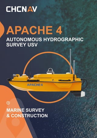
  • 1. APACHE 4 AUTONOMOUS HYDROGRAPHIC SURVEY USV MARINE SURVEY & CONSTRUCTION
  • 2. CHCNAV · APACHE 4 ADVANCED NAVIGATION CONTROLLER The autonomous control system enables APACHE 4 to navigate straight along the cross-section according to the profile view when the flow rate, turbulence, etc. change. The hovering technology can make APACHE 4 hover stably in the turbulent flow at the start and end points of ADCP observation, thereby improving the accuracy of flow estimation. Integrated adaptive water flow straight -line and hovering technology. BUILT-IN SINGLE-BEAM ECHO SOUNDER Single beam sounding data can be used to verify the accuracy of ADCP bottom tracking data, and even fed directly into the ADCP flow measurement software to compensate for the unavailability of ADCP data, and at the same time provide water depth profile data associated with the flow velocity profile measurement. Expand your unmanned survey capability. SMART POSITIONING AND NAVIGATION APACHE 4 provides stable position and heading to the ADCP and autopilot. Its IMU sensor ensures the availability of position data even during momentary GNSS signal loss. The obstacle avoidance radar system and live video feed ensure safe operations in case of loss of visibility or difficult environmental conditions. Completely autonomous, the APACHE 4 is safely operated from the shore. The AutoPlanner and HydroSurvey software suite allows the operator to define the entire mission, from the survey area to the export of the results. Interrupted positioning with GNSS+IMU. COMPATIBLE WITH MOST COMMON ADCPS The APACHE 4 central access shaft design provides unmanned cross-sectional flow measurement solutions for the leading ADCPs on the market. The APACHE 4 is particularly suited for hydrologists using ADCP sensors such as the M9, RTDP 1200, RiverPro, and RiverRay who are looking for an integrated, portable, and affordable unmanned solution. It does not only carry the ADCP, but also provides its positioning, orientation, power, waterproofing, network and 4G transmission solutions. Versatile. Carries up to 30 kg of payload. AUTONOMOUS SURVEY USV HYDROGRAPHIC The APACHE 4 is an Unmanned Surface Vessel (USV) that supports a wide variety of Acoustic Doppler Current Profiler (ADCP) systems available on the market. It offers an unmanned operation solution with a shallow draft, high navigational accuracy and stable hovering for hydrologists when measuring water flow velocity and discharge of a current section. Very compact, it enables easy handling at the mission site, facilitates safe launching and convenient transportation by car. The APACHE 4 USV brings together the best of high-accuracy positioning and automated navigation control technology, built around the operator's habits when conducting ADCP hydrographic cross- section flow measurements. The built-in adaptive water flow and hovering navigation technology significantly improves the accuracy of flow estimation. Even when GNSS positioning might be degraded by obstructed environments, the internal GNSS+IMU module continues to provide reliable position and heading for the ADCP and autopilot controller. The APACHE 4 is a perfect solution for obtaining high quality data for flow and velocity measurements in water where manned boat access is impractical, such as in front of dam structures, or where safety is a concern, such as during flood level measurements.
  • 3. CHCNAV · APACHE 4 Motor SBES Transducer 360° Camera ADCP access shaft EFFICIENT HYDROGRAPHIC SURVEY USV
  • 4. 3 @ CHC Navigation Headquarter Shanghai Huace Navigation Technology Ltd. 599 Gaojing Road, Building D, Shanghai, 201702, China +86 21 54260273 CHC Navigation Europe Infopark Building , Sétány 1, 1117 Budapest, Hungary +36 20 235 8248 +36 20 5999 369 info@chcnav.eu CHC Navigation USA LLC 16412 N 92nd Street, Suite 115, 85 260 Scottsdale, Arizona, USA +1 480 676 4306 CHC Navigation India 409 Trade Center, Khokhra Circle, Maninagar East, Ahmedabad, Gujarat, India +91 90 99 98 08 02 WWW.CHCNAV.COM | SALES@CHCNAV.COM 9 kg IP65 Electric Veering without steering engine Auto-return while low battery or signal loss Two-color light (Display satellite and positioning status) 7000 rpm 2 x 2 hours @ 2 m/s (running on 2 battery sets) 1200 mm x 750 mm x 300 mm 3rd wind level and 2nd wave level 30 kg SPECIFICATIONS * Specifications are subject to change without notice. (1) CHCGD is CHCNAV format. © 2021 Shanghai Huace Navigation Technology Ltd. All rights reserved. The CHC and CHC logo are trademarks of Shanghai Huace Navigation Technology Limited. All other trademarks are the property of their respective owners. Revision May 2021. Type Direction Control Auto-return Indicator Light Weight (w/o instrument and battery) Water Proof Maximum Motor Speed Battery Endurance Hull Dimension (L × W × H) Anti-Wave & Wind Draft Hull Design Propeller type Video 10 cm Triple-hull vessel Brushless DC 700 W 4 x 40,000mAh, 18.5 V 5 m/s Maximum Motor Power Li-ion Battery Capacity Top Speed 360° omnidirectional video Maximum payload Physical Power Communication Interface Positioning D230 Single Beam Echo Sounder Software Network bridge: 1 km and 4G: unlimited 1 km Data Communication Remote Control Range 2.4 GHz Nano SIM 432 0.2 ⁰ @1 m baseline CHCGD (1) , NMEA SDDPT/SDDBT, original waveform R/C Communication SIM Card Slot Channel Heading Accuracy Data Type Manual or Auto-Pilot 1.1 kg 200 KHz 10-30 V DC/ 220 V AC ±0.01 m + 0.1% x D (D is the depth of water) 0.15 m to 200 m 0.01 m 6.5° ± 1° 6 ⁰/ h Data collection and post-processing, coordinate conversion Path planning, autonomous navigation, hull parameter control, multi-angle video display Local multi-sessions and FTP push BDS B1/B2, GPS L1/L2, GLONASS L1/ L2, Galileo E1/E5, SBAS, QZSS Horizontal: 0.5 m Vertical: 0.85 m Horizontal: ±8 mm + 1 ppm Vertical: ±15 mm + 1 ppm Navigation Mode Weight Frequency Supply Voltage Sounding Accuracy Sounding Range Resolution Beam Angle Inertial Navigation Accuracy Hydro Survey Auto Planner Data Storage Satellite System SBAS Positioning Accuracy RTK Positioning Accuracy 2 x RJ45 port 2 x RS232 serial port 1 x RS485 serial port 1 x PPS Interface IP67 Horizontal: 1.5 m Vertical: 2.5 m Horizontal: 0.4 m + 1 ppm Vertical: 0.85 m + 1 ppm Water Proof of Master Control Single Point Position (RMS) DGNSS Positioning Accuracy Macromolecule polyester carbon fiber Material