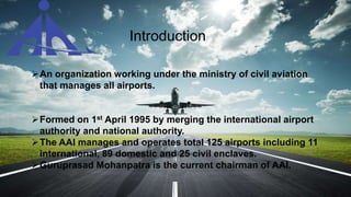
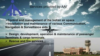
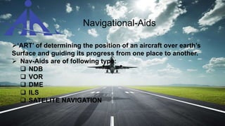
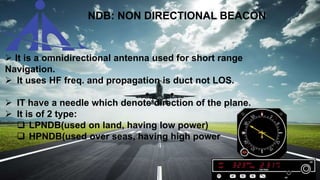
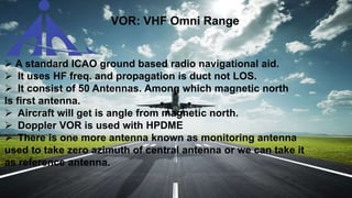
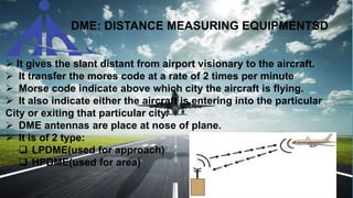
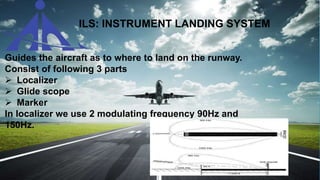
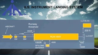
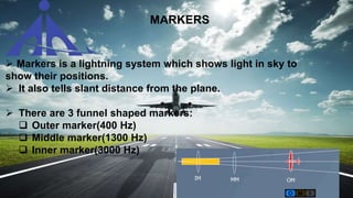
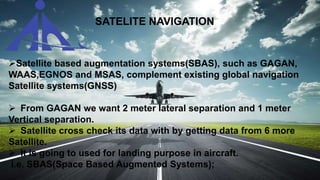
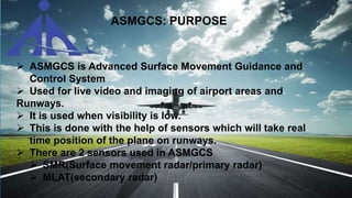
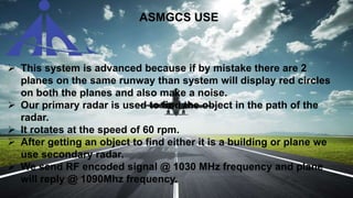
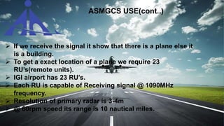
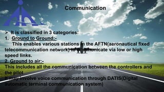
Summer Training Report on Nav-Aids,
ASMGCS and VHF
AIRPORT AUTHORITY OF INDIA,
DELHI
Submitted by-
Shubham Aggarwal
ECE F-4
Introduction
An organization working under the ministry of civil aviation
that manages all airports.
Formed on 1st April 1995 by merging the international airport
authority and national authority.
The AAI manages and operates total 125 airports including 11
international, 89 domestic and 25 civil enclaves.
Guruprasad Mohanpatra is the current chairman of AAI.
Services provided by AAI
Control and management of the Indian air space
Installation and maintenance of various Communication,
Navigation & Surveillance aids.
 Design, development, operation & maintenance of passenger
Terminals & cargo terminals.
 Rescue and fire services.
Navigational-Aids
‘ART’ of determining the position of an aircraft over earth’s
Surface and guiding its progress from one place to another.
 Nav-Aids are of following type:
 NDB
 VOR
 DME
 ILS
 SATELITE NAVIGATION
NDB: NON DIRECTIONAL BEACON
 It is a omnidirectional antenna used for short range
Navigation.
 It uses HF freq. and propagation is duct not LOS.
 IT have a needle which denote direction of the plane.
 It is of 2 type:
 LPNDB(used on land, having low power)
 HPNDB(used over seas, having high power
VOR: VHF Omni Range
 A standard ICAO ground based radio navigational aid.
 It uses HF freq. and propagation is duct not LOS.
 It consist of 50 Antennas. Among which magnetic north
Is first antenna.
 Aircraft will get is angle from magnetic north.
 Doppler VOR is used with HPDME
 There is one more antenna known as monitoring antenna
used to take zero azimuth of central antenna or we can take it
as reference antenna.
DME: DISTANCE MEASURING EQUIPMENTSD
 It gives the slant distant from airport visionary to the aircraft.
 It transfer the mores code at a rate of 2 times per minute
 Morse code indicate above which city the aircraft is flying.
 It also indicate either the aircraft is entering into the particular
City or exiting that particular city.
 DME antennas are place at nose of plane.
 It is of 2 type:
 LPDME(used for approach)
 HPDME(used for area)
ILS: INSTRUMENT LANDING SYSTEM
 Guides the aircraft as to where to land on the runway.
 Consist of following 3 parts
 Localizer
 Glide scope
 Marker
In localizer we use 2 modulating frequency 90Hz and
150Hz.
ILS: INSTRUMENT LANDING SYSTEM
MARKERS
 Markers is a lightning system which shows light in sky to
show their positions.
 It also tells slant distance from the plane.
 There are 3 funnel shaped markers:
 Outer marker(400 Hz)
 Middle marker(1300 Hz)
 Inner marker(3000 Hz)
ILS Performance Categories
OPERTIONS DECISION HEIGHT
CAT I Above 60m
CAT II Between 30 to 60m
CAT IIIA Lower than 30m
CAT IIIB Lower than 15m
CAT IIIC No Decision height
SATELITE NAVIGATION
Satellite based augmentation systems(SBAS), such as GAGAN,
WAAS,EGNOS and MSAS, complement existing global navigation
Satellite systems(GNSS)
 From GAGAN we want 2 meter lateral separation and 1 meter
Vertical separation.
 Satellite cross check its data with by getting data from 6 more
Satellite.
 It is going to used for landing purpose in aircraft.
i.e. SBAS(Space Based Augmented Systems);
ASMGCS: PURPOSE
 ASMGCS is Advanced Surface Movement Guidance and
Control System
 Used for live video and imaging of airport areas and
Runways.
 It is used when visibility is low.
 This is done with the help of sensors which will take real
time position of the plane on runways.
 There are 2 sensors used in ASMGCS
 SMR(Surface movement radar/primary radar)
 MLAT(secondary radar)
 This system is advanced because if by mistake there are 2
planes on the same runway than system will display red circles
on both the planes and also make a noise.
 Our primary radar is used to find the object in the path of the
radar.
 It rotates at the speed of 60 rpm.
 After getting an object to find either it is a building or plane we
use secondary radar.
 We send RF encoded signal @ 1030 MHz frequency and plane
will reply @ 1090Mhz frequency.
ASMGCS USE
 If we receive the signal it show that there is a plane else it
is a building.
 To get a exact location of a plane we require 23
RU’s(remote units).
 IGI airport has 23 RU’s.
 Each RU is capable of Receiving signal @ 1090MHz
frequency.
 Resolution of primary radar is 3-4m
 @ 60rpm speed its range is 10 nautical miles.
ASMGCS USE(cont..)
 It is classified in 3 categories:
1. Ground to Ground:-
This enables various stations in the AFTN(aeronautical fixed
telecommunication network) to communicate via low or high
speed links.
2. Ground to air:-
This includes all the communication between the controllers and
the pilot
It may involve voice communication through DATIS(Digital
automatic terminal communication system)
Communication
 DATIS is used to Transmitt the data to pilot like weather
condition, Air speed,Air pressure, direction and so on.
 We text all the data and with the help of automatic text to
voice conversion, synthetic voice is transmitted using VHF
transmitter.
3. Air to Air:-
 This includes communication between the pilots of two
aircrafts in the air, Such type of communication also uses
VHF and HF frequencies.
 For communication, A frequency band from 118MHz to 136
Mhz is used.
Communication(cont…)
Thank you

Aai industrial training

  • 1.
    Summer Training Reporton Nav-Aids, ASMGCS and VHF AIRPORT AUTHORITY OF INDIA, DELHI Submitted by- Shubham Aggarwal ECE F-4
  • 2.
    Introduction An organization workingunder the ministry of civil aviation that manages all airports. Formed on 1st April 1995 by merging the international airport authority and national authority. The AAI manages and operates total 125 airports including 11 international, 89 domestic and 25 civil enclaves. Guruprasad Mohanpatra is the current chairman of AAI.
  • 3.
    Services provided byAAI Control and management of the Indian air space Installation and maintenance of various Communication, Navigation & Surveillance aids.  Design, development, operation & maintenance of passenger Terminals & cargo terminals.  Rescue and fire services.
  • 4.
    Navigational-Aids ‘ART’ of determiningthe position of an aircraft over earth’s Surface and guiding its progress from one place to another.  Nav-Aids are of following type:  NDB  VOR  DME  ILS  SATELITE NAVIGATION
  • 5.
    NDB: NON DIRECTIONALBEACON  It is a omnidirectional antenna used for short range Navigation.  It uses HF freq. and propagation is duct not LOS.  IT have a needle which denote direction of the plane.  It is of 2 type:  LPNDB(used on land, having low power)  HPNDB(used over seas, having high power
  • 6.
    VOR: VHF OmniRange  A standard ICAO ground based radio navigational aid.  It uses HF freq. and propagation is duct not LOS.  It consist of 50 Antennas. Among which magnetic north Is first antenna.  Aircraft will get is angle from magnetic north.  Doppler VOR is used with HPDME  There is one more antenna known as monitoring antenna used to take zero azimuth of central antenna or we can take it as reference antenna.
  • 7.
    DME: DISTANCE MEASURINGEQUIPMENTSD  It gives the slant distant from airport visionary to the aircraft.  It transfer the mores code at a rate of 2 times per minute  Morse code indicate above which city the aircraft is flying.  It also indicate either the aircraft is entering into the particular City or exiting that particular city.  DME antennas are place at nose of plane.  It is of 2 type:  LPDME(used for approach)  HPDME(used for area)
  • 8.
    ILS: INSTRUMENT LANDINGSYSTEM  Guides the aircraft as to where to land on the runway.  Consist of following 3 parts  Localizer  Glide scope  Marker In localizer we use 2 modulating frequency 90Hz and 150Hz.
  • 9.
  • 10.
    MARKERS  Markers isa lightning system which shows light in sky to show their positions.  It also tells slant distance from the plane.  There are 3 funnel shaped markers:  Outer marker(400 Hz)  Middle marker(1300 Hz)  Inner marker(3000 Hz)
  • 11.
    ILS Performance Categories OPERTIONSDECISION HEIGHT CAT I Above 60m CAT II Between 30 to 60m CAT IIIA Lower than 30m CAT IIIB Lower than 15m CAT IIIC No Decision height
  • 12.
    SATELITE NAVIGATION Satellite basedaugmentation systems(SBAS), such as GAGAN, WAAS,EGNOS and MSAS, complement existing global navigation Satellite systems(GNSS)  From GAGAN we want 2 meter lateral separation and 1 meter Vertical separation.  Satellite cross check its data with by getting data from 6 more Satellite.  It is going to used for landing purpose in aircraft. i.e. SBAS(Space Based Augmented Systems);
  • 13.
    ASMGCS: PURPOSE  ASMGCSis Advanced Surface Movement Guidance and Control System  Used for live video and imaging of airport areas and Runways.  It is used when visibility is low.  This is done with the help of sensors which will take real time position of the plane on runways.  There are 2 sensors used in ASMGCS  SMR(Surface movement radar/primary radar)  MLAT(secondary radar)
  • 14.
     This systemis advanced because if by mistake there are 2 planes on the same runway than system will display red circles on both the planes and also make a noise.  Our primary radar is used to find the object in the path of the radar.  It rotates at the speed of 60 rpm.  After getting an object to find either it is a building or plane we use secondary radar.  We send RF encoded signal @ 1030 MHz frequency and plane will reply @ 1090Mhz frequency. ASMGCS USE
  • 15.
     If wereceive the signal it show that there is a plane else it is a building.  To get a exact location of a plane we require 23 RU’s(remote units).  IGI airport has 23 RU’s.  Each RU is capable of Receiving signal @ 1090MHz frequency.  Resolution of primary radar is 3-4m  @ 60rpm speed its range is 10 nautical miles. ASMGCS USE(cont..)
  • 16.
     It isclassified in 3 categories: 1. Ground to Ground:- This enables various stations in the AFTN(aeronautical fixed telecommunication network) to communicate via low or high speed links. 2. Ground to air:- This includes all the communication between the controllers and the pilot It may involve voice communication through DATIS(Digital automatic terminal communication system) Communication
  • 17.
     DATIS isused to Transmitt the data to pilot like weather condition, Air speed,Air pressure, direction and so on.  We text all the data and with the help of automatic text to voice conversion, synthetic voice is transmitted using VHF transmitter. 3. Air to Air:-  This includes communication between the pilots of two aircrafts in the air, Such type of communication also uses VHF and HF frequencies.  For communication, A frequency band from 118MHz to 136 Mhz is used. Communication(cont…)
  • 18.