Montien tique formulation
•
0 likes•848 views

5th International Disaster and Risk Conference IDRC 2014 Integrative Risk Management - The role of science, technology & practice 24-28 August 2014 in Davos, Switzerland

Recommended
Recommended
More Related Content
What's hot
What's hot (20)
Viewers also liked
Viewers also liked (20)
Similar to Montien tique formulation
Similar to Montien tique formulation (20)
More from Global Risk Forum GRFDavos
More from Global Risk Forum GRFDavos (20)
Recently uploaded
Recently uploaded (20)
Montien tique formulation
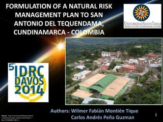
- 1. FORMULATION OF A NATURAL RISK MANAGEMENT PLAN TO SAN ANTONIO DEL TEQUENDAMA, CUNDINAMARCA - COLOMBIA Authors: Wilmer Fabián Montién Tique Source: http://sanantoniodeltequendama- 1 cundinamarca.gov.co/foros.shtml?apc=I---- Carlos Andrés Peña Guzman &x=2719684&s=C&m=v
- 2. INTRODUCTION Floods Landslides Colombia´s development process Water Scarcity Poor populations Climate change Source: http://www.semana.com/nacion/articulo/colombia-recibira-ayuda-venezuela-brasil-caf-para-afectados- lluvias/125190-3
- 3. PROBLEM DEFINITION San Antonio del Tequendama, Cundinamarca Colombia Landslides Floods Earthquakes Source: http://sanantoniodeltequendama- 3 cundinamarca.gov.co/noticias.shtml?apc=Cnxx-1- &x=2720026
- 4. Municipal Plan for Disaster Risk Management (MPDRM) National Unit for Disaster Risk Management (UNGRD) from Colombia. Instrument Prioritize Program Formule Risk knowledge Risk reduction Disaster management Municipal guide for risk management Technical assistance project in municipal and goverment risk management. Control Document structure Risk scenarios general characterization Programmatic component Diagnostic Identification risk scenarios Risk scenarios characterization Programs and actions formulation. Source: Author, 2013.
- 5. 1. RISK SCENARIOS GENERAL CHARACTERIZATION Source: Author, 2013.
- 6. SAN ANTONIO DEL TEQUENDAMA MUNICIPALITY Source: Author, 2013.
- 7. Map 1. San Antonio del Tequendama municipality delimitation. Source: Author, 2013.
- 8. Map 2. San Antonio del Tequendama administrative division Source: Author, 2013.
- 9. Demography 13. 885 People 13000 12500 12000 11500 11000 10500 2008 2009 2010 2011 2012 Población (Habitantes) Año 15000 10000 5000 0 2008 2009 2010 2011 2012 Población (Habitantes) Año 12000 10000 8000 6000 4000 2000 0 2008 2009 2010 2011 2012 Población (Habitantes) Año Growth population Urban growth population Rural growth population
- 10. DIAGNOSTIC Cundinamarca Department Height 850 m - 2700 m Rural Zone : 23 Communities Urban Zone : 4 Center population Bituima and Corraleja Zaragoza Faults Predominant soils: IV and VI Physiography: Peaks and ridges 10 % of the territory is flat, 25% hilly and 65% rugged Average rainfall: 1500 mm Average temperature: 20°C Bimodal annual rainfall 70% Agriculture 30% Poultry and pork sector Geography Geology and edaphology Topography Climatology Hydric resources Economic activities Source: Author, 2013.
- 11. IDENTIFICATION RISK SCENARIOS Secondary information Identification risk scenarios Guide for the preparation of land use plan methodology (IGAC) gvSIG software Risk Maps MPDRM Methodology CAR IDEAM IGAC SGC UNGRD Different timescales Natural hazard studies Identification of high risk areas in the scenarios 11
- 12. Source: Author, 2013. Map 3. Landslides related to slope
- 13. Map 4. Landslides related to erosion Source: Author, 2013.
- 14. Map 5. Flooding potential areas Source: Author, 2013.
- 15. Map 6. Earthquakes potential areas Source: Author, 2013.
- 16. 80% of the municipality population is vulnerable to the three risk scenarios identificated, represented by San José, Chicaque, La Rápida, Vancouver, Zaragoza, Quebradagrande, Caicedo, Cusio, Arracachal, Santafe, Patio de Bolas, El Cajón, Las Angustias, La Rambla and Vancouver communities as well as the municipal center and inspección de Santandercito urban center. 16
- 17. Map 7. Vulnerable Municipality population Source: Author, 2013.
- 18. Risk scenarios evaluation. RISK SCENARIOS EVALUATION Risk control analysis CAPRA Software Probabilistic analysis Probabilistic risk analysis Frequency Severity BOEHM RISKIT Historical data Methodology review SEI- SRE (Software Engineering Institute -Software Risk Evaluation) SERUM (Software Engineering Risk Understanding and Management) SERIM (Software Engineering Risk Index Management) SEI- SRE Methodology Risk scenarios priorization Qualitative analysis (brainstorming and diagrams) Risk management analysis prioritizing risk scenarios. Cost - benefit analysis Risk analysis using stadistics. @Risk Software Exposed elements definition Vulnerability definition @Risk Software Result Risk level Source: Author, 2013.
- 19. Chi squared test results, using @ RISK Software Probability frequency estimation, using Poisson Distribution with a stadistic media of 1. Probability frequency estimation, using Poisson Distribution with a stadistic media of 2. 19
- 20. Frequency criteria according SEI- SRE methodology Table 1. Frequency criteria description according SEI – SRE Methodology SourRce:e Rosbuertls,t 2s011. LANDSLIDES SCENARIO: “FREQUENT” FLOODS SCENARIO: “PROBABLE” EARTHQUAKES SCENARIO: “OCCASIONAL” 20
- 21. SEVERITY • Elements exposed definition. • Physical and human vulnerability definition. • Probabilistic risk analysis. 21
- 22. Physical and human vulnerability definition Graphics 1 and 2. Vulnerability functions by floods.M1 y M2. FSuoeunrctee:: AAuutthoor,r 2, 2001133. . 22
- 23. MODEL RESULTS USING @RISK SOFTWARE Source: Author, 2013. 23 Source: Author, 2013.
- 24. FRECUENCY AND SEVERITY PARAMETERS RESULTS OBTAINED RISK LEVEL ESTIMATED FOR EACH RISK SCENARIO EVALUATED TEQUENDAMA. Fuente: Autor, 2013. 24 Source: Author, 2013. Risk scenarios priorization
- 25. RISK SCENARIOS GENERAL CHARACTERIZATION Landslides risk scenario 1. Historical background 2. Threatening phenomenon description Bimodal annual rainfall Soil properties Slope Causes Deforestation Agriculture and livestock Unknowledge 3. Future analysis Measures for risk reduce Fuente: Autor, 2013. 25 Source: Author, 2013.
- 26. RISK SCENARIOS GENERAL CHARACTERIZATION Floods risk scenario 1. Historical background 2. Threatening phenomenon description Bimodal annual rainfall Topography Mudflows Causes Intensive agricultural uses Urbanization Unknowledge 3. Future analysis Measures for risk reduce Fuente: Autor, 2013. 26 Source: Author, 2013.
- 27. RISK SCENARIOS GENERAL CHARACTERIZATION Earthquakes risk scenario 1. Threatening phenomenon description Plate tectonics Active faults Soil properties Causes Earth’s dynamic processes 2. Future analysis Measures for risk reduce Fuente: Autor, 2013. 27 Source: Author, 2013.
- 28. 2. PROGRAMMATIC COMPONENT Source: Author, 2013.
- 29. PROGRAMS AND ACTIONS FORMULATION Programs and improvement actions against the risk scenarios analyzed. Source: Author, 2013.
- 30. PROGRAMS AND ACTIONS COST 30 Source: Author, 2013.
- 31. MULTICRITERIA ANALYSIS Definición de los desempeños
- 32. MODEL RESULTS Fuente: Autor, 2013. STRUCTURING OF VALUE TREES CONSTRUCTION OF CRITERIA DESCRIPTORS SCORING OF OPTIONS AND RESULTS. 32 Source Author, 2013.
- 33. ADDED VALUE FOR THE POST 2015 FRAMEWORK FOR DISASTER RISK REDUCTION Source Author, 2013.
- 34. CONCLUTIONS • 80% of the current population is vulnerable to the 3 risk scenarios analyzed. • The landslide risk scenario was the most critical, followed by floods and finally earthquakes. • The main causes in the risk scenarios by landslides and floods were by anthropic activities like deforestation for agriculture and livestock. • It’s more feasible invest in preventive actions to continue investing in projects to mitigate the risk once the emergency occur. • Specify the way to prioritize risk scenarios (MPDRM Methodology limitation) structure analysis in the Risk scenario characterization (MPDRM Methodology benefit) 34
- 35. “WE CANNOT STOP NATURAL DISASTERS BUT WE CAN ARM OURSELVES WITH KNOWLEDGE: SO MANY LIVES WOULDN´T HAVE TO BE LOST IF THERE WAS ENOUGH DISASTER PREPAREDNESS” PETRA NEMCOVA. 35