SlideShare a Scribd company logo
1 of 43
Download to read offline
National Aeronautics and Space Administration
Amita Mehta and Sean McCartney
6 August 2019
Earth Observations for Disaster Risk Assessment and
Resilience
2
NASA’s Applied Remote Sensing Training Program
Learning Objectives
• Learn about available NASA remote sensing and socioeconomic data and how to
combine them for Disaster Risk Assessment (DRA)
• Understand how to apply these data for assessing risk from floods, tropical
cyclones, and extreme heat in specific regions
• Demonstrate how operational agencies are using NASA data for risk management
3
NASA’s Applied Remote Sensing Training Program
Training Outline
Aug 6, 2019
NASA Remote
Sensing and
Socioeconomic
Data for Disaster
Risk Assessment
Aug 13, 2019
Disaster Risk
Assessment Case
Studies Using
Remote Sensing
Data
Aug 8, 2019
Assessing the Risk
of Floods &
Cyclones Using
NASA Data
Aug 15, 2019
Operational
Application of
Remote Sensing for
Disaster
Management
Image Credits (left to right): EM-DAT; NASA; WRI Resource Watch; PDC
4
NASA’s Applied Remote Sensing Training Program
Homework and Certificate
• Homework:
– 2 homework assignments
– Answers to homework must be submitted via Google Forms
• Certificate of Completion:
– Attend all webinars
– Complete 2 homework assignments by 30 August
• You will receive certificates approximately two months after the completion of the
course from: marines.martins@ssaihq.com
5
NASA’s Applied Remote Sensing Training Program
Part-1 Outline
• About ARSET
• Disaster Risk Assessment (DRA): Concept and Definitions
• Remote Sensing and Earth System Model Data Sources Relevant for DRA
• Socioeconomic Data Relevant for DRA
About ARSET
7
NASA’s Applied Remote Sensing Training Program
NASA’s Applied Remote Sensing Training Program (ARSET)
• Empowering the global community
through remote sensing training
• Seeks to increase the use of Earth
science in decision-making through
training for:
– policy makers
– environmental managers
– other professionals in the public and
private sector
• Training topics focus on:
– air quality
– disasters
Helping Professionals Solve Problems
Including…
http://arset.gsfc.nasa.gov/
– land
– water
8
NASA’s Applied Remote Sensing Training Program
ARSET Training Focus Areas
Air Quality Disasters Land Water
9
NASA’s Applied Remote Sensing Training Program
ARSET Team Members
Program Support
• Ana Prados, Program Manager (GSFC)
• David Barbato, Spanish Translator (GSFC)
• Brock Blevins, Training Coordinator (GSFC)
• Annelise Carleton-Hug, Program Evaluator
(Consultant)
• Elizabeth Hook, Technical Writer/Editor (GSFC)
• Selwyn Hudson-Odoi, Training Coordinator
(GSFC)
• Marines Martins, Project Support (GSFC)
• Stephanie Uz, Program Support (GSFC)
Disasters & Water Resources
• Amita Mehta, Instructor (GSFC)
• Erika Podest, Instructor (JPL)
• Sean McCartney, Instructor (GSFC)
Land & Wildfires
• Amber Jean McCullum, Lead (ARC)
• Juan Torres-Pérez, Instructor (ARC)
Health & Air Quality
• Pawan Gupta, Lead (MSFC)
• Melanie Follette-Cook, Instructor (GSFC)
Acknowledgement: We wish to thank Nancy Searby for her continued support
GSFC: Goddard Space Flight Center, JPL: Jet Propulsion Laboratory, ARC: Ames Research Center, MSFC: Marshall
Space Flight Center
10
NASA’s Applied Remote Sensing Training Program
ARSET Training Formats
Online
Free
Online training
1-5 weeks long
1-6 hours a week
Available at all levels
Materials available in English &
Spanish
In-Person
Hosted with a partner
Typically in a computer lab
2-7 days long
Focus on locally-relevant case
studies
Certain topics presented in Spanish
11
NASA’s Applied Remote Sensing Training Program
ARSET Training Levels
Fundamentals (Level 0)
Assumes no prior knowledge of remote sensing
Fundamentals of Remote Sensing
Basic (Level 1)
Requires level 0 training or equivalent knowledge
Covers specific applications
Introduction to Synthetic Aperture Radar
Advanced (Level 2)
Requires level 1 training or equivalent knowledge
In-depth and highly focused topics
Advanced Webinar: SAR Image and Data Processing
12
NASA’s Applied Remote Sensing Training Program
ARSET Trainings
110+ trainings 19,400+ participants 160+ countries 5,000+ organizations
* size of circle corresponds to number of participants
13
NASA’s Applied Remote Sensing Training Program
Sign up for the ARSET Listserv
https://lists.nasa.gov/mailman/listinfo/arset
Disaster Risk Assessment: Concept and
Definitions
15
NASA’s Applied Remote Sensing Training Program
Terminology
• Disaster Risk Assessment (DRA)
• Hazard
• Exposure
• Vulnerability
• Disaster
• Disaster Risk
• Resilience
• Disaster Risk Reduction (DRR)
• Disaster Risk Management (DRM)
Text Credit: UNISDR
• A process to determine the nature and
extent of risks
• Requires analysis of hazards and existing
conditions of exposure and vulnerability
• Focuses on potential harm to
– people
– property
– services
– livelihoods
– and the environment people depend on
16
NASA’s Applied Remote Sensing Training Program
Terminology
• Disaster Risk Assessment (DRA)
• Hazard
• Exposure
• Vulnerability
• Disaster
• Disaster Risk
• Resilience
• Disaster Risk Reduction (DRR)
• Disaster Risk Management (DRM)
• A comprehensive DRA evaluates the
magnitude and likelihood of potential losses
• It provides full understanding of the causes
and impact of those losses
• DRA is an integral part of Disaster Risk
Management, decision and policy-making
processes, and requires close collaboration
among various parts of society
Text Credit: UNISDR
17
NASA’s Applied Remote Sensing Training Program
Terminology
• Disaster Risk Assessment
• Hazard
• Exposure
• Vulnerability
• Disaster
• Disaster Risk
• Resilience
• Disaster Risk Reduction (DRR)
• Disaster Risk Management (DRM)
• A process, phenomenon, or human activity
that may cause:
– loss of life
– injury or other health impacts
– property damage
– social and economic disruption
– environmental degradation
• A hazard is characterized by:
– location or geographic area
– intensity or magnitude
– frequency or return period
– probability of occurrence
Text Credit: UNISDR
18
NASA’s Applied Remote Sensing Training Program
Terminology
• Disaster Risk Assessment
• Hazard
• Exposure
• Vulnerability
• Disaster
• Disaster Risk
• Resilience
• Disaster Risk Reduction (DRR)
• Disaster Risk Management (DRM)
• Natural hazards arise from events,
sometimes acting in combination, including:
– geological (earthquakes, landslides,
volcanoes)
– meteorological (storms, extreme
temperatures, wildfires)
– hydrological (floods, droughts)
– oceanic (wave surge)
– biological (disease epidemics)
• Human induced hazards include:
– industrial and transportation accidents
– environmental pollution
– human conflicts
– migration
Text Credit: UNISDR
19
NASA’s Applied Remote Sensing Training Program
Terminology
• Disaster Risk Assessment
• Hazard
• Exposure
• Vulnerability
• Disaster
• Disaster Risk
• Resilience
• Disaster Risk Reduction (DRR)
• Disaster Risk Management (DRM)
• The situation of people, infrastructure,
housing, production capacities, and other
tangible human assets located in hazard-
prone areas
• Exposure can be measured by the number
of people or types of assets in an area
• To estimate quantitative risks associated with
a hazard, exposure measurements can be
combined with specific vulnerability and
capacity of exposed elements
Text Credit: UNISDR
20
NASA’s Applied Remote Sensing Training Program
Terminology
• Disaster Risk Assessment
• Hazard
• Exposure
• Vulnerability
• Disaster
• Disaster Risk
• Resilience
• Disaster Risk Reduction (DRR)
• Disaster Risk Management (DRM)
• Determined by physical, social, economic,
and environmental factors or processes
• Assesses the susceptibility of an individual,
community, asset, or system to the impact of
hazards
• Depends on cultural and institutional factors,
including:
– poor design and construction of buildings
– poor environmental management
– inadequate protection of assets
– lack of public information and awareness
– levels of poverty and education
– limited official recognition of risks and
preparedness
– weak governance
Text Credit: UNISDR
21
NASA’s Applied Remote Sensing Training Program
Terminology
• Disaster Risk Assessment
• Hazard
• Exposure
• Vulnerability
• Disaster
• Disaster Risk
• Resilience
• Disaster Risk Reduction (DRR)
• Disaster Risk Management (DRM)
• A serious disruption of the functioning of a
community or a society at any scale due to
hazardous events leading to one or more of
the following losses and impacts:
– human
– material
– economic
– environmental
Text Credit: UNISDR
22
NASA’s Applied Remote Sensing Training Program
Terminology
• Disaster Risk Assessment
• Hazard
• Exposure
• Vulnerability
• Disaster
• Disaster Risk
• Resilience
• Disaster Risk Reduction (DRR)
• Disaster Risk Management (DRM)
• The potential loss of life, injury, or destroyed
or damaged assets that could occur to a
community as a function of a hazard,
exposure, or vulnerability
• Made up of different types of potential
losses that can be difficult to quantify
Text Credit: UNISDR
23
NASA’s Applied Remote Sensing Training Program
Terminology
• Disaster Risk Assessment
• Hazard
• Exposure
• Vulnerability
• Disaster
• Disaster Risk
• Resilience
• Disaster Risk Reduction (DRR)
• Disaster Risk Management (DRM)
• Ability of a system, community, or society
exposed to hazards to:
– resist
– absorb
– accommodate
– adapt to
– recover from effects
• Refers to the timely and efficient response,
including through preservation & restoration
of basic structures and functions
Text Credit: UNISDR
24
NASA’s Applied Remote Sensing Training Program
Terminology
• Disaster Risk Assessment
• Hazard
• Exposure
• Vulnerability
• Disaster
• Disaster Risk
• Resilience
• Disaster Risk Reduction (DRR)
• Disaster Risk Management (DRM)
• Aimed at
– preventing new disasters
– reducing existing disaster risk
– managing residual risk
• These contribute to strengthening resilience
• Involves developing strategies and policy
objectives
– across different timescales
– with concrete targets, indicators, and
timeframes
Text Credit: UNISDR
25
NASA’s Applied Remote Sensing Training Program
Terminology
• Disaster Risk Assessment
• Hazard
• Exposure
• Vulnerability
• Disaster
• Disaster Risk
• Resilience
• Disaster Risk Reduction (DRR)
• Disaster Risk Management (DRM)
• Application of Disaster Risk Reduction
policies and strategies to:
– prevent new disaster risk
– reduce existing disaster risk
– manage residual risk
• Can be categorized into:
– Prospective Disaster Risk Management
– Corrective Disaster Risk Management
– Compensatory Disaster Risk Management
(also referred to as Residual Risk
Management)
Text Credit: UNISDR
26
NASA’s Applied Remote Sensing Training Program
How to Conduct a Disaster Risk Assessment
Understanding of Current
Situation, Needs, and Gaps:
• systematic inventory
and evaluation of
existing risk assessment
studies, available data
and information, and
current institutional
framework and
capabilities
Identify the prevailing nature, location,
intensity, and likelihood of major hazards
Hazard Assessment
According to the UN Development Program (UNDP) the following steps are required for a
comprehensive risk assessment:
Steps within red boxes can
be derived from data
freely available from NASA
Exposure Assessment
Vulnerability Analysis
Loss/Impact Analysis
Risk Profiling &
Evaluation
Formulation or Revision
of DRR Strategies and
Action Plans
Identify population & assets at risk and
delineate disaster-prone areas
Determine the capacity of a system to
withstand given hazard scenarios
Estimate potential losses of exposed
population, property, services, livelihoods,
and environment. Assess their potential
impacts.
Identify cost-effective risk reduction options
in terms of socio-economic concerns and
capacity
Include setting priorities, allocating financial
and human resources, and installing a DRR
program
Text Credit: UNDP
27
NASA’s Applied Remote Sensing Training Program
Types of Natural Hazards
• Cyclones
• Droughts
• Earthquakes
• Extreme Precipitation
• Extreme Temperatures
• Floods
• Landslides
• Tsunamis
• Volcanoes
• Wildfires
Image Credits (Clockwise from Top Left): NOAA, USAF, USDA, Kieran Wood
28
NASA’s Applied Remote Sensing Training Program
Global Disaster Statistics (1998-2017)
In this time frame, floods and storms were the most dominant hazards
Image Credit: CRED and UNISDR
29
NASA’s Applied Remote Sensing Training Program
Global Disaster Statistics (1998-2017)
Floods, droughts, and storms affected the highest number of people
Image Credit: UNDRR, data from CRED and UNISDR
30
NASA’s Applied Remote Sensing Training Program
Global Disaster Statistics (1998-2017)
Earthquakes, storms, extreme heat, and floods
caused the most number of deaths
Based on these statistics, this webinar will focus on
disaster risk assessment (DRA) for:
• cyclones
• urban floods (Extreme Precipitation)
• extreme heat
Image Credit: CRED and UNISDR
31
NASA’s Applied Remote Sensing Training Program
Assessing the Potential Risk of a Hazard
Identify the nature, location, intensity, and likelihood of major hazards prevailing in a
community or environment
• Requires data and information about a type of hazard or multiple hazards:
– Past/historical data
• identify hazard-prone regions
• assess frequency and intensity of hazards
• establish strategies for DRR
– Current data for near-real time actions for DRR
– Future data (forecast) for assessing potential risk to an approaching hazard,
planning near-future actions for DRR
– Quantitative analysis of past-current-forecast data
32
NASA’s Applied Remote Sensing Training Program
Hazard Assessment Data Needs
• Cyclones: frequency, probability, intensity
– based on tracks, landfall locations, storm surge, sea level pressure, winds,
precipitation
• Floods: flood plain extent, frequency, intensity, duration
– based on precipitation, soil moisture, terrain/slope, impermeable surface
• Extreme Heat: frequency, probability, duration
– based on surface temperature, surface humidity
Data in blue are derived from NASA Earth Observations and Models
Data in brown are available from NOAA, the Joint Typhoon Warning Center, and
Worldwide Tropical Cyclone Centers
Reference: NOAA, Joint Typhoon Warning Center, Worldwide Tropical Cyclone Centers
Remote Sensing Data Sources Relevant for
Disaster Risk Assessment
34
NASA’s Applied Remote Sensing Training Program
Data for Hazard Assessment: Past Data (>18 Years)
Data Parameter Hazard Source
Spatial
Resolution
*Temporal Information
Land Surface Temperature
Surface Air Temperature
Extreme Heat
MODIS,
GLDAS,
MERRA-2
1 Km
0.25o x 0.25o
0.5o x 0.667o
2000-present
2000-present
1980-Present
Surface Humidity Extreme Heat
GLDAS,
MERRA-2
0.25o x 0.25o
0.5o x 0.667o
2000-present
1980-Present
Winds Cyclone MERRA-2 0.5o x 0.667o 1980-Present
Precipitation Flood, Cyclone
*TRMM TMPA
GPM/IMERG-
Final
0.25o x 0.25o
0.1o x 0.1o
1998-present
2000-present
Soil Moisture Flood
GLDAS
MERRA-2
0.25o x 0.25o
0.5o x 0.667o
2000-present
1980-Present
Elevation Flood SRTM
1-arc second
3-arc second
2000-present
*A combined TRMM/GPM precipitation data product is now available spanning 2000-present
35
NASA’s Applied Remote Sensing Training Program
Data for Hazard Assessment: Past Data (4-5 Years)
Data Parameter Hazard Source Spatial Resolution *Temporal Information
Precipitation Flood, Cyclone
GPM/IMERG-
Early and
Late
0.1o x 0.1o 3/2014 - present
Storm Surge Cyclone
*SLOSH (US
Only)
Tens of meters to
1 km
2014 - present
Soil Moisture Flood
GEOS-5
SMAP
0.3125o x 0.25o
36 km, 9 km
4/2015 - present
*All data have global coverage except for SLOSH
36
NASA’s Applied Remote Sensing Training Program
Data for Hazard Assessment: Near-Real Time and Forecasts
Data Parameter Hazard Source Spatial Resolution
Temporal
Information
Land Surface and
Surface Air Temperature
Extreme Heat
MODIS,
GEOS-5
1 Km
0.3125o x 0.25o
NRT
NRT and 10-day
Forecast
Surface Humidity Extreme Heat GEOS-5 0.3125o x 0.25o
Winds Cyclone GEOS-5 0.3125o x 0.25o
Soil Moisture Flood
GEOS-5
SMAP
0.3125o x 0.25o
36 km, 9 km
Precipitation
Flood
Cyclone
GEOS-5
GPM/IMERG
0.3125o x 0.25o
0.1o x 0.1o
Storm Surge Cyclone
*SLOSH (US
Only)
Tens of meters to 1
km
NRT and 48-hour
Forecast
* All data have global coverage except for SLOSH
37
NASA’s Applied Remote Sensing Training Program
For More Information on Data for Hazard Assessment
• Past Data (>18 Years)
– Fundamentals of Remote Sensing, Water Resources Management
– Intermediate Webinar: Remote Sensing for Disaster Scenarios (2019)
– Introductory Webinar: Monitoring Tropical Storms for Emergency Preparedness (2018)
• Past Data (4-5 Years) & Near-Real Time Forecasts
– Intermediate Webinar: Remote Sensing for Disaster Scenarios (2019)
– Introductory Webinar: Monitoring Tropical Storms for Emergency Preparedness (2018)
38
NASA’s Applied Remote Sensing Training Program
Data Access for Hazard Assessment
Data Access Tool Web Address
Giovanni & NASA Earthdata GES DISC
(MERRA-2, GLDAS, TRMM-TMPA, GPM-IMERG)
https://giovanni.gsfc.nasa.gov/giovanni/
https://disc.gsfc.nasa.gov/
Precipitation Measurement Mission
(GPM-IMERG)
https://pmm.nasa.gov/data-access/downloads/
AppEARS
(SMAP, MODIS)
https://nsidc.org/support/how/point-and-area-samples-
smap-data-using-appeears
NCCS Data Portal-Data Share
(GEOS-5)
https://fluid.nccs.nasa.gov/weather/
https://portal.nccs.nasa.gov/datashare/gmao_ops/pu
b/fp/forecast/
Probabilistic Tropical Storm Surge (P-Surge) https://slosh.nws.noaa.gov/psurge2.0/
39
NASA’s Applied Remote Sensing Training Program
Hazard Assessment and DRR
• Analysis of past data help identify
hazard-prone areas, intensity,
and frequency of hazard(s)
• Based on past hazard analysis
together with exposure,
vulnerability, and socioeconomic
impact (DRA), this helps prepare
for current and future DRR
• Useful for planning overall DRM
Image Credit: WMO
40
NASA’s Applied Remote Sensing Training Program
Disaster Risk Assessment
• DRA requires analysis of hazard assessment together with exposure (i.e. elements
at risk) and vulnerability (physical, social, economic, and environmental)
• Next Susana Adamo from SEDAC will present socioeconomic data relevant for
exposure and vulnerability for Disaster Risk Assessment
41
NASA’s Applied Remote Sensing Training Program
Reference
GEOS-5: Goddard Earth Observing System Model, Version 5
GLDAS: Global Land Data Assimilation System, version 2.1
GPM: Global Precipitation Measurement
IMERG: Integrated Multi-satellitE Retrievals for GPM
MERRA-2: Modern-Era Retrospective analysis for Research and Applications, Version 2
MODIS: MODerate-resolution Imaging Spectroradiometer
SLOSH: Sea Lake and Overland Surge from Hurricanes
SMAP: Soil Moisture Active Passive
SRTM: Shuttle Radar Topography Mission
TMPA: TRMM Multi-satellite Precipitation Analysis
TRMM: Tropical Rainfall Measuring Mission
Socioeconomic Data Relevant for Disaster Risk Assessment
Dr. Susana Adamo, CIESIN, Columbia University
43
NASA’s Applied Remote Sensing Training Program
Coming up Next Week -
• DRA from past earth observations
• DRA in near real-time and from10-day forecast

More Related Content

Similar to DisasterRisk_Part1.pdf

Vulnerability Mapping (Vulnerability Assessment)
Vulnerability Mapping (Vulnerability Assessment)Vulnerability Mapping (Vulnerability Assessment)
Vulnerability Mapping (Vulnerability Assessment)ESD UNU-IAS
 
MICRO-ZONING AND RISK MAPPING FOR DISASTER PREPAREDNESS
MICRO-ZONING AND RISK MAPPING FOR DISASTER PREPAREDNESSMICRO-ZONING AND RISK MAPPING FOR DISASTER PREPAREDNESS
MICRO-ZONING AND RISK MAPPING FOR DISASTER PREPAREDNESSEminent Planners
 
Disaster Management.pdf
Disaster Management.pdfDisaster Management.pdf
Disaster Management.pdfChandrika947449
 
Disaster Risk Resilience, curriculum that is fit for purpose in the sector, C...
Disaster Risk Resilience, curriculum that is fit for purpose in the sector, C...Disaster Risk Resilience, curriculum that is fit for purpose in the sector, C...
Disaster Risk Resilience, curriculum that is fit for purpose in the sector, C...Bibhuti Bhusan Gadanayak
 
Ppt on Disaster Risk Management and J & K Floods 2014
Ppt on Disaster Risk Management and J & K Floods 2014Ppt on Disaster Risk Management and J & K Floods 2014
Ppt on Disaster Risk Management and J & K Floods 2014Dr. Mohmed Amin Mir
 
Risk Assessment
Risk AssessmentRisk Assessment
Risk AssessmentAhmed871002
 
Disaster management using Remote sensing and GIS
Disaster management using Remote sensing and GISDisaster management using Remote sensing and GIS
Disaster management using Remote sensing and GISHarsh Singh
 
noaa_csc1231455445156555455656666566.ppt
noaa_csc1231455445156555455656666566.pptnoaa_csc1231455445156555455656666566.ppt
noaa_csc1231455445156555455656666566.pptPapuKumarNaik1
 
IDRC global risk of population by SDS-Yang Hui-Min_template2
IDRC global risk of population by SDS-Yang Hui-Min_template2IDRC global risk of population by SDS-Yang Hui-Min_template2
IDRC global risk of population by SDS-Yang Hui-Min_template2Global Risk Forum GRFDavos
 
Awareness of Disaster Risk Reduction (DRR) among Student of the Catanduanes S...
Awareness of Disaster Risk Reduction (DRR) among Student of the Catanduanes S...Awareness of Disaster Risk Reduction (DRR) among Student of the Catanduanes S...
Awareness of Disaster Risk Reduction (DRR) among Student of the Catanduanes S...Dr. Amarjeet Singh
 
EXPLORE EARTH by John J. Murray | TROPICS Applications Workshop II, February ...
EXPLORE EARTH by John J. Murray | TROPICS Applications Workshop II, February ...EXPLORE EARTH by John J. Murray | TROPICS Applications Workshop II, February ...
EXPLORE EARTH by John J. Murray | TROPICS Applications Workshop II, February ...Helen Gynell
 
Space Technologies for Disaster Management
Space Technologies for Disaster ManagementSpace Technologies for Disaster Management
Space Technologies for Disaster ManagementSTDM
 
Mainstreaming Disaster Risk Reduction/Climate Change Adaptation into Local De...
Mainstreaming Disaster Risk Reduction/Climate Change Adaptation into Local De...Mainstreaming Disaster Risk Reduction/Climate Change Adaptation into Local De...
Mainstreaming Disaster Risk Reduction/Climate Change Adaptation into Local De...practicalanswerssl
 
Stakeholder Engagement: Meeting Human and Environmental Needs
Stakeholder Engagement: Meeting Human and Environmental Needs Stakeholder Engagement: Meeting Human and Environmental Needs
Stakeholder Engagement: Meeting Human and Environmental Needs Cultural Vistas
 

Similar to DisasterRisk_Part1.pdf (20)

Vulnerability Mapping (Vulnerability Assessment)
Vulnerability Mapping (Vulnerability Assessment)Vulnerability Mapping (Vulnerability Assessment)
Vulnerability Mapping (Vulnerability Assessment)
 
MICRO-ZONING AND RISK MAPPING FOR DISASTER PREPAREDNESS
MICRO-ZONING AND RISK MAPPING FOR DISASTER PREPAREDNESSMICRO-ZONING AND RISK MAPPING FOR DISASTER PREPAREDNESS
MICRO-ZONING AND RISK MAPPING FOR DISASTER PREPAREDNESS
 
Disaster Management.pdf
Disaster Management.pdfDisaster Management.pdf
Disaster Management.pdf
 
Disaster Risk Resilience, curriculum that is fit for purpose in the sector, C...
Disaster Risk Resilience, curriculum that is fit for purpose in the sector, C...Disaster Risk Resilience, curriculum that is fit for purpose in the sector, C...
Disaster Risk Resilience, curriculum that is fit for purpose in the sector, C...
 
Ppt on Disaster Risk Management and J & K Floods 2014
Ppt on Disaster Risk Management and J & K Floods 2014Ppt on Disaster Risk Management and J & K Floods 2014
Ppt on Disaster Risk Management and J & K Floods 2014
 
Risk Assessment
Risk AssessmentRisk Assessment
Risk Assessment
 
Disaster management using Remote sensing and GIS
Disaster management using Remote sensing and GISDisaster management using Remote sensing and GIS
Disaster management using Remote sensing and GIS
 
noaa_csc1231455445156555455656666566.ppt
noaa_csc1231455445156555455656666566.pptnoaa_csc1231455445156555455656666566.ppt
noaa_csc1231455445156555455656666566.ppt
 
Mark Svoboda
Mark SvobodaMark Svoboda
Mark Svoboda
 
Disaster management
Disaster managementDisaster management
Disaster management
 
EDDY-IDRC DAVOS-CEOSv5
EDDY-IDRC DAVOS-CEOSv5EDDY-IDRC DAVOS-CEOSv5
EDDY-IDRC DAVOS-CEOSv5
 
IDRC global risk of population by SDS-Yang Hui-Min_template2
IDRC global risk of population by SDS-Yang Hui-Min_template2IDRC global risk of population by SDS-Yang Hui-Min_template2
IDRC global risk of population by SDS-Yang Hui-Min_template2
 
Awareness of Disaster Risk Reduction (DRR) among Student of the Catanduanes S...
Awareness of Disaster Risk Reduction (DRR) among Student of the Catanduanes S...Awareness of Disaster Risk Reduction (DRR) among Student of the Catanduanes S...
Awareness of Disaster Risk Reduction (DRR) among Student of the Catanduanes S...
 
EXPLORE EARTH by John J. Murray | TROPICS Applications Workshop II, February ...
EXPLORE EARTH by John J. Murray | TROPICS Applications Workshop II, February ...EXPLORE EARTH by John J. Murray | TROPICS Applications Workshop II, February ...
EXPLORE EARTH by John J. Murray | TROPICS Applications Workshop II, February ...
 
Space Technologies for Disaster Management
Space Technologies for Disaster ManagementSpace Technologies for Disaster Management
Space Technologies for Disaster Management
 
Mainstreaming Disaster Risk Reduction/Climate Change Adaptation into Local De...
Mainstreaming Disaster Risk Reduction/Climate Change Adaptation into Local De...Mainstreaming Disaster Risk Reduction/Climate Change Adaptation into Local De...
Mainstreaming Disaster Risk Reduction/Climate Change Adaptation into Local De...
 
Mod 2 part 1.pdf
Mod 2 part 1.pdfMod 2 part 1.pdf
Mod 2 part 1.pdf
 
Stakeholder Engagement: Meeting Human and Environmental Needs
Stakeholder Engagement: Meeting Human and Environmental Needs Stakeholder Engagement: Meeting Human and Environmental Needs
Stakeholder Engagement: Meeting Human and Environmental Needs
 
Davos Maposa 2014-IDRC14
Davos Maposa 2014-IDRC14Davos Maposa 2014-IDRC14
Davos Maposa 2014-IDRC14
 
Sem 5 mod-1 disaster management introduction (CIVIL, ELE, MECH, EC, COMP)
Sem 5 mod-1 disaster management introduction (CIVIL, ELE, MECH, EC, COMP)Sem 5 mod-1 disaster management introduction (CIVIL, ELE, MECH, EC, COMP)
Sem 5 mod-1 disaster management introduction (CIVIL, ELE, MECH, EC, COMP)
 

Recently uploaded

Presentation by Andreas Schleicher Tackling the School Absenteeism Crisis 30 ...
Presentation by Andreas Schleicher Tackling the School Absenteeism Crisis 30 ...Presentation by Andreas Schleicher Tackling the School Absenteeism Crisis 30 ...
Presentation by Andreas Schleicher Tackling the School Absenteeism Crisis 30 ...EduSkills OECD
 
Mastering the Unannounced Regulatory Inspection
Mastering the Unannounced Regulatory InspectionMastering the Unannounced Regulatory Inspection
Mastering the Unannounced Regulatory InspectionSafetyChain Software
 
Enzyme, Pharmaceutical Aids, Miscellaneous Last Part of Chapter no 5th.pdf
Enzyme, Pharmaceutical Aids, Miscellaneous Last Part of Chapter no 5th.pdfEnzyme, Pharmaceutical Aids, Miscellaneous Last Part of Chapter no 5th.pdf
Enzyme, Pharmaceutical Aids, Miscellaneous Last Part of Chapter no 5th.pdfSumit Tiwari
 
Software Engineering Methodologies (overview)
Software Engineering Methodologies (overview)Software Engineering Methodologies (overview)
Software Engineering Methodologies (overview)eniolaolutunde
 
Concept of Vouching. B.Com(Hons) /B.Compdf
Concept of Vouching. B.Com(Hons) /B.CompdfConcept of Vouching. B.Com(Hons) /B.Compdf
Concept of Vouching. B.Com(Hons) /B.CompdfUmakantAnnand
 
mini mental status format.docx
mini    mental       status     format.docxmini    mental       status     format.docx
mini mental status format.docxPoojaSen20
 
Alper Gobel In Media Res Media Component
Alper Gobel In Media Res Media ComponentAlper Gobel In Media Res Media Component
Alper Gobel In Media Res Media ComponentInMediaRes1
 
BASLIQ CURRENT LOOKBOOK LOOKBOOK(1) (1).pdf
BASLIQ CURRENT LOOKBOOK  LOOKBOOK(1) (1).pdfBASLIQ CURRENT LOOKBOOK  LOOKBOOK(1) (1).pdf
BASLIQ CURRENT LOOKBOOK LOOKBOOK(1) (1).pdfSoniaTolstoy
 
Employee wellbeing at the workplace.pptx
Employee wellbeing at the workplace.pptxEmployee wellbeing at the workplace.pptx
Employee wellbeing at the workplace.pptxNirmalaLoungPoorunde1
 
CARE OF CHILD IN INCUBATOR..........pptx
CARE OF CHILD IN INCUBATOR..........pptxCARE OF CHILD IN INCUBATOR..........pptx
CARE OF CHILD IN INCUBATOR..........pptxGaneshChakor2
 
Incoming and Outgoing Shipments in 1 STEP Using Odoo 17
Incoming and Outgoing Shipments in 1 STEP Using Odoo 17Incoming and Outgoing Shipments in 1 STEP Using Odoo 17
Incoming and Outgoing Shipments in 1 STEP Using Odoo 17Celine George
 
call girls in Kamla Market (DELHI) 🔝 >༒9953330565🔝 genuine Escort Service 🔝✔️✔️
call girls in Kamla Market (DELHI) 🔝 >༒9953330565🔝 genuine Escort Service 🔝✔️✔️call girls in Kamla Market (DELHI) 🔝 >༒9953330565🔝 genuine Escort Service 🔝✔️✔️
call girls in Kamla Market (DELHI) 🔝 >༒9953330565🔝 genuine Escort Service 🔝✔️✔️9953056974 Low Rate Call Girls In Saket, Delhi NCR
 
URLs and Routing in the Odoo 17 Website App
URLs and Routing in the Odoo 17 Website AppURLs and Routing in the Odoo 17 Website App
URLs and Routing in the Odoo 17 Website AppCeline George
 
POINT- BIOCHEMISTRY SEM 2 ENZYMES UNIT 5.pptx
POINT- BIOCHEMISTRY SEM 2 ENZYMES UNIT 5.pptxPOINT- BIOCHEMISTRY SEM 2 ENZYMES UNIT 5.pptx
POINT- BIOCHEMISTRY SEM 2 ENZYMES UNIT 5.pptxSayali Powar
 
Crayon Activity Handout For the Crayon A
Crayon Activity Handout For the Crayon ACrayon Activity Handout For the Crayon A
Crayon Activity Handout For the Crayon AUnboundStockton
 
Class 11 Legal Studies Ch-1 Concept of State .pdf
Class 11 Legal Studies Ch-1 Concept of State .pdfClass 11 Legal Studies Ch-1 Concept of State .pdf
Class 11 Legal Studies Ch-1 Concept of State .pdfakmcokerachita
 
Organic Name Reactions for the students and aspirants of Chemistry12th.pptx
Organic Name Reactions  for the students and aspirants of Chemistry12th.pptxOrganic Name Reactions  for the students and aspirants of Chemistry12th.pptx
Organic Name Reactions for the students and aspirants of Chemistry12th.pptxVS Mahajan Coaching Centre
 
“Oh GOSH! Reflecting on Hackteria's Collaborative Practices in a Global Do-It...
“Oh GOSH! Reflecting on Hackteria's Collaborative Practices in a Global Do-It...“Oh GOSH! Reflecting on Hackteria's Collaborative Practices in a Global Do-It...
“Oh GOSH! Reflecting on Hackteria's Collaborative Practices in a Global Do-It...Marc Dusseiller Dusjagr
 

Recently uploaded (20)

Presentation by Andreas Schleicher Tackling the School Absenteeism Crisis 30 ...
Presentation by Andreas Schleicher Tackling the School Absenteeism Crisis 30 ...Presentation by Andreas Schleicher Tackling the School Absenteeism Crisis 30 ...
Presentation by Andreas Schleicher Tackling the School Absenteeism Crisis 30 ...
 
Mastering the Unannounced Regulatory Inspection
Mastering the Unannounced Regulatory InspectionMastering the Unannounced Regulatory Inspection
Mastering the Unannounced Regulatory Inspection
 
Enzyme, Pharmaceutical Aids, Miscellaneous Last Part of Chapter no 5th.pdf
Enzyme, Pharmaceutical Aids, Miscellaneous Last Part of Chapter no 5th.pdfEnzyme, Pharmaceutical Aids, Miscellaneous Last Part of Chapter no 5th.pdf
Enzyme, Pharmaceutical Aids, Miscellaneous Last Part of Chapter no 5th.pdf
 
Software Engineering Methodologies (overview)
Software Engineering Methodologies (overview)Software Engineering Methodologies (overview)
Software Engineering Methodologies (overview)
 
Concept of Vouching. B.Com(Hons) /B.Compdf
Concept of Vouching. B.Com(Hons) /B.CompdfConcept of Vouching. B.Com(Hons) /B.Compdf
Concept of Vouching. B.Com(Hons) /B.Compdf
 
mini mental status format.docx
mini    mental       status     format.docxmini    mental       status     format.docx
mini mental status format.docx
 
Alper Gobel In Media Res Media Component
Alper Gobel In Media Res Media ComponentAlper Gobel In Media Res Media Component
Alper Gobel In Media Res Media Component
 
9953330565 Low Rate Call Girls In Rohini Delhi NCR
9953330565 Low Rate Call Girls In Rohini  Delhi NCR9953330565 Low Rate Call Girls In Rohini  Delhi NCR
9953330565 Low Rate Call Girls In Rohini Delhi NCR
 
BASLIQ CURRENT LOOKBOOK LOOKBOOK(1) (1).pdf
BASLIQ CURRENT LOOKBOOK  LOOKBOOK(1) (1).pdfBASLIQ CURRENT LOOKBOOK  LOOKBOOK(1) (1).pdf
BASLIQ CURRENT LOOKBOOK LOOKBOOK(1) (1).pdf
 
Employee wellbeing at the workplace.pptx
Employee wellbeing at the workplace.pptxEmployee wellbeing at the workplace.pptx
Employee wellbeing at the workplace.pptx
 
CARE OF CHILD IN INCUBATOR..........pptx
CARE OF CHILD IN INCUBATOR..........pptxCARE OF CHILD IN INCUBATOR..........pptx
CARE OF CHILD IN INCUBATOR..........pptx
 
Model Call Girl in Bikash Puri Delhi reach out to us at 🔝9953056974🔝
Model Call Girl in Bikash Puri  Delhi reach out to us at 🔝9953056974🔝Model Call Girl in Bikash Puri  Delhi reach out to us at 🔝9953056974🔝
Model Call Girl in Bikash Puri Delhi reach out to us at 🔝9953056974🔝
 
Incoming and Outgoing Shipments in 1 STEP Using Odoo 17
Incoming and Outgoing Shipments in 1 STEP Using Odoo 17Incoming and Outgoing Shipments in 1 STEP Using Odoo 17
Incoming and Outgoing Shipments in 1 STEP Using Odoo 17
 
call girls in Kamla Market (DELHI) 🔝 >༒9953330565🔝 genuine Escort Service 🔝✔️✔️
call girls in Kamla Market (DELHI) 🔝 >༒9953330565🔝 genuine Escort Service 🔝✔️✔️call girls in Kamla Market (DELHI) 🔝 >༒9953330565🔝 genuine Escort Service 🔝✔️✔️
call girls in Kamla Market (DELHI) 🔝 >༒9953330565🔝 genuine Escort Service 🔝✔️✔️
 
URLs and Routing in the Odoo 17 Website App
URLs and Routing in the Odoo 17 Website AppURLs and Routing in the Odoo 17 Website App
URLs and Routing in the Odoo 17 Website App
 
POINT- BIOCHEMISTRY SEM 2 ENZYMES UNIT 5.pptx
POINT- BIOCHEMISTRY SEM 2 ENZYMES UNIT 5.pptxPOINT- BIOCHEMISTRY SEM 2 ENZYMES UNIT 5.pptx
POINT- BIOCHEMISTRY SEM 2 ENZYMES UNIT 5.pptx
 
Crayon Activity Handout For the Crayon A
Crayon Activity Handout For the Crayon ACrayon Activity Handout For the Crayon A
Crayon Activity Handout For the Crayon A
 
Class 11 Legal Studies Ch-1 Concept of State .pdf
Class 11 Legal Studies Ch-1 Concept of State .pdfClass 11 Legal Studies Ch-1 Concept of State .pdf
Class 11 Legal Studies Ch-1 Concept of State .pdf
 
Organic Name Reactions for the students and aspirants of Chemistry12th.pptx
Organic Name Reactions  for the students and aspirants of Chemistry12th.pptxOrganic Name Reactions  for the students and aspirants of Chemistry12th.pptx
Organic Name Reactions for the students and aspirants of Chemistry12th.pptx
 
“Oh GOSH! Reflecting on Hackteria's Collaborative Practices in a Global Do-It...
“Oh GOSH! Reflecting on Hackteria's Collaborative Practices in a Global Do-It...“Oh GOSH! Reflecting on Hackteria's Collaborative Practices in a Global Do-It...
“Oh GOSH! Reflecting on Hackteria's Collaborative Practices in a Global Do-It...
 

DisasterRisk_Part1.pdf

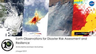
  • 1. National Aeronautics and Space Administration Amita Mehta and Sean McCartney 6 August 2019 Earth Observations for Disaster Risk Assessment and Resilience
  • 2. 2 NASA’s Applied Remote Sensing Training Program Learning Objectives • Learn about available NASA remote sensing and socioeconomic data and how to combine them for Disaster Risk Assessment (DRA) • Understand how to apply these data for assessing risk from floods, tropical cyclones, and extreme heat in specific regions • Demonstrate how operational agencies are using NASA data for risk management
  • 3. 3 NASA’s Applied Remote Sensing Training Program Training Outline Aug 6, 2019 NASA Remote Sensing and Socioeconomic Data for Disaster Risk Assessment Aug 13, 2019 Disaster Risk Assessment Case Studies Using Remote Sensing Data Aug 8, 2019 Assessing the Risk of Floods & Cyclones Using NASA Data Aug 15, 2019 Operational Application of Remote Sensing for Disaster Management Image Credits (left to right): EM-DAT; NASA; WRI Resource Watch; PDC
  • 4. 4 NASA’s Applied Remote Sensing Training Program Homework and Certificate • Homework: – 2 homework assignments – Answers to homework must be submitted via Google Forms • Certificate of Completion: – Attend all webinars – Complete 2 homework assignments by 30 August • You will receive certificates approximately two months after the completion of the course from: marines.martins@ssaihq.com
  • 5. 5 NASA’s Applied Remote Sensing Training Program Part-1 Outline • About ARSET • Disaster Risk Assessment (DRA): Concept and Definitions • Remote Sensing and Earth System Model Data Sources Relevant for DRA • Socioeconomic Data Relevant for DRA
  • 7. 7 NASA’s Applied Remote Sensing Training Program NASA’s Applied Remote Sensing Training Program (ARSET) • Empowering the global community through remote sensing training • Seeks to increase the use of Earth science in decision-making through training for: – policy makers – environmental managers – other professionals in the public and private sector • Training topics focus on: – air quality – disasters Helping Professionals Solve Problems Including… http://arset.gsfc.nasa.gov/ – land – water
  • 8. 8 NASA’s Applied Remote Sensing Training Program ARSET Training Focus Areas Air Quality Disasters Land Water
  • 9. 9 NASA’s Applied Remote Sensing Training Program ARSET Team Members Program Support • Ana Prados, Program Manager (GSFC) • David Barbato, Spanish Translator (GSFC) • Brock Blevins, Training Coordinator (GSFC) • Annelise Carleton-Hug, Program Evaluator (Consultant) • Elizabeth Hook, Technical Writer/Editor (GSFC) • Selwyn Hudson-Odoi, Training Coordinator (GSFC) • Marines Martins, Project Support (GSFC) • Stephanie Uz, Program Support (GSFC) Disasters & Water Resources • Amita Mehta, Instructor (GSFC) • Erika Podest, Instructor (JPL) • Sean McCartney, Instructor (GSFC) Land & Wildfires • Amber Jean McCullum, Lead (ARC) • Juan Torres-PĂ©rez, Instructor (ARC) Health & Air Quality • Pawan Gupta, Lead (MSFC) • Melanie Follette-Cook, Instructor (GSFC) Acknowledgement: We wish to thank Nancy Searby for her continued support GSFC: Goddard Space Flight Center, JPL: Jet Propulsion Laboratory, ARC: Ames Research Center, MSFC: Marshall Space Flight Center
  • 10. 10 NASA’s Applied Remote Sensing Training Program ARSET Training Formats Online Free Online training 1-5 weeks long 1-6 hours a week Available at all levels Materials available in English & Spanish In-Person Hosted with a partner Typically in a computer lab 2-7 days long Focus on locally-relevant case studies Certain topics presented in Spanish
  • 11. 11 NASA’s Applied Remote Sensing Training Program ARSET Training Levels Fundamentals (Level 0) Assumes no prior knowledge of remote sensing Fundamentals of Remote Sensing Basic (Level 1) Requires level 0 training or equivalent knowledge Covers specific applications Introduction to Synthetic Aperture Radar Advanced (Level 2) Requires level 1 training or equivalent knowledge In-depth and highly focused topics Advanced Webinar: SAR Image and Data Processing
  • 12. 12 NASA’s Applied Remote Sensing Training Program ARSET Trainings 110+ trainings 19,400+ participants 160+ countries 5,000+ organizations * size of circle corresponds to number of participants
  • 13. 13 NASA’s Applied Remote Sensing Training Program Sign up for the ARSET Listserv https://lists.nasa.gov/mailman/listinfo/arset
  • 14. Disaster Risk Assessment: Concept and Definitions
  • 15. 15 NASA’s Applied Remote Sensing Training Program Terminology • Disaster Risk Assessment (DRA) • Hazard • Exposure • Vulnerability • Disaster • Disaster Risk • Resilience • Disaster Risk Reduction (DRR) • Disaster Risk Management (DRM) Text Credit: UNISDR • A process to determine the nature and extent of risks • Requires analysis of hazards and existing conditions of exposure and vulnerability • Focuses on potential harm to – people – property – services – livelihoods – and the environment people depend on
  • 16. 16 NASA’s Applied Remote Sensing Training Program Terminology • Disaster Risk Assessment (DRA) • Hazard • Exposure • Vulnerability • Disaster • Disaster Risk • Resilience • Disaster Risk Reduction (DRR) • Disaster Risk Management (DRM) • A comprehensive DRA evaluates the magnitude and likelihood of potential losses • It provides full understanding of the causes and impact of those losses • DRA is an integral part of Disaster Risk Management, decision and policy-making processes, and requires close collaboration among various parts of society Text Credit: UNISDR
  • 17. 17 NASA’s Applied Remote Sensing Training Program Terminology • Disaster Risk Assessment • Hazard • Exposure • Vulnerability • Disaster • Disaster Risk • Resilience • Disaster Risk Reduction (DRR) • Disaster Risk Management (DRM) • A process, phenomenon, or human activity that may cause: – loss of life – injury or other health impacts – property damage – social and economic disruption – environmental degradation • A hazard is characterized by: – location or geographic area – intensity or magnitude – frequency or return period – probability of occurrence Text Credit: UNISDR
  • 18. 18 NASA’s Applied Remote Sensing Training Program Terminology • Disaster Risk Assessment • Hazard • Exposure • Vulnerability • Disaster • Disaster Risk • Resilience • Disaster Risk Reduction (DRR) • Disaster Risk Management (DRM) • Natural hazards arise from events, sometimes acting in combination, including: – geological (earthquakes, landslides, volcanoes) – meteorological (storms, extreme temperatures, wildfires) – hydrological (floods, droughts) – oceanic (wave surge) – biological (disease epidemics) • Human induced hazards include: – industrial and transportation accidents – environmental pollution – human conflicts – migration Text Credit: UNISDR
  • 19. 19 NASA’s Applied Remote Sensing Training Program Terminology • Disaster Risk Assessment • Hazard • Exposure • Vulnerability • Disaster • Disaster Risk • Resilience • Disaster Risk Reduction (DRR) • Disaster Risk Management (DRM) • The situation of people, infrastructure, housing, production capacities, and other tangible human assets located in hazard- prone areas • Exposure can be measured by the number of people or types of assets in an area • To estimate quantitative risks associated with a hazard, exposure measurements can be combined with specific vulnerability and capacity of exposed elements Text Credit: UNISDR
  • 20. 20 NASA’s Applied Remote Sensing Training Program Terminology • Disaster Risk Assessment • Hazard • Exposure • Vulnerability • Disaster • Disaster Risk • Resilience • Disaster Risk Reduction (DRR) • Disaster Risk Management (DRM) • Determined by physical, social, economic, and environmental factors or processes • Assesses the susceptibility of an individual, community, asset, or system to the impact of hazards • Depends on cultural and institutional factors, including: – poor design and construction of buildings – poor environmental management – inadequate protection of assets – lack of public information and awareness – levels of poverty and education – limited official recognition of risks and preparedness – weak governance Text Credit: UNISDR
  • 21. 21 NASA’s Applied Remote Sensing Training Program Terminology • Disaster Risk Assessment • Hazard • Exposure • Vulnerability • Disaster • Disaster Risk • Resilience • Disaster Risk Reduction (DRR) • Disaster Risk Management (DRM) • A serious disruption of the functioning of a community or a society at any scale due to hazardous events leading to one or more of the following losses and impacts: – human – material – economic – environmental Text Credit: UNISDR
  • 22. 22 NASA’s Applied Remote Sensing Training Program Terminology • Disaster Risk Assessment • Hazard • Exposure • Vulnerability • Disaster • Disaster Risk • Resilience • Disaster Risk Reduction (DRR) • Disaster Risk Management (DRM) • The potential loss of life, injury, or destroyed or damaged assets that could occur to a community as a function of a hazard, exposure, or vulnerability • Made up of different types of potential losses that can be difficult to quantify Text Credit: UNISDR
  • 23. 23 NASA’s Applied Remote Sensing Training Program Terminology • Disaster Risk Assessment • Hazard • Exposure • Vulnerability • Disaster • Disaster Risk • Resilience • Disaster Risk Reduction (DRR) • Disaster Risk Management (DRM) • Ability of a system, community, or society exposed to hazards to: – resist – absorb – accommodate – adapt to – recover from effects • Refers to the timely and efficient response, including through preservation & restoration of basic structures and functions Text Credit: UNISDR
  • 24. 24 NASA’s Applied Remote Sensing Training Program Terminology • Disaster Risk Assessment • Hazard • Exposure • Vulnerability • Disaster • Disaster Risk • Resilience • Disaster Risk Reduction (DRR) • Disaster Risk Management (DRM) • Aimed at – preventing new disasters – reducing existing disaster risk – managing residual risk • These contribute to strengthening resilience • Involves developing strategies and policy objectives – across different timescales – with concrete targets, indicators, and timeframes Text Credit: UNISDR
  • 25. 25 NASA’s Applied Remote Sensing Training Program Terminology • Disaster Risk Assessment • Hazard • Exposure • Vulnerability • Disaster • Disaster Risk • Resilience • Disaster Risk Reduction (DRR) • Disaster Risk Management (DRM) • Application of Disaster Risk Reduction policies and strategies to: – prevent new disaster risk – reduce existing disaster risk – manage residual risk • Can be categorized into: – Prospective Disaster Risk Management – Corrective Disaster Risk Management – Compensatory Disaster Risk Management (also referred to as Residual Risk Management) Text Credit: UNISDR
  • 26. 26 NASA’s Applied Remote Sensing Training Program How to Conduct a Disaster Risk Assessment Understanding of Current Situation, Needs, and Gaps: • systematic inventory and evaluation of existing risk assessment studies, available data and information, and current institutional framework and capabilities Identify the prevailing nature, location, intensity, and likelihood of major hazards Hazard Assessment According to the UN Development Program (UNDP) the following steps are required for a comprehensive risk assessment: Steps within red boxes can be derived from data freely available from NASA Exposure Assessment Vulnerability Analysis Loss/Impact Analysis Risk Profiling & Evaluation Formulation or Revision of DRR Strategies and Action Plans Identify population & assets at risk and delineate disaster-prone areas Determine the capacity of a system to withstand given hazard scenarios Estimate potential losses of exposed population, property, services, livelihoods, and environment. Assess their potential impacts. Identify cost-effective risk reduction options in terms of socio-economic concerns and capacity Include setting priorities, allocating financial and human resources, and installing a DRR program Text Credit: UNDP
  • 27. 27 NASA’s Applied Remote Sensing Training Program Types of Natural Hazards • Cyclones • Droughts • Earthquakes • Extreme Precipitation • Extreme Temperatures • Floods • Landslides • Tsunamis • Volcanoes • Wildfires Image Credits (Clockwise from Top Left): NOAA, USAF, USDA, Kieran Wood
  • 28. 28 NASA’s Applied Remote Sensing Training Program Global Disaster Statistics (1998-2017) In this time frame, floods and storms were the most dominant hazards Image Credit: CRED and UNISDR
  • 29. 29 NASA’s Applied Remote Sensing Training Program Global Disaster Statistics (1998-2017) Floods, droughts, and storms affected the highest number of people Image Credit: UNDRR, data from CRED and UNISDR
  • 30. 30 NASA’s Applied Remote Sensing Training Program Global Disaster Statistics (1998-2017) Earthquakes, storms, extreme heat, and floods caused the most number of deaths Based on these statistics, this webinar will focus on disaster risk assessment (DRA) for: • cyclones • urban floods (Extreme Precipitation) • extreme heat Image Credit: CRED and UNISDR
  • 31. 31 NASA’s Applied Remote Sensing Training Program Assessing the Potential Risk of a Hazard Identify the nature, location, intensity, and likelihood of major hazards prevailing in a community or environment • Requires data and information about a type of hazard or multiple hazards: – Past/historical data • identify hazard-prone regions • assess frequency and intensity of hazards • establish strategies for DRR – Current data for near-real time actions for DRR – Future data (forecast) for assessing potential risk to an approaching hazard, planning near-future actions for DRR – Quantitative analysis of past-current-forecast data
  • 32. 32 NASA’s Applied Remote Sensing Training Program Hazard Assessment Data Needs • Cyclones: frequency, probability, intensity – based on tracks, landfall locations, storm surge, sea level pressure, winds, precipitation • Floods: flood plain extent, frequency, intensity, duration – based on precipitation, soil moisture, terrain/slope, impermeable surface • Extreme Heat: frequency, probability, duration – based on surface temperature, surface humidity Data in blue are derived from NASA Earth Observations and Models Data in brown are available from NOAA, the Joint Typhoon Warning Center, and Worldwide Tropical Cyclone Centers Reference: NOAA, Joint Typhoon Warning Center, Worldwide Tropical Cyclone Centers
  • 33. Remote Sensing Data Sources Relevant for Disaster Risk Assessment
  • 34. 34 NASA’s Applied Remote Sensing Training Program Data for Hazard Assessment: Past Data (>18 Years) Data Parameter Hazard Source Spatial Resolution *Temporal Information Land Surface Temperature Surface Air Temperature Extreme Heat MODIS, GLDAS, MERRA-2 1 Km 0.25o x 0.25o 0.5o x 0.667o 2000-present 2000-present 1980-Present Surface Humidity Extreme Heat GLDAS, MERRA-2 0.25o x 0.25o 0.5o x 0.667o 2000-present 1980-Present Winds Cyclone MERRA-2 0.5o x 0.667o 1980-Present Precipitation Flood, Cyclone *TRMM TMPA GPM/IMERG- Final 0.25o x 0.25o 0.1o x 0.1o 1998-present 2000-present Soil Moisture Flood GLDAS MERRA-2 0.25o x 0.25o 0.5o x 0.667o 2000-present 1980-Present Elevation Flood SRTM 1-arc second 3-arc second 2000-present *A combined TRMM/GPM precipitation data product is now available spanning 2000-present
  • 35. 35 NASA’s Applied Remote Sensing Training Program Data for Hazard Assessment: Past Data (4-5 Years) Data Parameter Hazard Source Spatial Resolution *Temporal Information Precipitation Flood, Cyclone GPM/IMERG- Early and Late 0.1o x 0.1o 3/2014 - present Storm Surge Cyclone *SLOSH (US Only) Tens of meters to 1 km 2014 - present Soil Moisture Flood GEOS-5 SMAP 0.3125o x 0.25o 36 km, 9 km 4/2015 - present *All data have global coverage except for SLOSH
  • 36. 36 NASA’s Applied Remote Sensing Training Program Data for Hazard Assessment: Near-Real Time and Forecasts Data Parameter Hazard Source Spatial Resolution Temporal Information Land Surface and Surface Air Temperature Extreme Heat MODIS, GEOS-5 1 Km 0.3125o x 0.25o NRT NRT and 10-day Forecast Surface Humidity Extreme Heat GEOS-5 0.3125o x 0.25o Winds Cyclone GEOS-5 0.3125o x 0.25o Soil Moisture Flood GEOS-5 SMAP 0.3125o x 0.25o 36 km, 9 km Precipitation Flood Cyclone GEOS-5 GPM/IMERG 0.3125o x 0.25o 0.1o x 0.1o Storm Surge Cyclone *SLOSH (US Only) Tens of meters to 1 km NRT and 48-hour Forecast * All data have global coverage except for SLOSH
  • 37. 37 NASA’s Applied Remote Sensing Training Program For More Information on Data for Hazard Assessment • Past Data (>18 Years) – Fundamentals of Remote Sensing, Water Resources Management – Intermediate Webinar: Remote Sensing for Disaster Scenarios (2019) – Introductory Webinar: Monitoring Tropical Storms for Emergency Preparedness (2018) • Past Data (4-5 Years) & Near-Real Time Forecasts – Intermediate Webinar: Remote Sensing for Disaster Scenarios (2019) – Introductory Webinar: Monitoring Tropical Storms for Emergency Preparedness (2018)
  • 38. 38 NASA’s Applied Remote Sensing Training Program Data Access for Hazard Assessment Data Access Tool Web Address Giovanni & NASA Earthdata GES DISC (MERRA-2, GLDAS, TRMM-TMPA, GPM-IMERG) https://giovanni.gsfc.nasa.gov/giovanni/ https://disc.gsfc.nasa.gov/ Precipitation Measurement Mission (GPM-IMERG) https://pmm.nasa.gov/data-access/downloads/ AppEARS (SMAP, MODIS) https://nsidc.org/support/how/point-and-area-samples- smap-data-using-appeears NCCS Data Portal-Data Share (GEOS-5) https://fluid.nccs.nasa.gov/weather/ https://portal.nccs.nasa.gov/datashare/gmao_ops/pu b/fp/forecast/ Probabilistic Tropical Storm Surge (P-Surge) https://slosh.nws.noaa.gov/psurge2.0/
  • 39. 39 NASA’s Applied Remote Sensing Training Program Hazard Assessment and DRR • Analysis of past data help identify hazard-prone areas, intensity, and frequency of hazard(s) • Based on past hazard analysis together with exposure, vulnerability, and socioeconomic impact (DRA), this helps prepare for current and future DRR • Useful for planning overall DRM Image Credit: WMO
  • 40. 40 NASA’s Applied Remote Sensing Training Program Disaster Risk Assessment • DRA requires analysis of hazard assessment together with exposure (i.e. elements at risk) and vulnerability (physical, social, economic, and environmental) • Next Susana Adamo from SEDAC will present socioeconomic data relevant for exposure and vulnerability for Disaster Risk Assessment
  • 41. 41 NASA’s Applied Remote Sensing Training Program Reference GEOS-5: Goddard Earth Observing System Model, Version 5 GLDAS: Global Land Data Assimilation System, version 2.1 GPM: Global Precipitation Measurement IMERG: Integrated Multi-satellitE Retrievals for GPM MERRA-2: Modern-Era Retrospective analysis for Research and Applications, Version 2 MODIS: MODerate-resolution Imaging Spectroradiometer SLOSH: Sea Lake and Overland Surge from Hurricanes SMAP: Soil Moisture Active Passive SRTM: Shuttle Radar Topography Mission TMPA: TRMM Multi-satellite Precipitation Analysis TRMM: Tropical Rainfall Measuring Mission
  • 42. Socioeconomic Data Relevant for Disaster Risk Assessment Dr. Susana Adamo, CIESIN, Columbia University
  • 43. 43 NASA’s Applied Remote Sensing Training Program Coming up Next Week - • DRA from past earth observations • DRA in near real-time and from10-day forecast