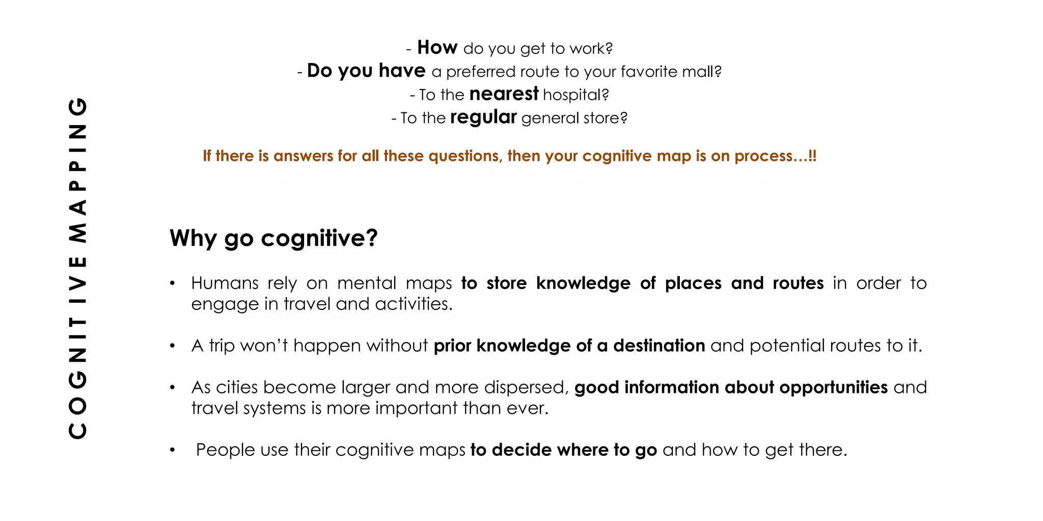
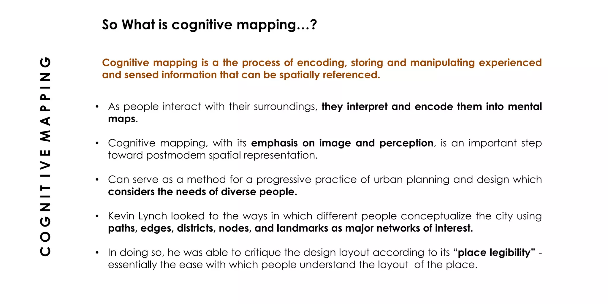
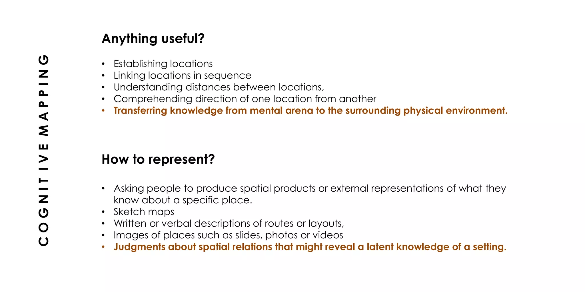
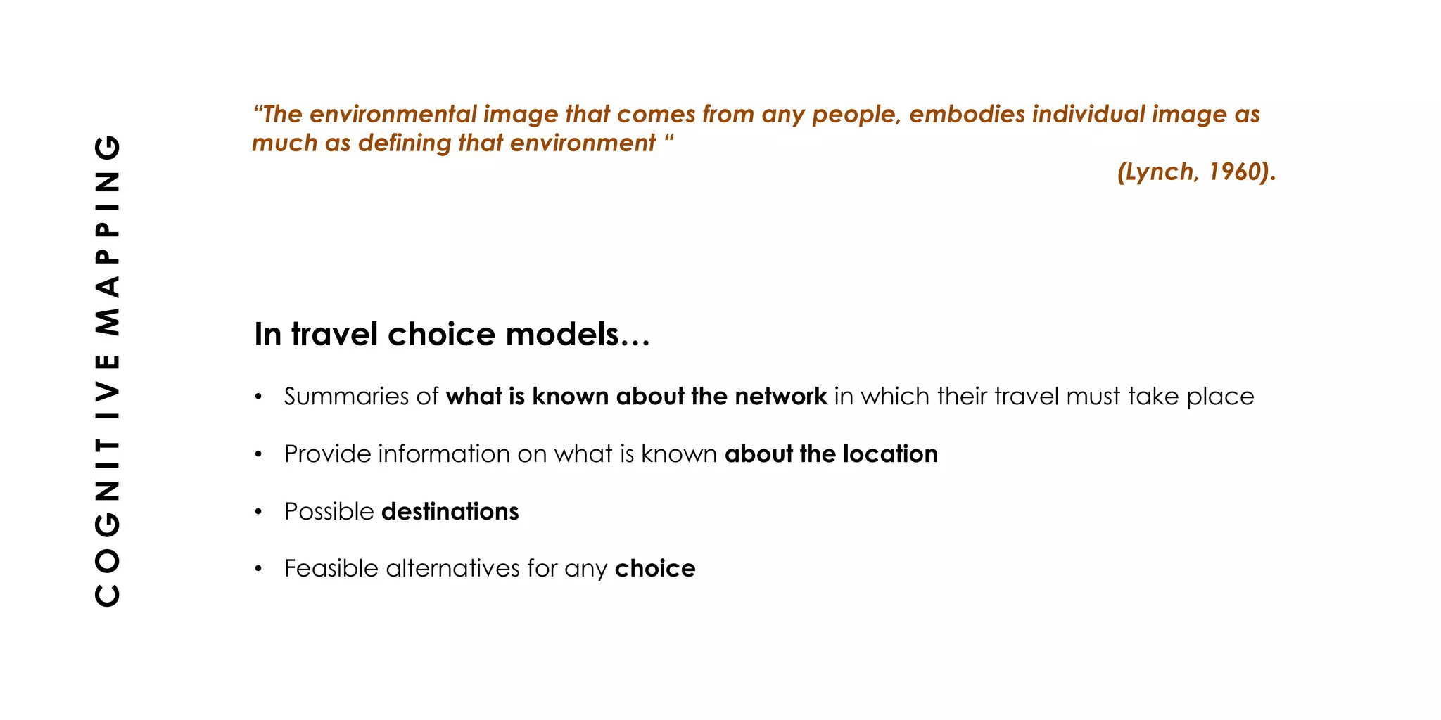
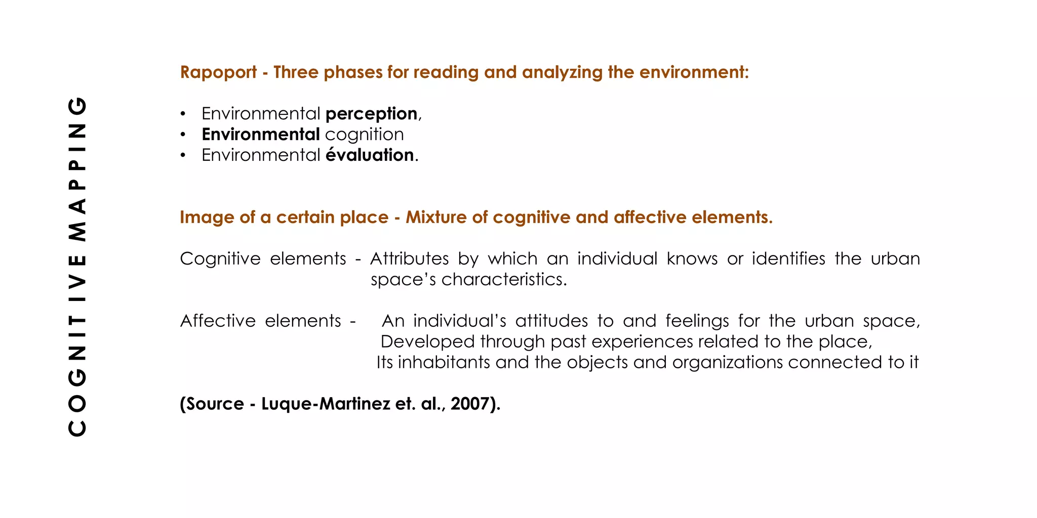
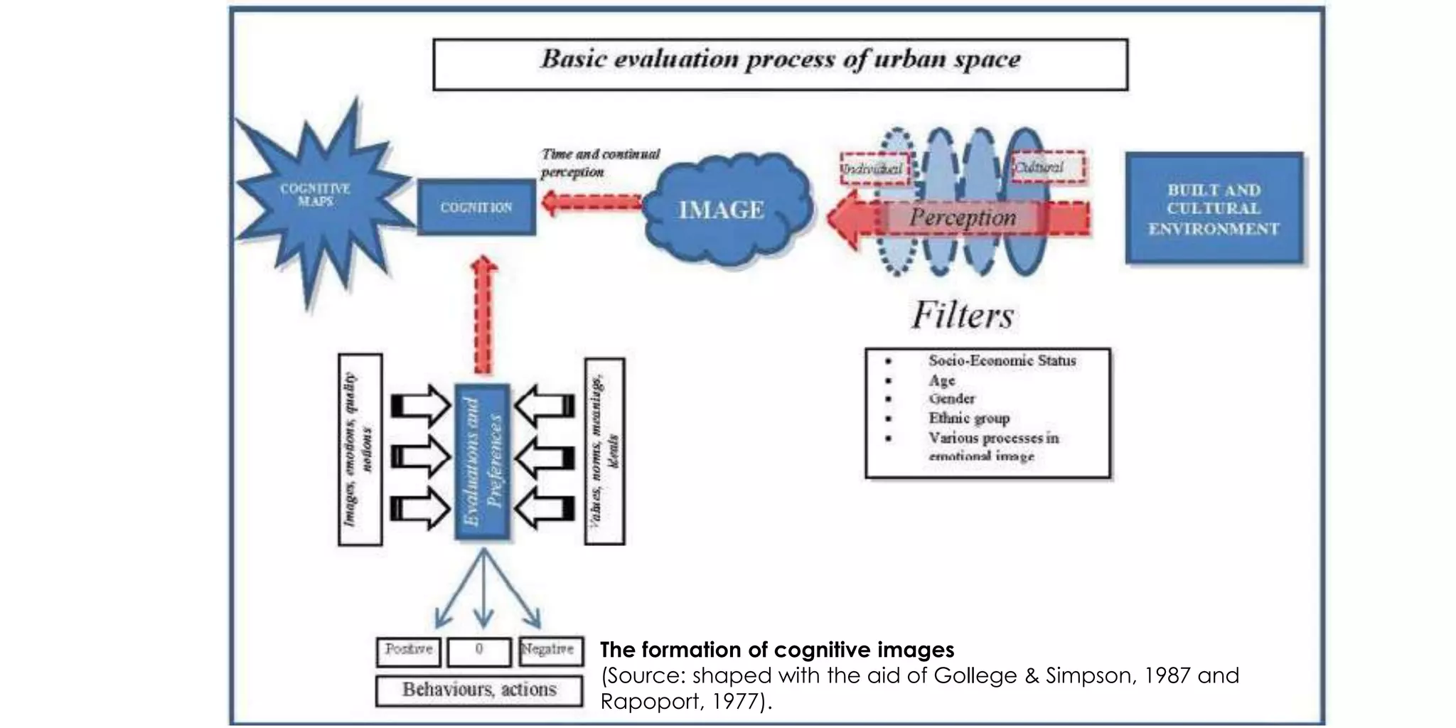
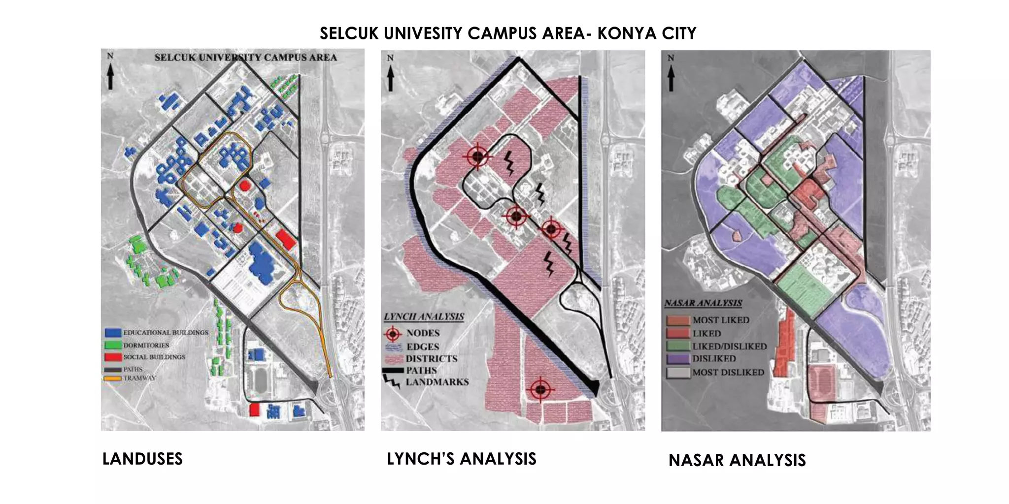
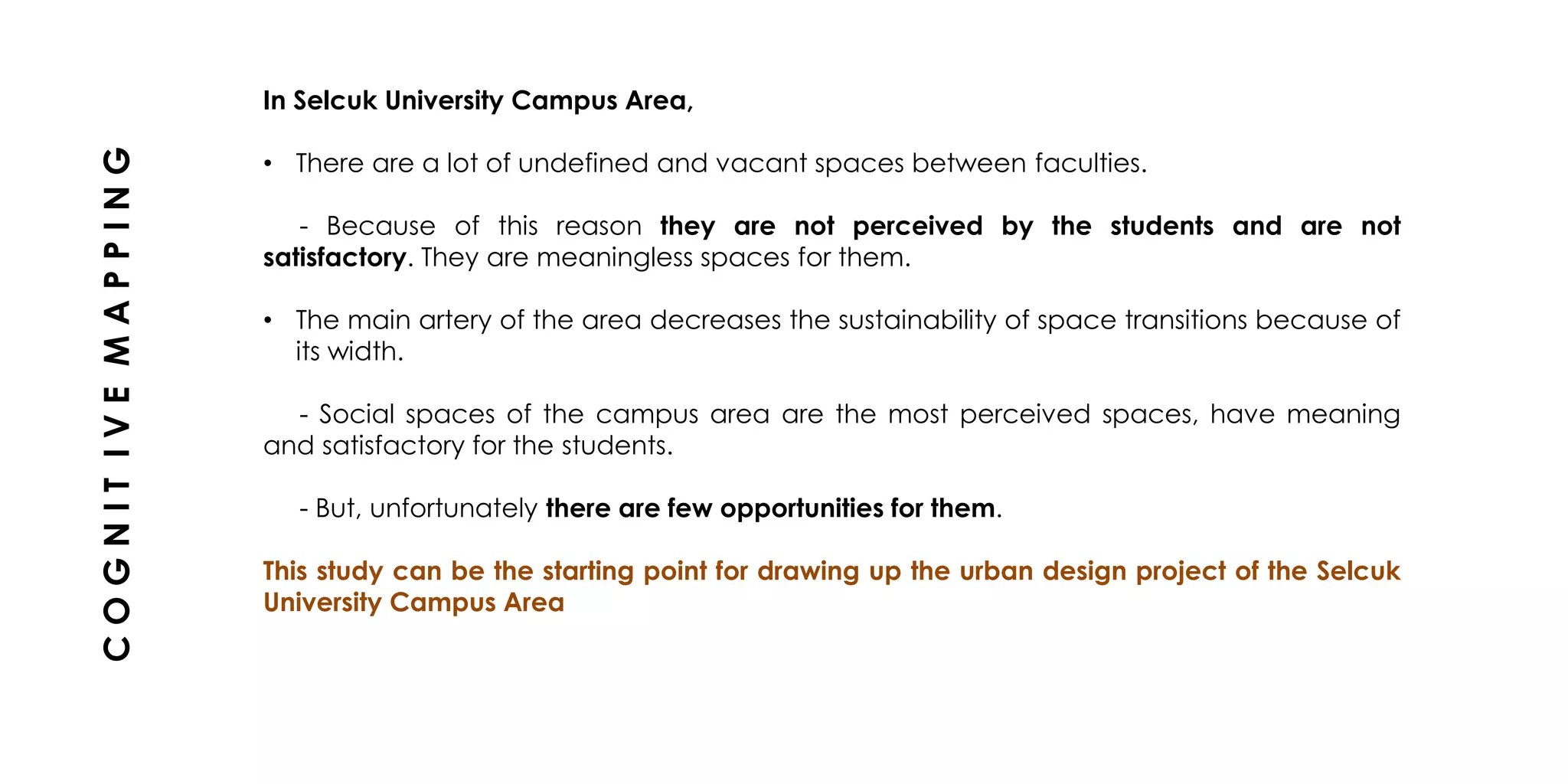
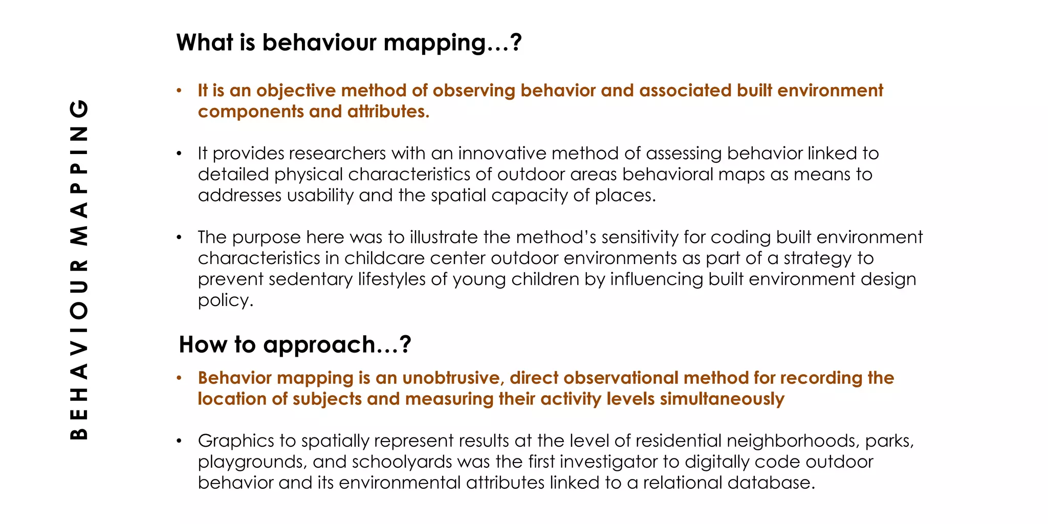
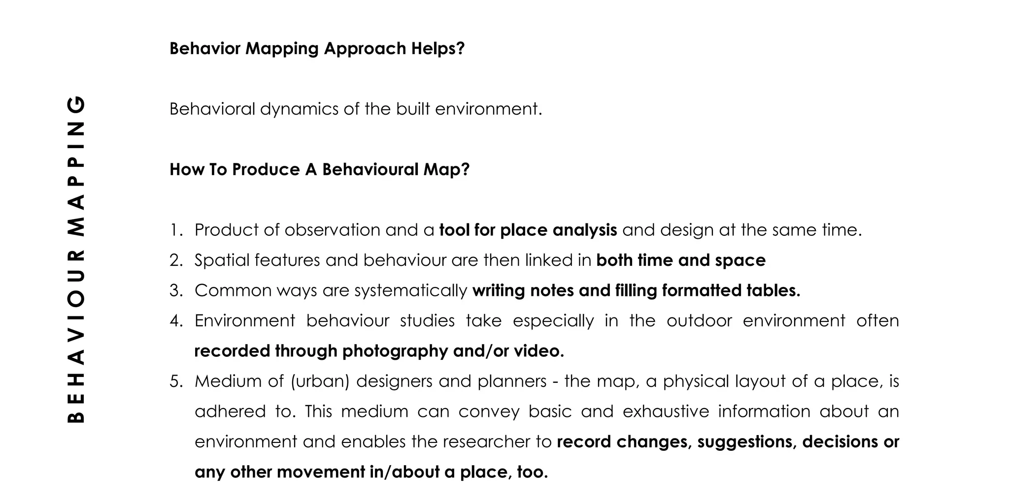
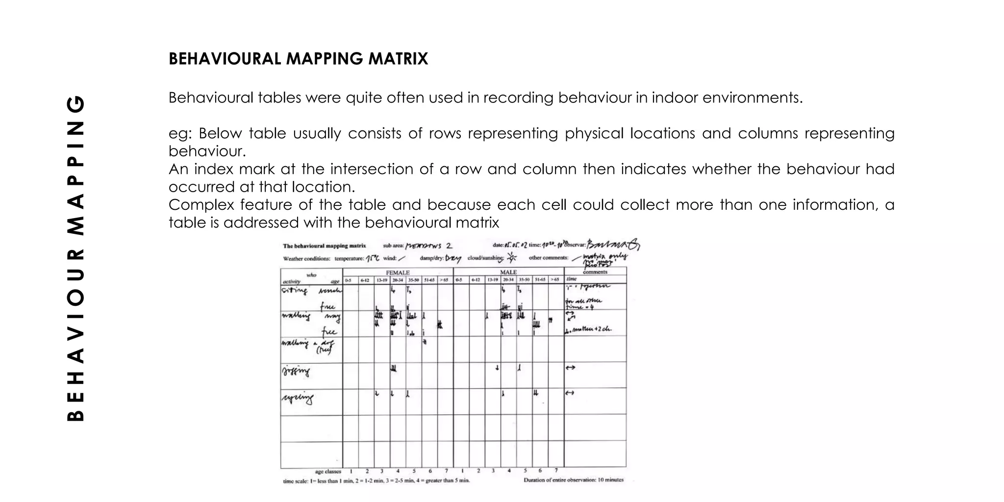
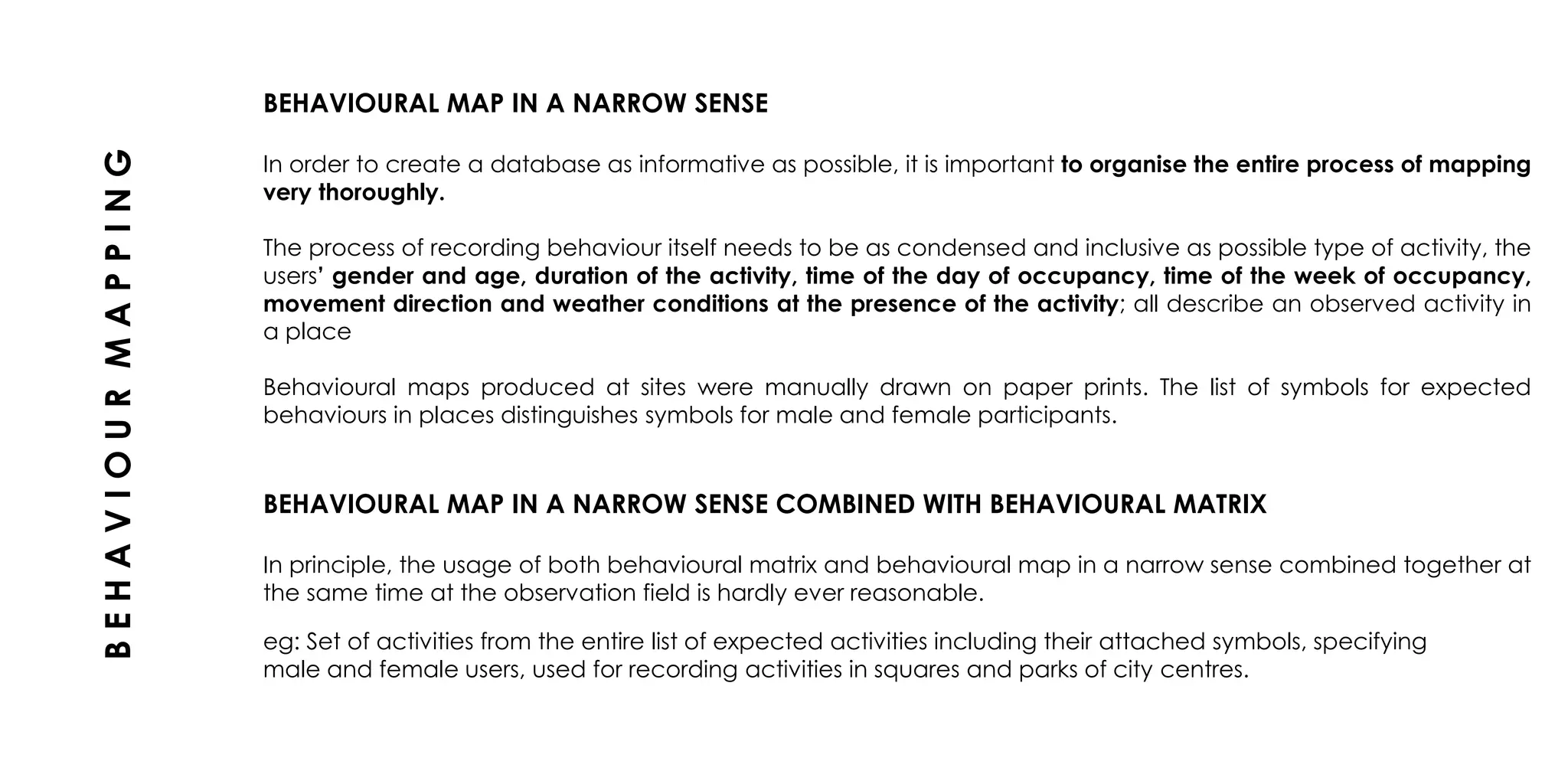
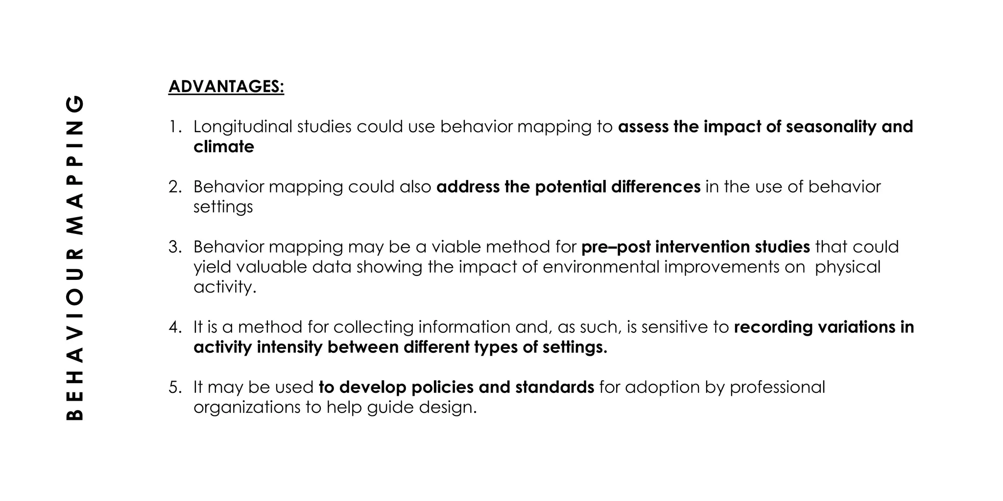
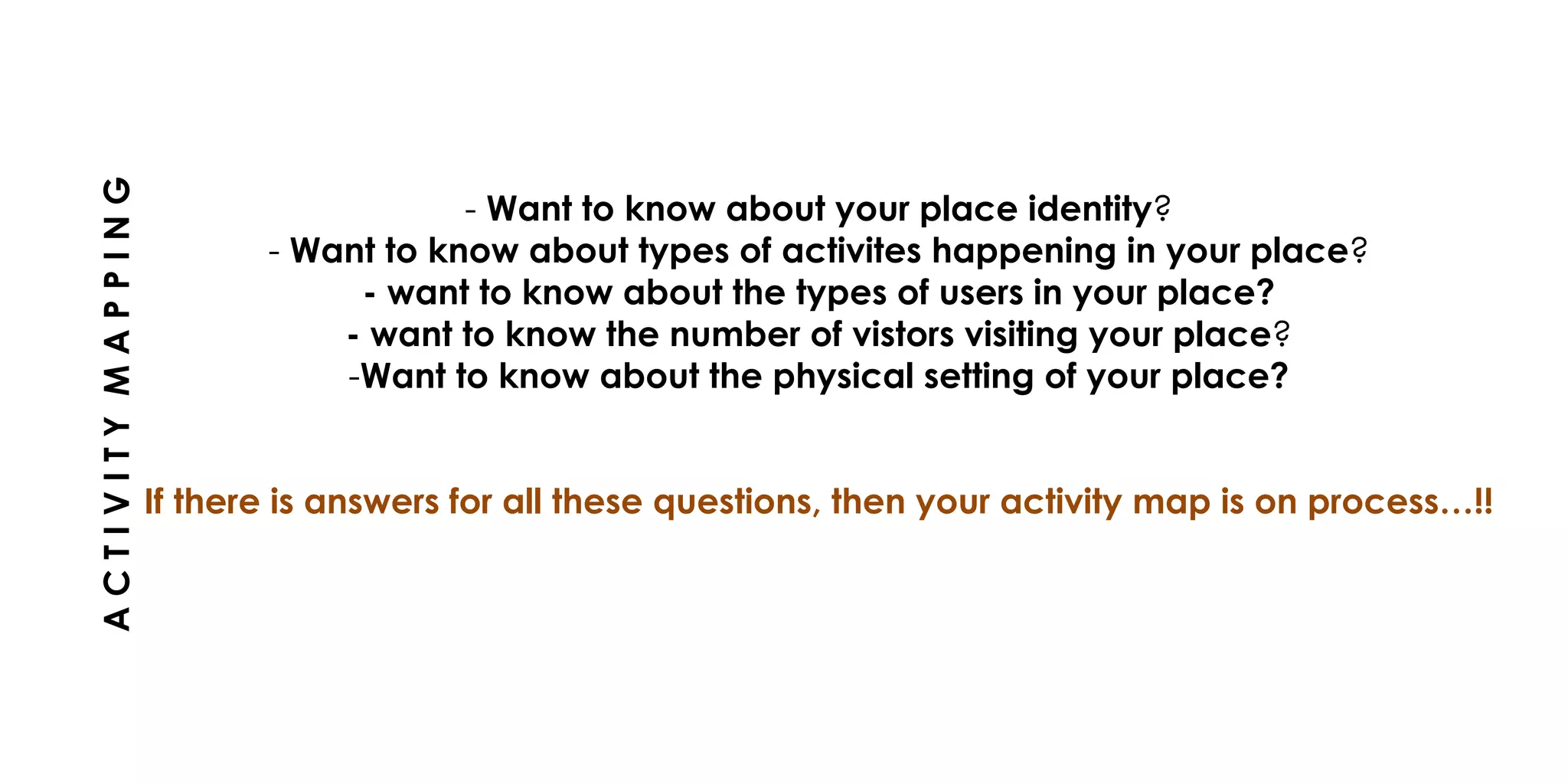
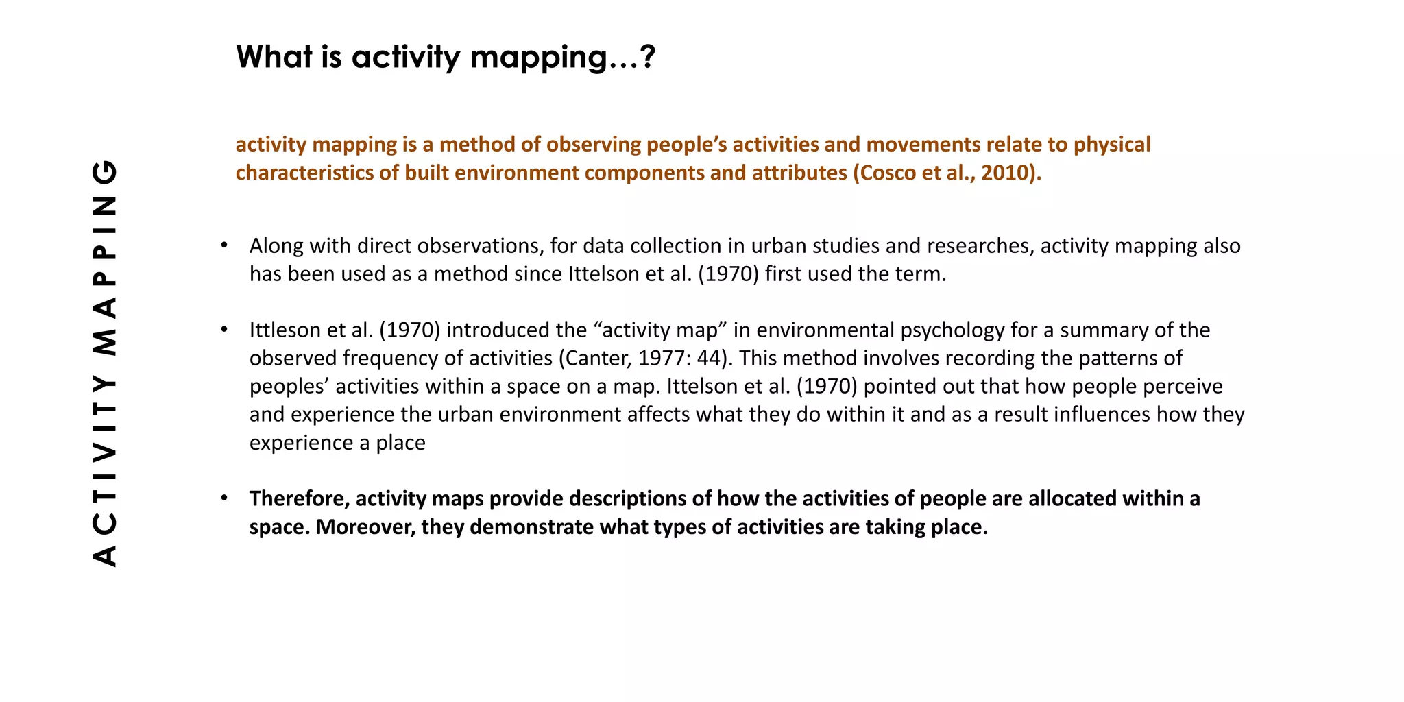
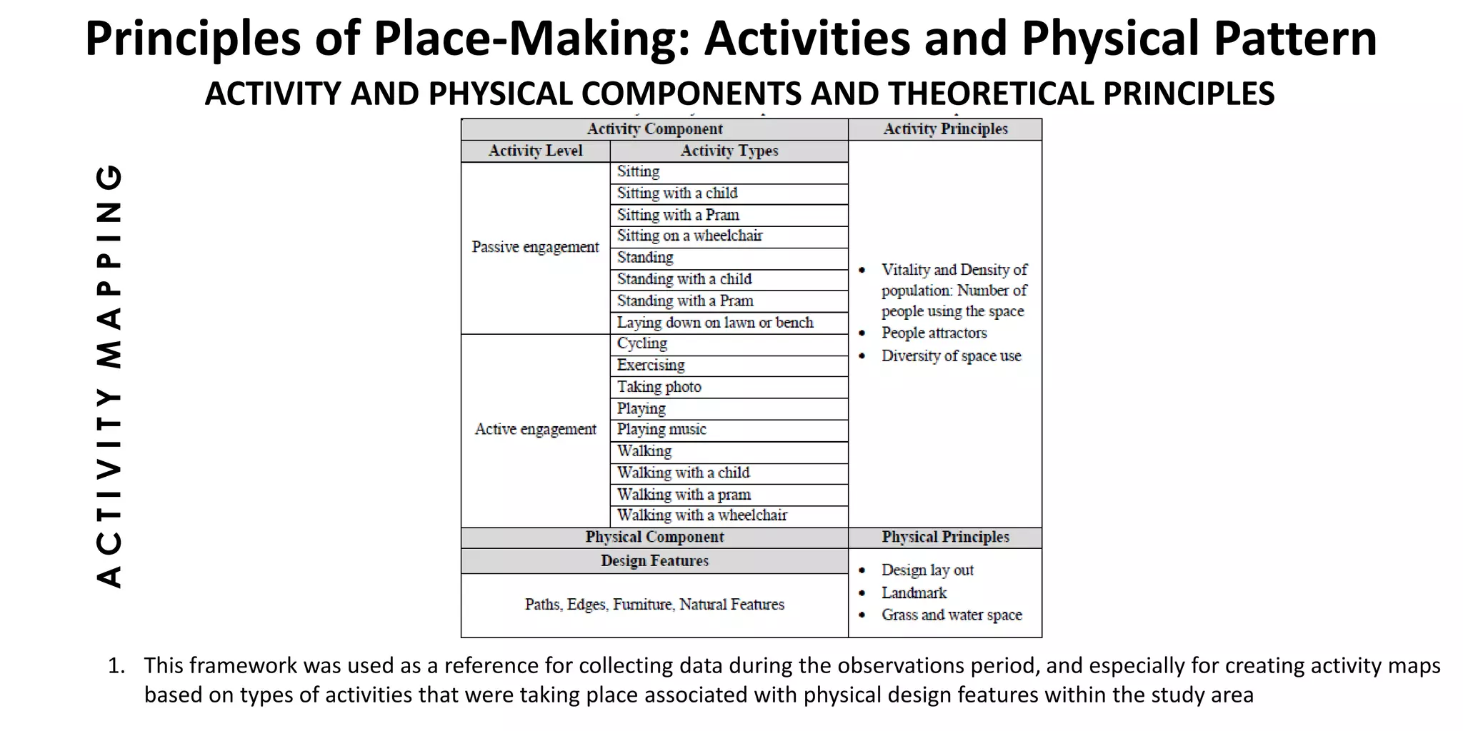
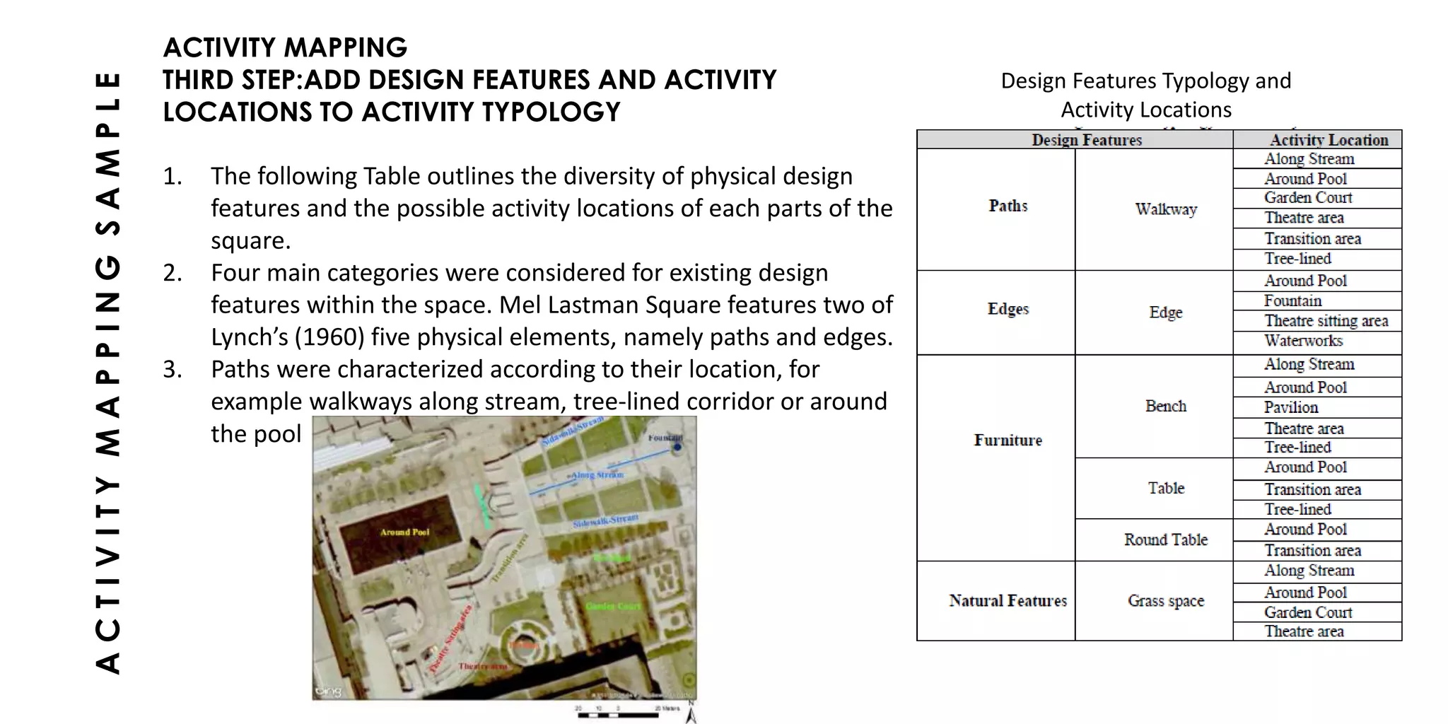
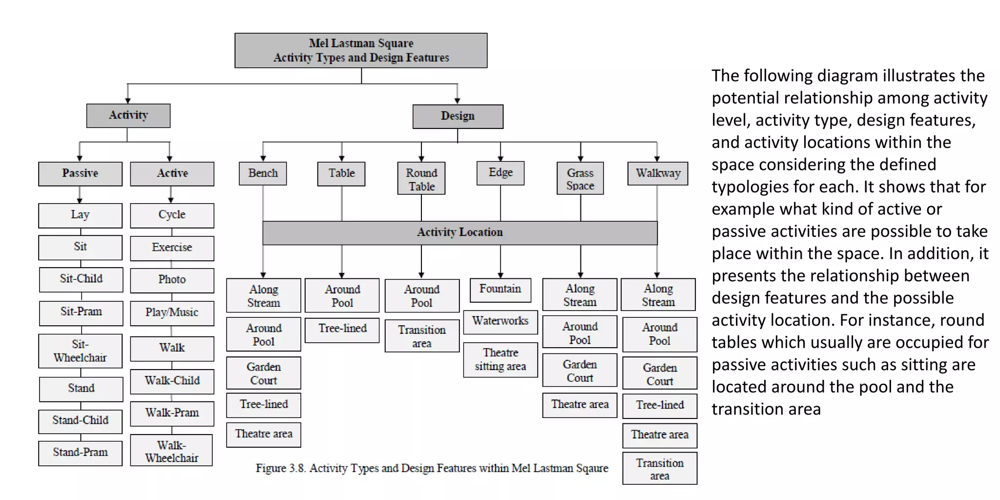
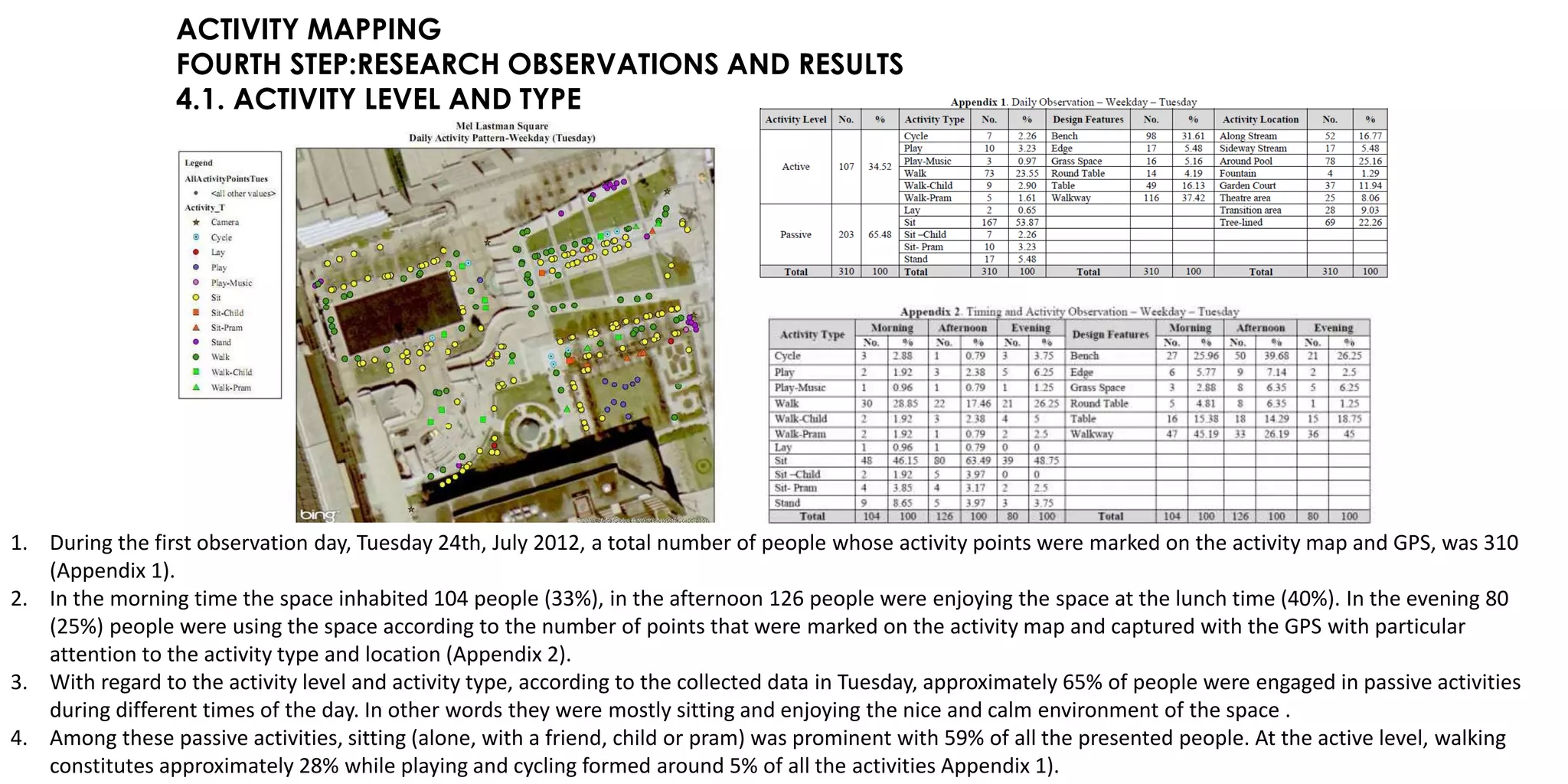
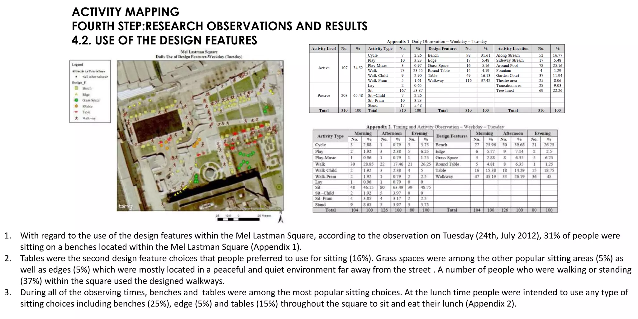
SlideShare a Scribd company logo
1 of 42
MAPPING
BY
Aarthi
p.Swapnika
namratha
Mudd
FOA
Manipal university
TYPES OF MAPPING
1.COGNITIVE MAPPING
2. BEHAVIOURAL MAPPING
3. ACTIVITY MAPPING
COGNITIVE MAPPING
- How do you get to work?
- Do you have a preferred route to your favorite mall?
- To the nearest hospital?
- To the regular general store?
If there is answers for all these questions, then your cognitive map is on process…!!
Why go cognitive?
• Humans rely on mental maps to store knowledge of places and routes in order to
engage in travel and activities.
• A trip won’t happen without prior knowledge of a destination and potential routes to it.
• As cities become larger and more dispersed, good information about opportunities and
travel systems is more important than ever.
• People use their cognitive maps to decide where to go and how to get there.
COGNITIVEMAPPING
• As people interact with their surroundings, they interpret and encode them into mental
maps.
• Cognitive mapping, with its emphasis on image and perception, is an important step
toward postmodern spatial representation.
• Can serve as a method for a progressive practice of urban planning and design which
considers the needs of diverse people.
• Kevin Lynch looked to the ways in which different people conceptualize the city using
paths, edges, districts, nodes, and landmarks as major networks of interest.
• In doing so, he was able to critique the design layout according to its “place legibility” -
essentially the ease with which people understand the layout of the place.
Cognitive mapping is a the process of encoding, storing and manipulating experienced
and sensed information that can be spatially referenced.
So What is cognitive mapping…?
COGNITIVEMAPPING
Anything useful?
• Establishing locations
• Linking locations in sequence
• Understanding distances between locations,
• Comprehending direction of one location from another
• Transferring knowledge from mental arena to the surrounding physical environment.
How to represent?
• Asking people to produce spatial products or external representations of what they
know about a specific place.
• Sketch maps
• Written or verbal descriptions of routes or layouts,
• Images of places such as slides, photos or videos
• Judgments about spatial relations that might reveal a latent knowledge of a setting.
COGNITIVEMAPPING
In travel choice models…
• Summaries of what is known about the network in which their travel must take place
• Provide information on what is known about the location
• Possible destinations
• Feasible alternatives for any choice
“The environmental image that comes from any people, embodies individual image as
much as defining that environment “
(Lynch, 1960).
COGNITIVEMAPPING
Cognitive mapping and its Inferences
Rapoport - Three phases for reading and analyzing the environment:
• Environmental perception,
• Environmental cognition
• Environmental évaluation.
Image of a certain place - Mixture of cognitive and affective elements.
Cognitive elements - Attributes by which an individual knows or identifies the urban
space’s characteristics.
Affective elements - An individual’s attitudes to and feelings for the urban space,
Developed through past experiences related to the place,
Its inhabitants and the objects and organizations connected to it
(Source - Luque-Martinez et. al., 2007).
COGNITIVEMAPPING
The formation of cognitive images
(Source: shaped with the aid of Gollege & Simpson, 1987 and
Rapoport, 1977).
LANDUSES LYNCH’S ANALYSIS NASAR ANALYSIS
SELCUK UNIVESITY CAMPUS AREA- KONYA CITY
In Selcuk University Campus Area,
• There are a lot of undefined and vacant spaces between faculties.
- Because of this reason they are not perceived by the students and are not
satisfactory. They are meaningless spaces for them.
• The main artery of the area decreases the sustainability of space transitions because of
its width.
- Social spaces of the campus area are the most perceived spaces, have meaning
and satisfactory for the students.
- But, unfortunately there are few opportunities for them.
This study can be the starting point for drawing up the urban design project of the Selcuk
University Campus Area
COGNITIVEMAPPING
BEHAVIOUR MAPPING
• It is an objective method of observing behavior and associated built environment
components and attributes.
• It provides researchers with an innovative method of assessing behavior linked to
detailed physical characteristics of outdoor areas behavioral maps as means to
addresses usability and the spatial capacity of places.
• The purpose here was to illustrate the method’s sensitivity for coding built environment
characteristics in childcare center outdoor environments as part of a strategy to
prevent sedentary lifestyles of young children by influencing built environment design
policy.
What is behaviour mapping…?
BEHAVIOURMAPPING
How to approach…?
• Behavior mapping is an unobtrusive, direct observational method for recording the
location of subjects and measuring their activity levels simultaneously
• Graphics to spatially represent results at the level of residential neighborhoods, parks,
playgrounds, and schoolyards was the first investigator to digitally code outdoor
behavior and its environmental attributes linked to a relational database.
Behavior Mapping Approach Helps?
Behavioral dynamics of the built environment.
How To Produce A Behavioural Map?
1. Product of observation and a tool for place analysis and design at the same time.
2. Spatial features and behaviour are then linked in both time and space
3. Common ways are systematically writing notes and filling formatted tables.
4. Environment behaviour studies take especially in the outdoor environment often
recorded through photography and/or video.
5. Medium of (urban) designers and planners - the map, a physical layout of a place, is
adhered to. This medium can convey basic and exhaustive information about an
environment and enables the researcher to record changes, suggestions, decisions or
any other movement in/about a place, too.
BEHAVIOURMAPPING
BEHAVIOURAL MAPPING MATRIX
Behavioural tables were quite often used in recording behaviour in indoor environments.
eg: Below table usually consists of rows representing physical locations and columns representing
behaviour.
An index mark at the intersection of a row and column then indicates whether the behaviour had
occurred at that location.
Complex feature of the table and because each cell could collect more than one information, a
table is addressed with the behavioural matrix
BEHAVIOURMAPPING
BEHAVIOURMAPPING
BEHAVIOURAL MAP IN A NARROW SENSE
In order to create a database as informative as possible, it is important to organise the entire process of mapping
very thoroughly.
The process of recording behaviour itself needs to be as condensed and inclusive as possible type of activity, the
users’ gender and age, duration of the activity, time of the day of occupancy, time of the week of occupancy,
movement direction and weather conditions at the presence of the activity; all describe an observed activity in
a place
Behavioural maps produced at sites were manually drawn on paper prints. The list of symbols for expected
behaviours in places distinguishes symbols for male and female participants.
BEHAVIOURAL MAP IN A NARROW SENSE COMBINED WITH BEHAVIOURAL MATRIX
In principle, the usage of both behavioural matrix and behavioural map in a narrow sense combined together at
the same time at the observation field is hardly ever reasonable.
BEHAVIOURMAPPING
eg: Set of activities from the entire list of expected activities including their attached symbols, specifying
male and female users, used for recording activities in squares and parks of city centres.
ADVANTAGES:
1. Longitudinal studies could use behavior mapping to assess the impact of seasonality and
climate
2. Behavior mapping could also address the potential differences in the use of behavior
settings
3. Behavior mapping may be a viable method for pre–post intervention studies that could
yield valuable data showing the impact of environmental improvements on physical
activity.
4. It is a method for collecting information and, as such, is sensitive to recording variations in
activity intensity between different types of settings.
5. It may be used to develop policies and standards for adoption by professional
organizations to help guide design.
BEHAVIOURMAPPING
ACTIVITY MAPPING
- Want to know about your place identity?
- Want to know about types of activites happening in your place?
- want to know about the types of users in your place?
- want to know the number of vistors visiting your place?
-Want to know about the physical setting of your place?
If there is answers for all these questions, then your activity map is on process…!!
ACTIVITYMAPPING
• Along with direct observations, for data collection in urban studies and researches, activity mapping also
has been used as a method since Ittelson et al. (1970) first used the term.
• Ittleson et al. (1970) introduced the “activity map” in environmental psychology for a summary of the
observed frequency of activities (Canter, 1977: 44). This method involves recording the patterns of
peoples’ activities within a space on a map. Ittelson et al. (1970) pointed out that how people perceive
and experience the urban environment affects what they do within it and as a result influences how they
experience a place
• Therefore, activity maps provide descriptions of how the activities of people are allocated within a
space. Moreover, they demonstrate what types of activities are taking place.
activity mapping is a method of observing people’s activities and movements relate to physical
characteristics of built environment components and attributes (Cosco et al., 2010).
What is activity mapping…?
ACTIVITYMAPPING
Why go activity mapping?
For Relph (1976), each place has a “unique address”. Without explaining how it becomes identifiable he argued that
“physical setting”, “activities” and “meanings” constitute the three basic elements of place identity. Drawing on Relph’s
work, Canter (1977) indicated places as a realm for “activities”, “physical attributes” and “conceptions”
ACTIVITYMAPPING
activities Physical
attributes
conceptions
place
BASIC ELEMENTS OF PLACE,
by cater (1977)
COMPONENTS OF SENSE OF PLACE, MONTGOMERY (1998)
ACTIVITYMAPPING
Principles of Place-Making: Activities and Physical Pattern
In identifying the processes of place making, it is important to find out who uses a space and how the space is being used to
present the activity pattern and, following that, to form physical patterns.
ACTIVITY PATTERN:
people need to feel psychologically comfortable or engaged enough to want to stay and play within the space (Carmona, 2010:
206).
In terms of being engaged to stay in a place, Carmona (2010) identifies two major types of engagement:
Passive engagement:
this type of engagement with the environment relates to a sense of relaxation which will require appropriate physical settings in a
place while there is no need to become actively involved. Sitting and people watching are among the primary form of passive
engagement
Active engagement:
this type of engagement represents an active experience within a place and will often result in social interaction among the
involved people.
To define a framework of activity pattern based on passive and active engagement, the following principles of activity pattern
can be identified in a place. Montgomery (1998) considers two main concepts, diversity and vitality, which will define the range
of activities within a place, and also defines several indicators:
Vitality:
this concept refers to the number of present people within the space during day and night, and is measured based on the number
of cultural events taking place and the active street life.
Diversity:
this concept is related to urban vitality however separated from it and includes primary uses and activities
ACTIVITYMAPPING
Principles of Place-Making: Activities and Physical Pattern
THEORETICAL FRAMEWORK
1. The aim of the proposed conceptual theoretical framework is to contribute to the field of urban design research, considering the
particular value of potential relationship between people activity and physical settings of space
2. This framework is helpful to identify different types of activities and integrate them into urban design practice to explore their
relationship with the physical design settings of urban spaces
ACTIVITYMAPPING
Principles of Place-Making: Activities and Physical Pattern
ACTIVITY AND PHYSICAL COMPONENTS AND THEORETICAL PRINCIPLES
1. This framework was used as a reference for collecting data during the observations period, and especially for creating activity maps
based on types of activities that were taking place associated with physical design features within the study area
ADVANTAGES
As part of the data collection procedure, the main advantage of such maps is in the possibility
of considering physical features related to people’s activities types (Golicnik, 2011).
Activity maps give a clear understanding of research questions and problems through
identifying types and frequencies of activities and demonstrating the relationships with a
particular physical feature
within the space (Golicnik, 2010).
Moreover, activity maps graphically display the relationships between physical features of
space and the activity patterns of people who are using the space.
ACTIVITYMAPPING
CASE STUDY
MEL LASTMAN SQUARE IN TORONTO
ACTIVITY MAPPING
FIRST STEP:OBSERVATIONS
1. Walking through each zone with a paper map of the Mel Lastman Square while that zone is being observed and
videotaped allowed each individual’s activity to be recorded on a map
2. Each activity point was assigned a unique numeric ID. Peoples’ activities were recorded on the paper map along
with marking activity points
3. These maps were used as complementary information in the data management while accompanied by required
information such as activity type and activity location.
4. Each session of observation and data collection yielded a daily pattern of activity through each activity map and
thus reveals the common location for particular activities that are quite often chosen/or not chosen by people.
5. A daily pattern of activity also reveals when people use the space for particular activities. Thus, the activity maps
will reveal the frequency and diversity of the activities in each observation session.
ACTIVITYMAPPINGSAMPLE
Sample of Activity Map - Mel Lastman Square
ACTIVITY MAPPING
SECOND STEP:PREPARE ACTIVITY TYPOLOGY
1. Therefore, collecting data required defined typologies for
each activity as well as for the physical design features.
Defining these typologies contributes to creating activity
maps as well as symbolizing data
2. Prior to starting the data collection, typologies were
determined for each required data element including activity
level, activity location and design features. Each observation
was classified according to the activity typology represented
in Table
3. The activity classes in this table were based on public space
previous researches particularly Carmona (2010), Whyte
(1980) and Gehl (1987)
ACTIVITYMAPPINGSAMPLE
ACTIVITY TYPOLOGY
ACTIVITY MAPPING
THIRD STEP:ADD DESIGN FEATURES AND ACTIVITY
LOCATIONS TO ACTIVITY TYPOLOGY
1. The following Table outlines the diversity of physical design
features and the possible activity locations of each parts of the
square.
2. Four main categories were considered for existing design
features within the space. Mel Lastman Square features two of
Lynch’s (1960) five physical elements, namely paths and edges.
3. Paths were characterized according to their location, for
example walkways along stream, tree-lined corridor or around
the pool
ACTIVITYMAPPINGSAMPLE
Design Features Typology and
Activity Locations
The following diagram illustrates the
potential relationship among activity
level, activity type, design features,
and activity locations within the
space considering the defined
typologies for each. It shows that for
example what kind of active or
passive activities are possible to take
place within the space. In addition, it
presents the relationship between
design features and the possible
activity location. For instance, round
tables which usually are occupied for
passive activities such as sitting are
located around the pool and the
transition area
ACTIVITY MAPPING
FOURTH STEP:RESEARCH OBSERVATIONS AND RESULTS
4.1. ACTIVITY LEVEL AND TYPE
1. During the first observation day, Tuesday 24th, July 2012, a total number of people whose activity points were marked on the activity map and GPS, was 310
(Appendix 1).
2. In the morning time the space inhabited 104 people (33%), in the afternoon 126 people were enjoying the space at the lunch time (40%). In the evening 80
(25%) people were using the space according to the number of points that were marked on the activity map and captured with the GPS with particular
attention to the activity type and location (Appendix 2).
3. With regard to the activity level and activity type, according to the collected data in Tuesday, approximately 65% of people were engaged in passive activities
during different times of the day. In other words they were mostly sitting and enjoying the nice and calm environment of the space .
4. Among these passive activities, sitting (alone, with a friend, child or pram) was prominent with 59% of all the presented people. At the active level, walking
constitutes approximately 28% while playing and cycling formed around 5% of all the activities Appendix 1).
ACTIVITY MAPPING
FOURTH STEP:RESEARCH OBSERVATIONS AND RESULTS
4.2. USE OF THE DESIGN FEATURES
1. With regard to the use of the design features within the Mel Lastman Square, according to the observation on Tuesday (24th, July 2012), 31% of people were
sitting on a benches located within the Mel Lastman Square (Appendix 1).
2. Tables were the second design feature choices that people preferred to use for sitting (16%). Grass spaces were among the other popular sitting areas (5%) as
well as edges (5%) which were mostly located in a peaceful and quiet environment far away from the street . A number of people who were walking or standing
(37%) within the square used the designed walkways.
3. During all of the observing times, benches and tables were among the most popular sitting choices. At the lunch time people were intended to use any type of
sitting choices including benches (25%), edge (5%) and tables (15%) throughout the square to sit and eat their lunch (Appendix 2).
ACTIVITY MAPPING
FOURTH STEP:RESEARCH OBSERVATIONS AND RESULTS
4.3. ACTIVITY LOCATION
According to the Tuesday observation (24th, July 2012) it is obvious that areas around the pool, the tree-lined path and along the stream constituted the most
preferable activity location areas as in total they inhabited 64% of the people (Appendix1). The garden court (11%) and the theatre area (8%) are the other parts of
the space that provide choices mostly for sitting and other types of activities
ACTIVITY MAPPING
FIFTH STEP:RESEARCH DATA ANALYSIS AND FINDINGS
The following sections address the analysis of the pattern of use within the Mel
Lastman Square by examining the relationship between actual use of design
features and activity type regarding the collected data. The applied analyses
consider the frequency of activity types related to the design features use in
order to answer the following research questions:
a) How do people’s activities relate to the physical patterns of the Mel
Lastman Square?
b) How are activities influenced and encouraged by physical settings of the
Mel Lastman Square?
Daily observation maps of Mel Lastman Square illustrate how people use the
space typically throughout a day whereas composite map of all daily
observations provide the opportunity to reveal the common pattern of use. In
order to find out the pattern of use throughout the observation period with
regard to weekdays’ and weekend’s similarities and differences, three main
relationships were examined:
a) Relationship between activity type and use of the design features
b) Relationship between activity type and activity location
c) Relationship among activity type, design features and activity location
Analysis Themes and Activity Frequency Diagram
ACTIVITY MAPPING
FIFTH STEP:RESEARCH DATA ANALYSIS AND FINDINGS
a) Analyzing Activity Type and Design Features relationship in Composite Map
The activity points in the composite map illustrate the patterns of activities and the design
features use across all four observation sessions. For example, according to the collected
data approximately 67% of Mel Lastman Square activities were passive and less than 40% of
activities belong to the active level (Appendix 11-1). Sitting, in general, comprised the largest
share of the passive activities at almost 55% of all observations.
As can be seen from the Table 4.1, for the active level of activities, the highest rank went for
walking within walkways which in total was 23% with the frequency of 295 out of 1220 and
the second rank belonged to playing within the grass space at 2% with the frequency of 47
out of 1220. The least activities that were taking place include taking photo and walking
within the grass space each for less than 1% with the frequency of 1.
ACTIVITY MAPPING
FIFTH STEP:RESEARCH DATA ANALYSIS AND FINDINGS
b) Analyzing Activity Type and location relationship in Composite Map
In order to understand how different locations affect the activity types within the Mel Lastman
Square the frequency of activity types related to the activity location were determined. This
frequency reveals the common activity type that is occurring within the square most of the
time at the particular location.
Analyzing the composite map reveals the common pattern of use within the Mel Lastman
Square and analyzing the weekdays’ and weekend’s activity type and activity location
determined the similarities and differences of the space use.
According to the Table 4.4, Mel Lastman square provides such conditions for people to
participate in active or passive activities with the optional characteristics.
ACTIVITY MAPPING
FIFTH STEP:RESEARCH DATA ANALYSIS AND FINDINGS
c) Analyzing Activity Type, Use of Design Features and Activity Location relationships in Composite Map
Frequency and Activity Location, Type, Design Features-All Observation Sessions
ACTIVITY MAPPING
FIFTH STEP:RESEARCH DATA ANALYSIS AND FINDINGS
c) Analyzing Sitting, Walking and Cycling Activity Frequency - All Observation Sessions
According to the data analysis it is obvious that sitting and walking were among those optional activities that were typical
within the space while people were using different related design features and locations. Table 4.10 displays sitting
frequency considering design features and location
ACTIVITY MAPPING
FIFTH STEP:RESEARCH DATA ANALYSIS AND FINDINGS
c) Analyzing Sitting, Walking and Cycling Activity Frequency - All Observation Sessions
Turning to analyzing walking and cycling activity frequency, it can be seen that most of the activity was taken place around
the pool and along the stream. The second positions belonged to walkways along the tree-lined path. Meanwhile the least
occupied part for walking was walkways within the garden court (Table 4.11).
The following map displays the walking and cycling activity location and the points
illustrate the frequency rate (Figure 4.24).
ACTIVITY MAPPING
SIXTH STEP:CONCLUSION
In conclusion, obtaining empirical knowledge about activity patterns and the use of design
features of the space through observation methods is of key importance in understanding
the actual use of the space and has an important role in planning and designing public
spaces. In addition, it might bring additional practical insights, thoughts and criteria about
the relationship between design features of the space and activities taking place within the
space.
REFERENCES:
1. Analysis of Activity Patterns and Design Features Relationships in Urban Public Spaces Using
Direct Field Observations, Activity Maps and GIS Analysis - by Mojgan Rasouli
2. Behavioural Maps and GIS in Place Evaluation and Design - by Barbara Golicnik Marusic and
Damjan Marusic
3. Cosco moore islam behaviour mapping
4. Inquiry by design:tools for environment behaviour research - by john zeisel

More Related Content

What's hot

Planning of chandigarh by le corbusier
Planning of chandigarh by le corbusierPlanning of chandigarh by le corbusier
Planning of chandigarh by le corbusier
ctlachu
 

What's hot (20)

Urban study of Adyar
Urban study of AdyarUrban study of Adyar
Urban study of Adyar
 
Urban design Case study GOA PANJIM
Urban design Case study GOA PANJIMUrban design Case study GOA PANJIM
Urban design Case study GOA PANJIM
 
serial vision
serial visionserial vision
serial vision
 
Neighbourhood Planning
Neighbourhood PlanningNeighbourhood Planning
Neighbourhood Planning
 
HOUSING AT PARSIK HILL
HOUSING AT PARSIK HILLHOUSING AT PARSIK HILL
HOUSING AT PARSIK HILL
 
Soria y mata
Soria y mataSoria y mata
Soria y mata
 
Image of city
Image of cityImage of city
Image of city
 
Neighbourhood unit (Clarence Perry)
Neighbourhood unit (Clarence Perry)Neighbourhood unit (Clarence Perry)
Neighbourhood unit (Clarence Perry)
 
Riverfront development Case study Hoshangabad Thesis
Riverfront development  Case study Hoshangabad Thesis Riverfront development  Case study Hoshangabad Thesis
Riverfront development Case study Hoshangabad Thesis
 
Architectural Conservation
Architectural ConservationArchitectural Conservation
Architectural Conservation
 
Concept ,Case study and Literature Study
Concept ,Case study and Literature StudyConcept ,Case study and Literature Study
Concept ,Case study and Literature Study
 
Planning of chandigarh by le corbusier
Planning of chandigarh by le corbusierPlanning of chandigarh by le corbusier
Planning of chandigarh by le corbusier
 
DOXIADIS (HUMAN SETTLEMENT AND PLANING)
DOXIADIS (HUMAN SETTLEMENT AND PLANING)DOXIADIS (HUMAN SETTLEMENT AND PLANING)
DOXIADIS (HUMAN SETTLEMENT AND PLANING)
 
THESIS REPORT ON CENTRAL BUSINESS DISRTICT
THESIS REPORT ON CENTRAL BUSINESS DISRTICTTHESIS REPORT ON CENTRAL BUSINESS DISRTICT
THESIS REPORT ON CENTRAL BUSINESS DISRTICT
 
Lecture 12 Theories of Urban Spatial Design
Lecture 12 Theories of Urban Spatial DesignLecture 12 Theories of Urban Spatial Design
Lecture 12 Theories of Urban Spatial Design
 
Urban design
Urban designUrban design
Urban design
 
Recreation Spaces, Open Spaces and student residences Literature Study
Recreation Spaces, Open Spaces and student residences Literature StudyRecreation Spaces, Open Spaces and student residences Literature Study
Recreation Spaces, Open Spaces and student residences Literature Study
 
Perception of Urban Space Shape of an Urban Form
Perception of Urban Space Shape of an Urban FormPerception of Urban Space Shape of an Urban Form
Perception of Urban Space Shape of an Urban Form
 
Garden city
Garden city Garden city
Garden city
 
Neighborhood concepts
Neighborhood conceptsNeighborhood concepts
Neighborhood concepts
 

Similar to cognitive, behaviour and activity mapping

The Shortest Path to Happiness: Recommending Beautiful, Quiet, and Happy Rout...
The Shortest Path to Happiness: Recommending Beautiful, Quiet, and Happy Rout...The Shortest Path to Happiness: Recommending Beautiful, Quiet, and Happy Rout...
The Shortest Path to Happiness: Recommending Beautiful, Quiet, and Happy Rout...
Ludovic Privat
 
Coates: topological approximations for spatial representation
Coates: topological approximations for spatial representationCoates: topological approximations for spatial representation
Coates: topological approximations for spatial representation
ArchiLab 7
 
Application of gis & rs in urban planning
Application of gis & rs in urban planning Application of gis & rs in urban planning
Application of gis & rs in urban planning
sathish1446
 

Similar to cognitive, behaviour and activity mapping (20)

User Experience Design for Mobile Cartography: Research Agenda Panel Discussion
User Experience Design for Mobile Cartography: Research Agenda Panel DiscussionUser Experience Design for Mobile Cartography: Research Agenda Panel Discussion
User Experience Design for Mobile Cartography: Research Agenda Panel Discussion
 
Lindsay McCunn "Exploring Spatial Navigation, Place Imageability and Sense of...
Lindsay McCunn "Exploring Spatial Navigation, Place Imageability and Sense of...Lindsay McCunn "Exploring Spatial Navigation, Place Imageability and Sense of...
Lindsay McCunn "Exploring Spatial Navigation, Place Imageability and Sense of...
 
Space related tools and techniques of participatory rural appraisal
Space related tools and techniques of participatory rural appraisalSpace related tools and techniques of participatory rural appraisal
Space related tools and techniques of participatory rural appraisal
 
Innovation in Cartographic Communication
Innovation in Cartographic CommunicationInnovation in Cartographic Communication
Innovation in Cartographic Communication
 
Rashed ieice
Rashed ieiceRashed ieice
Rashed ieice
 
iBEE Workshop
iBEE WorkshopiBEE Workshop
iBEE Workshop
 
Learning the city powerpointfrom am v3
Learning the city powerpointfrom am v3Learning the city powerpointfrom am v3
Learning the city powerpointfrom am v3
 
The Shortest Path to Happiness: Recommending Beautiful, Quiet, and Happy Rout...
The Shortest Path to Happiness: Recommending Beautiful, Quiet, and Happy Rout...The Shortest Path to Happiness: Recommending Beautiful, Quiet, and Happy Rout...
The Shortest Path to Happiness: Recommending Beautiful, Quiet, and Happy Rout...
 
Urban Planning Education In Context With Mobile Phones
Urban Planning Education In Context With Mobile PhonesUrban Planning Education In Context With Mobile Phones
Urban Planning Education In Context With Mobile Phones
 
Coates: topological approximations for spatial representation
Coates: topological approximations for spatial representationCoates: topological approximations for spatial representation
Coates: topological approximations for spatial representation
 
Narrative space
Narrative spaceNarrative space
Narrative space
 
Standard
StandardStandard
Standard
 
Using Social Networking Data to Understand Urban Human Mobility
Using Social Networking Data to Understand Urban Human Mobility Using Social Networking Data to Understand Urban Human Mobility
Using Social Networking Data to Understand Urban Human Mobility
 
Application of gis & rs in urban planning
Application of gis & rs in urban planning Application of gis & rs in urban planning
Application of gis & rs in urban planning
 
Presentation on social mapping
Presentation on social mappingPresentation on social mapping
Presentation on social mapping
 
application of gis rs in urban planninggem-150307035531-conversion-gate01 (1)...
application of gis rs in urban planninggem-150307035531-conversion-gate01 (1)...application of gis rs in urban planninggem-150307035531-conversion-gate01 (1)...
application of gis rs in urban planninggem-150307035531-conversion-gate01 (1)...
 
Geospatial_Center_Brochure_2016
Geospatial_Center_Brochure_2016Geospatial_Center_Brochure_2016
Geospatial_Center_Brochure_2016
 
Voiron-Canicio - Input2012
Voiron-Canicio - Input2012Voiron-Canicio - Input2012
Voiron-Canicio - Input2012
 
INTRODUCTION_TO_GIS.ppt
INTRODUCTION_TO_GIS.pptINTRODUCTION_TO_GIS.ppt
INTRODUCTION_TO_GIS.ppt
 
GEOGRAPHIC INFORMATION SYSTEM.pptx
GEOGRAPHIC INFORMATION SYSTEM.pptxGEOGRAPHIC INFORMATION SYSTEM.pptx
GEOGRAPHIC INFORMATION SYSTEM.pptx
 

More from padamatikona swapnika

More from padamatikona swapnika (20)

Composite climate and aurabindo ashramam,new delhi
Composite climate and aurabindo ashramam,new delhiComposite climate and aurabindo ashramam,new delhi
Composite climate and aurabindo ashramam,new delhi
 
factors behind the development of Noida
factors behind the development of Noida factors behind the development of Noida
factors behind the development of Noida
 
tele communications and community services
tele communications and community servicestele communications and community services
tele communications and community services
 
Fibre glass
Fibre glassFibre glass
Fibre glass
 
History of washington DC
History of washington DCHistory of washington DC
History of washington DC
 
water conservation and policies for sustainable future
water conservation and policies for sustainable futurewater conservation and policies for sustainable future
water conservation and policies for sustainable future
 
Urban housing scenario and rental housing in india
Urban housing scenario and rental housing in indiaUrban housing scenario and rental housing in india
Urban housing scenario and rental housing in india
 
Tsunami disaster managment
Tsunami disaster managmentTsunami disaster managment
Tsunami disaster managment
 
Stake holders role in water conservation
Stake holders role in water conservationStake holders role in water conservation
Stake holders role in water conservation
 
Peri urbanisation
Peri urbanisationPeri urbanisation
Peri urbanisation
 
Institutions in housing market and housing finance in india
Institutions in housing market and housing finance in indiaInstitutions in housing market and housing finance in india
Institutions in housing market and housing finance in india
 
Basic services to urban poor (Bsup)
Basic services to urban poor (Bsup)Basic services to urban poor (Bsup)
Basic services to urban poor (Bsup)
 
China urban tranformation
China urban tranformationChina urban tranformation
China urban tranformation
 
urban fringes
urban fringesurban fringes
urban fringes
 
case study on v.v. puram's food street, bangalore
case study on v.v. puram's food street, bangalorecase study on v.v. puram's food street, bangalore
case study on v.v. puram's food street, bangalore
 
ahmedabad BRTS study
ahmedabad BRTS studyahmedabad BRTS study
ahmedabad BRTS study
 
Aim, objective and methodology of transit oriented development (TOD)
Aim, objective and methodology of transit oriented development (TOD)Aim, objective and methodology of transit oriented development (TOD)
Aim, objective and methodology of transit oriented development (TOD)
 
state of urban service delivery in inda
state of urban service delivery in indastate of urban service delivery in inda
state of urban service delivery in inda
 
74th amendment act
74th amendment act74th amendment act
74th amendment act
 
Charles correa
Charles correaCharles correa
Charles correa
 

Recently uploaded

➥🔝 7737669865 🔝▻ dharamshala Call-girls in Women Seeking Men 🔝dharamshala🔝 ...
➥🔝 7737669865 🔝▻ dharamshala Call-girls in Women Seeking Men  🔝dharamshala🔝  ...➥🔝 7737669865 🔝▻ dharamshala Call-girls in Women Seeking Men  🔝dharamshala🔝  ...
➥🔝 7737669865 🔝▻ dharamshala Call-girls in Women Seeking Men 🔝dharamshala🔝 ...
amitlee9823
 
Just Call Vip call girls dharamshala Escorts ☎️9352988975 Two shot with one g...
Just Call Vip call girls dharamshala Escorts ☎️9352988975 Two shot with one g...Just Call Vip call girls dharamshala Escorts ☎️9352988975 Two shot with one g...
Just Call Vip call girls dharamshala Escorts ☎️9352988975 Two shot with one g...
gajnagarg
 
call girls in Dakshinpuri (DELHI) 🔝 >༒9953056974 🔝 genuine Escort Service 🔝✔️✔️
call girls in Dakshinpuri  (DELHI) 🔝 >༒9953056974 🔝 genuine Escort Service 🔝✔️✔️call girls in Dakshinpuri  (DELHI) 🔝 >༒9953056974 🔝 genuine Escort Service 🔝✔️✔️
call girls in Dakshinpuri (DELHI) 🔝 >༒9953056974 🔝 genuine Escort Service 🔝✔️✔️
9953056974 Low Rate Call Girls In Saket, Delhi NCR
 
Vip Mumbai Call Girls Bandra West Call On 9920725232 With Body to body massag...
Vip Mumbai Call Girls Bandra West Call On 9920725232 With Body to body massag...Vip Mumbai Call Girls Bandra West Call On 9920725232 With Body to body massag...
Vip Mumbai Call Girls Bandra West Call On 9920725232 With Body to body massag...
amitlee9823
 
Brookefield Call Girls: 🍓 7737669865 🍓 High Profile Model Escorts | Bangalore...
Brookefield Call Girls: 🍓 7737669865 🍓 High Profile Model Escorts | Bangalore...Brookefield Call Girls: 🍓 7737669865 🍓 High Profile Model Escorts | Bangalore...
Brookefield Call Girls: 🍓 7737669865 🍓 High Profile Model Escorts | Bangalore...
amitlee9823
 
➥🔝 7737669865 🔝▻ jhansi Call-girls in Women Seeking Men 🔝jhansi🔝 Escorts S...
➥🔝 7737669865 🔝▻ jhansi Call-girls in Women Seeking Men  🔝jhansi🔝   Escorts S...➥🔝 7737669865 🔝▻ jhansi Call-girls in Women Seeking Men  🔝jhansi🔝   Escorts S...
➥🔝 7737669865 🔝▻ jhansi Call-girls in Women Seeking Men 🔝jhansi🔝 Escorts S...
amitlee9823
 
➥🔝 7737669865 🔝▻ dehradun Call-girls in Women Seeking Men 🔝dehradun🔝 Escor...
➥🔝 7737669865 🔝▻ dehradun Call-girls in Women Seeking Men  🔝dehradun🔝   Escor...➥🔝 7737669865 🔝▻ dehradun Call-girls in Women Seeking Men  🔝dehradun🔝   Escor...
➥🔝 7737669865 🔝▻ dehradun Call-girls in Women Seeking Men 🔝dehradun🔝 Escor...
amitlee9823
 
RT Nagar Call Girls Service: 🍓 7737669865 🍓 High Profile Model Escorts | Bang...
RT Nagar Call Girls Service: 🍓 7737669865 🍓 High Profile Model Escorts | Bang...RT Nagar Call Girls Service: 🍓 7737669865 🍓 High Profile Model Escorts | Bang...
RT Nagar Call Girls Service: 🍓 7737669865 🍓 High Profile Model Escorts | Bang...
amitlee9823
 
Anamika Escorts Service Darbhanga ❣️ 7014168258 ❣️ High Cost Unlimited Hard ...
Anamika Escorts Service Darbhanga ❣️ 7014168258 ❣️ High Cost Unlimited Hard  ...Anamika Escorts Service Darbhanga ❣️ 7014168258 ❣️ High Cost Unlimited Hard  ...
Anamika Escorts Service Darbhanga ❣️ 7014168258 ❣️ High Cost Unlimited Hard ...
nirzagarg
 
Just Call Vip call girls Etawah Escorts ☎️9352988975 Two shot with one girl (...
Just Call Vip call girls Etawah Escorts ☎️9352988975 Two shot with one girl (...Just Call Vip call girls Etawah Escorts ☎️9352988975 Two shot with one girl (...
Just Call Vip call girls Etawah Escorts ☎️9352988975 Two shot with one girl (...
gajnagarg
 

Recently uploaded (20)

Sector 105, Noida Call girls :8448380779 Model Escorts | 100% verified
Sector 105, Noida Call girls :8448380779 Model Escorts | 100% verifiedSector 105, Noida Call girls :8448380779 Model Escorts | 100% verified
Sector 105, Noida Call girls :8448380779 Model Escorts | 100% verified
 
➥🔝 7737669865 🔝▻ dharamshala Call-girls in Women Seeking Men 🔝dharamshala🔝 ...
➥🔝 7737669865 🔝▻ dharamshala Call-girls in Women Seeking Men  🔝dharamshala🔝  ...➥🔝 7737669865 🔝▻ dharamshala Call-girls in Women Seeking Men  🔝dharamshala🔝  ...
➥🔝 7737669865 🔝▻ dharamshala Call-girls in Women Seeking Men 🔝dharamshala🔝 ...
 
Just Call Vip call girls dharamshala Escorts ☎️9352988975 Two shot with one g...
Just Call Vip call girls dharamshala Escorts ☎️9352988975 Two shot with one g...Just Call Vip call girls dharamshala Escorts ☎️9352988975 Two shot with one g...
Just Call Vip call girls dharamshala Escorts ☎️9352988975 Two shot with one g...
 
Sector 104, Noida Call girls :8448380779 Model Escorts | 100% verified
Sector 104, Noida Call girls :8448380779 Model Escorts | 100% verifiedSector 104, Noida Call girls :8448380779 Model Escorts | 100% verified
Sector 104, Noida Call girls :8448380779 Model Escorts | 100% verified
 
Pooja 9892124323, Call girls Services and Mumbai Escort Service Near Hotel Gi...
Pooja 9892124323, Call girls Services and Mumbai Escort Service Near Hotel Gi...Pooja 9892124323, Call girls Services and Mumbai Escort Service Near Hotel Gi...
Pooja 9892124323, Call girls Services and Mumbai Escort Service Near Hotel Gi...
 
call girls in Dakshinpuri (DELHI) 🔝 >༒9953056974 🔝 genuine Escort Service 🔝✔️✔️
call girls in Dakshinpuri  (DELHI) 🔝 >༒9953056974 🔝 genuine Escort Service 🔝✔️✔️call girls in Dakshinpuri  (DELHI) 🔝 >༒9953056974 🔝 genuine Escort Service 🔝✔️✔️
call girls in Dakshinpuri (DELHI) 🔝 >༒9953056974 🔝 genuine Escort Service 🔝✔️✔️
 
Just Call Vip call girls Nagpur Escorts ☎️8617370543 Starting From 5K to 25K ...
Just Call Vip call girls Nagpur Escorts ☎️8617370543 Starting From 5K to 25K ...Just Call Vip call girls Nagpur Escorts ☎️8617370543 Starting From 5K to 25K ...
Just Call Vip call girls Nagpur Escorts ☎️8617370543 Starting From 5K to 25K ...
 
Vip Mumbai Call Girls Bandra West Call On 9920725232 With Body to body massag...
Vip Mumbai Call Girls Bandra West Call On 9920725232 With Body to body massag...Vip Mumbai Call Girls Bandra West Call On 9920725232 With Body to body massag...
Vip Mumbai Call Girls Bandra West Call On 9920725232 With Body to body massag...
 
Brookefield Call Girls: 🍓 7737669865 🍓 High Profile Model Escorts | Bangalore...
Brookefield Call Girls: 🍓 7737669865 🍓 High Profile Model Escorts | Bangalore...Brookefield Call Girls: 🍓 7737669865 🍓 High Profile Model Escorts | Bangalore...
Brookefield Call Girls: 🍓 7737669865 🍓 High Profile Model Escorts | Bangalore...
 
High Profile Escorts Nerul WhatsApp +91-9930687706, Best Service
High Profile Escorts Nerul WhatsApp +91-9930687706, Best ServiceHigh Profile Escorts Nerul WhatsApp +91-9930687706, Best Service
High Profile Escorts Nerul WhatsApp +91-9930687706, Best Service
 
➥🔝 7737669865 🔝▻ jhansi Call-girls in Women Seeking Men 🔝jhansi🔝 Escorts S...
➥🔝 7737669865 🔝▻ jhansi Call-girls in Women Seeking Men  🔝jhansi🔝   Escorts S...➥🔝 7737669865 🔝▻ jhansi Call-girls in Women Seeking Men  🔝jhansi🔝   Escorts S...
➥🔝 7737669865 🔝▻ jhansi Call-girls in Women Seeking Men 🔝jhansi🔝 Escorts S...
 
Jordan_Amanda_DMBS202404_PB1_2024-04.pdf
Jordan_Amanda_DMBS202404_PB1_2024-04.pdfJordan_Amanda_DMBS202404_PB1_2024-04.pdf
Jordan_Amanda_DMBS202404_PB1_2024-04.pdf
 
➥🔝 7737669865 🔝▻ dehradun Call-girls in Women Seeking Men 🔝dehradun🔝 Escor...
➥🔝 7737669865 🔝▻ dehradun Call-girls in Women Seeking Men  🔝dehradun🔝   Escor...➥🔝 7737669865 🔝▻ dehradun Call-girls in Women Seeking Men  🔝dehradun🔝   Escor...
➥🔝 7737669865 🔝▻ dehradun Call-girls in Women Seeking Men 🔝dehradun🔝 Escor...
 
Gamestore case study UI UX by Amgad Ibrahim
Gamestore case study UI UX by Amgad IbrahimGamestore case study UI UX by Amgad Ibrahim
Gamestore case study UI UX by Amgad Ibrahim
 
Pooja 9892124323, Call girls Services and Mumbai Escort Service Near Hotel Hy...
Pooja 9892124323, Call girls Services and Mumbai Escort Service Near Hotel Hy...Pooja 9892124323, Call girls Services and Mumbai Escort Service Near Hotel Hy...
Pooja 9892124323, Call girls Services and Mumbai Escort Service Near Hotel Hy...
 
RT Nagar Call Girls Service: 🍓 7737669865 🍓 High Profile Model Escorts | Bang...
RT Nagar Call Girls Service: 🍓 7737669865 🍓 High Profile Model Escorts | Bang...RT Nagar Call Girls Service: 🍓 7737669865 🍓 High Profile Model Escorts | Bang...
RT Nagar Call Girls Service: 🍓 7737669865 🍓 High Profile Model Escorts | Bang...
 
Anamika Escorts Service Darbhanga ❣️ 7014168258 ❣️ High Cost Unlimited Hard ...
Anamika Escorts Service Darbhanga ❣️ 7014168258 ❣️ High Cost Unlimited Hard  ...Anamika Escorts Service Darbhanga ❣️ 7014168258 ❣️ High Cost Unlimited Hard  ...
Anamika Escorts Service Darbhanga ❣️ 7014168258 ❣️ High Cost Unlimited Hard ...
 
Hingoli ❤CALL GIRL 8617370543 ❤CALL GIRLS IN Hingoli ESCORT SERVICE❤CALL GIRL
Hingoli ❤CALL GIRL 8617370543 ❤CALL GIRLS IN Hingoli ESCORT SERVICE❤CALL GIRLHingoli ❤CALL GIRL 8617370543 ❤CALL GIRLS IN Hingoli ESCORT SERVICE❤CALL GIRL
Hingoli ❤CALL GIRL 8617370543 ❤CALL GIRLS IN Hingoli ESCORT SERVICE❤CALL GIRL
 
Just Call Vip call girls Etawah Escorts ☎️9352988975 Two shot with one girl (...
Just Call Vip call girls Etawah Escorts ☎️9352988975 Two shot with one girl (...Just Call Vip call girls Etawah Escorts ☎️9352988975 Two shot with one girl (...
Just Call Vip call girls Etawah Escorts ☎️9352988975 Two shot with one girl (...
 
VIP Model Call Girls Kalyani Nagar ( Pune ) Call ON 8005736733 Starting From ...
VIP Model Call Girls Kalyani Nagar ( Pune ) Call ON 8005736733 Starting From ...VIP Model Call Girls Kalyani Nagar ( Pune ) Call ON 8005736733 Starting From ...
VIP Model Call Girls Kalyani Nagar ( Pune ) Call ON 8005736733 Starting From ...
 

cognitive, behaviour and activity mapping

  • 2. TYPES OF MAPPING 1.COGNITIVE MAPPING 2. BEHAVIOURAL MAPPING 3. ACTIVITY MAPPING
  • 4. - How do you get to work? - Do you have a preferred route to your favorite mall? - To the nearest hospital? - To the regular general store? If there is answers for all these questions, then your cognitive map is on process…!! Why go cognitive? • Humans rely on mental maps to store knowledge of places and routes in order to engage in travel and activities. • A trip won’t happen without prior knowledge of a destination and potential routes to it. • As cities become larger and more dispersed, good information about opportunities and travel systems is more important than ever. • People use their cognitive maps to decide where to go and how to get there. COGNITIVEMAPPING
  • 5. • As people interact with their surroundings, they interpret and encode them into mental maps. • Cognitive mapping, with its emphasis on image and perception, is an important step toward postmodern spatial representation. • Can serve as a method for a progressive practice of urban planning and design which considers the needs of diverse people. • Kevin Lynch looked to the ways in which different people conceptualize the city using paths, edges, districts, nodes, and landmarks as major networks of interest. • In doing so, he was able to critique the design layout according to its “place legibility” - essentially the ease with which people understand the layout of the place. Cognitive mapping is a the process of encoding, storing and manipulating experienced and sensed information that can be spatially referenced. So What is cognitive mapping…? COGNITIVEMAPPING
  • 6. Anything useful? • Establishing locations • Linking locations in sequence • Understanding distances between locations, • Comprehending direction of one location from another • Transferring knowledge from mental arena to the surrounding physical environment. How to represent? • Asking people to produce spatial products or external representations of what they know about a specific place. • Sketch maps • Written or verbal descriptions of routes or layouts, • Images of places such as slides, photos or videos • Judgments about spatial relations that might reveal a latent knowledge of a setting. COGNITIVEMAPPING
  • 7. In travel choice models… • Summaries of what is known about the network in which their travel must take place • Provide information on what is known about the location • Possible destinations • Feasible alternatives for any choice “The environmental image that comes from any people, embodies individual image as much as defining that environment “ (Lynch, 1960). COGNITIVEMAPPING
  • 8. Cognitive mapping and its Inferences
  • 9. Rapoport - Three phases for reading and analyzing the environment: • Environmental perception, • Environmental cognition • Environmental évaluation. Image of a certain place - Mixture of cognitive and affective elements. Cognitive elements - Attributes by which an individual knows or identifies the urban space’s characteristics. Affective elements - An individual’s attitudes to and feelings for the urban space, Developed through past experiences related to the place, Its inhabitants and the objects and organizations connected to it (Source - Luque-Martinez et. al., 2007). COGNITIVEMAPPING
  • 10. The formation of cognitive images (Source: shaped with the aid of Gollege & Simpson, 1987 and Rapoport, 1977).
  • 11. LANDUSES LYNCH’S ANALYSIS NASAR ANALYSIS SELCUK UNIVESITY CAMPUS AREA- KONYA CITY
  • 12. In Selcuk University Campus Area, • There are a lot of undefined and vacant spaces between faculties. - Because of this reason they are not perceived by the students and are not satisfactory. They are meaningless spaces for them. • The main artery of the area decreases the sustainability of space transitions because of its width. - Social spaces of the campus area are the most perceived spaces, have meaning and satisfactory for the students. - But, unfortunately there are few opportunities for them. This study can be the starting point for drawing up the urban design project of the Selcuk University Campus Area COGNITIVEMAPPING
  • 14. • It is an objective method of observing behavior and associated built environment components and attributes. • It provides researchers with an innovative method of assessing behavior linked to detailed physical characteristics of outdoor areas behavioral maps as means to addresses usability and the spatial capacity of places. • The purpose here was to illustrate the method’s sensitivity for coding built environment characteristics in childcare center outdoor environments as part of a strategy to prevent sedentary lifestyles of young children by influencing built environment design policy. What is behaviour mapping…? BEHAVIOURMAPPING How to approach…? • Behavior mapping is an unobtrusive, direct observational method for recording the location of subjects and measuring their activity levels simultaneously • Graphics to spatially represent results at the level of residential neighborhoods, parks, playgrounds, and schoolyards was the first investigator to digitally code outdoor behavior and its environmental attributes linked to a relational database.
  • 15. Behavior Mapping Approach Helps? Behavioral dynamics of the built environment. How To Produce A Behavioural Map? 1. Product of observation and a tool for place analysis and design at the same time. 2. Spatial features and behaviour are then linked in both time and space 3. Common ways are systematically writing notes and filling formatted tables. 4. Environment behaviour studies take especially in the outdoor environment often recorded through photography and/or video. 5. Medium of (urban) designers and planners - the map, a physical layout of a place, is adhered to. This medium can convey basic and exhaustive information about an environment and enables the researcher to record changes, suggestions, decisions or any other movement in/about a place, too. BEHAVIOURMAPPING
  • 16. BEHAVIOURAL MAPPING MATRIX Behavioural tables were quite often used in recording behaviour in indoor environments. eg: Below table usually consists of rows representing physical locations and columns representing behaviour. An index mark at the intersection of a row and column then indicates whether the behaviour had occurred at that location. Complex feature of the table and because each cell could collect more than one information, a table is addressed with the behavioural matrix BEHAVIOURMAPPING
  • 18. BEHAVIOURAL MAP IN A NARROW SENSE In order to create a database as informative as possible, it is important to organise the entire process of mapping very thoroughly. The process of recording behaviour itself needs to be as condensed and inclusive as possible type of activity, the users’ gender and age, duration of the activity, time of the day of occupancy, time of the week of occupancy, movement direction and weather conditions at the presence of the activity; all describe an observed activity in a place Behavioural maps produced at sites were manually drawn on paper prints. The list of symbols for expected behaviours in places distinguishes symbols for male and female participants. BEHAVIOURAL MAP IN A NARROW SENSE COMBINED WITH BEHAVIOURAL MATRIX In principle, the usage of both behavioural matrix and behavioural map in a narrow sense combined together at the same time at the observation field is hardly ever reasonable. BEHAVIOURMAPPING eg: Set of activities from the entire list of expected activities including their attached symbols, specifying male and female users, used for recording activities in squares and parks of city centres.
  • 19. ADVANTAGES: 1. Longitudinal studies could use behavior mapping to assess the impact of seasonality and climate 2. Behavior mapping could also address the potential differences in the use of behavior settings 3. Behavior mapping may be a viable method for pre–post intervention studies that could yield valuable data showing the impact of environmental improvements on physical activity. 4. It is a method for collecting information and, as such, is sensitive to recording variations in activity intensity between different types of settings. 5. It may be used to develop policies and standards for adoption by professional organizations to help guide design. BEHAVIOURMAPPING
  • 21. - Want to know about your place identity? - Want to know about types of activites happening in your place? - want to know about the types of users in your place? - want to know the number of vistors visiting your place? -Want to know about the physical setting of your place? If there is answers for all these questions, then your activity map is on process…!! ACTIVITYMAPPING
  • 22. • Along with direct observations, for data collection in urban studies and researches, activity mapping also has been used as a method since Ittelson et al. (1970) first used the term. • Ittleson et al. (1970) introduced the “activity map” in environmental psychology for a summary of the observed frequency of activities (Canter, 1977: 44). This method involves recording the patterns of peoples’ activities within a space on a map. Ittelson et al. (1970) pointed out that how people perceive and experience the urban environment affects what they do within it and as a result influences how they experience a place • Therefore, activity maps provide descriptions of how the activities of people are allocated within a space. Moreover, they demonstrate what types of activities are taking place. activity mapping is a method of observing people’s activities and movements relate to physical characteristics of built environment components and attributes (Cosco et al., 2010). What is activity mapping…? ACTIVITYMAPPING
  • 23. Why go activity mapping? For Relph (1976), each place has a “unique address”. Without explaining how it becomes identifiable he argued that “physical setting”, “activities” and “meanings” constitute the three basic elements of place identity. Drawing on Relph’s work, Canter (1977) indicated places as a realm for “activities”, “physical attributes” and “conceptions” ACTIVITYMAPPING activities Physical attributes conceptions place BASIC ELEMENTS OF PLACE, by cater (1977) COMPONENTS OF SENSE OF PLACE, MONTGOMERY (1998)
  • 24. ACTIVITYMAPPING Principles of Place-Making: Activities and Physical Pattern In identifying the processes of place making, it is important to find out who uses a space and how the space is being used to present the activity pattern and, following that, to form physical patterns. ACTIVITY PATTERN: people need to feel psychologically comfortable or engaged enough to want to stay and play within the space (Carmona, 2010: 206). In terms of being engaged to stay in a place, Carmona (2010) identifies two major types of engagement: Passive engagement: this type of engagement with the environment relates to a sense of relaxation which will require appropriate physical settings in a place while there is no need to become actively involved. Sitting and people watching are among the primary form of passive engagement Active engagement: this type of engagement represents an active experience within a place and will often result in social interaction among the involved people. To define a framework of activity pattern based on passive and active engagement, the following principles of activity pattern can be identified in a place. Montgomery (1998) considers two main concepts, diversity and vitality, which will define the range of activities within a place, and also defines several indicators: Vitality: this concept refers to the number of present people within the space during day and night, and is measured based on the number of cultural events taking place and the active street life. Diversity: this concept is related to urban vitality however separated from it and includes primary uses and activities
  • 25. ACTIVITYMAPPING Principles of Place-Making: Activities and Physical Pattern THEORETICAL FRAMEWORK 1. The aim of the proposed conceptual theoretical framework is to contribute to the field of urban design research, considering the particular value of potential relationship between people activity and physical settings of space 2. This framework is helpful to identify different types of activities and integrate them into urban design practice to explore their relationship with the physical design settings of urban spaces
  • 26. ACTIVITYMAPPING Principles of Place-Making: Activities and Physical Pattern ACTIVITY AND PHYSICAL COMPONENTS AND THEORETICAL PRINCIPLES 1. This framework was used as a reference for collecting data during the observations period, and especially for creating activity maps based on types of activities that were taking place associated with physical design features within the study area
  • 27. ADVANTAGES As part of the data collection procedure, the main advantage of such maps is in the possibility of considering physical features related to people’s activities types (Golicnik, 2011). Activity maps give a clear understanding of research questions and problems through identifying types and frequencies of activities and demonstrating the relationships with a particular physical feature within the space (Golicnik, 2010). Moreover, activity maps graphically display the relationships between physical features of space and the activity patterns of people who are using the space. ACTIVITYMAPPING
  • 28. CASE STUDY MEL LASTMAN SQUARE IN TORONTO
  • 29. ACTIVITY MAPPING FIRST STEP:OBSERVATIONS 1. Walking through each zone with a paper map of the Mel Lastman Square while that zone is being observed and videotaped allowed each individual’s activity to be recorded on a map 2. Each activity point was assigned a unique numeric ID. Peoples’ activities were recorded on the paper map along with marking activity points 3. These maps were used as complementary information in the data management while accompanied by required information such as activity type and activity location. 4. Each session of observation and data collection yielded a daily pattern of activity through each activity map and thus reveals the common location for particular activities that are quite often chosen/or not chosen by people. 5. A daily pattern of activity also reveals when people use the space for particular activities. Thus, the activity maps will reveal the frequency and diversity of the activities in each observation session. ACTIVITYMAPPINGSAMPLE Sample of Activity Map - Mel Lastman Square
  • 30. ACTIVITY MAPPING SECOND STEP:PREPARE ACTIVITY TYPOLOGY 1. Therefore, collecting data required defined typologies for each activity as well as for the physical design features. Defining these typologies contributes to creating activity maps as well as symbolizing data 2. Prior to starting the data collection, typologies were determined for each required data element including activity level, activity location and design features. Each observation was classified according to the activity typology represented in Table 3. The activity classes in this table were based on public space previous researches particularly Carmona (2010), Whyte (1980) and Gehl (1987) ACTIVITYMAPPINGSAMPLE ACTIVITY TYPOLOGY
  • 31. ACTIVITY MAPPING THIRD STEP:ADD DESIGN FEATURES AND ACTIVITY LOCATIONS TO ACTIVITY TYPOLOGY 1. The following Table outlines the diversity of physical design features and the possible activity locations of each parts of the square. 2. Four main categories were considered for existing design features within the space. Mel Lastman Square features two of Lynch’s (1960) five physical elements, namely paths and edges. 3. Paths were characterized according to their location, for example walkways along stream, tree-lined corridor or around the pool ACTIVITYMAPPINGSAMPLE Design Features Typology and Activity Locations
  • 32. The following diagram illustrates the potential relationship among activity level, activity type, design features, and activity locations within the space considering the defined typologies for each. It shows that for example what kind of active or passive activities are possible to take place within the space. In addition, it presents the relationship between design features and the possible activity location. For instance, round tables which usually are occupied for passive activities such as sitting are located around the pool and the transition area
  • 33. ACTIVITY MAPPING FOURTH STEP:RESEARCH OBSERVATIONS AND RESULTS 4.1. ACTIVITY LEVEL AND TYPE 1. During the first observation day, Tuesday 24th, July 2012, a total number of people whose activity points were marked on the activity map and GPS, was 310 (Appendix 1). 2. In the morning time the space inhabited 104 people (33%), in the afternoon 126 people were enjoying the space at the lunch time (40%). In the evening 80 (25%) people were using the space according to the number of points that were marked on the activity map and captured with the GPS with particular attention to the activity type and location (Appendix 2). 3. With regard to the activity level and activity type, according to the collected data in Tuesday, approximately 65% of people were engaged in passive activities during different times of the day. In other words they were mostly sitting and enjoying the nice and calm environment of the space . 4. Among these passive activities, sitting (alone, with a friend, child or pram) was prominent with 59% of all the presented people. At the active level, walking constitutes approximately 28% while playing and cycling formed around 5% of all the activities Appendix 1).
  • 34. ACTIVITY MAPPING FOURTH STEP:RESEARCH OBSERVATIONS AND RESULTS 4.2. USE OF THE DESIGN FEATURES 1. With regard to the use of the design features within the Mel Lastman Square, according to the observation on Tuesday (24th, July 2012), 31% of people were sitting on a benches located within the Mel Lastman Square (Appendix 1). 2. Tables were the second design feature choices that people preferred to use for sitting (16%). Grass spaces were among the other popular sitting areas (5%) as well as edges (5%) which were mostly located in a peaceful and quiet environment far away from the street . A number of people who were walking or standing (37%) within the square used the designed walkways. 3. During all of the observing times, benches and tables were among the most popular sitting choices. At the lunch time people were intended to use any type of sitting choices including benches (25%), edge (5%) and tables (15%) throughout the square to sit and eat their lunch (Appendix 2).
  • 35. ACTIVITY MAPPING FOURTH STEP:RESEARCH OBSERVATIONS AND RESULTS 4.3. ACTIVITY LOCATION According to the Tuesday observation (24th, July 2012) it is obvious that areas around the pool, the tree-lined path and along the stream constituted the most preferable activity location areas as in total they inhabited 64% of the people (Appendix1). The garden court (11%) and the theatre area (8%) are the other parts of the space that provide choices mostly for sitting and other types of activities
  • 36. ACTIVITY MAPPING FIFTH STEP:RESEARCH DATA ANALYSIS AND FINDINGS The following sections address the analysis of the pattern of use within the Mel Lastman Square by examining the relationship between actual use of design features and activity type regarding the collected data. The applied analyses consider the frequency of activity types related to the design features use in order to answer the following research questions: a) How do people’s activities relate to the physical patterns of the Mel Lastman Square? b) How are activities influenced and encouraged by physical settings of the Mel Lastman Square? Daily observation maps of Mel Lastman Square illustrate how people use the space typically throughout a day whereas composite map of all daily observations provide the opportunity to reveal the common pattern of use. In order to find out the pattern of use throughout the observation period with regard to weekdays’ and weekend’s similarities and differences, three main relationships were examined: a) Relationship between activity type and use of the design features b) Relationship between activity type and activity location c) Relationship among activity type, design features and activity location Analysis Themes and Activity Frequency Diagram
  • 37. ACTIVITY MAPPING FIFTH STEP:RESEARCH DATA ANALYSIS AND FINDINGS a) Analyzing Activity Type and Design Features relationship in Composite Map The activity points in the composite map illustrate the patterns of activities and the design features use across all four observation sessions. For example, according to the collected data approximately 67% of Mel Lastman Square activities were passive and less than 40% of activities belong to the active level (Appendix 11-1). Sitting, in general, comprised the largest share of the passive activities at almost 55% of all observations. As can be seen from the Table 4.1, for the active level of activities, the highest rank went for walking within walkways which in total was 23% with the frequency of 295 out of 1220 and the second rank belonged to playing within the grass space at 2% with the frequency of 47 out of 1220. The least activities that were taking place include taking photo and walking within the grass space each for less than 1% with the frequency of 1.
  • 38. ACTIVITY MAPPING FIFTH STEP:RESEARCH DATA ANALYSIS AND FINDINGS b) Analyzing Activity Type and location relationship in Composite Map In order to understand how different locations affect the activity types within the Mel Lastman Square the frequency of activity types related to the activity location were determined. This frequency reveals the common activity type that is occurring within the square most of the time at the particular location. Analyzing the composite map reveals the common pattern of use within the Mel Lastman Square and analyzing the weekdays’ and weekend’s activity type and activity location determined the similarities and differences of the space use. According to the Table 4.4, Mel Lastman square provides such conditions for people to participate in active or passive activities with the optional characteristics.
  • 39. ACTIVITY MAPPING FIFTH STEP:RESEARCH DATA ANALYSIS AND FINDINGS c) Analyzing Activity Type, Use of Design Features and Activity Location relationships in Composite Map Frequency and Activity Location, Type, Design Features-All Observation Sessions
  • 40. ACTIVITY MAPPING FIFTH STEP:RESEARCH DATA ANALYSIS AND FINDINGS c) Analyzing Sitting, Walking and Cycling Activity Frequency - All Observation Sessions According to the data analysis it is obvious that sitting and walking were among those optional activities that were typical within the space while people were using different related design features and locations. Table 4.10 displays sitting frequency considering design features and location
  • 41. ACTIVITY MAPPING FIFTH STEP:RESEARCH DATA ANALYSIS AND FINDINGS c) Analyzing Sitting, Walking and Cycling Activity Frequency - All Observation Sessions Turning to analyzing walking and cycling activity frequency, it can be seen that most of the activity was taken place around the pool and along the stream. The second positions belonged to walkways along the tree-lined path. Meanwhile the least occupied part for walking was walkways within the garden court (Table 4.11). The following map displays the walking and cycling activity location and the points illustrate the frequency rate (Figure 4.24).
  • 42. ACTIVITY MAPPING SIXTH STEP:CONCLUSION In conclusion, obtaining empirical knowledge about activity patterns and the use of design features of the space through observation methods is of key importance in understanding the actual use of the space and has an important role in planning and designing public spaces. In addition, it might bring additional practical insights, thoughts and criteria about the relationship between design features of the space and activities taking place within the space. REFERENCES: 1. Analysis of Activity Patterns and Design Features Relationships in Urban Public Spaces Using Direct Field Observations, Activity Maps and GIS Analysis - by Mojgan Rasouli 2. Behavioural Maps and GIS in Place Evaluation and Design - by Barbara Golicnik Marusic and Damjan Marusic 3. Cosco moore islam behaviour mapping 4. Inquiry by design:tools for environment behaviour research - by john zeisel