Urban Heat Island and Global Warming: Possible Adaptations in Camden, New Jersey

Urban Heat Island and Global Warming: Possible Adaptations in Camden, New Jersey ` For more information, Please see websites below: ` Organic Edible Schoolyards & Gardening with Children http://scribd.com/doc/239851214 ` Double Food Production from your School Garden with Organic Tech http://scribd.com/doc/239851079 ` Free School Gardening Art Posters http://scribd.com/doc/239851159` ` Increase Food Production with Companion Planting in your School Garden http://scribd.com/doc/239851159 ` Healthy Foods Dramatically Improves Student Academic Success http://scribd.com/doc/239851348 ` City Chickens for your Organic School Garden http://scribd.com/doc/239850440 ` Simple Square Foot Gardening for Schools - Teacher Guide http://scribd.com/doc/239851110

Recommended
More Related Content
What's hot
What's hot (20)
Viewers also liked
Viewers also liked (6)
Similar to Urban Heat Island and Global Warming: Possible Adaptations in Camden, New Jersey
Similar to Urban Heat Island and Global Warming: Possible Adaptations in Camden, New Jersey (20)
More from School Vegetable Gardening - Victory Gardens
More from School Vegetable Gardening - Victory Gardens (20)
Recently uploaded
Recently uploaded (20)
Urban Heat Island and Global Warming: Possible Adaptations in Camden, New Jersey
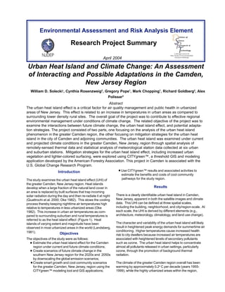
- 1. Environmental Assessment and Risk Analysis Element Research Project Summary April 2004 Linking Science to New Jersey’s Environmental Decision Making Urban Heat Island and Climate Change: An Assessment of Interacting and Possible Adaptations in the Camden, New Jersey Region William D. Solecki1, Cynthia Rosenzweig2, Gregory Pope1, Mark Chopping1, Richard Goldberg2, Alex Polissar3 Abstract The urban heat island effect is a critical factor for air quality management and public health in urbanized areas of New Jersey. This effect is related to an increase in temperatures in urban areas as compared to surrounding lower density rural sites. The overall goal of the project was to contribute to effective regional environmental management under conditions of climate change. The related objective of the project was to examine the interactions between future climate change, the urban heat island effect, and potential adapta-tion strategies. The project consisted of two parts, one focusing on the analysis of the urban heat island phenomenon in the greater Camden region, the other focusing on mitigation strategies for the urban heat island in the city of Camden and adjoining communities. The urban heat island was examined under current and projected climate conditions in the greater Camden, New Jersey, region through spatial analysis of remotely-sensed thermal data and statistical analysis of meteorological station data collected at six urban and suburban stations. Mitigation strategies for the urban heat island effect, including increased urban vegetation and lighter-colored surfacing, were explored using CITYgreen™, a threshold GIS and modeling application developed by the American Forestry Association. This project in Camden is associated with the U.S. Global Change Research Program. Introduction The study examines the urban heat island effect (UHI) of the greater Camden, New Jersey region. Heat islands develop when a large fraction of the natural land cover in an area is replaced by built surfaces that trap incoming solar radiation during the day and then re-radiate it at night (Quattrochi et al. 2000; Oke 1982). This slows the cooling process thereby keeping nighttime air temperatures high relative to temperatures in less urbanized areas (Oke 1982). This increase in urban air temperatures as com-pared to surrounding suburban and rural temperatures is referred to as the heat island effect (Figure 1). Heat islands of varying extent and magnitude have been observed in most urbanized areas in the world (Landsberg, 1981). Objectives The objectives of the study were as follows: Estimate the urban heat island effect for the Camden region under current and future climate conditions; Create scenarios of future climate change in the southern New Jersey region for the 2020s and 2050s by downscaling the global emission scenarios; Create smart growth and cool community scenarios for the greater Camden, New Jersey, region using the CITYgreen™ modeling tool and GIS applications; Use CITYgreen™ results and associated activities to estimate the benefits and costs of cool community pathways for the study region. Results There is a clearly identifiable urban heat island in Camden, New Jersey, apparent in both the satellite images and climate data. This UHI can be defined at three spatial scales, including the building, neighborhood, and city/region-scale. At each scale, the UHI is derived by different elements (e.g., architecture, meteorology, climatology, and land use change). The character and variability of the urban heat island will likely result in heightened peak energy demands for summertime air conditioning. Higher temperatures cause increased health risk to city dwellers because increased air temperatures are associated with heightened levels of secondary pollutants such as ozone. The urban heat island helps to concentrate almost all pollutants released in urban settings, particularly ozone, through the promotion of background thermal radiation. The climate of the greater Camden region overall has been warming by approximately 0.2o C per decade (years 1955- 1999), while the highly urbanized areas within the region,
- 2. 2 Figure 1. Sketch of an Urban Heat Island - Temperature profile for a late afternoon, summer day. Source: Lawrence Berkeley National Laboratory particularly in the city of Camden, have been warming at even faster rates (0.33o C per decade at the Philadelphia airport station). The difference between urban and suburban minimum temperatures has increased steadily over the past five decades. Suburban temperatures have risen more rapidly than more distant suburban/ex-urban temperatures, most likely the result of the extensive urbanization during the latter part of the 20th century. Surface temperatures in Camden are on average 4.0 to 6.0º C higher than suburban surface temperatures in the summer. High density residential land on average has the highest surface temperature (35.0o C) of any urban land use category. Data from the Camden area showed that the urban heat island effect is maximized in August. The temperature difference is much lower in winter. There is a strong annual profile in the magnitude of the urban heat island effect, and most of the monthly variability can be explained by correlat-ing wind speed and sky cover data to temperature differ-ences. Similar urban heat island results have been defined for a study for the greater Newark region. Within the city of Camden, there also is variation in tempera-ture. The highest surface temperatures are observed in the most highly developed parts of the city. Global climate models predict that the mean air tempera-tures in the Camden region will increase by 1.2 – 3.7o C in the next 50 years, and diurnal temperature range will decrease over this same period, indicating that the intensity of the urban heat island is likely to increase. Camden’s air quality problems are likely to be enhanced by interactions between global and regional climate change and the urban heat island effect. It is likely that pre-existing air quality and public health problems in Camden will worsen by warming temperatures, and affect an increasing percentage of the regional population. It becomes more important for climate change impacts to be factored into policy decisions regarding ozone mitigation strategies, as the planning horizon becomes more long-term. The heightened pollution levels in the city of Camden, combined with the fact that the per capita income of the city’s residents is well below poverty level and one of the lowest in the state, may increase the temporal extent and severity of exposure. It has been determined that the negative impacts of air pollution and high temperatures are disproportionately felt by socio-economically disadvantaged members of society (Kinney et al. 2000). There is a wide range of estimates as to how energy consumption will change with increased temperatures. If temperatures rise, the consensus is that energy consump-tion will also rise. To prevent increasing greenhouse gas emissions as well as electricity prices, mitigation strategies will become more crucial. The mitigation measures to reduce the heat island effect and air conditioning costs provide a link to local as well as global issues. The economic cost of implementation strategies is outweighed not only by the cooling energy savings, but also by the reduction in greenhouse gas emissions, esthetic value of urban forestry, and the increased quality of human health. These can be defined as win-win strategies. Mitigation of the urban heat island effect by increasing the use of surfaces covered in vegetation and building materials with higher than average reflectivity, in combination with an intensification of emissions reductions programs has the potential to help relieve Camden city’s current air quality problems. Strategic planting of deciduous trees at southern exposures can significantly reduce summer exposure of structures. The effectiveness of trees as a cooling element are limited under conditions of heightened humidity because the rates of evapotranspiration drops by ~50%. Mitigation potential in Camden is hampered significantly by city policy of paving over traditional street tree planting sites. As a result, the number of sites to plant trees on city blocks is very few. The addition of trees in neighborhoods will be an economically efficient method of reducing energy cost and consumption. Studies in other cities, such as Sacramento and Chicago, have found urban trees to be cost-effective as well. The benefits of urban trees continue to increase with time, especially if old or dead trees are periodically replaced with new ones. As trees mature, their canopy shades a larger area and therefore directly reduces energy demand and cost. Because it is necessary for trees to mature before their full benefits are realized, trees should be planted now. For example, carbon storage capacity increases substantially as the tree matures. For the carbon storage capacity to be maximized, the continuous planting of new trees is impor-tant. The establishment of new trees at the study sites could increase the amount of storage capacity by up to 33%. Other benefits from trees include the removal of air pollut-ants, the highest value coming from the removal of ozone and nitrogen dioxide. If these pollutants are reduced in the atmosphere, medical costs incurred from respiratory illnesses could be reduced by a significant amount. The amount of pollution removal estimated for the city of Camden represents a small percent (less than 2%) of the amount of emissions in Camden County in 1997 (U.S. EPA 1997). The current savings for the removal of all pollutants are estimated to be $1.2 million per year. If the extensive scenario is implemented then the savings could reach approximately $2.2 million in twenty years. This could become even more significant with future increased temperatures and energy demand.
- 3. 3 Light colored surfaces have cooler surface temperatures than dark colored surfaces. Road surfaces provide an example of this temperature difference: light colored road surfaces (e.g., concrete) have significantly cooler surface temperatures than dark colored road surfaces. Lighter colored roofs were not defined as a primary means of decreasing energy use in any of the three studied neighbor-hoods because the positive benefits of light colored roofs are mostly felt in the building space just below the roof. Two out of the three neighborhoods studied did not have any one-story houses (most of Camden is built with two and three-story houses) therefore the direct impact of lighter colored roofs is somewhat limited. However, this does not mean that lighter colored roofs would not be an effective method of mitigating the ambient urban heat island of the study blocks. This is especially important for communities such as Camden where the absence of tree canopy cover totally exposes the roofs to direct sunlight. The comparative advantage of lighter colored roofs is that they can provide immediate benefits upon application, while trees would require time to mature to provide full benefits. Negative impacts of air pollution and high temperatures are disproportionately felt by socio-economically disadvantaged members of society (Kinney et al. 2000). A decrease in the cost of energy use could lead to the affordability of air conditioning. Reducing Camden’s pollution and temperature by using trees could lead to the alleviation of respiratory disease hospitalizations and heat-stress related injuries. The urban heat island conditions of the region have spread as urban land development has taken place. Recent urban land conversion (lands developed between 1986 and 1995) has higher surface temperatures than more established urban land. Projected trends of suburban and exurban sprawl illustrate that the urban heat island will continue to spread spatially in the future. Several potential mitigation strategies can be integrated into the current operations and planning of many New Jersey state agencies (e.g., lighter road surfaces [NJDOT]), urban plantings [NJDEP], and buildings [BPU, DCA]). Conclusion and Recommendations Advanced statistical analysis of meteorological data over a longer time period, and especially of wind speed and cloud cover data is needed to extract relevant daily, monthly, and seasonal trends from the climate record. Incorporation of relative humidity, precipitation, and soil moisture levels would give a better process-oriented characterization of the surface-to-atmosphere transfer of heat and moisture in urban areas. Increasingly sophisticated regional climate models with high temporal and spatial resolution that incorporate the effects of urbanization and account for urban modifications of microcli-matic conditions are needed. Coupled with the data, this could provide a quantitative description of how the intensity of the urban heat island effect may interact with climate projections for the 21st century with respect to temperature, precipitation, wind speed, and cloud cover. Mitigation measures that incorporate knowledge of interac-tion between a dynamic climate and the built environment could provide solutions to the air quality and public health problems experienced in the city of Camden, thereby improving regional quality of life in the future. Urban heat island mitigation strategies will become essential for the future of urban development. It may become necessary to apply these methods to reduce the harmful impacts of increasing temperatures and the urban heat island. Shade Trees Cool Roofs Cool Roofs Light-colored Surfaces All Vegetation Direct Effect Indirect Effect Lowered AC Use & Cost Reduced Demand on Energy Producers Reduction in Greenhouse Gas Emissions Lower Temperature Slowed Ozone Production Fewer Heat-related Health Risks and Asthma Indirect Lower Ozone Levels Figure 2. Benefits of Mitigation Strategies - direct and indirect impacts of mitigation strategies. Source: Adapted from Akbari, H., Lawrence Berkeley National Laboratory: Heat Island Group. Presented at U.S. EPA HIRI Workshop, Washington D.C., March 6- 7, 2000. Planting trees is an inexpensive way to have a significant impact on the quality of life for citizens in Camden and the greater region. Policies could be considered for planting trees in neighborhoods, for instance via new guidelines for urban landscape design and construction. This will benefit citizens, even if only in indirect ways, through reducing energy consumption, lowering cooling costs, increasing the esthetic value of the city, increasing air quality and decreas-ing the related health problems. Currently, ordinances and guidelines for vegetation and lighter-colored roofing are being developed at the Lawrence Berkeley Lab in California. Urban planners can use these guidelines to mitigate the heat island effect across the country. Guidelines could be implemented to maintain standards for new construction concerning urban landscaping and light colored roofs. The U.S. Environmental Protection Agency, in partnership with the U.S. Department of Energy, encourages and awards energy-efficient buildings and homes through their Energy Star program (U.S. EPA and U.S. DOE 2001). Education and outreach is also an important aspect of the implementation of mitigation strategies; people cannot act until they are informed of these simple and relatively inexpen-sive methods of reducing energy costs. The nature and structure of the multiple urban heat islands (e.g., building, neighborhood, city/region) present within a
- 4. metropolitan region need to be further specified. The relative interactions among the three need to be better understood. A critical element is the distinction between the site-specific urban heat island and the ambient urban heat island and their relative presence in urban, suburban, and rural settings. The multiple urban heat islands can be understood through the application of higher resolution thermal data (e.g., Atlas data used for the federal Heat Island Reduction Initiative work on selected cities), and through the use of emerging 3-D thermal imaging. Assessment of municipal level and state planning activities in the area should be evaluated with respect to the connections between land development, surface temperature, and land use and vegetative cover. Further analysis on the relative contribution of land use planning strategies (e.g., clustered development vs. sprawl), greening strategies (e.g., afforesta-tion), and roofing strategies to mitigate the urban heat island need to be performed. The development of an integrated methodology to model the multiple urban heat islands and relative significance of a full range of mitigation strategies (white roofs, green roofs [roofs with vegetation], and trees) is a primary objective. This can either be attempted by integrating existing models (e.g., MM5, MARKAL, DOE-2) or through the creation of a new model specifically designed to study urban heat island and related mitigation strategies. The results of this project and its implications can be linked to other activities examining the effectiveness of urban heat island and global warming mitigation strategies, such as the work being done by stakeholders in Chicago and Tokyo, and among NGOs, such as International Council for Local Environmental Initiatives (ICLEI) and Earthpledge. References Kinney, P., D. Shindell, E. Chae (2000) Climate change and public health: Impact assessment for the NYC metropolitan region. In: Climate Change and a Global City: An Assessment of the Metropolitan East Coast Region (Rosenzweig, C. and W.D. Solecki, eds.) Columbia Earth Institute, New York, in press. Also available at http:// metroeast_climate.ciesin.columbia.edu/reports/health.pdf Landsberg, H. E. (1981) The Urban Climate. National Academy Press, New York, 275 pages. Oke, T.R. (1982) The energetic basis of urban heat island. Journal of the Royal Meteorological Society. 108 (455), 1-24. Quattrochi, D., Luvall, J., Rickman, D., Estes, M., Laymon, C., Howell, B. (2000) A decision support information system for urban landscape management using thermal infrared data. Photogrammetric Engineering and Remote Sensing. 66 (10), 1195-1207. Funding This project was funded by the NJDEP Division of Science, Research and Technology Greenhouse Gas Program under contract number SR01-09. Prepared By William D. Solecki, Gregory Pope, Mark Chopping, Montclair State University. Cynthia Rosenzweig, Richard Goldberg, NASA/GISS. Alexander Polissar, NJDEP, Division of Science, Research and Technology. 1 Montclair State University 2 NASA/GISS 3 NJDEP, Division of Science, Research and Technology. 4
- 5. STATE OF NEW JERSEY James E. McGreevey, Governor Department of Environmental Protection Bradley M. Campbell, Commissioner Division of Science, Research & Technology Dr. Eileen Murphy, Director Please send comments or requests to: Division of Science, Research and Technology P.O.Box 409, Trenton, NJ 08625 Phone: 609 984-6070 Visit the DSRT web site @ www.state.nj.us/dep/dsr RESEARCH PROJECT SUMMARY