Downloaded 322 times
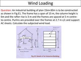
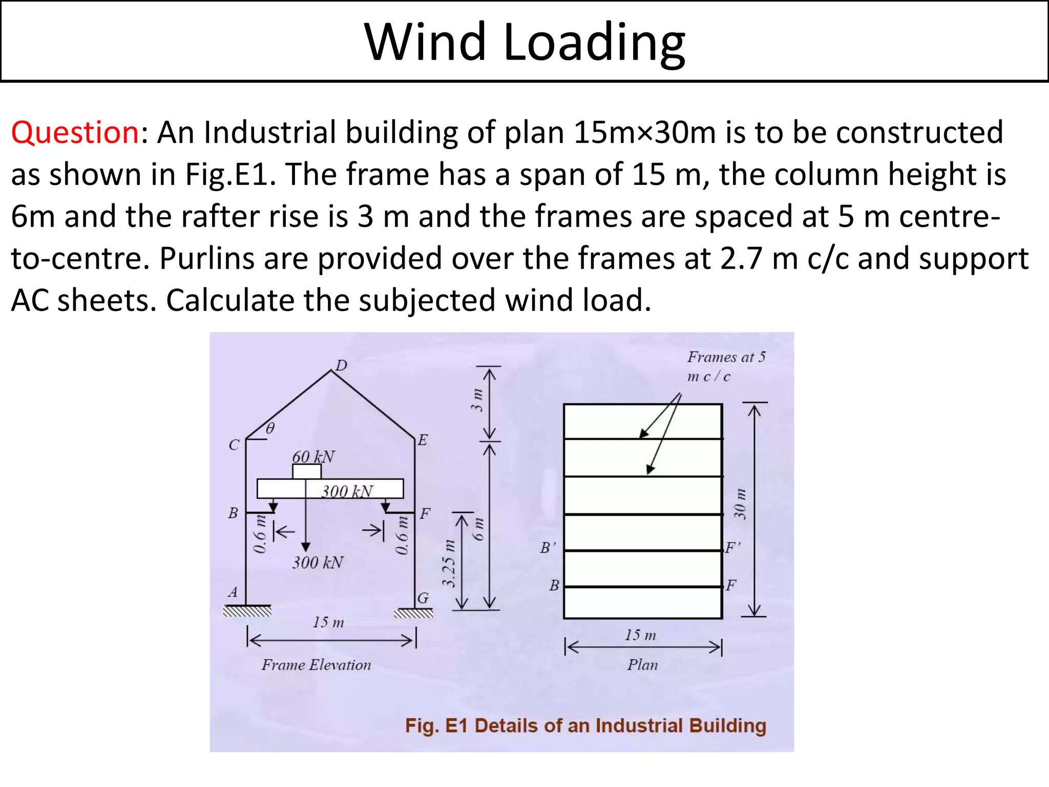
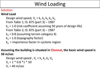
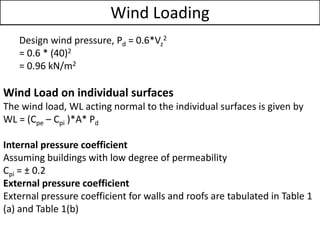
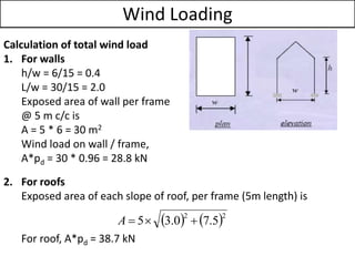
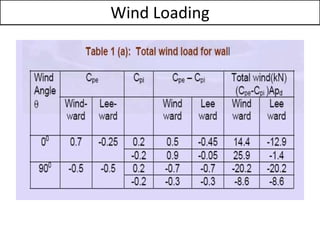
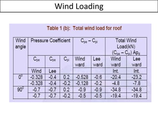


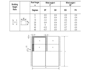

The document provides information about calculating wind load on an industrial building located in Chennai, India. It gives the dimensions of the building as 15m x 30m with a frame span of 15m and column height of 6m. It outlines the process to calculate the design wind speed using factors for risk, terrain, and topography. It then calculates the design wind pressure and uses this to calculate the wind load on the walls and roof of the building, finding values of 28.8 kN for the walls and 38.7 kN for the roof.