SlideShare a Scribd company logo
2020.03.18
Environmental Information Department
Programmer: Nyamsuren. B
Email: nyamkansn@gmail.com
1
Vegetation mapping by using GPM/DPR
over the Mongolian land
Information and Research institute of
Meteorology, Hydrology and Environment
2020.03.18
Байгаль Орчны Мэдээллийн Сангийн
хэлтсийн программист: Б.Нямсүрэн
1
GPM/DPR хиймэл дагуулаар Монгол
орны Ургамлын Зураглал хийх
Ус Цаг Уур, Орчны Судалгаа,
Мэдээллийн Хүрээлэн
Агуулга
 Монголын газрын бүрхэвчийн төрөл
 Ургамлын ач холбогдол
Оршил
 Монгол дахь Ургамлын доройтол
 Монгол дахь Ургамлын зураглал
Үндсэн асуудал
 Global Precipitation Measurement Mission (GPM)
 GPM/DPR радар, Ku/Ka цацрагийн утгууд
Ашигласан материал
• MODIS LAI, Хур тунадасны мэдээ харьцуулах
• NRCS ойсон цацрагийн характеристикууд,
тэдгээрийн зураглал.
Үр дүн
 Хэлэлцүүлэг
 Цаашдын судалгаа
Хэлэлцүүлэг
2Background Problem Method Result Discussion
Монгол орны газрын бүрхэвч (MODIS) УЦУОСМХ
Ой (~11%)
Хээр (~66.5%)
Цөл (~22.5%)
Source: http://www.eic.mn/land/gis.php
Mongolia is the landlocked country.
Total area is approximately 1,565,000 square km.
Located in the combined parts of Siberian forest biomes,
Central Asian steppe, and Gobi deserts. Land surface mainly
dominated by grassland. From northern to the south vegetation
density decreases gradually. Climate has 4 season with extreme
high changes hot summer average (+270 C), cold winter (-270 C).
3Background Problem Method Result Discussion
Монгол дахь ургамлын доройтол
Уур амьсгалын өөрчлөлт
- Ган
- Цөлжилт (76.9% area affected)
Хүний үйл ажиллагаа
- Уул уурхай
- Бэлчээрийн даац хэтрэлт
https://montsame.mn/en/read/130466
https://news.un.org/en/story http://zamineservices.com/
https://twitter.com/UNDPMongolia/status
Background Problem Method Result Discussion 5
Remote sensing
Vegetation dynamic GPM satellite
http://www.surf-forecast.com/breaks/El-Mongol
Designed to observe Earth’s precipitation
- High cost
- Limited coverage area
- Human labor intervention
- Low cost
- Large coverage area
- Less labor intervention
- Continuously mapping
Survey mapping Satellite mapping
Research goal : 1. Try to develop new method for vegetation by precipitation radar
2. Analyze vegetation dynamic for detecting the land degradation
Background Problem Method Result Discussion 6
Vegetation indicators in Remote Sensing
Currently in Remote sensing we use
optical sensors which directly see
the Earth from the Space. But we
can not see the Earth under the
cloud cover, haze and at night time.
Microwave Ku,Ka band can
penetrate the cloud cover and
able to detect at night time.
NDVI is ratio of Red, NIR
waves part of the Sunlight.
EVI, SAVI, RVI, ...
7
Sunlight = Electromagnetic Spectrum Ku, Ka
Vegetation indicators in Remote Sensing
SAR approach has several
weaknesses:
Microwave Ku,Ka band scan
narrow incidence angle, more
frequent observation.
SAR is complex approach
use microwave low
frequencies X,C,S,L, etc…
8
Sunlight = Electromagnetic Spectrum Ku, Ka
NASA ба JAXA-ийн хамтарсан төсөл
Орбит: Circular, non-sunsynchronous
Хөөргөсөн он: 2014.Feb.28
Жин: 3850 kg
Хүч чадал: 1950 W
Ажиглалтын хүрээ: 65°
GPM хиймэл дагуул нь глобал
түвшинд хур тунадасны ажиглалт
хийх зориулалттай.
Global Precipitation Mission – GPM
Background Problem Method Result Discussion 9
Global Precipitation Measurement Mission
GPM – Global Precipitation Measurement, launched 2014.Feb
Images source: https://pmm.nasa.gov/gpm
10Background Problem Method Result Discussion
GPM satellite Instruments
Build on success of TRMM
 Designed life: 5 years
 GPM Microwave Imager (GMI)
- Passive sensor installed from NASA.
- Multi-channel, conical scanning,
13 channels 10GHz – 183GHz
- Sense to total precipitation within all
cloud layers
Dual-frequency Precipitation Radar
(DPR)
- Active sensor developed from JAXA.
- Consist of Ka-band PR, Ku-band PR.
- Ku-band measure moderate-to-heavy
rain
- Ka-band measure frozen precipitation
and light rain
- Ku/Ka-band provide rain drop size
distribution in the cloud.
11Background Problem Method Result Discussion
DPR/ Ku and Ka band radar signal
Vegetation Characteristics
Normalized radar cross
section (NRCS or σ°)
backscattered values were
used for the calculation.
(2014 - 2018, May- Sep 5 km)
Without precipitation condition radar signals
retrieve the information about the land
surface.
Incidence angle Ku band ±17 degree,
Ka band ±8.5 degree scanning.
12Background Problem Method Result Discussion
Ku, Ka
band
Compare σ0 with Precipitation and MODIS/LAI
Based on map derived from ESA CCI 2015 landcover map:
13Background Problem Method Result Discussion
Forest
Grass
Desert
The Seasonal variation of: (2014-2017)
 MCD15A3H MODIS Leaf Area Index/FPAR 4 days composite data
 The precipitation data of 129 meteorological stations were used
In order to compare with the Ku and Ka band backscattered values.
Scheme to detect σ0 characteristic
GPM
NRCS σ0
map
Forest Incidence
Seasonal
variation
Seasonal
variation
Grass Incidence
Seasonal
variation
Seasonal
variation
Desert Incidence
Seasonal
variation
Seasonal
variation
GTOPO30
ESA CCI
Precipitation
MODIS/LAI
?
?
?
Ku and Ka signal
Background Problem Method Result Discussion 14
Characteristic of signals…
GPM
NRCS σ0
map
Forest Incidence
Seasonal
variation
Seasonal
variation
Grass Incidence
Seasonal
variation
Seasonal
variation
Desert Incidence
Seasonal
variation
Seasonal
variation
GTOPO30
ESA CCI
Precipitation
MODIS/LAI
?
?
?
Ku/Ka signal
Background Problem Method Result Discussion 15
Is there any relation???
Incidence angle dependency: Seasonal variation:
16Background Problem Method Result Discussion
NRCS σ° backscattering from the Forest
Incidence angle dependency: Seasonal variation:
17Background Problem Method Result Discussion
NRCS σ° backscattering from the Grass
Incidence angle dependency: Seasonal variation:
18Background Problem Method Result Discussion
NRCS σ° backscattering from the Desert
Compare backscatter from different Land
covers
 Ku-band backscatter with
incidence angle dependency.
 Ka-band backscatter with
incidence angle dependency.
Background Problem Method Result Discussion 19
Desert
Desert
Grass
Grass
Forest Forest
 Ku-band backscatter with
incidence angle dependency.
 Ka-band backscatter with
incidence angle dependency.
Background Problem Method Result Discussion 20
~3° ~3°
Compare backscatter from different Land
covers
Forest
Grass
Desert
Desert
Grass
Forest
From the Seasonal Aspect
~8°
~8°
Background Problem Method Result Discussion 21
Background Problem Method Result Discussion
Mapping – False color composite σ0
at ~3° and ~8°
22
KuPR:
R = σ0(3°)*1.4
G = σ0(7°+8°)
B = σ0(8°)*1.2
KaPR:
R = σ0(3°)*1.4
G = σ0(7°+8°)
B = σ0(8°)*1.2
MCD43A4:
R = B1
G = B4
B = B3
Mapping – Unsupervised clustering σ0
at ~3° to ~8°
Background Problem Method Result Discussion 23
KuPR: Forest and grass distinguished sufficiently.
KaPR: Desert and grass discriminated significantly.
Combination of these two radars backscatter might can distinguish
the forest, grass, and desert clearly.
Combination of KuPR and KaPR
+
concatenate
KuPR σ0 KaPR σ0
PCA (3 component) =
σ0
(2° ~ 8°)
Background Problem Method Result Discussion 24
σ0
(2° ~ 8°)
Explained total variance ~ 90 %
Combination of KuPR, KaPR radar
Background Problem Method Result Discussion 25
White: Water bodies
Black: Forest
Green: Grass land
Yellow-green: Desert
Discussion – compared with NDVI
NRCS vs NDVI map
KuPR KaPR σ0(2°~8°)
maps compared with
MOD13A2 16 days
1km NDVI maps in
2014, 2015, 2016,
2017, 2018 years
respectively.
26
0.
0
0.
0
0.6
5
0.
0
0.
0
0.
0.6
5
0.6
5
0.6
5
0.6
5
Discussion
Background Problem Method DiscussionResult
 GPM/DPR радарын ойлт нь хазайлтын өнцөг
нэмэгдэхэд Ойн бүсээс тогтмол (бага), харин Цөлийн
бүсээс буурах хандлага ажиглагдсан.
 Монголын нөхцөлд ургамал ургах улирал буюу 5-9-р
сар дахь Ku ба Ka сигналын 3° - 8° хазайлтын
өнцөгтэй ажиглалтын утгууд нь ургамлын зураглал
хийхэд хүрэлцээтэй.
 Ku-сигналь Ойн зураглал хийхэд тохиромжтой, Ka-
сигналь цөлийн бүсийг газраас ялган ангилахад
тохиромжтой.
27
Discussion
Background Problem Method DiscussionResult 28
The results showed same characteristics
with the ground radar experiments of Ku-
band (13 GHz) in Ulaby et al, study.
Dense
Dense
Sparse
Sparse
2. Journal Paper
Thank you for your attention…
Анхаарал тавьсанд баярлалаа...

More Related Content

What's hot

Ravasi_etal_EAGE2015b
Ravasi_etal_EAGE2015bRavasi_etal_EAGE2015b
Ravasi_etal_EAGE2015bMatteo Ravasi
 
Leaf Area Index (LAI) in the quantification of vegetation disturbance in Iris...
Leaf Area Index (LAI) in the quantification of vegetation disturbance in Iris...Leaf Area Index (LAI) in the quantification of vegetation disturbance in Iris...
Leaf Area Index (LAI) in the quantification of vegetation disturbance in Iris...
Environmental Protection Agency, Ireland
 
061018 Sea Wi Fs Work
061018 Sea Wi Fs Work061018 Sea Wi Fs Work
061018 Sea Wi Fs Work
Rudolf Husar
 
GENERATING FINE RESOLUTION LEAF AREA INDEX MAPS FOR BOREAL FORESTS OF FINLAND...
GENERATING FINE RESOLUTION LEAF AREA INDEX MAPS FOR BOREAL FORESTS OF FINLAND...GENERATING FINE RESOLUTION LEAF AREA INDEX MAPS FOR BOREAL FORESTS OF FINLAND...
GENERATING FINE RESOLUTION LEAF AREA INDEX MAPS FOR BOREAL FORESTS OF FINLAND...grssieee
 
4_Presentation.DE+EnVA.20110727.ppt
4_Presentation.DE+EnVA.20110727.ppt4_Presentation.DE+EnVA.20110727.ppt
4_Presentation.DE+EnVA.20110727.pptgrssieee
 
Ieee gold angiati
Ieee gold angiatiIeee gold angiati
Ieee gold angiatigrssieee
 
NPOESSPreparatoryProjectValidationPlansfortheOzoneMappingandProfilerSuite.ppt
NPOESSPreparatoryProjectValidationPlansfortheOzoneMappingandProfilerSuite.pptNPOESSPreparatoryProjectValidationPlansfortheOzoneMappingandProfilerSuite.ppt
NPOESSPreparatoryProjectValidationPlansfortheOzoneMappingandProfilerSuite.pptgrssieee
 
MO3.T10.5Ahmed.ppt
MO3.T10.5Ahmed.pptMO3.T10.5Ahmed.ppt
MO3.T10.5Ahmed.pptgrssieee
 
Modellistica Lagrangiana in ISAC Torino - risultati e nuovi sviluppi
Modellistica Lagrangiana in ISAC Torino - risultati e nuovi sviluppiModellistica Lagrangiana in ISAC Torino - risultati e nuovi sviluppi
Modellistica Lagrangiana in ISAC Torino - risultati e nuovi sviluppi
ARIANET
 
Chen, Huilin: Comparisons of AirCore vertical profiles of greenhouse gases fr...
Chen, Huilin: Comparisons of AirCore vertical profiles of greenhouse gases fr...Chen, Huilin: Comparisons of AirCore vertical profiles of greenhouse gases fr...
Chen, Huilin: Comparisons of AirCore vertical profiles of greenhouse gases fr...
Integrated Carbon Observation System (ICOS)
 
Clear sky and all-weather global and beam irradiance models: long term valida...
Clear sky and all-weather global and beam irradiance models: long term valida...Clear sky and all-weather global and beam irradiance models: long term valida...
Clear sky and all-weather global and beam irradiance models: long term valida...
Sandia National Laboratories: Energy & Climate: Renewables
 
07 a70401 remotesensingandgisapplications
07 a70401 remotesensingandgisapplications07 a70401 remotesensingandgisapplications
07 a70401 remotesensingandgisapplicationsimaduddin91
 
Atmospheric correction
Atmospheric correctionAtmospheric correction
Atmospheric correction
Nirmal Kumar
 
Integration of flux tower data and remotely sensed data into the SCOPE simula...
Integration of flux tower data and remotely sensed data into the SCOPE simula...Integration of flux tower data and remotely sensed data into the SCOPE simula...
Integration of flux tower data and remotely sensed data into the SCOPE simula...
Integrated Carbon Observation System (ICOS)
 
SPIE_Newsroom_Dubovik_et_al_2014
SPIE_Newsroom_Dubovik_et_al_2014SPIE_Newsroom_Dubovik_et_al_2014
SPIE_Newsroom_Dubovik_et_al_2014Oleg Dubovik
 
VALIDATING SATELLITE LAND SURFACE TEMPERATURE PRODUCTS FOR GOES-R AND JPSS MI...
VALIDATING SATELLITE LAND SURFACE TEMPERATURE PRODUCTS FOR GOES-R AND JPSS MI...VALIDATING SATELLITE LAND SURFACE TEMPERATURE PRODUCTS FOR GOES-R AND JPSS MI...
VALIDATING SATELLITE LAND SURFACE TEMPERATURE PRODUCTS FOR GOES-R AND JPSS MI...grssieee
 
Geothermal exploration using remote sensing techniques
Geothermal exploration using remote sensing techniquesGeothermal exploration using remote sensing techniques
Geothermal exploration using remote sensing techniques
Sepideh Abadpour
 
CLIM: Transition Workshop - Optimization Methods in Remote Sensing - Jessica...
CLIM: Transition Workshop - Optimization Methods in Remote Sensing  - Jessica...CLIM: Transition Workshop - Optimization Methods in Remote Sensing  - Jessica...
CLIM: Transition Workshop - Optimization Methods in Remote Sensing - Jessica...
The Statistical and Applied Mathematical Sciences Institute
 

What's hot (19)

Ravasi_etal_EAGE2015b
Ravasi_etal_EAGE2015bRavasi_etal_EAGE2015b
Ravasi_etal_EAGE2015b
 
Leaf Area Index (LAI) in the quantification of vegetation disturbance in Iris...
Leaf Area Index (LAI) in the quantification of vegetation disturbance in Iris...Leaf Area Index (LAI) in the quantification of vegetation disturbance in Iris...
Leaf Area Index (LAI) in the quantification of vegetation disturbance in Iris...
 
061018 Sea Wi Fs Work
061018 Sea Wi Fs Work061018 Sea Wi Fs Work
061018 Sea Wi Fs Work
 
GENERATING FINE RESOLUTION LEAF AREA INDEX MAPS FOR BOREAL FORESTS OF FINLAND...
GENERATING FINE RESOLUTION LEAF AREA INDEX MAPS FOR BOREAL FORESTS OF FINLAND...GENERATING FINE RESOLUTION LEAF AREA INDEX MAPS FOR BOREAL FORESTS OF FINLAND...
GENERATING FINE RESOLUTION LEAF AREA INDEX MAPS FOR BOREAL FORESTS OF FINLAND...
 
4_Presentation.DE+EnVA.20110727.ppt
4_Presentation.DE+EnVA.20110727.ppt4_Presentation.DE+EnVA.20110727.ppt
4_Presentation.DE+EnVA.20110727.ppt
 
Ieee gold angiati
Ieee gold angiatiIeee gold angiati
Ieee gold angiati
 
NPOESSPreparatoryProjectValidationPlansfortheOzoneMappingandProfilerSuite.ppt
NPOESSPreparatoryProjectValidationPlansfortheOzoneMappingandProfilerSuite.pptNPOESSPreparatoryProjectValidationPlansfortheOzoneMappingandProfilerSuite.ppt
NPOESSPreparatoryProjectValidationPlansfortheOzoneMappingandProfilerSuite.ppt
 
MO3.T10.5Ahmed.ppt
MO3.T10.5Ahmed.pptMO3.T10.5Ahmed.ppt
MO3.T10.5Ahmed.ppt
 
Modellistica Lagrangiana in ISAC Torino - risultati e nuovi sviluppi
Modellistica Lagrangiana in ISAC Torino - risultati e nuovi sviluppiModellistica Lagrangiana in ISAC Torino - risultati e nuovi sviluppi
Modellistica Lagrangiana in ISAC Torino - risultati e nuovi sviluppi
 
Chen, Huilin: Comparisons of AirCore vertical profiles of greenhouse gases fr...
Chen, Huilin: Comparisons of AirCore vertical profiles of greenhouse gases fr...Chen, Huilin: Comparisons of AirCore vertical profiles of greenhouse gases fr...
Chen, Huilin: Comparisons of AirCore vertical profiles of greenhouse gases fr...
 
Clear sky and all-weather global and beam irradiance models: long term valida...
Clear sky and all-weather global and beam irradiance models: long term valida...Clear sky and all-weather global and beam irradiance models: long term valida...
Clear sky and all-weather global and beam irradiance models: long term valida...
 
07 a70401 remotesensingandgisapplications
07 a70401 remotesensingandgisapplications07 a70401 remotesensingandgisapplications
07 a70401 remotesensingandgisapplications
 
Atmospheric correction
Atmospheric correctionAtmospheric correction
Atmospheric correction
 
Integration of flux tower data and remotely sensed data into the SCOPE simula...
Integration of flux tower data and remotely sensed data into the SCOPE simula...Integration of flux tower data and remotely sensed data into the SCOPE simula...
Integration of flux tower data and remotely sensed data into the SCOPE simula...
 
SPIE_Newsroom_Dubovik_et_al_2014
SPIE_Newsroom_Dubovik_et_al_2014SPIE_Newsroom_Dubovik_et_al_2014
SPIE_Newsroom_Dubovik_et_al_2014
 
Dinh_BIOMASS_TomoSAR
Dinh_BIOMASS_TomoSARDinh_BIOMASS_TomoSAR
Dinh_BIOMASS_TomoSAR
 
VALIDATING SATELLITE LAND SURFACE TEMPERATURE PRODUCTS FOR GOES-R AND JPSS MI...
VALIDATING SATELLITE LAND SURFACE TEMPERATURE PRODUCTS FOR GOES-R AND JPSS MI...VALIDATING SATELLITE LAND SURFACE TEMPERATURE PRODUCTS FOR GOES-R AND JPSS MI...
VALIDATING SATELLITE LAND SURFACE TEMPERATURE PRODUCTS FOR GOES-R AND JPSS MI...
 
Geothermal exploration using remote sensing techniques
Geothermal exploration using remote sensing techniquesGeothermal exploration using remote sensing techniques
Geothermal exploration using remote sensing techniques
 
CLIM: Transition Workshop - Optimization Methods in Remote Sensing - Jessica...
CLIM: Transition Workshop - Optimization Methods in Remote Sensing  - Jessica...CLIM: Transition Workshop - Optimization Methods in Remote Sensing  - Jessica...
CLIM: Transition Workshop - Optimization Methods in Remote Sensing - Jessica...
 

Similar to Vegetation monitoring using gpm data over mongolia

Merging multiple soil moisture products for improving the accuracy in rainfal...
Merging multiple soil moisture products for improving the accuracy in rainfal...Merging multiple soil moisture products for improving the accuracy in rainfal...
Merging multiple soil moisture products for improving the accuracy in rainfal...
Luca Brocca
 
WETLAND MAPPING USING RS AND GIS
WETLAND MAPPING USING RS AND GISWETLAND MAPPING USING RS AND GIS
WETLAND MAPPING USING RS AND GISAbhiram Kanigolla
 
MO3.T10.5Ahmed.ppt
MO3.T10.5Ahmed.pptMO3.T10.5Ahmed.ppt
MO3.T10.5Ahmed.pptgrssieee
 
MO3.T10.5Ahmed.ppt
MO3.T10.5Ahmed.pptMO3.T10.5Ahmed.ppt
MO3.T10.5Ahmed.pptgrssieee
 
A PHYSICAL METHOD TO COMPUTE SURFACE RADIATION FROM GEOSTATIONARY SATELLITES
A PHYSICAL METHOD TO COMPUTE SURFACE RADIATION FROM GEOSTATIONARY SATELLITES  A PHYSICAL METHOD TO COMPUTE SURFACE RADIATION FROM GEOSTATIONARY SATELLITES
A PHYSICAL METHOD TO COMPUTE SURFACE RADIATION FROM GEOSTATIONARY SATELLITES
Roberto Valer
 
TU2.L09 - POTENTIALS OF A COMPACT POLARIMETRIC SAR SYSTEM
TU2.L09 - POTENTIALS OF A COMPACT POLARIMETRIC SAR SYSTEMTU2.L09 - POTENTIALS OF A COMPACT POLARIMETRIC SAR SYSTEM
TU2.L09 - POTENTIALS OF A COMPACT POLARIMETRIC SAR SYSTEMgrssieee
 
On_the_development_of_dualfrq_PR_china(Tiger).ppt
On_the_development_of_dualfrq_PR_china(Tiger).pptOn_the_development_of_dualfrq_PR_china(Tiger).ppt
On_the_development_of_dualfrq_PR_china(Tiger).pptgrssieee
 
TU3.L09 - SPACEBORNE FULLY POLARIMETRIC TIME-SERIES DATASETS FOR LAND COVER A...
TU3.L09 - SPACEBORNE FULLY POLARIMETRIC TIME-SERIES DATASETS FOR LAND COVER A...TU3.L09 - SPACEBORNE FULLY POLARIMETRIC TIME-SERIES DATASETS FOR LAND COVER A...
TU3.L09 - SPACEBORNE FULLY POLARIMETRIC TIME-SERIES DATASETS FOR LAND COVER A...grssieee
 
Reanalysis Datasets for Solar Resource Assessment Presented at ASES 2014
Reanalysis Datasets for Solar Resource Assessment Presented at ASES 2014Reanalysis Datasets for Solar Resource Assessment Presented at ASES 2014
Reanalysis Datasets for Solar Resource Assessment Presented at ASES 2014
Gwendalyn Bender
 
4th SEM THESIS Anurag Ghosh.pptx
4th SEM THESIS Anurag Ghosh.pptx4th SEM THESIS Anurag Ghosh.pptx
4th SEM THESIS Anurag Ghosh.pptx
BANKURA UNIVERSITY
 
Thresholds of Detection for Falling Snow from Satellite-Borne Active and Pas...
Thresholds of Detection for Falling Snow  from Satellite-Borne Active and Pas...Thresholds of Detection for Falling Snow  from Satellite-Borne Active and Pas...
Thresholds of Detection for Falling Snow from Satellite-Borne Active and Pas...grssieee
 
Accuracy improvement of gnss and real time kinematic using egyptian network a...
Accuracy improvement of gnss and real time kinematic using egyptian network a...Accuracy improvement of gnss and real time kinematic using egyptian network a...
Accuracy improvement of gnss and real time kinematic using egyptian network a...
Alexander Decker
 
Antarctic_ice_shelf_3D_cross_sectional_profile_imaging_using_MIMO_radar.ppt
Antarctic_ice_shelf_3D_cross_sectional_profile_imaging_using_MIMO_radar.pptAntarctic_ice_shelf_3D_cross_sectional_profile_imaging_using_MIMO_radar.ppt
Antarctic_ice_shelf_3D_cross_sectional_profile_imaging_using_MIMO_radar.pptgrssieee
 
Future guidelines on solar forecasting the research view - David Pozo (Univer...
Future guidelines on solar forecasting the research view - David Pozo (Univer...Future guidelines on solar forecasting the research view - David Pozo (Univer...
Future guidelines on solar forecasting the research view - David Pozo (Univer...
IrSOLaV Pomares
 
West Med Seismic Survey Project Report - June 2009
West Med Seismic Survey Project Report - June 2009 West Med Seismic Survey Project Report - June 2009
West Med Seismic Survey Project Report - June 2009 Victoria Oil and Gas Plc
 
Rahul seminar2 2_for_slideshare.pptx
Rahul seminar2 2_for_slideshare.pptxRahul seminar2 2_for_slideshare.pptx
Rahul seminar2 2_for_slideshare.pptx
RahulSingh769902
 
TH3.L10.1: THE NASA SOIL MOISTURE ACTIVE PASSIVE (SMAP) MISSION: OVERVIEW
TH3.L10.1: THE NASA SOIL MOISTURE ACTIVE PASSIVE (SMAP) MISSION: OVERVIEWTH3.L10.1: THE NASA SOIL MOISTURE ACTIVE PASSIVE (SMAP) MISSION: OVERVIEW
TH3.L10.1: THE NASA SOIL MOISTURE ACTIVE PASSIVE (SMAP) MISSION: OVERVIEWgrssieee
 
FR4.T05.1.ppt
FR4.T05.1.pptFR4.T05.1.ppt
FR4.T05.1.pptgrssieee
 
1 IGARSS 2011 JPSS Monday Goldberg.pptx
1 IGARSS 2011 JPSS Monday Goldberg.pptx1 IGARSS 2011 JPSS Monday Goldberg.pptx
1 IGARSS 2011 JPSS Monday Goldberg.pptxgrssieee
 

Similar to Vegetation monitoring using gpm data over mongolia (20)

Merging multiple soil moisture products for improving the accuracy in rainfal...
Merging multiple soil moisture products for improving the accuracy in rainfal...Merging multiple soil moisture products for improving the accuracy in rainfal...
Merging multiple soil moisture products for improving the accuracy in rainfal...
 
WETLAND MAPPING USING RS AND GIS
WETLAND MAPPING USING RS AND GISWETLAND MAPPING USING RS AND GIS
WETLAND MAPPING USING RS AND GIS
 
MO3.T10.5Ahmed.ppt
MO3.T10.5Ahmed.pptMO3.T10.5Ahmed.ppt
MO3.T10.5Ahmed.ppt
 
MO3.T10.5Ahmed.ppt
MO3.T10.5Ahmed.pptMO3.T10.5Ahmed.ppt
MO3.T10.5Ahmed.ppt
 
A PHYSICAL METHOD TO COMPUTE SURFACE RADIATION FROM GEOSTATIONARY SATELLITES
A PHYSICAL METHOD TO COMPUTE SURFACE RADIATION FROM GEOSTATIONARY SATELLITES  A PHYSICAL METHOD TO COMPUTE SURFACE RADIATION FROM GEOSTATIONARY SATELLITES
A PHYSICAL METHOD TO COMPUTE SURFACE RADIATION FROM GEOSTATIONARY SATELLITES
 
TU2.L09 - POTENTIALS OF A COMPACT POLARIMETRIC SAR SYSTEM
TU2.L09 - POTENTIALS OF A COMPACT POLARIMETRIC SAR SYSTEMTU2.L09 - POTENTIALS OF A COMPACT POLARIMETRIC SAR SYSTEM
TU2.L09 - POTENTIALS OF A COMPACT POLARIMETRIC SAR SYSTEM
 
On_the_development_of_dualfrq_PR_china(Tiger).ppt
On_the_development_of_dualfrq_PR_china(Tiger).pptOn_the_development_of_dualfrq_PR_china(Tiger).ppt
On_the_development_of_dualfrq_PR_china(Tiger).ppt
 
TU3.L09 - SPACEBORNE FULLY POLARIMETRIC TIME-SERIES DATASETS FOR LAND COVER A...
TU3.L09 - SPACEBORNE FULLY POLARIMETRIC TIME-SERIES DATASETS FOR LAND COVER A...TU3.L09 - SPACEBORNE FULLY POLARIMETRIC TIME-SERIES DATASETS FOR LAND COVER A...
TU3.L09 - SPACEBORNE FULLY POLARIMETRIC TIME-SERIES DATASETS FOR LAND COVER A...
 
Reanalysis Datasets for Solar Resource Assessment Presented at ASES 2014
Reanalysis Datasets for Solar Resource Assessment Presented at ASES 2014Reanalysis Datasets for Solar Resource Assessment Presented at ASES 2014
Reanalysis Datasets for Solar Resource Assessment Presented at ASES 2014
 
4th SEM THESIS Anurag Ghosh.pptx
4th SEM THESIS Anurag Ghosh.pptx4th SEM THESIS Anurag Ghosh.pptx
4th SEM THESIS Anurag Ghosh.pptx
 
Thresholds of Detection for Falling Snow from Satellite-Borne Active and Pas...
Thresholds of Detection for Falling Snow  from Satellite-Borne Active and Pas...Thresholds of Detection for Falling Snow  from Satellite-Borne Active and Pas...
Thresholds of Detection for Falling Snow from Satellite-Borne Active and Pas...
 
Accuracy improvement of gnss and real time kinematic using egyptian network a...
Accuracy improvement of gnss and real time kinematic using egyptian network a...Accuracy improvement of gnss and real time kinematic using egyptian network a...
Accuracy improvement of gnss and real time kinematic using egyptian network a...
 
Antarctic_ice_shelf_3D_cross_sectional_profile_imaging_using_MIMO_radar.ppt
Antarctic_ice_shelf_3D_cross_sectional_profile_imaging_using_MIMO_radar.pptAntarctic_ice_shelf_3D_cross_sectional_profile_imaging_using_MIMO_radar.ppt
Antarctic_ice_shelf_3D_cross_sectional_profile_imaging_using_MIMO_radar.ppt
 
Rocca.ppt
Rocca.pptRocca.ppt
Rocca.ppt
 
Future guidelines on solar forecasting the research view - David Pozo (Univer...
Future guidelines on solar forecasting the research view - David Pozo (Univer...Future guidelines on solar forecasting the research view - David Pozo (Univer...
Future guidelines on solar forecasting the research view - David Pozo (Univer...
 
West Med Seismic Survey Project Report - June 2009
West Med Seismic Survey Project Report - June 2009 West Med Seismic Survey Project Report - June 2009
West Med Seismic Survey Project Report - June 2009
 
Rahul seminar2 2_for_slideshare.pptx
Rahul seminar2 2_for_slideshare.pptxRahul seminar2 2_for_slideshare.pptx
Rahul seminar2 2_for_slideshare.pptx
 
TH3.L10.1: THE NASA SOIL MOISTURE ACTIVE PASSIVE (SMAP) MISSION: OVERVIEW
TH3.L10.1: THE NASA SOIL MOISTURE ACTIVE PASSIVE (SMAP) MISSION: OVERVIEWTH3.L10.1: THE NASA SOIL MOISTURE ACTIVE PASSIVE (SMAP) MISSION: OVERVIEW
TH3.L10.1: THE NASA SOIL MOISTURE ACTIVE PASSIVE (SMAP) MISSION: OVERVIEW
 
FR4.T05.1.ppt
FR4.T05.1.pptFR4.T05.1.ppt
FR4.T05.1.ppt
 
1 IGARSS 2011 JPSS Monday Goldberg.pptx
1 IGARSS 2011 JPSS Monday Goldberg.pptx1 IGARSS 2011 JPSS Monday Goldberg.pptx
1 IGARSS 2011 JPSS Monday Goldberg.pptx
 

More from GeoMedeelel

Intro mga mon_15mar22
Intro mga mon_15mar22Intro mga mon_15mar22
Intro mga mon_15mar22
GeoMedeelel
 
Presentation 20220316 nandia
Presentation 20220316 nandiaPresentation 20220316 nandia
Presentation 20220316 nandia
GeoMedeelel
 
Developer community -remote-sensing.pptx
Developer community -remote-sensing.pptxDeveloper community -remote-sensing.pptx
Developer community -remote-sensing.pptx
GeoMedeelel
 
Intro mga mon_18feb22
Intro mga mon_18feb22Intro mga mon_18feb22
Intro mga mon_18feb22
GeoMedeelel
 
Agriculture drone intro
Agriculture drone introAgriculture drone intro
Agriculture drone intro
GeoMedeelel
 
Drone 20201216
Drone 20201216Drone 20201216
Drone 20201216
GeoMedeelel
 
Intro mga 15dec2021 (1)
Intro mga 15dec2021 (1)Intro mga 15dec2021 (1)
Intro mga 15dec2021 (1)
GeoMedeelel
 
Unisec global mongolia
Unisec global mongoliaUnisec global mongolia
Unisec global mongolia
GeoMedeelel
 
Bayanmunkh geomeeting
Bayanmunkh geomeetingBayanmunkh geomeeting
Bayanmunkh geomeeting
GeoMedeelel
 
Intro mga mon_19jan2021
Intro mga mon_19jan2021Intro mga mon_19jan2021
Intro mga mon_19jan2021
GeoMedeelel
 
хиймэл дагуулын мэдээ ашиглан ойн биомассийг тооцох 12 25
хиймэл дагуулын мэдээ ашиглан ойн биомассийг тооцох 12 25хиймэл дагуулын мэдээ ашиглан ойн биомассийг тооцох 12 25
хиймэл дагуулын мэдээ ашиглан ойн биомассийг тооцох 12 25
GeoMedeelel
 
Bayanmunkh geomeeting (1)
Bayanmunkh geomeeting (1)Bayanmunkh geomeeting (1)
Bayanmunkh geomeeting (1)
GeoMedeelel
 
хиймэл дагуулын мэдээ ашиглан ойн биомассийг тооцох 12 25
хиймэл дагуулын мэдээ ашиглан ойн биомассийг тооцох 12 25хиймэл дагуулын мэдээ ашиглан ойн биомассийг тооцох 12 25
хиймэл дагуулын мэдээ ашиглан ойн биомассийг тооцох 12 25
GeoMedeelel
 
Intro mga mon_19jan2021
Intro mga mon_19jan2021Intro mga mon_19jan2021
Intro mga mon_19jan2021
GeoMedeelel
 
Chcnav moblie mapping solution2
Chcnav moblie mapping solution2Chcnav moblie mapping solution2
Chcnav moblie mapping solution2
GeoMedeelel
 
5 d world_v5-19
5 d world_v5-19 5 d world_v5-19
5 d world_v5-19
GeoMedeelel
 
Intro mga 18may2021
Intro mga 18may2021Intro mga 18may2021
Intro mga 18may2021
GeoMedeelel
 
Intro mga 14apr2021
Intro mga 14apr2021Intro mga 14apr2021
Intro mga 14apr2021
GeoMedeelel
 
Demonstration of super map ai gis technology
Demonstration of super map ai gis technology  Demonstration of super map ai gis technology
Demonstration of super map ai gis technology
GeoMedeelel
 
Supermap gis 10i(2020) ai gis technology v1.0
Supermap gis 10i(2020) ai gis technology v1.0Supermap gis 10i(2020) ai gis technology v1.0
Supermap gis 10i(2020) ai gis technology v1.0
GeoMedeelel
 

More from GeoMedeelel (20)

Intro mga mon_15mar22
Intro mga mon_15mar22Intro mga mon_15mar22
Intro mga mon_15mar22
 
Presentation 20220316 nandia
Presentation 20220316 nandiaPresentation 20220316 nandia
Presentation 20220316 nandia
 
Developer community -remote-sensing.pptx
Developer community -remote-sensing.pptxDeveloper community -remote-sensing.pptx
Developer community -remote-sensing.pptx
 
Intro mga mon_18feb22
Intro mga mon_18feb22Intro mga mon_18feb22
Intro mga mon_18feb22
 
Agriculture drone intro
Agriculture drone introAgriculture drone intro
Agriculture drone intro
 
Drone 20201216
Drone 20201216Drone 20201216
Drone 20201216
 
Intro mga 15dec2021 (1)
Intro mga 15dec2021 (1)Intro mga 15dec2021 (1)
Intro mga 15dec2021 (1)
 
Unisec global mongolia
Unisec global mongoliaUnisec global mongolia
Unisec global mongolia
 
Bayanmunkh geomeeting
Bayanmunkh geomeetingBayanmunkh geomeeting
Bayanmunkh geomeeting
 
Intro mga mon_19jan2021
Intro mga mon_19jan2021Intro mga mon_19jan2021
Intro mga mon_19jan2021
 
хиймэл дагуулын мэдээ ашиглан ойн биомассийг тооцох 12 25
хиймэл дагуулын мэдээ ашиглан ойн биомассийг тооцох 12 25хиймэл дагуулын мэдээ ашиглан ойн биомассийг тооцох 12 25
хиймэл дагуулын мэдээ ашиглан ойн биомассийг тооцох 12 25
 
Bayanmunkh geomeeting (1)
Bayanmunkh geomeeting (1)Bayanmunkh geomeeting (1)
Bayanmunkh geomeeting (1)
 
хиймэл дагуулын мэдээ ашиглан ойн биомассийг тооцох 12 25
хиймэл дагуулын мэдээ ашиглан ойн биомассийг тооцох 12 25хиймэл дагуулын мэдээ ашиглан ойн биомассийг тооцох 12 25
хиймэл дагуулын мэдээ ашиглан ойн биомассийг тооцох 12 25
 
Intro mga mon_19jan2021
Intro mga mon_19jan2021Intro mga mon_19jan2021
Intro mga mon_19jan2021
 
Chcnav moblie mapping solution2
Chcnav moblie mapping solution2Chcnav moblie mapping solution2
Chcnav moblie mapping solution2
 
5 d world_v5-19
5 d world_v5-19 5 d world_v5-19
5 d world_v5-19
 
Intro mga 18may2021
Intro mga 18may2021Intro mga 18may2021
Intro mga 18may2021
 
Intro mga 14apr2021
Intro mga 14apr2021Intro mga 14apr2021
Intro mga 14apr2021
 
Demonstration of super map ai gis technology
Demonstration of super map ai gis technology  Demonstration of super map ai gis technology
Demonstration of super map ai gis technology
 
Supermap gis 10i(2020) ai gis technology v1.0
Supermap gis 10i(2020) ai gis technology v1.0Supermap gis 10i(2020) ai gis technology v1.0
Supermap gis 10i(2020) ai gis technology v1.0
 

Recently uploaded

DRAFT NRW Recreation Strategy - People and Nature thriving together
DRAFT NRW Recreation Strategy - People and Nature thriving togetherDRAFT NRW Recreation Strategy - People and Nature thriving together
DRAFT NRW Recreation Strategy - People and Nature thriving together
Robin Grant
 
Navigating the complex landscape of AI governance
Navigating the complex landscape of AI governanceNavigating the complex landscape of AI governance
Navigating the complex landscape of AI governance
Piermenotti Mauro
 
Daan Park Hydrangea flower season I like it
Daan Park Hydrangea flower season I like itDaan Park Hydrangea flower season I like it
Daan Park Hydrangea flower season I like it
a0966109726
 
Willie Nelson Net Worth: A Journey Through Music, Movies, and Business Ventures
Willie Nelson Net Worth: A Journey Through Music, Movies, and Business VenturesWillie Nelson Net Worth: A Journey Through Music, Movies, and Business Ventures
Willie Nelson Net Worth: A Journey Through Music, Movies, and Business Ventures
greendigital
 
Q&A with the Experts: The Food Service Playbook
Q&A with the Experts: The Food Service PlaybookQ&A with the Experts: The Food Service Playbook
Q&A with the Experts: The Food Service Playbook
World Resources Institute (WRI)
 
一比一原版(UMTC毕业证书)明尼苏达大学双城分校毕业证如何办理
一比一原版(UMTC毕业证书)明尼苏达大学双城分校毕业证如何办理一比一原版(UMTC毕业证书)明尼苏达大学双城分校毕业证如何办理
一比一原版(UMTC毕业证书)明尼苏达大学双城分校毕业证如何办理
zm9ajxup
 
Presentación Giulio Quaggiotto-Diálogo improbable .pptx.pdf
Presentación Giulio Quaggiotto-Diálogo improbable .pptx.pdfPresentación Giulio Quaggiotto-Diálogo improbable .pptx.pdf
Presentación Giulio Quaggiotto-Diálogo improbable .pptx.pdf
Innovation and Technology for Development Centre
 
Characterization and the Kinetics of drying at the drying oven and with micro...
Characterization and the Kinetics of drying at the drying oven and with micro...Characterization and the Kinetics of drying at the drying oven and with micro...
Characterization and the Kinetics of drying at the drying oven and with micro...
Open Access Research Paper
 
Sustainable farming practices in India .pptx
Sustainable farming  practices in India .pptxSustainable farming  practices in India .pptx
Sustainable farming practices in India .pptx
chaitaliambole
 
Celebrating World-environment-day-2024.pdf
Celebrating  World-environment-day-2024.pdfCelebrating  World-environment-day-2024.pdf
Celebrating World-environment-day-2024.pdf
rohankumarsinghrore1
 
growbilliontrees.com-Trees for Granddaughter (1).pdf
growbilliontrees.com-Trees for Granddaughter (1).pdfgrowbilliontrees.com-Trees for Granddaughter (1).pdf
growbilliontrees.com-Trees for Granddaughter (1).pdf
yadavakashagra
 
UNDERSTANDING WHAT GREEN WASHING IS!.pdf
UNDERSTANDING WHAT GREEN WASHING IS!.pdfUNDERSTANDING WHAT GREEN WASHING IS!.pdf
UNDERSTANDING WHAT GREEN WASHING IS!.pdf
JulietMogola
 
NRW Board Paper - DRAFT NRW Recreation Strategy
NRW Board Paper - DRAFT NRW Recreation StrategyNRW Board Paper - DRAFT NRW Recreation Strategy
NRW Board Paper - DRAFT NRW Recreation Strategy
Robin Grant
 
Sustainable Rain water harvesting in india.ppt
Sustainable Rain water harvesting in india.pptSustainable Rain water harvesting in india.ppt
Sustainable Rain water harvesting in india.ppt
chaitaliambole
 
How about Huawei mobile phone-www.cfye-commerce.shop
How about Huawei mobile phone-www.cfye-commerce.shopHow about Huawei mobile phone-www.cfye-commerce.shop
How about Huawei mobile phone-www.cfye-commerce.shop
laozhuseo02
 
alhambra case study Islamic gardens part-2.pptx
alhambra case study Islamic gardens part-2.pptxalhambra case study Islamic gardens part-2.pptx
alhambra case study Islamic gardens part-2.pptx
CECOS University Peshawar, Pakistan
 
Artificial Reefs by Kuddle Life Foundation - May 2024
Artificial Reefs by Kuddle Life Foundation - May 2024Artificial Reefs by Kuddle Life Foundation - May 2024
Artificial Reefs by Kuddle Life Foundation - May 2024
punit537210
 
ppt on beauty of the nature by Palak.pptx
ppt on  beauty of the nature by Palak.pptxppt on  beauty of the nature by Palak.pptx
ppt on beauty of the nature by Palak.pptx
RaniJaiswal16
 
Natural farming @ Dr. Siddhartha S. Jena.pptx
Natural farming @ Dr. Siddhartha S. Jena.pptxNatural farming @ Dr. Siddhartha S. Jena.pptx
Natural farming @ Dr. Siddhartha S. Jena.pptx
sidjena70
 
Summary of the Climate and Energy Policy of Australia
Summary of the Climate and Energy Policy of AustraliaSummary of the Climate and Energy Policy of Australia
Summary of the Climate and Energy Policy of Australia
yasmindemoraes1
 

Recently uploaded (20)

DRAFT NRW Recreation Strategy - People and Nature thriving together
DRAFT NRW Recreation Strategy - People and Nature thriving togetherDRAFT NRW Recreation Strategy - People and Nature thriving together
DRAFT NRW Recreation Strategy - People and Nature thriving together
 
Navigating the complex landscape of AI governance
Navigating the complex landscape of AI governanceNavigating the complex landscape of AI governance
Navigating the complex landscape of AI governance
 
Daan Park Hydrangea flower season I like it
Daan Park Hydrangea flower season I like itDaan Park Hydrangea flower season I like it
Daan Park Hydrangea flower season I like it
 
Willie Nelson Net Worth: A Journey Through Music, Movies, and Business Ventures
Willie Nelson Net Worth: A Journey Through Music, Movies, and Business VenturesWillie Nelson Net Worth: A Journey Through Music, Movies, and Business Ventures
Willie Nelson Net Worth: A Journey Through Music, Movies, and Business Ventures
 
Q&A with the Experts: The Food Service Playbook
Q&A with the Experts: The Food Service PlaybookQ&A with the Experts: The Food Service Playbook
Q&A with the Experts: The Food Service Playbook
 
一比一原版(UMTC毕业证书)明尼苏达大学双城分校毕业证如何办理
一比一原版(UMTC毕业证书)明尼苏达大学双城分校毕业证如何办理一比一原版(UMTC毕业证书)明尼苏达大学双城分校毕业证如何办理
一比一原版(UMTC毕业证书)明尼苏达大学双城分校毕业证如何办理
 
Presentación Giulio Quaggiotto-Diálogo improbable .pptx.pdf
Presentación Giulio Quaggiotto-Diálogo improbable .pptx.pdfPresentación Giulio Quaggiotto-Diálogo improbable .pptx.pdf
Presentación Giulio Quaggiotto-Diálogo improbable .pptx.pdf
 
Characterization and the Kinetics of drying at the drying oven and with micro...
Characterization and the Kinetics of drying at the drying oven and with micro...Characterization and the Kinetics of drying at the drying oven and with micro...
Characterization and the Kinetics of drying at the drying oven and with micro...
 
Sustainable farming practices in India .pptx
Sustainable farming  practices in India .pptxSustainable farming  practices in India .pptx
Sustainable farming practices in India .pptx
 
Celebrating World-environment-day-2024.pdf
Celebrating  World-environment-day-2024.pdfCelebrating  World-environment-day-2024.pdf
Celebrating World-environment-day-2024.pdf
 
growbilliontrees.com-Trees for Granddaughter (1).pdf
growbilliontrees.com-Trees for Granddaughter (1).pdfgrowbilliontrees.com-Trees for Granddaughter (1).pdf
growbilliontrees.com-Trees for Granddaughter (1).pdf
 
UNDERSTANDING WHAT GREEN WASHING IS!.pdf
UNDERSTANDING WHAT GREEN WASHING IS!.pdfUNDERSTANDING WHAT GREEN WASHING IS!.pdf
UNDERSTANDING WHAT GREEN WASHING IS!.pdf
 
NRW Board Paper - DRAFT NRW Recreation Strategy
NRW Board Paper - DRAFT NRW Recreation StrategyNRW Board Paper - DRAFT NRW Recreation Strategy
NRW Board Paper - DRAFT NRW Recreation Strategy
 
Sustainable Rain water harvesting in india.ppt
Sustainable Rain water harvesting in india.pptSustainable Rain water harvesting in india.ppt
Sustainable Rain water harvesting in india.ppt
 
How about Huawei mobile phone-www.cfye-commerce.shop
How about Huawei mobile phone-www.cfye-commerce.shopHow about Huawei mobile phone-www.cfye-commerce.shop
How about Huawei mobile phone-www.cfye-commerce.shop
 
alhambra case study Islamic gardens part-2.pptx
alhambra case study Islamic gardens part-2.pptxalhambra case study Islamic gardens part-2.pptx
alhambra case study Islamic gardens part-2.pptx
 
Artificial Reefs by Kuddle Life Foundation - May 2024
Artificial Reefs by Kuddle Life Foundation - May 2024Artificial Reefs by Kuddle Life Foundation - May 2024
Artificial Reefs by Kuddle Life Foundation - May 2024
 
ppt on beauty of the nature by Palak.pptx
ppt on  beauty of the nature by Palak.pptxppt on  beauty of the nature by Palak.pptx
ppt on beauty of the nature by Palak.pptx
 
Natural farming @ Dr. Siddhartha S. Jena.pptx
Natural farming @ Dr. Siddhartha S. Jena.pptxNatural farming @ Dr. Siddhartha S. Jena.pptx
Natural farming @ Dr. Siddhartha S. Jena.pptx
 
Summary of the Climate and Energy Policy of Australia
Summary of the Climate and Energy Policy of AustraliaSummary of the Climate and Energy Policy of Australia
Summary of the Climate and Energy Policy of Australia
 

Vegetation monitoring using gpm data over mongolia

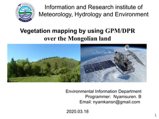
  • 1. 2020.03.18 Environmental Information Department Programmer: Nyamsuren. B Email: nyamkansn@gmail.com 1 Vegetation mapping by using GPM/DPR over the Mongolian land Information and Research institute of Meteorology, Hydrology and Environment
  • 2. 2020.03.18 Байгаль Орчны Мэдээллийн Сангийн хэлтсийн программист: Б.Нямсүрэн 1 GPM/DPR хиймэл дагуулаар Монгол орны Ургамлын Зураглал хийх Ус Цаг Уур, Орчны Судалгаа, Мэдээллийн Хүрээлэн
  • 3. Агуулга  Монголын газрын бүрхэвчийн төрөл  Ургамлын ач холбогдол Оршил  Монгол дахь Ургамлын доройтол  Монгол дахь Ургамлын зураглал Үндсэн асуудал  Global Precipitation Measurement Mission (GPM)  GPM/DPR радар, Ku/Ka цацрагийн утгууд Ашигласан материал • MODIS LAI, Хур тунадасны мэдээ харьцуулах • NRCS ойсон цацрагийн характеристикууд, тэдгээрийн зураглал. Үр дүн  Хэлэлцүүлэг  Цаашдын судалгаа Хэлэлцүүлэг 2Background Problem Method Result Discussion
  • 4. Монгол орны газрын бүрхэвч (MODIS) УЦУОСМХ Ой (~11%) Хээр (~66.5%) Цөл (~22.5%) Source: http://www.eic.mn/land/gis.php Mongolia is the landlocked country. Total area is approximately 1,565,000 square km. Located in the combined parts of Siberian forest biomes, Central Asian steppe, and Gobi deserts. Land surface mainly dominated by grassland. From northern to the south vegetation density decreases gradually. Climate has 4 season with extreme high changes hot summer average (+270 C), cold winter (-270 C). 3Background Problem Method Result Discussion
  • 5. Монгол дахь ургамлын доройтол Уур амьсгалын өөрчлөлт - Ган - Цөлжилт (76.9% area affected) Хүний үйл ажиллагаа - Уул уурхай - Бэлчээрийн даац хэтрэлт https://montsame.mn/en/read/130466 https://news.un.org/en/story http://zamineservices.com/ https://twitter.com/UNDPMongolia/status Background Problem Method Result Discussion 5
  • 6. Remote sensing Vegetation dynamic GPM satellite http://www.surf-forecast.com/breaks/El-Mongol Designed to observe Earth’s precipitation - High cost - Limited coverage area - Human labor intervention - Low cost - Large coverage area - Less labor intervention - Continuously mapping Survey mapping Satellite mapping Research goal : 1. Try to develop new method for vegetation by precipitation radar 2. Analyze vegetation dynamic for detecting the land degradation Background Problem Method Result Discussion 6
  • 7. Vegetation indicators in Remote Sensing Currently in Remote sensing we use optical sensors which directly see the Earth from the Space. But we can not see the Earth under the cloud cover, haze and at night time. Microwave Ku,Ka band can penetrate the cloud cover and able to detect at night time. NDVI is ratio of Red, NIR waves part of the Sunlight. EVI, SAVI, RVI, ... 7 Sunlight = Electromagnetic Spectrum Ku, Ka
  • 8. Vegetation indicators in Remote Sensing SAR approach has several weaknesses: Microwave Ku,Ka band scan narrow incidence angle, more frequent observation. SAR is complex approach use microwave low frequencies X,C,S,L, etc… 8 Sunlight = Electromagnetic Spectrum Ku, Ka
  • 9. NASA ба JAXA-ийн хамтарсан төсөл Орбит: Circular, non-sunsynchronous Хөөргөсөн он: 2014.Feb.28 Жин: 3850 kg Хүч чадал: 1950 W Ажиглалтын хүрээ: 65° GPM хиймэл дагуул нь глобал түвшинд хур тунадасны ажиглалт хийх зориулалттай. Global Precipitation Mission – GPM Background Problem Method Result Discussion 9
  • 10. Global Precipitation Measurement Mission GPM – Global Precipitation Measurement, launched 2014.Feb Images source: https://pmm.nasa.gov/gpm 10Background Problem Method Result Discussion
  • 11. GPM satellite Instruments Build on success of TRMM  Designed life: 5 years  GPM Microwave Imager (GMI) - Passive sensor installed from NASA. - Multi-channel, conical scanning, 13 channels 10GHz – 183GHz - Sense to total precipitation within all cloud layers Dual-frequency Precipitation Radar (DPR) - Active sensor developed from JAXA. - Consist of Ka-band PR, Ku-band PR. - Ku-band measure moderate-to-heavy rain - Ka-band measure frozen precipitation and light rain - Ku/Ka-band provide rain drop size distribution in the cloud. 11Background Problem Method Result Discussion
  • 12. DPR/ Ku and Ka band radar signal Vegetation Characteristics Normalized radar cross section (NRCS or σ°) backscattered values were used for the calculation. (2014 - 2018, May- Sep 5 km) Without precipitation condition radar signals retrieve the information about the land surface. Incidence angle Ku band ±17 degree, Ka band ±8.5 degree scanning. 12Background Problem Method Result Discussion Ku, Ka band
  • 13. Compare σ0 with Precipitation and MODIS/LAI Based on map derived from ESA CCI 2015 landcover map: 13Background Problem Method Result Discussion Forest Grass Desert The Seasonal variation of: (2014-2017)  MCD15A3H MODIS Leaf Area Index/FPAR 4 days composite data  The precipitation data of 129 meteorological stations were used In order to compare with the Ku and Ka band backscattered values.
  • 14. Scheme to detect σ0 characteristic GPM NRCS σ0 map Forest Incidence Seasonal variation Seasonal variation Grass Incidence Seasonal variation Seasonal variation Desert Incidence Seasonal variation Seasonal variation GTOPO30 ESA CCI Precipitation MODIS/LAI ? ? ? Ku and Ka signal Background Problem Method Result Discussion 14
  • 15. Characteristic of signals… GPM NRCS σ0 map Forest Incidence Seasonal variation Seasonal variation Grass Incidence Seasonal variation Seasonal variation Desert Incidence Seasonal variation Seasonal variation GTOPO30 ESA CCI Precipitation MODIS/LAI ? ? ? Ku/Ka signal Background Problem Method Result Discussion 15 Is there any relation???
  • 16. Incidence angle dependency: Seasonal variation: 16Background Problem Method Result Discussion NRCS σ° backscattering from the Forest
  • 17. Incidence angle dependency: Seasonal variation: 17Background Problem Method Result Discussion NRCS σ° backscattering from the Grass
  • 18. Incidence angle dependency: Seasonal variation: 18Background Problem Method Result Discussion NRCS σ° backscattering from the Desert
  • 19. Compare backscatter from different Land covers  Ku-band backscatter with incidence angle dependency.  Ka-band backscatter with incidence angle dependency. Background Problem Method Result Discussion 19 Desert Desert Grass Grass Forest Forest
  • 20.  Ku-band backscatter with incidence angle dependency.  Ka-band backscatter with incidence angle dependency. Background Problem Method Result Discussion 20 ~3° ~3° Compare backscatter from different Land covers Forest Grass Desert Desert Grass Forest
  • 21. From the Seasonal Aspect ~8° ~8° Background Problem Method Result Discussion 21
  • 22. Background Problem Method Result Discussion Mapping – False color composite σ0 at ~3° and ~8° 22 KuPR: R = σ0(3°)*1.4 G = σ0(7°+8°) B = σ0(8°)*1.2 KaPR: R = σ0(3°)*1.4 G = σ0(7°+8°) B = σ0(8°)*1.2 MCD43A4: R = B1 G = B4 B = B3
  • 23. Mapping – Unsupervised clustering σ0 at ~3° to ~8° Background Problem Method Result Discussion 23 KuPR: Forest and grass distinguished sufficiently. KaPR: Desert and grass discriminated significantly. Combination of these two radars backscatter might can distinguish the forest, grass, and desert clearly.
  • 24. Combination of KuPR and KaPR + concatenate KuPR σ0 KaPR σ0 PCA (3 component) = σ0 (2° ~ 8°) Background Problem Method Result Discussion 24 σ0 (2° ~ 8°) Explained total variance ~ 90 %
  • 25. Combination of KuPR, KaPR radar Background Problem Method Result Discussion 25 White: Water bodies Black: Forest Green: Grass land Yellow-green: Desert
  • 26. Discussion – compared with NDVI NRCS vs NDVI map KuPR KaPR σ0(2°~8°) maps compared with MOD13A2 16 days 1km NDVI maps in 2014, 2015, 2016, 2017, 2018 years respectively. 26 0. 0 0. 0 0.6 5 0. 0 0. 0 0. 0.6 5 0.6 5 0.6 5 0.6 5
  • 27. Discussion Background Problem Method DiscussionResult  GPM/DPR радарын ойлт нь хазайлтын өнцөг нэмэгдэхэд Ойн бүсээс тогтмол (бага), харин Цөлийн бүсээс буурах хандлага ажиглагдсан.  Монголын нөхцөлд ургамал ургах улирал буюу 5-9-р сар дахь Ku ба Ka сигналын 3° - 8° хазайлтын өнцөгтэй ажиглалтын утгууд нь ургамлын зураглал хийхэд хүрэлцээтэй.  Ku-сигналь Ойн зураглал хийхэд тохиромжтой, Ka- сигналь цөлийн бүсийг газраас ялган ангилахад тохиромжтой. 27
  • 28. Discussion Background Problem Method DiscussionResult 28 The results showed same characteristics with the ground radar experiments of Ku- band (13 GHz) in Ulaby et al, study. Dense Dense Sparse Sparse
  • 30. Thank you for your attention… Анхаарал тавьсанд баярлалаа...