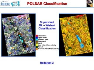
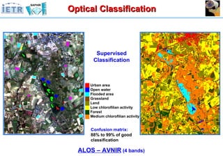
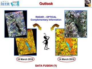
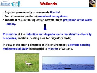
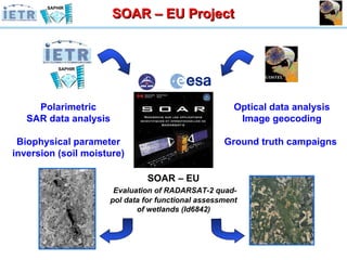
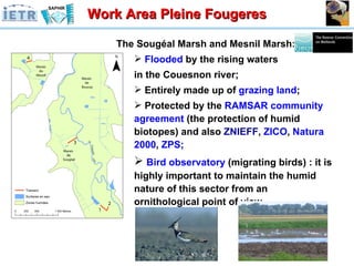
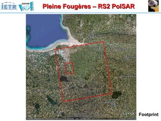
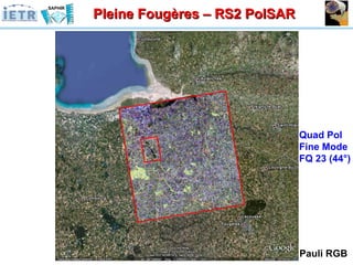
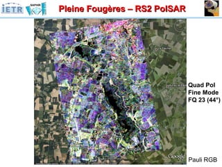
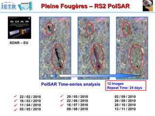
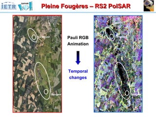
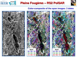
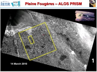
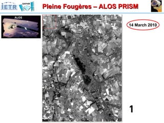
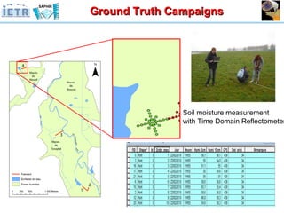
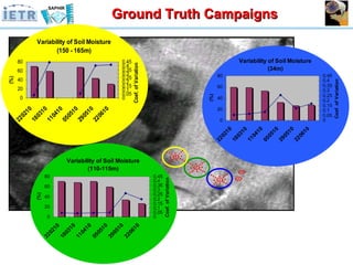
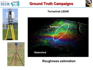
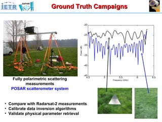
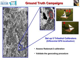
The document summarizes a project using spaceborne fully polarimetric time-series datasets from Radarsat-2 and ALOS for land cover analysis and monitoring of wetlands. The objectives were to delineate wetlands and map vegetation, identify agricultural practices, and determine water cycles and levels. Ground truth campaigns were conducted including soil moisture and roughness measurements. Initial qualitative analysis of the Radarsat-2 data showed polarimetric descriptors and classifications could distinguish flooded areas with 78-94% accuracy. Optical data from ALOS provided complementary information and 88-99% classification accuracy. Further inversion of parameters like soil moisture from time-series datasets and data fusion of radar and optical data was outlined.


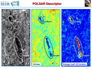
![Radarsat-2 Pre-Processing Data Extract [ T3 ] Post-Processing Methodology Polarimetric Decomposition Theorems Polarimetric descriptor sensitive to the Temporal Variability of the marsh flooded areas 1st Qualitative analysis Pauli RGB RADARSAT 2 H A ](https://image.slidesharecdn.com/spacebornefullypolarimetrictime-series-100727164751-phpapp01/85/TU3-L09-SPACEBORNE-FULLY-POLARIMETRIC-TIME-SERIES-DATASETS-FOR-LAND-COVER-ANALYSIS-27-320.jpg)
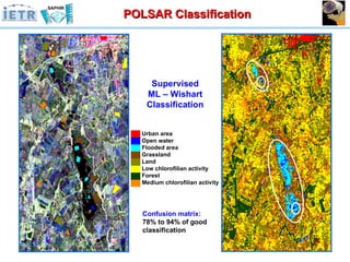
![Radarsat-2 Pre-Processing Data Extract [ T3 ] Post-Processing Methodology Supervised Classification ML – Wishart Classification procedure 1st Qualitative analysis Pauli RGB ML - Wishart RADARSAT 2](https://image.slidesharecdn.com/spacebornefullypolarimetrictime-series-100727164751-phpapp01/85/TU3-L09-SPACEBORNE-FULLY-POLARIMETRIC-TIME-SERIES-DATASETS-FOR-LAND-COVER-ANALYSIS-29-320.jpg)
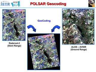
![Radarsat-2 Pre-Processing Data Extract [ T3 ] Post-Processing Methodology GeoCoding T3 Matrix 46 G.C.P rms: 0.9 pix Pauli RGB ML - Wishart 1st Qualitative analysis RADARSAT 2](https://image.slidesharecdn.com/spacebornefullypolarimetrictime-series-100727164751-phpapp01/85/TU3-L09-SPACEBORNE-FULLY-POLARIMETRIC-TIME-SERIES-DATASETS-FOR-LAND-COVER-ANALYSIS-31-320.jpg)