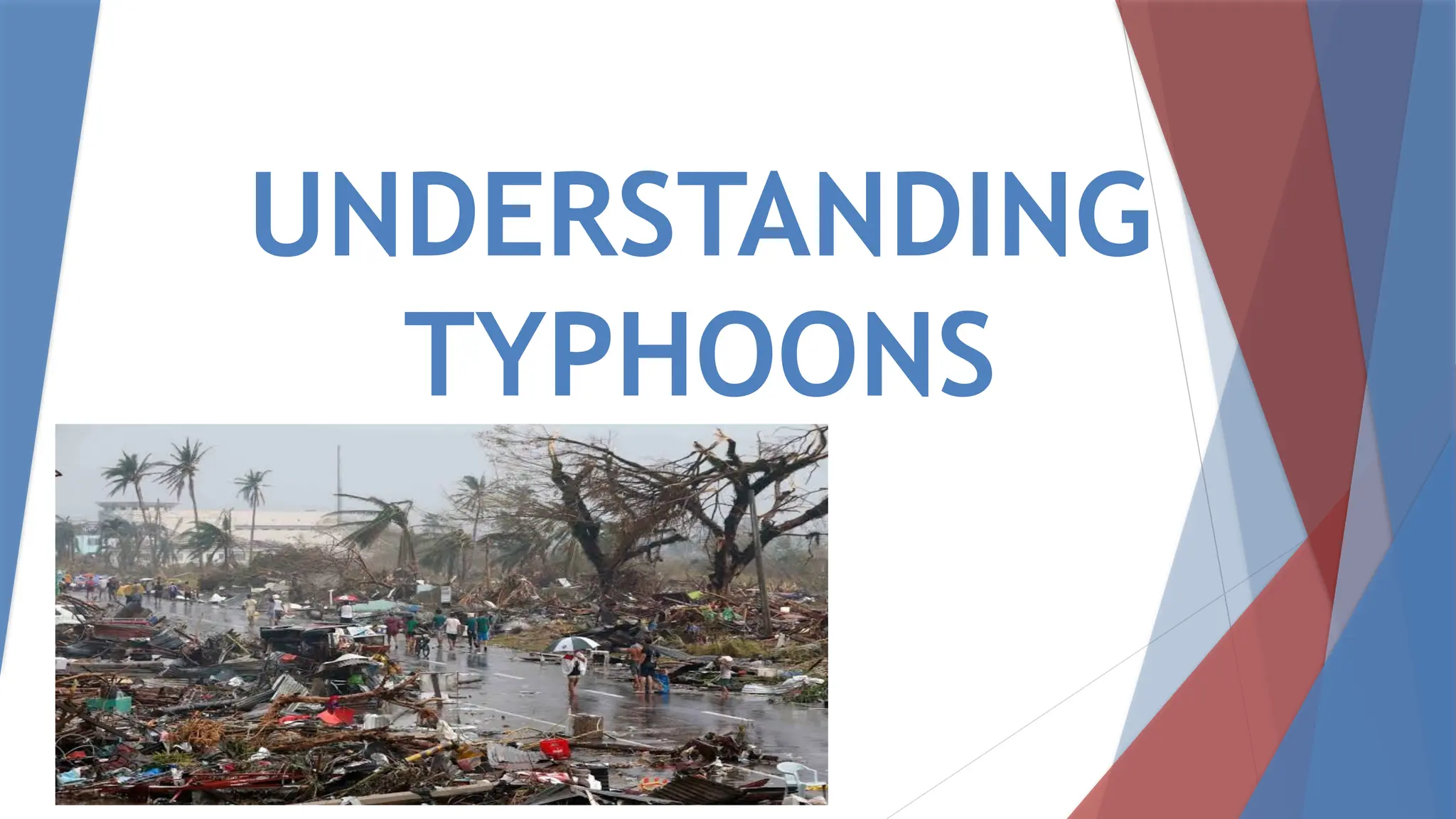
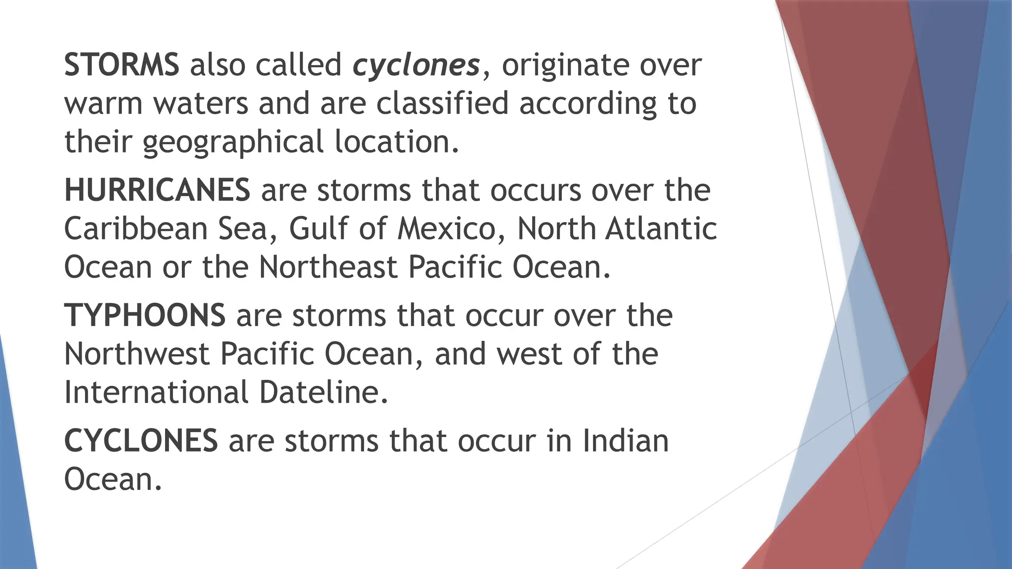
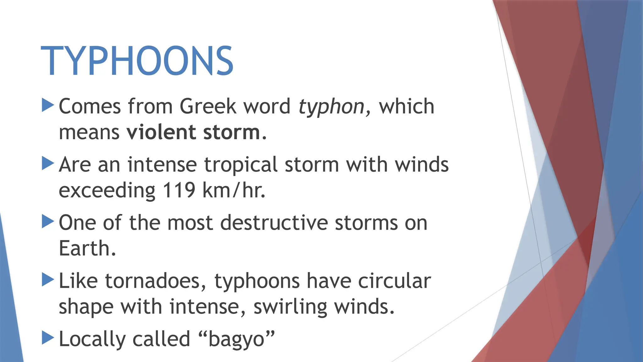
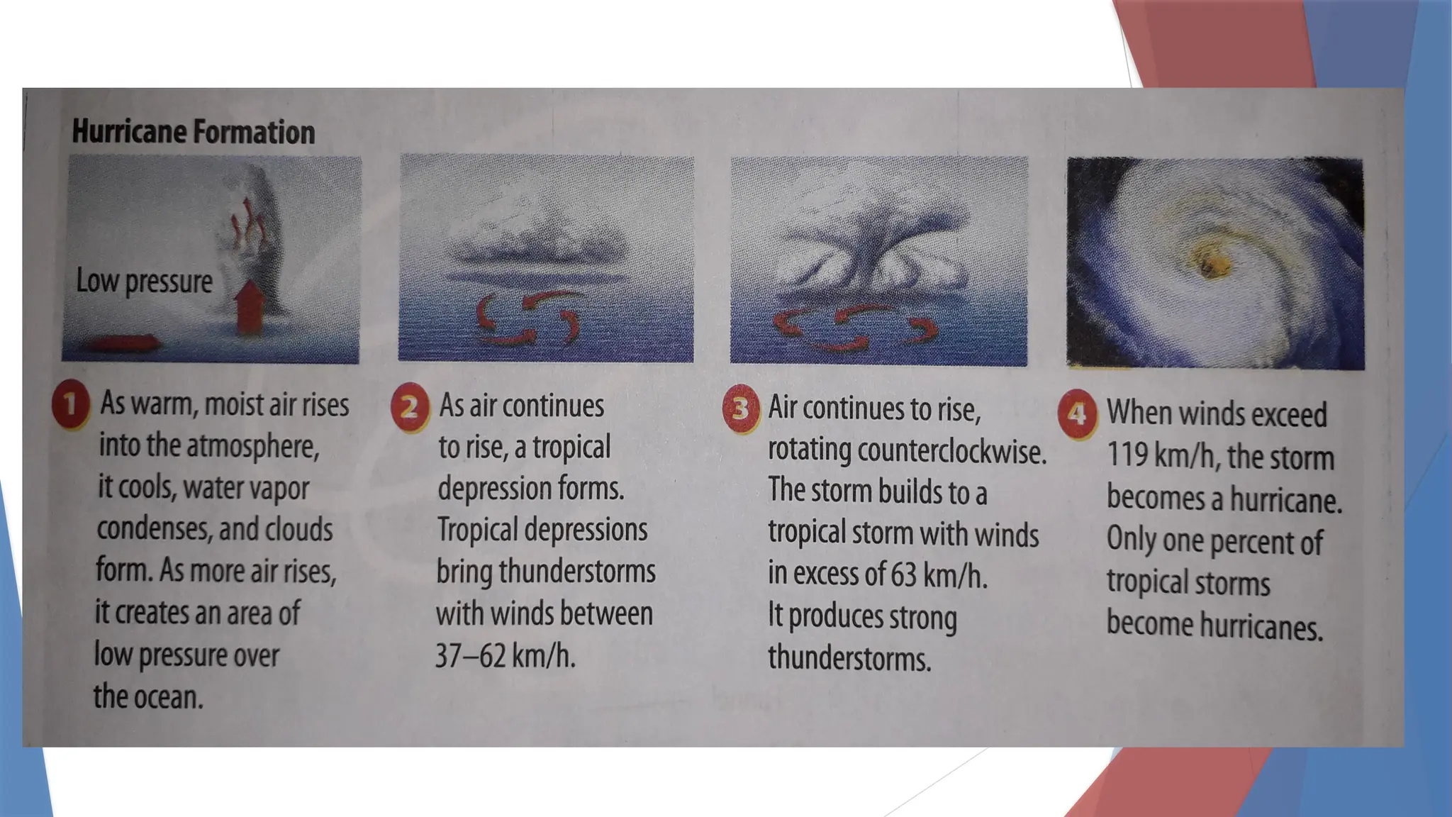
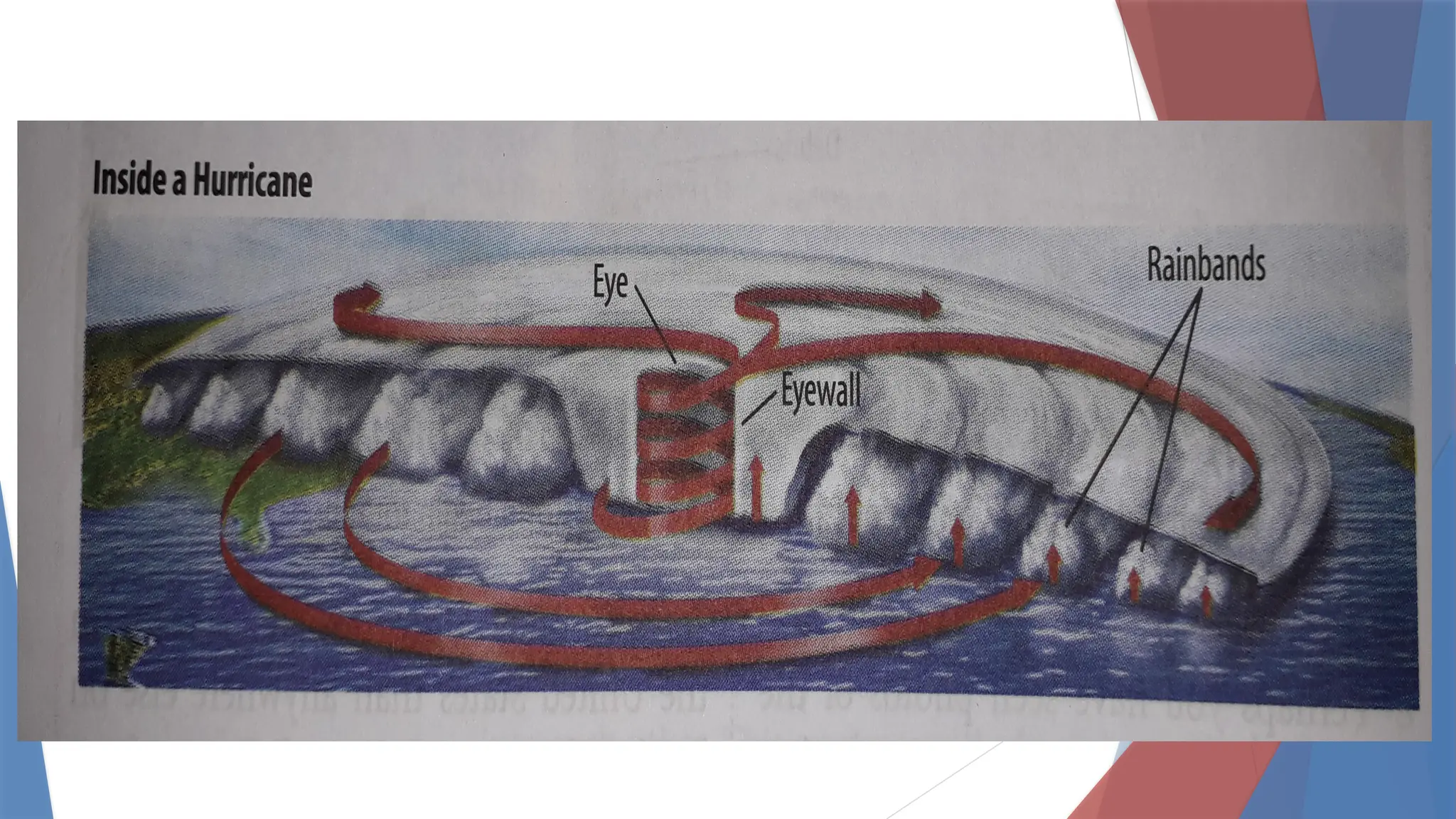
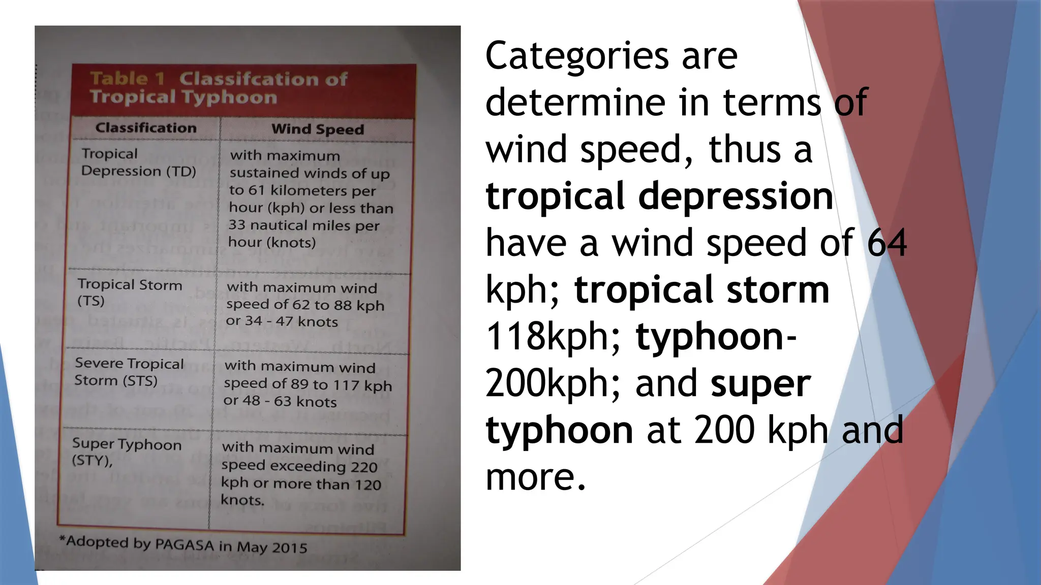
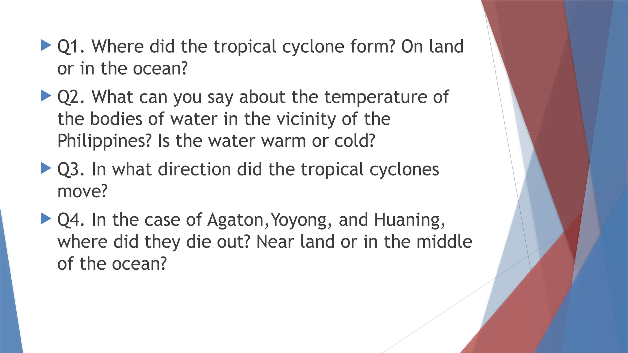
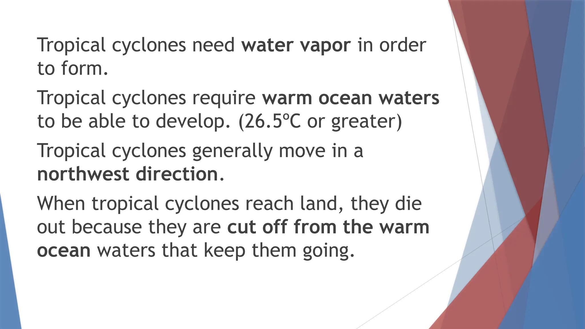
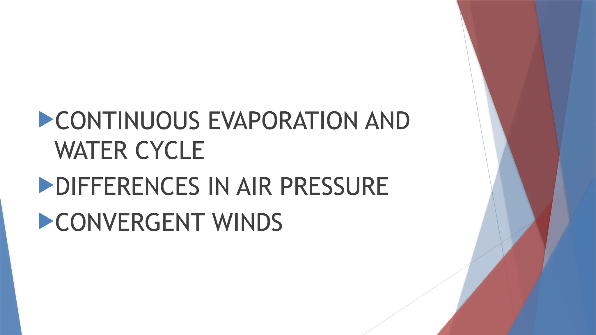
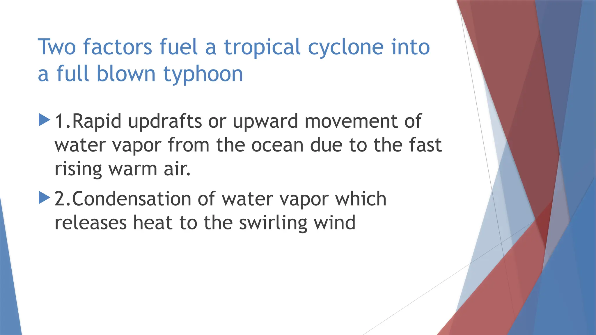
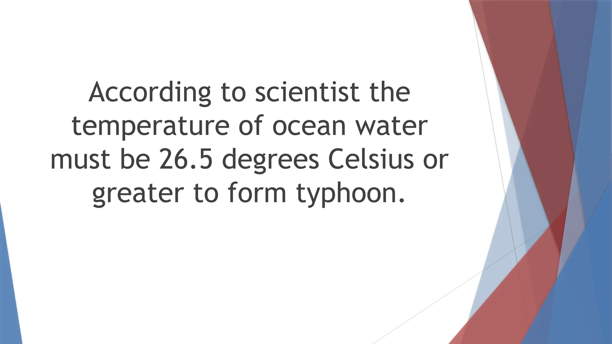
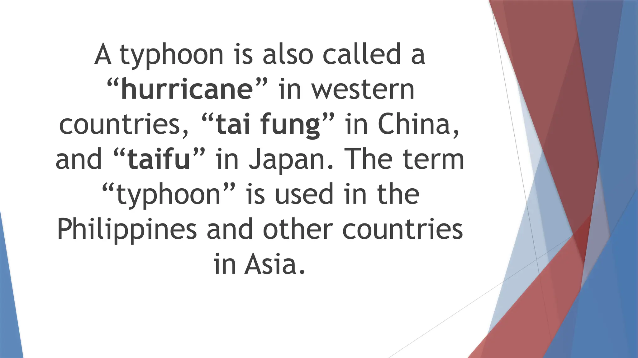
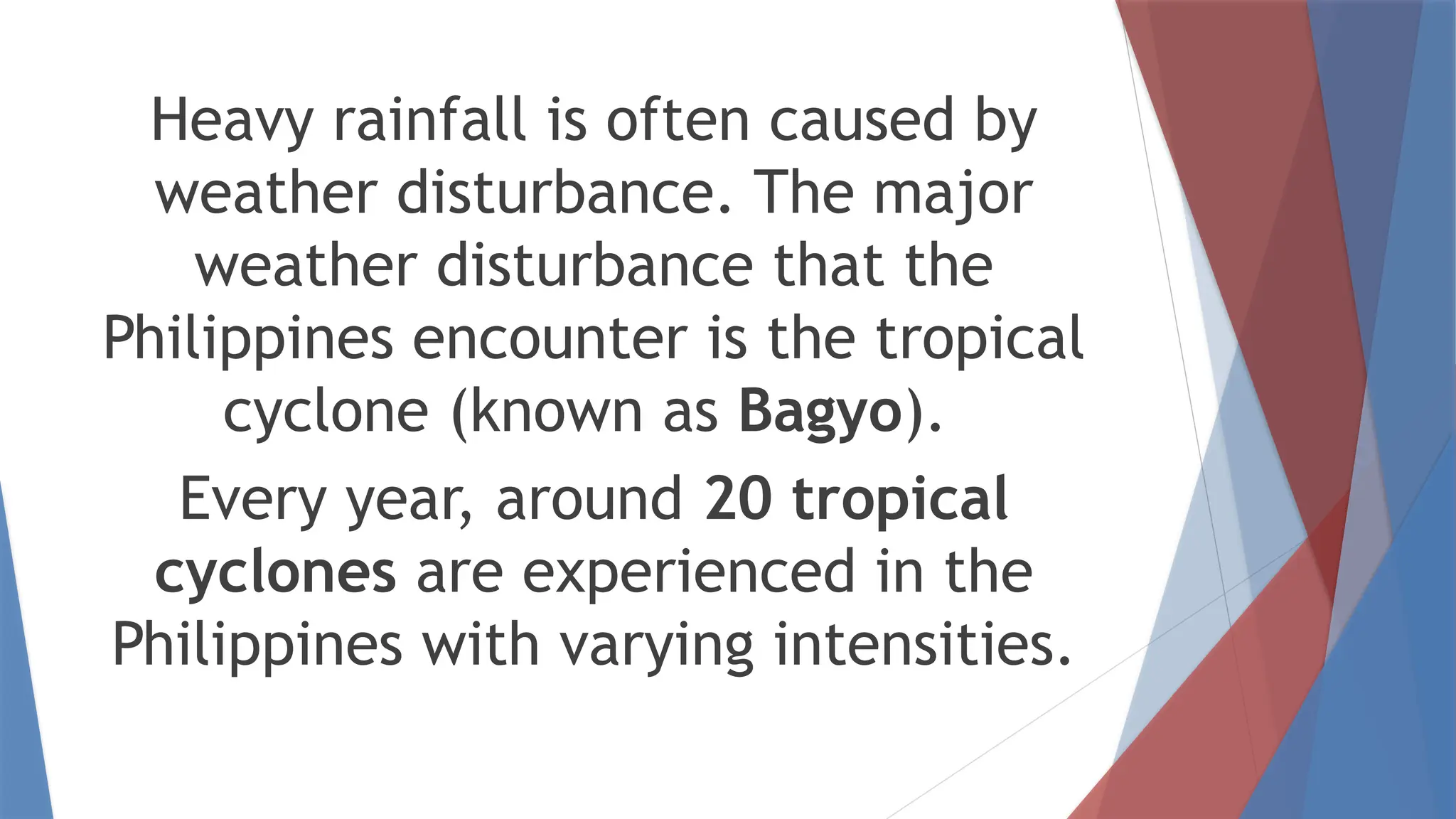
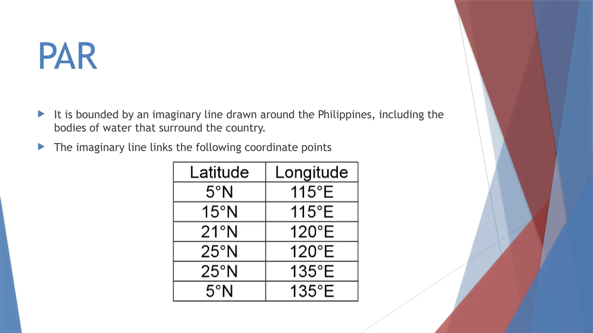
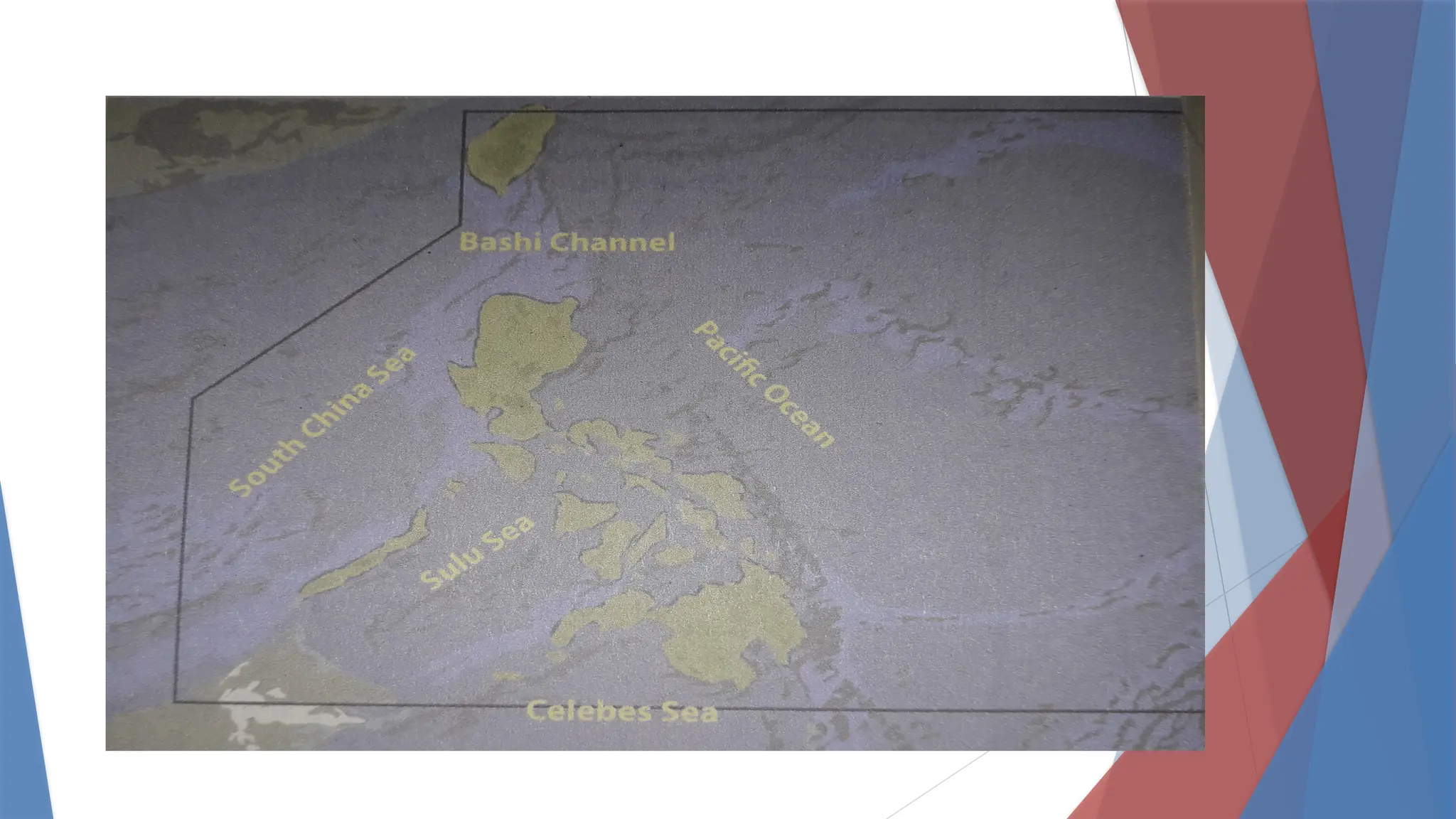
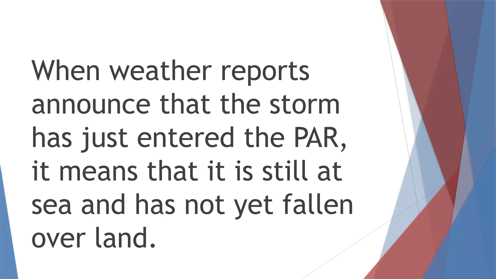
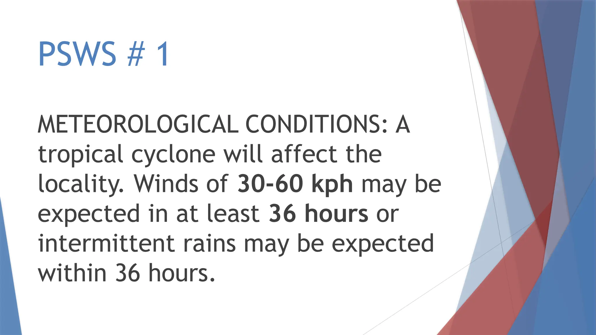
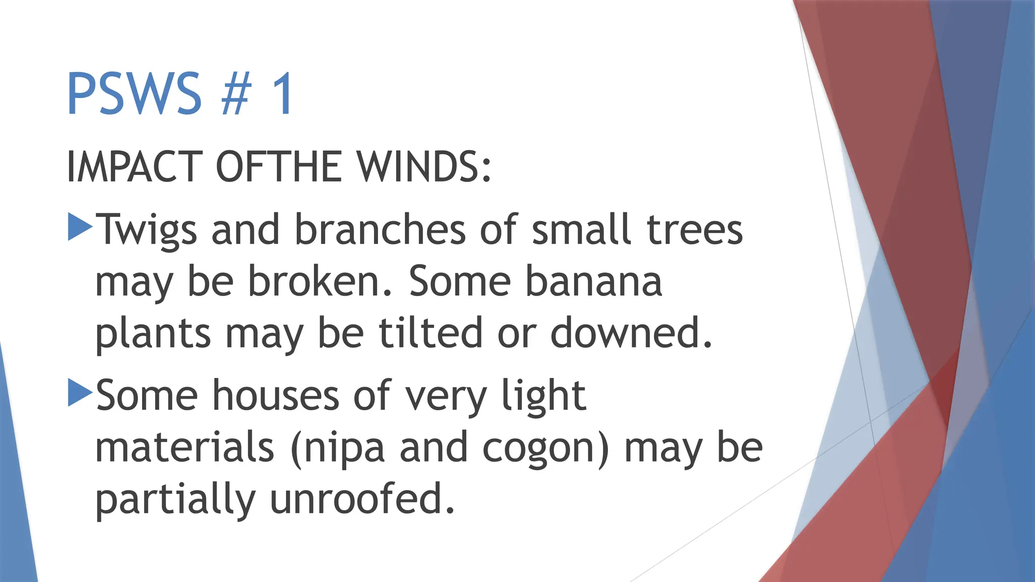
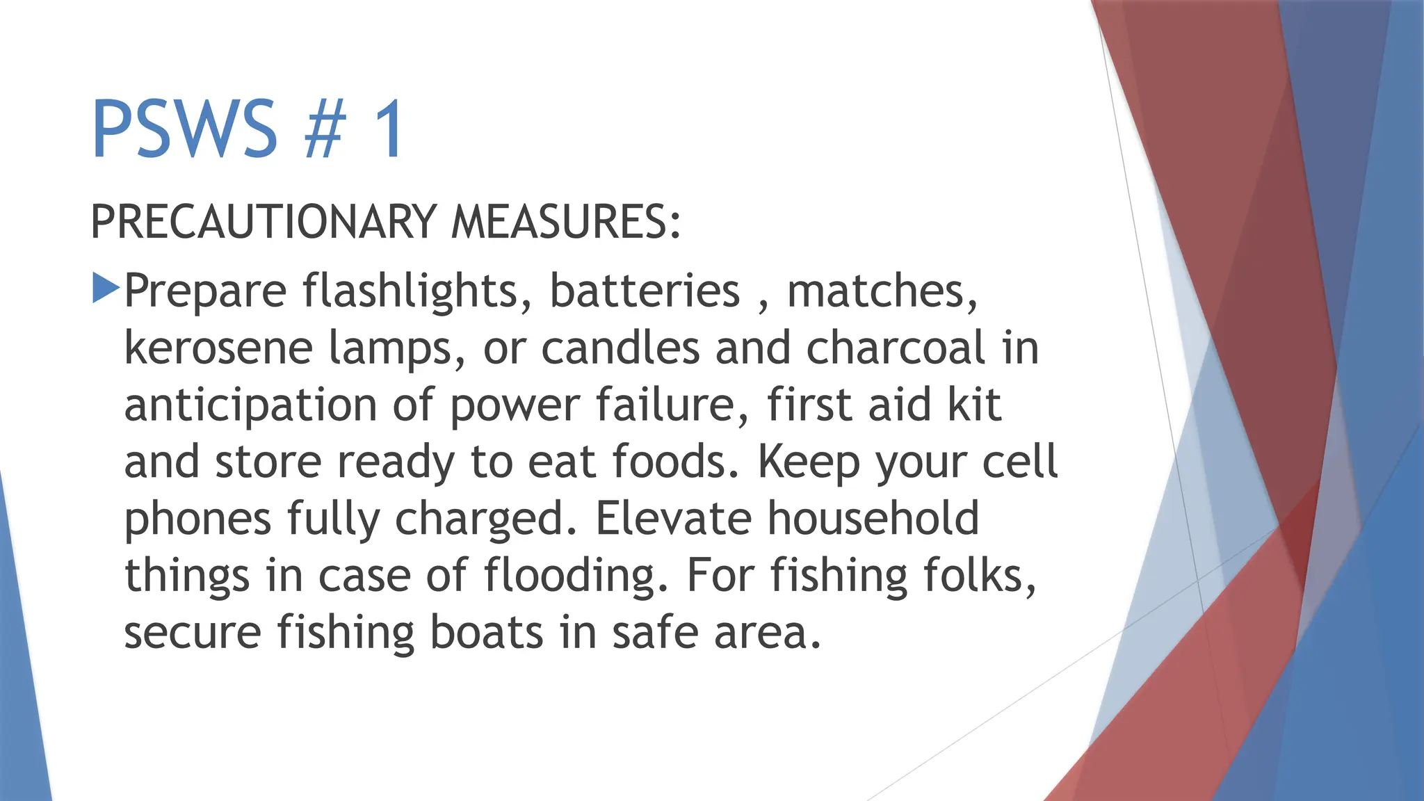
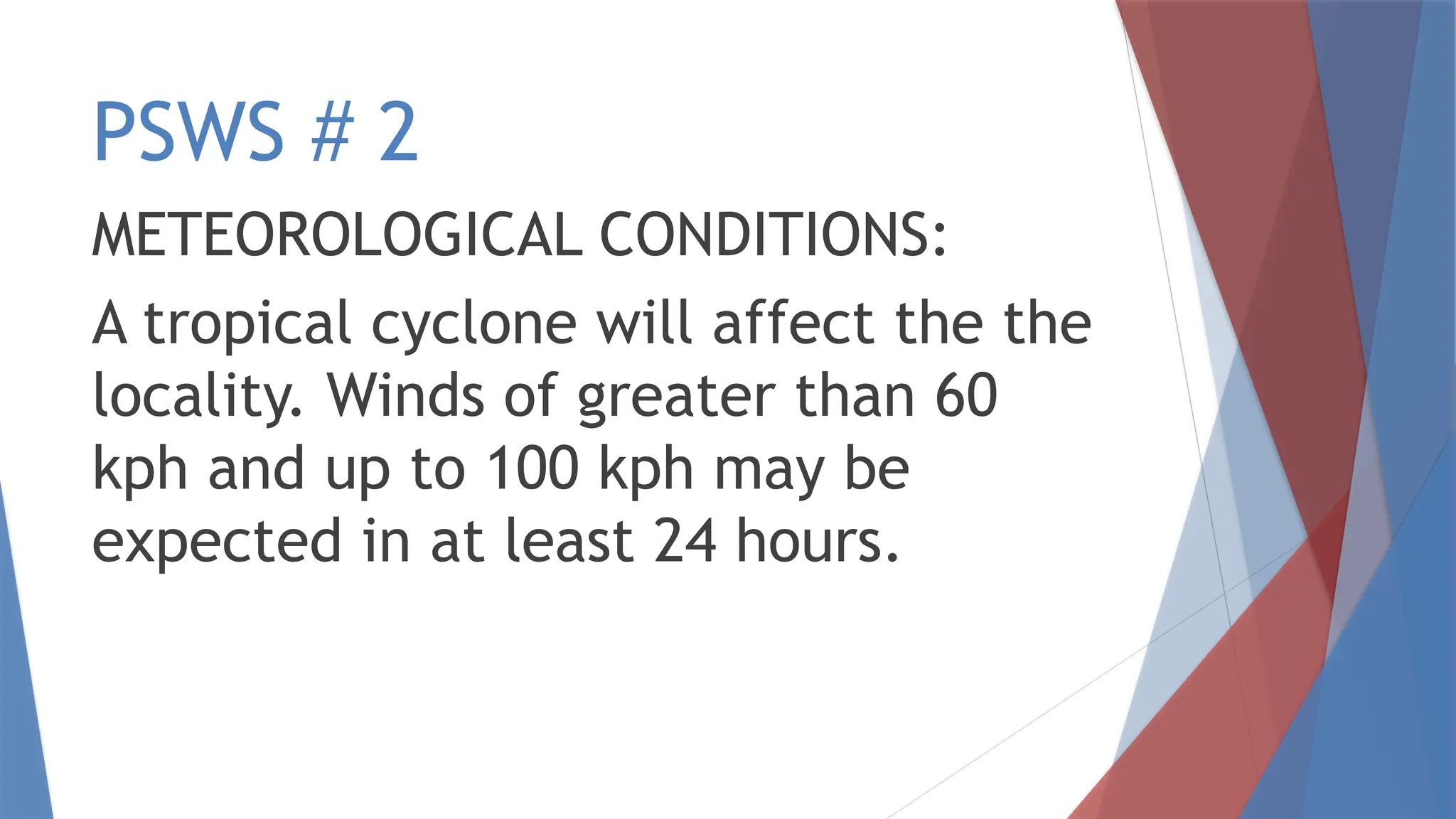
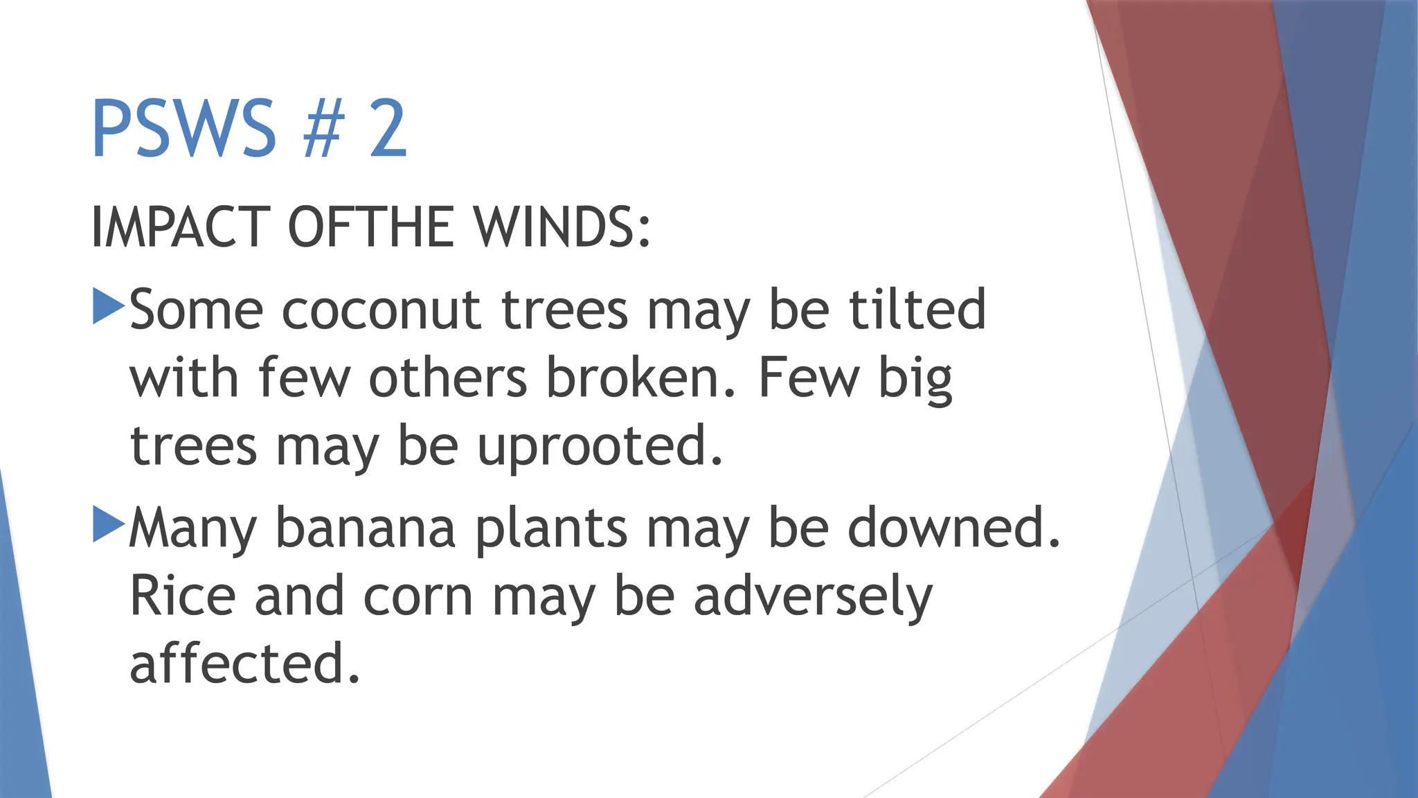
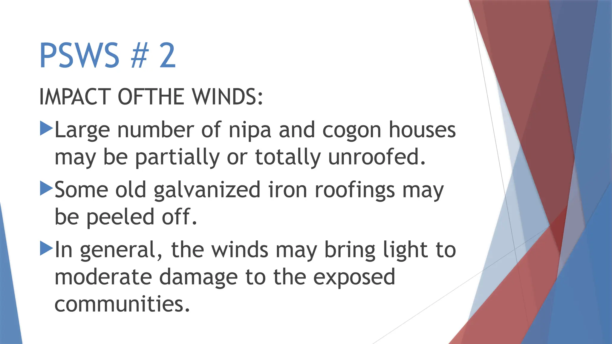
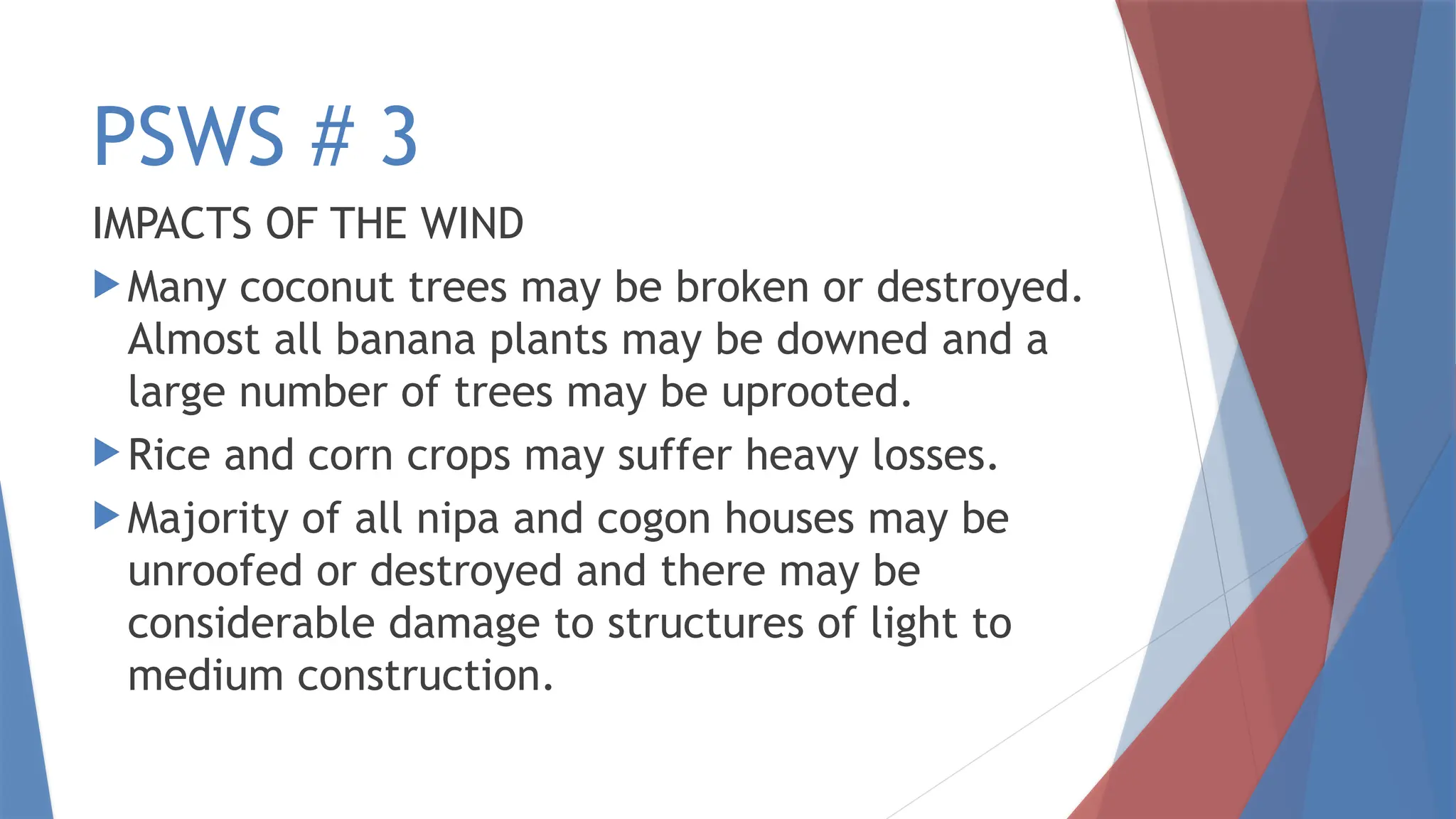
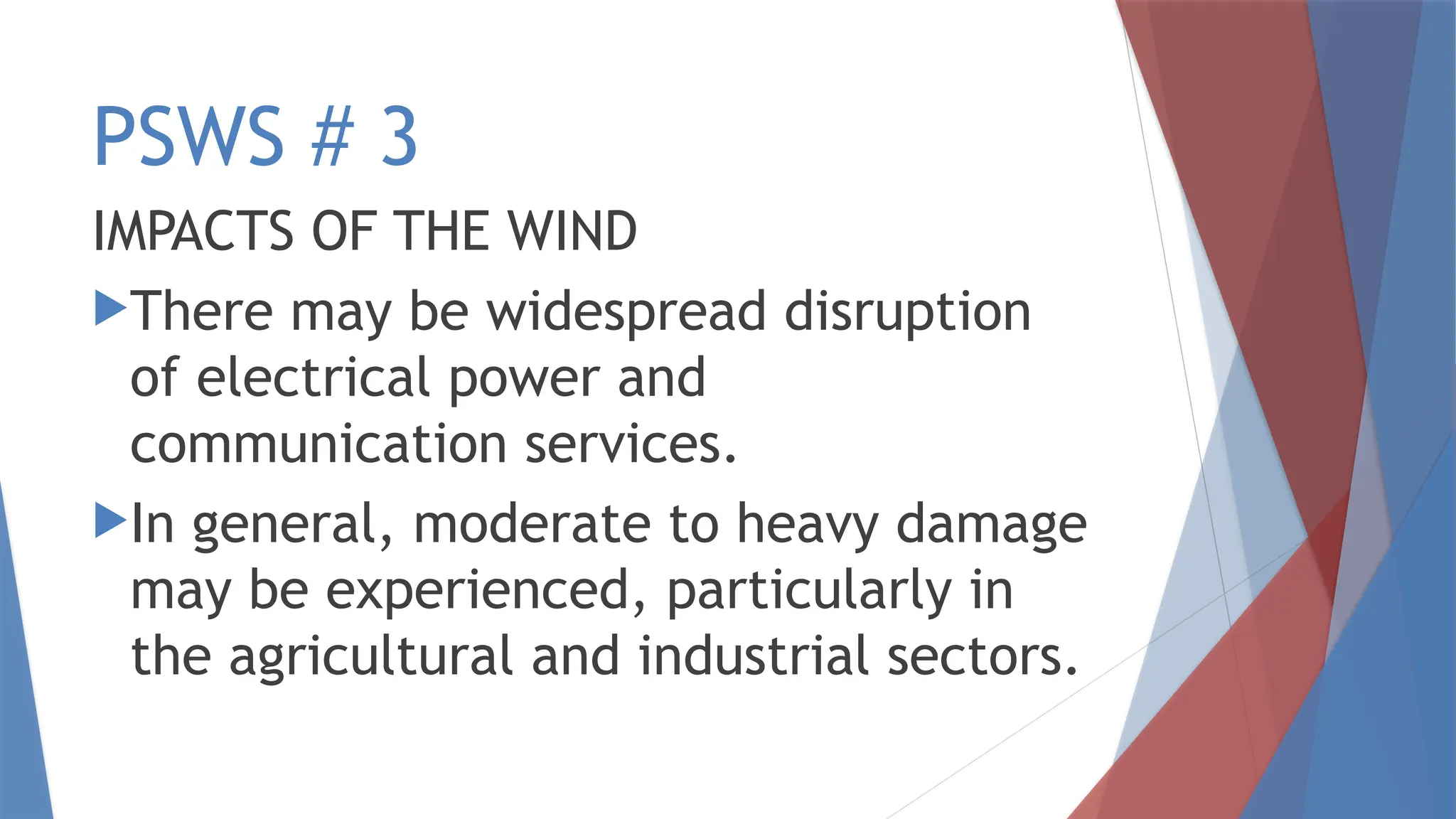
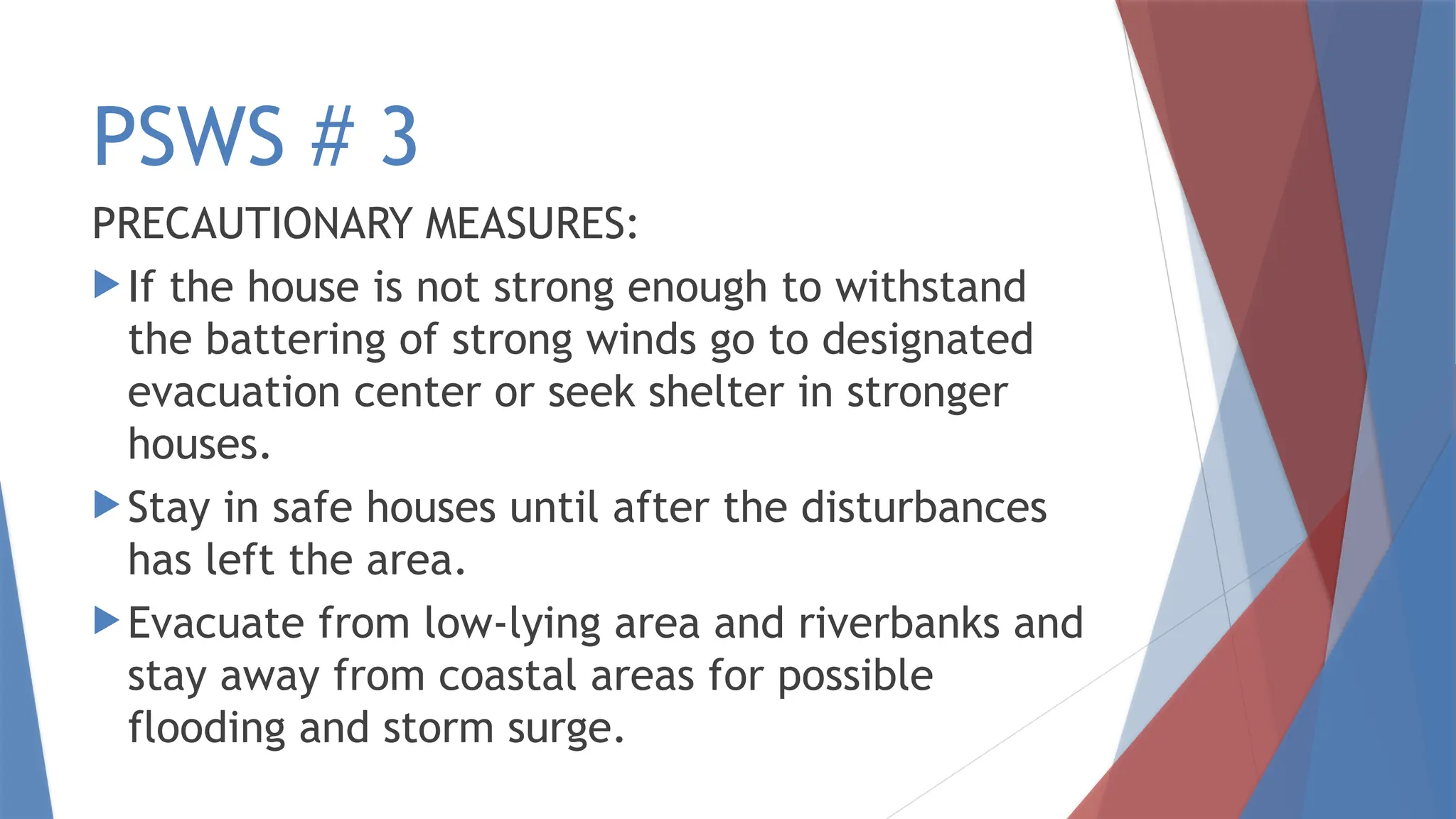
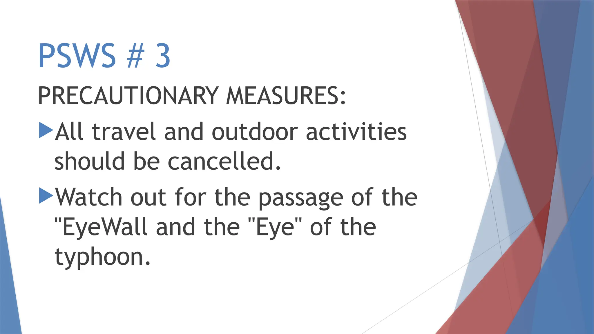
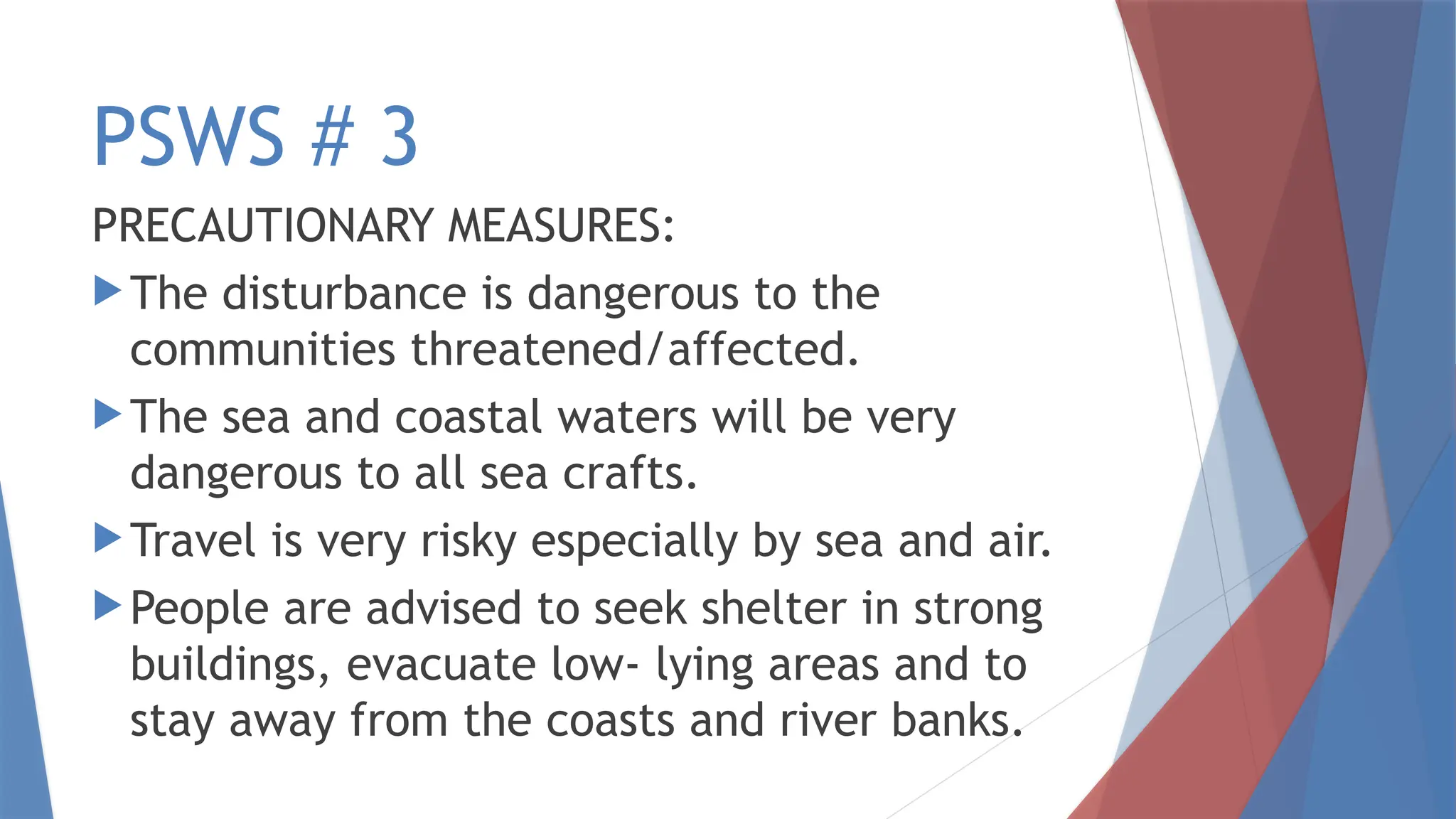
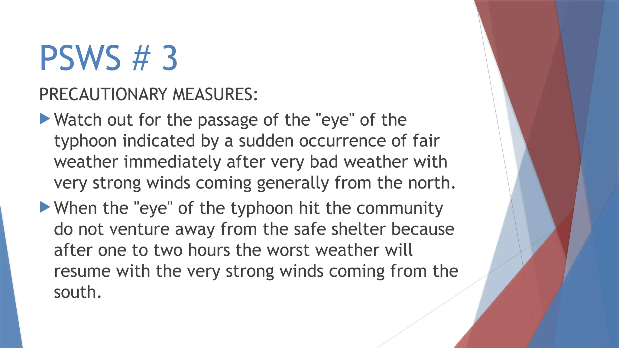
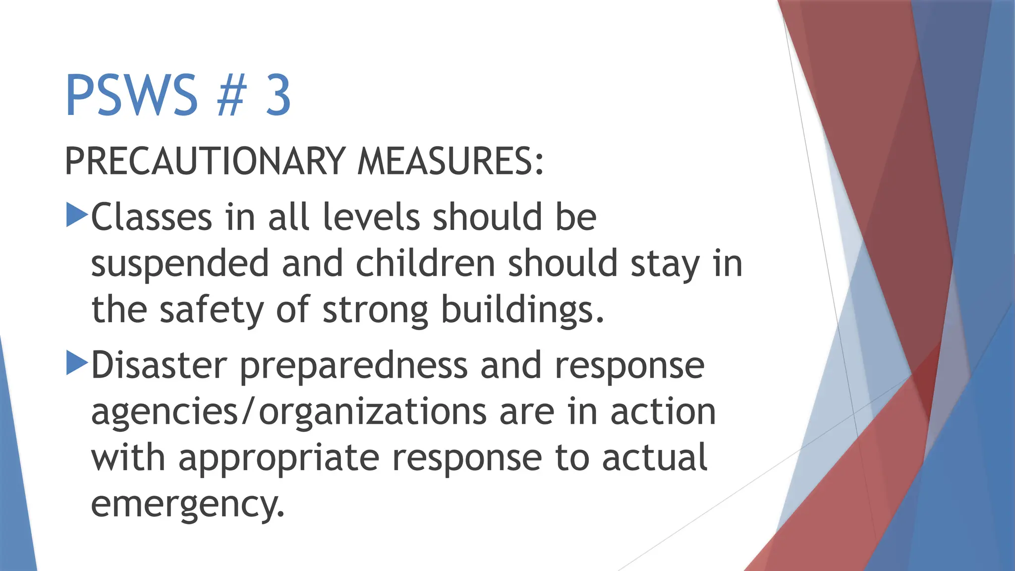
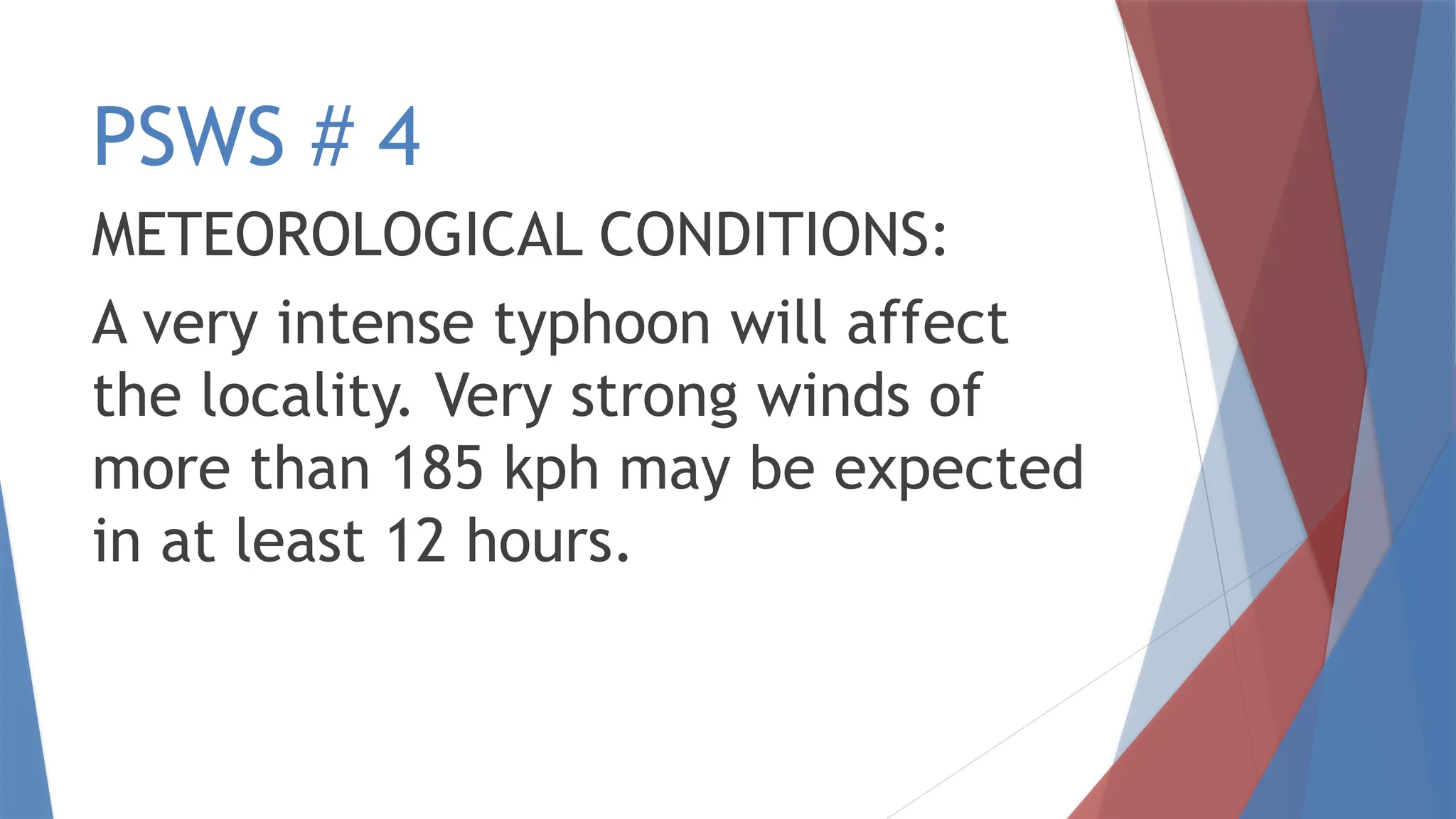
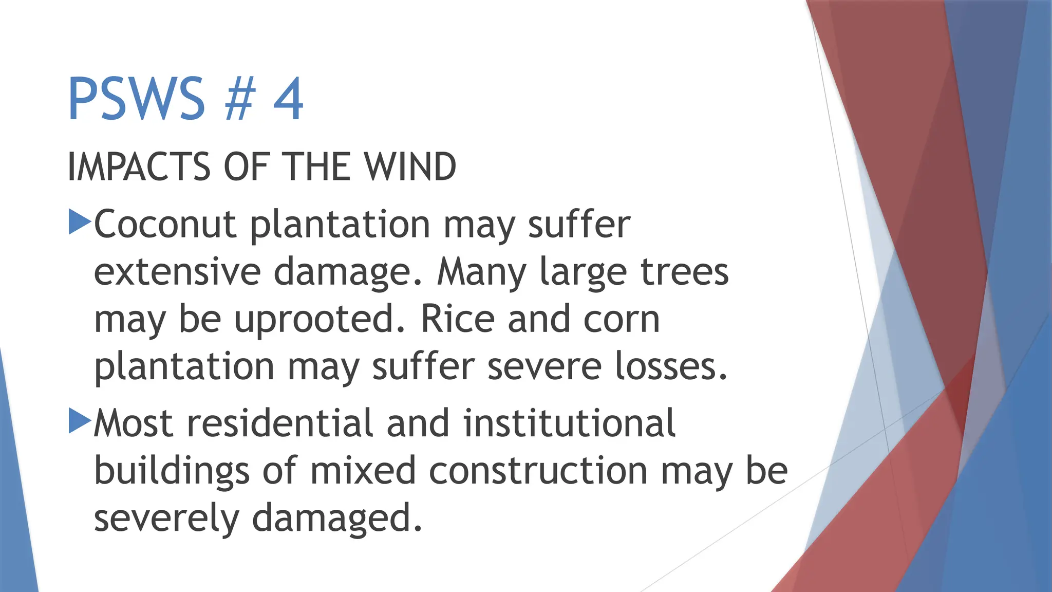
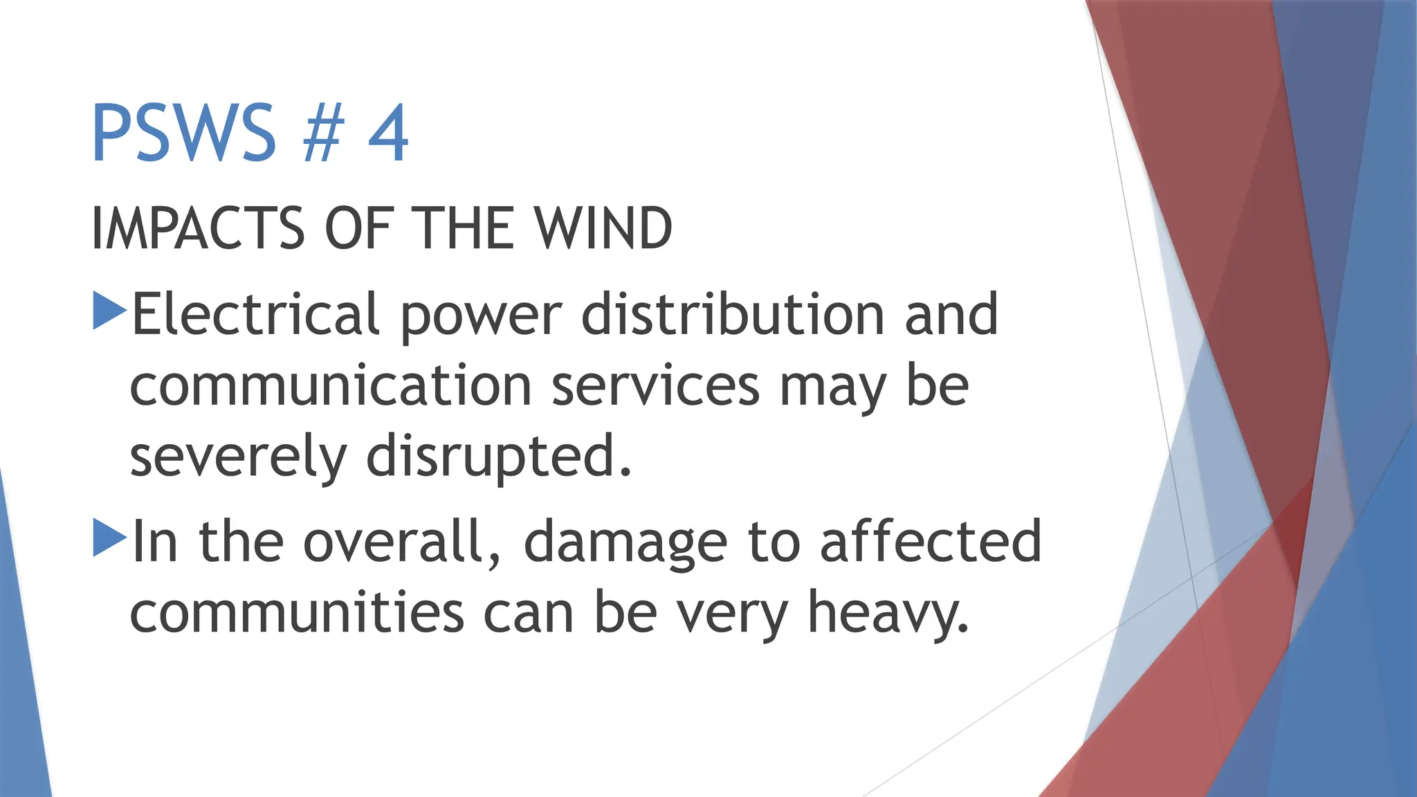
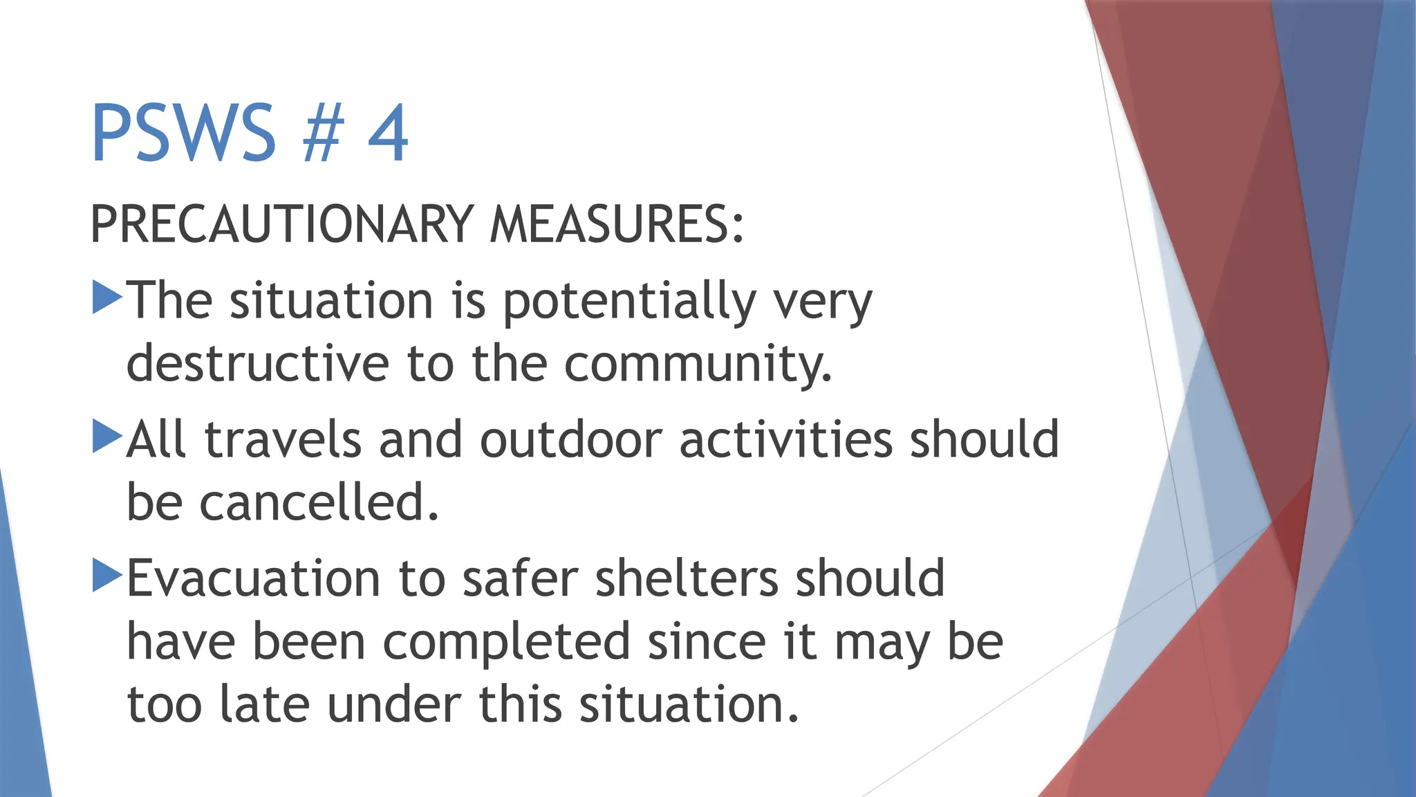
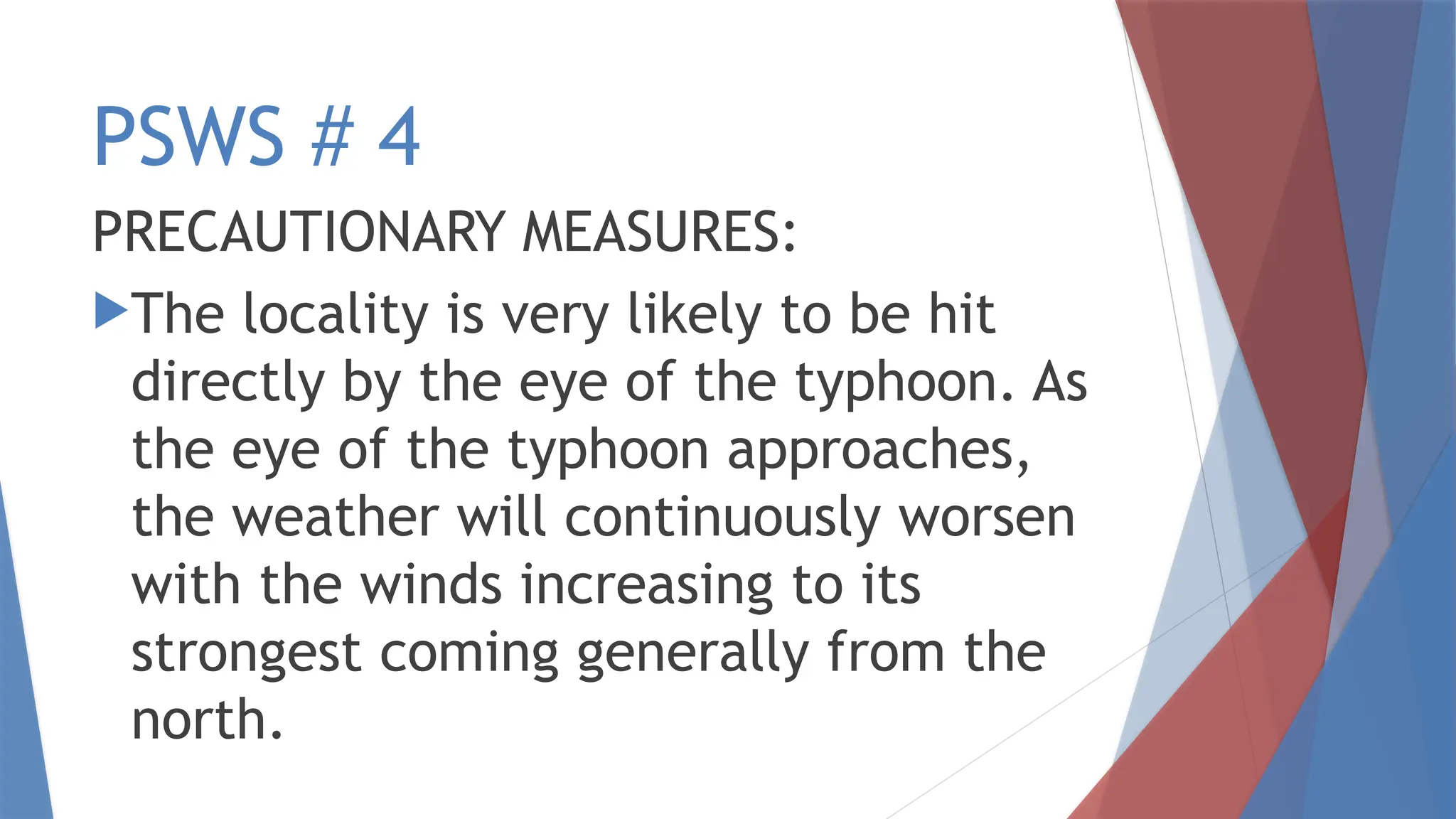
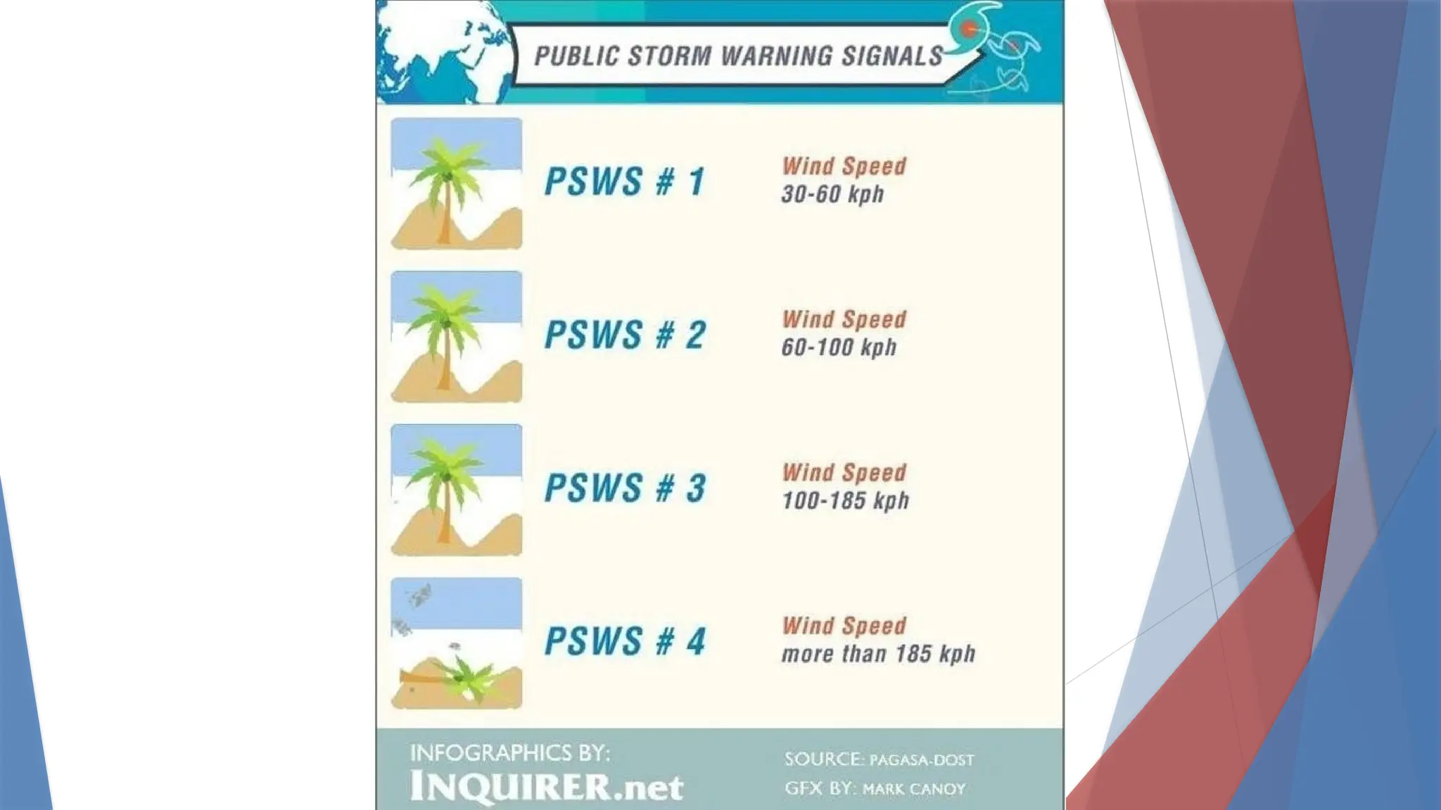
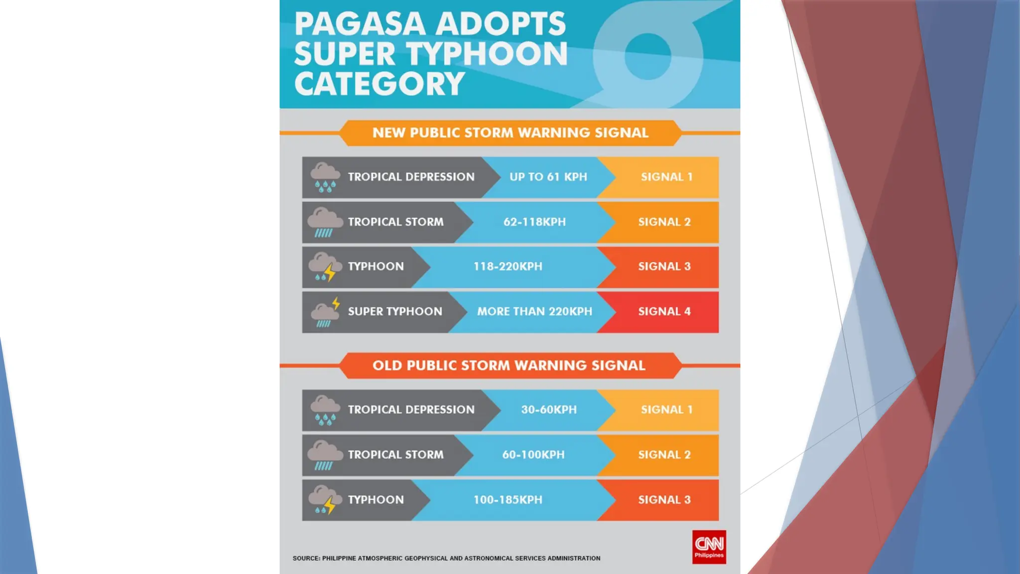
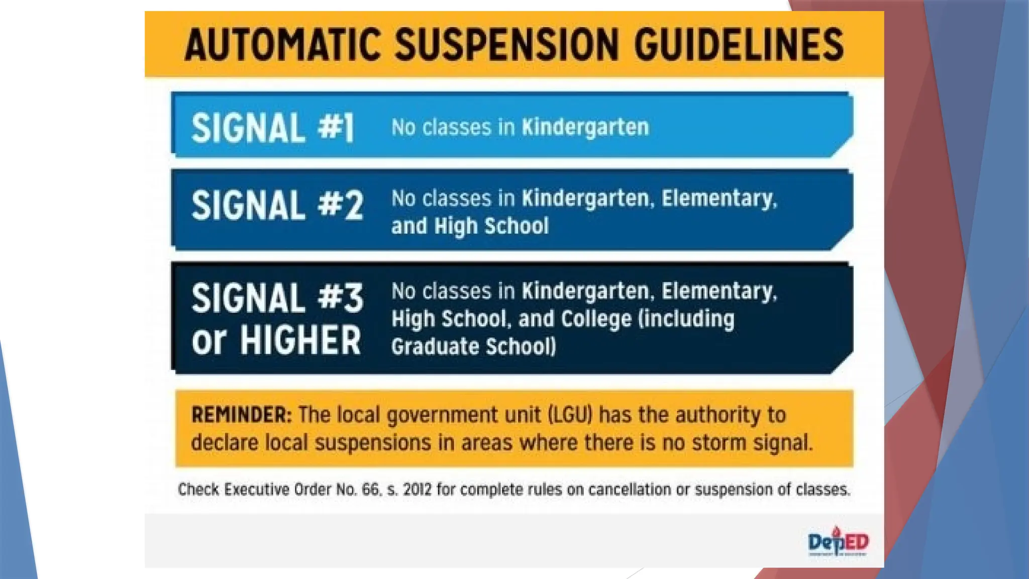
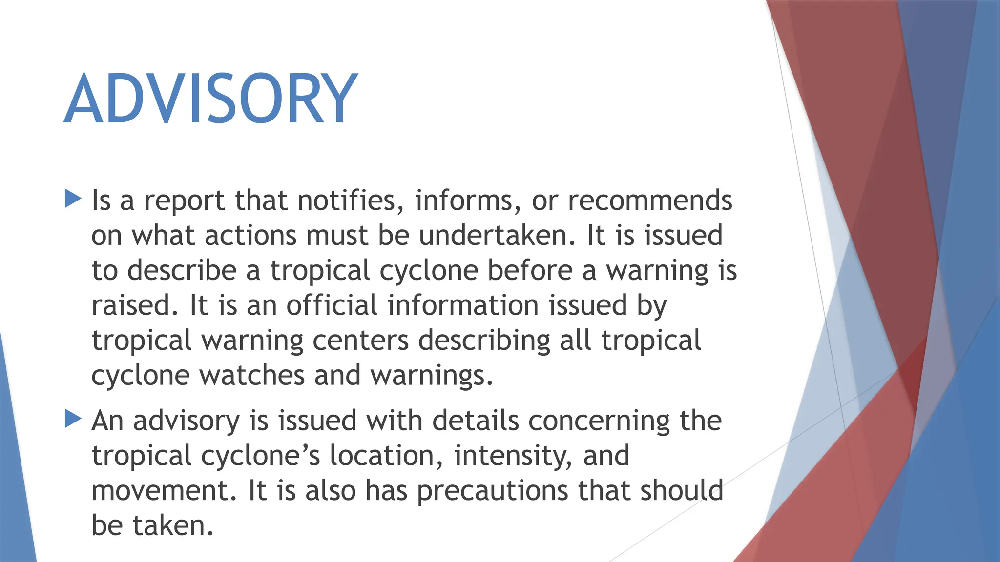
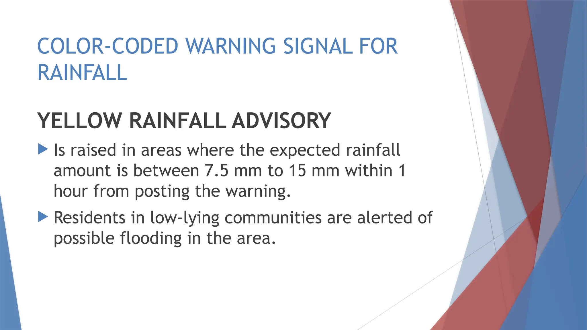
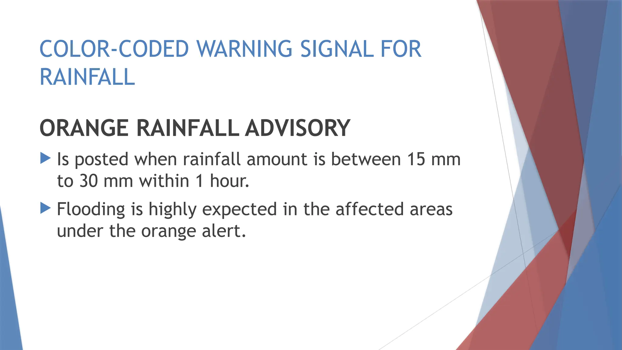
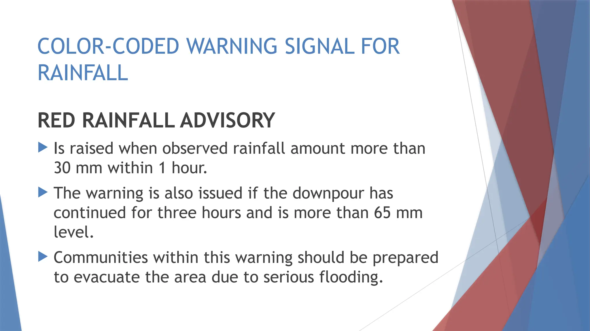
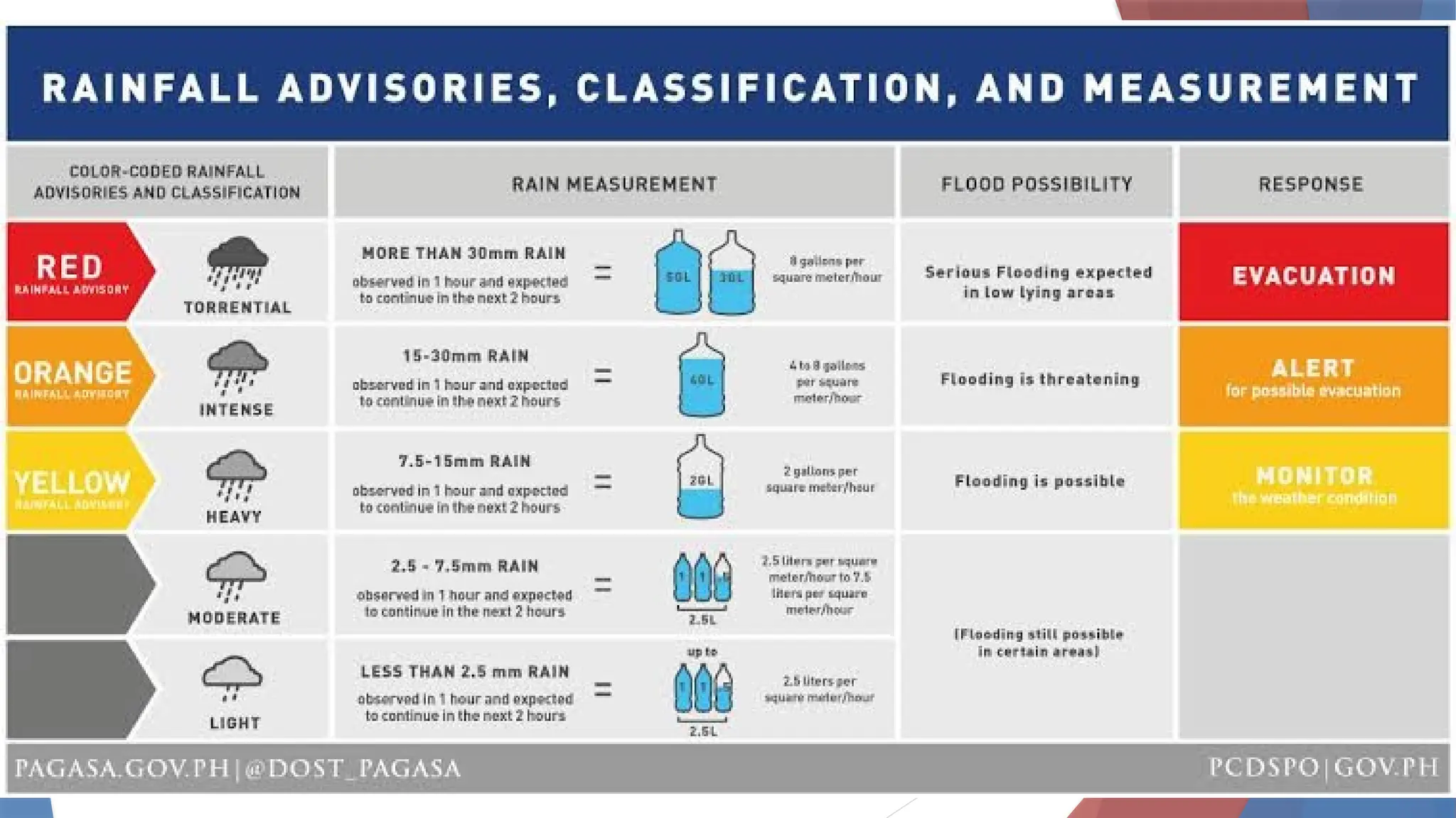
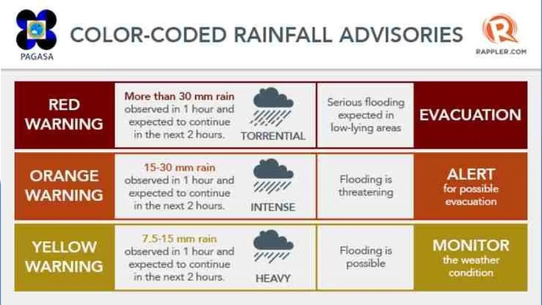
UNDERSTANDING
TYPHOONS
WEATHER
WEATHER
Is the atmospheric conditions,
along with short-term changes , of
a certain time.
Is a day to day condition of the
atmosphere at a particular time
and place.
WEATHER
Takes place at the troposphere,
which is about 10 km thick at the
poles and 16 km thick at the
equator.
Meteorologist
Scientist who study the
atmosphere and the
weather.
WEATHER VARIABLES
Air temperature, air pressure,
wind speed and direction,
humidity, cloud coverage and
precipitation
THE WATER CYCLE
STORMS also called cyclones, originate over
warm waters and are classified according to
their geographical location.
HURRICANES are storms that occurs over the
Caribbean Sea, Gulf of Mexico, North Atlantic
Ocean or the Northeast Pacific Ocean.
TYPHOONS are storms that occur over the
Northwest Pacific Ocean, and west of the
International Dateline.
CYCLONES are storms that occur in Indian
Ocean.
TYPHOONS
 Comes from Greek word typhon, which
means violent storm.
 Are an intense tropical storm with winds
exceeding 119 km/hr.
 One of the most destructive storms on
Earth.
 Like tornadoes, typhoons have circular
shape with intense, swirling winds.
 Locally called “bagyo”
HOW TYPHOONS DEVELOP?
A typhoon is formed when a series of
clouds form a spiral pattern. This
formation usually reaches several
kilometres in diameter . The pattern
moves with great strength in a
counterclockwise direction powered by
strong winds.
CLOUD WATCH
WEATHER WATCH
CLASSIFICATION
OF TROPICAL
TYPHOON
Categories are
determine in terms of
wind speed, thus a
tropical depression
have a wind speed of 64
kph; tropical storm
118kph; typhoon-
200kph; and super
typhoon at 200 kph and
more.
 Q1. Where did the tropical cyclone form? On land
or in the ocean?
 Q2. What can you say about the temperature of
the bodies of water in the vicinity of the
Philippines? Is the water warm or cold?
 Q3. In what direction did the tropical cyclones
move?
 Q4. In the case of Agaton,Yoyong, and Huaning,
where did they die out? Near land or in the middle
of the ocean?
Tropical cyclones need water vapor in order
to form.
Tropical cyclones require warm ocean waters
to be able to develop. (26.5ºC or greater)
Tropical cyclones generally move in a
northwest direction.
When tropical cyclones reach land, they die
out because they are cut off from the warm
ocean waters that keep them going.
Conditions
for Typhoon
Formation
CONTINUOUS EVAPORATION AND
WATER CYCLE
DIFFERENCES IN AIR PRESSURE
CONVERGENT WINDS
Two factors fuel a tropical cyclone into
a full blown typhoon
 1.Rapid updrafts or upward movement of
water vapor from the ocean due to the fast
rising warm air.
 2.Condensation of water vapor which
releases heat to the swirling wind
TRIVIA
TIME
According to scientist the
temperature of ocean water
must be 26.5 degrees Celsius or
greater to form typhoon.
A typhoon is also called a
“hurricane” in western
countries, “tai fung” in China,
and “taifu” in Japan. The term
“typhoon” is used in the
Philippines and other countries
in Asia.
Heavy rainfall is often caused by
weather disturbance. The major
weather disturbance that the
Philippines encounter is the tropical
cyclone (known as Bagyo).
Every year, around 20 tropical
cyclones are experienced in the
Philippines with varying intensities.
 In 1963 by the Philippine Weather Bureau through
the use of four sets of alphabetically arranged
Filipino women nicknames ending in “ng” that are
alternately used every four years. In 1999, the
Philippine Atmospheric, Geophysical and
Astronomical Services (PAGASA) held a nationwide
search for new generation tropical cyclone
names. It was dubbed as “Name the Bagyo
Contest.”The result of the search which was
picked out from more than 18,000 entries was 140
no- gender-bias names that will be used until 2016
by PAGASA.
In November 2013, super typhoon
Yolanda (also known as Haiyan)
made landfall on the eastern part of
the Philippines, mainly in Leyte and
Samar, leaving thousands of Filipino
families homeless.
INSIDE TROPICAL CYCLONES
 The lowest air pressure is at the eye of a
tropical cyclone.
 At the eye of a tropical cyclone, wind
speed is low.
 At the eyewall, the wind speed is great.
 When the eye of a tropical cyclone passes
over a certain place, it is the winds at the
eyewall that wreak a lot of damage.
FACTORS AFFECTING
THE WEATHER IN THE
PHILIPPINES
The Philippines can be
expected to experience
typhoons many times in
a year.
Why is the Philippine
archipelago prone to
typhoons?
LOCATION
The Philippine archipelago is
strategically located within the
typhoon belt of the pacific lying
within the proximity of the
Intertropical Convergence Zone
where trade winds converge and
storms commonly form within the
western Pacific.
Intertropical Convergence Zone is an
area where the Northern and Southern
Hemispheric winds converge and rising
air encircle the Earth near the equator
(the rising air produces high cloudiness,
frequent thunderstorms and heavy
rainfall), usually located between 10
degrees North and South of the equator.
And the Philippines lies within the ITCZ.
EFFECTS OF
LANDFORMS
OROGRAPHY
Study of the formation and
topography of mountains and
hills.
Orographic lifting occurs when air
flows over mountains and is forced
to rise, causing rain or snow over
the mountains which is called
orographic precipitation.
The Philippines has numerous mountain
ranges and challenging terrains that influence
the speed, intensity, and circulation of
tropical cyclones.
Land interaction may change the track of a
typhoon especially when the land is
mountainous. The rugged terrains and
mountains can disrupt the center of the
typhoon’s circulation
EFFECTS OF
BODIES OF WATER
Large bodies of water can have an
effect on the strength of typhoons that
hit adjacent land masses. These bodies
of water determine whether the air
temperature will be warm or cold, or if
the relative humidity will be high or low.
TYPHOON
TRACKING
PAGASA
 Philippine Atmospheric, Geophysical and
Astronomical Services Administration is the
government agency responsible for monitoring
typhoons and weather disturbances, weather
forecasting, flood control, and astronomy research.
They also give out various warning signals to advise
the public and communities on what actions to take
for safety during typhoons and other weather
disturbances.
 PAGASA falls under the scope of Department of
Science and Technology (DOST)
PAGASA
Is also responsible for monitoring
tropical cyclone occurrences within
the Philippine Area of Responsibility
(PAR) in the northwestern Pacific.
PAR
 It is bounded by an imaginary line drawn around the Philippines, including the
bodies of water that surround the country.
 The imaginary line links the following coordinate points
When weather reports
announce that the storm
has just entered the PAR,
it means that it is still at
sea and has not yet fallen
over land.
PUBLIC STORM
WARNING SIGNALS
PSWS # 1
METEOROLOGICAL CONDITIONS: A
tropical cyclone will affect the
locality. Winds of 30-60 kph may be
expected in at least 36 hours or
intermittent rains may be expected
within 36 hours.
PSWS # 1
IMPACT OFTHE WINDS:
Twigs and branches of small trees
may be broken. Some banana
plants may be tilted or downed.
Some houses of very light
materials (nipa and cogon) may be
partially unroofed.
PSWS # 1
IMPACTS OF THE WINDS:
Unless this warning signal is upgraded
during the entire existence of the tropical
cyclone, only very light or no damage at
all may be sustained by the exposed
communities.
Rice crop, however, may suffer significant
damage when it is in its flowering stage.
PSWS # 1
PRECAUTIONARY MEASURES:
When the tropical cyclone is strong or
is intensifying and is moving closer,
this signal may be upgraded to the
next higher level. The waves on
coastal waters may gradually develop
and become bigger and higher.
PSWS # 1
PRECAUTIONARY MEASURES:
Inspect your house if necessary
repair/fixing is needed. Clean up
drainage system. Harvest crops that can
be yielded.
Monitor the latest Severe Weather
Bulletin issued By PAGASA every six hours
and hourly updates.
PSWS # 1
PRECAUTIONARY MEASURES:
The people are advised to listen to the
latest severe weather bulletin issued
by PAGASA every six hours. In the
meantime, business may be carried
out as usual except when flood occur.
Disaster preparedness is activated to
alert status.
PSWS # 1
PRECAUTIONARY MEASURES:
Prepare flashlights, batteries , matches,
kerosene lamps, or candles and charcoal in
anticipation of power failure, first aid kit
and store ready to eat foods. Keep your cell
phones fully charged. Elevate household
things in case of flooding. For fishing folks,
secure fishing boats in safe area.
PSWS # 2
METEOROLOGICAL CONDITIONS:
A tropical cyclone will affect the the
locality. Winds of greater than 60
kph and up to 100 kph may be
expected in at least 24 hours.
PSWS # 2
IMPACT OFTHE WINDS:
Some coconut trees may be tilted
with few others broken. Few big
trees may be uprooted.
Many banana plants may be downed.
Rice and corn may be adversely
affected.
PSWS # 2
IMPACT OFTHE WINDS:
Large number of nipa and cogon houses
may be partially or totally unroofed.
Some old galvanized iron roofings may
be peeled off.
In general, the winds may bring light to
moderate damage to the exposed
communities.
PSWS # 2
PRECAUTIONARY MEASURES:
The sea and coastal waters are dangerous
to small sea crafts.
 Special attention should be given to the
latest position, the direction and speed
of movement and the intensity of the
storm as it may intensify and move
towards the locality.
PSWS # 2
PRECAUTIONARY MEASURES:
The general public especially people
travelling by sea and air are
cautioned to avoid unnecessary
risks.
Outdoor activities of children should
be postponed.
PSWS # 2
PRECAUTIONARY MEASURES:
Secure properties before the signal
is upgraded.
Disaster preparedness agencies /
organizations are in action to alert
their communities.
PSWS # 3
METEOROLOGICAL CONDITIONS:
A tropical cyclone will affect the
locality. Winds of greater than 100
kph up to 185 kph may be expected
in at least 18 hours.
PSWS # 3
IMPACTS OF THE WIND
 Many coconut trees may be broken or destroyed.
Almost all banana plants may be downed and a
large number of trees may be uprooted.
 Rice and corn crops may suffer heavy losses.
 Majority of all nipa and cogon houses may be
unroofed or destroyed and there may be
considerable damage to structures of light to
medium construction.
PSWS # 3
IMPACTS OF THE WIND
There may be widespread disruption
of electrical power and
communication services.
In general, moderate to heavy damage
may be experienced, particularly in
the agricultural and industrial sectors.
PSWS # 3
PRECAUTIONARY MEASURES:
 If the house is not strong enough to withstand
the battering of strong winds go to designated
evacuation center or seek shelter in stronger
houses.
 Stay in safe houses until after the disturbances
has left the area.
 Evacuate from low-lying area and riverbanks and
stay away from coastal areas for possible
flooding and storm surge.
PSWS # 3
PRECAUTIONARY MEASURES:
All travel and outdoor activities
should be cancelled.
Watch out for the passage of the
"EyeWall and the "Eye" of the
typhoon.
PSWS # 3
PRECAUTIONARY MEASURES:
 The disturbance is dangerous to the
communities threatened/affected.
 The sea and coastal waters will be very
dangerous to all sea crafts.
 Travel is very risky especially by sea and air.
 People are advised to seek shelter in strong
buildings, evacuate low- lying areas and to
stay away from the coasts and river banks.
PSWS # 3
PRECAUTIONARY MEASURES:
 Watch out for the passage of the "eye" of the
typhoon indicated by a sudden occurrence of fair
weather immediately after very bad weather with
very strong winds coming generally from the north.
 When the "eye" of the typhoon hit the community
do not venture away from the safe shelter because
after one to two hours the worst weather will
resume with the very strong winds coming from the
south.
PSWS # 3
PRECAUTIONARY MEASURES:
Classes in all levels should be
suspended and children should stay in
the safety of strong buildings.
Disaster preparedness and response
agencies/organizations are in action
with appropriate response to actual
emergency.
PSWS # 4
METEOROLOGICAL CONDITIONS:
A very intense typhoon will affect
the locality. Very strong winds of
more than 185 kph may be expected
in at least 12 hours.
PSWS # 4
IMPACTS OF THE WIND
Coconut plantation may suffer
extensive damage. Many large trees
may be uprooted. Rice and corn
plantation may suffer severe losses.
Most residential and institutional
buildings of mixed construction may be
severely damaged.
PSWS # 4
IMPACTS OF THE WIND
Electrical power distribution and
communication services may be
severely disrupted.
In the overall, damage to affected
communities can be very heavy.
PSWS # 4
PRECAUTIONARY MEASURES:
The situation is potentially very
destructive to the community.
All travels and outdoor activities should
be cancelled.
Evacuation to safer shelters should
have been completed since it may be
too late under this situation.
PSWS # 4
PRECAUTIONARY MEASURES:
The locality is very likely to be hit
directly by the eye of the typhoon. As
the eye of the typhoon approaches,
the weather will continuously worsen
with the winds increasing to its
strongest coming generally from the
north.
PSWS # 4
PRECAUTIONARY MEASURES:
Then a sudden improvement of the weather with
light winds (a lull) will be experienced. This means
that the eye of the typhoon is over the locality.
This improved weather may last for one to two
hours depending on the diameter of the eye and
the speed of movement.
As the eye moves out of the locality, the worst
weather experienced before the lull will suddenly
commence.
PSWS # 4
PRECAUTIONARY MEASURES:
 This time the very strong winds will come
generally from the south.
 The disaster coordinating councils
concerned and other disaster response
organizations are now fully responding to
emergencies and in full readiness to
immediately respond to possible calamity.
PAGASA
RAINFALL
ADVISORY
ADVISORY
 Is a report that notifies, informs, or recommends
on what actions must be undertaken. It is issued
to describe a tropical cyclone before a warning is
raised. It is an official information issued by
tropical warning centers describing all tropical
cyclone watches and warnings.
 An advisory is issued with details concerning the
tropical cyclone’s location, intensity, and
movement. It is also has precautions that should
be taken.
COLOR-CODED WARNING SIGNAL FOR
RAINFALL
YELLOW RAINFALL ADVISORY
 Is raised in areas where the expected rainfall
amount is between 7.5 mm to 15 mm within 1
hour from posting the warning.
 Residents in low-lying communities are alerted of
possible flooding in the area.
COLOR-CODED WARNING SIGNAL FOR
RAINFALL
ORANGE RAINFALL ADVISORY
 Is posted when rainfall amount is between 15 mm
to 30 mm within 1 hour.
 Flooding is highly expected in the affected areas
under the orange alert.
COLOR-CODED WARNING SIGNAL FOR
RAINFALL
RED RAINFALL ADVISORY
 Is raised when observed rainfall amount more than
30 mm within 1 hour.
 The warning is also issued if the downpour has
continued for three hours and is more than 65 mm
level.
 Communities within this warning should be prepared
to evacuate the area due to serious flooding.
The rainfall warning system is useful
to communities even if there is no
typhoon. PAGASA has observed that
lately “rains have become damaging
even if there is no typhoon”.
SOME WAYS TO REDUCE DAMAGES
SUSTAINED DURING TYPHOON
Keep river channels free from waste
and debris.
Build a seawall to protect a
community from rising seawater.
Campaign for proper use of land.
Prepare an evacuation plan.

UNDERSTANDING TYPHOONS -SCIENCE 8 (QUARTER 2)

  • 1.
  • 2.
  • 3.
    WEATHER Is the atmosphericconditions, along with short-term changes , of a certain time. Is a day to day condition of the atmosphere at a particular time and place.
  • 4.
    WEATHER Takes place atthe troposphere, which is about 10 km thick at the poles and 16 km thick at the equator.
  • 5.
    Meteorologist Scientist who studythe atmosphere and the weather.
  • 6.
    WEATHER VARIABLES Air temperature,air pressure, wind speed and direction, humidity, cloud coverage and precipitation
  • 7.
  • 8.
    STORMS also calledcyclones, originate over warm waters and are classified according to their geographical location. HURRICANES are storms that occurs over the Caribbean Sea, Gulf of Mexico, North Atlantic Ocean or the Northeast Pacific Ocean. TYPHOONS are storms that occur over the Northwest Pacific Ocean, and west of the International Dateline. CYCLONES are storms that occur in Indian Ocean.
  • 9.
    TYPHOONS  Comes fromGreek word typhon, which means violent storm.  Are an intense tropical storm with winds exceeding 119 km/hr.  One of the most destructive storms on Earth.  Like tornadoes, typhoons have circular shape with intense, swirling winds.  Locally called “bagyo”
  • 10.
    HOW TYPHOONS DEVELOP? Atyphoon is formed when a series of clouds form a spiral pattern. This formation usually reaches several kilometres in diameter . The pattern moves with great strength in a counterclockwise direction powered by strong winds.
  • 11.
  • 12.
  • 16.
  • 17.
    Categories are determine interms of wind speed, thus a tropical depression have a wind speed of 64 kph; tropical storm 118kph; typhoon- 200kph; and super typhoon at 200 kph and more.
  • 22.
     Q1. Wheredid the tropical cyclone form? On land or in the ocean?  Q2. What can you say about the temperature of the bodies of water in the vicinity of the Philippines? Is the water warm or cold?  Q3. In what direction did the tropical cyclones move?  Q4. In the case of Agaton,Yoyong, and Huaning, where did they die out? Near land or in the middle of the ocean?
  • 23.
    Tropical cyclones needwater vapor in order to form. Tropical cyclones require warm ocean waters to be able to develop. (26.5ºC or greater) Tropical cyclones generally move in a northwest direction. When tropical cyclones reach land, they die out because they are cut off from the warm ocean waters that keep them going.
  • 24.
  • 25.
    CONTINUOUS EVAPORATION AND WATERCYCLE DIFFERENCES IN AIR PRESSURE CONVERGENT WINDS
  • 26.
    Two factors fuela tropical cyclone into a full blown typhoon  1.Rapid updrafts or upward movement of water vapor from the ocean due to the fast rising warm air.  2.Condensation of water vapor which releases heat to the swirling wind
  • 27.
  • 28.
    According to scientistthe temperature of ocean water must be 26.5 degrees Celsius or greater to form typhoon.
  • 29.
    A typhoon isalso called a “hurricane” in western countries, “tai fung” in China, and “taifu” in Japan. The term “typhoon” is used in the Philippines and other countries in Asia.
  • 30.
    Heavy rainfall isoften caused by weather disturbance. The major weather disturbance that the Philippines encounter is the tropical cyclone (known as Bagyo). Every year, around 20 tropical cyclones are experienced in the Philippines with varying intensities.
  • 31.
     In 1963by the Philippine Weather Bureau through the use of four sets of alphabetically arranged Filipino women nicknames ending in “ng” that are alternately used every four years. In 1999, the Philippine Atmospheric, Geophysical and Astronomical Services (PAGASA) held a nationwide search for new generation tropical cyclone names. It was dubbed as “Name the Bagyo Contest.”The result of the search which was picked out from more than 18,000 entries was 140 no- gender-bias names that will be used until 2016 by PAGASA.
  • 32.
    In November 2013,super typhoon Yolanda (also known as Haiyan) made landfall on the eastern part of the Philippines, mainly in Leyte and Samar, leaving thousands of Filipino families homeless.
  • 33.
    INSIDE TROPICAL CYCLONES The lowest air pressure is at the eye of a tropical cyclone.  At the eye of a tropical cyclone, wind speed is low.  At the eyewall, the wind speed is great.  When the eye of a tropical cyclone passes over a certain place, it is the winds at the eyewall that wreak a lot of damage.
  • 34.
  • 35.
    The Philippines canbe expected to experience typhoons many times in a year.
  • 36.
    Why is thePhilippine archipelago prone to typhoons?
  • 37.
  • 38.
    The Philippine archipelagois strategically located within the typhoon belt of the pacific lying within the proximity of the Intertropical Convergence Zone where trade winds converge and storms commonly form within the western Pacific.
  • 39.
    Intertropical Convergence Zoneis an area where the Northern and Southern Hemispheric winds converge and rising air encircle the Earth near the equator (the rising air produces high cloudiness, frequent thunderstorms and heavy rainfall), usually located between 10 degrees North and South of the equator. And the Philippines lies within the ITCZ.
  • 40.
  • 41.
    OROGRAPHY Study of theformation and topography of mountains and hills.
  • 42.
    Orographic lifting occurswhen air flows over mountains and is forced to rise, causing rain or snow over the mountains which is called orographic precipitation.
  • 44.
    The Philippines hasnumerous mountain ranges and challenging terrains that influence the speed, intensity, and circulation of tropical cyclones. Land interaction may change the track of a typhoon especially when the land is mountainous. The rugged terrains and mountains can disrupt the center of the typhoon’s circulation
  • 45.
  • 46.
    Large bodies ofwater can have an effect on the strength of typhoons that hit adjacent land masses. These bodies of water determine whether the air temperature will be warm or cold, or if the relative humidity will be high or low.
  • 47.
  • 48.
    PAGASA  Philippine Atmospheric,Geophysical and Astronomical Services Administration is the government agency responsible for monitoring typhoons and weather disturbances, weather forecasting, flood control, and astronomy research. They also give out various warning signals to advise the public and communities on what actions to take for safety during typhoons and other weather disturbances.  PAGASA falls under the scope of Department of Science and Technology (DOST)
  • 49.
    PAGASA Is also responsiblefor monitoring tropical cyclone occurrences within the Philippine Area of Responsibility (PAR) in the northwestern Pacific.
  • 50.
    PAR  It isbounded by an imaginary line drawn around the Philippines, including the bodies of water that surround the country.  The imaginary line links the following coordinate points
  • 52.
    When weather reports announcethat the storm has just entered the PAR, it means that it is still at sea and has not yet fallen over land.
  • 53.
  • 54.
    PSWS # 1 METEOROLOGICALCONDITIONS: A tropical cyclone will affect the locality. Winds of 30-60 kph may be expected in at least 36 hours or intermittent rains may be expected within 36 hours.
  • 55.
    PSWS # 1 IMPACTOFTHE WINDS: Twigs and branches of small trees may be broken. Some banana plants may be tilted or downed. Some houses of very light materials (nipa and cogon) may be partially unroofed.
  • 56.
    PSWS # 1 IMPACTSOF THE WINDS: Unless this warning signal is upgraded during the entire existence of the tropical cyclone, only very light or no damage at all may be sustained by the exposed communities. Rice crop, however, may suffer significant damage when it is in its flowering stage.
  • 57.
    PSWS # 1 PRECAUTIONARYMEASURES: When the tropical cyclone is strong or is intensifying and is moving closer, this signal may be upgraded to the next higher level. The waves on coastal waters may gradually develop and become bigger and higher.
  • 58.
    PSWS # 1 PRECAUTIONARYMEASURES: Inspect your house if necessary repair/fixing is needed. Clean up drainage system. Harvest crops that can be yielded. Monitor the latest Severe Weather Bulletin issued By PAGASA every six hours and hourly updates.
  • 59.
    PSWS # 1 PRECAUTIONARYMEASURES: The people are advised to listen to the latest severe weather bulletin issued by PAGASA every six hours. In the meantime, business may be carried out as usual except when flood occur. Disaster preparedness is activated to alert status.
  • 60.
    PSWS # 1 PRECAUTIONARYMEASURES: Prepare flashlights, batteries , matches, kerosene lamps, or candles and charcoal in anticipation of power failure, first aid kit and store ready to eat foods. Keep your cell phones fully charged. Elevate household things in case of flooding. For fishing folks, secure fishing boats in safe area.
  • 61.
    PSWS # 2 METEOROLOGICALCONDITIONS: A tropical cyclone will affect the the locality. Winds of greater than 60 kph and up to 100 kph may be expected in at least 24 hours.
  • 62.
    PSWS # 2 IMPACTOFTHE WINDS: Some coconut trees may be tilted with few others broken. Few big trees may be uprooted. Many banana plants may be downed. Rice and corn may be adversely affected.
  • 63.
    PSWS # 2 IMPACTOFTHE WINDS: Large number of nipa and cogon houses may be partially or totally unroofed. Some old galvanized iron roofings may be peeled off. In general, the winds may bring light to moderate damage to the exposed communities.
  • 64.
    PSWS # 2 PRECAUTIONARYMEASURES: The sea and coastal waters are dangerous to small sea crafts.  Special attention should be given to the latest position, the direction and speed of movement and the intensity of the storm as it may intensify and move towards the locality.
  • 65.
    PSWS # 2 PRECAUTIONARYMEASURES: The general public especially people travelling by sea and air are cautioned to avoid unnecessary risks. Outdoor activities of children should be postponed.
  • 66.
    PSWS # 2 PRECAUTIONARYMEASURES: Secure properties before the signal is upgraded. Disaster preparedness agencies / organizations are in action to alert their communities.
  • 67.
    PSWS # 3 METEOROLOGICALCONDITIONS: A tropical cyclone will affect the locality. Winds of greater than 100 kph up to 185 kph may be expected in at least 18 hours.
  • 68.
    PSWS # 3 IMPACTSOF THE WIND  Many coconut trees may be broken or destroyed. Almost all banana plants may be downed and a large number of trees may be uprooted.  Rice and corn crops may suffer heavy losses.  Majority of all nipa and cogon houses may be unroofed or destroyed and there may be considerable damage to structures of light to medium construction.
  • 69.
    PSWS # 3 IMPACTSOF THE WIND There may be widespread disruption of electrical power and communication services. In general, moderate to heavy damage may be experienced, particularly in the agricultural and industrial sectors.
  • 70.
    PSWS # 3 PRECAUTIONARYMEASURES:  If the house is not strong enough to withstand the battering of strong winds go to designated evacuation center or seek shelter in stronger houses.  Stay in safe houses until after the disturbances has left the area.  Evacuate from low-lying area and riverbanks and stay away from coastal areas for possible flooding and storm surge.
  • 71.
    PSWS # 3 PRECAUTIONARYMEASURES: All travel and outdoor activities should be cancelled. Watch out for the passage of the "EyeWall and the "Eye" of the typhoon.
  • 72.
    PSWS # 3 PRECAUTIONARYMEASURES:  The disturbance is dangerous to the communities threatened/affected.  The sea and coastal waters will be very dangerous to all sea crafts.  Travel is very risky especially by sea and air.  People are advised to seek shelter in strong buildings, evacuate low- lying areas and to stay away from the coasts and river banks.
  • 73.
    PSWS # 3 PRECAUTIONARYMEASURES:  Watch out for the passage of the "eye" of the typhoon indicated by a sudden occurrence of fair weather immediately after very bad weather with very strong winds coming generally from the north.  When the "eye" of the typhoon hit the community do not venture away from the safe shelter because after one to two hours the worst weather will resume with the very strong winds coming from the south.
  • 74.
    PSWS # 3 PRECAUTIONARYMEASURES: Classes in all levels should be suspended and children should stay in the safety of strong buildings. Disaster preparedness and response agencies/organizations are in action with appropriate response to actual emergency.
  • 75.
    PSWS # 4 METEOROLOGICALCONDITIONS: A very intense typhoon will affect the locality. Very strong winds of more than 185 kph may be expected in at least 12 hours.
  • 76.
    PSWS # 4 IMPACTSOF THE WIND Coconut plantation may suffer extensive damage. Many large trees may be uprooted. Rice and corn plantation may suffer severe losses. Most residential and institutional buildings of mixed construction may be severely damaged.
  • 77.
    PSWS # 4 IMPACTSOF THE WIND Electrical power distribution and communication services may be severely disrupted. In the overall, damage to affected communities can be very heavy.
  • 78.
    PSWS # 4 PRECAUTIONARYMEASURES: The situation is potentially very destructive to the community. All travels and outdoor activities should be cancelled. Evacuation to safer shelters should have been completed since it may be too late under this situation.
  • 79.
    PSWS # 4 PRECAUTIONARYMEASURES: The locality is very likely to be hit directly by the eye of the typhoon. As the eye of the typhoon approaches, the weather will continuously worsen with the winds increasing to its strongest coming generally from the north.
  • 80.
    PSWS # 4 PRECAUTIONARYMEASURES: Then a sudden improvement of the weather with light winds (a lull) will be experienced. This means that the eye of the typhoon is over the locality. This improved weather may last for one to two hours depending on the diameter of the eye and the speed of movement. As the eye moves out of the locality, the worst weather experienced before the lull will suddenly commence.
  • 81.
    PSWS # 4 PRECAUTIONARYMEASURES:  This time the very strong winds will come generally from the south.  The disaster coordinating councils concerned and other disaster response organizations are now fully responding to emergencies and in full readiness to immediately respond to possible calamity.
  • 85.
  • 86.
    ADVISORY  Is areport that notifies, informs, or recommends on what actions must be undertaken. It is issued to describe a tropical cyclone before a warning is raised. It is an official information issued by tropical warning centers describing all tropical cyclone watches and warnings.  An advisory is issued with details concerning the tropical cyclone’s location, intensity, and movement. It is also has precautions that should be taken.
  • 87.
    COLOR-CODED WARNING SIGNALFOR RAINFALL YELLOW RAINFALL ADVISORY  Is raised in areas where the expected rainfall amount is between 7.5 mm to 15 mm within 1 hour from posting the warning.  Residents in low-lying communities are alerted of possible flooding in the area.
  • 88.
    COLOR-CODED WARNING SIGNALFOR RAINFALL ORANGE RAINFALL ADVISORY  Is posted when rainfall amount is between 15 mm to 30 mm within 1 hour.  Flooding is highly expected in the affected areas under the orange alert.
  • 89.
    COLOR-CODED WARNING SIGNALFOR RAINFALL RED RAINFALL ADVISORY  Is raised when observed rainfall amount more than 30 mm within 1 hour.  The warning is also issued if the downpour has continued for three hours and is more than 65 mm level.  Communities within this warning should be prepared to evacuate the area due to serious flooding.
  • 93.
    The rainfall warningsystem is useful to communities even if there is no typhoon. PAGASA has observed that lately “rains have become damaging even if there is no typhoon”.
  • 94.
    SOME WAYS TOREDUCE DAMAGES SUSTAINED DURING TYPHOON Keep river channels free from waste and debris. Build a seawall to protect a community from rising seawater. Campaign for proper use of land. Prepare an evacuation plan.