
Recommended
More Related Content
What's hot
What's hot (20)
Similar to Town planning of chittaranjan township
Similar to Town planning of chittaranjan township (20)
Recently uploaded
Recently uploaded (20)
Town planning of chittaranjan township
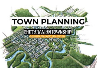
- 1. TOWN PLANNING CHITTARANJAN TOWNSHIP CLEAN CITY,GREEN CITY,CITY OF PEACE
- 3. CONTENT ➢ NEED FOR THE STUDY ➢ AIM ➢ OBJECTIVE ➢ PROBLEMS ➢ SCOPE AND LIMITATIONS ➢ METHODOLOGY ➢ ABOUT CHITTARANJAN CITY ➢ CLIMATOLOGY ➢ SITE ➢ REGIONAL LINKAGE ➢ FACILITIES ➢ BASE MAP ➢ TRAFFIC ANALYSIS ➢ LAND USE,BUILD USE,BUILT HEIGHT,FIGURE GROUND,OPEN SPACE,SOCIAL INFRASTRUCTURE ➢ ISSUES AND PROPOSALS ➢ CONCLUSION
- 4. NEED FOR THE STUDY HISTORY: ● Before the town's development, the area was heavily forested and infested with plunderers and marauders. ● The discovery of coal led to its industrialization, clearing most of the forests. AIM: ● TO PROPOSE DEVELOPMENT STRATEGIES FOR PROPER USE OF LAND AND OTHER SERVICES IN THE AREA. ● TO REGULATE THE DEVELOPMENT AND USE OF LAND IN THE PUBLIC INTEREST PREVENTING LAND USE CONFLICT. OBJECTIVE: ● TO STUDY THE PHYSICAL INFRASTRUCTURE OF CHITTARANJAN TOWNSHIP ● TO STUDY THE BUILT USE,BUILT HEIGHT,TRANSPORT,LAND USE ETC IN THE AREA. ● TO FIND OUT ISSUES AND BE ABLE TO INPUT WITH SOME FAVOURABLE SOLUTIONS. ● CONSERVE SENSITIVE NATURAL ENVIRONMENT. ● DEVELOP WELL DISTRIBUTED PHYSICAL AND SOCIAL INFRASTRUCTURE. ● CREATE AN IMAGE THAT REPRESENTS THE CULTURE AND IMAGE OF CHITTARANJAN TOWNSHIP
- 5. SCOPE 1) To learn about basic town planning process and techniques. 2) Survey on drainage,electricity lines,road width,parkings and building types were carried out. LIMITATION 1) THE DATA COLLECTION WAS SOLELY BASED ON THE SECONDARY SURVEY WITH THE HELP OF GOOGLE MAP AND VISUAL OBSERVATION AND NOT WITH ANY PROFESSIONAL EQUIPMENT. 2) WATER SUPPLY DATA COLLECTION WAS NOT CARRIED OUT.
- 6. CHITTARANJAN CITY Chittaranjan Locomotive Works (CLW) has been named after the great freedom fighter, leader and statesmen Deshbandhu Chittaranjan Das. The production activity started on 26th January, 1950 the day when India became Republic. The initial product of Chittaranjan Locomotive Works was Steam Locomotive . Chittaranjan has 5,070 residential quarters, 71 miles of road, 120 miles of piping for water supply and 100 miles of water borne sewage. Every single house has a minimum of two rooms, verandah and courtyai-d, electricity, continuous supply of filtered water, its own sanitary pi’ivy and batii. E ach house in Chittaranjan has been provided with the basic facilities of a modem home. The township has been planned in separate colonies of composite self-sufficient units, each of which has its shopping centre, maternity clinic, school, playground, dispensary, park, social amenity and recreation centres. There are at present in Chittaranjan 5 dispensaries, 4 maternity and health centres. 7 basic schools, 4 community halls and 6 parks. The main hospital has 50 beds and is centrally situated to provide medical facilities for all residents of the township. Chittaranjan is ideally located for an industrial undertaking of this nature. It is situated within 10 miles of West Bengal’s rich coal belt and only 6 miles from the Maithan Dam of the Damodar Valley Corporation from where Hydro-Electric energy will be obtained. The Maithon reservoir will also provide a source of perennial water supply for the township and the workshop. The hilly nature of the country facilitates easy drainage, so important for the establishment of a clean, healthy township and the excellent climatic conditions are expected to ensure a high level of labour attendance and efficiency. Workshop and the colony are spread over an area of over 7 square miles
- 7. DEMOGRAPHY WE CAN SEE FROM THE CHART THAT IT HAVE REMARKABLE RATE IT IS BECAUSE MOST OF THE POPULATION OF REGION MIGRATES TO THE CITY IN SEARCH OF FACILITIES CLIMATE CHART
- 8. SITE- CHITTARANJAN TOWNSHIP(W.B) INDIA WEST BENGAL CHITTARANJAN
- 9. FACILITIES ● Chittaranjan, an ISO 14001 certified township has neatly arranged row-houses, broad, clean roads, greenery and lakes. ● The township houses over 9300 quarters of various types and sizes for the employees of CLW. ● All these quarters are neatly grouped under various areas (equivalent to wards in cities) with each area having its own Primary Health Unit (locally famous as dispensary), marketplace, primary school, and a community hall. In addition to the dispensaries in each area, Chittaranjan also has its own 200-bed hospital - the Kasturba Gandhi Hospital. ● Chittaranjan has non-stop electricity (24/7). Being a railway colony, a total of 3 DVC (Damodar Valley Corporation) power lines enters Chittaranjan, so that even after the failure of one power source, a power failure doesn't occur. ● It also has an emergency diesel generator, for main infrastructures like Hospitals, CLW, post offices etc. in case of complete power failure. The last complete power failure occurred on 31 July 2012 during the India Blackouts. ● The Diminutive Hilltop is the main water treatment plant located in Chittaranjan where water is purified and supplied to the households generally twice a day, though the main infrastructures (like the hospital and GM office) receive a non-stop water supply. ● It also has two big playgrounds: the Oval Ground and the Srilata Ground, which hold various sub-divisional tournaments. ● There is also a helipad built at the Oval ground, used by visiting delegates. ● In addition to this, Chittaranjan has two multi-sport stadiums, two swimming pools, a basketball court, a badminton court, a lawn tennis court, many football grounds, a gymnasium and a fully air-conditioned indoor stadium. ● Chittaranjan has one movie theater, the Ranjan Cinema that shows Hindi and Bengali movies. ● Chittaranjan has a dedicated officer's club popularly called as the Chittaranjan Club which is used by officers for recreational purposes. ● A stranger cannot enter Chittaranjan without showing the proper permit. There are three gates to enter or leave the township. These gates are protected by the armed RPF (Railway Protection Force).
- 10. Some of the main location of the township HOSPITAL STADIUM DAM R A I L W A Y S T A T I O N
- 11. REGIONAL LINKAGES KAZI NAZRUL ISLAM AIRPORT,DURGAPUR Netaji Subhas Chandra Bose International Airport ➢ The distance between Chittaranjan and Kolkata Airport (CCU) is 207 km. The road distance is 234.5 km. The road distance is 234.5 km. ➢ Closest airport to Chittaranjan is Kazi Nazrul Islam Airport (RDP). Distance from Kazi Nazrul Islam Airport to Chittaranjan is 26.9 miles / 43.3 kilometers. ASANSOL RAILWAYS STATION (W.B) CHITTARANJAN RAILWAY STATION ➢ The nearest important railway junction is, Asansol situated 25 km away. ➢ Road transports of both Bengal and Jharkhand can be accessed from here. ➢ A unique feature of this place is that the railway station is located at Jharkhand state (name of the place- Mihijam, district: Jamtara) whereas the township is in West Bengal. ➢ Chittaranjan also has about 50 bus services with Private buses (it includes one AC bus service run by Bijoy Yatra Travels and a state bus service South Bengal State Transport Corporation). It has a dedicated bus stand at Gate no. 1 where buses arrive and depart to Haldia, Kolkata, Bankura, Mukutmanipur, Burdwan, Kalna, Asansol, Raniganj, Durgapur, Bongaon and elsewhere.
- 14. TRAFFIC ANALYSIS BUS STAND AUTO STAND
- 15. BUILT USE
- 16. LAND USE
- 17. BUILT HEIGHT
- 22. ISSUES 1) TRANSPORTATION PROBLEMS DUE THE NARROW ROADS.
- 23. ISSUES 2) LACK OF PROPER ROAD SIGNAGE.
- 24. ISSUES 3)THERE ARE LOTS OF TREES IN TOWNSHIP SO IN RAINY OR STORMY DAYS BRANCHES OF TREES FALLS ON ELECTRIC WIRES AND CREATE PROBLEMS,EXAMPLE-DUE TO THIS PEOPLE FACES POWER CUTS.
- 25. PROPOSALS 1) TO INCREASES THE WIDTH OF THE ROADS FOR THE PROPER TRANSPORTATION.
- 26. PROPOSALS 2) TO PROVIDE PROPER ROAD SIGNAGE AT EACH AND EVERY TURNINGS OF THE ROAD.
- 27. PROPOSALS 3) TO CREATE THE UNDERGROUND ELECTRIC WIRING LINES.
- 29. CONCLUSION ● Through this assignment we tried to have a general idea about the nature and functioning of the stretch of chittaranjan township from the perspective of a town planner. ● By the means of surveying and mapping we have obtained several data’s about element like built height,built use,land use,base map,important landmarks and other details about services like water supply and electrification. ● These data have helped us to have a general idea about the lifestyles,infrastructure,economy and issues experienced by the people in these localities. ● Keeping these issues in mind we have tried to come up with some proposals for some particular locations of the site. ● This project has proved to be very helpful to us in understanding the role played by a town planner in shaping the built environment of an urban locality.
- 30. REFERENCE- ● https://en.wikipedia.org/wiki/Chittaranjan ● Google image ● Google earth Videos of chittaranjan township https://www.facebook.com/debabrata.ghosh.313371/videos/17384369 06311371/
- 31. THANKYOU