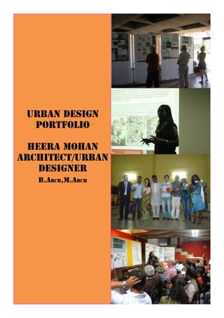
Heera Mohan PORTFOLIO
•
1 like•3,853 views

Heera Mohan's portfolio outlines their experience and qualifications in urban design and architecture. They have a B.Arch and M.Arch and their experience includes a masters thesis on Auroville, India; a project on urban transformation in Mapusa, India; and designing a sustainable extension for GIFT City in Ahmedabad. They have also published an article on Auroville and worked on development plans for Ulhasnagar, India and projects in Bhopal and Kerala, India focusing on sustainable tourism and urban renewal.

More Related Content
What's hot
What's hot (20)
Viewers also liked
Similar to Heera Mohan PORTFOLIO
Similar to Heera Mohan PORTFOLIO (20)
Recently uploaded
Recently uploaded (20)
Heera Mohan PORTFOLIO
- 2. Studio Project Experience (Studies and Documentation): (a) 2009-10, Masters in Urban Design Thesis:- “Auroville – Towards realising Utopia” under guid- ance of Prof. Rajeev Kathpalia (b) 2009 July to Dec 09, Urban Transformation:- Urban Design as a tool to connect grass root level administration through 73rd and 74th amendment act, “Urban Transformation-Public Participatory develop- ment”, Case: Mapusa, Goa state, India (c) 2008 Dec – May 09, Urban Extension:- Making Sustainable GIFT (Gujarat International Fi- nance Tech City)city for 3 lakh population, Ahmedabad
- 3. Masters in Urban Design Thesis
- 25. Published Article on “Auroville: Natural systems as a determinant role in realizing Utopia” in Journal of Landscape Architecture – LA 31 (LANDSCAPE URBANISM) April to June 2011.
- 26. Urban Design as a tool to connect grass root level administration through 73rd and 74th amendment act, “Urban Transfor- mation-Public Participatory development”, Case: Mapusa, Goa state, India
- 29. URBAN EXTENSION STUDIO - GIFT,GANDHINAGAR VISION AND INTRODUCTION NARRATIVE INDIAN CITIES ARE EXPANDING AND CHANGING AT A SUPERFLOUS RATE UNDER THE PRESSURE OF URBANIZATION AND GLOBALIZATION. THE PROBLEMS OF LESS SPACE, STIPULATED TIME AND INCREASING POPULATION, HAVE LEAD TO A SEVERE PRESSURE ON EXTINGUISHING RESOURCES. THE DEVELOPMENTS ARE EITHER UNPLANNED AND GROW IN A HAPHAZARD PATTERN OR THE PLANNING APPROACH LEADS IT TO BE VOID OF HUMAN EXPERIENCE AND VALUES. THERE NEED OF THE HOUR IS TO REALIZE, UNDERSTAND AND TACKLE THESE ISSUES SENSITIVELY. URBAN AGGLOMERATION THRIVES ON SOME BASIC PUSH AND PULL FACTORS. CENTRIPETAL FORCES DRAW THE POPULATION TOWARDS CENTER AND INCREASE THE DENSITY, WHEREAS THE CENTRIFUGAL FORCES LIKE EFFICIENT TRANSPORTATION DECONGEST AND DECENTRALIZE THE PRESSURES. THE BALANCE BETWEEN THESE FORCES HELP IN SUSTAINANCE OF A CITY. VISION TO ADOPT A HOLISTIC APPROACH TOWARDS DESIGNING A LIVABLE ENVIRONMENT WHERE THERE IS A CONCERN OF TIME, SPACE, RESOURCES AND PEOPLE. INTENT TRANSIT-ORIENTED DEVELOPMENT, COMPACT NEIGHBORHOODS, PEDESTRIAN & BICYCLE-FRIENDLY DESIGN. A> TRANSIT-ORIENTED DEVELOPMENT (TOD) MAXIMIZE ACCESS TO PUBLIC TRANSPORT, NIL PRIVATE VEHICULAR MOVEMENT, MIXED-USE/COMPACT NEIGHBORHOODS WHICH TEND TO USE TRANSIT THROUGHOUT THE DAY, REDUCE THE USE OF RESOURCES, REGIONAL COOPERATION TO INCREASE EFFICIENCY AND EXPAND SERVICES. OTHER TOPICS FALL UNDER THIS CONCEPT: TRANSPORTATION DEMAND/ MANAGEMENT MEASURES, ROAD/ PRICING SYSTEM (TOLLING), COMMERCIAL PARKING TAXES, PARKING CASH OUT. B>COMPACT NEIGHBOURHOODS REDUCES URBAN SPRAWL, CHANNELING HOUSING AND JOB GROWTH INTO URBAN CENTERS AND NEIGHBORHOOD BUSINESS DISTRICTS, TO CREATE COMPACT, WALK ABLE, AND BIKE- AND TRANSIT-FRIENDLY HUBS, MIXED-USE DEVELOPMENT, INCLUSION OF AFFORDABLE HOUSING, RESTRICTIONS OR LIMITATIONS ON SUBURBAN DESIGN FORMS, INCLUSION OF PARKS AND RECREATION AREAS C>PEDEST LOCATION ACCESSIB SOIL CON VEGETAT SABARMA Making Sustainable GIFT (Gujarat International Finance Tech City)city for 3 lakh population, Ahmedabad
- 30. SHEET NO. 5a MASTERS PROGRAMME IN URBAN DESIGN , SEMESTER - II FACULTY OF ARCHITECTURE, CEPT UNIVERSITY , AHMEDABAD D INTRODUCTION AMIT SINGH, HEERA MOHAN, KOMAL PANJWANI. OBLEMS OF PMENTS ARE LUES. AND THE D PEOPLE. C>PEDESTRIAN POCKETS LESS LAND IS COMSUMED, LESS TRAFFIC IS GENERATED, LESS POLLUTION IS PRODUCED, BIKING AND WALKING INSTEAD OF DRIVING, CAN REDUCE EMISSIONS, SAVE MONEY ON FUEL AND MAINTENANCE, FOSTER A HEALTHIER POPULATION. LOCATION LOCATED 12KM FROM AHMEDABAD AND 8KMS FROM STATE CAPITAL GANDHINAGAR AND 12KM FROM THE NEAREST AIRPORT. THE SITE IS LOCATED ON THE BANKS OF NON PERENNIAL RIVER SABARMATI. OWING TO ITS STRATEGIC LOCATION THE AREA WILL WITNESS DEVELOPMENTS THAT WOULD INCLUDE GIFT (GUJARAT INTERNATIONAL FINANCE TECHNOLOGY) CITY AND 2700 ACRE OF INTEGRATED TOWNSHIP. ACCESSIBILITY THE SITE IS ACCESSIBLE THROUGH A PUCCKA ROAD FROM NH8 (MUMBAI- DELHI HIGHWAY) OTHER ROUTES INCLUDE ACCESS FROM THE 3 VILLAGES OF RATANPUR, LOWARPUR,SHAHPUR, PHEROZPUR. A BRTS AND MRTS ROUTE IS PROPOSED TO PASS THROUGH THE SITE CATERING TO INTER-CITY MOVEMENT. SOIL CONDITION BAD LAND TOPOGRAPHY- LACK OF HUMUS IN SOIL HENCE SPARSE VEGETATION. SOIL IS LOOSE IN THE RAVINES AND IS PRONE TO EROSION AS IT IS BARREN LAND. THE VEGETATION IS MAINLY VEGETATION VEGETATION TYPICALLY CONSISTS OF PLANTS THAT EITHER ARE EMERGENT AQUATIC PLANTS, OR HERBS, TREES AND SHRUBS THAT THRIVE IN PROXIMITY TO WATER. THE RAVINE IN THE WESTERN CORNER OF THE SITE IS ABUTTED BY LEMON PLANTATIONS. THE AREA CONSISTS BASICALLY OF SHRUBS AND NO LARGE FOLIAGE TREES ARE PRESENT. CLIMATE THE REGION HAS SEMI- ARID CLIMATE REGIME. THREE DISTINCT SEASONS ARE EXPERIENCED: HOT DRY SUMMERS, COLD DRY WINTERS AND WARM HUMID MONSOONS. MAX TEMP. 45C, MIN TEMP. 3C. MAJOR WIND DIRECTIONS AREFROM S-W IN SUMMER-MONSOON AND FROM N-E IN WINTER. AVERAGE ANNUAL RAINFAL IS 782 MM. SABARMATI RIVER THE SABARMATI ORIGINATES IN THE ARAVALLI RANGE OF THE UDAIPUR DISTRICT OF RAJASTHAN. THE 3 MAJOR CITIES THAT LIE ON THE RIVER ARE GANDHINAGAR, AHMEDABAD, SURAT. DHAROI DAM WHICH IS CONSTRUCTED ON THE RIVER FACILITATES IRRIGATION TOWARDS WESTERN PART OF GUJARAT. THE PORTION OF RIVER PRE-AHMEDABAD SUFFERS FROM SEVERE EROSION WHICH CAN BE SEEN FROM EXCESSIVE SAND SETTLEMENTS AND RIVER BRAIDING.
- 31. URBAN EXTENSION STUDIO - GIFT,GANDHINAGAR REGIONAL LINKAGES GANDHINAGAR SHEET NO. 5c MASTERS PROGRAMME IN URBAN DESIGN , SEMESTER - IIAMIT SINGH, HEERA MOHAN, KOMAL PANJWANI. REGIONAL LINKAGES
- 32. SHEET NO. 5i MASTERS PROGRAMME IN URBAN DESIGN , SEMESTER - II RE OF OPEN SPACES AMIT SINGH, HEERA MOHAN, KOMAL PANJWANI. 0 50 200
- 33. 0 200 400 600 800 1000 1200 1400 1600 1800 2000 2200 200 400 600 800 1000 1200 1400 1600 1800 2000 2 0 200 400 600 800 1000 1200 1400 1600 1800 2000 2200 200 400 600 800 1000 1200 1400 1600 1800 2000 2200 2400 2600 2800 URBAN EXTENSION STUDIO - GIFT,GANDHINAGAR BRTS AND MRTS LINKAGE PLAN AMIT SINGH, HEERA MOHAN, KOMA A A B B C C D D 0 200 400 600 800 1000 1200 1400 1600 1800 2000 2200 200 400 600 800 1000 1200 1400 1600 1800 2000 2200 2400 2600 2800 STORM WATER DRAIN BIOSWALE WATER CATCHMENT AREA GREEN SPACE FOR ROOT ZONE TREATMENT RECREATIONAL AREA URBAN EXTENSION STUDIO - GIFT,GANDHINAGAR SHEET NO. 5n MASTERS PROGRAMME IN URBAN DESIGN , SEMESTER - II FACULTY OF ARCHITECTURE, CEPT UNIVERSITY , AHMEDABAD WASTE WATER MANAGEMENT AMIT SINGH, HEERA MOHAN, KOMAL PANJWANI. 0 200 400 600 800 1000 1200 1400 1600 1800 2000 2200 200 400 600 800 1000 1200 1400 1600 1800 2000 2200 2400 2600 2800 200 400 600 800 1000 1200 1400 1600 1800 2000 2200 2400 2600 2800 SION STUDIO - GIFT,GANDHINAGAR MASTERS PROGRAMME IN FACULTY OF ARCHITECTURE, CE BRTS AND MRTS LINKAGE PLAN AMIT SINGH, HEERA MOHAN, KOMAL PANJWANI.
- 34. Professional Experience: • CRDC, School of Planning, CEPT, Ahmedabad - Worked as an Urban design Research Associ- ate under Prof. Utpal Sharma (July 2010-July 2011) Preparation of Development Plan for Ulhasnagar, Maharashtra, Improving Patna – Master Plan 2031. • DHV INDIA, Executive Urban Designer, Bhopal (Jan 2012 – May 2012) Development of Sustainable schemes for Bhopal by PPP, Madhya Pradesh. • GITPAC INTERNATIONAL ,Kerala Urban Designer (May 2012 – August 2012) - PROJECT FOR GANDHI SMRITHIVANAM AS ECOTOURISM PROJECTS AT PURAKKAD IN ALAPPUZHA DISTRICT. - INTEGRATED MASTER PLAN FOR ATTUKAL REGION - GOK PROJECT (ON-GOING) - PREPARATION OF SUSTAINABLE TOURISM PLAN FOR NILA RIVER (ON-GOING)
- 35. Preparation of Development Plan for Ulhasnagar
- 41. Development Strategies for the Project The strategies for sustainable development for Bhopal on a holistic basis require two distinct development strategies, one cov- ering the Greenfield Projects and second covering the Brownfield Projects. Greenfield Projects involving virgin lands, which are available only on the outskirts of the city, would need to be formulated as per the provisions of Section 50 of the M.P. Town & Country Planning Act h1973, where by schemes would be formulated for the designated area, through a process of land pooling/land acquisition and implemented. The Brownfield Projects, involving the optimization of Built Space through various strategies like Urban Renewal, Densifica- tion, Redevelopment and Re-densification. Development of Sustainable schemes for Bhopal by PPP
- 42. Development and the Density of Government Housing Stock This shows the evolution of government housing stock in the new capital city which was initiated with North and South T. T. Nagar which housed F, G, H, and I type quarters (3000 nos.), 45 Bungalows which housed D & E type quarters, and some parts of 74 quarters which housed B, C & D type quarters. Delineated Area for Phase I Redensification Schemes in New Bhopal- TT Nagar, Professors Colony and Temporary Qtrs, Tulsi Nagar
- 43. Key Issues in the Study Area The key issues identified in the delineated area of T.T. Nagar (North and South are summarised with respect to the (i) Land, Built Form and Activity Pattern, (ii) Traffic and Transportation. A. Land, Built Form and Activity Pattern • Under Utilization of Land • A number of units Unsafe and the housing in the area has outlived its life • Built form across valleys and not in optimal orientation • Inappropriate informal turned formal commercial activities near Anjali Complex, Tinshed and at Jawahar Chowk B. Traffic • A number of thorough movement options in the South T.T. Nagar area • Individual Residential entries on the Arterial roads • Vehicular & pedestrian movement combined • Severe lack of parking space at New Market • Entries to residential areas from Arterial roads choked at most of the places PHASING PLAN AND PACKAGING The Phasing Plan has been evolved for the housing and infrastructure components respectively considering: • the availability of land for initiating the process for construction of the government houses in the Stage 1 of the Pro- ject with minimal relocation requirements; • identifying the land parcels where structures have already been demolished/ large number of structures have already been declared unsafe/ are vacant. • the relocation to the newly housing stock has been considered in a way that the workable chunks of land are avail- able for construction of government houses in the South T.T. Nagar in subsequent stages • the developer is able to get the pockets vacated for compensatory land parcels in North T.T. Nagar and few pockets in South T.T. Nagar area
- 44. Redensification/Urban Renewal Schemes for Shahjehanabad Bhopal Development Authority appointed consultants for preparation of sustainable development schemes for Bhopal on PPP Basis. The schemes to be designed on the principles of urban renewal, redevelopment and densification without affecting the basic structure, character and heritage of this traditional city of Bhopal. Emergence of Shahjehanabad Identifying areas of intervention Existing activities in the intervention area
- 45. Proposed activities in the intervention area Ram Nagar - existing Plot area (sq.mtr): 34,310 Ram Nagar - proposed
- 46. A project is for establishing a Smrithivanam, commemorative forest, at Purakkad in Alappuzha district. The initial proposal was to establish a biodiversity conservation park over an extent of 600 acres of paddy field known as MAN- AKKAL padasekharam. Due to the lack of maintenance (stopping of Agricultural activities, weakening of the bunds etc) the Paddy field has been transformed as a Wetland that supports an Eco system of Birds, Fish, grazing ground for Buffaloes The SITE lies within an existing system of Paddy fields which are inter- connected by canals. Excess water which is pumped out from the paddy fields, through these canals, are interlinked to the TS Canal or the adjoining Rivers. PROJECT FOR GANDHI SMRITHIVANAM AS ECOTOURISM PROJECTS AT PURAKKAD
- 47. EXISTING FEATURES OF THE SITE The SITE lies within an existing system of Paddy fields which are interconnected by canals. The settlements mainly depend on agriculture for their livelihood. The average house hold size is 5 members project concept Of the 337 acres, an extent of 64 acres lies in continuous block and the remaining 273 acres of land lies interspersed with private land. DETAILED APPROACH Development of a sustainable Tourism development taking into ac- count wetland biodiversity conservation. Encouraging Agriculture, fisheries, poultry and other traditional prac- tices with in the Site area. Providing Employment opportunities to the local people who are as- sociated with the Paddy field. In Turn upgrading the existing infrastructure in the area like develop- ing proper roads, street lights, organizing pathways leading to the adjoining settlements etc. Retaining a part of the wetland as it is to support the existing ecosys- tem associated with it.
- 48. LAND RECLAIMATION PROCESS CONCEPTUAL ZONING PLAN The canal could act as a spine for the Development, for circulation and as a‘Node’. The canal is to accommodate a Water Detention pond connecting the built space around it. Proposed paddy cultivation on the western part of the site due to the site topography and also as a buffer from the existing settlement.
- 49. INTEGRATED MASTER PLAN FOR ATTUKAL REGION INCEPTION REPORT KERALA SIDCO The Attukal Bhagavathy Temple is renowned for the annual Attukal Pongala festival, in which over a million women partici- pate. Attukal Pongala is an exclusive women’s only festival, which has entered the Guinness Book of World Records for being the World’s largest religious gathering of women. Devotees who gather to offer Pongala to Attukal devi increases in numbers every year. The rush is so intense that the entire Trivandrum City, about 5 km radius around the Attukal temple, becomes the holy grounds for women to offer Pongala nivedyam to Goddess. From temple grounds to courtyards of houses, to bus station and railway station to public roads one can see only devotees offering Pongala to Attukal Devi. This sudden influx of people in the CBD area of Trivandrum City bring with it, its own share of problems. The large share of pilgrims contributes mainly to the sanitation, transportation and environmental and infrastructural requirement issues in the region. ATTUKAL TEMPLE Kawdiar Sasthamangalam Vazhuthakkadu PMG jnt Pattom Medical college Kumarapuram Pattor Panvila jnt Chalai Market Manacaud Kovalam Route Thiruvalam Marathurkadav Bridge East Fort KILLIPALAM HIGHWAY MANACAUD ATTUKAL TEMPLE BYPASS The Temple is bounded by major Urban Features like: Killi River on the Eastern side Dense Residential Fabric on the Western side East fort, Chalai Market and Railway station on the Northern side.
- 50. The increased pressure on development has currently left Attukal Temple ‘Land-locked’ within the dense residential settlement. Also in a regional level, the temple is being cramped within the surrounding setting of the East Fort , the Chalai Market and the Railway line running on the Northern side. Presently, there are open lands on the north eastern side of the temple which is dispersed within private lands. ATTAKULAMKARA MANACAUD KILLI PALAM CHIRAMUKKU EAST FORT CHALAI MARKET NH BYPASS NH47 MARUTHOORKADAVU BRIDGE Scale I Scale iiiScale ii Integrated urban Planning approach at 3 levels: Scale I : TEMPLE AND ITS ADJACENT PADDY FIELDS APPROX(100 ACRES OF LAND) Scale II : ATTUKAL TEMPLE HUB Scale III : ATTUKAL TEMPLE AND 29 WARDS - EMPHASIZING ON PONGALA SPREAD AREA Planning concept
- 51. Scale I : TEMPLE AND ITS ADJACENT PADDY FIELDS APPROX(100 ACRES OF LAND) Currently the temple has around 10 Acres of land which is dispersed between Private land holdings. The land is low-lying on which patches of cultivation presently occurs. Due to the pressures of development, it is envisaged that, over the years ,the present private open space could get engulfed within the surrounding residential development. Meanwhile, there is a need for an contiguous open space near the temple to accommodate the temple activities . Hence it is proposed to adopt Town planning scheme as a‘Tool’for reconstituting private and temple lands and to develop a contiguous open space. Scale II : ATTUKAL TEMPLE HUB To Define a Township zone which comprises the Temple and its immediate settlements ,in turn upgradation of infrastruc- ture, environmental management, lifestyle improvement, up-liftment of slum dwellings, formulation of policies and guidelines to strengthen the character of the region as a Temple Hub Scale III : THE MASTER PLAN BOUNDARY INCLUDING THE 29 WARDS This scale deals with a regional scale with Attukal Temple and 29 wards adjoining it. To develop the temple and its precinct as a Nodal Zone, it is essential to strengthen it by facilitating basic infrastructures like physical, social and economic upgradation of the region at Ward level, city level and region level. PONGALA FACILITATION interim PLAN
- 52. Pattom Kumarapuram Kannanmula Bridge Pettah Chakka Bypass jnt Model school jnt Palayam Vazhuthakadu Bakery jnt Overbridge East fort Enjakkal Kumari Manacaud Attakulamkara Killipalam Karamana Bridge Jagathy Sasthamangalam Kawdiar Poojapura Marathurvadavu Bridge Kovalam Route NH Bypass Thiruvalam Pattom Kumarapuram Kannanmula Bridge Pettah Chakka Bypass jnt Model school jnt Palayam Vazhuthakadu Bakery jnt Overbridge East fort Enjakkal Kumari Manacaud Attakulamkara Killipalam Karamana Bridge Jagathy Sasthamangalam Kawdiar Poojapura Marathurvadavu Bridge Kovalam Route NH Bypass Thiruvalam Existing major concerns to be addressed LACK OF SANITATION FACILITIES LIKE BATHROOMS AND TOILETS during pongala as the pilgrims depend on the adjacent houses. no PORTABLE DRINKING WATER AVAILIBILITY even though frequent water tankers are there to meet the water needs of the pilgrims. Open spaces that presently accommodate Pongala needs to be organized to facilitate the pilgrims with proper sanitation, drinking water and shaded resting space. TEMPLE BEING INACCESSIBLE DURING THE FESTIVAL DAYS DUE TO OVER CROWDING OF THE ROADS Linking TO IT. IMPROPER WASTE DISPOSAL MECHANISM NEEDS TO THE ADDRESSED.
- 53. PROPOSAL i: SANITATION FACILITIES LIKE temporary BATHROOMS AND TOILETS PROPOSAL ii: Provision of portable drinking water facility at frequent intervals PROPOSAL iii: ORGANIZING OPEN SPACES FOR PROPER PILGRIM FA- CILITATION Identified space for facilitationExisting Pongala Spatial Spread PROPOSAL iv: Developing an efficient movement plan for Pon- gala Pattom Kumarapuram Kannanmula Bridge Pettah Chakka Bypass jnt Model school jnt Palayam Vazhuthakadu Bakery jnt Overbridge East fort Enjakkal Kumari Manacaud Attakulamkara Killipalam Karamana Bridge Jagathy Sasthamangalam Kawdiar Poojapura Marathurvadavu BridgeKovalam Route NH Bypass Thiruvalam Vellayambalam An efficient Movement Plan is proposed connecting between the major Entry nodes (at the city fringes) to Manacaud Junction. 7 Routes are identified where‘Mini-Bus’service is proposed to provide To and Fro pickup facility. These Routes need to cleared to demarcate space for the ease movement of the vehicles. ROUTE 1 – Chakka Bypass – Palayam – East Fort – Manacaud ROUTE 2 – Thiruvalam – Manacaud ROUTE 3 – Marathurkadavu – Killipalam – Ambalathara – Manacaud ROUTE 4 – Karamana Bridge – Killipalam – Ambalathara – Manacaud ROUTE 5 – Vellayambalam – Jagathy – Killipalam – Ambalathara – Manacaud ROUTE 6 – Enjakkal – East Fort – Manacaud ROUTE 7 – Kumari – Manacaud
- 54. WORKSHOPS PARTCIPATED: • Participated and won a special mention award in 2nd session: West African workshop of urban plan- ning in Porto-Novo on STRATEGY AND URBAN DESIGN FOR THE CITY CENTRE OF PORTO NOVO – July 23rd to August 13th 2011. • LES ATELIERS, SCIENTIFIC MANAGER ASSISTANT, In- ternational Professional Workshop in Naya Raipur, India from November 17th – 30th 2012 (Duration of Task - August 25th to December 3rd 2012) prepara- tion of the context document, participant guide and the final session book.
- 55. The lower valley of the Ouémé Nokoué Lake (150 km) and Porto-Novo lagoon (35 km) together form the largest wetland of Benin, with 91 000 ha. Water and food plays a major socio-economic, feeds the groundwater that supplies water wells in the vicinity and is used to irrigate vegetable crops. The lagoon contains important fishery resources to feed the people of the region and serves as a means of trans- porting goods and people. Porto Novo & Its surroundings West African workshop of urban planning in Porto-Novo on STRATEGY AND URBAN DESIGN FOR THE CITY CENTRE OF PORTO NOVO
- 56. The study site At the heart of the city, the site devel- ops to the west of a line running from the bridge, the only means of access to the city from the south shore of the lagoon and Cotonou, Place Jean Bayol to the crossroads and Catchi the outer boulevard. It is bounded on the south by the end of the plateau overlook- ing the lagoon and to the west by the valley of Zounvi. It is characterized by major thoroughfares, squares and intersections strong symbolic (Place Bayol Catchi Carrefour, Place de la Ré- publique, the axis of power, the avenue Victor Ballot ...), and the presence of a heritage built mainly occupied by colonial government and military which marks the border between the city and the traditional town colonial history, further east. UPCOMING PRO- JECTS - NEW ASSEMBLY • Currently under construction, the new National Assembly takes place at the bridge is Porto-Novo. It will thus be one of the first buildings seen (with the Supreme Court) by any visitor to Porto-Novo. - PROPOSED RELOCA- TION OF THE TOWN HALL: • The municipality of Porto-Novo now wishes to settle, once the new national assembly built in the former premises of the National Assembly which is located in the former building of the colonial Governor’s Palace.
- 57. Today, it is proposing a project responding to the combination of two aspects: - City of Culture - Capital City The future of the city must mix the attributes which constitute a major capital while maintaining its tangible and intangible heritage. ECONOMIC STRATEGIES SITE ANALYSIS KEY ISSUES
- 58. The heritage monuments are deterio- rating and an appropriate strategy is to be developed to rehabilitate them. There are many dead edges in the city centre and there is a need activate it. The heavy traffic congestion at the entrance of the city needs to be addressed. DESIGN PRINCIPLES 1. TO CONNECT THE CITY TO THE LAGOONS Integration of public amenity such as public toilet, biogas centre with the existing communities 2. HERITAGE WALK 3. PROPOSING MIXED USES IN THE ADMINISTRATIVE AREA OF THE CITY CENTRE
- 59. 4. TO WIDEN THE ENTRANCE BRIDGE. Existing Bridge Proposed Bridge 5. CONNECTIONS BETWEEN SONGHAI, THE NEW UNIVERSITY AND THE BOTANICAL GARDEN Proposed Density PROPOSED MASTER PLAN
- 60. The EAST project gathers partners from Europe (ENTP – European New Towns and Pilot Cities Platform, Basildon Borough Council, and Les Ateliers), India (Naya Raipur Development Authority and the EuroIndia Centre) and China (Baoshan and Qingpu districts). The project is cofinanced by the European Union (Thematic Programme“Non-state actors and local authori- ties in development”) for a duration of 4 years, from 2011 to 2014. Naya Raipur is a new, planned capital city for 560,000 inhabitants, adjacent to the existing city of Raipur and currently under construction. The state government has moved to Naya Raipur on November 1st, 2012, attracting new workers, residents and businesses and beginning the establishment of a new urban population centre. This workshop will take place at a point in time when the first steps of a new city have already been taken, but different possibilities remain open. NRDA, the devel- opment agency responsible for the new city is open to ideas and wants the professional participants to work under the les Ateliers method, to explore possibilities, with the intention of implementation of the best results. The objective of the workshop is to explore the potential for the new city plan to achieve its goal of becoming a‘city for every- one’. The Government of Chhattisgarh recently shifted the capital to Naya Raipur to establish the identity of the state and also to provide for the insuffi cient social and institutional infra- structure. The city structure of Raipur is defined by a strong nucleus which is the intersection of GE road and NH 200. It acts as a major node for commercial and public / semi-public activities.
- 61. A striking feature of Raipur is its ponds, locally called as‘talabs’. Dug for various purposes across the country, here the aim was to store water for domestic use and also to help increase the water table. The ponds not only helped in irrigation, but also were scientifi cally developed for water harvesting. Raipur is dotted with such man-made ponds which were interconnected and acted as water detention ponds. But gradually as the city grew and the water supply lines were laid, the talabs were ignored and the road network interfered with these water channels. The city of ponds Raipur Masterplan 2021 - Existing and proposed land uses Location of Naya Raipur City in the region Boundaries The area is divided into 3 layers: Naya Raipur it- self (Layer-I, including a 500m-wide green belt), the peripheral zone (Layer-II) and the airport zone (Layer-III).
- 62. The Transportation System The Transport plan seeks high mobility for all. The city level system is integrated with the regional infrastructure: rail (one main station in the north and a local station in the south), highways (NH-6 and NH-43) and airport. Two expressways are being planned near the city boundaries and can improve regional connectivity in the future: Bhilai- Durg-Raipur- Mahasamund and Dhamtari-Raipur-Bilaspur Expressways.
- 63. The formation of new towns in India Are traditional principles worth recovering for the design of New Towns in the con- temporary context? Should New Towns be extensions of existing cities and towns or should they be self-propelled entities, tree standing in their own landscape? How could the (urban) poor be made part of the evolu- tionary process of a New Town? Could New Towns be fi nancially viable and self-sus- taining entities? What should determine the urban form of a New Town? What eventually gives it the bright lights of the city? Is the idea of New Towns capable of generating, in contemporary India, the idealism and hope that propelled its crea- tion historically? Understanding of ‘Indian urbanism’ Indian Urbanity is the underlying concept that unifi es the cul- tural, social and religious nature of the Indian cities and their coexistence. These aspects are often refl ected in the physical manifestation of the urban fabric and depend on the‘life’of an Indian city. Other characteristic of Indian cities are the wise response to climate - in the hot and humid Indian tropics which gives out- door spaces more importance than house interior. The cultural homage to myth - in India where the public’and the‘private’are perpetually intersected by the‘sacred’, physi- cality is more supernatural than real. Hence the four general topics for the workshop to explore are: mixity; public transport and urban density; space and water as social resources; “positioning” of the city. certain questions which were raised... In Naya Raipur, how would these ‘in between realms’ be treated, whether it is between houses, between residential and commercial, between a water body and the built environment, between the exising villages and the new planned city or in a regional scale, between Naya Raipur and Raipur and along its boundaries? How can the public space of the street be best organized to continue to support this critical connection between the different scales of transport and the mixed urban scales? In Naya Raipur, as the road structure is defi ned in a grid pattern in contrast with the to- pography of the land, how could the future development address the existing water system in the region? Another important aspect to be thought of is how Naya Raipur could envisages economic viability for all when the Town Planning scheme coming up in the outer periphery of Raipur will make it more attractive to the economic weaker section? It is a great challenge for Naya Raipur to be a city affordable for all, economically viable, socially inclusive and also give a place for the real estate developers, function as a state capital and continue to be a livable green city.
- 64. Introduction days: visits Introduction days: conferences team work
- 65. ROLE OF THE JURY Following the methodology developed over 31 years by Les Ateliers, each workshop ends with the presentation by the three multidisciplinary teams of participants to a“jury”. The members of the jury are chosen by Naya Raipur Development Authority, ENTP (East Project) and Les Ateliers. Their mission is not to classify the teams’proposals, but to identify the most relevant ideas and elements of all the projects and indicate the ones which could/should be considered for implementation by the local authorities. Therefore, the jury takes part to the process of collective production and could be considered the 4th team of the workshop. MANAGING TEAM