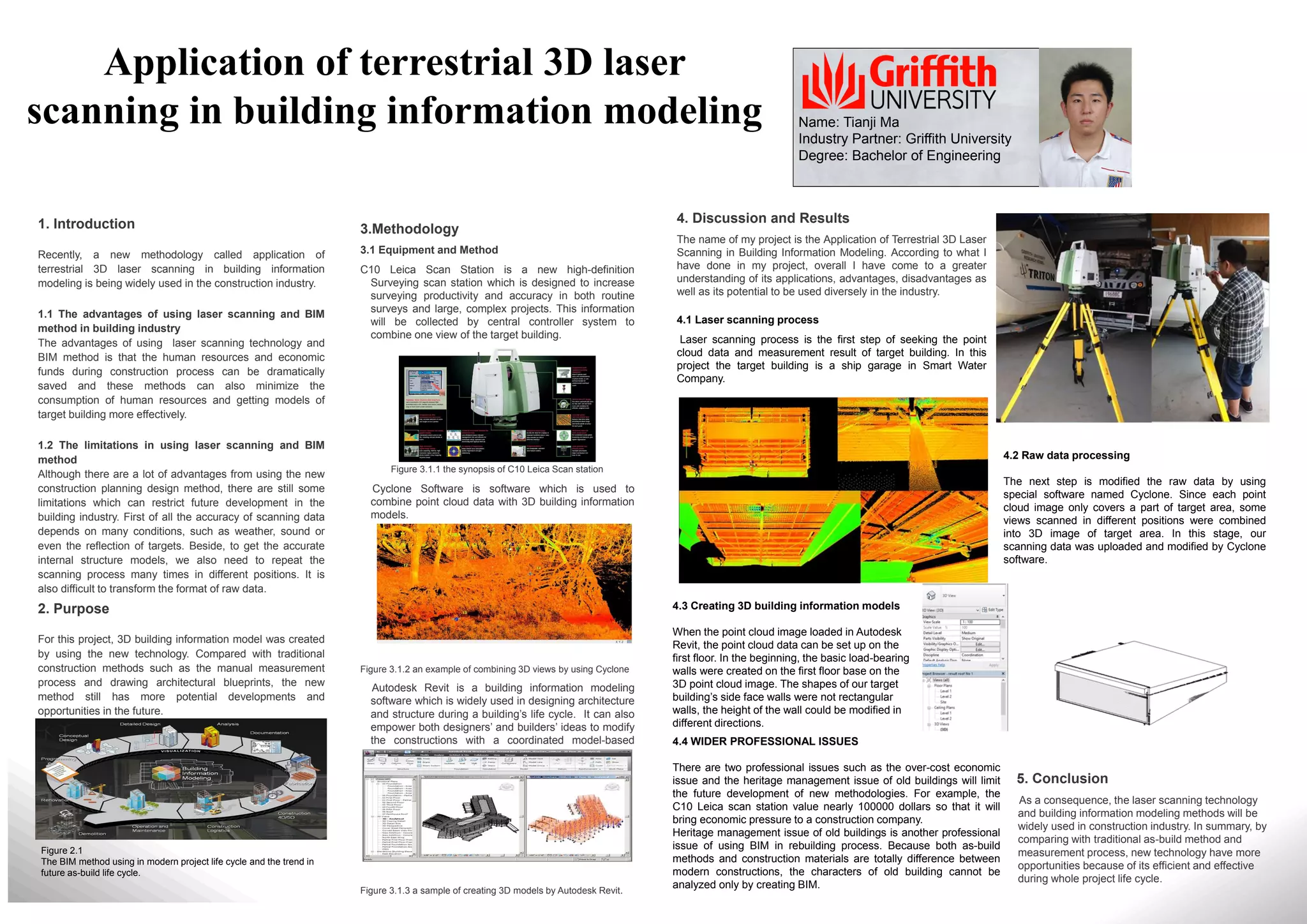
The document discusses the methodology used in a project applying terrestrial 3D laser scanning in building information modeling (BIM). It describes using a Leica Scan Station C10 laser scanner to collect point cloud data of a target building. Cyclone software was then used to combine the point cloud data with a 3D BIM. Autodesk Revit, a BIM software, was used to create 3D models from the point cloud data. The project involved laser scanning a ship garage to collect point cloud data, processing the raw data in Cyclone, and creating a 3D BIM of the garage in Revit based on the point cloud.