2. 1
THE BIM PROCESS
360° PANORAMIC VIEW
ONLINE OR OFFLINE WEB PLATFORM
2D SURVEY
REVIT MODEL READY-TO-BIM
3D POINT CLOUD
2
4
8
6
10
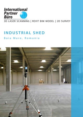
I N D U S T R I A L S H E D
LOCATION:
Baia Mare, Romania
BUILDING AREA:
10.000 sqm
Industrial shed - scanned area
Faster data collection, as compared to conventional methods;
Very low risk of occupational accidents;
Non-invasive method of data collection;
Full, authentic and accurate 3D copy of reality, unsurpassed by any other means or method
of measurement;
2D and 3D documentation provided to architects and structural engineers for all future works;
Possibility of being updated further as needed by the beneficiary’s requests;
Conversion of data into 2D and 3D models compatible with all CAD software;
Structural details - complex documentation due to accuracy and large amount of data collected
through 3D laser scanning;
Providing all the necessary data for building positioning or as-built recordings;
Perfect alternative to conventional measurement methods.
3D Laser Scanning
Project purpose: Revit model ready-to-BIM | 2D Survey
3D laser scanning is an advanced technology that allows for better
documentation of as-built and existing conditions, which especially
benefits the BIM and Architecture, Engineering and Construction (AEC)
market.
3D laser scanning offers an excellent means of documenting and
capturing existing conditions of current buildings as well as as-built
recording of new structures.
This technology can be applied in the industrial field for measuring
large buildings shuch as: sheds, warehouses, factories etc.
Advantages of the survey and 3D BIM model obtained through this innovative measurement
technique are:
International Partner Buro S.R.L.
Office:
www.ipartner.ro
office@ipartner.ro
+4 - 0722 998 663
Bucharest, Romania
PhD. Dipl.-Eng. Marian RăDOI
CEO - International Partner Buro S.R.L.
3D Laser Scanning & Surveying specialist
Member of ICOMOS Romania
+ 4 - 0766 462 766
marian.radoi@ipartner.ro
3. 2 3
THE BIM PROCESS
Revit model ready-to-BIM
based on the point cloud
BIM model based on the 2D
survey (CAD to BIM)
Delivered products:
These products are obtained based on the
3D laser scanning and are compatible to
CAD software, often exported as*rvt, *fbx,
*xml, *dwg, *dxf, *pdf files etc.
What is BIM | eBIM ?
Building Information Modelling (BIM) is the process of building a 3D model containing
parametric information about each element of a construction, including time and cost data. The
model can be used to make decisions during the whole life cycle of a building, from the design
stage to maintenance, preservation and rehabilitation works.
Existing Building Information (eBIM) provides a detailed and accurate 3D model of the current
stage of a construction made by processing the point cloud obtained from 3D laser scanning.
Detail level included in the 3D BIM model:
- Visible structural elements (columns, beams, slabs);
- Exterior elements: exterior walls, roof;
- Partition elements: interior walls;
- Stairs, windows, doors;
- Sanitary fittings;
- Decorative architectural elements.
eBIM models can be generated in BIM software such as Autodesk Revit, Graphisoft ArchiCAD, RhinoBIM etc.
Advantages of the 3D model ready-to-BIM obtained from the 3D laser scanning:
Performing the 3D model faster, as compared to obtaining the model starting from the 2D survey;
High accuracy of the 3D model, as it is achieved by processing the point cloud obtained from the
3D laser scanning;
Complete documentation of the current state of the scanned building;
High level of detail of complex architectural, structural and installation elements;
The possibility of achieving accurate data about each building’s element, due to the parametric
3D eBIM model;
Full documentation provided to contractors, architects and engineers, enabling maintenance,
preservation and rehabilitation works.
3D LASER SCANNING
- larger amount of data
collected in a shorter period
of time;
- very low risk of occupational
accidents;
- non-invasive method of
data collection.
POINT CLOUD
- full and authentic 3D copy of
reality;
- the starting point for a complete
documentation of the building’s
current state;
- accuracy and high detail level of
the scanned object.
REVIT Model READY-TO-BIM
- the delivered project is an
intelligent parametric 3D model;
- obtaining a detailed and accurate
model in a short time;
- enables a more efficient and
collaborative interaction between
the client, architect and engineer. 3D model ready-to-BIM obtained in Autodesk Revit based on the 3D point cloud
Processing the 3D point cloud in Autodesk Revit - cross section and level plan
Planning
eBIM
Analysis
DesignDemolition
Construction
DocumentationMaintenance
Rehabilitation
4. 4 5
3D point cloud - interior view
Processing the 3D point cloud in Autodesk Revit - isometric view
DELIVERED PRODUCT:
3D POINT CLOUD
3D point cloud animations;
Simulations with insertion of a
proposed intervention on the
existing site achieved from the
3D point cloud;
Point cloud viewing system,
in free software, with the
possibility of measuring
distances and exporting point
clouds.
Advantages of the point clouds obtained from 3D laser scanning:
Point clouds are a full, authentic and accurate copy of reality, which cannont be obtained by any
other means or method of measurement;
The current state of the buildings can be thoroughly documented, based on the 3D point cloud;
3D point clouds allow exact measurements of distances and areas and they represent the starting
point for the 2D survey and the 3D model.
3D point cloud - interior view
Processing the 3D point cloud in Autodesk Revit - isometric view
5. 6 7
DELIVERED PRODUCT:
REVIT MODEL
READY-TO -BIM
Exterior 3D volume
Interior 3D model
Roof framing 3D model
These products are obtained based on
the3D laser scanning and are compatible
to CAD software, often exported as *dwg,
*dxf, *3ds, *pdf files etc.
Advantages of the 3D model obtained from 3D laser scanning:
Allows measuring and viewing all architectural elements, even if they may not be included in
the 2D survey;
The 3D model may be used for volume measurements;
The roof framing model is an accurate 3D copy of the roof ’s framework, allowing structural
calculations for consolidation or addition works;
May be used for further editing in order to obtain realistic visualizations.
3D model - detail
3D model - isometric view from bottom 3D model - structure
3D model - structure and exterior walls
6. 8 9
These products are obtained based on
the3D laser scanning and are compatible
to CAD software, often exported as *dwg,
*dxf, *3ds, *pdf files etc.
DELIVERED PRODUCT:
2D SURVEY
Floor plans
Façades
Roof framing plan
Roof plan
Cross section
Longitudinal section
Advantages of the 2D survey obtained from 3D laser scanning:
The 2D survey can be obtained very fast, as it is generated from the 3D Revit model;
Accurate survey, unsurpassed by any other measurement techniques;
Very good quality/cost/time ratio;
No need for returning to the site for additional measurements.
Revit door family - elevation
Longitudinal section East elevation
Roof framing plan
7. 1 0 1 1
3D measurements
The general map offers the possibility of measuring distances and surfaces, and the 3D view
allows easy measurement of point-to-point distances.
360° panoramic view - on IPB WebShare platform or by means of free software - Scene LT.
Detailed panoramic display - each panoramic position provides a 360° view, including all the
details recorded.
Acces for authorized users
Authorized users may acces the original 3D data through the download option and may
examine data by using free software SCENE LT.
Interior view - measuring distances in software Scene LT Roof structure detail - view in software Scene LT
Measuring distances between columns in software Scene LT
Industrial shed - interior view detail
DELIVERED PRODUCT:
360° PANORAMIC
VIEW
ON ONLINE OR OFFLINE
WEB PLATFORM
WebShare online or offline
system for viewing scans
through panoramic views, with
the possibility of measuring
distances.
8. 1 2
C O N T A C T
Y O U R N U M B E R 1 O P T I O N
I N 3 D L A S E R S C A N N I N G
PhD Dipl.-Eng. Marian RADOI
CEO - International Partner Buro S.R.L.
3D Laser Scanning & Survey specialist
Member of ICOMOS Romania
International Council of Monuments and Sites
+ 4 - 0766 462 766
marian.radoi@ipartner.ro
OFFICE:
www.ipartner.ro
office@ipartner.ro
+ 4 - 0722 998 663
/ScanareLaser3D
/ipartner.ro
Bucharest, Romania
* International Partner Buro provides 3D laser scanning
services globally.
Planning
DesignDemolition
DocumentationMaintenance
Analysis
ConstructionRehabilitation
eBIM
3D LASER SCANNING POINT CLOUD eBIM model
EFFICIENCY AND ACCURACY IN SURVEYING EXISTING BUILDINGS
9. 3DLASERSCANNING
UAVFOTOGRAMMETRY
S U R V E Y
BIM
G I S
ARCHITECTURAL SURVEY
CONSTRUCTION SURVEY
ENGINEERING SURVEY
LAND SURVEY
3DBUILDINGMODELLLING
3DTERRAINMODELLING
2DDRAWINGS
CADASTRE
LANDREGISTRATION
www.ipartner.ro