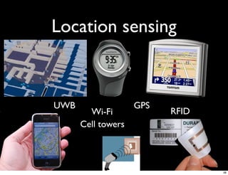
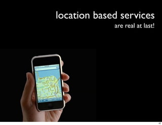
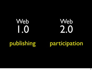
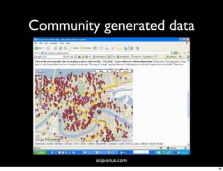
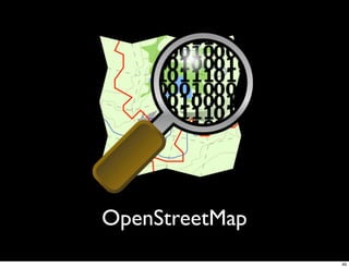
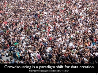
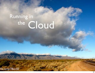
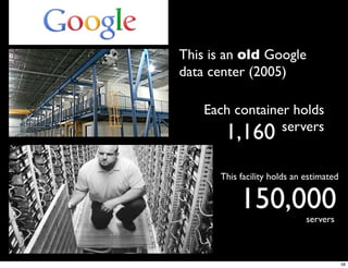
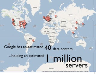
The Geospatial
  Revolution
   Peter Batty


    December 2010


                    1
2
The Revolution
                 3
4
The
      changing nature
              of geospatial data


                                   5
Crowdsourcing   6
The Cloud


flic.kr/p/7Bzn5E
                          7
The Revolution

                 8
GIS has been a specialized backroom
          technology for many years
                                  9
Players
                                                      Utility GIS


                         Smallworld

            Intergraph

     ESRI
                                      Network modeling

                                      Scalability

                                      Customizability

                                      Utility focus

                                      Non-network apps

                                      “Mainstream” core

                                      New technologies
10
11
flic.kr/p/7A6vVg
             12
flic.kr/p/7NEJzF


 Location is now

             Pervasive and Simple
                  in consumer applications


flic.kr/p/7rnNAD
                                             13
Disruptive technology
    Functionality /
    performance                                                                   og   y
                                                                          h   nol
                                                                    d tec
                                                            h   e
                                                     a blis
                                                  Est                                       Mainstream
                                                                                            Market
                                                                                            requirements


                                                 lo   gy
                                            chno
                                   tiv e te
                          ru   p
                      Dis


                                                                                           Time


                                                                                                           14
Consumer driven innovation


                             15
“But these new
  systems are just
simple web mapping,
  they’re not GIS”


                      16
Demo
       Offline


                17
Mobile too!
Runs on smart phones         … and tablets
 including iPhone…           including iPad


                                              18
19
flic.kr/p/7UjM5T
             20
The changing nature of
   geospatial data


                         21
September 12, 2010
                     22
23
24
25
26
27
28
Microsoft Photosynth
                       29
Google Streetview
                    30
Microsoft “Street Slide”


http://bit.ly/streetside
                                                      31
layar
        32
Blaise Aguera y Arcas at TED 2010


     Something on layar


http://www.ted.com/talks/blaise_aguera.html
                                              33
maps


Manhattan

            34
C3 Technologies


   Las Vegas

                  35
prototypegame.org


   Manhattan
                    36
The Sensor Web


     Need a spatial context to
      make sense of all this
                                 37
Location sensing


UWB                 GPS
        Wi-Fi             RFID
      Cell towers


                                 38
New TomTom traffic   speed dataset
                          derived from

            600 billion
            speed readings from users


                  real time data within
                  3 minutes


                flickr.com/photos/rutlo/3164449930/
                                                39
40
41
location based services
             are real at last!


                                 42
Will have the ability to know where everything is
      - and what is happening - all the time


                                                    43
Crowdsourcing


                44
Web           Web
  1.0           2.0
publishing   participation


                             45
Wikipedia


            46
Hurricane Katrina
    New Orleans
                    47
Community generated data


         scipionus.com
                           48
OpenStreetMap
                49
December 3, 2007


Google                      OpenStreetMap


            July 7, 2009
                                            50
200,000+
                                  300,000+                          users


                                       24m             km of highways


  crazy
                                       34m                    km of ways
          momentum!!
OSM stats from May 2009
NAVTEQ had 18m km of highways in Dec 2007
                                        flickr.com/photos/pimpmasterjazz/2601898276/
                                                                                 51
What about quality?

             Dr Muki Haklay of UCL


“OSM quality is beyond good enough, it is a product
  that can be used for a wide range of activities”


                                 Based on a detailed analysis
                                 http://tinyurl.com/mukiosm
                                                                52
Something on MapQuest / Microsoft OSM


                                        53
Database
                                                                2007 data
  69 countries
  11m miles (18m km) of roads
  18m points of interest
People                             “Creating, maintaining and delivering a
                                comprehensive, high quality map database is a
  Field force 700                multi-step, labor-intensive process. We
  Central production 270        currently employ over 270 employees in our
                                 centralized production facility and a global
  Technology 500                workforce of over 700 geographic analysts in
                                                32 countries”
  Total 3349
Financial
  Revenue $853m (~€604m)
  Data creation & distribution costs       $396m          (~€280m)

                                                                                54
Crowdsourcing is a paradigm shift for data creation
              flickr.com/photos/jamescridland/613445810/
                                                          55
Running in
          the
                  Cloud


flic.kr/p/7Bzn5E
                          56
57
This is an old Google
data center (2005)

    Each container holds
                 servers
       1,160
      This facility holds an estimated


           150,000           servers


                                         58
Google has an estimated   40 data centers…
  …holding an estimated
                          1 million
                                    servers
                                              59
3 billion
searches per day
                   35,000
                   searches per second


                                         60
2 billion   videos per day


                             61
100 million
  monthly users
                  62
one   zillion times more computer science
      PhDs than your company or mine has
                                            63
HUGE
         economies of scale
                              Google
Amazon


               Your IT
             department
                                       64
Save
BIG!!


        flic.kr/p/64kFKH
                          65
EC2 Pricing


September 5, 2010


                    66
My daily quotas (max $5 per day)


46.5 CPU hours            43.2m web requests!
6.5 CPU hours free
                                                        67
My total server costs for development of
            myWorld so far


                13c

                                           68
flic.kr/p/4iCux7


but is it   SECURE???
                                          69
There is a strong case that


      your data
                   is
   more secure
                in the cloud

                               70
Agility


Google Maps had    400
releases in its first 4 years

                               flic.kr/p/7BM8zr
                                            71
Cloud benefits
     Ultra scalable
     Secure
     Major cost savings
      Hardware, admin, upgrades
     Much faster enhancements & fixes


flic.kr/p/7Bzn5E
                                       72
Summary


          73
Fast train?


flic.kr/p/7b5sKd
                                74
The
      changing nature
              of geospatial data


                                   75
flic.kr/p/4vLS2o
                  76
77
Cloud


flic.kr/p/6aJDqo
                          78
79
?
peter.batty@ubisense.net
geothought.blogspot.com
  twitter.com/pmbatty


                           80
Backup
Demo screen shots


                    81
Matches Smallworld styles


                            82
Google basemap gives context


                               83
Google satellite map


                       84
Display attribute data


                         85
Street View gives extra info


                               86
Street View gives extra info


                               87
Street View gives extra info


                               88
Google style one box search


    Something on “Google style search”


                                         89
Autocomplete search


                      90
Autocomplete search


                      91
Reports in search too


                        92
Reports from search


                      93
Google geocoding very flexible


                                94
Google local search


                      95
“Enterprise mashups”


                Outages
                 Trucks
                 WMS
                  CIS
               Smart Grid

                            96
Ability to link to maps


                          97
Click link, no software needed!


                   Demo


                                  98
Different Approaches
to integration


                       flic.kr/p/pWMRk
                                    99
Sparse data      Sparse data


                   Trucks
                  Outages
                     Jobs
                Often don’t need
              detailed “GIS” maps

               KML and GeoRSS
               are good formats

                                    100
KML
                                             is child’s play!
<?xml version="1.0" encoding="UTF-8"?>
<kml xmlns="http://www.opengis.net/kml/2.2">
  <Placemark>
    <name>Simple placemark</name>
    <description>Attached to the ground. Intelligently places itself
        at the height of the underlying terrain.</description>
    <Point>
       <coordinates>-122.0822035425683,37.42228990140251,0</coordinates>
    </Point>
  </Placemark>
</kml>


                                                                           101
So is
<entry>
  <title>M 3.2, Mona Passage</title>
                                                geoRSS
  <link href="http://example.org/2005/09/09/atom01"/>
  <id>urn:uuid:1225c695-cfb8-4ebb-aaaa-80da344efa6a</id>
  <updated>2005-08-17T07:02:32Z</updated>
  <summary>We just had a big one.</summary>
  <georss:point>45.256 -71.92</georss:point>
</entry>
                                                               102
You can use KML in lots of places
    KML uploaded to GeoCommons and used for thematic mapping
                                                               103
KML
flic.kr/p/8eZBZk


                                    The Good


 Simple
 Good for sparse and dynamic data
 Works with multiple platforms / products
                                            104
KML
                         The Bad

                         Hard to match
                             GIS styles

                  Hard to scale to large
                          data volumes
flic.kr/p/6hwSwn
                                           105
Dense Data

             106
Raster map tiles


Pre-render maps into image files
Approach used by Google, Microsoft, etc
Very high performance and scalability
Easy to integrate with Google Maps etc

                                          107
“If a dataset available on the web is in
   a format that can't be indexed by
    Google, does it make a sound?”

             Kevin Wiebe
             Safe Software


                                           108
109
110
111
112
113
…/a2e/data/datasources/Pole/90974


REST APIs
                                    114
…/a2e/data/datasources/Pole/90974?f=gjson


REST APIs: simple and powerful
                                                115
…/a2e/data/datasources/Pole/search?f=gjson
    &lat=42.600&lon=-76.1780&d=4


                                             116
REST is good!!

     <Picture of Jason>   Jason Birch
                          City of Nanaimo


                                        117
“Neo GIS” examples


                     118
Cartography


Andy Allan, Cloudmade

                   119
120
Data creation and maintenance


                Upcoming Mapzen editor
                           Cloudmade
                                    121
Data creation and maintenance


     “Walking Papers” for OpenStreetMap       Stamen Design
Here’s a print of Chinatown, San Francisco.                   122
Geospatial
  analysis
 Stamen Design
                 123
Geospatial analysis
 FortiusOne / GeoCommons
                       124
Usability


            flic.kr/p/kjwKm
                        125
Usability


            flic.kr/p/kjwKm
                        126
I highly recommend
this book


                     127
My   top 3   rules
                       for good usability

1   Do usability testing

    2   Do usability testing

         3   Do usability testing

                                            128
Doing a usability test


Put application in      Shut up            Watch
  front of user


  flic.kr/p/7UqPo1    flic.kr/p/53WUkg   flic.kr/p/72M6L
                                                        129
130
131
Don’t make me think


Krug’s first law of usability   flic.kr/p/28o3cz
                                            132
133
134
135
136
137
138
139

The Geospatial Revolution ANZ 2010