The document summarizes events and activities at a co-working space called the Hub for the month of July 2010. It includes a summer party, movie nights, member spotlights, talks on various topics, and a popcorn experiment for idea sharing. The space will have condensed opening hours but remain open late on Tuesdays to accommodate members.
The team explored different directions for their camera project, focusing on domains like music, cooking, physical therapy, and storytelling. They decided to focus on using the camera's voice recognition and sound output capabilities to enhance storytelling. The camera would produce sounds related to actions or environments described in stories in response to trigger words, images, gestures, or sounds. At a subsequent make session, the team further refined their idea to focus on adding ambiance to an environment using sound and movement in response to music.
DRCOG: The Geospatial Revolution Peter BattyPeter Batty
Presentation at DRCOG in Denver on the Geospatial Revolution. Some additional material on data sharing compared to previous versions of the same talk (but a lot of common material)
Smallworld and Google: the best of both worldsPeter Batty
Presentation at the Smallworld User Conference in Baltimore, September 2010. Discusses work we have done to integrate Smallworld with Google Maps and create a very easy to use application which can access complex utility network data in a simple way. Also discusses advantages of running in the cloud and usability.
The Geospatial Revolution - AGI GeoCommunity keynotePeter Batty
The document discusses the growing mainstream adoption of geospatial technologies. It notes that geospatial data is now easily accessible and integrated into many applications as just another data type. Crowdsourcing of geospatial data through projects like OpenStreetMap is allowing much more comprehensive and up-to-date maps to be created at a fraction of the traditional cost. The widespread availability of location sensing technologies and real-time geospatial data is enabling new applications and use cases across many domains.
GITA PNW keynote presentation: Openness in GeospatialPeter Batty
Presentation on different aspects of openness in geospatial. Just a few minor changes compared to my presentation on the same topic in Nottingham a couple of weeks before.
Closing plenary talk at the AGI geocommunity conference immediately prior to FOSS4G 2013 in Nottingham. On various aspects of open geospatial, but especially on Open Source.
Enterprise integration options with SmallworldPeter Batty
The document discusses various options for integrating Smallworld with external data sources. It covers database integration using technologies like database syncing, web services, and EAI. It also discusses map integration standards like OGC/WMS and approaches like generating pre-rendered map tiles that can be overlaid from different sources. REST and tile-based approaches are highlighted as being simple, scalable ways to integrate data and maps across platforms.
Enterprise integration options with SmallworldPeter Batty
The document discusses various options for integrating databases and mapping technologies with Smallworld, including database integration, data integration, and map integration. It covers database types, importing data, database synchronization, web services, EAI, OGC/WMS standards, REST APIs, and tile services. The presentation examines challenges around connecting different data silos and typical integration solutions like enterprise application integration.
This document discusses how geospatial technologies are becoming ubiquitous. It notes that location data is now widely available through mobile devices and sensors and that crowdsourcing is enabling new forms of user-generated geospatial data and mapping. Open source geospatial software is also becoming more full-featured and able to support many traditional GIS functions. Cloud computing is further reducing barriers to accessing geospatial capabilities. Overall, the document argues that geospatial analysis and mapping are no longer limited to specialized applications or users and have become possible everywhere.
The document summarizes attendance data from past FOSS4G conferences between 2006 and 2011. It shows line graphs depicting rising attendance numbers, with 902 attendees in Denver 2011 being the highest. Pie charts show the geographical distribution of attendees, with North America making up 76% and Europe 18%. The US alone accounted for 612 attendees. The document discusses the collaborative and educational nature of the conferences in bringing together the 'meeting of the tribes' in open source geospatial technologies. It provides information on the local organizing committee and sponsors for FOSS4G 2011 in Denver.
OpenStreetMap (OSM) is a crowdsourced map of the world. It began in 2007 and has grown significantly since then, with over 18 million miles of roads mapped by over 700 contributors. OSM data quality has been found to be high enough for many uses. The Humanitarian OSM Team uses OSM for disaster response. OSM is used in many mobile applications and for routing. The future of OSM includes managing trust, licensing issues, and monetizing through mobile applications.
Presentation I gave at the Denver OpenStreetMap meetup in June 2011. A bit of something for everyone - some intro slides for newbies and assorted examples of (mainly) new and interesting applications, data usage and development tools.
My first presentation at WhereCamp EU, relating to the work we're doing with Ubisense myWorld. In the title G=Google and the question has two meanings ... if you're a traditional GIS user, should you be using Google Maps or something similar (answer=yes), and given that, should you be using Google specifically (answer is it depends ... we no longer use Google App Engine, we do use Google Maps but have been testing OpenLayers for offline applications).
Precision (Indoor) Real Time Location SystemsPeter Batty
This document summarizes an indoor real-time location system (RTLS) using ultrawideband (UWB) technology. It can track tags with 15cm accuracy. The system uses sensors to detect time-of-arrival of UWB signals from tags to determine precise 3D locations. Example applications discussed include tracking assets in manufacturing plants and ports with accuracy better than WiFi and RFID. The system has also been used to track soldiers in military training exercises, track vehicles and tools at BMW, and monitor dairy cows on farms.
UbisensemyWorld is a new location-based software solution that provides a simple and scalable way to access and update spatial data from Smallworld and other sources. It uses open standards and leverages trends in mobile, wireless access, and augmented reality to provide value at a low cost of ownership. The demo showed how users can access maps and asset information from smartphones both online and offline. The roadmap outlines plans to enhance integration with Smallworld, improve search and update workflows, customize outputs, and expand mobile capabilities.
Smallworld and Google: the best of both worldsPeter Batty
My presentation at the Smallworld User Conference in Baltimore, talking about the benefits of combining the strengths of Smallworld and Google Maps (the work we are doing with Ubisense myWorld).
My keynote presentation at the GITA Geospatial Solutions Conference in Dallas, April 2011. The talk is on the theme of simplicity and includes a look back at how things have changed over the lifetime of the GITA conference.
This document discusses the benefits of using cloud computing for geospatial applications and services. It notes that complexity is reduced by moving to the cloud. Examples are given of existing geospatial applications and services that are cloud-based, like Google Fusion Tables and OpenGeo on Amazon. Benefits of the cloud include scalability, lower costs due to large economies of scale of major cloud providers, and faster development cycles. Security in the cloud is also discussed as potentially better than traditional on-premise IT systems.
Latest iteration of my Geospatial Revolution talk that I've been using on my down under tour. Includes various cricket slides, probably comprehensible only to Aussies and Pommies :) !!
This document discusses usability best practices for web and mobile applications. It recommends doing usability testing, removing unnecessary words, and following conventions. It also provides examples of how ArcGIS mobile apps have good usability and how REST APIs can provide simple and powerful mapping capabilities similar to Google Maps.
GIS in the Rockies Geospatial RevolutionPeter Batty
GIS in the Rockies keynote presentation, September 15 in Loveland, CO. Much common content but slightly longer than the one I gave at NSGIC a couple of days previously.
OpenStreetMap is a free editable map of the world created by volunteers. It began in 2004 as an alternative to proprietary map data. The summary provides high-level information about OpenStreetMap's origins, growth, and importance. Over 260,000 registered users have mapped over 18 million points of interest and 11 million miles of roads across 69 countries. Analysis has found OpenStreetMap data to be of high enough quality to be used for many purposes. It is created through crowdsourcing rather than centralized production, representing a paradigm shift for data creation.
Generative AI Deep Dive: Advancing from Proof of Concept to ProductionAggregage
Join Maher Hanafi, VP of Engineering at Betterworks, in this new session where he'll share a practical framework to transform Gen AI prototypes into impactful products! He'll delve into the complexities of data collection and management, model selection and optimization, and ensuring security, scalability, and responsible use.
Communications Mining Series - Zero to Hero - Session 1DianaGray10
This session provides introduction to UiPath Communication Mining, importance and platform overview. You will acquire a good understand of the phases in Communication Mining as we go over the platform with you. Topics covered:
• Communication Mining Overview
• Why is it important?
• How can it help today’s business and the benefits
• Phases in Communication Mining
• Demo on Platform overview
• Q/A
Observability Concepts EVERY Developer Should Know -- DeveloperWeek Europe.pdfPaige Cruz
Monitoring and observability aren’t traditionally found in software curriculums and many of us cobble this knowledge together from whatever vendor or ecosystem we were first introduced to and whatever is a part of your current company’s observability stack.
While the dev and ops silo continues to crumble….many organizations still relegate monitoring & observability as the purview of ops, infra and SRE teams. This is a mistake - achieving a highly observable system requires collaboration up and down the stack.
I, a former op, would like to extend an invitation to all application developers to join the observability party will share these foundational concepts to build on:
GraphSummit Singapore | The Future of Agility: Supercharging Digital Transfor...Neo4j
Leonard Jayamohan, Partner & Generative AI Lead, Deloitte
This keynote will reveal how Deloitte leverages Neo4j’s graph power for groundbreaking digital twin solutions, achieving a staggering 100x performance boost. Discover the essential role knowledge graphs play in successful generative AI implementations. Plus, get an exclusive look at an innovative Neo4j + Generative AI solution Deloitte is developing in-house.
Alt. GDG Cloud Southlake #33: Boule & Rebala: Effective AppSec in SDLC using ...James Anderson
Effective Application Security in Software Delivery lifecycle using Deployment Firewall and DBOM
The modern software delivery process (or the CI/CD process) includes many tools, distributed teams, open-source code, and cloud platforms. Constant focus on speed to release software to market, along with the traditional slow and manual security checks has caused gaps in continuous security as an important piece in the software supply chain. Today organizations feel more susceptible to external and internal cyber threats due to the vast attack surface in their applications supply chain and the lack of end-to-end governance and risk management.
The software team must secure its software delivery process to avoid vulnerability and security breaches. This needs to be achieved with existing tool chains and without extensive rework of the delivery processes. This talk will present strategies and techniques for providing visibility into the true risk of the existing vulnerabilities, preventing the introduction of security issues in the software, resolving vulnerabilities in production environments quickly, and capturing the deployment bill of materials (DBOM).
Speakers:
Bob Boule
Robert Boule is a technology enthusiast with PASSION for technology and making things work along with a knack for helping others understand how things work. He comes with around 20 years of solution engineering experience in application security, software continuous delivery, and SaaS platforms. He is known for his dynamic presentations in CI/CD and application security integrated in software delivery lifecycle.
Gopinath Rebala
Gopinath Rebala is the CTO of OpsMx, where he has overall responsibility for the machine learning and data processing architectures for Secure Software Delivery. Gopi also has a strong connection with our customers, leading design and architecture for strategic implementations. Gopi is a frequent speaker and well-known leader in continuous delivery and integrating security into software delivery.
Unlock the Future of Search with MongoDB Atlas_ Vector Search Unleashed.pdfMalak Abu Hammad
Discover how MongoDB Atlas and vector search technology can revolutionize your application's search capabilities. This comprehensive presentation covers:
* What is Vector Search?
* Importance and benefits of vector search
* Practical use cases across various industries
* Step-by-step implementation guide
* Live demos with code snippets
* Enhancing LLM capabilities with vector search
* Best practices and optimization strategies
Perfect for developers, AI enthusiasts, and tech leaders. Learn how to leverage MongoDB Atlas to deliver highly relevant, context-aware search results, transforming your data retrieval process. Stay ahead in tech innovation and maximize the potential of your applications.
#MongoDB #VectorSearch #AI #SemanticSearch #TechInnovation #DataScience #LLM #MachineLearning #SearchTechnology
Securing your Kubernetes cluster_ a step-by-step guide to success !KatiaHIMEUR1
Today, after several years of existence, an extremely active community and an ultra-dynamic ecosystem, Kubernetes has established itself as the de facto standard in container orchestration. Thanks to a wide range of managed services, it has never been so easy to set up a ready-to-use Kubernetes cluster.
However, this ease of use means that the subject of security in Kubernetes is often left for later, or even neglected. This exposes companies to significant risks.
In this talk, I'll show you step-by-step how to secure your Kubernetes cluster for greater peace of mind and reliability.
Goodbye Windows 11: Make Way for Nitrux Linux 3.5.0!SOFTTECHHUB
As the digital landscape continually evolves, operating systems play a critical role in shaping user experiences and productivity. The launch of Nitrux Linux 3.5.0 marks a significant milestone, offering a robust alternative to traditional systems such as Windows 11. This article delves into the essence of Nitrux Linux 3.5.0, exploring its unique features, advantages, and how it stands as a compelling choice for both casual users and tech enthusiasts.
Unlocking Productivity: Leveraging the Potential of Copilot in Microsoft 365, a presentation by Christoforos Vlachos, Senior Solutions Manager – Modern Workplace, Uni Systems
In the rapidly evolving landscape of technologies, XML continues to play a vital role in structuring, storing, and transporting data across diverse systems. The recent advancements in artificial intelligence (AI) present new methodologies for enhancing XML development workflows, introducing efficiency, automation, and intelligent capabilities. This presentation will outline the scope and perspective of utilizing AI in XML development. The potential benefits and the possible pitfalls will be highlighted, providing a balanced view of the subject.
We will explore the capabilities of AI in understanding XML markup languages and autonomously creating structured XML content. Additionally, we will examine the capacity of AI to enrich plain text with appropriate XML markup. Practical examples and methodological guidelines will be provided to elucidate how AI can be effectively prompted to interpret and generate accurate XML markup.
Further emphasis will be placed on the role of AI in developing XSLT, or schemas such as XSD and Schematron. We will address the techniques and strategies adopted to create prompts for generating code, explaining code, or refactoring the code, and the results achieved.
The discussion will extend to how AI can be used to transform XML content. In particular, the focus will be on the use of AI XPath extension functions in XSLT, Schematron, Schematron Quick Fixes, or for XML content refactoring.
The presentation aims to deliver a comprehensive overview of AI usage in XML development, providing attendees with the necessary knowledge to make informed decisions. Whether you’re at the early stages of adopting AI or considering integrating it in advanced XML development, this presentation will cover all levels of expertise.
By highlighting the potential advantages and challenges of integrating AI with XML development tools and languages, the presentation seeks to inspire thoughtful conversation around the future of XML development. We’ll not only delve into the technical aspects of AI-powered XML development but also discuss practical implications and possible future directions.
UiPath Test Automation using UiPath Test Suite series, part 5DianaGray10
Welcome to UiPath Test Automation using UiPath Test Suite series part 5. In this session, we will cover CI/CD with devops.
Topics covered:
CI/CD with in UiPath
End-to-end overview of CI/CD pipeline with Azure devops
Speaker:
Lyndsey Byblow, Test Suite Sales Engineer @ UiPath, Inc.
How to Get CNIC Information System with Paksim Ga.pptxdanishmna97
Pakdata Cf is a groundbreaking system designed to streamline and facilitate access to CNIC information. This innovative platform leverages advanced technology to provide users with efficient and secure access to their CNIC details.
Sudheer Mechineni, Head of Application Frameworks, Standard Chartered Bank
Discover how Standard Chartered Bank harnessed the power of Neo4j to transform complex data access challenges into a dynamic, scalable graph database solution. This keynote will cover their journey from initial adoption to deploying a fully automated, enterprise-grade causal cluster, highlighting key strategies for modelling organisational changes and ensuring robust disaster recovery. Learn how these innovations have not only enhanced Standard Chartered Bank’s data infrastructure but also positioned them as pioneers in the banking sector’s adoption of graph technology.
Why You Should Replace Windows 11 with Nitrux Linux 3.5.0 for enhanced perfor...SOFTTECHHUB
The choice of an operating system plays a pivotal role in shaping our computing experience. For decades, Microsoft's Windows has dominated the market, offering a familiar and widely adopted platform for personal and professional use. However, as technological advancements continue to push the boundaries of innovation, alternative operating systems have emerged, challenging the status quo and offering users a fresh perspective on computing.
One such alternative that has garnered significant attention and acclaim is Nitrux Linux 3.5.0, a sleek, powerful, and user-friendly Linux distribution that promises to redefine the way we interact with our devices. With its focus on performance, security, and customization, Nitrux Linux presents a compelling case for those seeking to break free from the constraints of proprietary software and embrace the freedom and flexibility of open-source computing.
UiPath Test Automation using UiPath Test Suite series, part 6DianaGray10
Welcome to UiPath Test Automation using UiPath Test Suite series part 6. In this session, we will cover Test Automation with generative AI and Open AI.
UiPath Test Automation with generative AI and Open AI webinar offers an in-depth exploration of leveraging cutting-edge technologies for test automation within the UiPath platform. Attendees will delve into the integration of generative AI, a test automation solution, with Open AI advanced natural language processing capabilities.
Throughout the session, participants will discover how this synergy empowers testers to automate repetitive tasks, enhance testing accuracy, and expedite the software testing life cycle. Topics covered include the seamless integration process, practical use cases, and the benefits of harnessing AI-driven automation for UiPath testing initiatives. By attending this webinar, testers, and automation professionals can gain valuable insights into harnessing the power of AI to optimize their test automation workflows within the UiPath ecosystem, ultimately driving efficiency and quality in software development processes.
What will you get from this session?
1. Insights into integrating generative AI.
2. Understanding how this integration enhances test automation within the UiPath platform
3. Practical demonstrations
4. Exploration of real-world use cases illustrating the benefits of AI-driven test automation for UiPath
Topics covered:
What is generative AI
Test Automation with generative AI and Open AI.
UiPath integration with generative AI
Speaker:
Deepak Rai, Automation Practice Lead, Boundaryless Group and UiPath MVP
UiPath Test Automation using UiPath Test Suite series, part 6
Building a new location-aware infrastructure for calendaring and scheduling
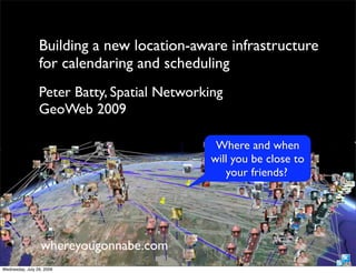
1. Building a new location-aware infrastructure
for calendaring and scheduling
Peter Batty, Spatial Networking
GeoWeb 2009
Where and when
will you be close to
your friends?
whereyougonnabe.com!
Wednesday, July 29, 2009
7. Benefits
• Meet friends / business contacts more often
and more easily
• Make better use of time
• Save travel costs
• Environmental benefits
Wednesday, July 29, 2009
8. Key Challenges
• Modeling (fine grained) future space-time
• Obtaining data on future plans
• Notification & Visualization
Wednesday, July 29, 2009
10. Coarse grained future location
Where is “close” to
San Jose in Dopplr?
Novato
75 miles, 2+ hours in traffic
= “CLOSE”
“Proximity” is based
on closest “big” city
Los Gatos
10 miles, 15 minutes
= “NOT CLOSE”
Wednesday, July 29, 2009
11. Fine grained
future location
Wednesday, July 29, 2009
12. Overlapping activities!
Lunch (Bella Mia Drinks (Splash Bar
Restaurant)! & Grill)!
Time!
Repeating activities!
Work!
Time!
Wednesday, July 29, 2009
13. Maybe? Probably? Either ... or? Uncertainty and
alternatives
Linear activities
Road trips
Train journeys
Wednesday, July 29, 2009
14. Obtaining data on future plans
Direct input Calendar
Other location
systems
Wednesday, July 29, 2009
15. Obtaining data on future plans
Travel bookings Restaurant Invitations &
reservations Events
Tickets
Wednesday, July 29, 2009
16. Outlook add-in
Email whereyougonnabe
Calendar
Full automation
The implicit web
Wednesday, July 29, 2009
17. Multiple
data sources
Departing at Denver Airport
Jul 22, 9:06am to 11:06am
Flying Denver to Vancouver
Jul 22, 11:06am to 1:15pm
Arriving Vancouver Airport
Jul 22, 1:15pm to 2:15pm
Driving Vancouver to Whistler
Jul 22, 2:15pm to 4:30pm
Mountain biking vacation at Fairmont
Whistler
Jul 22 4:30pm to Jul 25 10:51am
Driving Whistler to Vancouver
Jul 25 10:51am to 1:06pm
Departing at Vancouver Airport
Jul 25 1:06pm to 3:06pm
Flying Vancouver to Denver
Jul 25 3:06pm to 6:55pm
Arriving at Denver Airport
Jul 25, 6:55pm to 7:55pm
Wednesday, July 29, 2009
19. Factors in
“interestingness”
Geographical
Distance apart
Temporal
Distance
Length of activity
from home
Distance Availability
from home Nature of activity
Adjacent activities
Distance between homes Personal
Preferences re this person
When did you last meet?
Wednesday, July 29, 2009
37. Hosting options
Running in the cloud
Physical hosting
Virtual hosting
Elastic hosting (Amazon)
Application hosting (Google App Engine)
http://www.flickr.com/photos/glennharper/36001149/
Wednesday, July 29, 2009
38. Running your company
in the cloud
Source control (cvsdude.com)
Documentation (various wikis)
Development management (e.g. rallydev.com)
Project management (e.g. basecamp)
Email, calendar etc (Google apps)
Finances (QuickBooks online, vcfo)
http://www.flickr.com/photos/glennharper/36001149/
Wednesday, July 29, 2009
39. Performance
Testing
210,245 users
(5 per zip code)
21MB data, 17MB index
33,579,939
friend relationships
(30-300 per user)
1286MB data, 631MB index
1,198,639 activities
(5-10 per user, 1 week period)
111MB data, 95MB index
Used free zip code data to generate database
Wednesday, July 29, 2009
40. Performance findings
• Very impressed with PostGIS
• 2D or 3D indexing? 2D for now
• Partition tables by time? No
• Segment geographically? No
• Specific SQL can have a big impact
• Mix of explicit storage and dynamic calculation
Confident we can scale to millions of users
Wednesday, July 29, 2009
46. Graphic on “freezing”
flickr.com/photos/jeremybarwick/3536348957/
Wednesday, July 29, 2009
47. We will bounce back!
http://www.flickr.com/photos/timusan/507493823/
Wednesday, July 29, 2009
48. Summary
• Continue to believe there is a big
opportunity in the future location space
• Location aware calendar
• People
• Events
• Looking at options going forward
Wednesday, July 29, 2009