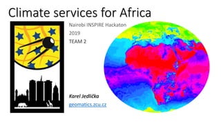
This document discusses a team's idea to demonstrate using meteorological data to help African farmers. They propose a use case of a farmer getting climate services to help with maize cultivation, including receiving alerts about insect pests, recommendations for nitrogen fertilization, and a growth plan based on planting dates and expected yields. The team outlines how these services could be provided using various data sources and models, and communicated to farmers through websites, apps, SMS, calls, or in-person contacts. Future work includes further developing concepts and discussing with stakeholders.
Quantifying trends of rainfall and temperature extremes over Central Tanzania...africa-rising
Poster prepared by Francis Muthoni, Exavery Kigosi and Shitindi Mawazo for the Africa RISING ESA Project Review and Planning Meeting, Dar es Salaam, Tanzania, 11-12 September 2019.
Cropland extent of South Asia @ 30 m resolution using time series Landsat dat...ICRISAT
Though South Asia has one of the largest cropland area as well as irrigated area, the region runs the risk of becoming food insecure because of its rapidly growing population. Information on the spatial distribution of agriculture and irrigation is crucial for policy making affecting sustainable agriculture and food security. Current low resolution crop extent datasets are inadequate in providing a complete and accurate picture of cropland. Detailed spatial distribution of croplands and agricultural water use at high spatial resolution are critical baseline data to understand crop and water dynamics, and to generate higher level products like crop type maps and biomass and yield assessments, which will aid decision making and planning for food security.
Agrohacks - Down To Earth ~ a tool alerting farmers about forecasted severe w...plan4all
Presentation of the #SanJuanINSPIREHackathon winning team, showing their project: Bajada a Tierra (Down To Earth) ~ a tool alerting farmers about forecasted severe weather conditions.
Calculation of agro climatic factors from global climatic dataplan4all
Authors: Pavel Hájek,
Raitis Berzins , Jiří Valeš, Martin Pitoňák , Vincent
Onckelet , Tomáš Andrš, Veronika Osmiková , Ronald
Ssembajwe , Amit Kirschenbaum , Jörg Schliesser , Michal Kepka & Karel Jedlička
Big Data for Building Inclusive Agriculture in Dry Areas ICARDA
25 to 30 August. The World Water Week in Stockholm is an annual focal point for the globe’s water issues. Organized by the Stockholm International Water Institute (SIWI), and supported by the United Nations water programs.
Wednesday 28 August
“Big data for all”, can it help improve agricultural productivity?
The REDD-pac project and Globiom BrazilCIFOR-ICRAF
This presentation shows how land use models can be used for policy evaluation, what the Globiom Model is and what Globiom in Brazil does. Also it will give some preliminary results concerning forest evolution and draw conclusions from that.
As part of the final BETTER Hackathon, project partners prepared 4 hackathon exercises. WFP organised this exercise as the challenge promoter for the Food Security thematic area.
This open exercise featured the use of Binder and purposely provided cloud resources. Participants were expected to be familiar with the Jupyter environment (Python 3) and the most common EO libraries (e.g. GDAL) and were guided to use their favourite approach (e.g. pixel-based or object-based classification) to derive a crop type map for the region using the following combinations of datasets: S2 unfiltered – benchmark, S2 filtered, S2 unfiltered + SAR, S2 filtered + SAR. Libraries used included Rasterio / GDAL, pandas + numpy, scipy, numba, keras / tensorflow / opencv. The recorded part includes the introduction of the exercise in the context of the BETTER project.
SarVision is a spin-off from Wageningen University and Research, and a pioneer in the operational application of systematic satellite and airborne monitoring and mapping systems for environmental and natural resource management. Our innovative systems provide our partners with the latest maps and information on land and forest cover, change, fire and hydrology, updated on a regular basis. In this workshop, we will focus on the value of nature. How can we combine satellite technology with accounting, in order to enhance spatial planning and sustainable land management? During this workshop we will collectively explore natural capital bookkeeping as a way to gain better insight in the value of nature, and how this can be translated into national accounting as well as spatial planning mechanisms. Money for Nature, that is what we want to focus on.
ICRISAT Governing Board 2019 PC meeting: District Level Database for India an...ICRISAT
ICRISAT has started collating meso level database (country, state and district level) since 1980’s, covering 7 states initially, later expanded to 10 states in 1990’s. Currently under a project jointly supported by Tata Cornell Institute on Nutrition and Agriculture (TCI) and ICRISAT (Since May 2018).
Choice and usage of optimum tractor power and agricultural machinery size is important to decrease cost and complete agricultural operations in available time. Improper size machinery increases the production costs in the farms. Determination of optimum tractor power and machinery size is a tedious and complex procedure that requires many calculations and computational work. In this study, a Microsoft office 2016 software was developed to enable the model and imitate different conditions to determine optimum size of farm machinery and power considering all parameters for selection of farm machinery base on “the least cost method” for Sikkim. The program developed in this study was applied to the representative farm size and crops such as buck wheat, rice, and maize.
Varieties with diverse maturity class,
Striga and drought-tolerant maize varieties
Soil fertility management technologies
Good agronomic practices e.g. planting dates
At the FAO Workshop, held in Panama City on August 6 - 8th the CGIAR Research Program on Climate Change, Agriculture and Food Security (CCAFS), Head of Research James Hansen gave a presentation on CRAFT tool. More info: http://ow.ly/ocIqJ
Commercial & research landscape for smart irrigation systems. A survey of commercial product offerings, research prototypes and approaches to smart irrigation. I also cover the why there is such a dire need to conserve water and increase yield.
Linking satellite imagery and crop modeling for integrated assessment of clim...ICRISAT
Crop simulation models are valuable tools for evaluating potential effects of environmental, biological and management factors on crop growth and developments. These models need to be applied at larger scales in order to be economically useful so that the effects of various alternate management strategies across the watershed or the region could be analyzed. Linking crop models with Remote sensing and Geographical Information System (GIS) have demonstrated a strong feasibility of crop modeling applications at a spatial scale.
“Connecting data streams to make irrigation science easier to implement” by Justin Gibson at the 2023 Water for Food Global Conference. A recording of the presentation can be found on the conference playlist: https://youtube.com/playlist?list=PLSBeKOIXsg3JNyPowwJj6NDSpx4vlnCYj.
Using well-established empirical and mechanistic models such as Ecocrop, Maxent, DSSAT to assess the impact of climate change on productivity and climate-suitability of crops and production systems.
Comparison Analysis of Oil Crop Yield Prediction in Magway Region using Machi...eieimoetun2
Agriculture assumes a predominant job in the development of the nation's economy. In the Myanmar economy, agriculture is the fundamental help and the major financial division of the nation. The atmosphere and other natural changes have become a significant danger in the agribusiness field. Machine Learning is a fundamental methodology for accomplishing pragmatic and powerful answers to this issue. Oil Crop Yield Prediction includes foreseeing the yield of the oil crop from accessible chronicled accessible information like climate boundary, soil boundary, and noteworthy harvest yield. This paper focuses on foreseeing the yield of the harvest depends on the current information by utilizing a machine learning algorithm. Real data of the Magway region were utilized for building the models and the models were tested with samples. The prediction will assist the rancher in predicting the yield of the crop before developing onto the agriculture field. To anticipate the crop yield in future precisely machine learning tools, a generally incredible and well known managed ML algorithm is utilized. This research is executed as a framework to anticipate crop yield from past information. This is accomplished by applying three machine learning techniques, for example, Neural Networks, Support Vector Machines, and Decision Tree strategies for oil crop information in the Magway region. Oil crops in the Magway district are sesame, groundnut, and some sunflower. The exploration is expected to assist farmers in predicting the yield of the crop before developing onto the agribusiness field. The proposed framework is intended to arrive at smart farming for Myanmar agriculture.
This presentation by Mitch Maguire, a master's student at the University of Nebraska-Lincoln, was presented at the Daugherty Water for Food Global Institute’s Research Forum on Thursday, May 11, 2017. Mitch is a 2016-2017 student support grantee of the Institute.
Agrihub INSPIRE Hackathon 2021: Challenge #7: Analysis, processing and standa...plan4all
This is a presentation of results of Challenge #7: Analysis, processing and standardisation of data from agriculture machinery for easier utilization by farmers of the Agrihub INSPIRE Hackathon 2021.
Digitalization of indigenous knowledge in African agriculture for fostering f...plan4all
Authors:
Antoine Kantiza, AKANTIZA CONSULT, Burundi
Didier Muyiramye, Swedish University of Agricultural Sciences, Rwanda
Elias Cherenet Weldemariam, HARAMAYA UNIVERSITY, Ethiopia
Petr Horak, WIRELESSINFO, Czech Republic
Robert Sabimana, Frutus Fresco Ltd, Uganda
Pavel Hajek, West Bohemia University, Czech Republic
Tuula Löytty, Smart & Lean Hub Oy, Finland
Demet Osmancelebioglu, Smart & Lean Hub Oy, Finland
Karel charvat map-compositions-format-intro-presentation-by-karel (1)plan4all
Karel Charvat on behalf of Plan4all, Lesprojekt, BOSC and Asplan Viak gave a presentation about the project to create a Google Docs-like map application and map composition format.
Karel charvat map-whiteboard-collaborative-map-making-breakout-sessionplan4all
Karel Charvat on behalf of Plan4all, Lesprojekt, BOSC and Asplan Viak gave a presentation about the project to create a Google Docs-like map application and map composition format.
Artificial Reefs by Kuddle Life Foundation - May 2024punit537210
Situated in Pondicherry, India, Kuddle Life Foundation is a charitable, non-profit and non-governmental organization (NGO) dedicated to improving the living standards of coastal communities and simultaneously placing a strong emphasis on the protection of marine ecosystems.
One of the key areas we work in is Artificial Reefs. This presentation captures our journey so far and our learnings. We hope you get as excited about marine conservation and artificial reefs as we are.
Please visit our website: https://kuddlelife.org
Our Instagram channel:
@kuddlelifefoundation
Our Linkedin Page:
https://www.linkedin.com/company/kuddlelifefoundation/
and write to us if you have any questions:
info@kuddlelife.org
"Understanding the Carbon Cycle: Processes, Human Impacts, and Strategies for...MMariSelvam4
The carbon cycle is a critical component of Earth's environmental system, governing the movement and transformation of carbon through various reservoirs, including the atmosphere, oceans, soil, and living organisms. This complex cycle involves several key processes such as photosynthesis, respiration, decomposition, and carbon sequestration, each contributing to the regulation of carbon levels on the planet.
Human activities, particularly fossil fuel combustion and deforestation, have significantly altered the natural carbon cycle, leading to increased atmospheric carbon dioxide concentrations and driving climate change. Understanding the intricacies of the carbon cycle is essential for assessing the impacts of these changes and developing effective mitigation strategies.
By studying the carbon cycle, scientists can identify carbon sources and sinks, measure carbon fluxes, and predict future trends. This knowledge is crucial for crafting policies aimed at reducing carbon emissions, enhancing carbon storage, and promoting sustainable practices. The carbon cycle's interplay with climate systems, ecosystems, and human activities underscores its importance in maintaining a stable and healthy planet.
In-depth exploration of the carbon cycle reveals the delicate balance required to sustain life and the urgent need to address anthropogenic influences. Through research, education, and policy, we can work towards restoring equilibrium in the carbon cycle and ensuring a sustainable future for generations to come.
Natural farming @ Dr. Siddhartha S. Jena.pptxsidjena70
A brief about organic farming/ Natural farming/ Zero budget natural farming/ Subash Palekar Natural farming which keeps us and environment safe and healthy. Next gen Agricultural practices of chemical free farming.
UNDERSTANDING WHAT GREEN WASHING IS!.pdfJulietMogola
Many companies today use green washing to lure the public into thinking they are conserving the environment but in real sense they are doing more harm. There have been such several cases from very big companies here in Kenya and also globally. This ranges from various sectors from manufacturing and goes to consumer products. Educating people on greenwashing will enable people to make better choices based on their analysis and not on what they see on marketing sites.
Characterization and the Kinetics of drying at the drying oven and with micro...Open Access Research Paper
The objective of this work is to contribute to valorization de Nephelium lappaceum by the characterization of kinetics of drying of seeds of Nephelium lappaceum. The seeds were dehydrated until a constant mass respectively in a drying oven and a microwawe oven. The temperatures and the powers of drying are respectively: 50, 60 and 70°C and 140, 280 and 420 W. The results show that the curves of drying of seeds of Nephelium lappaceum do not present a phase of constant kinetics. The coefficients of diffusion vary between 2.09.10-8 to 2.98. 10-8m-2/s in the interval of 50°C at 70°C and between 4.83×10-07 at 9.04×10-07 m-8/s for the powers going of 140 W with 420 W the relation between Arrhenius and a value of energy of activation of 16.49 kJ. mol-1 expressed the effect of the temperature on effective diffusivity.
WRI’s brand new “Food Service Playbook for Promoting Sustainable Food Choices” gives food service operators the very latest strategies for creating dining environments that empower consumers to choose sustainable, plant-rich dishes. This research builds off our first guide for food service, now with industry experience and insights from nearly 350 academic trials.
6. Idea
• Aim ~ demonstrate options of meteorological data exploitation for
the needs of African farmers
• Approach
• Design a clear use case
• Describe processes of the use case
• Outline communication channels to end users
• Constraints
• Short time schedule
• Limited knowledge of local conditions
• Communication channels to the end user
7. Climate data for maize cultivation
• Use case: a farmer plans to plant and cultivate maize on a field
• The farmer can rely on a traditional approach
- or -
• The farmer can use meteorological data
8. Climate data for maize cultivation
• Use case: a farmer uses meteo data to plan maze planting and
cultivation
• The farmer sends a field position to the climate service
• The service provides:
• Growth plan
• Nitrogen plan
• Insect pests alert
What ?
9. Climate data for maize cultivation
• Insect pests alert
• Input
• Position of the field
• Weather forecast (temperatures)
• Process
• Calculation of cumulation of effective
temperatures from weather forecast data
• Output
• A risk ratio of insect pests attack forecast
for upcoming days
How ?
10. Climate data for maize cultivation
• Insect pests alert
• Process
• Connect to Weather Forecast API (meteoblue agriculture API)
• Request 3 days (hour by hour) temperature forecast
• Calculate how many hours in the upcoming 3 days temperature is above 10°C ~ and add
the sum of these temperatures into a EffectiveTemperatureSum variable
• If the EffectiveTemperatureSum exceeds a threshold (e.g. a species need 1400°C of
cumulative heat to evolve) the system stores a timestamp when that is going to happen
How ?
11. Climate data for maize cultivation
• Nitrogen plan
• Inputs
• Position
• (Soil type)
• (Planting day)
• Weather forecast data (temperature, moisture)
• Process
• Searching a date in next 14 days, suitable for fertilisation
(soil moisture higher than a treshold or rain expectation)
• Output
• Dates recommended for nitrogen fertilisation
How ?
12. Climate data for maize cultivation
• Nitrogen plan
• Apply the fertilizer when the soil is (or going to be) moist (asking meteoblue
agriculture API.
• Apply Di-Ammonium Phosphate (DAP) or NPK at a rate of 50 kg per acre at
the planting time.
• Once the crop is about 45 cm high use Calcium Ammonium Nitrate (CAN) at a
rate of 50 kg per acre in low rainfall areas.
• In high rainfall areas, split fertilization in 2 parts. 1. part: 6 weeks after
planting, 2. Part: just before maize flowers.
How ?
13. Climate data for maize cultivation
• Growth plan
• Inputs
• Position
• (Soil type)
• Historic meteorological data
• Area specific maize growth model
• Process
• Analysis of historic meteorologic
data matching conditions defined by the
growth model
• Output
• Table relatig planting date to a likely yield
How ?
14. Climate data for maize cultivation
• Growth plan
• Process
• Simulating yield with a crop model (CERES-Maize, DSSAT) with meteoblue
historical meteorological data.
• Simulation period will be one year by setting manually different “virtually” planting
dates. The CERES model output will be yield as a function of the planting date
respectively planting period.
• This approach can be applied for 30-years historical data provided by meteoblue.
• This leads to an optimized planting date/period as a function of meteorological
parameters (Temperature sums, precipitation, radiation)
• For the actual season, meteorological data of the actual season and the 7-day
forecast are taken into account in order to estimate the optimal planting date.
How ?
15. Climate data for maize cultivation
• EUXDAT e-Infrastructure
• Client side: web based coding
environment
• Jupyter Notebook & Python
• Server side (cloud/HPC):
• GDAL/OGR
• GRASS
• Meteoblue API
• Orfeo
• …
How ?
16. Climate data for maize cultivation
• We can tell farmer
• When to plant
• When to fertilize
• When to put a pesticide
How ?
But How?
17. Climate data for maize cultivation
• Communication channels
• General findings
• Get introduced by a trustworthy person.
• Cooperate with local agriculture trainers, agriculture coordinators, farmers.
• Communicate in local language if possible.
• Proposed channels
• Web page
• mobile app
• SMS
• GSM call
• Personal contact
(trainers)
(farmers, trainers)
(farmers)
(farmers)
How ?
(farmers)
18. Conclusion
• Concept exists, proof of concept ahead
• Next actions
• (euxdat.eu) and StarGate projects
• Discussion continues at bit.ly/Clima4Africa