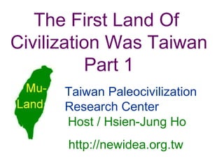
Volcanoes and earthquakes education powerpointShubham Saha
This power point is intended to educate you about volcanoes and earthquakes as it is very easy to understand and very descriptive. This can help you in school projects, work purposes or even just for your knowledge. Enjoy....
1.new terms
2.What is a volcano?
3.How and why do volcanoes erupt?
4.Explosive Eruptions
5.Parts of Volcanoes
6. subduction
7.how are they formed
8.volcanic activity levels
9. types of volcanos
10.SHIELD VOLCANO
11. Mt. Kilauea
12.CINDER CONE VOLCANO
13.COMPOSITE VOLCANO
14.Volcanoes around the world
15.Multiple Eruption volcanoes
made by :RATIKA,Delhi,India
Slides from Madani Sahari's talk on Malaysia's National Automotive Policy (NAP) 2014 & the automotive industry at the Asian Automotive World Class Manufacturing Summit 2015, Jakarta.
Car industry in Vietnam: too fast too pretentiousDI Marketing
Vietnamese automobile market will growth significantly in the next 3 to 5 years, especially in low and medium segment
Find more at:
http://www.di-onlinesurvey.com/
Automotive Intelligence for Professionals: The Malaysia AutoBook includes company profiles of OEM car makers, multinational and local automotive parts suppliers as well as organizations, media and exhibitions.
It also includes detailed statistics about Automotive sales, market share, OEM capacities and information about new programs 2017-20.
The Malaysia AutoBook helps you to find new customers in the Automotive industry in Malaysia.
Thai AutoBook 2015: Thailand Automotive Cluster EditionUli Kaiser
Thai AutoBook 2015: Thailand Automotive Cluster Edition
The Thailand AutoBook 2014 is a comprehensive overview about the Thai Auto industry and the main players: OEMs, The Thai Automotive Cluster, Tier 1 Suppliers from Japan, USA, Europe and Australia, Automotive Organizations, Industrial Estates, Events and Media and much more. It also includes detailed statistics about Automotive sales, market share, OEM capacities and information about new programs 2013-15.
This 'Thai Automotive Cluster Version' is a free edition to support the participation of 10 Thai companies at IZB 2014, organised by Thai European Business Association (TEBA) and does NOT include the Japanese, European and North American suppliers.
Automotive Electronics In Automobile | Electronic control unitjignesh parmar
this presentation covers Automotive Electronics Management in Automobile Engineering
It Includes>>
ECU
SENSOR
ACTUAORS
Electronic control unit, a generic term for any embedded system that controls one or more of the electrical systems or subsystems in a motor vehicle
Automotive Industry Analysis of the Big 3Matt Blair
During a course at the Kelley School of Business at Indiana University, we were tasked with forming a descriptive analysis of the automotive industry and identifying opportunities for improvement.
Stress At Work (Tips to Reduce and Manage Job and Workplace Stress)Jodie Harper
While some workplace stress is normal, excessive stress can interfere with your productivity and impact your physical and emotional health. You can’t control everything in your work environment, but that doesn’t mean you’re powerless—even when you’re stuck in a difficult situation. Finding ways to manage workplace stress isn’t about making huge changes or rethinking career ambitions, but rather about focusing on the one thing that’s always within your control: YOU.
Shared by: http://www.familychiropractic.com.sg/
Neuro-symbolic is not enough, we need neuro-*semantic*Frank van Harmelen
Neuro-symbolic (NeSy) AI is on the rise. However, simply machine learning on just any symbolic structure is not sufficient to really harvest the gains of NeSy. These will only be gained when the symbolic structures have an actual semantics. I give an operational definition of semantics as “predictable inference”.
All of this illustrated with link prediction over knowledge graphs, but the argument is general.
GraphRAG is All You need? LLM & Knowledge GraphGuy Korland
Guy Korland, CEO and Co-founder of FalkorDB, will review two articles on the integration of language models with knowledge graphs.
1. Unifying Large Language Models and Knowledge Graphs: A Roadmap.
https://arxiv.org/abs/2306.08302
2. Microsoft Research's GraphRAG paper and a review paper on various uses of knowledge graphs:
https://www.microsoft.com/en-us/research/blog/graphrag-unlocking-llm-discovery-on-narrative-private-data/
UiPath Test Automation using UiPath Test Suite series, part 4DianaGray10
Welcome to UiPath Test Automation using UiPath Test Suite series part 4. In this session, we will cover Test Manager overview along with SAP heatmap.
The UiPath Test Manager overview with SAP heatmap webinar offers a concise yet comprehensive exploration of the role of a Test Manager within SAP environments, coupled with the utilization of heatmaps for effective testing strategies.
Participants will gain insights into the responsibilities, challenges, and best practices associated with test management in SAP projects. Additionally, the webinar delves into the significance of heatmaps as a visual aid for identifying testing priorities, areas of risk, and resource allocation within SAP landscapes. Through this session, attendees can expect to enhance their understanding of test management principles while learning practical approaches to optimize testing processes in SAP environments using heatmap visualization techniques
What will you get from this session?
1. Insights into SAP testing best practices
2. Heatmap utilization for testing
3. Optimization of testing processes
4. Demo
Topics covered:
Execution from the test manager
Orchestrator execution result
Defect reporting
SAP heatmap example with demo
Speaker:
Deepak Rai, Automation Practice Lead, Boundaryless Group and UiPath MVP
JMeter webinar - integration with InfluxDB and GrafanaRTTS
Watch this recorded webinar about real-time monitoring of application performance. See how to integrate Apache JMeter, the open-source leader in performance testing, with InfluxDB, the open-source time-series database, and Grafana, the open-source analytics and visualization application.
In this webinar, we will review the benefits of leveraging InfluxDB and Grafana when executing load tests and demonstrate how these tools are used to visualize performance metrics.
Length: 30 minutes
Session Overview
-------------------------------------------
During this webinar, we will cover the following topics while demonstrating the integrations of JMeter, InfluxDB and Grafana:
- What out-of-the-box solutions are available for real-time monitoring JMeter tests?
- What are the benefits of integrating InfluxDB and Grafana into the load testing stack?
- Which features are provided by Grafana?
- Demonstration of InfluxDB and Grafana using a practice web application
To view the webinar recording, go to:
https://www.rttsweb.com/jmeter-integration-webinar
Builder.ai Founder Sachin Dev Duggal's Strategic Approach to Create an Innova...Ramesh Iyer
In today's fast-changing business world, Companies that adapt and embrace new ideas often need help to keep up with the competition. However, fostering a culture of innovation takes much work. It takes vision, leadership and willingness to take risks in the right proportion. Sachin Dev Duggal, co-founder of Builder.ai, has perfected the art of this balance, creating a company culture where creativity and growth are nurtured at each stage.
Dev Dives: Train smarter, not harder – active learning and UiPath LLMs for do...UiPathCommunity
💥 Speed, accuracy, and scaling – discover the superpowers of GenAI in action with UiPath Document Understanding and Communications Mining™:
See how to accelerate model training and optimize model performance with active learning
Learn about the latest enhancements to out-of-the-box document processing – with little to no training required
Get an exclusive demo of the new family of UiPath LLMs – GenAI models specialized for processing different types of documents and messages
This is a hands-on session specifically designed for automation developers and AI enthusiasts seeking to enhance their knowledge in leveraging the latest intelligent document processing capabilities offered by UiPath.
Speakers:
👨🏫 Andras Palfi, Senior Product Manager, UiPath
👩🏫 Lenka Dulovicova, Product Program Manager, UiPath
Search and Society: Reimagining Information Access for Radical FuturesBhaskar Mitra
The field of Information retrieval (IR) is currently undergoing a transformative shift, at least partly due to the emerging applications of generative AI to information access. In this talk, we will deliberate on the sociotechnical implications of generative AI for information access. We will argue that there is both a critical necessity and an exciting opportunity for the IR community to re-center our research agendas on societal needs while dismantling the artificial separation between the work on fairness, accountability, transparency, and ethics in IR and the rest of IR research. Instead of adopting a reactionary strategy of trying to mitigate potential social harms from emerging technologies, the community should aim to proactively set the research agenda for the kinds of systems we should build inspired by diverse explicitly stated sociotechnical imaginaries. The sociotechnical imaginaries that underpin the design and development of information access technologies needs to be explicitly articulated, and we need to develop theories of change in context of these diverse perspectives. Our guiding future imaginaries must be informed by other academic fields, such as democratic theory and critical theory, and should be co-developed with social science scholars, legal scholars, civil rights and social justice activists, and artists, among others.
Let's dive deeper into the world of ODC! Ricardo Alves (OutSystems) will join us to tell all about the new Data Fabric. After that, Sezen de Bruijn (OutSystems) will get into the details on how to best design a sturdy architecture within ODC.
State of ICS and IoT Cyber Threat Landscape Report 2024 previewPrayukth K V
The IoT and OT threat landscape report has been prepared by the Threat Research Team at Sectrio using data from Sectrio, cyber threat intelligence farming facilities spread across over 85 cities around the world. In addition, Sectrio also runs AI-based advanced threat and payload engagement facilities that serve as sinks to attract and engage sophisticated threat actors, and newer malware including new variants and latent threats that are at an earlier stage of development.
The latest edition of the OT/ICS and IoT security Threat Landscape Report 2024 also covers:
State of global ICS asset and network exposure
Sectoral targets and attacks as well as the cost of ransom
Global APT activity, AI usage, actor and tactic profiles, and implications
Rise in volumes of AI-powered cyberattacks
Major cyber events in 2024
Malware and malicious payload trends
Cyberattack types and targets
Vulnerability exploit attempts on CVEs
Attacks on counties – USA
Expansion of bot farms – how, where, and why
In-depth analysis of the cyber threat landscape across North America, South America, Europe, APAC, and the Middle East
Why are attacks on smart factories rising?
Cyber risk predictions
Axis of attacks – Europe
Systemic attacks in the Middle East
Download the full report from here:
https://sectrio.com/resources/ot-threat-landscape-reports/sectrio-releases-ot-ics-and-iot-security-threat-landscape-report-2024/
Essentials of Automations: Optimizing FME Workflows with ParametersSafe Software
Are you looking to streamline your workflows and boost your projects’ efficiency? Do you find yourself searching for ways to add flexibility and control over your FME workflows? If so, you’re in the right place.
Join us for an insightful dive into the world of FME parameters, a critical element in optimizing workflow efficiency. This webinar marks the beginning of our three-part “Essentials of Automation” series. This first webinar is designed to equip you with the knowledge and skills to utilize parameters effectively: enhancing the flexibility, maintainability, and user control of your FME projects.
Here’s what you’ll gain:
- Essentials of FME Parameters: Understand the pivotal role of parameters, including Reader/Writer, Transformer, User, and FME Flow categories. Discover how they are the key to unlocking automation and optimization within your workflows.
- Practical Applications in FME Form: Delve into key user parameter types including choice, connections, and file URLs. Allow users to control how a workflow runs, making your workflows more reusable. Learn to import values and deliver the best user experience for your workflows while enhancing accuracy.
- Optimization Strategies in FME Flow: Explore the creation and strategic deployment of parameters in FME Flow, including the use of deployment and geometry parameters, to maximize workflow efficiency.
- Pro Tips for Success: Gain insights on parameterizing connections and leveraging new features like Conditional Visibility for clarity and simplicity.
We’ll wrap up with a glimpse into future webinars, followed by a Q&A session to address your specific questions surrounding this topic.
Don’t miss this opportunity to elevate your FME expertise and drive your projects to new heights of efficiency.
3. Three prehistoric civilizations of the road-cut, Capital Hill, Smyrna, Asia Minor, 500 feet above sea level, at an angle of 45 degrees, existed before the mountains were raised. Civilization remains of Capital Hill
4. Now 7,000 feet above the level of the sea, Mountains of 5,000 feet higher is intervening. Geologically, the lowest city dates was in existence more than 50,000 years ago. Niven’s Mexican buried cities
7. Mythology and legend rumor ancestor came after the cataclysm Ethnologist points out: In more than 130 races of Indian in America, mostly there are mythologies taking a cataclysmic flood as the theme in all races. According to the expert estimates, the known flood mythology and legend are more than 500 in the entire world. Even aboriginal in mountain area, nomadic people in desert and island nationalities, including Austronesia language family, have the legends of global cataclysmic flood that destroys most human, and the cataclysmic flood is all in northern hemisphere.
8.
9. The reason was mostly the global cataclysmic flood taking place According to legend, the ancient civilization lost mostly that the global cataclysmic flood took place. It was not the unusual weather that fell ultra torrential rain causing regional flood or local earthquake took place, but only came from “mega-tsunami”, which raised the waves higher than 100 meters in the ocean and destroyed everything on the islands and adjacent shores.
10. There are 2 kinds of the occurrence of mega-tsunami 1. The asteroid strikes the earth’s ocean. An asteroid struck and still added the Yucatan peninsula open waters earnestly 65 million years ago that caused the mega-tsunami and climatic changed, therefore the dinosaur became extinct. But there was no earth mark indicating the asteroid struck the ocean in near ten thousands year, so, the lost civilization was not destroyed by the asteroid. 2. The flank failure of stratovolcano island. As 4 th glacial period finished bringing the large-scale volcanic eruptions of stratovolcano island and its flank failure might cause the mega-tsunami.
12. The 4th glacial period of Europe began climatic change till now The temperature change pursued 80,000 years ago in Europe.
13. The fourth glacial period ended at 12,000 years ago Eruption of Toba volcano in Sumatra erupted the volcanic ash and covered the whole of earth to begin the 4th glacial period In 75,000 years ago and culminated nearly 18,000 years ago. At that time, the area of ice sheet covered three times larger than today and piled up the ice sheet several dozen meters thick equally on the global ground. Then the ice began to melt away gradually and dissolved and flowed into the sea. After a cold spell, before lasting until about 12,000 years ago, the climate got warm again and glacial period ended. The sea level has risen till now.
14. From Barbados Island submarine Coral of Acropora palmate rebuilt the history of rising sea level 120 meters for 18,000 years through dating of 14 C. (Source: Fairbanks, 1989)
15. Sea level was low 120 meters in 4th glacial period Some moisture formed the ice and snow, and was intercepted on the land in the 4th glacial period, so, the sea level was lower than now about 120 meters. The Eurasian edge in west Pacific Ocean is a shelf, including the selves of Japan, East China Sea, Taiwan, South Sea, Ryukyu Archi-continent and Sunda Archicontinent, joining together as a piece of continent of the shallow sea land.
17. Earth's crust balance was destroyed producing the volcanic eruption When low temperature reached the lowest point, iced lamination deeply and seriously loaded in the earth's crust but remained stable. When getting warm again after a cold spell about 12,000 years ago, the glacier gradually vanished. The stress balance was destroyed and adding the continents shifting that producing the crack in the earth's crust, which initiated the magma rising from the cracks, and triggering the volcanic eruption and strong earthquake.
18. The formation of volcanoes Each plate of crust extrudes in the plain of contact and makes the earth's crust break. Then the magma in the high-temperature mantle upwells from the crack, namely the volcanic eruption takes place.
19. Eruption of s tratovolcano island causes Mega-tsunami
20.
21.
22.
23. Mega-tsunami causes human century calamities The wave height of Mega-tsunami is over 100 meters in the deep sea, and wave length can be over one hundred-km-long. The long wave and high water wall can traverse big ocean of thousands of kilo-meters, and surge into the distant coast. The tall and big water wall can go deep into dozens of kilometers in the inland, and cause crushing destruction. A mega-tsunami will become a cataclysm on all the islands and coastal land, and causes the human calamity.
25. A big landslide happened on 8th July 1958 in Lituya Bay of Alaska that made a mega-tsunami to ruin trees to an altitude of 520 m. A big landslide made a mega-tsunami
32. There are many volcanoes exist-ing in northeast-ern Taiwan and its vicinal waters, including the northern Snow Mountains, which is the intersected place between Ryukyu and Lu-zon volcanic arcs. Volcanic area in northeastern Taiwan
33. The volcanoes eruption has taken place many times in the northeastern Taiwan and nearby waters. We can often find a lot of volcanic eruption remains “pumice” on the nearby valley or seashore. In there are still full of volcanoes. Volcano distribution map near Southern Okinawa Trough
34. There are 60-70 volcanoes in the seabed and at least 11 are still active and 30-40 nozzles of hot spring around the active Turtle Island . T his is a 4m-diameter , 6m-height nozzle of hot spring, the biggest one in the world. The north segment of Snow Mountains nearby Turtle Island, there is the volcanoes in the past. Around Turtle Island is still an active volcanic region
40. The original eastern slope of Snow Mountains may be symmetric to the western slope. The profile from Taipei C ity to Toucheng around Pei-I Highway denotes a landslide of eastern slope of Snow Mountains. The profile shows a landslide
42. ment of tunnel, 3.5 km in length, was found very fragile, complex geology with many folds and 6 main faults. In total there were 98 major collapses and 36 large artesian waters during the tunnel construction. Tunnel construction of Snow Moun-tains in No.2 Freeway is difficult The tunnel construction of No.2 Freeway, 12.9 km in length, penetrates the north-ern Snow Mountains. It is the longest tunnel in Southeast Asia. East seg-
43.
44.
45. The Isotope dating data of groundwater in Snow Mountain’s Tunnel in Pei-I Freeway 1.81±0.17TU 5140±80 δ 13 C = -14.3‰ Guide Tunnel 38K+950 1998/12/11 2.86±0.17TU Guide Tunnel 39K+079 1997/07/01 2.52±0.17TU 5500±100 δ 13 C = -13.99‰ Guide Tunnel 39K+070 1997/07/01 0.64±0.16TU Guide Tunnel 39K+178 1997/06/23 2.60±0.20TU Guide Tunnel Tian-Chi stele (elevation 520m) 1997/06/23 0.87±0.17TU Guide Tunnel 39K+150 1997/06/23 2.64±0.17TU Guide Tunnel 39K+070 l997/06/23 2.38±0.14TU Guide Tunnel 39K+070 1997/06/23 3.17±0.10TU 4850±80 δ 13 C = -14.28‰ Guide T unnel 39K+070 1996/04/24 3 H (TU) 14 C (yr B.P. ) Sampling location Sampling date
47. The data of 14 C isotope dating shows that groundwater in the tunnel of Snow Mountains i s more than 8,000 yr B.P. . 3 H isotope analysis determines a low limit of 1.0 TU that indicates the old groundwater does not combine with new rainfall. It shows that there are “natural under-ground reservoirs” concealing the groundwater inside the north segment of Snow Mountains, and It is difficult to flow out . There are natural underground reservoirs inside this mountain
48. A fter digging the tunnel of Snow Mountains, the water of natural underground reservoirs lost during the drought in 2003 , and then more than 300 hectares of tea trees at Pinlin just above the tunnel fade d the half that never happened. It also indicates there are a series of natural underground reservoirs inside the northern Snow Mountains . T ea trees faded the half indicated reservoirs inside Snow Mountains
49. The northern Snow Mountains is in the volcanic area, s everal hot springs still exist today in this area , the two most famous are: Jiaoxi Spring on the east side and Wulai Spring on the other side, and there are a series of natural underground reservoirs inside it that indicates it is a kind of stratovolcano, which inclines to collapse. The northern Snow Mountains belongs to the stratovolcano
50. The outcome of ODP Site 1202 operation proved the high depositing area
51. The ODP Site 1202 is on the north slope of Ilan Sill In April 2001, t he Ocean Drilling Program (ODP) Site 1202 operated on the south slope of s outhern Okinawa Trough , the same position on the northern slope of Ilan Sill . Four holes are cored ; the deepest one is 1,275 m under sea level and 410 m below seafloor (mbsf). The drill core of entire 410-m depth takes out from the strata, and makes various kinds of inspection.
56. The Southern Okinawa Trough is the place of highest sedimentation rates The analysis of 410 mbsf terrigenous sediments in the ODP Site 1202 leaks out the sedimentation rate is the biggest one in the world, about 400 ~ 500 cm/kyr. According to the global data of the world, t he common condition is 3~5 cm/kyr. The sediments at Site 1202 are deposited from low-grade metamorphic schist and marls , which is found within these mountain ranges on the island of Taiwan.
57. Sediments of Site 1202 doesn’t come from Lanyang River At Site 1202, the nearest river is Lanyang River, which is a clear stream, low in sand, and limited flow. The sediment of Lanyang River does not exceed 1,500,000 m 3 every year that indicates it cannot drift enormous sediment of sand and stone continuously to southern Okinawa Trough. It has not been clear where does this district sediment comes from?
58. The outcome of ODP Site 1202 proved a big landslide from the volcanic eruption
59. Volcanic ash reveals nearby volcanic eruption From the analysis of the drill core of ODP Site 1202, there are a few volcano glass particle samples in it that shows once nearby the eruption of volcanoes in the north segment of Snow Mountains happened, and little part of the sediment mixed the volcanic ash.
60. Once the volcanoes of northern Snow Mountains erupted, the magma upwelled to heat the water of the natural underground reservoirs, and then raised the water pressure and triggered the collapse, which created a big landslide. The chain effect took place; whole an enormous volume of earth rolled and fell that made the smooth coastline to form the beautiful concave arc. The volcanoes eruption of Snow Mountains cause a big landslide
61. The image from the space shows that there is an indentation of beautiful arched coastline . 3-D image of northeastern Taiwan
62. The original coastline of northeast corner of Taiwan was straight The original coastline of northeast corner of Taiwan was pushed and raised by Eurasia plate and Philippine marine plate. So, it should spread from the coast of Hua-Tung straightly, through the east of Turtle Island, until reaches Santiago, and presents with the precipitous rocky coast.
63. The map of north-eastern Taiwan and its waters
64. The original topographic map Before landslide of Snow Mountains, the original topo-graphy of northeastern Taiwan should be the red line (contour line of -1000 m) and Black Current passed between Ryukyu Islands Arc and Taiwan Island.
65. Landslide spread into the ocean and formed Ilan Shelf and Ilan Sill When the landslide happened, the enormous volume of earth in eastern flank of Snow Mountains dropped into the Pacific Ocean, and not only filled and led up the seafloor of more than 3,000 meters, but also spread out to form Ilan Shelf, Ilan Sill, and joined the Ryukyu Islands Arc. It also filled out the height of southern Okinawa Trough over thousands of meters that obstructed the flow of Black Current and compelled the flow to upwell.
68. The enormous volume of earth dropped into the Pacific Ocean From the east flank of Snow Mountains to the original coastline of Ilan, the area is about 800 km 2 . After volcano erupted and collapsed that lowered the average elevation about 600 m; therefore, estimating the volume of earth about 480 km 3 dropped into the Pacific Ocean that caused a mega-tsunami.
69.
70. Sediment at Site 1202 comes from the landslide of Snow Mountains It is the only answer that the volcanoes of northern Snow Mountains have erupted and triggered the big landslide of east hillside that produced the sediments of earth to ODP Site 1202. This big landslide may cause a mega-tsunami that becomes a worldwide cataclysm and the calamity of human.
72. From a viewpoint of geography Lanyang River is a new one There is very little evidence of thick sub-marine fans and major slope deformation features in the mouth of Lanyang River, and around it the seashore line and the contour lines beneath the sea level are very straight and smooth that shows the river doesn’t deposit the obvious sediments and indicates it is a young river.
73. Suao Bay was once Lanyang River mouth There are two nature prominent embank-ments beside Suao Bay, and all the contour lines bulge out from it at the influence of Black Current northwards, and there are several sand bars outside Suao Bay, including a submarine elliptic sand bar about more than 2.5 km long, indicating that the Lanyang River once has flowed out from Suao Bay since long time ago.
75. Lanyang Plain wasn't formed from alluvium of Lanyang River Lanyang Plain is a vast triangular plain, about 800 km 2 , but Lanyang River is only a clear stream, which is 75 km in length, low in sand and limited flow. The amount of depositing sediments in Lanyang River is only about 8 million metric tons every year that can not be the sources of earth in Lanyang Plain. How did the vast triangular Lanyang Plain form?
76. The great change of Lanyang River course should come from a big landslide of northern Snow Mountain in the east hillside. The place of landslide formed Lanyang Plain directly. The great amount of earth and stone sank into the sea, and then there was no obstructer to make a turn to Suao Bay. So, it pour into the sea directly, and formed the new Lanyang River course and a new river mouth that proved the fact of big landslide once took place in northern Snow Mountains. Lanyang River changed its course proved landslide of Snow Mountains
77. Picture of Suao Bay from South Bank This is the strip of artificial breakwater on the right of the right picture that is the mouth of original Lanyang River.
78. In Snow Mountains beside the western Lanyang Plain, the assemble stratums are Hsitsun formation and Szeleng sandstone, which is a very hard stone. We can fine the stratums break end at here but no fault line pass through. The lower reach of Lanyang River is in the central part of Lanyang Plain that is exactly on the stretch line of assemble stratums, which should be still the rock structure, unexpectedly it become the thickest layer of deposit areas in Lanyang Plain that indicates the east side of Snow Mountains has been a big landslide. The big landslide has made the vast triangular Lanyang plain and causes from Santiago to Suao Bay a beautiful circular concave coastline at the same time. Geologic consideration: a big landslide happened in Snow Mountains
79. Geologic Map of North-eastern Taiwan In the red circle, the stratums break end.
80. Great change removed mountain and sea in the northeastern Taiwan The great change of Lanyang River course should come from a big landslide of northern Snow Mountain. The great amount of earth and stone sank into the sea, and then there was no obstructer to make a turn to Suao Bay. So, it pour into the sea directly, and formed the new Lanyang River course and a new river mouth that proved the fact of big landslide once took place in northern Snow Mountains.
81.
82. From the outcomes of analysis terrigenous sediments at ODP Site 1202 express time interval as following: The average time is about 12,000 years B.P.. When did landslide happen ? 11.6 kyr ~ 11.1 kyr A reversal of oxygen isotopic values to more positive values suggested 25 kyr ~ 11 kyr C/N ratio and CaCO 3 content of the bulk sediments in the smaller than 63 micron fraction suggested terrestrial source contributed significantly during the period 17 kyr ~ 8 kyr From the terrigenous sediment s the depletion of heavy oxygen isotope began and lasted to
84. Japan's oldest ancestor disappeared about 18,000 years ago Minatokawajin, Japan's oldest ancestor dis-appeared on Okinawa Island of Ryukyu about 18,000 years ago, and then no cultural remain appeared after 10,000 years. From the legend it was destroyed because of flooding the ancient land of Ryukyu in cataclysm. A lot of nationalities of all parts surrounded the Pacific Ocean, including Taiwanese aboriginals, it was said their ancestors survived after the cataclysm wreaked havoc.
85. The land of Mu lost about 12,000 years ago According to extinction times of first man of Japan and dating times of the drill core at DOP Site 1202, and the end times of the fourth glacial period, infer mega-tsunami happened about 12,000 years ago, it is identical to sink in times with the land of Mu.
86. From the outcomes of analysis terrigenous sediment at Site 1202, the average time is about 12,000 years before present. The time interval coincides with the mega-tsunami. When t he 4 th glacial period ended in this time and t he first people in Japan on Okinawa Island was about 18 kyr BP, briefly the mega-tsunami happened about 12,000 years ago. What’s the time of ancient civilization being destroyed?
88. In the world, there are 2 earliest civilization lands: Mu and Atlantis. According to the legends both lands have lost already about 12,000 years ago. The 2 earliest civilized continents have already disappeared
89. The lost first civilized continent in the world ── Atlantis
90. The Greek philosopher Plato’s “ Dialogues ” described: Atlantis was in the Atlantic Ocean. Atlantis Plato The map of Atlantis
91.
92. The Empire of Atlantis According to “ Dialogues ”, the big island of Atlantis lay in the center of the Atlantic Ocean in ancient times. The King Poseidon cut the island apart into ten to rule each on the island for five pairs of twins' son. The plain is cut apart into 90,000 regions; there are commanding officers in each region. The Empire had 1,200,000 soldiers, by means of the fight group forced to advocate Atlantis culture. Every place that believed in the god of the Sun may be the colony of Atlantis.
93. There are double-deck ring land and three ring canals all around in Capital Poseidonia, 9 km from the seashore. Acropolis in the middle of the island, there is the Royal Palace and the magnificent shrine of Poseidon, the tutela-ry god people offer sacrifice to. Capital of Atlantis - Poseidonia The imagination of Capital Poseidonia
94. The high civilization of Atlantis Empire Atlantis was under the democratic system; all legal clauses were all carved on orichalcum post of the temple of Poseidon that became the law with main royal power. The people continued to have prosperity and richness, and were very gentle, wise and able, but wouldn’t wallow in the millionaire. Everything is one with the morals. There was exquisite building technology and other high civilization.
95. Degeneration of Atlantis Empire For generations the Atlanteans lived simple, virtuous lives. But slowly they began to change. Greed and power began to corrupt them. They lighted the ambition to conquer the world. The army of the Empire crossed the Straits of Gibraltar and attacked Europe; having suffered defeat in Greece at last, the tendency of Empire began to go down.
96. Disappearance of Atlantis About 12,000 years ago, heavy earthquake and flood took place in succession afterwards, among a day and night, the island of Atlantis, its people and its memory were swallowed by the sea and disappeared.
97. Searching having no Atlantis According to Plato’s Dialogue, Atlantis is a country on a big island in the Atlantic Ocean. Though all the time and all parts of the world find there are a lot of reports in Atlantis site, but there is not any one yet can be accepted. From ancient times to the present, there is not any evidence indeed discovering it in the Atlantic Ocean or other areas yet. The geologists surveyed the Atlantic Ocean and pointed out the sea floor area rose in fact, not like the land one that Atlantis sank, so they denied the statement with Atlantis in the Atlantic Ocean.
111. There are many fossils of ancient elephant confirm Taiwan once have been a paradise of elephants. The above pictures : the down molar tooth of Stegodon at Tainan (left), the mammoth's skull in Taiwan Strait (middle) and the elephant skull at Chai-liao River (right). Fossils of elephant in ancient Taiwan
112. Lian-Jie Wang, the expert of fossil, reserves about 70,000~80,000 pieces of Taiwan’s fossil. These are fossils of elephant's molar (left) and the incomplete fossils of ivory and elephant's vertebra (right) that Lian-Jie Wang keeps.
113.
114. Fossils of wild buffalo in ancient Taiwan Fossils of skull (left) and lower jaw (right) of wild buffalo in Taiwan. These fossils compare with recently born buffalo's lower jaw (above light color).
115. Fossils of wild buffalo’s head and horn in Taiwan Fossils of wild buffalo’s bone in Taiwan
116. 4. Antilia that Atlantis remained was Taiwan In nautical chart of the 15th ~ 16th century, two major islands that have left over Atlantis ―― Antilia and Satanazee, lies near the central oceanic ridges of the Atlantic Ocean, the researchers recognize to be Taiwan and Japan, and Ymana by Antilia is Peng-hu, Saya by Satanazee is Hokkaido.
117.
118. Scientist's textual research Antilia was Taiwan Island In 1995 South University of Florida professor Robert Fuson’s " Legendary Islands of the Ocean Sea " unveiled a textual research of Antilia. According to its 4 arguments: size and form, main river mouth, five major rivers and characteristic of ocean coastline, and sand gold held in store and a lot of western islands was Peng-Fu Islands. He took a conclusion: Antilia, lying in real ocean, in fact was seen for the first time in the Pacific Ocean island of the western map――Taiwan. So Fuson asserted Antilia that Atlantis remained was Taiwan Island.
122. Building stones of white, black and red colors are produced at Suao nearby In the eastern Taiwan near Suao, abounds with stone materials: White marble (left); Black serpentine (marble) (middle); Red rose stone (right). There are the stone materials that accord with the building colors in the Capital of Atlantis.
123. 2. Cold spring and hot spring in the capital that have near Suao too There were cold spring and hot spring in the capital of Poseidonia. Now cold spring of Suao and hot spring of Jiaoxi are in the Ilan County of Taiwan that are according with this condition of Posei-donia. Precious cold spring at Suao
124. 3. The ancient wood carving pattern of Taiwan is similar to ring canal in the Capital In ancient time the Capital of the Empire of Atlantis was in Ilan, where lived the earliest aboriginal of Kavalan. Ketagalan and Kavalan call themselves the brother's friendship now; so, the two should be the direct descendants of the people of Atlantis.
125. Ancient wood carving of Ketagalan There are a capital figure and spotted deer in the ancient wood carving of Taiwanese aboriginal Ketagalan.
126. Taiwan is the lost civilization land The imagining figure (left) of Atlantis’ capital, Posei-donia, is similar to ancient wood carving (right) of Ketagalan that reveals Taiwan is the lost civilization land——Atlantis.
127. The heavy ships in order to sail to global various countries, the Capital must face Pacific Ocean; from data of the map, it should be on the east shore of Taiwan that we can figure out. Topographic map of 4th glacial age The Capital of the Empire of the Sun should be in sea floor of Suao Bay
128. Poseidonia, the Capital of the Empire of the Atlantis, was set up in the glacial period, and should face passing at the sea port and great river and canal, by inference it should be near old Lanyang River mouth, now namely in the sea floor near Suao Bay.
129. Poseidonia, the Capital of Atlantis, should be in the sea floor of Suao Bay. The Map of original Lanyang River
130.
131. The other lost first civilized continent in the world ── the land of Mu
132. Churchward found the Naacal tablets, the interesting symbols and vignettes, in the Indian temple in 1868, and he researched and finally deciphered its meaning after 2 years. Then he searched for tablets of remains and ancient books around the world, and investigated a lot of ancient remains in the world. The Source of the land of Mu British: James Churchward
133. Naacal tablets in India Churchward understood the existence of ancient Land of Mu in view of the Naacal tablets.
134. The data of the lost continent of Mu Churchward searched the data of ancient book, including: Maya’s Paris Codex , Cortesianus Codex , Dresden Codex and Troano Manuscript , Indian Epic of Lamayana , Egyptian Book of the Death and Tibetan Lhasa Record . Then he wrote “ The lost continent of Mu ” after 50 years to introduce the land of Mu, which lost at 12,000 years ago. The book was attracted attention by common people.
137. Churchward found t he distribution of megalith on the South Sea Islands
138. According to the place of the megalith traces drew the map of Land of Mu
139. Churchward’s Description of Mu Long long ago, there was a great civilized Empire of the Sun in the land of Mu, the Motherland of Man, in the Pacific Ocean. The Empire ruled the earth, had possession of huge temple and 7 beautiful cities. Their people lived with free and unrestrained under the shiny sun. The emperor named “La Mu”, and “La” means the Sun, “Mu” Means the mother. The civilization of Mu dates back more than 50,000 years ago.
140. Society of the Empire of the Sun La Mu, the Emperor, managed all thing, politics and religion at the Royal Palace of the Capital. The people organized by ten races, and there were 64 million people in all; and the leading right of culture was had by white race. It was a matriarchal society and religion had only one, worshiped the God of Sun, and worshiped the Creator of Universe—the seven-headed serpent—Narayana. The Great Creator——Narayana
141.
142. The line of colonization from the land of Mu to the entire world
144. The Destruction of Mu According to Churchward’s description, about 12,000 years ago a great catastrophe struck the whole land of Mu. The beginning from the capital, rumblings from the bowels of the earth, followed by earthquakes and volcanic outbursts. The volcanoes belched out their fire, smoke and lava. A thick black pall of smoke overshadowed the land. The land heaved and rolled like the ocean’s waves, and trembled and shook like the leaves of a tree in a storm. Then h uge cataclysmic waves from all sides came rolling in over the land. The cities, forests, people and animals all were engulfed. Finally, the land of Mu sank into the ocean and disappeared.
145. A volcanic catastrophe Temples and palaces of Mu came crashing to the ground and monuments and statues were overturned. The cities became heaps of ruins.
146. A volcanic cataclysm Such as completed the destruction of the Maya edifices in Yucatan, after the earthquakes had shaken them to their foundation. The Yucatan Mayas—the builders—were virtually wiped out, 9500 B. C.
147. After the submersion of Mu After the mega-tsunami, this figure showed the Empire of the Sun was destroyed, and left disused hilltops and alarmed people of Mu.
148.
149. The other relevant existed records of the land of Mu 1. Map of Mu in “ Book of the Dead ” 2. “Book of the Death” recorded the land of Mu disappeared 3. “Book of the Death” had figures to be related to the land of Mu 4. A North American Indian Tableau depicts the destruction of Mu 5. A commemorative monument to Mu was found in Gold Gulch of Nevada 6. There are existing ruins which tell the lost continent of Mu
150. 1. Map of Mu in “ Book of the Dead ” The lands of the West (Mu) came from the Egyptian “ Book of the Dead ”.
151. 2. “ Book of the Death ” recorded the land of Mu disappeared In the Egyptian “ The Book of the Death” , a compound symbol or vignette described the destruction of Mu. is the symbol for flames of fire. is a symbol for the Motherland. is an ancient symbol for an abyss. is a symbol for the water. Thus the vignette reads: Mu was gone down into an abyss of fire, and as she sank into the ocean and then disappeared.
152. 3. “Book of the Death” had figures to be related to the land of Mu From “ The Book of the Death”, the head represents an Egyptian, as shown by the head-dress. The head has arisen out of a lotus, which is shown as dead and close. In this vignette the lotus is dead Mu. A free reading of this vignette would be: I am an Egyptian of pure descent; my forefather came from the motherland Mu, the Empire of the Sun, which is now dead and gone. A head peeping out of a lotus flower
153. 4. A North American Indian Tableau depicts the destruction of Mu The tableau: A Quetzacoatl sym-bols the Deity; A Thunder Bird symbols Sacred Forces; The Killer Whale symbols the ocean waters. The Thunder Bird stands on the whale, with its claws embed in the whale’s back. The whale’s neck has been broken and is dead. It showed the Creator desired the destruction of the Motherland of Man. The Great Forces, the executors of the Creator's com-mands, caused the lands to go down and the waters to cover them over. They went down into a watery abyss and were submerged.
154. 5. A commemorative monument to Mu was found in Gold Gulch of Nevada The stone resembles the squat and bent figure of a man in a posture of grief and mourning. There are some symbols in the figure as below show that means “A mouth opened, volcanic fires and vapors came forth, the land of Mu, the Empire of the Sun, sank into the abyss of fire”. Its nick is a monument disappearing to the land of Mu.
158. The land of Mu is not in the middle of the Pacific Ocean From the perspective of marine geology, except coastal continental shelf, the marine depth in the Pacific Ocean exceeds 1,000 meters; the position of Churchward’s Mu-Land is deeper and there is never any continent existed. According to geologic perspective, if the seabed of coral reef descends at a rate of 3 cm/k yr in common, in 10,000 years only 30 cm drop. So, the land of Mu is not in the middle of the Pacific Ocean.
159. The land of Mu should be near Ryukyu and Taiwan As for geology, on the Pacific Ocean, there are only regions along Japan, Ryukyu, Taiwan and the coasts of South and North America will take place violent volcanic eruption and earthquake in ancient times, and Churchward’s Land of Mu is in the safety area should be excluded. Because change of the earth's crust with several million year or several ten million year as an unit go on, so the state several ten thousand years ago should be limited with the modern difference. Along the coasts of South and North America have not found any sunken continent, so volcanic eruption and sunken continent may happen near Japan, Ryukyu or Taiwan.
160. The landslide of Snow Mountains is understood as the sunk land of Mu According to " The lost continent of Mu " described the circumstances, which accorded with the volcanic eruption at the north segment of Snow Mountains in Taiwan made the east hillside collapsed and a big landslide caused earth and stone fell into sea, and triggered off a mega-tsunami in the Pacific Ocean, and times were all the same 12,000 years ago. The big landslide of Snow Mountains collapsed that made the capital of the Empire of the Sun in the coast area of Ilan to sink into the sea, and formed the big circular gulf that Churchward described for the sunk land of Mu.
162. Taiwan was verified to be the land of Mu The “mega-tsunami event” at the northeast corner of Taiwan corresponded with the Churchward’s plot of “ The lost continent of Mu ”, including the volcanic eruption, earthquake, submergence of land in the Pacific Ocean and 12,000 years ago. So, it can do for the evidences of “Taiwan was exactly the land of Mu”.
163. 2. The Naacal Tablets reveal the land of Mu may be Taiwan
164. Churchward deciphered the Naacal Tablets In the vignette, symbols the land of Mu that is emerged; the lotus is the floral symbolical flower of Mu; three pieces of foliage give Mu's numeral that means there are 3 lands, including 2 smaller islands; the water symbols the emerged land is surrounded by water; the jumping deer deciphers the first man on earth.
165. 3 pieces of foliage shows the land of Mu may be ancient Taiwan The vignette shows 3 pieces of foliage above , which symbols the land of Mu including 3 islands. We can decipher t he large one is Taiwan Island and the other smaller two are Ryukyu Archicontinent and Penghu l and bridge which separate from Taiwan with trough and waterway. The other two are found ancient remain s of city or temple in submarine now, so it may be the evidences of the land of Mu.
166. The jumping deer in the vignette was Formosan sika deer According to the picture of jumping deer (Left), its appearance and characteristic are very similar to Formosan sika deer (right) that means the first man on earth maybe appeared in Formosa ( Taiwan).
167. Jumping deer is on behalf of the first man should be born in ancient Taiwan Only growing in southeastern Asia, the Formosan sika deer is the most and largest one in the world. This deer was found from plain to mountain in everywhere of Taiwan, and history of Taiwan and civilization of aborigine are close correlation with it. Only one year in 1638, the record of Netherlander showed 150,000 sheets of deerskin exported from Taiwan. From ancient times till last century, the deerskin of Taiwan was the largest export in the world. So, the jumping deer is on behalf of the first man should be born in ancient Taiwan, and Taiwan may be the motherland of man——Garden of Eden.
168. 3. Many fossils of ancient elephant in Taiwan correspond with the land of Mu
169. The land of Mu once was the paradise of ancient elephants According to Indian and Maya Records, there were many ancient elephants walking in the forest in the glacial era. Roaming through the primeval vast forests of the land of Mu were herds of “mighty masto-dons and elephants” that flapped their big ears to drive off annoying insects.
170. The fossils of ancient elephant prove Taiwan should be the land of Mu Many fossils of ancient elephants were excavated everywhere in Taiwan, such as: Stegodon Sinensis, Stegodon Akashiensis, Stegodon Aurorae, Indian Stegodon, Taiwanese mammoth, Elephas Maxi-mus, Elephas Namadicus, Stegodon Insignis, Stegodon Orientalis, Palaeoloxodon Sp., Mastodon etc., which confirmed Taiwan once was a paradise of ancient elephants. Its circumstances were similar to the land of Mu, so Taiwan should be the land of Mu.
171. The land of Mu and Atlantis should be the same continent of lost ancient civilization
172.
173.
174. Archaeologist asserts the land of Mu and Atlantis are the same one German Famous archaeologist Heinrich Schlie-mann threw himself into the archaeological undertaking in all his life in the 19th century, made Homer’s epic considered to be the country with fictitious literature and art in medium or long term: Troy, Mycenae and Tiryns, reappeared its history. He, on apparently two records of the Troano Manuscript and the Lhasa Record , asserts that Atlantis was the land of Mu.
177. The land of Mu lost about 12,000 years ago According to extinction times of first man of Japan and dating times of the drill core at DOP Site 1202, and the end times of the fourth glacial period, infer mega-tsunami event in Taiwan happened about 12,000 years ago. It is identical to sink in times with the land of Mu.
178.
179.
180.
181.
182.
183.
184.
185.
186.
187.
188.
189. The above-mentioned 13 propositions are admitted by masses, but except article 1: ‘Atlantis was in the Atlantic Ocean’ is quoted by the mistake; other propositions mostly conform with environments of Taiwan; especially in March 2005 in the east coast of Taiwan archaeologists already found the accurate molds of ancient bronze ware and ironware that were in conformity with article 9, so we can assert: 'Atlantis was ancient Taiwan'.
190. The ancient remains of the Empire of the Sun in Taiwan The land of Mu was Taiwan that should leave over some ancient civilization trace of the Empire of the Sun in Taiwan. It have not been just paid attention to by everybody yet, now we point out the most important items as following: 1. Some submarine constructions around Taiwan 2. Over one hundred artificial caves 3. Megalithic civilizations 4. Other remains of civilization
191. 1. Some submarine constructions around Taiwan There were some megalithic constructions of the Empire of the Sun to be built around Taiwan. After glacial period ended, the sea water went up and submerged them into sea floor: 1. The submarine city beside Hujing Islet 2. The submarine stonewall near Dongji Islet 3. An ancient memorial altar near seashore at Maoao of Gongliao 4. The submarine rectangular slab stone at Taimali and submarine pyramid at Jiaroshui etc. 5. The submarine altar of temple on Yonaguni Island in Japan
192. 1. The submarine city beside Hujing Islet of Penghu The locations of the remains of submarine city, was found near the shallow waters of Hujing Islet.
195. Hancock confirms it is a civilization remains after diving and prospecting Writer Hancock indicates at the press conference meeting, the sunken city of Hujing Islet will be really probably the human lost civilization in ancient times.
196. The submarine city is called 'crisscross city' “ The general records of Penghu” recorded “trans-parent profound of Hujing”, which described a submarine city beside the east bank of islet of Hujing. Overlook from height of the bank had lines of form like city wall really; it enclosed the eastern end of the islet and was high-visible concealed in the seabed and its both ends were to the depths but vaguely gradually. Custom called “the sunken city of Hujing”, already for a long time legend. There are two city walls cross vertically and a big stone with a crisscross carving on it, so the submarine city is called 'crisscross city'.
197.
198.
199. The wall of submarine city presents the straight line to extend limitlessly The sizes of trapezoid wall are: bottom wide 2.5 m, above wide 1.5 m and height 3 m.
200. The middle of the walls is concave In the middle of the two walls of submarine City, the crossed place presents the concave form that may be the wave to pat for a long time.
201. The rock walls may be the city wall The rock walls of Crisscross City stand upright in the sea floor to be similarly to the city wall, which are 3 m in height.
202. The wall has the artificial sign The part wall pours out already, but the horizontal texture shows to be the artificial sign.
203. There is artificial mark of piling up at the submarine wall of Crisscross City Drawing out 5 inch thick seaweed, the city wall can be seen that is piled up with the square stones. The camera lens tilts.
204. People stand in the sea floor and see stones are vertically, closely piled up. The camera is i n vertical condition.
205. The submarine city wall and the igneous rock are different A row of igneous rock at Lailai seashore at the northeast corner of Taiwan that came from the broken crust and the squirted mag-ma solidified. It looks completely different from the wall of Criss-cross City.
206. The northern wall of Crisscross City joins a round construction The diameter of round construction exceeds 20 meters, which shows it is built artificially.
207. Round constructions is watchtower Comparing to the watchtower of Jericho City in Israel (left), the round construction of Crisscross City (right) should be also a watchtower, but it is bigger.
209. Computer drawing wall picture of submarine Crisscross City The directions of city wall are exactly in east, west, south and north, square, and the length of both walls are about 200 meters respectively. The round construction of city wall is watchtower; its diameter is more than about 20 meters.
210. In the fourth glacial period 12,000 years ago, the sea level is lower by 120 meters than now, and Taiwan Channel is continental shelf, so the submarine construction of Crisscross City can be built before it. It is the city of Jericho in Israel before 9,000 years in the oldest city of the world at present. The history of Crisscross City has more than 12,000 years, so it should be the oldest city of the world, and may be the urban trace of Mu-Land in ancient times. Crisscross City may be the oldest city in the world
211. Penghu submarine city should be the remains of the Land of Mu The wall-like structure in the sunken city of Hujing Islet is built with basalt in regular ladder shape. The directions of the two wall are exactly in east-west and south-north exactly, and just crisscross vertically, and the length of both walls are about 200 meters respectively. There is a round wall of 20 meters in diameter to join with the northern city wall that reveals the artificial masterpiece. Professor Kimura of Ryukyu University considers sunken city should be the urban trace of the land of Mu in ancient times. It should be built in 12000 years to 30000 years ago.
212. 2. The submarine stonewall near Dongji Islet of Penghu The stone wall is high about 1 m, wide about 50 cm and long about 100 m.
213. The stone wall was piled up well arranged by the lump of stone The stone in the wall is piled up and arranged well shows it is artificial.
214. 3. An ancient memorial altar near seashore at Maoao of Gongliao There are three huge stones near seashore at Maoao of Gongliao originally; three huge stones respectfully present platform for sacrificial offerings to hold a memorial ceremony. Ancient Ketagalan people pay homage to the mother of the Earth to hold a memorial ceremony in here, orientation the big rock of baboon face shape in Laolan hill. Behind the 3 huge stone there are other constructions of stone that is the place that ancient everybody's clansman assembled and offered sacrifices to paying homage to, but the three huge stones only have one left today.
215. The huge stone at Maoao is the place to offerings and pay homage The huge stone is different from low stone quality to show it is moved from other place.
216. Submarine constructions at Maoao The submarine platform (left) and stone wall (right) are the place that ancient everybody's clansman assembled to pay homage to the god.
217.
218.
219. A bird’s eye view of the temple remains of Gonaguni Island in the sea floor
220. An upward view of the temple remains of Gonaguni Island in the sea floor
221. Top of the temple remains of Gonaguni Island under the sea level
222. A different view of the temple remains of Gonaguni Island in the seafloor
223. Platform of the temple remains of Gonaguni Island under the sea level