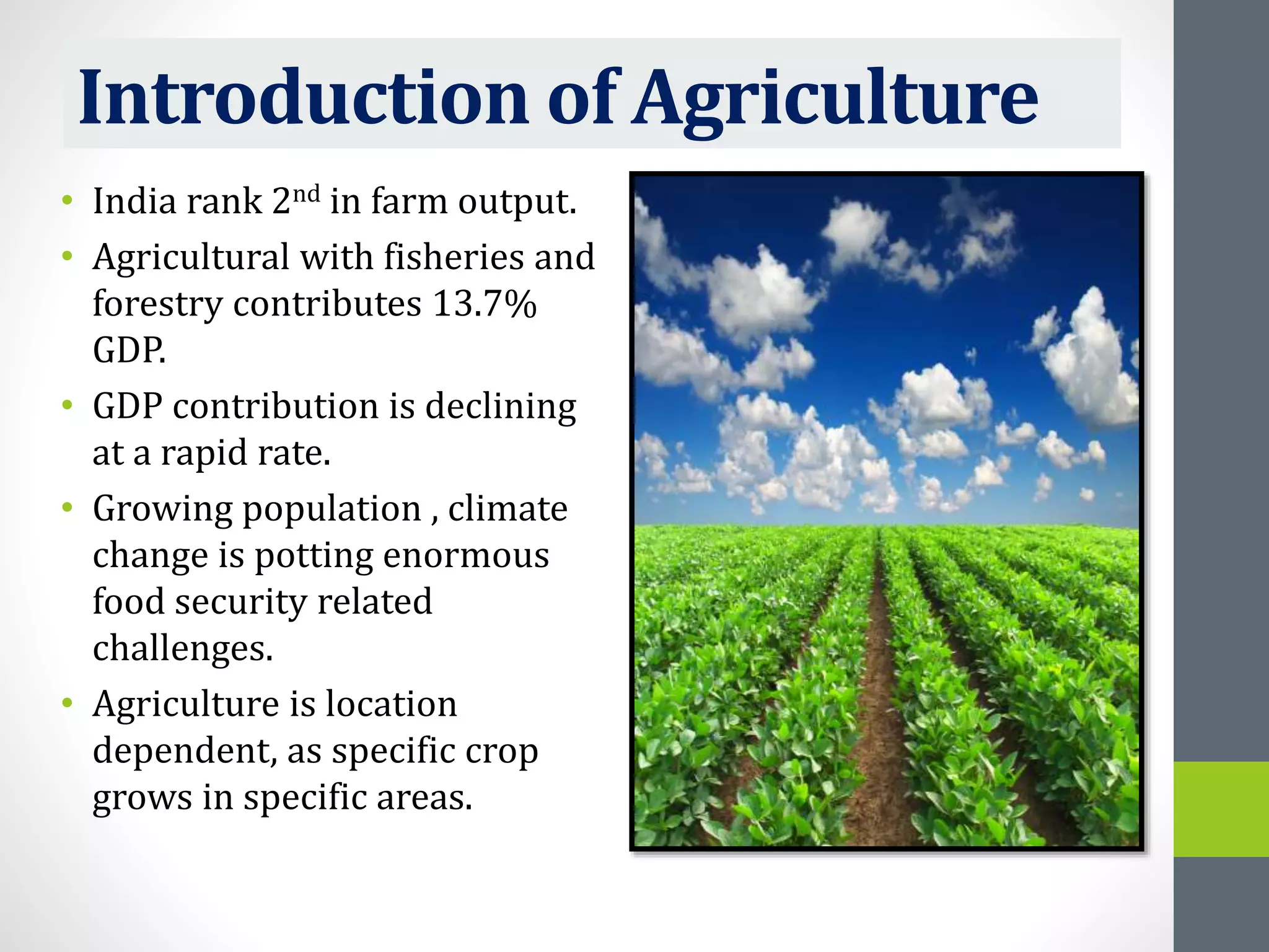
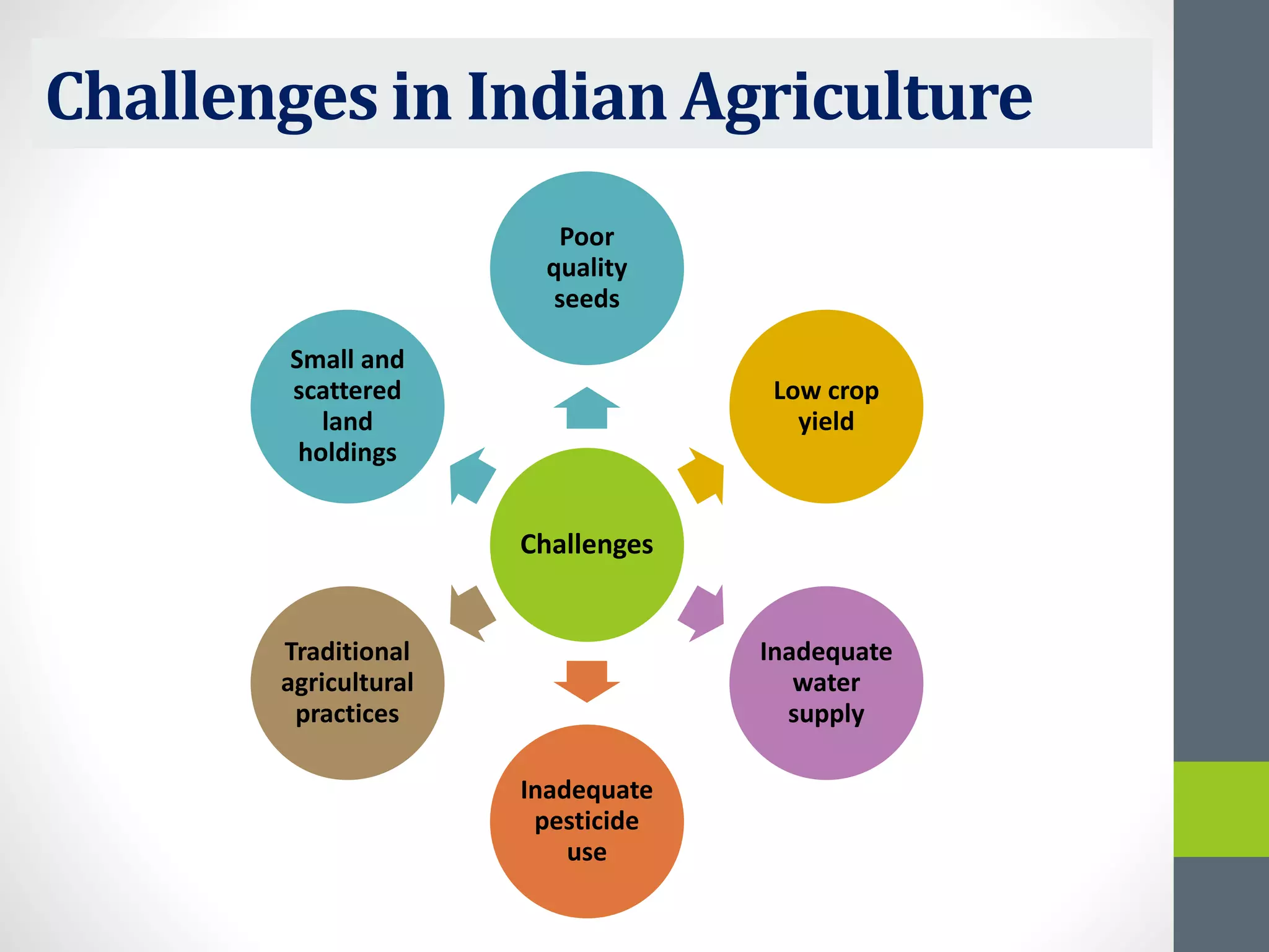
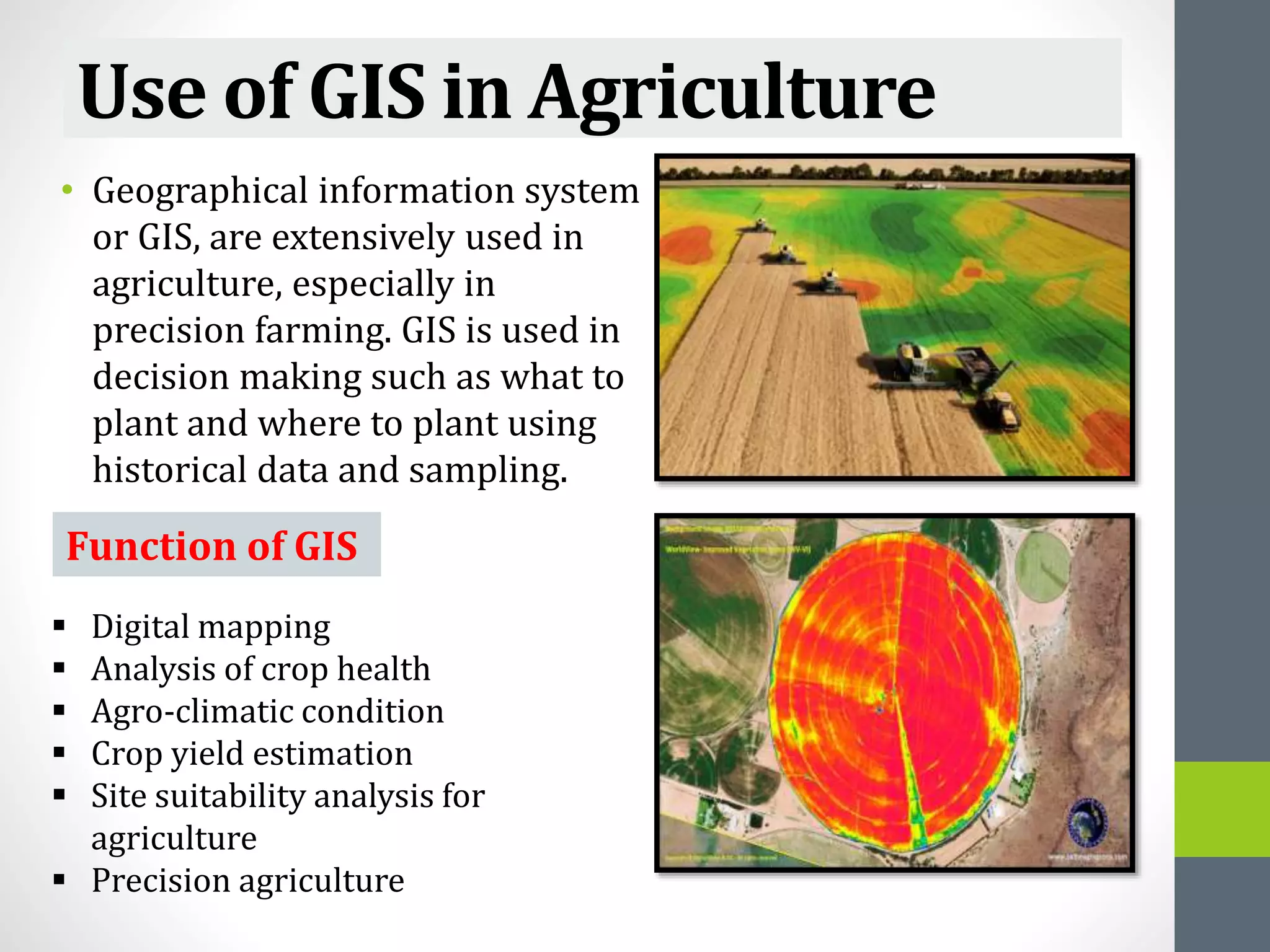
DeenDayalUpadhyayaGorakhpur University
Marching Towards Excellence
TOPIC
Application of GIS in Agriculture
PRESENTED BY-
Nishat Fatima
Research Scholar
Environmental Science
CONTENTS
• Introduction of agriculture
• Challenges in Indian agriculture
• Use of GIS in agriculture
• Crop mapping
• Factors contributing to increase in use of GIS
technologies
• Challenges
• IT Vision 2020
• Conclusion
Introduction of Agriculture
• India rank 2nd in farm output.
• Agricultural with fisheries and
forestry contributes 13.7%
GDP.
• GDP contribution is declining
at a rapid rate.
• Growing population , climate
change is potting enormous
food security related
challenges.
• Agriculture is location
dependent, as specific crop
grows in specific areas.
Challenges in Indian Agriculture
Challenges
Poor
quality
seeds
Low crop
yield
Inadequate
water
supply
Inadequate
pesticide
use
Traditional
agricultural
practices
Small and
scattered
land
holdings
Use of GIS in Agriculture
• Geographical information system
or GIS, are extensively used in
agriculture, especially in
precision farming. GIS is used in
decision making such as what to
plant and where to plant using
historical data and sampling.
Function of GIS
 Digital mapping
 Analysis of crop health
 Agro-climatic condition
 Crop yield estimation
 Site suitability analysis for
agriculture
 Precision agriculture
Crop Mapping
• Create crop maps,
meteorological maps, agro-
climatic zones.
• Compare time interval between
different stages of crop growth
through visual analytics.
• Image capture through UAVs
processing and visualization in
near real-time for monitoring
purpose.
• UAV or satellite captured
processed images can be
utilized to determine crop
stress, crop health status,
quality, quantity etc.
Factors contributing to increase in use
of GIS technologies
25%
25%
17%
17%
8%
8%
Efficient management of
resources
Greater analytic
capabilities
Web based technology to
disseminate data services
Efficient monitoring and
decision making
Easy to adopt 8%
Others
Challenges
• The lack of reliable connectivity in rural areas.
• Poor literacy level.
• Farmers benefit more from simple technology,
which communicates information, which is
relevant and easy to understand.
• Door delivery of information is limited by the
fact that there are a very large number of farm
households and many families may not own
radios or television sets and may not have
access to a daily newspaper.
IT Vision 2020
• Department of Agriculture and corporation (DAC) has some vision
such as-
1. Extension and advisory services making use of information
technology would be available to the farmers on round the clock
basis.
2. The tools for information technology will provide networking of
agriculture sector not only in the country but also globally.
CONCLUSION
GIS can improve farm management and
farming technologies by efficient farm
management.
GIS helps in better marketing exposure and
pricing and reduction of agricultural risks
and enhanced incomes.
Thank You !

Application of GIS in agriculture

  • 1.
    DeenDayalUpadhyayaGorakhpur University Marching TowardsExcellence TOPIC Application of GIS in Agriculture PRESENTED BY- Nishat Fatima Research Scholar Environmental Science
  • 2.
    CONTENTS • Introduction ofagriculture • Challenges in Indian agriculture • Use of GIS in agriculture • Crop mapping • Factors contributing to increase in use of GIS technologies • Challenges • IT Vision 2020 • Conclusion
  • 3.
    Introduction of Agriculture •India rank 2nd in farm output. • Agricultural with fisheries and forestry contributes 13.7% GDP. • GDP contribution is declining at a rapid rate. • Growing population , climate change is potting enormous food security related challenges. • Agriculture is location dependent, as specific crop grows in specific areas.
  • 4.
    Challenges in IndianAgriculture Challenges Poor quality seeds Low crop yield Inadequate water supply Inadequate pesticide use Traditional agricultural practices Small and scattered land holdings
  • 5.
    Use of GISin Agriculture • Geographical information system or GIS, are extensively used in agriculture, especially in precision farming. GIS is used in decision making such as what to plant and where to plant using historical data and sampling. Function of GIS  Digital mapping  Analysis of crop health  Agro-climatic condition  Crop yield estimation  Site suitability analysis for agriculture  Precision agriculture
  • 6.
    Crop Mapping • Createcrop maps, meteorological maps, agro- climatic zones. • Compare time interval between different stages of crop growth through visual analytics. • Image capture through UAVs processing and visualization in near real-time for monitoring purpose. • UAV or satellite captured processed images can be utilized to determine crop stress, crop health status, quality, quantity etc.
  • 7.
    Factors contributing toincrease in use of GIS technologies 25% 25% 17% 17% 8% 8% Efficient management of resources Greater analytic capabilities Web based technology to disseminate data services Efficient monitoring and decision making Easy to adopt 8% Others
  • 8.
    Challenges • The lackof reliable connectivity in rural areas. • Poor literacy level. • Farmers benefit more from simple technology, which communicates information, which is relevant and easy to understand. • Door delivery of information is limited by the fact that there are a very large number of farm households and many families may not own radios or television sets and may not have access to a daily newspaper.
  • 9.
    IT Vision 2020 •Department of Agriculture and corporation (DAC) has some vision such as- 1. Extension and advisory services making use of information technology would be available to the farmers on round the clock basis. 2. The tools for information technology will provide networking of agriculture sector not only in the country but also globally.
  • 10.
    CONCLUSION GIS can improvefarm management and farming technologies by efficient farm management. GIS helps in better marketing exposure and pricing and reduction of agricultural risks and enhanced incomes.
  • 11.