SlideShare a Scribd company logo
1 of 52
DOCTORAL SEMINAR
on
Recent advances on application of remote sensing in fruit
production of important fruit crops
COURSE NO. - FSC 691
CREDIT HOURS- 1(0+1)
Department of Fruit Science Indira Gandhi Krishi Vishwavidyalaya, Raipur
Seminar Incharge
Dr. Prabhakar Singh
Professor and Head
Department of Fruit Science,
College of Agriculture,
Indira Gandhi Krishi
Vishwavidyalaya, Raipur (C.G.)
Presented by,
Diksha
Ph.D. (Hort.)
First Year
(Fruit Science)
Introduction
Historical perspective
Principle of remote sensing
Applications of remote sensing in fruit crops
Stages involved in remote sensing system
Platforms for remote sensing system
CONTENTS
Types of sensors
Sensors used in fruit crops
Remote sensing organizations
Research findings
Government Initiatives
Constraints of remote sensing
Conclusion
References
Remote sensing
• Remote - Something which is far away
• Sensing – Getting information or getting data
India’s national remote sensing agency (NRSA) defined as: “ Remote
sensing is the technique of deriving information about objects on the
surface of the earth without physically coming into contact with them.’’
• Remote sensing is science of
Acquiring
Processing
Interpreting
Historical perspective
• 1860’s - First aerial photos from balloons
• 1940’s - 50’s - widespread use of aerial photos (WWII)
• 1960’s - First satellite images (ERTS)
• 1970’s - Landsat MSS, airborne scanners
• 1980’s - Landsat TM, AVHRR (Advances very high resolution radiometer)
• 1988 ‘s - First remote sensing in India was lunched , named as IRS.
• 1990’s - Airborne digital cameras, RADAR, IRS C&.D, release of
classified data
• 2000’s - New satellites, improvements in airborne digital cameras, LIDAR
• 2010’s - Higher spatial & spectral resolution, extensive use of LIDAR,
Hyperspectral imagery , UAV’s
• The term ‘’Remote Sensing’’ first used in united states in the 1950’s by Mr.
Evelya Pruill.
Principle of Remote Sensing
Source- Paul R. Beumann, 2010
Stages involved in remote sensing system
1. Energy source or illumination (A)
2. Radiation and the atmosphere (B)
3. Interaction with the target (C)
4. Recording of energy by the sensor (D)
5. Transmission, reception, and processing (E)
6. Interpretation and analysis (F)
7. Application (G)
Platforms for remote sensing system
Platforms are nothing but vehicles or carriers
of remote sensing. Mainly there are three
types of platforms.
Ground Based:
These includes the use of vehicles, Tripod
stands and towers. These are mounted with
cameras, and sensors at different heights.
Airborne:
It includes the use of aeroplanes,
helicopters, drone and balloons. It is not
cost effective one and occupies only small
areas.
Space Borne:
In space-borne remote sensing, sensors are mounted onboard a spacecraft
(space shuttle or satellite) orbiting the earth. Space born or satellite platform
are onetime cost effected but relatively lower cost per unit area of coverage.
• Earth synchronous satellites
• Sun synchronous satellites
Source-Moran et al.,1991
There are two basic types of sensors:
Passive Sensor:
In this type solar energy is used as a
source of energy. This operates only in
day condition whenever sunlight is
available.
• Camera without flash
• Thematic Mapper (TM)
• Landsat satellite.
Active sensor:
As name indicates this requires artificial
source of energy. It can be operate in
both day and night condition.
• Camera flash
• RADAR
• Topographic LIDAR laser
Vegetation indices
• Vegetation indices Biophysical features of plants can be characterized
spectrally by vegetation indices.
• NDVI index- used most frequently to determine the condition,
developmental stages and biomass of cultivated plants and to forecasts their
yields.
• It has become the most commonly used vegetation index ,Wallace et al.
(2004). Multispectral and hyper-spectral aerial and satellite imagery helps
in creating NDVI maps, which can differentiate soil from grass or forest,
detect plants under stress, and differentiate between crops and crop stages.
Global positioning system (GPS)
• GPS is “a network of satellites that continuously transmit coded
information, which make it possible to precisely identify locations
on earth by measuring distance from the satellites’’
• GPS provide the accurate positional information, which is useful in
locating the spatial variability with accuracy.
Some other tools in precision farming
Geographical information system (GIS)
• A geographical information system is a computer system capable of
capturing, storing, manipulation, and displaying spatially
information . Intermediate step because it combine the data collected
based on sampling regimes, to develop the process models, expert
system etc.
Spatial data GIS Computer
There are many types of sensors used in fruit crops
Sensor: These are the devices that receive electromagnetic radiation and
convert it into signal that can be recorded or displayed as either
numerical data or an image.
1. Microwave radiometer
2. Spectrometer
3. Radar
4. Satellites also act as sensors
5. Digital camera (RGB)
6. Multispectral camera
7. Infrared thermal imager
8. Hyperspectral camera
9. LIDAR
UAV/Drone with Digital Camera
Hyper spectral sensor
View of Multispectral sensor image
Source – Bay Spec, 2022
San Jose, USA
Thermal Infrared Imaging Sensor
Source –T.C Liu.,2012
LIDAR crop classification with Drone
Source –Adriaan Jacobus prins, 2021
Crop Devices/Platforms Purpose Type of Remote
Sensing
Apple Green seeker 505, tetra
cam ADC
Weed biomass evaluation Active and passive
remote sensing
IRSA WiFS Orchard characterization Satellite remote
sensing
Orange and
pineapple
IRS-P Satellite sensor,
LISS-III
Soil site suitability analysis Satellite remote
sensing
Peach Spectra radio diameter Mite damage Aerial remote
sensing
Nectarines
and peaches
Field spectrometer ASD
with reflectance of 400 -
1100nm
Detecting water stress effects
on fruits
Aerial remote
sensing
Mango IRS-P Satellite Yield estimation Satellite remote
sensing
Grapes Digital multispectral
sensors
Zonal vine yard management Aerial remote
sensing
Different types of remote sensing systems and sensors used in fruit crops
Source -Appani Laxman Kumar et al.,2021
Applications of Remote Sensing in fruit crops
 Assessment of crop area
 Delineation of orchards and spatial analysis
 Determination of fruit yield
 Quantification and scheduling of precise and proper fertilizer,
irrigation needs and application of pesticides
 Identification of diseases and pest attacks
 Weather study for site specific crops management in fruit crops
 Detection of growth and health of orchards on a larger scale.
 Land suitability assessment for crops
 Disaster management
 Precision horticulture
Land suitability assessment for orchard
Source – Rajendra Zolekar et al.,2018
Identification of diseases and pest attacks area
Disaster management
Some key application of remote sensing in fruit crops
1) Estimation of cultivable land area and mapping of orchards:
Remote sensing systems have the capability of providing regular,
synoptic, multi-spectral and multi-temporal coverage of a
cultivable area.
 For example Apple orchard area was estimated using remote
sensing and agro-metrology land based observation in Pulwama
district of Kashmir valley. Landsat and AWIFS digital data were
used to monitor and estimate acreage under apple orchards.
2) Recommended dose of fertilizer application: The site-specific
grove management by variable rate delivery of inputs such as
fertilizers on a tree size basis could improve horticulture crops
profitability, reduce fertilizer wastage and provide environmental
protection.
Source- Appani Laxman Kumar,2021
3) Detection of Water Stress: Remote sensing technology can also
help in identification of water stress by change in leaf colour. Many
techniques such as high spatial resolution multispectral and thermal
airborne imagery were used to monitor crown temperature and the
Photochemical Reflectance Index (PRI) in peach orchards.
4) Quality assessment in grape using remote sensing : In grape wine
quality was assessed by vigour of vine (Johnson et al., 2001).
Remote sensed vegetation index imagery was used to establish sub-
block management zones in a three hectare commercial vineyard of
chardonnay wine-grapes.
5) Identification of Pest and Diseases in Fruit : Remote sensing
techniques can decrease pest monitoring costs in orchards. The
spider mite damage in orchards is evaluated by measuring visible
and near infrared reflectance of leaves and canopies in peach
orchards in California. (Eike L. et al.,2009)
6. High resolution remote sensing imagery in fruit crops
The potential of the narrow-band TBVI (two-band vegetation
index) derived from airborne hyperspectral imagery to predict
citrus fruit yield was examined in Japan (Ye et al., 2008).
• The microwave backscatter response of pecan tree canopy
samples to estimate pecan yield in situ using terrestrial radar
was studied (James et al., 2013).
7. Soil salinity detection using thermal imaging
Soil salinity causes severe environmental degradation that
impedes crop growth and overall regional production. Soil
salinity information can be extracted from thermal imageries
as emitted radiance can provide subsoil information.
Remote sensing organizations
These are some remote sensing organizations at national and international level
1. ISPRS- International Society for Photogrammetry and Remote Sensing(France)
2. NASA- National Aeronautic and Space Administration (USA)
3. ESA- European Space Agency (Europe)
4. NASDA- National Space Development Agency (Japan)
5. CSA- Canadian Space Agency (Canada)
6. ISRO- Indian Space Research Organisation (Banglore, Karnataka)
7. NRSA- National Remote Sensing Agency (Balanagar, Hyderabad)
Research findings
Case study#1
Research title: Mango yield mapping at the orchard scale based on
tree structure and land cover assessed by UAV.
Major findings:
 To estimate and map tree species, structure, and yields in mango
orchards of various cropping systems in the Niayes region, West
Senegal.
 Tree structure parameters (height, crown area and volume), species, and
mango cultivars were measured using unmanned aerial vehicle (UAV)
photogrammetry and geographic, object-based image analysis.
 This procedure reached an average overall accuracy of 0.89 for
classifying tree species and mango cultivars.
 Models reached satisfying accuracies with R2 greater than 0.77 and
RMSE% ranging from 20% to 29% when evaluated with the measured
production of 60 validation trees.
Author: Julien Sarron et. al. 2018
Orchard yield mapping outputs
.
A) UAV- acquired
RGB orthomosaic
image
B) GEOBIA Land
cover map
C) Canopy height
model (CHM)(in
meter)
D) Mango cultivar
yield map (in Kg
per tree).
Case study#2
Research title - Geospatial technology for acreage estimation of
natural rubber and identification of potential areas for its
cultivation in Tripura state.
 Potential of temporal and multi-resolution satellite datasets were
explored in this project for inventory of natural rubber in Tripura.
 The study revealed that natural rubber showed distinct spectral signature
on multi-date LISS-III data and it could be delineated using temporal
NDVI profile.
 The satellite analysis revealed about 48,033 ha of natural rubber (more
than 3 years old) in the state as of december 2011.
 The mapping accuracy for the older mature natural rubber was 96.15
per cent indicating the utility of RS data for NR mapping and
monitoring.
Author - Mr. Uday Raj et.al 2012
Case study#3
Research title: Spectral discrimination of healthy and malformed
mango panicles using spectroradiometer.
Research findings–
• The potential of using hyperspectral reflectance data to discriminate
healthy and malformed mango panicles, both under field and
laboratory conditions was evaluated.
• The spectral reflectance of both malformed and healthy panicles were
collected using ground based portable ASD FS3 spectroradiometer.
• Among all the indices Normalized Difference Vegetation Index
(NDVI) was found to be the best parameter in differentiating the
healthy (0.495) and malformed (0.751) mango panicles significantly
under laboratory conditions.
• Hence, it can be concluded that spectral reflectance based indices will
be a potential tool in the identification of malformed mango panicles
spatially through remote sensing data.
Author - A. Nagaraja et al., 2014
Vegetative indices of healthy and malformed panicles of mango at
laboratory (A) and field conditions (B).
Index NDVI
A
Laboratory condition
B
field conditions
Healthy panicle 0.495 0.503
Malformed panicle 0.751 0.780
Case study#4
Research title - Citrus canker detection using hyperspectral
reflectance imaging and PCA based image classification
method.
Research findings –
• This research demonstrated that hyperspectral imaging
technique could be used for discriminating citrus canker from
other confounding diseases.
• The overall accuracy for canker detection was 92.7%.
• Four optimal wavelengths (553, 677, 718, and 858 nm) were
identified in visible and short-wavelength near-infrared region
that could be adopted by a future multispectral imaging
solution for detecting citrus canker on a sorting machine.
Author -Jianwei Qin et al.,2008
Images of a cankerous samples at selected wavelengths from
400 to 900 nm
Hyperspectral reflectance images of grapefruit samples
Images of normal and other diseased skin conditions at 600nm
Reflectance spectra of grapefruit samples with normal and diseased skin conditions
Reflectance between canker and other skin conditions was evident in spectral
region between 550 to 850 nm, in which relative reflectance of cankerous and
marketable samples were in the range 15 -42% and 37-65% respectively.
Government Initiatives
FASAL (Forecasting Agricultural output using Space, Agro-
meteorological and Land-based observations)
Launched in 2006.
• The main aim was to collect monsoon data using remote sensing,
economic data and monitoring of crop when growing.
• A team of ISRO/Department of Space, State Remote Sensing
Applications Centers, State Agricultural universities and many other
institutions are working on FASAL.
• Remote sensing component of FASAL- handled by the Ahmedabad
- based Space Application Centre of the Indian Space Research
Organization.
NCFC (National Crop Forecast Centre)
• Launched in April 2012
• Provide estimates of crop output and assess the drought situation in
the country through latest technologies.
• Located at the New Delhi.
• Equipped with image-processing facilities, laboratories and
software.
• Named after the well known Indian Statistician P. C. Mahalanobis,
founder of the Indian Statistical Institute, who played a significant
role in evolving methods to estimate crop yields.
CHAMAN (Coordinated Horticulture Assessment and
Management using Geoinformatics)
• Implemented by Mahalanobis National Crop Forecast Centre
(MNCFC) in collaboration with ISRO Centres and 12 state
horticulture departments, NHRDF, IMD, ICAR Centre and State
Remote Sensing Centers is likely to be completed in march 2018.
• Envisages use of satellite remote sensing data for area and production
estimation of 7 horticultural crops (Potato, Onion, Tomato, Chili,
Mango, Banana and Citrus) in 12 major states in 180 districts.
• The programme also uses GIS (Geographical Information System)
tools along with remote sensing data for generating action plans for
horticultural development (site suitability, infrastructure development,
crop intensification, orchard rejuvenation, aqua-horticulture, etc.).
Advantages of remote sensing
1. Remote sensing is a fast process and it can survey large and
inaccessible areas in a short time.
2. Once Remote Sensors have collected data, it can be used and
analyzed multiple times for different applications.
3. Remote sensing technology like LIDAR collects point cloud data,
this data can be quickly and easily analyzed with point cloud
software.
4. Remote Sensors measure reflected light either natural sunlight or a
light pulse. This light is harmless to objects, vegetation, human and
environment.
5. Remote Sensing allows for easy collection of data over a variety of
scales and resolutions.
Constraints of Remote Sensing in India
• Small size of land holdings
• Lack of success stories
• Infrastructure and institutional constraints
• Lack of local technical expertise
• Heterogeneity of cropping systems
• High initial investment
• Issues with satellite data
 Not viable for small land holdings
 May not be effective for pest attack information due to inherent
delay in providing data
 Limitation of predictive model development
 Data degradation due to atmospheric disturbances
Conclusion
• Remote sensing technology has developed from balloon photography to
aerial photography & then advanced to multi-spectral satellite imaging.
• Precision farming in many development countries including India is in its
infancy but there are numerous opportunities for adoption.
• Radiation interaction characteristics of earth and atmosphere in different
regions of electromagnetic spectrum are very useful for identifying and
characterizing earth and atmospheric features.
• Remote sensing raising yields and economic returns on fields with
significant, variability and for minimizing environmental degradation.
• Helps in reducing monitoring costs, enhances resource use efficiency,
lowering total production cost and Increases profit.
References
Eike L, Adam H, Minghua Z, Walter JB, Cecil D. Remote sensing of spider mite
damage in California peach orchards. Int. J. App. Earth Observation and
Geoinformation. 2009; 11(3):244-255.
Handique, B. K., Goswami, C., Gupta, C., Pandit, S., Gogoi, S., Jadi, R., ... & Raju, P.
L. N. (2020). Hierarchical classification for assessment of horticultural crops in
mixed cropping pattern using UAV-borne multi-spectral sensor. The International
Archives of Photogrammetry, Remote Sensing and Spatial Information
Sciences, 43, 67-74.
Jacob, J., & Raj, U. (2012). Geospatial Technology For Acreage Estimation of Natural
Rubber and Identification of potential Areas for its Cultivation in Tripura
State. National Remote Sensing Centre ISRO, Govt. of India and Rubber Research
Institute of India Rubber Board, Min. of Commerce & Industry, Govt. of India.
James A, Hardin PR, Weckler CL. Microwave backscatter response of pecan tree
canopy samples for estimation of pecan yield in situ using terrestrial radar.
Computers and Electronics in Agriculture. 2013; 90:5462.
Johnson LF, Bosch DF, Wiiliums DC, Lobitz BM. Remote sensing of vineyard
management zones: Implications for wine quality. Applied Engineering in
Agriculture. 2001; 17(4):557-560.
Kumar, A. L., Tanuja, P., Reddy, P. M., & Chaithanya, K. Chapter-4 Remote Sensing In
Fruit Crops.2021.
Mushtaq G, Asima N. Estimation of apple orchard using remote sensing and agro-
meteorology land based observation in Pulwama district of Kashmir valley. Int. J.
Remote sensing and Geo. Sci. 2014; 3(6):2319-3484.
Pal, S., Pandey, S. K., & Sharma, S. K. (2022). Applications of remote sensing and GIS
in fruit crops: A review.
Pujar, D. U., Pujar, U. U., Shruthi, C. R., Wadagave, A., & Chulaki, M. (2017). Remote
sensing in fruit crops. Journal of Pharmacognosy and Phytochemistry, 6(5), 2479-
2484.
Nagaraja A, Sahoo RN, Usha K, Singh SK, Sivaramanae N, Gupta VK. Spectral
discrimination of healthy and malformed mango panicles using spectroradiometer.
Indian Journal of Horticulture. 2014; 71(1):40-44.
qin, j., burks, t.f., kim, m.s., chao, k., ritenour, m.a. (2008). citrus canker detection
using hyperspectral reflectance imaging and pca-based image classification
method. sensing and instrumentation for food quality and safety 2:168–177.
Sarron, J., Malézieux, É., Sané, C. A. B., & Faye, É. (2018). Mango yield mapping
at the orchard scale based on tree structure and land cover assessed by
UAV. Remote Sensing, 10(12), 1900.
Satone, M., Diwakar, S., & Joshi, V. (2017). Automatic bruise detection in fruits
using thermal images. International Journal, 7(5).
Suarez L, Zarco TPJ, Gonzalez V, Berni JA, Sagardoy R, Morales B, Fereres E.
Detecting water stress effects on fruit quality in orchards with time-series PRI
airborne imagery. Remote Sensing Env. 2010; 114(4):286-298.
Ye X, Sakai K, Asada S. Application of narrow-band two-band vegetation index in
estimating fruit yield in citrus. Biosystems Engineering. 2008; 99:179-189.
Thank you

More Related Content

Similar to DOCTORAL SEMINAR on remote sensing in Agriculture

remote sensing in agriculture
remote sensing in agricultureremote sensing in agriculture
remote sensing in agricultureveerendra manduri
 
remote sensing ppt.pptx
remote sensing ppt.pptxremote sensing ppt.pptx
remote sensing ppt.pptxswarnrajsingh1
 
remote sensing and GIS -role in pest managment
remote sensing and GIS -role in pest managmentremote sensing and GIS -role in pest managment
remote sensing and GIS -role in pest managmentInder15
 
449879014-Remote-Sensing-Ppt.pptx
449879014-Remote-Sensing-Ppt.pptx449879014-Remote-Sensing-Ppt.pptx
449879014-Remote-Sensing-Ppt.pptxRoopa Santosh
 
Forest monitoring through remote sensing
Forest monitoring through remote sensingForest monitoring through remote sensing
Forest monitoring through remote sensingPritam Kumar Barman
 
Remote sensing in fruit crops.
 Remote sensing in fruit crops. Remote sensing in fruit crops.
Remote sensing in fruit crops.KuldeepSingh1530
 
Remote Sensing Applications in Agriculture in Pakistan
Remote Sensing Applications in Agriculture in PakistanRemote Sensing Applications in Agriculture in Pakistan
Remote Sensing Applications in Agriculture in PakistanGhulam Asghar
 
Application of remote sensing in precision farming
 Application of remote sensing in precision farming  Application of remote sensing in precision farming
Application of remote sensing in precision farming Suman Dey
 
REMOTE SENSING AND GEOGRAPHIC INFORMATION SYSTEMS
REMOTE SENSING AND GEOGRAPHIC INFORMATION SYSTEMS REMOTE SENSING AND GEOGRAPHIC INFORMATION SYSTEMS
REMOTE SENSING AND GEOGRAPHIC INFORMATION SYSTEMS AM Publications
 
Application of Remote sensing in fruit crops
Application of Remote sensing in fruit cropsApplication of Remote sensing in fruit crops
Application of Remote sensing in fruit cropsKiran Patnaik
 
Application of spectral remote sensing in agronomic decision by Dr.V.Harihara...
Application of spectral remote sensing in agronomic decision by Dr.V.Harihara...Application of spectral remote sensing in agronomic decision by Dr.V.Harihara...
Application of spectral remote sensing in agronomic decision by Dr.V.Harihara...Hari Hariharasudhan
 
Remote Sensing and its Applications in Agriculture
Remote Sensing and its Applications in AgricultureRemote Sensing and its Applications in Agriculture
Remote Sensing and its Applications in AgricultureVikas Kashyap
 
Rs in agriculture & soil
Rs in agriculture & soilRs in agriculture & soil
Rs in agriculture & soilMuhammad Asim
 
ASSESSMENT OF VEGETATION COVER USING UAV-BASED REMOTE SENSING
ASSESSMENT OF VEGETATION COVER  USING UAV-BASED REMOTE SENSINGASSESSMENT OF VEGETATION COVER  USING UAV-BASED REMOTE SENSING
ASSESSMENT OF VEGETATION COVER USING UAV-BASED REMOTE SENSINGPritam Kumar Barman
 
Remote sensing in agriculture
Remote sensing in agricultureRemote sensing in agriculture
Remote sensing in agricultureChitra Nair
 

Similar to DOCTORAL SEMINAR on remote sensing in Agriculture (20)

Dz33758761
Dz33758761Dz33758761
Dz33758761
 
Dz33758761
Dz33758761Dz33758761
Dz33758761
 
Dz33758761
Dz33758761Dz33758761
Dz33758761
 
remote sensing in agriculture
remote sensing in agricultureremote sensing in agriculture
remote sensing in agriculture
 
remote sensing ppt.pptx
remote sensing ppt.pptxremote sensing ppt.pptx
remote sensing ppt.pptx
 
remote sensing and GIS -role in pest managment
remote sensing and GIS -role in pest managmentremote sensing and GIS -role in pest managment
remote sensing and GIS -role in pest managment
 
449879014-Remote-Sensing-Ppt.pptx
449879014-Remote-Sensing-Ppt.pptx449879014-Remote-Sensing-Ppt.pptx
449879014-Remote-Sensing-Ppt.pptx
 
Forest monitoring through remote sensing
Forest monitoring through remote sensingForest monitoring through remote sensing
Forest monitoring through remote sensing
 
Remote sensing in fruit crops.
 Remote sensing in fruit crops. Remote sensing in fruit crops.
Remote sensing in fruit crops.
 
Remote Sensing Applications in Agriculture in Pakistan
Remote Sensing Applications in Agriculture in PakistanRemote Sensing Applications in Agriculture in Pakistan
Remote Sensing Applications in Agriculture in Pakistan
 
Application of remote sensing in precision farming
 Application of remote sensing in precision farming  Application of remote sensing in precision farming
Application of remote sensing in precision farming
 
REMOTE SENSING AND GEOGRAPHIC INFORMATION SYSTEMS
REMOTE SENSING AND GEOGRAPHIC INFORMATION SYSTEMS REMOTE SENSING AND GEOGRAPHIC INFORMATION SYSTEMS
REMOTE SENSING AND GEOGRAPHIC INFORMATION SYSTEMS
 
Application of Remote sensing in fruit crops
Application of Remote sensing in fruit cropsApplication of Remote sensing in fruit crops
Application of Remote sensing in fruit crops
 
Application of spectral remote sensing in agronomic decision by Dr.V.Harihara...
Application of spectral remote sensing in agronomic decision by Dr.V.Harihara...Application of spectral remote sensing in agronomic decision by Dr.V.Harihara...
Application of spectral remote sensing in agronomic decision by Dr.V.Harihara...
 
Remote Sensing and its Applications in Agriculture
Remote Sensing and its Applications in AgricultureRemote Sensing and its Applications in Agriculture
Remote Sensing and its Applications in Agriculture
 
Rs in agriculture & soil
Rs in agriculture & soilRs in agriculture & soil
Rs in agriculture & soil
 
ASSESSMENT OF VEGETATION COVER USING UAV-BASED REMOTE SENSING
ASSESSMENT OF VEGETATION COVER  USING UAV-BASED REMOTE SENSINGASSESSMENT OF VEGETATION COVER  USING UAV-BASED REMOTE SENSING
ASSESSMENT OF VEGETATION COVER USING UAV-BASED REMOTE SENSING
 
Remote sensing
Remote sensingRemote sensing
Remote sensing
 
Remote sensing
 Remote sensing Remote sensing
Remote sensing
 
Remote sensing in agriculture
Remote sensing in agricultureRemote sensing in agriculture
Remote sensing in agriculture
 

More from AmanDohre

Nutrient and water management, important physiological disorders of plantatio...
Nutrient and water management, important physiological disorders of plantatio...Nutrient and water management, important physiological disorders of plantatio...
Nutrient and water management, important physiological disorders of plantatio...AmanDohre
 
Crop improvement in Coconut, Oilpalm, Avocado, Mangosteen, Pineapple & Annona
Crop improvement in Coconut, Oilpalm, Avocado, Mangosteen, Pineapple & AnnonaCrop improvement in Coconut, Oilpalm, Avocado, Mangosteen, Pineapple & Annona
Crop improvement in Coconut, Oilpalm, Avocado, Mangosteen, Pineapple & AnnonaAmanDohre
 
‘Crop Modeling for Stress Situation , Assessing Stress through Remote Sensing’
‘Crop Modeling for Stress Situation , Assessing Stress through Remote Sensing’‘Crop Modeling for Stress Situation , Assessing Stress through Remote Sensing’
‘Crop Modeling for Stress Situation , Assessing Stress through Remote Sensing’AmanDohre
 
TAXONOMICAL CLASSIFICATION ,ORIGIN AND DISTRIBUTION OF MANGO , BANANA , PAPAY...
TAXONOMICAL CLASSIFICATION ,ORIGIN AND DISTRIBUTION OF MANGO , BANANA , PAPAY...TAXONOMICAL CLASSIFICATION ,ORIGIN AND DISTRIBUTION OF MANGO , BANANA , PAPAY...
TAXONOMICAL CLASSIFICATION ,ORIGIN AND DISTRIBUTION OF MANGO , BANANA , PAPAY...AmanDohre
 
EFFECT OF DIFFERENT CANOPY TYPE ON PRODUCTION AND QUALITY OF FRUIT CROPS
EFFECT OF DIFFERENT CANOPY TYPE ON PRODUCTION AND QUALITY OF FRUIT CROPSEFFECT OF DIFFERENT CANOPY TYPE ON PRODUCTION AND QUALITY OF FRUIT CROPS
EFFECT OF DIFFERENT CANOPY TYPE ON PRODUCTION AND QUALITY OF FRUIT CROPSAmanDohre
 
Origin and Distribution Commercial Varieties Eco-physiological Requirements R...
Origin and Distribution Commercial Varieties Eco-physiological Requirements R...Origin and Distribution Commercial Varieties Eco-physiological Requirements R...
Origin and Distribution Commercial Varieties Eco-physiological Requirements R...AmanDohre
 
METHODS OF STORAGE AND POST HARVEST DISORDERS OF FRUIT CROPS
METHODS OF STORAGE AND POST HARVEST DISORDERS OF FRUIT CROPSMETHODS OF STORAGE AND POST HARVEST DISORDERS OF FRUIT CROPS
METHODS OF STORAGE AND POST HARVEST DISORDERS OF FRUIT CROPSAmanDohre
 
Application of PGR, soil and moisture conservation practices, canopy manageme...
Application of PGR, soil and moisture conservation practices, canopy manageme...Application of PGR, soil and moisture conservation practices, canopy manageme...
Application of PGR, soil and moisture conservation practices, canopy manageme...AmanDohre
 
Green House Effect, Methane Emission and its Relevance to Abiotic Stress, Use...
Green House Effect, Methane Emission and its Relevance to Abiotic Stress, Use...Green House Effect, Methane Emission and its Relevance to Abiotic Stress, Use...
Green House Effect, Methane Emission and its Relevance to Abiotic Stress, Use...AmanDohre
 
Recent advances in quality and processing of plantation crops in India, Role ...
Recent advances in quality and processing of plantation crops in India, Role ...Recent advances in quality and processing of plantation crops in India, Role ...
Recent advances in quality and processing of plantation crops in India, Role ...AmanDohre
 
Use of PGR’s in stress management, mode of action & practical use, HSP(Heat s...
Use of PGR’s in stress management, mode of action & practical use, HSP(Heat s...Use of PGR’s in stress management, mode of action & practical use, HSP(Heat s...
Use of PGR’s in stress management, mode of action & practical use, HSP(Heat s...AmanDohre
 
CROP IMPROVEMENT-INTRODUCTION, SELECTION & HYBRIDIZATION FOR APPLE, PEAR ,PEA...
CROP IMPROVEMENT-INTRODUCTION, SELECTION & HYBRIDIZATION FOR APPLE, PEAR ,PEA...CROP IMPROVEMENT-INTRODUCTION, SELECTION & HYBRIDIZATION FOR APPLE, PEAR ,PEA...
CROP IMPROVEMENT-INTRODUCTION, SELECTION & HYBRIDIZATION FOR APPLE, PEAR ,PEA...AmanDohre
 
crop improvement of Aonla, Beal, ber, jackfruit, karonda, phalsa
crop improvement of Aonla, Beal, ber, jackfruit, karonda, phalsacrop improvement of Aonla, Beal, ber, jackfruit, karonda, phalsa
crop improvement of Aonla, Beal, ber, jackfruit, karonda, phalsaAmanDohre
 
To improve the knowledge about principle and practice of canopy management in...
To improve the knowledge about principle and practice of canopy management in...To improve the knowledge about principle and practice of canopy management in...
To improve the knowledge about principle and practice of canopy management in...AmanDohre
 
CANPOY CLASSIFICATION AND CANOPY MANAGEMENT THROUGH ROOTSTOCK AND SCION
CANPOY CLASSIFICATION AND CANOPY MANAGEMENT THROUGH ROOTSTOCK AND SCIONCANPOY CLASSIFICATION AND CANOPY MANAGEMENT THROUGH ROOTSTOCK AND SCION
CANPOY CLASSIFICATION AND CANOPY MANAGEMENT THROUGH ROOTSTOCK AND SCIONAmanDohre
 
Canopy Development And Management In Relation To Growth, Flowering, Fruiting ...
Canopy Development And Management In Relation To Growth, Flowering, Fruiting ...Canopy Development And Management In Relation To Growth, Flowering, Fruiting ...
Canopy Development And Management In Relation To Growth, Flowering, Fruiting ...AmanDohre
 
Crop improvement by mutation breeding, polyploidy breeding & rootstock breedi...
Crop improvement by mutation breeding, polyploidy breeding & rootstock breedi...Crop improvement by mutation breeding, polyploidy breeding & rootstock breedi...
Crop improvement by mutation breeding, polyploidy breeding & rootstock breedi...AmanDohre
 
METHODS OF POST HARVEST HANDLING INCLUDING :- PRE-COOLING, WAXING, CHEMICAL T...
METHODS OF POST HARVEST HANDLING INCLUDING :- PRE-COOLING, WAXING, CHEMICAL T...METHODS OF POST HARVEST HANDLING INCLUDING :- PRE-COOLING, WAXING, CHEMICAL T...
METHODS OF POST HARVEST HANDLING INCLUDING :- PRE-COOLING, WAXING, CHEMICAL T...AmanDohre
 
Processing Of Waste By-products And Food Safety Standards (FPO Specification)
Processing Of Waste By-products And Food Safety Standards (FPO Specification)Processing Of Waste By-products And Food Safety Standards (FPO Specification)
Processing Of Waste By-products And Food Safety Standards (FPO Specification)AmanDohre
 
REJUVENATION THROUGH PROGENY ORCHAD AND SCION BANK
REJUVENATION THROUGH PROGENY ORCHAD AND SCION BANKREJUVENATION THROUGH PROGENY ORCHAD AND SCION BANK
REJUVENATION THROUGH PROGENY ORCHAD AND SCION BANKAmanDohre
 

More from AmanDohre (20)

Nutrient and water management, important physiological disorders of plantatio...
Nutrient and water management, important physiological disorders of plantatio...Nutrient and water management, important physiological disorders of plantatio...
Nutrient and water management, important physiological disorders of plantatio...
 
Crop improvement in Coconut, Oilpalm, Avocado, Mangosteen, Pineapple & Annona
Crop improvement in Coconut, Oilpalm, Avocado, Mangosteen, Pineapple & AnnonaCrop improvement in Coconut, Oilpalm, Avocado, Mangosteen, Pineapple & Annona
Crop improvement in Coconut, Oilpalm, Avocado, Mangosteen, Pineapple & Annona
 
‘Crop Modeling for Stress Situation , Assessing Stress through Remote Sensing’
‘Crop Modeling for Stress Situation , Assessing Stress through Remote Sensing’‘Crop Modeling for Stress Situation , Assessing Stress through Remote Sensing’
‘Crop Modeling for Stress Situation , Assessing Stress through Remote Sensing’
 
TAXONOMICAL CLASSIFICATION ,ORIGIN AND DISTRIBUTION OF MANGO , BANANA , PAPAY...
TAXONOMICAL CLASSIFICATION ,ORIGIN AND DISTRIBUTION OF MANGO , BANANA , PAPAY...TAXONOMICAL CLASSIFICATION ,ORIGIN AND DISTRIBUTION OF MANGO , BANANA , PAPAY...
TAXONOMICAL CLASSIFICATION ,ORIGIN AND DISTRIBUTION OF MANGO , BANANA , PAPAY...
 
EFFECT OF DIFFERENT CANOPY TYPE ON PRODUCTION AND QUALITY OF FRUIT CROPS
EFFECT OF DIFFERENT CANOPY TYPE ON PRODUCTION AND QUALITY OF FRUIT CROPSEFFECT OF DIFFERENT CANOPY TYPE ON PRODUCTION AND QUALITY OF FRUIT CROPS
EFFECT OF DIFFERENT CANOPY TYPE ON PRODUCTION AND QUALITY OF FRUIT CROPS
 
Origin and Distribution Commercial Varieties Eco-physiological Requirements R...
Origin and Distribution Commercial Varieties Eco-physiological Requirements R...Origin and Distribution Commercial Varieties Eco-physiological Requirements R...
Origin and Distribution Commercial Varieties Eco-physiological Requirements R...
 
METHODS OF STORAGE AND POST HARVEST DISORDERS OF FRUIT CROPS
METHODS OF STORAGE AND POST HARVEST DISORDERS OF FRUIT CROPSMETHODS OF STORAGE AND POST HARVEST DISORDERS OF FRUIT CROPS
METHODS OF STORAGE AND POST HARVEST DISORDERS OF FRUIT CROPS
 
Application of PGR, soil and moisture conservation practices, canopy manageme...
Application of PGR, soil and moisture conservation practices, canopy manageme...Application of PGR, soil and moisture conservation practices, canopy manageme...
Application of PGR, soil and moisture conservation practices, canopy manageme...
 
Green House Effect, Methane Emission and its Relevance to Abiotic Stress, Use...
Green House Effect, Methane Emission and its Relevance to Abiotic Stress, Use...Green House Effect, Methane Emission and its Relevance to Abiotic Stress, Use...
Green House Effect, Methane Emission and its Relevance to Abiotic Stress, Use...
 
Recent advances in quality and processing of plantation crops in India, Role ...
Recent advances in quality and processing of plantation crops in India, Role ...Recent advances in quality and processing of plantation crops in India, Role ...
Recent advances in quality and processing of plantation crops in India, Role ...
 
Use of PGR’s in stress management, mode of action & practical use, HSP(Heat s...
Use of PGR’s in stress management, mode of action & practical use, HSP(Heat s...Use of PGR’s in stress management, mode of action & practical use, HSP(Heat s...
Use of PGR’s in stress management, mode of action & practical use, HSP(Heat s...
 
CROP IMPROVEMENT-INTRODUCTION, SELECTION & HYBRIDIZATION FOR APPLE, PEAR ,PEA...
CROP IMPROVEMENT-INTRODUCTION, SELECTION & HYBRIDIZATION FOR APPLE, PEAR ,PEA...CROP IMPROVEMENT-INTRODUCTION, SELECTION & HYBRIDIZATION FOR APPLE, PEAR ,PEA...
CROP IMPROVEMENT-INTRODUCTION, SELECTION & HYBRIDIZATION FOR APPLE, PEAR ,PEA...
 
crop improvement of Aonla, Beal, ber, jackfruit, karonda, phalsa
crop improvement of Aonla, Beal, ber, jackfruit, karonda, phalsacrop improvement of Aonla, Beal, ber, jackfruit, karonda, phalsa
crop improvement of Aonla, Beal, ber, jackfruit, karonda, phalsa
 
To improve the knowledge about principle and practice of canopy management in...
To improve the knowledge about principle and practice of canopy management in...To improve the knowledge about principle and practice of canopy management in...
To improve the knowledge about principle and practice of canopy management in...
 
CANPOY CLASSIFICATION AND CANOPY MANAGEMENT THROUGH ROOTSTOCK AND SCION
CANPOY CLASSIFICATION AND CANOPY MANAGEMENT THROUGH ROOTSTOCK AND SCIONCANPOY CLASSIFICATION AND CANOPY MANAGEMENT THROUGH ROOTSTOCK AND SCION
CANPOY CLASSIFICATION AND CANOPY MANAGEMENT THROUGH ROOTSTOCK AND SCION
 
Canopy Development And Management In Relation To Growth, Flowering, Fruiting ...
Canopy Development And Management In Relation To Growth, Flowering, Fruiting ...Canopy Development And Management In Relation To Growth, Flowering, Fruiting ...
Canopy Development And Management In Relation To Growth, Flowering, Fruiting ...
 
Crop improvement by mutation breeding, polyploidy breeding & rootstock breedi...
Crop improvement by mutation breeding, polyploidy breeding & rootstock breedi...Crop improvement by mutation breeding, polyploidy breeding & rootstock breedi...
Crop improvement by mutation breeding, polyploidy breeding & rootstock breedi...
 
METHODS OF POST HARVEST HANDLING INCLUDING :- PRE-COOLING, WAXING, CHEMICAL T...
METHODS OF POST HARVEST HANDLING INCLUDING :- PRE-COOLING, WAXING, CHEMICAL T...METHODS OF POST HARVEST HANDLING INCLUDING :- PRE-COOLING, WAXING, CHEMICAL T...
METHODS OF POST HARVEST HANDLING INCLUDING :- PRE-COOLING, WAXING, CHEMICAL T...
 
Processing Of Waste By-products And Food Safety Standards (FPO Specification)
Processing Of Waste By-products And Food Safety Standards (FPO Specification)Processing Of Waste By-products And Food Safety Standards (FPO Specification)
Processing Of Waste By-products And Food Safety Standards (FPO Specification)
 
REJUVENATION THROUGH PROGENY ORCHAD AND SCION BANK
REJUVENATION THROUGH PROGENY ORCHAD AND SCION BANKREJUVENATION THROUGH PROGENY ORCHAD AND SCION BANK
REJUVENATION THROUGH PROGENY ORCHAD AND SCION BANK
 

Recently uploaded

G9 Science Q4- Week 1-2 Projectile Motion.ppt
G9 Science Q4- Week 1-2 Projectile Motion.pptG9 Science Q4- Week 1-2 Projectile Motion.ppt
G9 Science Q4- Week 1-2 Projectile Motion.pptMAESTRELLAMesa2
 
Orientation, design and principles of polyhouse
Orientation, design and principles of polyhouseOrientation, design and principles of polyhouse
Orientation, design and principles of polyhousejana861314
 
SOLUBLE PATTERN RECOGNITION RECEPTORS.pptx
SOLUBLE PATTERN RECOGNITION RECEPTORS.pptxSOLUBLE PATTERN RECOGNITION RECEPTORS.pptx
SOLUBLE PATTERN RECOGNITION RECEPTORS.pptxkessiyaTpeter
 
VIRUSES structure and classification ppt by Dr.Prince C P
VIRUSES structure and classification ppt by Dr.Prince C PVIRUSES structure and classification ppt by Dr.Prince C P
VIRUSES structure and classification ppt by Dr.Prince C PPRINCE C P
 
Nightside clouds and disequilibrium chemistry on the hot Jupiter WASP-43b
Nightside clouds and disequilibrium chemistry on the hot Jupiter WASP-43bNightside clouds and disequilibrium chemistry on the hot Jupiter WASP-43b
Nightside clouds and disequilibrium chemistry on the hot Jupiter WASP-43bSérgio Sacani
 
All-domain Anomaly Resolution Office U.S. Department of Defense (U) Case: “Eg...
All-domain Anomaly Resolution Office U.S. Department of Defense (U) Case: “Eg...All-domain Anomaly Resolution Office U.S. Department of Defense (U) Case: “Eg...
All-domain Anomaly Resolution Office U.S. Department of Defense (U) Case: “Eg...Sérgio Sacani
 
Biopesticide (2).pptx .This slides helps to know the different types of biop...
Biopesticide (2).pptx  .This slides helps to know the different types of biop...Biopesticide (2).pptx  .This slides helps to know the different types of biop...
Biopesticide (2).pptx .This slides helps to know the different types of biop...RohitNehra6
 
Luciferase in rDNA technology (biotechnology).pptx
Luciferase in rDNA technology (biotechnology).pptxLuciferase in rDNA technology (biotechnology).pptx
Luciferase in rDNA technology (biotechnology).pptxAleenaTreesaSaji
 
GFP in rDNA Technology (Biotechnology).pptx
GFP in rDNA Technology (Biotechnology).pptxGFP in rDNA Technology (Biotechnology).pptx
GFP in rDNA Technology (Biotechnology).pptxAleenaTreesaSaji
 
Boyles law module in the grade 10 science
Boyles law module in the grade 10 scienceBoyles law module in the grade 10 science
Boyles law module in the grade 10 sciencefloriejanemacaya1
 
Call Girls in Mayapuri Delhi 💯Call Us 🔝9953322196🔝 💯Escort.
Call Girls in Mayapuri Delhi 💯Call Us 🔝9953322196🔝 💯Escort.Call Girls in Mayapuri Delhi 💯Call Us 🔝9953322196🔝 💯Escort.
Call Girls in Mayapuri Delhi 💯Call Us 🔝9953322196🔝 💯Escort.aasikanpl
 
Recombination DNA Technology (Nucleic Acid Hybridization )
Recombination DNA Technology (Nucleic Acid Hybridization )Recombination DNA Technology (Nucleic Acid Hybridization )
Recombination DNA Technology (Nucleic Acid Hybridization )aarthirajkumar25
 
Lucknow 💋 Russian Call Girls Lucknow Finest Escorts Service 8923113531 Availa...
Lucknow 💋 Russian Call Girls Lucknow Finest Escorts Service 8923113531 Availa...Lucknow 💋 Russian Call Girls Lucknow Finest Escorts Service 8923113531 Availa...
Lucknow 💋 Russian Call Girls Lucknow Finest Escorts Service 8923113531 Availa...anilsa9823
 
Natural Polymer Based Nanomaterials
Natural Polymer Based NanomaterialsNatural Polymer Based Nanomaterials
Natural Polymer Based NanomaterialsAArockiyaNisha
 
Artificial Intelligence In Microbiology by Dr. Prince C P
Artificial Intelligence In Microbiology by Dr. Prince C PArtificial Intelligence In Microbiology by Dr. Prince C P
Artificial Intelligence In Microbiology by Dr. Prince C PPRINCE C P
 
Nanoparticles synthesis and characterization​ ​
Nanoparticles synthesis and characterization​  ​Nanoparticles synthesis and characterization​  ​
Nanoparticles synthesis and characterization​ ​kaibalyasahoo82800
 
Labelling Requirements and Label Claims for Dietary Supplements and Recommend...
Labelling Requirements and Label Claims for Dietary Supplements and Recommend...Labelling Requirements and Label Claims for Dietary Supplements and Recommend...
Labelling Requirements and Label Claims for Dietary Supplements and Recommend...Lokesh Kothari
 
Call Us ≽ 9953322196 ≼ Call Girls In Mukherjee Nagar(Delhi) |
Call Us ≽ 9953322196 ≼ Call Girls In Mukherjee Nagar(Delhi) |Call Us ≽ 9953322196 ≼ Call Girls In Mukherjee Nagar(Delhi) |
Call Us ≽ 9953322196 ≼ Call Girls In Mukherjee Nagar(Delhi) |aasikanpl
 

Recently uploaded (20)

G9 Science Q4- Week 1-2 Projectile Motion.ppt
G9 Science Q4- Week 1-2 Projectile Motion.pptG9 Science Q4- Week 1-2 Projectile Motion.ppt
G9 Science Q4- Week 1-2 Projectile Motion.ppt
 
Orientation, design and principles of polyhouse
Orientation, design and principles of polyhouseOrientation, design and principles of polyhouse
Orientation, design and principles of polyhouse
 
SOLUBLE PATTERN RECOGNITION RECEPTORS.pptx
SOLUBLE PATTERN RECOGNITION RECEPTORS.pptxSOLUBLE PATTERN RECOGNITION RECEPTORS.pptx
SOLUBLE PATTERN RECOGNITION RECEPTORS.pptx
 
VIRUSES structure and classification ppt by Dr.Prince C P
VIRUSES structure and classification ppt by Dr.Prince C PVIRUSES structure and classification ppt by Dr.Prince C P
VIRUSES structure and classification ppt by Dr.Prince C P
 
Nightside clouds and disequilibrium chemistry on the hot Jupiter WASP-43b
Nightside clouds and disequilibrium chemistry on the hot Jupiter WASP-43bNightside clouds and disequilibrium chemistry on the hot Jupiter WASP-43b
Nightside clouds and disequilibrium chemistry on the hot Jupiter WASP-43b
 
All-domain Anomaly Resolution Office U.S. Department of Defense (U) Case: “Eg...
All-domain Anomaly Resolution Office U.S. Department of Defense (U) Case: “Eg...All-domain Anomaly Resolution Office U.S. Department of Defense (U) Case: “Eg...
All-domain Anomaly Resolution Office U.S. Department of Defense (U) Case: “Eg...
 
Biopesticide (2).pptx .This slides helps to know the different types of biop...
Biopesticide (2).pptx  .This slides helps to know the different types of biop...Biopesticide (2).pptx  .This slides helps to know the different types of biop...
Biopesticide (2).pptx .This slides helps to know the different types of biop...
 
Luciferase in rDNA technology (biotechnology).pptx
Luciferase in rDNA technology (biotechnology).pptxLuciferase in rDNA technology (biotechnology).pptx
Luciferase in rDNA technology (biotechnology).pptx
 
GFP in rDNA Technology (Biotechnology).pptx
GFP in rDNA Technology (Biotechnology).pptxGFP in rDNA Technology (Biotechnology).pptx
GFP in rDNA Technology (Biotechnology).pptx
 
The Philosophy of Science
The Philosophy of ScienceThe Philosophy of Science
The Philosophy of Science
 
Boyles law module in the grade 10 science
Boyles law module in the grade 10 scienceBoyles law module in the grade 10 science
Boyles law module in the grade 10 science
 
Call Girls in Mayapuri Delhi 💯Call Us 🔝9953322196🔝 💯Escort.
Call Girls in Mayapuri Delhi 💯Call Us 🔝9953322196🔝 💯Escort.Call Girls in Mayapuri Delhi 💯Call Us 🔝9953322196🔝 💯Escort.
Call Girls in Mayapuri Delhi 💯Call Us 🔝9953322196🔝 💯Escort.
 
Recombination DNA Technology (Nucleic Acid Hybridization )
Recombination DNA Technology (Nucleic Acid Hybridization )Recombination DNA Technology (Nucleic Acid Hybridization )
Recombination DNA Technology (Nucleic Acid Hybridization )
 
Lucknow 💋 Russian Call Girls Lucknow Finest Escorts Service 8923113531 Availa...
Lucknow 💋 Russian Call Girls Lucknow Finest Escorts Service 8923113531 Availa...Lucknow 💋 Russian Call Girls Lucknow Finest Escorts Service 8923113531 Availa...
Lucknow 💋 Russian Call Girls Lucknow Finest Escorts Service 8923113531 Availa...
 
Natural Polymer Based Nanomaterials
Natural Polymer Based NanomaterialsNatural Polymer Based Nanomaterials
Natural Polymer Based Nanomaterials
 
Artificial Intelligence In Microbiology by Dr. Prince C P
Artificial Intelligence In Microbiology by Dr. Prince C PArtificial Intelligence In Microbiology by Dr. Prince C P
Artificial Intelligence In Microbiology by Dr. Prince C P
 
Nanoparticles synthesis and characterization​ ​
Nanoparticles synthesis and characterization​  ​Nanoparticles synthesis and characterization​  ​
Nanoparticles synthesis and characterization​ ​
 
9953056974 Young Call Girls In Mahavir enclave Indian Quality Escort service
9953056974 Young Call Girls In Mahavir enclave Indian Quality Escort service9953056974 Young Call Girls In Mahavir enclave Indian Quality Escort service
9953056974 Young Call Girls In Mahavir enclave Indian Quality Escort service
 
Labelling Requirements and Label Claims for Dietary Supplements and Recommend...
Labelling Requirements and Label Claims for Dietary Supplements and Recommend...Labelling Requirements and Label Claims for Dietary Supplements and Recommend...
Labelling Requirements and Label Claims for Dietary Supplements and Recommend...
 
Call Us ≽ 9953322196 ≼ Call Girls In Mukherjee Nagar(Delhi) |
Call Us ≽ 9953322196 ≼ Call Girls In Mukherjee Nagar(Delhi) |Call Us ≽ 9953322196 ≼ Call Girls In Mukherjee Nagar(Delhi) |
Call Us ≽ 9953322196 ≼ Call Girls In Mukherjee Nagar(Delhi) |
 

DOCTORAL SEMINAR on remote sensing in Agriculture

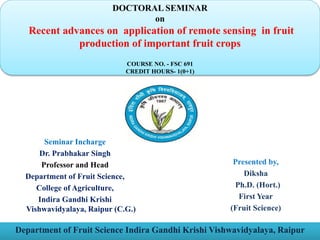
  • 1. DOCTORAL SEMINAR on Recent advances on application of remote sensing in fruit production of important fruit crops COURSE NO. - FSC 691 CREDIT HOURS- 1(0+1) Department of Fruit Science Indira Gandhi Krishi Vishwavidyalaya, Raipur Seminar Incharge Dr. Prabhakar Singh Professor and Head Department of Fruit Science, College of Agriculture, Indira Gandhi Krishi Vishwavidyalaya, Raipur (C.G.) Presented by, Diksha Ph.D. (Hort.) First Year (Fruit Science)
  • 2. Introduction Historical perspective Principle of remote sensing Applications of remote sensing in fruit crops Stages involved in remote sensing system Platforms for remote sensing system CONTENTS Types of sensors Sensors used in fruit crops Remote sensing organizations Research findings Government Initiatives Constraints of remote sensing Conclusion References
  • 3. Remote sensing • Remote - Something which is far away • Sensing – Getting information or getting data India’s national remote sensing agency (NRSA) defined as: “ Remote sensing is the technique of deriving information about objects on the surface of the earth without physically coming into contact with them.’’ • Remote sensing is science of Acquiring Processing Interpreting
  • 4. Historical perspective • 1860’s - First aerial photos from balloons • 1940’s - 50’s - widespread use of aerial photos (WWII) • 1960’s - First satellite images (ERTS) • 1970’s - Landsat MSS, airborne scanners • 1980’s - Landsat TM, AVHRR (Advances very high resolution radiometer) • 1988 ‘s - First remote sensing in India was lunched , named as IRS. • 1990’s - Airborne digital cameras, RADAR, IRS C&.D, release of classified data • 2000’s - New satellites, improvements in airborne digital cameras, LIDAR • 2010’s - Higher spatial & spectral resolution, extensive use of LIDAR, Hyperspectral imagery , UAV’s • The term ‘’Remote Sensing’’ first used in united states in the 1950’s by Mr. Evelya Pruill.
  • 5.
  • 6. Principle of Remote Sensing Source- Paul R. Beumann, 2010
  • 7. Stages involved in remote sensing system 1. Energy source or illumination (A) 2. Radiation and the atmosphere (B) 3. Interaction with the target (C) 4. Recording of energy by the sensor (D) 5. Transmission, reception, and processing (E) 6. Interpretation and analysis (F) 7. Application (G)
  • 8. Platforms for remote sensing system Platforms are nothing but vehicles or carriers of remote sensing. Mainly there are three types of platforms. Ground Based: These includes the use of vehicles, Tripod stands and towers. These are mounted with cameras, and sensors at different heights. Airborne: It includes the use of aeroplanes, helicopters, drone and balloons. It is not cost effective one and occupies only small areas.
  • 9. Space Borne: In space-borne remote sensing, sensors are mounted onboard a spacecraft (space shuttle or satellite) orbiting the earth. Space born or satellite platform are onetime cost effected but relatively lower cost per unit area of coverage. • Earth synchronous satellites • Sun synchronous satellites
  • 11. There are two basic types of sensors: Passive Sensor: In this type solar energy is used as a source of energy. This operates only in day condition whenever sunlight is available. • Camera without flash • Thematic Mapper (TM) • Landsat satellite. Active sensor: As name indicates this requires artificial source of energy. It can be operate in both day and night condition. • Camera flash • RADAR • Topographic LIDAR laser
  • 12. Vegetation indices • Vegetation indices Biophysical features of plants can be characterized spectrally by vegetation indices. • NDVI index- used most frequently to determine the condition, developmental stages and biomass of cultivated plants and to forecasts their yields. • It has become the most commonly used vegetation index ,Wallace et al. (2004). Multispectral and hyper-spectral aerial and satellite imagery helps in creating NDVI maps, which can differentiate soil from grass or forest, detect plants under stress, and differentiate between crops and crop stages.
  • 13.
  • 14. Global positioning system (GPS) • GPS is “a network of satellites that continuously transmit coded information, which make it possible to precisely identify locations on earth by measuring distance from the satellites’’ • GPS provide the accurate positional information, which is useful in locating the spatial variability with accuracy. Some other tools in precision farming
  • 15. Geographical information system (GIS) • A geographical information system is a computer system capable of capturing, storing, manipulation, and displaying spatially information . Intermediate step because it combine the data collected based on sampling regimes, to develop the process models, expert system etc. Spatial data GIS Computer
  • 16. There are many types of sensors used in fruit crops Sensor: These are the devices that receive electromagnetic radiation and convert it into signal that can be recorded or displayed as either numerical data or an image. 1. Microwave radiometer 2. Spectrometer 3. Radar 4. Satellites also act as sensors 5. Digital camera (RGB) 6. Multispectral camera 7. Infrared thermal imager 8. Hyperspectral camera 9. LIDAR
  • 19. View of Multispectral sensor image Source – Bay Spec, 2022 San Jose, USA
  • 20. Thermal Infrared Imaging Sensor Source –T.C Liu.,2012
  • 21. LIDAR crop classification with Drone Source –Adriaan Jacobus prins, 2021
  • 22. Crop Devices/Platforms Purpose Type of Remote Sensing Apple Green seeker 505, tetra cam ADC Weed biomass evaluation Active and passive remote sensing IRSA WiFS Orchard characterization Satellite remote sensing Orange and pineapple IRS-P Satellite sensor, LISS-III Soil site suitability analysis Satellite remote sensing Peach Spectra radio diameter Mite damage Aerial remote sensing Nectarines and peaches Field spectrometer ASD with reflectance of 400 - 1100nm Detecting water stress effects on fruits Aerial remote sensing Mango IRS-P Satellite Yield estimation Satellite remote sensing Grapes Digital multispectral sensors Zonal vine yard management Aerial remote sensing Different types of remote sensing systems and sensors used in fruit crops Source -Appani Laxman Kumar et al.,2021
  • 23. Applications of Remote Sensing in fruit crops  Assessment of crop area  Delineation of orchards and spatial analysis  Determination of fruit yield  Quantification and scheduling of precise and proper fertilizer, irrigation needs and application of pesticides  Identification of diseases and pest attacks  Weather study for site specific crops management in fruit crops  Detection of growth and health of orchards on a larger scale.  Land suitability assessment for crops  Disaster management  Precision horticulture
  • 24. Land suitability assessment for orchard Source – Rajendra Zolekar et al.,2018
  • 25. Identification of diseases and pest attacks area
  • 27. Some key application of remote sensing in fruit crops 1) Estimation of cultivable land area and mapping of orchards: Remote sensing systems have the capability of providing regular, synoptic, multi-spectral and multi-temporal coverage of a cultivable area.  For example Apple orchard area was estimated using remote sensing and agro-metrology land based observation in Pulwama district of Kashmir valley. Landsat and AWIFS digital data were used to monitor and estimate acreage under apple orchards. 2) Recommended dose of fertilizer application: The site-specific grove management by variable rate delivery of inputs such as fertilizers on a tree size basis could improve horticulture crops profitability, reduce fertilizer wastage and provide environmental protection. Source- Appani Laxman Kumar,2021
  • 28. 3) Detection of Water Stress: Remote sensing technology can also help in identification of water stress by change in leaf colour. Many techniques such as high spatial resolution multispectral and thermal airborne imagery were used to monitor crown temperature and the Photochemical Reflectance Index (PRI) in peach orchards. 4) Quality assessment in grape using remote sensing : In grape wine quality was assessed by vigour of vine (Johnson et al., 2001). Remote sensed vegetation index imagery was used to establish sub- block management zones in a three hectare commercial vineyard of chardonnay wine-grapes. 5) Identification of Pest and Diseases in Fruit : Remote sensing techniques can decrease pest monitoring costs in orchards. The spider mite damage in orchards is evaluated by measuring visible and near infrared reflectance of leaves and canopies in peach orchards in California. (Eike L. et al.,2009)
  • 29. 6. High resolution remote sensing imagery in fruit crops The potential of the narrow-band TBVI (two-band vegetation index) derived from airborne hyperspectral imagery to predict citrus fruit yield was examined in Japan (Ye et al., 2008). • The microwave backscatter response of pecan tree canopy samples to estimate pecan yield in situ using terrestrial radar was studied (James et al., 2013). 7. Soil salinity detection using thermal imaging Soil salinity causes severe environmental degradation that impedes crop growth and overall regional production. Soil salinity information can be extracted from thermal imageries as emitted radiance can provide subsoil information.
  • 30. Remote sensing organizations These are some remote sensing organizations at national and international level 1. ISPRS- International Society for Photogrammetry and Remote Sensing(France) 2. NASA- National Aeronautic and Space Administration (USA) 3. ESA- European Space Agency (Europe) 4. NASDA- National Space Development Agency (Japan) 5. CSA- Canadian Space Agency (Canada) 6. ISRO- Indian Space Research Organisation (Banglore, Karnataka) 7. NRSA- National Remote Sensing Agency (Balanagar, Hyderabad)
  • 32. Case study#1 Research title: Mango yield mapping at the orchard scale based on tree structure and land cover assessed by UAV. Major findings:  To estimate and map tree species, structure, and yields in mango orchards of various cropping systems in the Niayes region, West Senegal.  Tree structure parameters (height, crown area and volume), species, and mango cultivars were measured using unmanned aerial vehicle (UAV) photogrammetry and geographic, object-based image analysis.  This procedure reached an average overall accuracy of 0.89 for classifying tree species and mango cultivars.  Models reached satisfying accuracies with R2 greater than 0.77 and RMSE% ranging from 20% to 29% when evaluated with the measured production of 60 validation trees. Author: Julien Sarron et. al. 2018
  • 33. Orchard yield mapping outputs . A) UAV- acquired RGB orthomosaic image B) GEOBIA Land cover map C) Canopy height model (CHM)(in meter) D) Mango cultivar yield map (in Kg per tree).
  • 34. Case study#2 Research title - Geospatial technology for acreage estimation of natural rubber and identification of potential areas for its cultivation in Tripura state.  Potential of temporal and multi-resolution satellite datasets were explored in this project for inventory of natural rubber in Tripura.  The study revealed that natural rubber showed distinct spectral signature on multi-date LISS-III data and it could be delineated using temporal NDVI profile.  The satellite analysis revealed about 48,033 ha of natural rubber (more than 3 years old) in the state as of december 2011.  The mapping accuracy for the older mature natural rubber was 96.15 per cent indicating the utility of RS data for NR mapping and monitoring. Author - Mr. Uday Raj et.al 2012
  • 35.
  • 36.
  • 37. Case study#3 Research title: Spectral discrimination of healthy and malformed mango panicles using spectroradiometer. Research findings– • The potential of using hyperspectral reflectance data to discriminate healthy and malformed mango panicles, both under field and laboratory conditions was evaluated. • The spectral reflectance of both malformed and healthy panicles were collected using ground based portable ASD FS3 spectroradiometer. • Among all the indices Normalized Difference Vegetation Index (NDVI) was found to be the best parameter in differentiating the healthy (0.495) and malformed (0.751) mango panicles significantly under laboratory conditions. • Hence, it can be concluded that spectral reflectance based indices will be a potential tool in the identification of malformed mango panicles spatially through remote sensing data. Author - A. Nagaraja et al., 2014
  • 38. Vegetative indices of healthy and malformed panicles of mango at laboratory (A) and field conditions (B). Index NDVI A Laboratory condition B field conditions Healthy panicle 0.495 0.503 Malformed panicle 0.751 0.780
  • 39. Case study#4 Research title - Citrus canker detection using hyperspectral reflectance imaging and PCA based image classification method. Research findings – • This research demonstrated that hyperspectral imaging technique could be used for discriminating citrus canker from other confounding diseases. • The overall accuracy for canker detection was 92.7%. • Four optimal wavelengths (553, 677, 718, and 858 nm) were identified in visible and short-wavelength near-infrared region that could be adopted by a future multispectral imaging solution for detecting citrus canker on a sorting machine. Author -Jianwei Qin et al.,2008
  • 40. Images of a cankerous samples at selected wavelengths from 400 to 900 nm Hyperspectral reflectance images of grapefruit samples
  • 41. Images of normal and other diseased skin conditions at 600nm
  • 42. Reflectance spectra of grapefruit samples with normal and diseased skin conditions Reflectance between canker and other skin conditions was evident in spectral region between 550 to 850 nm, in which relative reflectance of cankerous and marketable samples were in the range 15 -42% and 37-65% respectively.
  • 43. Government Initiatives FASAL (Forecasting Agricultural output using Space, Agro- meteorological and Land-based observations) Launched in 2006. • The main aim was to collect monsoon data using remote sensing, economic data and monitoring of crop when growing. • A team of ISRO/Department of Space, State Remote Sensing Applications Centers, State Agricultural universities and many other institutions are working on FASAL. • Remote sensing component of FASAL- handled by the Ahmedabad - based Space Application Centre of the Indian Space Research Organization.
  • 44. NCFC (National Crop Forecast Centre) • Launched in April 2012 • Provide estimates of crop output and assess the drought situation in the country through latest technologies. • Located at the New Delhi. • Equipped with image-processing facilities, laboratories and software. • Named after the well known Indian Statistician P. C. Mahalanobis, founder of the Indian Statistical Institute, who played a significant role in evolving methods to estimate crop yields.
  • 45. CHAMAN (Coordinated Horticulture Assessment and Management using Geoinformatics) • Implemented by Mahalanobis National Crop Forecast Centre (MNCFC) in collaboration with ISRO Centres and 12 state horticulture departments, NHRDF, IMD, ICAR Centre and State Remote Sensing Centers is likely to be completed in march 2018. • Envisages use of satellite remote sensing data for area and production estimation of 7 horticultural crops (Potato, Onion, Tomato, Chili, Mango, Banana and Citrus) in 12 major states in 180 districts. • The programme also uses GIS (Geographical Information System) tools along with remote sensing data for generating action plans for horticultural development (site suitability, infrastructure development, crop intensification, orchard rejuvenation, aqua-horticulture, etc.).
  • 46. Advantages of remote sensing 1. Remote sensing is a fast process and it can survey large and inaccessible areas in a short time. 2. Once Remote Sensors have collected data, it can be used and analyzed multiple times for different applications. 3. Remote sensing technology like LIDAR collects point cloud data, this data can be quickly and easily analyzed with point cloud software. 4. Remote Sensors measure reflected light either natural sunlight or a light pulse. This light is harmless to objects, vegetation, human and environment. 5. Remote Sensing allows for easy collection of data over a variety of scales and resolutions.
  • 47. Constraints of Remote Sensing in India • Small size of land holdings • Lack of success stories • Infrastructure and institutional constraints • Lack of local technical expertise • Heterogeneity of cropping systems • High initial investment • Issues with satellite data  Not viable for small land holdings  May not be effective for pest attack information due to inherent delay in providing data  Limitation of predictive model development  Data degradation due to atmospheric disturbances
  • 48. Conclusion • Remote sensing technology has developed from balloon photography to aerial photography & then advanced to multi-spectral satellite imaging. • Precision farming in many development countries including India is in its infancy but there are numerous opportunities for adoption. • Radiation interaction characteristics of earth and atmosphere in different regions of electromagnetic spectrum are very useful for identifying and characterizing earth and atmospheric features. • Remote sensing raising yields and economic returns on fields with significant, variability and for minimizing environmental degradation. • Helps in reducing monitoring costs, enhances resource use efficiency, lowering total production cost and Increases profit.
  • 49. References Eike L, Adam H, Minghua Z, Walter JB, Cecil D. Remote sensing of spider mite damage in California peach orchards. Int. J. App. Earth Observation and Geoinformation. 2009; 11(3):244-255. Handique, B. K., Goswami, C., Gupta, C., Pandit, S., Gogoi, S., Jadi, R., ... & Raju, P. L. N. (2020). Hierarchical classification for assessment of horticultural crops in mixed cropping pattern using UAV-borne multi-spectral sensor. The International Archives of Photogrammetry, Remote Sensing and Spatial Information Sciences, 43, 67-74. Jacob, J., & Raj, U. (2012). Geospatial Technology For Acreage Estimation of Natural Rubber and Identification of potential Areas for its Cultivation in Tripura State. National Remote Sensing Centre ISRO, Govt. of India and Rubber Research Institute of India Rubber Board, Min. of Commerce & Industry, Govt. of India. James A, Hardin PR, Weckler CL. Microwave backscatter response of pecan tree canopy samples for estimation of pecan yield in situ using terrestrial radar. Computers and Electronics in Agriculture. 2013; 90:5462.
  • 50. Johnson LF, Bosch DF, Wiiliums DC, Lobitz BM. Remote sensing of vineyard management zones: Implications for wine quality. Applied Engineering in Agriculture. 2001; 17(4):557-560. Kumar, A. L., Tanuja, P., Reddy, P. M., & Chaithanya, K. Chapter-4 Remote Sensing In Fruit Crops.2021. Mushtaq G, Asima N. Estimation of apple orchard using remote sensing and agro- meteorology land based observation in Pulwama district of Kashmir valley. Int. J. Remote sensing and Geo. Sci. 2014; 3(6):2319-3484. Pal, S., Pandey, S. K., & Sharma, S. K. (2022). Applications of remote sensing and GIS in fruit crops: A review. Pujar, D. U., Pujar, U. U., Shruthi, C. R., Wadagave, A., & Chulaki, M. (2017). Remote sensing in fruit crops. Journal of Pharmacognosy and Phytochemistry, 6(5), 2479- 2484. Nagaraja A, Sahoo RN, Usha K, Singh SK, Sivaramanae N, Gupta VK. Spectral discrimination of healthy and malformed mango panicles using spectroradiometer. Indian Journal of Horticulture. 2014; 71(1):40-44.
  • 51. qin, j., burks, t.f., kim, m.s., chao, k., ritenour, m.a. (2008). citrus canker detection using hyperspectral reflectance imaging and pca-based image classification method. sensing and instrumentation for food quality and safety 2:168–177. Sarron, J., Malézieux, É., Sané, C. A. B., & Faye, É. (2018). Mango yield mapping at the orchard scale based on tree structure and land cover assessed by UAV. Remote Sensing, 10(12), 1900. Satone, M., Diwakar, S., & Joshi, V. (2017). Automatic bruise detection in fruits using thermal images. International Journal, 7(5). Suarez L, Zarco TPJ, Gonzalez V, Berni JA, Sagardoy R, Morales B, Fereres E. Detecting water stress effects on fruit quality in orchards with time-series PRI airborne imagery. Remote Sensing Env. 2010; 114(4):286-298. Ye X, Sakai K, Asada S. Application of narrow-band two-band vegetation index in estimating fruit yield in citrus. Biosystems Engineering. 2008; 99:179-189.