Downloaded 738 times


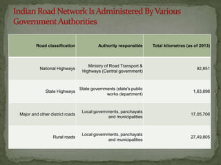
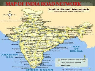
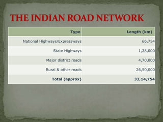
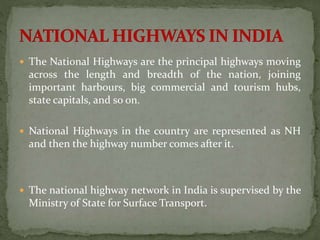


India has one of the largest road networks in the world, spanning over 3.3 million kilometers. The network consists of national highways, maintained by the central government; state highways and major district roads, maintained by state governments; and rural roads, maintained by local governments. It connects cities, towns, villages, and agricultural areas across the country to facilitate transportation of people and goods.


