Transportation engineering involves the planning, design, operation and management of transportation facilities to provide for the safe, efficient and economical movement of people and goods. The document discusses various modes of transportation including their advantages and disadvantages. It provides details on the historical development of roads in India and committees formed to improve the road network in the country. Key highlights from the multi-page document include classifications of roads based on factors like traffic volume and location, as well as the importance of proper highway alignment for cost, safety and traffic flow.
DAVV IET_ TraNSPORTATION [PPT LECTURES ALL 501.pptxprtaap1
(Established by the Government of India under NITSER Act,)
P.O. ICHCHHANATH, SURAT-395 007, GUJARAT, INDIA
Website: http://www.svnit.ac.in
Advt No. Estt. /2022/Gr_A1/2002 Date: October 17, 2022
RECRUITMENT FOR NON-TEACHING POSITIONS
Sardar Vallabhbhai National Institute of Technology Surat (SVNIT) was established by the
Government of India by an Act of Parliament, offering UG, PG and Ph.D. Programs in Engineering/
Technology and Sciences. The Institute is in search of bright, dynamic, experienced, qualified, and
suitable Indian Nationals to cater the Institute’s requirement. The Institute invites online
applications for the following Non-teaching positions on direct recruitment in various departments/
sections of the Institute:
Sl.
No
Name of the Post (s)
& Specialization/
Relevant Field
Pay Level
(as per 7 CPC)
No of Vacant Posts* Total* Upper
Age
Limit
UR SC ST OBCNCL
EWS
1 Librarian Pay Level 14
[PB-4 & GP Rs
10000]
1 - - - - 1 56
2 Scientific Officer /
Technical Officer
(MIS)
Pay Level 10
[PB-3 & GP Rs
5400]
1 - - - - 1 35
3 Executive Engineer
(Civil-01, Electrical-
01)
Pay Level 10
[PB-3 & GP Rs
5400]
2 - - - - 2 35
Total 4 0 0 0 0 4
*One post will be filled up from the identified person with benchmark disabilities, if found suitable
The eligibility criteria for the above posts is as per Recruitment Rules of NITs (2019) and as
updated from time to time by Ministry of Education, Govt. of India. For details regarding the
online Application Form, Educational Qualifications, Experience, other requirements and terms &
conditions for these positions, please visit the Institute website http://www.svnit.ac.in. The
number of Posts may vary at the time of final selection / recruitment.
The recruitment notice for the post advertised vide advertisement no. Estt./2021/Gr_A/3051
dated 02.03.2021 & Estt./2021/2021/EE/678 dated 07.06.2021 for which the recruitment process
has not been completed is cancelled vide Notice No.E/Rect.(2021)/1165 dated 14.10.2022. The
interested applicant who has applied earlier may apply afresh.
The interested candidates may apply online through the Institute website http://www.svnit.ac.in
and send the filled in downloaded online application form duly singed alongwith self-attested
documents viz. relevant testimonials, certificates, payment receipts etc. by speed/ registered
posts to the Deputy Registrar (Establishment), Sardar Vallabhbhi National Institute of
Technology, Ichchhanath, Dumas Road, Surat – 395 007, Gujarat, The applications received
through any other mode shall not be accepted and summarily rejected. The last date for
submission of online application is December 02, 2022 till 5.00 p.m. and receipt of
downloaded signed completed application at SVNIT Surat is December 12, 2022.
-sd/-
REGISTRAR
1
(Established by the Government of India under NITSER Act,)
P.O. ICHCHHANATH, SURAT-395 007, GUJARAT, INDIA
Website: http://www.svnit.ac.in
Advt No. Estt. /2022/Gr_A1/2002 Date: October 17, 2022
RECRUITMENT FOR NON-TEACHING P
Highway Engineering for BE Civil Engineering Students
History of Roads in India, IRC, CRRI, Classification of Roads, Three 20 year Road Development Plans, Road patterns, Accident Studies,
Highway planning and alignment: Different modes of transportation – historical Development of road construction- Highway Development in India –Classification of roads- Road pattern
– Highway planning in India- Highway alignment - Engineering Surveys for alignment – Highway Project- Important Transport/Highway related agencies in India. PMGSY project.
Introduction about IRC, NRRDA
Study of causes of failures and remedies on roadShantanu Patil
Highway engineering means the art of designing, constructing and maintaining public roads. Roads are considered to be one of the most cost effective and preferred modes of transportation. It is easily available and accessible to all sections of the society. It facilitates the movement of both men and materials from one place to another within a country. It helps to bring about national integration as well as provide for countries overall socio-economic development. It is a key infrastructural unit which links to other modes of transportation like railway, shipping, airways etc. Hence an efficient and well established road network is inevitable for promoting trade and commerce as well as meeting the needs of sound transportation system in the country.
this is the PPT created on the chapter 'lifelines of Indian economy'. Me and some of my friends created the slide we are of kendriya Vidyalaya Aurangabad. i hope you will enjoy this ppt...........best of luck.......
Similar to CE PC 506 TRANSPORTATION ENGINEERING.pptx (20)
The Impact of Artificial Intelligence on Modern Society.pdfssuser3e63fc
Just a game Assignment 3
1. What has made Louis Vuitton's business model successful in the Japanese luxury market?
2. What are the opportunities and challenges for Louis Vuitton in Japan?
3. What are the specifics of the Japanese fashion luxury market?
4. How did Louis Vuitton enter into the Japanese market originally? What were the other entry strategies it adopted later to strengthen its presence?
5. Will Louis Vuitton have any new challenges arise due to the global financial crisis? How does it overcome the new challenges?Assignment 3
1. What has made Louis Vuitton's business model successful in the Japanese luxury market?
2. What are the opportunities and challenges for Louis Vuitton in Japan?
3. What are the specifics of the Japanese fashion luxury market?
4. How did Louis Vuitton enter into the Japanese market originally? What were the other entry strategies it adopted later to strengthen its presence?
5. Will Louis Vuitton have any new challenges arise due to the global financial crisis? How does it overcome the new challenges?
This comprehensive program covers essential aspects of performance marketing, growth strategies, and tactics, such as search engine optimization (SEO), pay-per-click (PPC) advertising, content marketing, social media marketing, and more
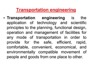
1. Transportation engineering is the
application of technology and scientific
principles to the planning, functional design,
operation and management of facilities for
any mode of transportation in order to
provide for the safe, efficient, rapid,
comfortable, convenient, economical, and
environmentally compatible movement of
people and goods from one place to other.
3. Highways
Car, Bus, Truck, non- motorized ..etc
Railways
Passenger and Goods
Airways
Aircraft and Helicopters
Waterways
Continuous Flow systems
Pipelines,belts,elevetor,ropeway
Merits and Demerits: Based on accessibility, mobility, cost, tonnage..
4. Fastest among all other modes
More comfortable
Time saving
Uneconomical
Waterways
slowest among all other modes
It needs minimum energy to haul unit load
through unit distance.
This can be possible between ports on the sea
routes or along the river
economical
5. The transportation along the railways track
could be advantageous by railways between
the stations both for the passengers and
goods, particularly for long distance.
It depends upon the road transport i.e. road
could serve as a feeder system.
Energy require to haul a unit load through
unit distance by the railway is only ¼ to 1/5
of that required by road.
Safety
6. It gives the maximum service to one and all
It gives maximum flexibility for travel with reference
to route, direction, time and speed of travel
It provide door to door service
Other modes are depend on it
It requires small investment for the government
Motor vehicles are cheaper than other carriers like
rail locomotive and wagons
It saves the time for short distance
High degree of accident due to flexibility of
movement
7. Development, planning and location
Highway design, geometric and structure
Traffic performance and its control
Materials, construction and maintenance
Economic, finance and administration
8. ROLE /IMPACT OF TRANSPORTATION
Economic Development
Social Development
Spatial Development
Cultural Development
Political Development
9. Roads are used by various types of road vehicles,
like passenger cars, buses, trucks, pedal cycle and
animal drawn vehicle.
It requires a relatively small investment for the
government.
It offers a complete freedom to road users to
transfer the vehicle from one lane to another and
from one road to another according to need and
convenience.
Speed and movement is directly related with the
severity of accident.
Road transport is the only means of transport that
offers itself to the whole community alike.
10. HISTORICAL DEVELOPMENT OF ROAD
CONSTRUCTION
Oldest mode
Foot paths-
As civilization evolved the need for transportation
increased
ROMAN ROAD-(500 B.C.)
They were built straight regardless of gradient
They were built after the soft soil was removed and
a hard stratum was reached.
Thickness varies from 0.75 m to 1.2m
13. Other oldest road transport are
Tresaguet construction
Metcalf construction
Telford construction
Mecadam construction
14. India has a large road network of over 3.314
million kilometers of roadways (2.1 million
miles), making it 3rd largest road network in the
world.
At 0.66 km of highway per square kilometer of
land the density of highway network is
higher than that of the United States (0.65) and
far higher than that of China's (0.16) or Brazil's
(0.20).
15. Jayakar Committee (1927)
Central Road Fund (1929)
Indian Roads Congress (IRC), 1934
Central Road Research Institute (CRRI), 1950
Motor vehicle act (1936)
National Highway Authority of India (NHAI),1995
First twenty year road plan ( 1943-61 )
Second twenty year road plan ( 1961-81 )
Highway Research board ( 1973 )
National Transport Policy committee ( 1978 )
Third twenty year road plan ( 1981-2001 )
16. After the first World War, motor vehicle using the roads
increases, this demanded a better road network.
In 1927,Indian road development committee was appointed
by the government with M.R. Jaykar as chairman.
Road development in the country should be made as a
national interest since local govt. do not have financial and
technical capacity for road development.
An extra tax should be levied on petrol from road users to
create the road development fund.
To establish a semi-official ,technical institution to pool
technical knowledge, sharing of ideas and to act as an
advisory body.
To create a national level institution to carry research ,
development works and consultation.
17. It was formed on 1st march 1929
The consumers of petrol were charged an extra
leavy of 2.64 paisa per litre of petrol to built up
this road development fund.
From this 20% of annual reveneu is to be retain
as a central reveneu for research and
experimental work expenses..etc
Balance 80% is allowed by central govt. to
various states based on actual petrol
consumption or revenue collected.
18. CRF Act , 2000
Distribution of 100% cess on petrol as follows:
57.5% for NH
30% for SH
12.5% for safety works on rail-Road crossing.
50% cess on diesel for Rural Road development
MORTH
19. Central semi official body known as IRC was formed in
1934.
To provide national forum for regular pooling of
experience and ideas on matters related to construction
and maintenance of highways.
It is a active body controlling the specification,
standardization and recommendations on materials,
design of roads and bridges.
It publishes journals, research publications and standard
specifications guide lines.
To provide a platform for expression of professional
opinion on matters relating to roads and road transport.
20. It was formed in 1939
To regulate the road traffic in the form of
traffic laws, ordinances and regulations.
Three phases primarily covered are
control of driver, vehicle ownership and
vehicle operation
It was revised on 1988
21. engaged in carrying out research and development
projects.
design, construction and maintenance of roads and
runways, traffic and transportation planning of mega
and medium cities, management of roads in different
terrains,
Improvement of marginal materials.
Utilization of industrial waste in road construction.
Landslide control.
Ground improvements, environmental pollution.
Road traffic safety.
22. Ministry of Road Transport & Highways
Planning, development and maintenance of
National Highways in the country.
Extends technical and financial support to State
Governments for the development of state roads
and the roads of inter-state connectivity and
economic importance.
Evolves standard specifications for roads and
bridges in the country.
It stores the data related to technical knowledge
on roads and bridges.
23. To ascertain the nature and extent of
research required
To correlate research information from
various organisation in India and abroad.
To collect and correlation services.
To collect result on research
To channelise consultative services
24. Depending on weather
All weather roads
Fair weather roads
Depending the type of Carriage way
Paved roads(WBM)
Unpaved roads(earth road or gravel road)
Depending upon the pavement surface
Surfaced roads(bituminous or cement concrete
road)
Un surfaced roads
25. Based on the Traffic Volume
Heavy
Medium
Light
Based on Load or Tonnage
Class 1 or Class 2 etc or Class A , B etc Tonnes per
day
Based on location and function ( Nagpur road plan )
National highway (NH)
State highway (SH)
Major district road (MDR)
Other district road (ODR)
Village road (VR)
27. Heavy traffic at high speed (120km/hr)
Land Width (90m)
Full access control
Connects major points of traffic generation
No slow moving traffic allowed
No loading, unloading,
parking.
The Mumbai-Pune Expressway as seen
from Khandala
28. NH are the main highways running through the length and
breadth of India, connecting major parts,foreign
highways,capital of large states and large industrial and
tourist centres including roads required for strategic
movements for the defence of India.
The national highways have a total length of 70,548 kms.
Indian highways cover 2% of the total road network of India
and carry 40% of the total traffic.
The highway connecting Delhi-Ambala-Amritsar is denoted
as NH-1, whereas a bifurcation of this highway beyond
Jalandar to Srinagar and Uri is denoted NH-1-A
The longest highway in India is NH7 which stretches from
Varansi in Uttar Pradesh to Kanyakumari in the southern
most point of Indian mainland.
29. The shortest highway is NH47A which stretches
from Ernakulam to Kochi and covers total length of
4 Kms.
Golden Quadrilateral (5,846 Kms) connecting Delhi-
Kolkata-Chennai-Mumbai
NH-2 Delhi- Kol (1453 km)
NH 4,7&46 Che-Mum (1290km )
NH5&6 Kol- Che (1684 m)
NH 8 Del- Mum (1419 km)
30. They are the arterial roads of a state,
connecting up with the national highways of
adjacent states, district head quarters and
important cities within the state.
Total length of all SH in the country is
1,37,119 Kms.
Speed 80 kmph
31. Important roads with in a district serving
areas of production and markets ,
connecting those with each other or with
the major highways.
India has a total of 4,70,000 kms of MDR.
Speed 60-80kmph
32. serving rural areas of production and providing
them with outlet to market centers or other
important roads like MDR or SH.
Speed 50-60kmph
Village roads
They are roads connecting villages or group of
villages with each other or to the nearest road of a
higher category like ODR or MDR.
India has 26,50,000 kms of ODR+VR out of the
total 33,15,231 kms of all type of roads.
Speed-40-50kmph
34. No frontage access, no standing vehicle,
very little cross traffic.
Design Speed : 80km/hr
Land width : 50 60m
Divided roads with full or partial parking
Pedestrian allowed to walk only at
intersection
35. Bus stops but no standing vehicle.
Less mobility than arterial.
Spacing for CBD
Design speed
Land width
: 0.5km
: 60 km/hr
: 30 40 m
36. Collects and distributes traffic from local
streets
Provides access to arterial roads
Located in residential, business and
industrial areas.
Full access allowed.
Parking permitted.
Design speed : 50km/hr
Land Width : 20-30m
37. Design Speed : 30km/hr.
Land Width : 10 20m.
Primary access to residence, business or
other abutting property
Less volume of traffic at slow speed
Unrestricted parking, pedestrian
movements. (with frontage access, parked
vehicle, bus stops and no waiting
restrictions)
38. Dead End Street with only one entry
access for entry and exit.
Recommended in Residential areas
39. A driveway is a type of private road for local
access to one or a small group of structures, and
is owned and maintained by an individual or
group.
Driveways are commonly used as paths to
private garages, fuel stations, or houses
40. Rectangular or Block patterns
Radial or Star block pattern
Radial or Star Circular pattern
Radial or Star grid pattern
Hexagonal Pattern
Minimum travel Pattern
41. The conference of chief engineer held at Nagpur in
1943 finalized the first 20-years road development
plan for India called Nagpur road plan
Road network was classified into five categories.
The responsibility of construction maintenance of NH
was assign to central govt.
The target road length was 5,32,700 km at the end of
1961.
Density of about 16km of road length per 100 sq. km
area would be available in the country by the year
1963.
42. The formulae were based on star and grid
pattern of road network.
An allowance of 15% is provided for
agricultural industrial development during the
next 20-years
The length of railway track in the area was
also consider in deciding the length of first
category road. The length or railway track is
directly subtracted from the estimated road
length of metalled roads.
43. It was initiated by the IRC and was finalised in
1959 at the meeting of chief engineers.
It is known as the Bombay road plan.
The target road length was almost double that
of Nagpur road plan i.e. 10,57,330 km.
Density about 32 km per 100 sq. km. and an
outlay of 5200 crores
Every town with population above 2000 in
plans and above 1000 in semi hill area and
above 500 in hilly area should be connected
by metalled road
44. the maximum distance from any place in a
semi develop area would be 12.8 km from
metalled road and 4.8 from any road
Expressways have also been considered in
this plan and 1600km of length has been
included in the proposed target NH
Length of railway track is considered
independent of road system
5% are to be provided for future development
and unforeseen factor
45. Third twenty years road plan (1981-2001)
The future road development should be based on
the revised classification of roads system i.e.
primary, secondary and tertiary
Develop the rural economy and small towns with all
essential features.
Population over 500 should be connected by all
weather roads.
Density increases to 82 km per 100 sq. km
The NH network should be expanded to form a
square grids of 100 km sides so that no part of the
country is more than 50 km away from the NH
46. Third twenty years road plan
Expressway should be constructed along major
traffic corridors
All towns and villages with population over 1500
should be connected by MDR and villages with
population 1000-1500 by ODR.
Road should be built in less industrialized areas to
attract the growth of industries
The existing roads should be improved by rectifying
the defects in the road geometry, widening, riding
quality and strengthening the existing pavement to
save vehicle operation cost and thus to conserve
energy
47.
48. The position or lay out of centre line of the highway
on the ground is called the alignment.
It includes straight path, horizontal deviation and
curves.
Due to improper alignment , the disadvantages are,
Increase in construction
Increase in maintenance cost
Increase in vehicle operation cost
Increase in accident cost
Once the road is aligned and constructed, it is not
easy to change the alignment due to increase in
cost of adjoining land and construction of costly
structure.
49.
50.
51. Short
Easy
Safe
Economical
Short- desirable to have a short alignment between two
terminal stations.
Easy- easy to construct and maintain the road with minimum
problem also easy for operation of vehicle.
Safe- safe enough for construction and maintenance from
the view point of stability of natural hill slope, embankment
and cut slope also safe for traffic operation.
Economical- total cost including initial cost, maintenance
cost and vehicle operation cost should be minimum.
Requrements of highway alignment
53. Obligatory points
Obligatory points through which alignment is to pass
Examples:-
Obligatory points through which alignment should not
pass.
Examples:-
Traffic
origin and destination survey should be carried out in the
area and the desire lines be drawn showing the trend of
traffic flow.
New road to be aligned should keep in view the desired lines,
traffic flow patterns and future trends.
54. Design factors such as gradient ,radius of curve and sight
distance also govern the final alignment of the highway.
Gradient should be flat and less than the ruling gradient or
design gradient.
Avoid sudden changes in sight distance, especially near
crossings
Avoid sharp horizontal curves
Avoid road intersections near bend
Economy
Alignment finalised based on total cost including initial cost,
maintenance cost and vehicle operation cost.
Other consideration
Drainage consideration, political consideration
Surface water level, high flood level
Environmental consideration
55. Topographical control points
The alignment, where possible should avoid passing
through
Marshy and low lying land with poor drainage
Flood prone areas
Unstable hilly features
Materials and constructional features
Deep cutting should be avoided
Earth work is to be balanced; quantities for filling and
excavation
Alignment should preferably be through better soil area
to minimize pavement thickness
Location may be near sources of embankment and
pavement materials
56. A common problem in hilly roads is land sliding
The cutting and filling of the earth to construct the roads on
hilly sides causes steepening of existing slope and affect its
stability.
Drainage
Avoid the cross drainage structure
The number of cross drainage structure should be minimum.
Geometric standard of hilly road
Gradient, curve and speed
Sight distance, radius of curve
Resisting length
The total work to be done to move the loads along the route
taking horizontal length, the actual difference in level between
two stations and the sum of the ineffective rise and fall in
excess of floating gradient. Should kept as low as possible.
57. Before a highway alignment is finalised in highway
project, the engineering survey are to be carried out.
The various stages of engineering surveys are
Map study (Provisional alignment Identification)
Reconnaissance survey
Preliminary survey
Final location and detailed surveys
Engineering Surveys for Highway locations
58. MAP STUDY
From the map alternative routes can be suggested
in the office, if the topographic map of that area is
available.
The probable alignment can be located on the map
from the fallowing details available on the map.
Avoiding valleys, ponds or lake
Avoiding bend of river
If road has to cross a row of hills, possibility of
crossing through mountain pass.
Map study gives a rough guidance of the routes to
be further surveyed in the field
59. RECONNAISSANCE SURVEY
To confirm features indicated on map.
To examine the general character of the area in field for
deciding the most feasible routes for detailed studies.
A survey party may inspect along the proposed alternative
routes of the map in the field with very simple instrument
like abney level, tangent clinometer, barometer etc . To
collect additional details.
Details to be collected from alternative routes during this
survey are,
Valleys, ponds, lakes, marshy land, hill, permanent
structure and other obstruction.
Value of gradient, length of gradient and radius of curve.
60. RECONNAISSANCE SURVEY
Number and type of cross drainage structures.
High Flood Level (HFL)
Soil Characteristics.
Geological features.
source of construction materials- stone quarries, water
sources.
Prepare a report on merits and demerits of different
alternative routs.
As a result a few alternate alignments may be chosen for
further study based on practical considerations observed
at the site.
61. Objective of preliminary survey are:
To survey the various alternative alignments proposed after
the reconnaissance and to collect all the necessary physical
information and detail of topography, drainage and soil.
To compare the different proposals in view of the
requirements of the good alignment.
To estimate quantity of earthwork materials and other
construction aspect and to workout the cost of the alternate
proposals.
Methods of preliminary survey:
a) Conventional approach-survey party carries out surveys
using the required field equipment, taking measurement,
collecting topographical and other data and carrying out soil
survey.
62. Longitudinal and cross sectional profile.
200m
: 100
: 50m
: 30m
Plain Terrain`
Rolling Terrain
Hilly Terrain
Other studies
Drainage, Hydrological survey, soil survey, Traffic and
Material survey.
b) Modern rapid approach-
By Aerial survey taking the required aerial photographs for
obtaining the necessary topographic and other maps
including details of soil and geology.
Finalise the best alignment from all considerations by
comparative analysis of alternative routes.
63. The alignment finalised at the design office after the
preliminary survey is to be first located on the field by
establishing the centre line.
Location survey:
Transferring the alignment on to ground.
This is done by transit theodolite.
Major and minor control points are established on the
ground and centre pegs are driven, checking the
geometric design requirements.
Centre line stacks are driven at suitable intervals, say 50m
interval in plane and rolling terrains and 20m in hilly
terrain.
64. Final location and detailed survey cont..
Detailed survey:
Temporary bench marks are fixed at intervals of about 250m
and at all drainage and under pass structure.
Earthwork calculations and drainage details are to be workout
from the level books.
Cross sectional levels are taken at intervals of 50-100m in
Plane terrain, 50-75m in Rolling terrain, 50m in built-up area,
20m in Hill terrain.
Detail soil survey is to be carried out.
CBR value of the soils along the alignment may be determined
for design of pavement.
The data during detailed survey should be elaborate and
complete for preparing detailed plans, design and estimates of
project.
65. Key map
Index map
Preliminary survey plans
Detailed plan and longitudinal section
Detailed cross section
Land acquisition plans
Drawings of cross drainage and other retaining
structures
Drawings of road intersections
Land plans showing quarries etc
66. Map study
Reconnaissance survey
Preliminary survey
Location of final alignment
Detailed survey
Material survey
Geometric and structural design
Earth work
Pavement construction
Construction controls