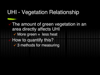
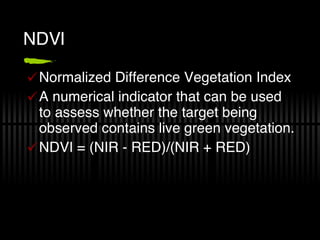
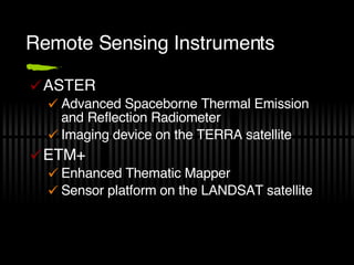
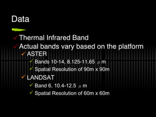
Urban heat islands occur when land and air temperatures are significantly higher in urban areas compared to surrounding rural areas. This is due to factors like construction materials that absorb more heat, lack of vegetation, and waste heat from energy use. Remote sensing using instruments like ASTER and Landsat can measure land surface temperatures to analyze urban heat islands. More advanced methods can separate natural from anthropogenic heat sources. The amount of vegetation, measured by metrics like NDVI, vegetation fraction, and LAI, directly affects the intensity of urban heat islands. Mitigation strategies include increasing urban greenery and using reflective building materials.
![Remote Sensing of the Urban Heat Island Effect Christopher S Martin [email_address]](https://image.slidesharecdn.com/urban-heat-island-1209002366278040-9/85/Remote-Sensing-the-Urban-Heat-Island-Effect-1-320.jpg)
![Remote Sensing of the Urban Heat Island Effect Christopher S Martin [email_address]](https://image.slidesharecdn.com/urban-heat-island-1209002366278040-9/75/Remote-Sensing-the-Urban-Heat-Island-Effect-1-2048.jpg)
![Procedure Calibration L=0.0370588·DN+3.2 BT Calculation BT = K 2 /{ln[(K 1 /L) + 1]} LST Calculation T s = BT/{1+[(λ ⋅BT/ρ)⋅lnε]}](https://image.slidesharecdn.com/urban-heat-island-1209002366278040-9/85/Remote-Sensing-the-Urban-Heat-Island-Effect-9-320.jpg)