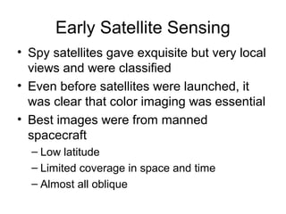
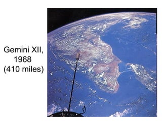
SlideShare a Scribd company logo
Remote Sensing Systems
Early Satellite Sensing
• Spy satellites gave exquisite but very local
views and were classified
• Even before satellites were launched, it
was clear that color imaging was essential
• Best images were from manned
spacecraft
– Low latitude
– Limited coverage in space and time
– Almost all oblique
Gemini XII,
1968
(410 miles)
Early Satellite Sensing
• Meteorological satellites gave hints of
what might be possible
– Snow coverage
– Sea ice
– Glaciers
– Gross geological structures
Nimbus I image
1964
Landsat
• Landsat 1 1972-1978
• Landsat 2 1975-1981
• Landsat 3 1978-1983
• Landsat 4 1982-1993
• Landsat 5 1984, still functioning
• Landsat 6 1993, failed to reach orbit
• Landsat 7 1999, still functioning, but with
faulty scan line corrector (May 2003)
• Landsat Data Continuity Mission,
scheduled for 2012
Two Key Features of Landsat
• Orbits are sun synchronous: satellite
crosses equator southbound on day side
at about 10 AM local time
• Orbits repeat ground track precisely every
14-18 days (Revisit period)
• A term to know: Nadir = point directly
below (opposite of Zenith)
Early Landsat
• Originally modeled on Nimbus weather
satellite system
• Landsat 1 observed in Green, Red and
two IR bands with 80-m resolution
• Landsat 3 had 30-m resolution
• Landsat 3 added a fifth thermal IR band
but it failed
• Landsat 4: 7 bands
• Landsat 7: 15 m resolution panchromatic
Failed Experiment
• President Jimmy Carter recommended private
sector operation of Landsat, 1979
• Earth Observation Satellite Company (EOSAT),
a partnership of Hughes Aircraft and RCA, was
awarded ten year contract to operate Landsat,
1985
• EOSAT operated Landsats 4 and 5 and had
exclusive rights to market Landsat data.
• EOSAT needed repeated bailouts
• Congress passed Land Remote Sensing Policy
Act (Public Law 102-555) and returned Landsat
to public domain, 1992
Landsat 7 Bands
1 0.45-0.52µm Blue-Green 30 m
2 0.52-0.60 µm Green 30 m
3 0.63-0.69 µm Red 30 m
4 0.76-0.90 µm Near IR 30 m
5 1.55-1.75 µm Mid-IR 30 m
6 10.40-12.50 µm Thermal IR 60 m
7 2.08-2.35 µm Mid-IR 30 m
0,52-0.90 µm Panchromatic 15 m
Uses of Landsat 7 Bands
1. Coastal water mapping, soil/vegetation discrimination,
forest classification, man-made feature identification
2. Vegetation discrimination and health monitoring, man-
made feature identification
3. Plant species identification, man-made feature
identification
4. Soil moisture monitoring, vegetation monitoring, water
body discrimination
5. Vegetation moisture content monitoring
6. Surface temperature, vegetation stress monitoring, soil
moisture monitoring, cloud differentiation, volcanic
monitoring
7. Mineral and rock discrimination, vegetation moisture
content
False Color Images
• Near IR (ETM+ band 4)  Red
• Red (ETM+ band 3)  Green
• Green (ETM+ band 2)  Blue
• Colors on image are shifted one band
toward blue compared to real scene
Making a False-Color Image
Landsat 7 Facts
• Altitude: 705 kilometers
• Period: 98.9 minutes
• Inclination: Sun-synchronous, 98.2 degrees
• Equatorial crossing: Southbound 10:00AM +/-
15 min.
• Repeat coverage interval: 16 days (233 orbits)
• Swath width: 185 kilometers
• On-board data storage: ~375 Gb (solid state)
See SPOT. See SPOT See
• Satellite Pour l'Observation de la Terre
• Sun-synchronous
• Altitude: 832 kilometers,
• Inclination: 98.7
• Revisit period: 26 days
• Uses CCD’s and stare mode; no scanning
SPOT 5 Bands
Band (microns) Colors Resolution
0.51 - 0.73 Panchromatic 2.5 & 5m
0.50 - 0.59 Green 10m
0.61 - 0.68 Red 10m
0.79 - 0.89 Near IR 10m
1.58 - 1.73 Mid IR 20m
SPOT
Image of
Kuwait
City,
2004
IKONOS
• 1992 Land Remote Sensing Policy Act
permitted private companies to enter the
satellite imaging business.
• Lockheed Martin
• Launched 2000
• 1 m resolution
• Bands: Blue, Green, Red, Near IR
• Now operated by GeoEye Inc., Dulles VA
Burj Khalifa by IKONOS
Terra
• Part of NASA EOS (Earth Observation System)
• Partnership of U.S., Canada, Japan
• Instruments
– ASTER (Advanced Spaceborne Thermal Emission
and Reflection Radiometer)
– CERES (Clouds and Earth's Radiant Energy System)
– MISR (Multiangle Imaging Spectroradiometer)
– MODIS (Moderate-Resolution Imaging
Spectroradiometer)
– MOPITT (Measurements of Pollution in the
Troposphere)
ASTER
• U.S. – Japan joint mission
• Three Subsystems, each with own
telescopes
• VNIR: Four visible and near-IR channels,
15-m resolution
• SWIR: Six short wave IR channels, 30-m
resolution
• TIR: Five Thermal IR Channels, 90-m
resolution
– IR sensors use Stirling Cycle coolers
MODIS
• Resolutions 250, 500 and 1000 meters
• Ten visible bands (250 and 500-m)
• Ten Near IR bands (500 and 1000 m)
• 16 Medium and Thermal IR bands
(1000 m)
• Bands are narrow and tailored to specific
emissions and absorptions (ocean color,
aerosols, ozone, water vapor, cloud
temperature)

More Related Content

What's hot

Ikonos
IkonosIkonos
space technology
space technologyspace technology
space technology
Rosita Belandres Romana
 
GPS
GPS GPS
Presentation on GPS
Presentation  on GPSPresentation  on GPS
Presentation on GPS
Amit Bshwas
 
Global positioning system (GPS)
Global positioning system (GPS)Global positioning system (GPS)
Global positioning system (GPS)
Chandana R
 
Satellite orbits/geosynchronous satellites
Satellite orbits/geosynchronous satellitesSatellite orbits/geosynchronous satellites
Satellite orbits/geosynchronous satellites
cecillecepillo
 
What is geostationary satellite
What is geostationary satelliteWhat is geostationary satellite
What is geostationary satellite
DPSG
 
Satellites in Communication
Satellites in CommunicationSatellites in Communication
Satellites in Communication
Tejaswa Jain
 
Earth Observation Satellites
Earth Observation SatellitesEarth Observation Satellites
Earth Observation Satellites
Divya Basuti
 
Introduction to GPS
Introduction to GPSIntroduction to GPS
Introduction to GPS
Daniel Kim
 
Global positioning system
Global positioning systemGlobal positioning system
Global positioning system
Naeem Kamboh Ravian
 
Satellite orbit and constellation design
Satellite orbit and constellation designSatellite orbit and constellation design
Satellite orbit and constellation design
Exploring Career Opportunities Internationally
 
Gps(global positioning system)
Gps(global positioning system)Gps(global positioning system)
Gps(global positioning system)
Amit Bshwas
 
Satellite applications satellite applicationssatellite applications
Satellite applications satellite applicationssatellite applicationsSatellite applications satellite applicationssatellite applications
Satellite applications satellite applicationssatellite applications
nader babo
 
Sc ppt -jntuworld.com__jwfiles
Sc ppt -jntuworld.com__jwfilesSc ppt -jntuworld.com__jwfiles
Sc ppt -jntuworld.com__jwfiles
Brem Kumar
 
Global Positioning System (GPS)
Global Positioning System (GPS)Global Positioning System (GPS)
Global Positioning System (GPS)
Arpit Kurel
 
Remote sensing presentation with case study
Remote sensing presentation with case studyRemote sensing presentation with case study
Remote sensing presentation with case study
Keshav Chaurasia
 
Global positioning system
Global positioning systemGlobal positioning system
Global positioning system
Jeevan Reddy Mandali
 
Chris Spry Ikonos
Chris Spry IkonosChris Spry Ikonos
Chris Spry Ikonos
Wuzzy13
 
GPS Surveying
GPS SurveyingGPS Surveying
GPS Surveying
Malla Reddy University
 

What's hot (20)

Ikonos
IkonosIkonos
Ikonos
 
space technology
space technologyspace technology
space technology
 
GPS
GPS GPS
GPS
 
Presentation on GPS
Presentation  on GPSPresentation  on GPS
Presentation on GPS
 
Global positioning system (GPS)
Global positioning system (GPS)Global positioning system (GPS)
Global positioning system (GPS)
 
Satellite orbits/geosynchronous satellites
Satellite orbits/geosynchronous satellitesSatellite orbits/geosynchronous satellites
Satellite orbits/geosynchronous satellites
 
What is geostationary satellite
What is geostationary satelliteWhat is geostationary satellite
What is geostationary satellite
 
Satellites in Communication
Satellites in CommunicationSatellites in Communication
Satellites in Communication
 
Earth Observation Satellites
Earth Observation SatellitesEarth Observation Satellites
Earth Observation Satellites
 
Introduction to GPS
Introduction to GPSIntroduction to GPS
Introduction to GPS
 
Global positioning system
Global positioning systemGlobal positioning system
Global positioning system
 
Satellite orbit and constellation design
Satellite orbit and constellation designSatellite orbit and constellation design
Satellite orbit and constellation design
 
Gps(global positioning system)
Gps(global positioning system)Gps(global positioning system)
Gps(global positioning system)
 
Satellite applications satellite applicationssatellite applications
Satellite applications satellite applicationssatellite applicationsSatellite applications satellite applicationssatellite applications
Satellite applications satellite applicationssatellite applications
 
Sc ppt -jntuworld.com__jwfiles
Sc ppt -jntuworld.com__jwfilesSc ppt -jntuworld.com__jwfiles
Sc ppt -jntuworld.com__jwfiles
 
Global Positioning System (GPS)
Global Positioning System (GPS)Global Positioning System (GPS)
Global Positioning System (GPS)
 
Remote sensing presentation with case study
Remote sensing presentation with case studyRemote sensing presentation with case study
Remote sensing presentation with case study
 
Global positioning system
Global positioning systemGlobal positioning system
Global positioning system
 
Chris Spry Ikonos
Chris Spry IkonosChris Spry Ikonos
Chris Spry Ikonos
 
GPS Surveying
GPS SurveyingGPS Surveying
GPS Surveying
 

Viewers also liked

קטלוג ראש השנה 2013 טופי
קטלוג ראש השנה 2013  טופיקטלוג ראש השנה 2013  טופי
קטלוג ראש השנה 2013 טופי
Noa Ben-Ezra
 
Remote sensing
Remote sensingRemote sensing
Remote sensing
Nishant Chaturvedi
 
Interior s exhibition_s (2)
Interior s exhibition_s (2)Interior s exhibition_s (2)
Interior s exhibition_s (2)
British Council
 
ESTACIONES MÓVILES DE COMBUSTIBLE Y TANQUES PARA ALMACENAJE ESTÁTICO DE GASOL...
ESTACIONES MÓVILES DE COMBUSTIBLE Y TANQUES PARA ALMACENAJE ESTÁTICO DE GASOL...ESTACIONES MÓVILES DE COMBUSTIBLE Y TANQUES PARA ALMACENAJE ESTÁTICO DE GASOL...
ESTACIONES MÓVILES DE COMBUSTIBLE Y TANQUES PARA ALMACENAJE ESTÁTICO DE GASOL...
Grupo CRUSAN
 
00002web集客の最大化を実現「外食版seoサービス」
00002web集客の最大化を実現「外食版seoサービス」00002web集客の最大化を実現「外食版seoサービス」
00002web集客の最大化を実現「外食版seoサービス」
Nobuharu Sato
 
Masterpiece caterers breakfast menus
Masterpiece caterers breakfast menusMasterpiece caterers breakfast menus
Masterpiece caterers breakfast menus
Glui
 
ツリーエディタ チュートリアル - ズカンドットコム
ツリーエディタ チュートリアル - ズカンドットコムツリーエディタ チュートリアル - ズカンドットコム
ツリーエディタ チュートリアル - ズカンドットコム
zukan.com
 
Git - Introduction and Overview
Git - Introduction and OverviewGit - Introduction and Overview
Git - Introduction and Overview
asmajlovic
 
Remote sensing
Remote sensingRemote sensing
Remote sensing
Nishant Chaturvedi
 
Why Small Businesses and Start-ups Need HR Sooner Than They Think
Why Small Businesses and Start-ups Need HR Sooner Than They ThinkWhy Small Businesses and Start-ups Need HR Sooner Than They Think
Why Small Businesses and Start-ups Need HR Sooner Than They Think
Mary Beth Huerta
 
Manual Passo a Passo para Instalação da Moldura 2DIN do Novo Uno 2015/...
Manual Passo a Passo para Instalação da Moldura 2DIN do Novo Uno 2015/...Manual Passo a Passo para Instalação da Moldura 2DIN do Novo Uno 2015/...
Manual Passo a Passo para Instalação da Moldura 2DIN do Novo Uno 2015/...
Indústria e Comércio de Autopeças Autoplast
 
Remote sensing
Remote sensingRemote sensing
Remote sensing
Nishant Chaturvedi
 
Proteína ideal en pollos
Proteína ideal en pollosProteína ideal en pollos
Proteína ideal en pollos
Universidad de la Salle
 
Remote sensing
Remote sensingRemote sensing
Remote sensing
Nishant Chaturvedi
 

Viewers also liked (15)

קטלוג ראש השנה 2013 טופי
קטלוג ראש השנה 2013  טופיקטלוג ראש השנה 2013  טופי
קטלוג ראש השנה 2013 טופי
 
Remote sensing
Remote sensingRemote sensing
Remote sensing
 
Interior s exhibition_s (2)
Interior s exhibition_s (2)Interior s exhibition_s (2)
Interior s exhibition_s (2)
 
ESTACIONES MÓVILES DE COMBUSTIBLE Y TANQUES PARA ALMACENAJE ESTÁTICO DE GASOL...
ESTACIONES MÓVILES DE COMBUSTIBLE Y TANQUES PARA ALMACENAJE ESTÁTICO DE GASOL...ESTACIONES MÓVILES DE COMBUSTIBLE Y TANQUES PARA ALMACENAJE ESTÁTICO DE GASOL...
ESTACIONES MÓVILES DE COMBUSTIBLE Y TANQUES PARA ALMACENAJE ESTÁTICO DE GASOL...
 
Yourprezi
YourpreziYourprezi
Yourprezi
 
00002web集客の最大化を実現「外食版seoサービス」
00002web集客の最大化を実現「外食版seoサービス」00002web集客の最大化を実現「外食版seoサービス」
00002web集客の最大化を実現「外食版seoサービス」
 
Masterpiece caterers breakfast menus
Masterpiece caterers breakfast menusMasterpiece caterers breakfast menus
Masterpiece caterers breakfast menus
 
ツリーエディタ チュートリアル - ズカンドットコム
ツリーエディタ チュートリアル - ズカンドットコムツリーエディタ チュートリアル - ズカンドットコム
ツリーエディタ チュートリアル - ズカンドットコム
 
Git - Introduction and Overview
Git - Introduction and OverviewGit - Introduction and Overview
Git - Introduction and Overview
 
Remote sensing
Remote sensingRemote sensing
Remote sensing
 
Why Small Businesses and Start-ups Need HR Sooner Than They Think
Why Small Businesses and Start-ups Need HR Sooner Than They ThinkWhy Small Businesses and Start-ups Need HR Sooner Than They Think
Why Small Businesses and Start-ups Need HR Sooner Than They Think
 
Manual Passo a Passo para Instalação da Moldura 2DIN do Novo Uno 2015/...
Manual Passo a Passo para Instalação da Moldura 2DIN do Novo Uno 2015/...Manual Passo a Passo para Instalação da Moldura 2DIN do Novo Uno 2015/...
Manual Passo a Passo para Instalação da Moldura 2DIN do Novo Uno 2015/...
 
Remote sensing
Remote sensingRemote sensing
Remote sensing
 
Proteína ideal en pollos
Proteína ideal en pollosProteína ideal en pollos
Proteína ideal en pollos
 
Remote sensing
Remote sensingRemote sensing
Remote sensing
 

Similar to Remote sensing systems

Landsat.pptx
Landsat.pptxLandsat.pptx
Landsat.pptx
Reshma Jeswani
 
REMOTE SENSING PLATFORMS.ppt
REMOTE SENSING PLATFORMS.pptREMOTE SENSING PLATFORMS.ppt
REMOTE SENSING PLATFORMS.ppt
DivyaPriya700213
 
4_REMOTE SENSING PLATFORMS.ppt
4_REMOTE SENSING PLATFORMS.ppt4_REMOTE SENSING PLATFORMS.ppt
4_REMOTE SENSING PLATFORMS.ppt
DivyaPriya700213
 
remote sensing platforms materials for student
remote sensing platforms materials for studentremote sensing platforms materials for student
remote sensing platforms materials for student
WidyastutiSAA
 
Landsat seminar
Landsat seminarLandsat seminar
Landsat seminar
Nitheesh Iyer
 
Lrm 111 intro remote sensing lesson iv
Lrm 111 intro remote sensing lesson ivLrm 111 intro remote sensing lesson iv
Lrm 111 intro remote sensing lesson iv
musadoto
 
AAS National Conference 2008: Graham Gibbs
AAS National Conference 2008: Graham GibbsAAS National Conference 2008: Graham Gibbs
AAS National Conference 2008: Graham Gibbs
American Astronautical Society
 
MODIS (Moderate Resolution Imaging Spectrometer)
MODIS (Moderate Resolution Imaging Spectrometer)MODIS (Moderate Resolution Imaging Spectrometer)
MODIS (Moderate Resolution Imaging Spectrometer)
Nepal Flying Labs
 
RS Intro.ppt
RS Intro.pptRS Intro.ppt
RS Intro.ppt
MohammadSuhail63
 
mateorological and ocean monitoring satellite (2).pptx
mateorological and ocean monitoring satellite (2).pptxmateorological and ocean monitoring satellite (2).pptx
mateorological and ocean monitoring satellite (2).pptx
sapna kinattinkara
 
Types of satellite metrological & resource satellites
Types of satellite metrological & resource satellitesTypes of satellite metrological & resource satellites
Types of satellite metrological & resource satellites
Manish Kothe
 
13 Sept 2021 Introduction to GPS and GNSS.pptx
13 Sept 2021 Introduction to GPS and GNSS.pptx13 Sept 2021 Introduction to GPS and GNSS.pptx
13 Sept 2021 Introduction to GPS and GNSS.pptx
PranjalSingh116154
 
Scanners, image resolution, orbit in remote sensing, pk mani
Scanners, image resolution, orbit in remote sensing, pk maniScanners, image resolution, orbit in remote sensing, pk mani
Scanners, image resolution, orbit in remote sensing, pk mani
P.K. Mani
 
GPS.pptx
GPS.pptxGPS.pptx
GPS.pptx
sivaganesan23
 
Remote Sensing fundamentals
Remote Sensing fundamentalsRemote Sensing fundamentals
Remote Sensing fundamentals
Mohammed_82
 
Remote sensing with all fundamentals
Remote sensing with all  fundamentalsRemote sensing with all  fundamentals
Remote sensing with all fundamentals
Mohammed_82
 
Rs fundamentals
Rs fundamentalsRs fundamentals
Rs fundamentals
Mohammed_82
 
Application of Satellite Data to Rapidly and Effectively Evaluate Rates of De...
Application of Satellite Data to Rapidly and Effectively Evaluate Rates of De...Application of Satellite Data to Rapidly and Effectively Evaluate Rates of De...
Application of Satellite Data to Rapidly and Effectively Evaluate Rates of De...
Texas Alliance of Groundwater Districts
 
Remote Sensing - Operating Satellites
Remote Sensing -  Operating SatellitesRemote Sensing -  Operating Satellites
Remote Sensing - Operating Satellites
Ahmed Nassar
 
The use of geoinformatics in mineral exploration and exploitation
The use of geoinformatics in mineral exploration and exploitationThe use of geoinformatics in mineral exploration and exploitation
The use of geoinformatics in mineral exploration and exploitation
Marguerite Walsh
 

Similar to Remote sensing systems (20)

Landsat.pptx
Landsat.pptxLandsat.pptx
Landsat.pptx
 
REMOTE SENSING PLATFORMS.ppt
REMOTE SENSING PLATFORMS.pptREMOTE SENSING PLATFORMS.ppt
REMOTE SENSING PLATFORMS.ppt
 
4_REMOTE SENSING PLATFORMS.ppt
4_REMOTE SENSING PLATFORMS.ppt4_REMOTE SENSING PLATFORMS.ppt
4_REMOTE SENSING PLATFORMS.ppt
 
remote sensing platforms materials for student
remote sensing platforms materials for studentremote sensing platforms materials for student
remote sensing platforms materials for student
 
Landsat seminar
Landsat seminarLandsat seminar
Landsat seminar
 
Lrm 111 intro remote sensing lesson iv
Lrm 111 intro remote sensing lesson ivLrm 111 intro remote sensing lesson iv
Lrm 111 intro remote sensing lesson iv
 
AAS National Conference 2008: Graham Gibbs
AAS National Conference 2008: Graham GibbsAAS National Conference 2008: Graham Gibbs
AAS National Conference 2008: Graham Gibbs
 
MODIS (Moderate Resolution Imaging Spectrometer)
MODIS (Moderate Resolution Imaging Spectrometer)MODIS (Moderate Resolution Imaging Spectrometer)
MODIS (Moderate Resolution Imaging Spectrometer)
 
RS Intro.ppt
RS Intro.pptRS Intro.ppt
RS Intro.ppt
 
mateorological and ocean monitoring satellite (2).pptx
mateorological and ocean monitoring satellite (2).pptxmateorological and ocean monitoring satellite (2).pptx
mateorological and ocean monitoring satellite (2).pptx
 
Types of satellite metrological & resource satellites
Types of satellite metrological & resource satellitesTypes of satellite metrological & resource satellites
Types of satellite metrological & resource satellites
 
13 Sept 2021 Introduction to GPS and GNSS.pptx
13 Sept 2021 Introduction to GPS and GNSS.pptx13 Sept 2021 Introduction to GPS and GNSS.pptx
13 Sept 2021 Introduction to GPS and GNSS.pptx
 
Scanners, image resolution, orbit in remote sensing, pk mani
Scanners, image resolution, orbit in remote sensing, pk maniScanners, image resolution, orbit in remote sensing, pk mani
Scanners, image resolution, orbit in remote sensing, pk mani
 
GPS.pptx
GPS.pptxGPS.pptx
GPS.pptx
 
Remote Sensing fundamentals
Remote Sensing fundamentalsRemote Sensing fundamentals
Remote Sensing fundamentals
 
Remote sensing with all fundamentals
Remote sensing with all  fundamentalsRemote sensing with all  fundamentals
Remote sensing with all fundamentals
 
Rs fundamentals
Rs fundamentalsRs fundamentals
Rs fundamentals
 
Application of Satellite Data to Rapidly and Effectively Evaluate Rates of De...
Application of Satellite Data to Rapidly and Effectively Evaluate Rates of De...Application of Satellite Data to Rapidly and Effectively Evaluate Rates of De...
Application of Satellite Data to Rapidly and Effectively Evaluate Rates of De...
 
Remote Sensing - Operating Satellites
Remote Sensing -  Operating SatellitesRemote Sensing -  Operating Satellites
Remote Sensing - Operating Satellites
 
The use of geoinformatics in mineral exploration and exploitation
The use of geoinformatics in mineral exploration and exploitationThe use of geoinformatics in mineral exploration and exploitation
The use of geoinformatics in mineral exploration and exploitation
 

Recently uploaded

How to Get CNIC Information System with Paksim Ga.pptx
How to Get CNIC Information System with Paksim Ga.pptxHow to Get CNIC Information System with Paksim Ga.pptx
How to Get CNIC Information System with Paksim Ga.pptx
danishmna97
 
Why You Should Replace Windows 11 with Nitrux Linux 3.5.0 for enhanced perfor...
Why You Should Replace Windows 11 with Nitrux Linux 3.5.0 for enhanced perfor...Why You Should Replace Windows 11 with Nitrux Linux 3.5.0 for enhanced perfor...
Why You Should Replace Windows 11 with Nitrux Linux 3.5.0 for enhanced perfor...
SOFTTECHHUB
 
Essentials of Automations: The Art of Triggers and Actions in FME
Essentials of Automations: The Art of Triggers and Actions in FMEEssentials of Automations: The Art of Triggers and Actions in FME
Essentials of Automations: The Art of Triggers and Actions in FME
Safe Software
 
Climate Impact of Software Testing at Nordic Testing Days
Climate Impact of Software Testing at Nordic Testing DaysClimate Impact of Software Testing at Nordic Testing Days
Climate Impact of Software Testing at Nordic Testing Days
Kari Kakkonen
 
GraphSummit Singapore | Graphing Success: Revolutionising Organisational Stru...
GraphSummit Singapore | Graphing Success: Revolutionising Organisational Stru...GraphSummit Singapore | Graphing Success: Revolutionising Organisational Stru...
GraphSummit Singapore | Graphing Success: Revolutionising Organisational Stru...
Neo4j
 
GraphSummit Singapore | The Art of the Possible with Graph - Q2 2024
GraphSummit Singapore | The Art of the  Possible with Graph - Q2 2024GraphSummit Singapore | The Art of the  Possible with Graph - Q2 2024
GraphSummit Singapore | The Art of the Possible with Graph - Q2 2024
Neo4j
 
UiPath Test Automation using UiPath Test Suite series, part 5
UiPath Test Automation using UiPath Test Suite series, part 5UiPath Test Automation using UiPath Test Suite series, part 5
UiPath Test Automation using UiPath Test Suite series, part 5
DianaGray10
 
Cosa hanno in comune un mattoncino Lego e la backdoor XZ?
Cosa hanno in comune un mattoncino Lego e la backdoor XZ?Cosa hanno in comune un mattoncino Lego e la backdoor XZ?
Cosa hanno in comune un mattoncino Lego e la backdoor XZ?
Speck&Tech
 
Let's Integrate MuleSoft RPA, COMPOSER, APM with AWS IDP along with Slack
Let's Integrate MuleSoft RPA, COMPOSER, APM with AWS IDP along with SlackLet's Integrate MuleSoft RPA, COMPOSER, APM with AWS IDP along with Slack
Let's Integrate MuleSoft RPA, COMPOSER, APM with AWS IDP along with Slack
shyamraj55
 
GenAI Pilot Implementation in the organizations
GenAI Pilot Implementation in the organizationsGenAI Pilot Implementation in the organizations
GenAI Pilot Implementation in the organizations
kumardaparthi1024
 
Goodbye Windows 11: Make Way for Nitrux Linux 3.5.0!
Goodbye Windows 11: Make Way for Nitrux Linux 3.5.0!Goodbye Windows 11: Make Way for Nitrux Linux 3.5.0!
Goodbye Windows 11: Make Way for Nitrux Linux 3.5.0!
SOFTTECHHUB
 
“I’m still / I’m still / Chaining from the Block”
“I’m still / I’m still / Chaining from the Block”“I’m still / I’m still / Chaining from the Block”
“I’m still / I’m still / Chaining from the Block”
Claudio Di Ciccio
 
GraphSummit Singapore | The Future of Agility: Supercharging Digital Transfor...
GraphSummit Singapore | The Future of Agility: Supercharging Digital Transfor...GraphSummit Singapore | The Future of Agility: Supercharging Digital Transfor...
GraphSummit Singapore | The Future of Agility: Supercharging Digital Transfor...
Neo4j
 
20240607 QFM018 Elixir Reading List May 2024
20240607 QFM018 Elixir Reading List May 202420240607 QFM018 Elixir Reading List May 2024
20240607 QFM018 Elixir Reading List May 2024
Matthew Sinclair
 
Video Streaming: Then, Now, and in the Future
Video Streaming: Then, Now, and in the FutureVideo Streaming: Then, Now, and in the Future
Video Streaming: Then, Now, and in the Future
Alpen-Adria-Universität
 
20240609 QFM020 Irresponsible AI Reading List May 2024
20240609 QFM020 Irresponsible AI Reading List May 202420240609 QFM020 Irresponsible AI Reading List May 2024
20240609 QFM020 Irresponsible AI Reading List May 2024
Matthew Sinclair
 
Infrastructure Challenges in Scaling RAG with Custom AI models
Infrastructure Challenges in Scaling RAG with Custom AI modelsInfrastructure Challenges in Scaling RAG with Custom AI models
Infrastructure Challenges in Scaling RAG with Custom AI models
Zilliz
 
みなさんこんにちはこれ何文字まで入るの?40文字以下不可とか本当に意味わからないけどこれ限界文字数書いてないからマジでやばい文字数いけるんじゃないの?えこ...
みなさんこんにちはこれ何文字まで入るの?40文字以下不可とか本当に意味わからないけどこれ限界文字数書いてないからマジでやばい文字数いけるんじゃないの?えこ...みなさんこんにちはこれ何文字まで入るの?40文字以下不可とか本当に意味わからないけどこれ限界文字数書いてないからマジでやばい文字数いけるんじゃないの?えこ...
みなさんこんにちはこれ何文字まで入るの?40文字以下不可とか本当に意味わからないけどこれ限界文字数書いてないからマジでやばい文字数いけるんじゃないの?えこ...
名前 です男
 
National Security Agency - NSA mobile device best practices
National Security Agency - NSA mobile device best practicesNational Security Agency - NSA mobile device best practices
National Security Agency - NSA mobile device best practices
Quotidiano Piemontese
 
Mariano G Tinti - Decoding SpaceX
Mariano G Tinti - Decoding SpaceXMariano G Tinti - Decoding SpaceX
Mariano G Tinti - Decoding SpaceX
Mariano Tinti
 

Recently uploaded (20)

How to Get CNIC Information System with Paksim Ga.pptx
How to Get CNIC Information System with Paksim Ga.pptxHow to Get CNIC Information System with Paksim Ga.pptx
How to Get CNIC Information System with Paksim Ga.pptx
 
Why You Should Replace Windows 11 with Nitrux Linux 3.5.0 for enhanced perfor...
Why You Should Replace Windows 11 with Nitrux Linux 3.5.0 for enhanced perfor...Why You Should Replace Windows 11 with Nitrux Linux 3.5.0 for enhanced perfor...
Why You Should Replace Windows 11 with Nitrux Linux 3.5.0 for enhanced perfor...
 
Essentials of Automations: The Art of Triggers and Actions in FME
Essentials of Automations: The Art of Triggers and Actions in FMEEssentials of Automations: The Art of Triggers and Actions in FME
Essentials of Automations: The Art of Triggers and Actions in FME
 
Climate Impact of Software Testing at Nordic Testing Days
Climate Impact of Software Testing at Nordic Testing DaysClimate Impact of Software Testing at Nordic Testing Days
Climate Impact of Software Testing at Nordic Testing Days
 
GraphSummit Singapore | Graphing Success: Revolutionising Organisational Stru...
GraphSummit Singapore | Graphing Success: Revolutionising Organisational Stru...GraphSummit Singapore | Graphing Success: Revolutionising Organisational Stru...
GraphSummit Singapore | Graphing Success: Revolutionising Organisational Stru...
 
GraphSummit Singapore | The Art of the Possible with Graph - Q2 2024
GraphSummit Singapore | The Art of the  Possible with Graph - Q2 2024GraphSummit Singapore | The Art of the  Possible with Graph - Q2 2024
GraphSummit Singapore | The Art of the Possible with Graph - Q2 2024
 
UiPath Test Automation using UiPath Test Suite series, part 5
UiPath Test Automation using UiPath Test Suite series, part 5UiPath Test Automation using UiPath Test Suite series, part 5
UiPath Test Automation using UiPath Test Suite series, part 5
 
Cosa hanno in comune un mattoncino Lego e la backdoor XZ?
Cosa hanno in comune un mattoncino Lego e la backdoor XZ?Cosa hanno in comune un mattoncino Lego e la backdoor XZ?
Cosa hanno in comune un mattoncino Lego e la backdoor XZ?
 
Let's Integrate MuleSoft RPA, COMPOSER, APM with AWS IDP along with Slack
Let's Integrate MuleSoft RPA, COMPOSER, APM with AWS IDP along with SlackLet's Integrate MuleSoft RPA, COMPOSER, APM with AWS IDP along with Slack
Let's Integrate MuleSoft RPA, COMPOSER, APM with AWS IDP along with Slack
 
GenAI Pilot Implementation in the organizations
GenAI Pilot Implementation in the organizationsGenAI Pilot Implementation in the organizations
GenAI Pilot Implementation in the organizations
 
Goodbye Windows 11: Make Way for Nitrux Linux 3.5.0!
Goodbye Windows 11: Make Way for Nitrux Linux 3.5.0!Goodbye Windows 11: Make Way for Nitrux Linux 3.5.0!
Goodbye Windows 11: Make Way for Nitrux Linux 3.5.0!
 
“I’m still / I’m still / Chaining from the Block”
“I’m still / I’m still / Chaining from the Block”“I’m still / I’m still / Chaining from the Block”
“I’m still / I’m still / Chaining from the Block”
 
GraphSummit Singapore | The Future of Agility: Supercharging Digital Transfor...
GraphSummit Singapore | The Future of Agility: Supercharging Digital Transfor...GraphSummit Singapore | The Future of Agility: Supercharging Digital Transfor...
GraphSummit Singapore | The Future of Agility: Supercharging Digital Transfor...
 
20240607 QFM018 Elixir Reading List May 2024
20240607 QFM018 Elixir Reading List May 202420240607 QFM018 Elixir Reading List May 2024
20240607 QFM018 Elixir Reading List May 2024
 
Video Streaming: Then, Now, and in the Future
Video Streaming: Then, Now, and in the FutureVideo Streaming: Then, Now, and in the Future
Video Streaming: Then, Now, and in the Future
 
20240609 QFM020 Irresponsible AI Reading List May 2024
20240609 QFM020 Irresponsible AI Reading List May 202420240609 QFM020 Irresponsible AI Reading List May 2024
20240609 QFM020 Irresponsible AI Reading List May 2024
 
Infrastructure Challenges in Scaling RAG with Custom AI models
Infrastructure Challenges in Scaling RAG with Custom AI modelsInfrastructure Challenges in Scaling RAG with Custom AI models
Infrastructure Challenges in Scaling RAG with Custom AI models
 
みなさんこんにちはこれ何文字まで入るの?40文字以下不可とか本当に意味わからないけどこれ限界文字数書いてないからマジでやばい文字数いけるんじゃないの?えこ...
みなさんこんにちはこれ何文字まで入るの?40文字以下不可とか本当に意味わからないけどこれ限界文字数書いてないからマジでやばい文字数いけるんじゃないの?えこ...みなさんこんにちはこれ何文字まで入るの?40文字以下不可とか本当に意味わからないけどこれ限界文字数書いてないからマジでやばい文字数いけるんじゃないの?えこ...
みなさんこんにちはこれ何文字まで入るの?40文字以下不可とか本当に意味わからないけどこれ限界文字数書いてないからマジでやばい文字数いけるんじゃないの?えこ...
 
National Security Agency - NSA mobile device best practices
National Security Agency - NSA mobile device best practicesNational Security Agency - NSA mobile device best practices
National Security Agency - NSA mobile device best practices
 
Mariano G Tinti - Decoding SpaceX
Mariano G Tinti - Decoding SpaceXMariano G Tinti - Decoding SpaceX
Mariano G Tinti - Decoding SpaceX
 

Remote sensing systems

  • 2. Early Satellite Sensing • Spy satellites gave exquisite but very local views and were classified • Even before satellites were launched, it was clear that color imaging was essential • Best images were from manned spacecraft – Low latitude – Limited coverage in space and time – Almost all oblique
  • 4. Early Satellite Sensing • Meteorological satellites gave hints of what might be possible – Snow coverage – Sea ice – Glaciers – Gross geological structures
  • 6. Landsat • Landsat 1 1972-1978 • Landsat 2 1975-1981 • Landsat 3 1978-1983 • Landsat 4 1982-1993 • Landsat 5 1984, still functioning • Landsat 6 1993, failed to reach orbit • Landsat 7 1999, still functioning, but with faulty scan line corrector (May 2003) • Landsat Data Continuity Mission, scheduled for 2012
  • 7. Two Key Features of Landsat • Orbits are sun synchronous: satellite crosses equator southbound on day side at about 10 AM local time • Orbits repeat ground track precisely every 14-18 days (Revisit period) • A term to know: Nadir = point directly below (opposite of Zenith)
  • 8. Early Landsat • Originally modeled on Nimbus weather satellite system • Landsat 1 observed in Green, Red and two IR bands with 80-m resolution • Landsat 3 had 30-m resolution • Landsat 3 added a fifth thermal IR band but it failed • Landsat 4: 7 bands • Landsat 7: 15 m resolution panchromatic
  • 9. Failed Experiment • President Jimmy Carter recommended private sector operation of Landsat, 1979 • Earth Observation Satellite Company (EOSAT), a partnership of Hughes Aircraft and RCA, was awarded ten year contract to operate Landsat, 1985 • EOSAT operated Landsats 4 and 5 and had exclusive rights to market Landsat data. • EOSAT needed repeated bailouts • Congress passed Land Remote Sensing Policy Act (Public Law 102-555) and returned Landsat to public domain, 1992
  • 10. Landsat 7 Bands 1 0.45-0.52µm Blue-Green 30 m 2 0.52-0.60 µm Green 30 m 3 0.63-0.69 µm Red 30 m 4 0.76-0.90 µm Near IR 30 m 5 1.55-1.75 µm Mid-IR 30 m 6 10.40-12.50 µm Thermal IR 60 m 7 2.08-2.35 µm Mid-IR 30 m 0,52-0.90 µm Panchromatic 15 m
  • 11. Uses of Landsat 7 Bands 1. Coastal water mapping, soil/vegetation discrimination, forest classification, man-made feature identification 2. Vegetation discrimination and health monitoring, man- made feature identification 3. Plant species identification, man-made feature identification 4. Soil moisture monitoring, vegetation monitoring, water body discrimination 5. Vegetation moisture content monitoring 6. Surface temperature, vegetation stress monitoring, soil moisture monitoring, cloud differentiation, volcanic monitoring 7. Mineral and rock discrimination, vegetation moisture content
  • 12. False Color Images • Near IR (ETM+ band 4)  Red • Red (ETM+ band 3)  Green • Green (ETM+ band 2)  Blue • Colors on image are shifted one band toward blue compared to real scene
  • 14. Landsat 7 Facts • Altitude: 705 kilometers • Period: 98.9 minutes • Inclination: Sun-synchronous, 98.2 degrees • Equatorial crossing: Southbound 10:00AM +/- 15 min. • Repeat coverage interval: 16 days (233 orbits) • Swath width: 185 kilometers • On-board data storage: ~375 Gb (solid state)
  • 15. See SPOT. See SPOT See • Satellite Pour l'Observation de la Terre • Sun-synchronous • Altitude: 832 kilometers, • Inclination: 98.7 • Revisit period: 26 days • Uses CCD’s and stare mode; no scanning
  • 16. SPOT 5 Bands Band (microns) Colors Resolution 0.51 - 0.73 Panchromatic 2.5 & 5m 0.50 - 0.59 Green 10m 0.61 - 0.68 Red 10m 0.79 - 0.89 Near IR 10m 1.58 - 1.73 Mid IR 20m
  • 18. IKONOS • 1992 Land Remote Sensing Policy Act permitted private companies to enter the satellite imaging business. • Lockheed Martin • Launched 2000 • 1 m resolution • Bands: Blue, Green, Red, Near IR • Now operated by GeoEye Inc., Dulles VA
  • 19. Burj Khalifa by IKONOS
  • 20. Terra • Part of NASA EOS (Earth Observation System) • Partnership of U.S., Canada, Japan • Instruments – ASTER (Advanced Spaceborne Thermal Emission and Reflection Radiometer) – CERES (Clouds and Earth's Radiant Energy System) – MISR (Multiangle Imaging Spectroradiometer) – MODIS (Moderate-Resolution Imaging Spectroradiometer) – MOPITT (Measurements of Pollution in the Troposphere)
  • 21. ASTER • U.S. – Japan joint mission • Three Subsystems, each with own telescopes • VNIR: Four visible and near-IR channels, 15-m resolution • SWIR: Six short wave IR channels, 30-m resolution • TIR: Five Thermal IR Channels, 90-m resolution – IR sensors use Stirling Cycle coolers
  • 22. MODIS • Resolutions 250, 500 and 1000 meters • Ten visible bands (250 and 500-m) • Ten Near IR bands (500 and 1000 m) • 16 Medium and Thermal IR bands (1000 m) • Bands are narrow and tailored to specific emissions and absorptions (ocean color, aerosols, ozone, water vapor, cloud temperature)